Tag:barrier=hedge
 |
| Description |
|---|
| A line of closely spaced shrubs and tree species, which form a barrier or mark the boundary of an area. |
| Rendering in OSM Carto |

|
| Group: barriers |
| Used on these elements |
| Implies |
| Useful combination |
| See also |
| Status: approved |
| Tools for this tag |
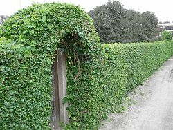
barrier=hedge is used to identify a line of closely spaced shrubs and tree species, which form a barrier or mark the boundary of an area. Hedges may be actively managed, but this is not always the case.
For an area of maintained shrubs use natural=shrubbery. For unmaintainded shrubs use natural=scrub.
Examples
Large Hedges or Field and Road Boundaries

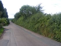
Hedges are most notable at a landscape level when they create field, road, and large property boundaries.
These hedges commonly contain many species, many of which have self seeded within the hedge.
Although there is a major difference between a small single-species garden hedge and a massive multi-species field boundary hedge, they are currently both mapped as Hedges.
They are commonly only managed to maintain the function as a barrier. Some of these type of hedges have become poorly managed in recent decades with landowners repairing gaps in hedges with barbed wire.
They can be centuries old and have legal protection.
Small Hedges and Urban or Garden Hedges

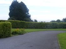
Much smaller formal hedges can also be used in areas such as parks and gardens.
These hedges commonly consist of a single species. Maintenance commonly goes beyond simply maintaining the barrier function, but also includes maintenance for making the hedge visually appealing.
How to map

Create a line along the length of the hedge. Where a hedge joins another hedge use a shared node. If there are substantial gaps in the hedge then end that line, leave a gap and create a new way for the next section. If there is a fence adjacent to the hedge to make it stock proof, it is preferable to map the hedge if only one barrier is to be mapped.
Mark a gate or stile in the hedge by creating a node on the way at the appropriate location and tagging it with barrier=gate or barrier=stile or similar. For a short gap consider using an entrance=* node. Mark lone trees using natural=tree.
If the vegetation is too wide to be called a hedge or if, for some other reason, it would be better mapped as an area, consider natural=shrubbery or natural=scrub. Avoid tagging as barrier=hedge+area=yes, as this can be ambiguously interpreted as an area surrounded by hedges (similarly to how barrier=fence is often used to tag fenced in areas).
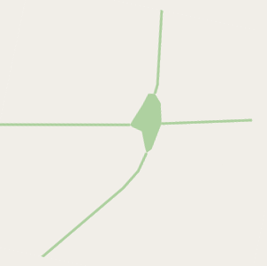
If the hedge really is a bit wider and you want to map it as area, do not tag any other features than the hedge on it. Note that OSM Carto does not render hedges as areas; it only renders the outline. See also this discussion.
The width=* and height=* tags can also be used. Some people also tag the hedge with genus=*, species=* or taxon=*.
Where hedges meet and an area of woodland has formed, common in the corners of fields, map the line of the hedge, and also map the small area of woodland using natural=wood.
Possible Tagging Mistake
See also
leaf_type=*andleaf_cycle=*.- For other types of barriers that are not hedges (including ditches and fences) see
barrier=*. - To map a lines of trees which do not form a barrier use
natural=tree_row.