Tag:crossing=traffic_signals
 |
| Description |
|---|
| Traffic light controlled pedestrian crossings |
| Group: crossings |
| Used on these elements |
| Useful combination |
| Status: approved |
| Tools for this tag |
|
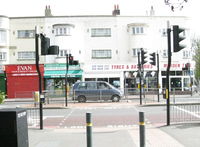
This tag is used for traffic light controlled pedestrian crossings.
Some mappers instead use crossing:signals=* in combination with crossing:markings=*, because some unmarked crossings are also signalized or have unknown signalization.
How to map
Set a node ![]() on the highway where the transition is and add
on the highway where the transition is and add
Draw a way ![]() which can be used by pedestrians to cross the road and add
which can be used by pedestrians to cross the road and add
A traffic light (highway=traffic_signals) can be on a nearby node, or the crossing=traffic_signals node can be tagged highway=traffic_signals (instead of highway=crossing) if there is no better place to map the traffic light. See the examples.
Tags to use in combination
traffic_signals:sound=yes/no- Indicates that sound is emitted oncrossing=traffic_signalswhen crossing is permittedtraffic_signals:vibration=yes/no- Indicates that vibrations occur oncrossing=traffic_signalswhen crossing is permittedbutton_operated=yes/no- if the signal can be requested via a buttontactile_paving=yes/no- Indicates whether a blind or visually impaired pedestrian can detect or follow the feature using a canewheelchair=*- Indicate if a special place can be used with wheelchairscrossing:island=yes/no- Specifies whether a pedestrian crossing has a refuge islandlit=yes/no- Indicates whether a feature is litcrossing:markings=*- The existence and style of pedestrian crossing markingstraffic_signals:operating_times=*- for traffic signals, which are switched off (completely dark or flashing yellow) at certain times.
Software support
Renderers
OsmAnd draws gray and white stripes along the crossing way and adds a red-and-green, two-aspect pedestrian signal pictogram at the crossing node. Andy Townsend's England and Wales rural pedestrian style marks the crossing with a three-aspect vehicular signal pictogram, just like a highway=traffic_signals node. [1] Organic Maps similarly equates this tag with highway=traffic_signals. [2]
AB Street infers a stop line at the crossing. [3][4] Straßenraumkarte Neukölln draws a white dashed line along both sides of the crossing way [5] and reserves a parking-free buffer zone around the crossing that is larger than for crossing=marked. [6]
Routers
OsmAnd penalizes the crossing by more time than crossing=uncontrolled and crossing=unmarked. [7] OpenTripPlanner also applies an extra penalty to the crossing [8], and a proposed blind user mode in Valhalla would do the same. [9] BRouter's default car profile penalizes the crossing the same as it would penalize a highway=traffic_signals node. [10]
GraphHopper infers crossing:signals=yes from crossing=traffic_signals. [11]
Possible tagging mistakes
See also
highway=traffic_signals- A traffic signal (or a set of those) for regulating circulation.