Tag:sport=climbing
| Description |
|---|
| Marks elements to represent natural climbing sites (climbing areas, sectors, crags, frozen waterfalls, etc.) or artificial climbs (climbing walls, indoor climbing halls, etc.) |
| Group: sports |
| Used on these elements |
| Useful combination |
| See also |
| Status: de facto |
| Tools for this tag |
|
The tag sport=climbing marks elements and the general location to represent natural climbing sites (![]() climbing areas, sectors,
climbing areas, sectors, ![]() crags, frozen waterfalls, etc.) or artificial climbs (climbing walls, indoor climbing halls, etc.).
crags, frozen waterfalls, etc.) or artificial climbs (climbing walls, indoor climbing halls, etc.).
Mapping of particular routes as well as many other details (grade, bolting, route length etc.) is described in the article climbing. Meta data like amount of routes, grades, links to operators/topos etc. are considered to enable a wide range of use of the data; e.g. a search for rocks matching user defined criteria.
How to map
sport=climbing should be preferably applied to ![]() nodes for artificial climbing walls and on
nodes for artificial climbing walls and on ![]() ways in conjunction with natural=cliff or
ways in conjunction with natural=cliff or ![]() areas for climbing halls with building=yes. The scheme also applies to boulders attached to bedrock natural=rock and free standing boulders natural=stone.
areas for climbing halls with building=yes. The scheme also applies to boulders attached to bedrock natural=rock and free standing boulders natural=stone.
Basic tags
- Main article: Climbing - a feature page summarizing many tags of climbing-related details.
The most important, basic tags to describe a climbing site:
| Tag | Description |
|---|---|
| sport=climbing | Climbing is possible here. |
| name=* | Name of the crag/climbing hall/boulder, if applicable. |
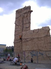
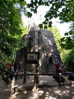
| leisure=sports_centre | Artificial climbing wall. In combination with building=yes or similar it is indoors, otherwise outdoors, for example on a playground. For tower-like structures, man_made=tower and tower:type=climbing can be added. |
See also
- sport=climbing_adventure - Used to tag an area as "Adventure Park", "Ropes Courses", "Climbing Adventure", "Zip-line", or "Treetop Adventure", where people climb, walk or otherwise move on prebuilt wires and other objects.
- playground=climbingwall - (typically without the sport tag) for small climbing walls for children, often on playgrounds
- Climbing the main article
- Tagging discussion in the forum (en) English or (de) German.
- Proposal: High ropes course - (leisure=high_ropes_course)
- Proposal: via ferrata -
![Wikipedia [W]](/w/images/2/24/Wikipedia-16px.png) Via ferrata - (highway=via_ferrata)
Via ferrata - (highway=via_ferrata)

