Template:Hu:Map Features:addr
(Redirected from Template:HU:Map Features:addr)
Címek
'addr:' kulcs névtérrel jelölhetjük a címeket.
| Kulcs | Érték | Alapelem | Magyarázat | Megjelenítés | Fotó | |
|---|---|---|---|---|---|---|
Tags for individual houses | ||||||
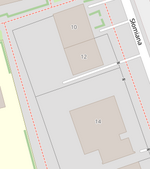
| addr:housenumber | user defined | Házszám: Lehet benne betű is. Több házszámmal rendelkező épület és területet, házszámait "," karakterrel válaszuk el (lásd: 12b,12c). Ezt a kulcsot minden képen meg kell adni, a többi opcionális. | 
|
 | ||
| addr:housename | user defined | Háznév: Néhány országban (pl.: Anglia), házszám helyett használják,. |  | |||
| addr:flats | user defined | The unit numbers (a range or a list) of the flats or apartments located behind a single entrance door. | 
|

| ||
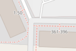
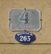
| addr:conscriptionnumber | user defined | This special kind of housenumber relates to a settlement instead of a street. Conscription numbers were introduced in the Austro-Hungarian Empire and are still in use in some parts of Europe, sometimes together with street-related housenumbers which are also called orientation numbers. |  | |||
| addr:street | user defined | Utcanév: Épülethez, vagy területhez tartozó utca megnevezése. |  | |||
| addr:place | user defined | This is part of an address which refers to the name of some territorial zone (usually a place=* like island, square or very small village) instead of a street (highway=*). Should not be used together with addr:street=*.
|
||||
| addr:postcode | user defined | Irányítószám: Épülethez, vagy területhez tartozó irányítószám. | ||||
| addr:city | user defined | Város név: Város neve amihez az épület, vagy terület tartozik. Olyan mint a is_in:city=*.
|
 | |||
| addr:country | user defined | Országkód:Ország kétbetűs kódja a ISO 3166-1 alpha-2 szerint, nagy betűkkel. Például: "hu" Magyarország, "de" Németország, "it" Olaszország. Figyelmeztetés: A ISO 3166-1 szerint Nagy-Britanniát "gb" kóddal jelölik és nem "UK" kóddal. Olyan mint is_in:country_code=*.
|
||||
| addr:postbox | user defined | Use this for addressing postal service Post Office Box (PO Box, BP - Boîte Postale, CP - Case Postale, Поштански преградак, Поштански фах, Поштански претинац) as alternative to addressing using street names. Example: "PO Box 34" | ||||
| addr:full | user defined | Use this for a full-text, often multi-line, address if you find the structured address fields unsuitable for denoting the address of this particular location. Examples: "Fifth house on the left after the village oak, Smalltown, Smallcountry", or addresses using special delivery names or codes (possibly via an unrelated city name and post code), or PO Boxes. Beware that these strings can hardly be parsed by software: "1200 West Sunset Boulevard Suite 110A" is still better represented as addr:housenumber=1200 + addr:street=West Sunset Boulevard + addr:unit=110A.
|
||||
For countries using hamlet, subdistrict, district, province, state, county | ||||||
| addr:hamlet | user defined | The hamlet of the object. In France, some addresses use hamlets instead of street names, use the generic addr:place=* instead.
|
 | |||
| addr:suburb | user defined | If an address exists several times in a city. You have to add the name of the settlement. See Australian definition of suburb. | ||||
| addr:subdistrict | user defined | The subdistrict of the object. | ||||
| addr:district | user defined | The district of the object. | ||||
| addr:province | user defined | The province of the object. For Canada, uppercase two-letter postal abbreviations (BC, AB, ON, QC, etc.) are used. In Russia a synonym {{{key:addr:region}}} is widely used | ||||
| addr:state | user defined | The state of the object. For the US, uppercase two-letter postal abbreviations (AK, CA, HI, NY, TX, WY, etc.) are used. | ||||
| addr:county | user defined | The county of the object. | ||||
Tags for interpolation ways | ||||||
| addr:interpolation | all/even/odd/ alphabetic | Házszámok helyének interpolálása: Ha automatikus házszámmegadást akarunk akkor megadhatjuk hogy az adott szakaszon hogyan legyen interpolálva a házak helye. Lásd a részletes leírást(en). |  | |||
| addr:interpolation | Number n | Every nth house between the end nodes is represented by the interpolation way. | ||||
| addr:inclusion | actual/estimate/potential | Optional tag to indicate the accuracy level of survey used to create the address interpolation way. See detailed description. |
||||
This section is a wiki template with a default description in English. Editable here.
A táblázat fordítását ezen az oldalon szerkesztheted.