Template:Ja:Map Features:cycleway
自転車通行空間
おもに自転車利用者のためのインフラの解説です。JA:サイクリングルート もご覧ください。
| 値 | 要素 | 説明 | 写真 | |||
|---|---|---|---|---|---|---|
自転車レーン | ||||||
lane
|
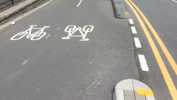
自転車レーンはその定義上、道路を構成する一部分です。他の車線とは物理的に分離されておらず、路面に境界線が塗られているだけです。北米ではクラス II 自転車設備として知られてます。注目すべきは、自転車レーンと道路との間には縁石がないことです。
国によっては自転車レーンは二種類に分類されます。
以上2種類の自転車レーンを区別するには、自転車レーンに
|
 | ||||
共用自転車レーン | ||||||
shared_lane
|
ひとつの車線を自転車利用者とエンジン付き車両とで共有しています。また、そのことを示すための路面標示( 一般的に、この路面標示を設置する目的は、自転車ルートであることを示すため、あるいはこの車線は自転車で走行してもよいのだということをドライバーに思い出してもらうためです。 |
 | ||||
share_busway
|
公共交通機関専用の特別な車線ですが、自転車利用者の通行も許可されています。 |  | ||||
自転車道 | ||||||
track
|
自転車道は、車道のすぐ横を平行に走る道で、縁石やパーキングロット、芝や街路樹、車止め杭といった物理障壁によって車道と隔てられています。北米での呼び名は protected bike lane、separated bike lane、greenway、green lane あるいは class IV facility[1] とさまざまです。
車道に 米国においてこのタグが慣例的に使われるのは、自転車レーンが駐車車両で(場合によっては車止め杭やポストフレックスも併用して)保護されている場合です。つまり、車両走行車線と自転車レーンとのあいだに駐車用車線が配されたレイアウトです。自転車レーンが対面通行でボラードで分離されているケースでは、たとえ車両通行車線と段差で分離されていなくとも、慣例的に独立したウェイとして描画されてきました。 |
 | ||||
separate
|
ある道路に属する自転車道が独立したOSM要素としてマッピングされている(すなわち highway=cycleway タグが付加されている)ことを示すために使います。意味としては、歩道のマッピングで sidewalk=separate タグを使った場合と同様で、将来的にはこれを利用してレンダリング形状をシンプルにできるかもしれません。さらには、このタグを付けることで、すでに自転車道がマッピングされている道路に cycleway=track タグを重複してつけてしまうような事態を避けられるという効果もあるでしょう。なお segregated=yes タグとは混同しないよう注意してください。
|
|||||
自転車インフラなし | ||||||
no
|
道路に自転車インフラが存在しないことを明示します。これを使うと、その道路は自転車インフラに関する調査が実施済みであると示すことができます。 |  | ||||
その他の自転車インフラ | ||||||
crossing
|
独立してマッピングされたウェイが自転車横断帯であることを示すのに使います。 |  | ||||
shoulder
|
自転車の通行のためのインフラは存在しないものの、路肩(または緊急停止帯)は物理的にも法的にも自転車で通行可能であることを示すのに使います。制限速度の高い郊外の道路ではとくに、自転車で走れる路肩の存在が、自転車にとって(そこそこであっても)安全かどうかを左右する要素となりえます。ただし、あらゆるshoulder=*が自動的に自転車走行可になるわけではありません。駐車用の路肩であったり(parking=shoulder)、舗装されていなかったりします(=アスファルトではなく、たとえば緑化ブロックで覆われている)。なお shoulder=yes タグについては、通常は車両が収まるぐらいの幅のある路肩にだけ使われます。自転車で走るのならそれよりも幅が狭くても大丈夫です。
|
 | ||||
link
|
自転車交通のためのOSMセグメント間コネクターとして機能します。たとえば、独立してマッピングされた自転車道を、反対側にある交差点と接続する場合です。主な使いみちは経路探索支援であり、物理的な構造物として識別可能である必要はありません。 |  | ||||
traffic_island
|
cycleway=crossing の途中にある退避スペース部分に使用します。
|
|||||
asl
|
交差点に設置された前出し停止線ないしは bike box を示します。道路ウェイを構成するcycleway=asl タグを付加してください。できれば、direction=forward または direction=backward タグを使って、最も近い交差点のうちどれに停止線が含まれるのか、そしてどちら向きの交通に対して適用されるのかを指定してください。
|
 | ||||
gap_jump
|
MTBのダウンヒルコースに設けられたギャップジャンプ区間を示します。一般的に2つないし3つの部分から構成されます。ジャンプ台、物理的には存在しない空中の区間、それから着地台(これは省略されることもあります。着地台がなければ通常の自転車走路が着地ゾーンとなります)です。空中区間は別の道路や地物を横切ることがあり、その場合は layer=1 とタグ付けし、交差部にはノードを作らないようにします。surface=none というタグが使われることもあります。自転車以外の移動手段にルートとして使われないよう、foot=no ないしは access=no+bicycle=designated タグを付けることも検討してください。
|
 | ||||
廃止済みまたは非推奨のタグ | ||||||
opposite |
oneway:bicycle=* が使われるようになるよりも前に、一方通行を示すのに使われていました。一方通行道路における自転車インフラのマッピング方法については下記を参照してください。
| |||||
shared |
segregated=* タグが正式に使われるようになるよりも前に、ウェイに highway=cycleway タグを付けて独立した自転車道としてマッピングする際に使われていました。現在では、highway=cycleway タグとの組み合わせは廃止されています。
| |||||
この表は日本語で記述されたwikiテンプレートです。 編集するにはここをクリック.

