Category:Norway
Jump to navigation
Jump to search
This category contains all the sub-pages of the Norway mapping project.
- For more details on this topic, see Wikipedia:nb:Noreg and Wikipedia:Norway.
Subcategories
This category has the following 11 subcategories, out of 11 total.
Pages in category "Norway"
The following 51 pages are in this category, out of 51 total.
+
H
I
K
N
- NO Retail Chains
- No:Buses
- No:Map Features/background
- No:Oslomarka
- No:Road signs in Norway
- Norway specific QA
- Norway/Bus routes in Trondheim
- Norway/crossings
- Norway/Forbedre sykkelkart i Oslo
- Norway/Highway stats
- Norway/Highways
- Norway/Hiking maps for singletrack mountain biking use
- Norway/Norwegian Sea Map
- Norway/NTNU
- Norway/NTNU/List of Faculties and departments at NTNU
- Norway/Progress
- Norway/Public Services
- Norway/Public transport/Ruter/Analysis/Lines
- Norway/Railways
- Norway/Språksamlingane
- Norway/Sykkelruter i Norge
- Norway/Translation
- No:Permissions
- Norwegian Mapping Authority
S
Media in category "Norway"
The following 27 files are in this category, out of 27 total.
-
 Camp site cabins symbol from Norwegian map standard.png 50 × 50; 118 KB
-
 Elveg SOSI 4.0 2008.pdf ; 509 KB
-
 Entur 128px.png 100 × 100; 3 KB
-
 Fv-skilt.jpg 122 × 111; 12 KB
-
 Glims example norway1.png 852 × 996; 45 KB
-
 Glims example norway2.png 852 × 996; 76 KB
-
 Hostel symbol from Norwegian map standard.png 50 × 50; 118 KB
-
 Image all kindergartens norway.png 809 × 832; 17 KB
-
 INT1-U18 no.svg 368 × 369; 5 KB
-
 INT1-U23 no.svg 518 × 518; 4 KB
-
 INT1-U26 no.svg 368 × 369; 7 KB
-
 INT1-U30 no.svg 744 × 1,052; 4 KB
-
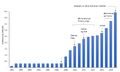
 Mtbscale-trend.png 1,091 × 380; 27 KB
-
 NO 609.svg 2,480 × 2,302; 49 KB
-
 NO 727.4.png 292 × 229; 22 KB
-
 No sign-NationalCycleRouteNumber-755.png 60 × 60; 2 KB
-
 NO skilt 521 2.png 663 × 663; 29 KB
-
 NO terrengsykling.svg 362 × 362; 5 KB
-
 NO turskoyteloping.svg 362 × 363; 4 KB
-
 NO vandring.svg 363 × 363; 4 KB
-
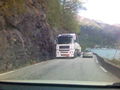 NO-RV7-18Wheeler.jpg 640 × 480; 31 KB
-
 Norway-From no coast to some coast.png 905 × 854; 854 KB
-
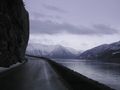 Norway-Rv7-important single lane road.jpg 1,600 × 1,200; 99 KB
-
 Offshore power usage.jpg 1,411 × 852; 79 KB
-
 OpenStreetMap-example-no.png 718 × 626; 299 KB
-
 OSM Norway logo.svg 256 × 256; 206 KB
-
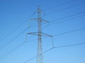 Skagerrak-hvdc-tower.jpg 800 × 600; 66 KB


