JA:OpenLinkMap


OpenLinkMap は、 OpenStreetMap の背景地図に追加情報を可視化するウェブアプリケーションです。
このウェブアプリケーションは2010年1月にリリースされました。プロジェクトは(Wikipedia-)リンクを地図上に表示することを目的に開始しました(これがこのアプリケーションが OpenLinkMap と呼ばれている理由です)。
At the beginning the project only visualized (Wikipedia-)links, but in a steady process of developing, the application was extended by many new features. Now OpenLinkMap offers a lot of useful features with the aim to show as much information from OpenStreetMap as useful as possible in a single application and to present the user all available information at a glance.
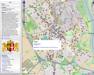
The application presents a lot of details of POIs, such as linked images, an abstract from Wikipedia, next bus stops or parkings, details about smoking, cuisine, internet access and much more. It also shows links to websites with departure information for public transport stops.
The aim of this project is to provide an extended map, visualizing data which is not visible in a standard tile map, and to add information from other web sources or link to them (wikipedia, departure times).
Alexander Matheisen, the founder of the project, announced shutdown of his service on 11. January 2016. The service has later been continued by Jens Kammann.
Features
- POI layer: open popups with additional information by clicking on markers
- worldwide data, daily updated
- markers are clustered for better clarity
- related Wikipedia article, translated into user's language
- related image, selected by tag or taken from a linked Wikipedia article
- show near objects like the next bus stop or parking
- display a POI's name in the user's preferred language
- indicator showing whether a POI is currently open or closed
- popups showing various additional information, e.g. smoking, opening hours, contact, website, cuisine, etc. (list of considered tags)
- country specific addressformats
- support for semicolon-separated values
- public-transport layer
- visualization of public transport stops and additional information such as accessibility
- linked operator websites with realtime departure information (up-to-date list of supported operators)
- built-in support for Osmosis TagTransform rulefiles
- hillshading
- the startposition of the map is automatically set by IP the browser geolocation API if possible
- search, based on Nominatim
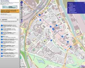
- local bounded search
- display search results on the map
- permalinks
- support of touchscreen devices
- available in different languages: translation of names, wikipedia information and the user interface
- export HTML code to embed a small map with a popup into another website
- manipulate different options with URL parameters
構築に利用されているソフトウェア
- osmfilter
- osmconvert
- osmupdate
- OpenLayers
- Osmosis
- Linux
- PostgreSQL
- PostGIS
- Apache, PHP, Javascript, CSS, ...
URLパラメーター
lang=<Language code according to ISO 639-1>
nameタグが多言語に対応して記載されている場合、表示される言語を変更することが可能です。指定されていない場合は、 HTTPの Accept-Languageヘッダーが適用されます。
id=<ID of an OSM object>
typeパラメーターと連動して指定します。特定のオブジェクトの詳細情報を直接表示することができます。
type=node|way|relation
idパラメーターと連動して指定します。特定のオブジェクトの詳細情報を直接表示することができます。
q=<search>
ページを読み込んだ時に、このパラメーターで指定された値で検索が実行されます。
bounded=1|0
この値に 1 が指定されている場合、 q で指定した検索指定が、マップで表示されている範囲内のみで実行されます。 latや、lon、zoomパラメーターが指定されているときにのみ有効です。
lat=<Latitude coordinate>
lon と zoomと連動して指定します。マップの初期表示位置を指定することができます。
lon=<Longitude coordinate>
lat と zoomと連動して指定します。マップの初期表示位置を指定することができます。
zoom=<Zoomlevel>
lat と lonと連動して指定します。マップの初期表示位置を指定することができます。
offset=<Difference between the local timezone and UTC in hours>
このパラメーターを使ってタイムゾーンを指定することで、opening_hoursタグの表示や、データベースの最終更新日時をユーザが正しく指定することができます。
API
APIを利用する場合、サービスが小規模であれば特に事前通達の必要はありません。もしサービスの規模が大きく、通信量が大きくなることが予測される場合は、サーバの負荷上昇を避けるため、プロジェクトの管理者に事前にお知らせください。
全てのAPIリクエストは JSONPをサポートしています。この形式を利用する場合、URLパラメーターで指定を行う必要があります。
format=json
callback=<Callback-function>
特定地域内のPOI
http://openlinkmap.org/api/list.php
パラメーター:
bbox: 矩形範囲指定。値の指定形式は 左,下辺,右,上辺, で、カンマ区切りで行います。
format: csv, json; デフォルト値: csv
レスポンス:
CSVファイル: <lon>|<lat>|<osmid>|<type>
パラメーター例: http://www.openlinkmap.org/api/list.php?bbox=6.67336,51.203552,6.679132,51.206406
Public transports within a certain area
http://openlinkmap.org/api/ptlist.php
パラメーター:
bbox: 矩形範囲指定。値の指定形式は 左,下辺,右,上辺, で、カンマ区切りで行います。
format: csv, json; デフォルト値: csv
レスポンス:
CSVファイル: <lon>|<lat>|<osmid>|<type>
パラメーター例: http://www.openlinkmap.org/api/ptlist.php?bbox=6.67336,51.203552,6.679132,51.206406
詳細情報
http://openlinkmap.org/api/details.php
パラメーター:
format: text (formatted HTML), xml, json; デフォルト値: xml
id:     リクエストされたオブジェクトのOSM ID
type:   リクエストされたオブジェクトの種別: node/way/relation
offset: 地域のタイムゾーンとUTCとの時刻差分(単位は"hour")です。 デフォルト値: 0
lang:   優先して表示する言語。形式は ISO 639-1 codeで指定。 デフォルト値: HTTP Accept-Language header
レスポンス:
XML、JSON、整形済み HTML のいずれか
パラメーター例: http://www.openlinkmap.org/api/details.php?id=18530948&type=way
さらに詳細な情報
http://openlinkmap.org/api/extdetails.php
パラメーター:
format: text (formatted HTML), xml, json; デフォルト値: xml
id:     リクエストされたオブジェクトのOSM ID
type:   リクエストされたオブジェクトの種別: node/way/relation
offset: 地域のタイムゾーンとUTCとの時刻差分(単位は"hour")です。 デフォルト値: 0
lang:   優先して表示する言語。形式は ISO 639-1 codeで指定。 デフォルト値: HTTP Accept-Language header
レスポンス:
XML、 JSON、整形済み HTML のいずれか
パラメーター例: http://www.openlinkmap.org/api/extdetails.php?id=18530948&type=way
近隣オブジェクト
http://openlinkmap.org/api/nextobject.php
パラメーター:
lat:    リクエストされた緯度 (needed in connection with lon, if no OSM-object is requested; otherwise not needed)
lon:    リクエストされた経度 (needed in connection with lat, if no OSM-object is requested; otherwise not needed)
type:   リクエストされたオブジェクトの種別: node/way/relation (needed in connection with id, if no position is requested; otherwise not needed)
id:     リクエストされたオブジェクトのOSM ID (needed in connection with type, if no position is requested; otherwise not needed)
format: text (formatted HTML), xml, json; デフォルト値: text
レスポンス:
XML, JSON or formatted HTML
The returned distance is only air-line distance!
Example: http://www.openlinkmap.org/api/nextobject.php?id=80148145&type=way&format=xml
データベース最終更新日
http://openlinkmap.org/api/timestamp.php
パラメーター:
lang:   Preferred language as ISO 639-1, e.g. needed for selecting the strings in the correct language; standardvalue: lang from HTTP_ACCEPT_LANGUAGE with highest priority
format: text (simple plain text), xml, json; Default: xml
offset: Difference in hours between user's timezone and UTC (needed for calculating the difference between current timestamp and last update); Default: 0
Response:
XML, JSON or plain text
With this request you can get the timestamp of the last database update and the age of the data.
Example: http://www.openlinkmap.org/api/timestamp.php?format=xml
POI名称
http://openlinkmap.org/api/name.php
パラメーター:
lang:   優先して表示する言語。形式は ISO 639-1 codeで指定。 例えば、特定の言語における名称の指定など。デフォルト値: HTTP_ACCEPT_LANGUAGEで指定されている最も優先度の高い言語
format: text (formatted HTML), xml, json; デフォルト値: xml
id:     リクエストされたオブジェクトのOSM ID
type:   リクエストされたオブジェクトの種別: node/way/relation
レスポンス:
XML、JSON、プレーンテキストのいずれか
このリクエストによって、オブジェクトの(特定言語における)名称を取得することが可能です。
パラメーター例: http://www.openlinkmap.org/api/name.php?format=xml&id=18530948&type=way&format=xml
ユーザの言語設定
http://openlinkmap.org/api/userlang.php
パラメーター:
none
レスポンス:
優先する言語設定を ISO 639-1形式で指定。
HTTP Accept-Language headerで検出可能な場合、ユーザ設定で指定されている言語を最も高い優先度として返します。
IP地域指定
http://openlinkmap.org/api/ippos.php
パラメーター:
format: text (simple plain text), xml, json; デフォルト値: text
IPアドレスをもとに、ユーザの現在地を返します。
Tag-Translation
http://openlinkmap.org/api/tagtranslation.php
Parameters:
 lang: Preferred language as ISO 639-1
 tag: One or more tags to translate, split with ",". Key and value are connected with "=" (like in the example below).
 format: text (simple plain text), xml, json; Default: text
Returns the translation of one or more tags.
Example: http://www.openlinkmap.org/api/tagtranslation.php?lang=en&tag=amenity=fuel,shop=bakery
Public transport details
http://openlinkmap.org/api/ptdetails.php
パラメーター:
format: text (formatted HTML), xml, json; デフォルト値: xml
id:     リクエストされたオブジェクトのOSM ID
type:   リクエストされたオブジェクトの種別: node/way/relation
offset: 地域のタイムゾーンとUTCとの時刻差分(単位は"hour")です。 デフォルト値: 0
lang:   優先して表示する言語。形式は ISO 639-1 codeで指定。 デフォルト値: HTTP Accept-Language header
レスポンス:
XML、JSON、整形済み HTML のいずれか
パラメーター例: http://www.openlinkmap.org/api/ptdetails.php?id=80725474&type=node
他ウェブサイトへのマップ埋め込み
マーカーとポップアップが記載された小さな地図をあなたのウェブサイトに埋め込むには、以下の記述を行います:
<iframe width="420" height="350" frameborder="0" scrolling="no" marginheight="0" marginwidth="0" src="http://www.openlinkmap.org/embed.php?id=<OSM-ID>&type=<node|way|relation>" style="border: 1px solid black"></iframe>
There is also a mode where you can embed a small slippymap with all points shown in OpenLinkMap:
<iframe width="420" height="350" frameborder="0" scrolling="no" marginheight="0" marginwidth="0" src="http://www.openlinkmap.org/small.php?lat=<LAT>&lon=<LON>&zoom=<ZOOM>" style="border: 1px solid black"></iframe>
タグづけ
POI-Layer
Necessary tags
A POI has to contain at least one of the following tags to be shown on this layer. You can find more information about each tag and valid values on their wikipages.
wikipedia=*wikipedia:*=*contact:phone=*website=*url=*phone=*fax=*email=*addr:email=*image=*url:official=*contact:website=*addr:phone=*phone:mobile=*contact:mobile=*addr:fax=*contact:email=*contact:fax=*image:panorama=*opening_hours=*
Additional tags
There are some more tags which are considered in the popups. You can find more information about each tag and valid values on their wikipages.
name=*undname:LANGUAGE=*addr=*fee=*toll=*ref=*capacity=*service_times=*ele=*operator=*image=*description=*stars=*cuisine=*biergarten=*beer_garden=*smoking=*brewery=*microbrewery=*internet_access=*population=*disused=*fuel=*iata=*undicao=*wheelchair=*,wheelchair:toilets=*,wheelchair:rooms=*,wheelchair:access=*,wheelchair:places=*car_wash=yescar_repair=yesshop=kioskkiosk=yes
Public-transport-Layer
Necessary tags
A POI has to contain at least one of the following tags to be shown on this layer. You can find more information about each tag and valid values on their wikipages.
amenity=bus_stationhighway=bus_stophighway=platformrailway=stationrailway=haltrailway=tram_stoprailway=platformpublic_transport=platform
加えて、オブジェクトには name=* タグが必要です。
Additional tags
There are some more tags which are considered in the popups. You can find more information about each tag and valid values on their wikipages.
name=*undname:LANGUAGE=*wikipedia=*wikipedia:*=*website=*url=*url:official=*contact:website=*operator=*shelter=*bench=*bin=*tactile_paving=*wheelchair=*image=*
Depending on the rulefile for linked departure times, there are some more tags considered, like ref=*, uic_ref=*, ibnr_ref=*, etc.
有効な値
いくつかのタグにおいては、有効な値の形式が複数存在します:
| 情報 | キー | 有効な値 |
|---|---|---|
| Wikipediaページ | http://de.wikipedia.org/wiki/Köln de:Köln | |
| 特定の言語のWikipediaページ | http://de.wikipedia.org/wiki/Köln de:Köln Köln | |
| Wikipediaページ(英語) | Cologne | |
| メモ: wikipediaページへのリンクはタグが1つあれば可能です! もし同じ対象のページであれば、他の言語へのリンクは Wikipedia-APIを利用して検索することが可能です。 | ||
| 携帯電話 | +49-1234-56789 +49 1234 56789 | |
| Fax |
|
+49-1234-56789 +49 1234 56789 |
| ウェブサイト |
|
www.... http://www... http://... https://www... https://... |
| 関連画像 |
|
画像、または画像のページの完全なURL; 法的な問題のため、Wikimedia Commons からは画像のみ表示します |
貢献者
- rurseekatze (Project founder, does not run the website any more)
利用可能な言語
- English
- French
- German
- Italian
- Japanese
- Nederlands
- Russian
一覧に追加したい言語がありますか? この wikiページや、OpenLinkMapそのものの翻訳をお手伝いいただけると幸いです! You can do this either on Transifex, or you translate the Gettext-files from the Github-Repository into your language and send these file to me. Contact me for more information!
バグ / 追加機能 / アイデア / TODOs
- add more UI languages
- add more background map styles
- improve parsing of opening hours: dates, months, holidays; show whether a POI opens or closes in the next x minutes
- add routing feature
- show complete ways and areas
- ruler feature
- improve browser support
- popup-shadows
- show small flag indicating cuisine=*
- include weather and local time of citys/countrys
- add edit-mode like wheelmap.org
- better design, effects with CSS3
- better support of mobile devices
- show names of near objects in userlanguage if possible
- include translated background maps, dependend on user's preferred language
- add edit link to sidebar
- show a loading indicator while loading an image
- Bugfix: sometimes popups cannot be closed
- differentiate between different POI-categories by color or icons
- show circle around user's position
- panorama feature
- filter POIs by wikipedia/image/website-tags
- adjust centroids to Mapnik
- show tooltips with name of a POI by hovering markers
- show search results layer above POI-layer
- show type of POI (e.g. an icon in the popups)
- show number of clustered points in clustermarkers
- add permalinks to save search request
- country- and language-dependent format of update timestamp
- jump to the top of the extended details (otherwise search results are shown before and you have to scroll down)
- Bugfix: some browsers do not load near objects
- show description tagged with description:<lang>=*
- detect and show syntax errors in
opening_hours=* - add tag for (free) wifi availability
- daily data update - process starts at 01:00 and finishes about 05:00
貢献
プログラマー、翻訳者、デザイナーによる貢献を歓迎しています。貢献したい場合はお問い合わせください。
マッピング: この地図の使い勝手はデータに依存しています。マッピングされた情報を最新の状態に保つため、そして詳細情報を追加するために、あなたの知識で貢献してください!
プログラミング: 興味深い新しい機能を開発したり、既存のコードについてバグを修正したりしていただけますか? 作成したコードをお送りいただければ、追加させていただきます。
翻訳: OpenLinkMap を多くの利用者に多くの言語で利用してもらいたいと考えています。アプリケーションやこのウィキページを他の言語に翻訳してください!
デザイン: 現在のデザインはあまりいいものではありません。デザインの改善や、さまざまなブラウザへの対応の改善を支援してください!
資源: OpenLinkMap は現在、私の空き時間で進めているプロジェクトであるため、ハードウェアやドメインのような資源が限られています。これらの資源について支援を歓迎しています!
バグ報告、各種ブラウザーでの動作テスト、機能の提案もお待ちしています。お問い合わせください。
ダウンロード
- Download the latest development state from the Github Repository
- Download older, but stable releases
The commit history can be seen in the Git-Repository. The Changelog lists up all changes between the published versions.
Own developments
Everybody is allowed to use OpenLinkMap as a base for own development, if this is compatible to the terms and conditions of the GNU General Public License Version 3. In exceptional case I also allow the usage under modified conditions!
My free time is limited and the development of OpenLinkMap already costs a lot of time, which means I do not develop applications by request! I can only help by answering questions related to my code or the setup.
お問い合わせ
(to be added)
著作権表示
- OpenLinkMap's hosting is kindly supported by CSL Computer Service Langenbach GmbH
- Map and overlays are displayed by using OpenLayers
- The icon is taken from the Oxygen-Iconset, licensed under LGPLv3
- gulp21 and Mitja supported me sometimes
- Gulp21 helped creating CSS3-animations and the Wikipedia parsing code
- The search is provided by Nominatim
- Peter Büttner improved the code
- Daniele Forsi created the italian translation
- NothisIm created the russian translation
- The domain is sponsored by joker.com
- Many thanks to Markus Weber, who added new features to his programs osmfilter, osmconvert und osmupdate and supported me in using them
- Last but not least a lot of other people who collaborated by reporting bugs or suggesting new features
- Osmosis is used to update the data.
- The position of an IP is detected by using GeoLite City database
- Shu Higashi created the japanese translation
リンク
- Sourcecode
- FacilMap/API/POIs — OpenLinkMap Layer for OpenLayers