Proposal:Add strolling to sac scale and some further refinements
| Add strolling to sac_scale and some further refinements | |
|---|---|
| Proposal status: | Approved (active) |
| Proposed by: | Supsup |
| Tagging: | sac_scale=strolling
|
| Applies to: | |
| Definition: | A wide and smooth trail |
| Statistics: |
|
| Draft started: | 2024-09-26 |
| Vote start: | 2024-10-15 |
| Vote end: | 2024-10-29 |
Proposal
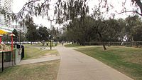
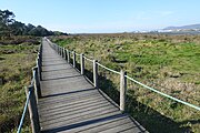
I propose to add "strolling" to sac_scale to help with differentiating very easy pathways that need no attention when walking, usually allow people to walk side by side and that are accessible even to people who might be using walking aids like crutches, people who are blind (with a guide) or people pushing a stroller from hiking trails that can still be walked by any healthy not-disabled person but that need some attention.
In addition, I propose to:
- remove "steady ascent" from sac_scale=mountain_hiking trail description (the same information is already in the terrain specification) and instead specify T1, T2 and T3 a bit more in terms of obstacles on the path (see table below for detailed formulation)
- remove the requirement for the tag to only be used in mountains (as it widely is used so)
- make it explicit that while OSM's sac_scale is based on the Swiss Alpine Club scale, it is its own thing.
Rationale
For people who are not dedicated hikers, an information whether a given trail is suitable for small children/very old/with a stroller can be quite useful. This is not necessarily the same as wheelchair=yes/no/limited. It might be argued that sac_scale=strolling probably implies wheelchair=yes/limited whereas sac_scale=hiking implies wheelchair=no. However, the audience of this tag is more people who can walk but who are either somewhat frail or might be using a walking cane or pushing a stroller or are visually impaired. Wheelchair should only be marked when officially signed or when a wheelchair user assessed the trail; no such limitation applies to sac_scale. As of now, overlap with wheelchair is low: https://taginfo.openstreetmap.org/tags/sac_scale=hiking#combinations https://taginfo.openstreetmap.org/tags/sac_scale=mountain_hiking#combinations (filter for "wheelchair" - it is mostly "no"). If this proposal is adopted, some additional pathways might get tagged with sac_scale.
It can be argued that all information can be already conveyed using tags like width, surface, incline and smoothness. However, this tag is functional in its classification. It in no way prevents people from entering those more detailed physical traits.
As of now, sac_scale is supposed to be only used for hiking trails in the mountains. That is not being upheld as can be seen here: https://taginfo.openstreetmap.org/keys/sac_scale#map there are no mountains between Brest (northwestern France) and Helsinky (Finland) but there is a continuous coverage by sac_scale. It seems to work for people and potentially hazardous trails are not necessarily only in the mountains (they can be also at cliffs above the sea or in river gorges, they could also be in caves...). While sac_scale is based on the Swiss Alpine Club scale, it has been modified and diverged, which should be explicit (this is just stating something that is de facto the case).
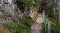
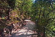
For mountain_hiking, the current picture on the wiki does not show a steady ascent and the original sac_scale only mentions that the trail might be steep at places, not continuously (which is already reflected in the "terrain" column). Anyway, the defining trait is that there is already some risk of falling and being injured. Steepnes can be communicated with incline and hiking maps will normally show contours that are much more precise anyway. Instead of meantioning steepness, the type of obstacles on the trail is specified.
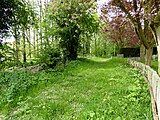
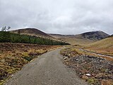
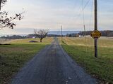
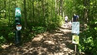
Examples
Rendering
For renderers optimized for hiking, sac_scale=strolling/hiking can be rendered the same. For renderers that choose to ignore difficult hiking trails (above mountain hiking or demanding_mountain_hiking), they should be different.
Features/Pages affected
External discussions
This is based on these forum threads: https://community.openstreetmap.org/t/adding-t0-strolling-to-sac-scale/118972
It also draws inspiration for a more radical foot_scale draft proposals:
User:Hungerburg/FootScaleGallery
Edits to the draft
October 4, 9:00 UTC: Implement suggested tendency for strolling to be wide enoug for two people and hiking not necessarily being that way.
October 4, 9:50 UTC: Mention blind people in the proposal as suggested in the community forum (and made explicit that no obstacles are on the ground for strolling).
October 15 18:00 UTC: Very minor wording adjustment to the proposal and rationale no substantial changes, just clarification.
Comments
Please comment on the discussion page.
How the wiki would look like if passed:
 |
| Description |
|---|
| A difficulty rating scheme for hiking trails. |
| Group: properties |
| Used on these elements |
| Implies |
| Useful combination |
| Status: approved |
| Tools for this tag |
|
The key sac_scale=* is used to classify hiking trails with regard to the difficulties to be expected.
The scale discerns seven grades in ascending level: From strolling up to difficult_alpine_hiking.
It does not cover visibility of the path, for that see trail_visibility=*.
How to map
Add the key sac_scale=* to a way with one of the following primary feature tags:
highway=path- A generic or multi-use path open to non-motorized traffichighway=track- A minor land-access road like a farm or forest trackhighway=footway- For designated footpaths, i.e. mainly/exclusively for pedestrians
General notes
- Use this tag solely on ways used for hiking, as it solves a domain specific need. The scale was originally devised for mountainous areas but has since been used in all sorts of environments where people hike. Use common sense when applying it.
- A
highway=trackcan carry asac_scale=*tag if commonly (dual-)used for hiking or marked with hiking signs (Alpenverein, tourist authority). Then thesac_scale=*most likely will be strolling, hiking, or rarely mountain_hiking (if hazardous/slippery, map navigation required, etc.)
Most hiking trails that are found in printed maps fall into the strolling, hiking and mountain_hiking categories. In low mountain ranges, ways are often strolling or hiking only, although higher grades are possible.
A way may not fit all of the criteria listed below for trail, terrain and requirements. In general, use the greatest difficulty that is matched.
A note on mountaineering boots: Such boots are heavier and torsionally stiffer than the popular trekking or hiking boots. Ideally they make it comfortable to walk for hours with crampons, at least they make it easy to kick steps into snow crust or slippery soil [1]. However, people use all sorts of shoes for all sorts of terrain.
Values
| Value | SAC scale and Swiss marking colour | Trail | Terrain | Requirements | Illustration |
|---|---|---|---|---|---|
strolling
|
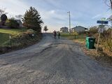
none | Smooth trail with no obstacles usually wide enough to be walked side-by-side. No exposed areas. | Terrain level; no risk of falling or tripping over minor obstacles. |
|

|
hiking
|
T1
yellow |
Trail well cleared or with rather minor obstacles like roots, usually walked single file. Exposed areas well secured. | Terrain level or inclined; no risk of falling with appropriate behaviour. |
|

|
mountain_hiking
|
T2
white with red stripe |
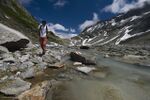
Continuous trail, with somewhat bigger obstacles like stones, smaller rocks. Exposed areas made more secure. | Terrain steep in places and may pose fall hazards. |
|
|
demanding_mountain_hiking
|
T3
white with red stripe |
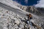
Obstacles like boulders. Exposed areas ordinarily secured with fixed ropes or chains. Use of hands for balance potentially needed. | Portions of the route exposed with danger of falling. Trail may have unmarked portions and cross fields of loose scree or talus. |
|
|
alpine_hiking
|
T4
white with blue stripe |
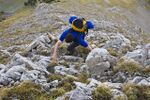
Use of hands needed in order to advance in certain places. | Terrain already quite exposed, including steep grassy pitches, talus slopes, easy snowfields, or snow-free glacier crossings. |
|
|
demanding_alpine_hiking
|
T5
white with blue stripe |
Individual easy climbing sections. | Exposed and demanding terrain. May include steep rock scrambles, glaciers and snowfields with risk of sliding. |
|
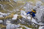 
|
difficult_alpine_hiking
|
T6
white with blue stripe |
Includes climbing pitches up to UIAA grade II. | Severe exposure. Difficult craggy terrain. Glaciers with high risk of sliding. |
|
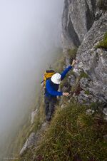 
|
The illustration images above have been provided by Marco Volken, member of the SAC trail classification working group.
Relationship to Swiss Alpine Club Mountain and Alpine Hiking Scale
The scale is based on the SAC Mountain and Alpine Hiking Scale, but modified for OSM needs.
The 2023 revision of the SAC Scale specifies a blurred matching: See German French Version.
| Tag | If marked on site more | less (likely) | ||
|---|---|---|---|
| sac_scale=hiking | T1 | ||
| sac_scale=mountain_hiking | T2 | ||
| sac_scale=demanding_mountain_hiking | T3 | ||
| sac_scale=alpine_hiking | T4 | ||
| sac_scale=demanding_alpine_hiking | T5 | ||
| sac_scale=difficult_alpine_hiking | T6 | ||
More pictures
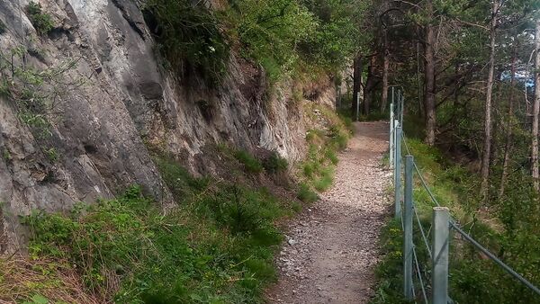 |
Trail well paved. Exposed areas well secured. |
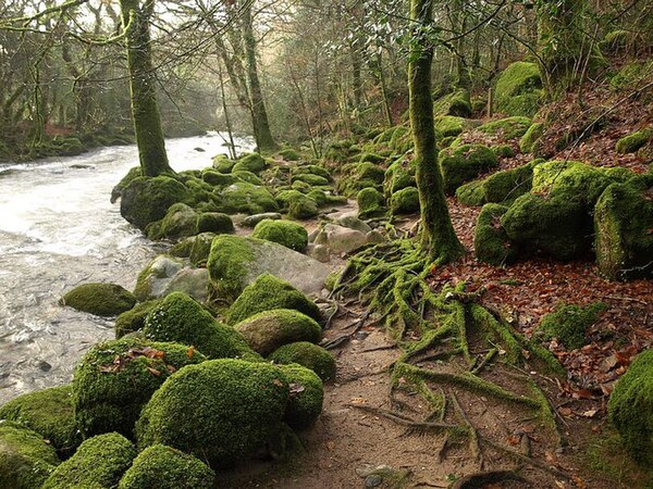 |
Continuous trail. Basic surefootedness required.
In a poll of the German community 16 out of 31 voted this picture shows hiking while 15 considered it mountain_hiking. [2] |
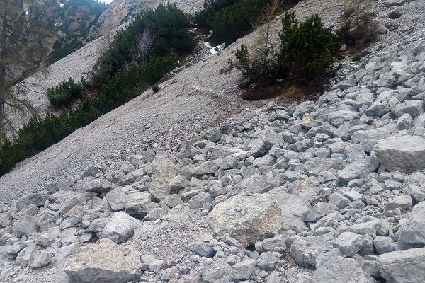 |
Trail not continuous. |
Granularity
Between two crossroads, a hiking trail can have varying difficulty. For example, it might be mountain_hiking most of the way, but in the middle, there might be a stretch where you need to use your hands in order to advance. There are tto approaches how to map this:
- Map the trail according to the highest difficulty found between the crossroads. Rationale: This makes it much more likely a user will not overlook the higher difficulty on a shorter stretch of path that he or she is not comfortable with. This is also easier to map as it needs less tagging and less segments. Disadvantage: User might assume the whole of the trail is a lot more demanding than it actually is.
- Split the trail into different segments with each having the appropriate sac_scale applied. Rationale: This reflects reality better and still lets renderers apply logic to display maps as if they were mapped accordign to method 1 while still allowing routers to use the increased granularityto better guess time needed to traverse the trail. Disadvantages: A user might overlook a harder segment, more mapping work.
There is no consensus which approach is better.
Controversy
Based on the guidelines of verifiability some people find this tag lacking of verifiability. Please have a look at the discussion page at Talk:Proposed features/Hiking. As always on OSM, you are free to use the tags you like. Before changing an already existing value, the mapper who set the prior value might be contacted.
Possible tagging mistakes
See also
mtb:scale=*– a classification scheme for the difficulty of trails for mountainbiking- Relation of SAC scale to mtb:scale
- Consider using
incline=up/downto specify the direction of the way up or down the mountain. climbing:grade:uiaa=*– UIAA Grade for Rock Climbingassisted_trail=*– Indicates that the dangerous or difficult sections of a hiking path are secured by technical means- Hiking
- Hiking Maps to see how this tag is rendered by OSM hiking maps
- highway=via ferrata
- JOSM Mappaint style
- Approved proposal for this tag
Voting
Voting on this proposal has been closed.
It was approved with 28 votes for, 5 votes against and 2 abstentions.
 I approve this proposal. Well, I suggested it so I vote in favour :-). --Supsup (talk) 18:21, 15 October 2024 (UTC)
 I approve this proposal. Duja (talk) 18:35, 15 October 2024 (UTC)
 I approve this proposal. --Cick0 (talk) 21:43, 15 October 2024 (UTC)
 I approve this proposal. --Fizzie41 (talk) 21:47, 15 October 2024 (UTC)
 I approve this proposal. but I'd recommend for the wiki to give priority to the waymarked classification on the ground if there is any. I would prefer to tag swiss official hiking routes as sac_scale=hiking rather than sac_scale=strolling even if they would fulfill the criteria for "strolling" here. Otherwise I'd expect complications for people/renderers that rely on the previous tagging scheme.--Segubi (talk)
 I oppose this proposal. sac_scale should stay at the official class values! --chris66 (talk) 06:22, 16 October 2024 (UTC)
 I approve this proposal. --rhhs (talk) 06:43, 16 October 2024 (UTC)
 I approve this proposal. I would prefer to remove the instruction to use "solely on hiking trails" - mappers should feel free to use the tag where it is useful in the context of its surroundings, without having to decide "is this a hiking trail or not". For example, if an area with a lot of hiking trails also has a path constructed to be widely accessible. But that is a minor aspect of the proposal that does not affect my vote. --Alan gr (talk) 07:39, 16 October 2024 (UTC)
 I approve this proposal. I can see the compromise it brings between simplicity (prefer one scheme only) and overlap with an existing scheme; anyway, this sounds as a helpful extension of the SAC scale --VojtaFilip (talk) 08:00, 16 October 2024 (UTC)
 I oppose this proposal. while I understand the intention this proposal has several quirks: 1. It should not be limited to only three types of highways as
 sac_scale=*is also useful with unpavedhighway=serviceandhighway=unclassifiedat least. 2.strollingis misleading as it makes the impression that a way is suitable for stroller which heavily depends on thesurface=*. 3. Adding a value belowhikingredefines the latter but there is no concept presented howto make the transition to the new value in the database. --Skyper (talk) 11:55, 16 October 2024 (UTC)
- Re your first point: It's true that the proposal, under "how the wiki would look like if passed", says the tag should only be used for path, track, and footway. But that was directly copied from the current Wiki page and the proposal doesn't change it. So am I right that that's not something that is being voted on? @Supsup: can you clarify? Osmuser63783 (talk) 17:24, 17 October 2024 (UTC)
- Yes, that keeps from the original wiki. I think it can be widened to these unpaved highways too even without a vote. As for strollers, "to stroll" is defined as "to walk in a slow relaxed way, especially for pleasure" which sounds quite apt to me. I am not sure the connection between strolling and a stroller is so strong, but I am not a native speaker. I would be curious about a better suggestion. Indeed, the transition is not very developed, Supsup (talk) 18:41, 17 October 2024 (UTC)
- Re your first point: It's true that the proposal, under "how the wiki would look like if passed", says the tag should only be used for path, track, and footway. But that was directly copied from the current Wiki page and the proposal doesn't change it. So am I right that that's not something that is being voted on? @Supsup: can you clarify? Osmuser63783 (talk) 17:24, 17 October 2024 (UTC)
 I approve this proposal. I strongly believe that the difficulty for foot-travel needs to have a low value below
 sac_scale=hikingthat is different from an unknown/unsurveyed status. This proposal accomplishes that goal. While I'd prefer thefoot_scale=*alternative to fully separate from the Swiss Alpine Club's SAC scale terminology, I accept this proposal as reasonable given how far the OSMsac_scale=*has diverged from the SAC T1-T6 scale already. --Adamfranco (talk) 13:21, 16 October 2024 (UTC) I oppose this proposal. While I agree with the proposed clarifications to sac_scale, I oppose the proposed extenstion for "strolling" and the use with highway=path. Right now path is an ill-defined tag including both wide, paved, mixed-use cycleways and real single-trail hiking trails. Wee could use sac_scale to distinguish between the two. With the proposed extension, but no requirement to acutally use sac_scale we would loose this chance to resolve the ambiguity. It would be better to not introduce strolling and not use sac_scale with mixed-use ways or add a requirement for sac_scale to always be used with path to make path/strolling and path/hiking distinguishable. --Nop (talk) 06:41, 17 October 2024 (UTC)
- You could still do that by simply looking at the actual value of the `sac_scale=*` tag to see if it is `hiking` or any of the higher difficulties (which you need to do _anyway_ to catch invalid values). The addition of a new value does not prevent that in any way. --Woazboat (talk) 12:24, 18 October 2024 (UTC)
 I have comments but abstain from voting on this proposal. I think a scale indication should remain consistent with the underlying scale (here from SAC). --Chris2map (talk) 17:39, 17 October 2024 (UTC)
- I like bullet (3) in the proposal: "make it explicit that while OSM's sac_scale is based on the Swiss Alpine Club scale, it is its own thing." As noticed in the page, there was a revision in 2023 on the SAC side, and there may be other in the future. Possibly the key "sac_scale" was poorly chosen initially, but that's what it is now, an OSM key, nothing more, nothing less. --Yvecai (talk) 05:07, 18 October 2024 (UTC)
 I approve this proposal. It's a good idea to be explicit and complete the scale with a simple, clear value. --Yvecai (talk) 05:07, 18 October 2024 (UTC)
 I approve this proposal. Timmy_Tesseract (talk) 09:39, 18 October 2024 (UTC)
 I approve this proposal. I supported the idea of a tag 'below' T1/hiking even before this proposal, so that's obviously a yes from me. The official SAC scale and the sac_scale tag in OSM have already diverged, so clarifying that explicitly is a good idea. The use of sac_scale to indicate path difficulty in non-mountainous regions is already widespread (for good reason, artificially limiting the tag to 'mountains' doesn't make any sense when it can also perfectly describe path difficulty in other regions), so that is more or less just fixing the documentation to match actual use. --Woazboat (talk) 12:15, 18 October 2024 (UTC)
 I approve this proposal. ArcticRocinante (talk) 00:11, 20 October 2024 (UTC)
 I approve this proposal. -깨몽/dreamy (talk) 11:57, 20 October 2024 (UTC)
 I have comments but abstain from voting on this proposal. Same reasons as Chris2map --Nospam2005 (talk) 13:40, 20 October 2024 (UTC)
 I approve this proposal. I like the idea of a simple tag to describe easy/everyday/no difficulty. Should it stay in the SAC scale in the long run? Future will tell but I do not foresee any difficulty to amend this if a different tagging schema emerges. I am also OK with `strolling`Divaddivag (talk)
 I approve this proposal. It makes the scale more comprehensive. I'm also on board with further edit to expand the scope of sac_scale to cover any unpaved roads, beyond the current three options. --julcnx (talk) 15:16, 20 October 2024 (UTC)
 I approve this proposal. --JIDB (talk) 17:17, 20 October 2024 (UTC)
 I approve this proposal. Good idea, as this addresses one of the main weaknesses of `sac_scale`: the lowest category is too wide and includes a lot of paths I wouldn't be comfortable recommending to someone who has difficulty walking. It will take some time to revisit existing ways tagged
 sac_scale=hikingas some of them should probably besac_scale=strollinginstead, but that's not really a problem: it's more problematic to underestimate the difficulty of a hiking path than to overestimate it. Re @Skyper:'s comment: I assume here we're not voting on limitingsac_scale=*to path, track and footway. It's commonly used on steps and on roads, especially unpaved ones, and it should continue to be. Osmuser63783 (talk) 17:31, 20 October 2024 (UTC) I approve this proposal. --Pb07 (talk) 18:04, 20 October 2024 (UTC)The difference sac_scale = scrolling/hiking covers the same thing that the difference route=hiking/route=foot but it is better to have it at the way level.
 I approve this proposal. --Lumikeiju (talk) 18:46, 20 October 2024 (UTC)
 I oppose this proposal. Use for strollers and people with crutches should be better an
 access=*tag such asstroller=yes(tag already exists),walker=yesorcrutches=yes. This proposal extends some form of surface tag with values for access. --Fabi2 (talk) 19:27, 20 October 2024 (UTC)
- Disagree. The access tag defined who is (by law) allowed to use something. It has nothing to do with practicality or surface quality. A path that isn't designed for wheelchair users usually doesn't forbid wheelchair users access. -- Jonathan Haas (talk) 10:46, 21 October 2024 (UTC)
 I approve this proposal. --Heilbron 20:43, 20 October 2024 (UTC)
 I approve this proposal. --Aighes (talk) 21:30, 20 October 2024 (UTC)
 I approve this proposal. A value beneath T1 can be helpful. Inferring "T0" from other tags is more error-prone than if it is tagged directly. I do not like the deviation from the original SAC scale, but that ship has sailed and, thus, does not really affect my decision. I hope we can rename this scale to something more generic in the future and introduce the actual SAC scale. --Crodthauser (talk) 21:55, 20 October 2024 (UTC)
 I approve this proposal. --Adiatmad (talk) 02:26, 21 October 2024 (UTC)
 I approve this proposal. --Jonathan Haas (talk) 10:46, 21 October 2024 (UTC)
 I approve this proposal. --mahau (talk) 17:34, 21 October 2024 (UTC)
 I oppose this proposal. I support defining a way to tag a path whose difficulty falls below T1, but I think "strolling" is a not great name. I'd rather see this value proposed as
 sac_scale=nowhich IMO communicates the same thing, without implying that the value is officially defined by SAC. — Jake Low (talk) 05:29, 25 October 2024 (UTC) I approve this proposal. --EneaSuper (talk) 13:43, 27 October 2024 (UTC)
 I approve this proposal. While it is unfortunate that OSM is stuck with a scale based on some specific regional scaling system, at least this adds a needed value since OSM has long ago moved beyond only tagging "officially"-rated routes. I don't think "strolling" is a very good name, but I can't really think of a much better alternative. HellMap (talk) 21:40, 27 October 2024 (UTC)
