Uk:Featured images/Jul-Sep 2017
Jump to navigation
Jump to search


These are featured images, which have been identified as the best examples of OpenStreetMap mapping, or as useful illustrations of the OpenStreetMap project.
If you know another image of similar quality, you can nominate it on Featured image proposals.
| ← з липня по вересень 2016 р. | ← з квітня по червень 2017 р. | з жовтня по грудень 2017 р. → | з липня по вересень 2018 р. → |
Галерея зі значними зображеннями, з липня по вересень 2017 року
-
 2017, тиждень 27
 -
 2017, тиждень 28
 -
 2017, тиждень 29
 -
 2017, тиждень 30
 -
 2017, тиждень 31
 -
 2017, тиждень 32
 -
 2017, тиждень 33
 -
 2017, тиждень 34
 -
 2017, тиждень 35
 -
 2017, тиждень 36
 -
 2017, тиждень 37
 -
 2017, тиждень 38
 -
 2017, тиждень 39
Детали и титры
Тиждень 27 (з понеділок 3 липня 2017 року до неділя 9 липня 2017 року) [Edit]

- English : With drone pilots, Marines, Navy and Army's Scout Rangers, User:Schadow1 organised a mapping expedition in southern Philippines for logistics, navigation, military operations purposes, and tourism. 1,957 data elements were added by the expedition.
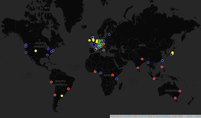
Тиждень 28 (з понеділок 10 липня 2017 року до неділя 16 липня 2017 року) [Edit]

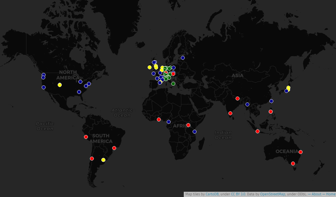
- English : An historical map locating all State Of The Map conferences that took place since 2007. An interactive map is also available, made with UMap.
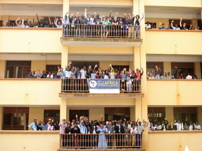
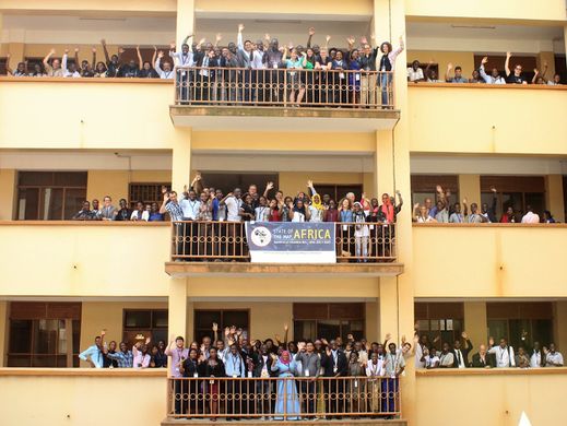
Тиждень 29 (з понеділок 17 липня 2017 року до неділя 23 липня 2017 року) [Edit]

- English : The first “State of the Map Africa” conference took place one week ago in Kampala, Uganda.
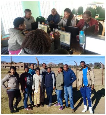
Тиждень 30 (з понеділок 24 липня 2017 року до неділя 30 липня 2017 року) [Edit]

- English : Mzwandile Thokoane from the MapLesotho project, lead a mapping event to bring advanced JOSM mapping back to Hlotse, in Leribe, Lesotho.
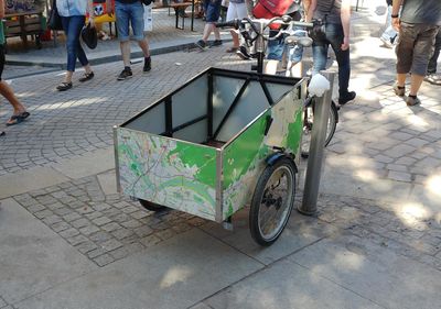
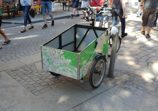
Тиждень 31 (з понеділок 31 липня 2017 року до неділя 6 серпня 2017 року) [Edit]

- English : Spotted wheeling the streets of Dresden, Germany, this tricycle has a localised OpenStreetMap design!
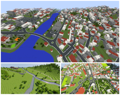
Тиждень 32 (з понеділок 7 серпня 2017 року до неділя 13 серпня 2017 року) [Edit]

- English : OpenStreetMap data can be represented in the 3D blocky virtual world of Minecraft. See Minecraft for a list of projects to make this conversion. These scenes were created by WorldBloxer.
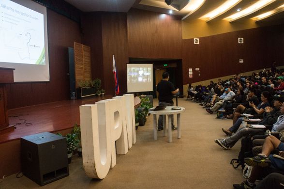
Тиждень 33 (з понеділок 14 серпня 2017 року до неділя 20 серпня 2017 року) [Edit]

- English : Presenting OpenStreetMap and GPS mapping to an audience of over 100 mountaineers at AkyatCon2.0, the conference of the University of Philippines Mountaineers (UPM).
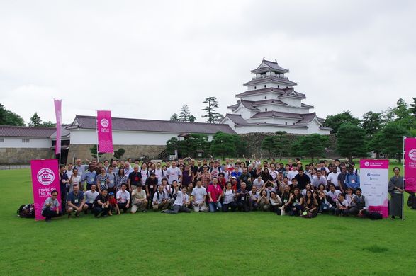
Тиждень 34 (з понеділок 21 серпня 2017 року до неділя 27 серпня 2017 року) [Edit]

- English : The international OpenStreetMap conference State Of The Map 2017 took place last weekend in Aizu-Wakamatsu, Japan.
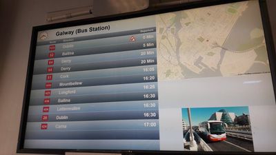
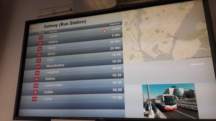
Тиждень 35 (з понеділок 28 серпня 2017 року до неділя 3 вересня 2017 року) [Edit]

- English : OpenStreetMap in the information screens of the Ireland bus company Bus Éireann.
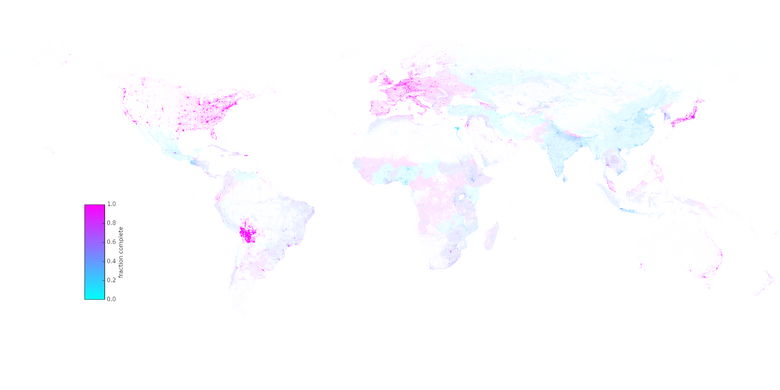
Тиждень 36 (з понеділок 4 вересня 2017 року до неділя 10 вересня 2017 року) [Edit]

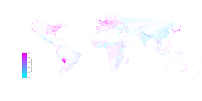
- English : A research article by Christopher Barrington-Leigh and Adam Millard-Ball has undertaken worldwide completeness analysis of OpenStreetMap's road coverage based on visual comparison of imagery and other statistical methods.
Тиждень 37 (з понеділок 11 вересня 2017 року до неділя 17 вересня 2017 року) [Edit]

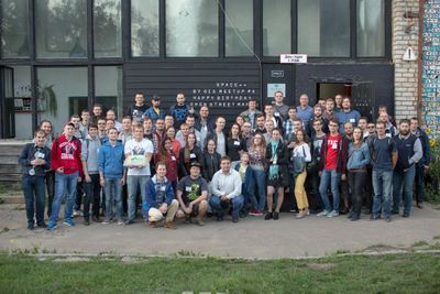
- English : In Belarus the OpenStreetMap community came together with the byGIS community for a big gathering with presentations and an OpenStreetMap birthday cake! More details, photos and talk videos on Gardster's OSM diary.
Тиждень 38 (з понеділок 18 вересня 2017 року до неділя 24 вересня 2017 року) [Edit]

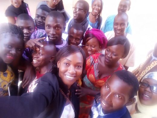
Тиждень 39 (з понеділок 25 вересня 2017 року до неділя 1 жовтня 2017 року) [Edit]

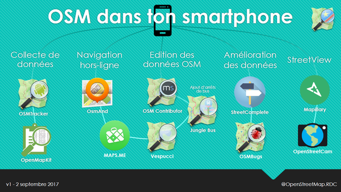
- English : A selection of Android apps for different types of OpenStreetMap contribution and use, presented by Claire Halleux at a recent mapathon in Kinshasa.