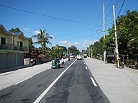
This section shows appropriate tagging for roads.
| Name
|
Description
|
Examples
|
Picture
|
Speed (in kilometers per hour/kph)
|
| Motorway
|
Expressways
|
|


|
60 (minimum); 80 (maximum for trucks and buses); 100 (maximum)
|
| Motorway link
|
Expressway entrance and exit ramps, usually with toll gates.
|
|
|
40 (if legal, tag as maxspeed=*)(if advisory, tag as maxspeed:advisory=*
|
| Trunk
|
- Primary national roads and major urban thoroughfares connecting major cities and administrative areas.
- Urban areas: typically four-lane roads with a white center line or divided multi-lane roads with a center island.
- Rural trunk roads may range from two-lane roads to four-lane roads, sometimes the two added lanes are former shoulders.
|
|


|
40-80 (unless signed)
|
| Trunk link
|
Ramps on non-expressway grade roads, slip roads between roads of the same type or below (primary, secondary, tertiary, etc.), and U-turn slots
|
|
|
|
| Primary
|
- Primary national highways (or sections of) not listed as parts of the core network
|
|


|
40-60 (unless signed)
|
| Primary link
|
Ramps on roads that does not serve the function of a trunk road, slip roads between roads of the same type or lower (secondary, tertiary, unclassified, etc), and U-turn slots
|
|
|
40-60 (unless signed)
|
| Secondary
|
Secondary importance roads usually connecting barangays with the city/town center.
|
|


|
30-60
|
| Tertiary
|
Tertiary-importance roads usually serving a barangay or residential area and mostly lined with houses. Collector roads on a populated area.
|
|

|
20-40
|
| Unclassified
|
Roads usually serving through traffic on industrial or commercial areas. May occur on rural areas as a less important road on a barangay, usually paralleling a road tagged with highway=tertiary.
|
|
|
20-40
|
| Residential
|
Roads on residential areas.
|
|

|
20 (unless signed)
|
| Service
|
Parking lot roads. Roads around malls, industrial areas, or commercial areas, unless it serves as a through route.
|
|
|
The simple guide
- Motorway:
- Trunk:
- Routes 1-11 (backbone national roads, with exceptions listed below)
- Route 51, 52, 53, 54, 55 (except portion in Dagupan bypassed by Route 241 and De Venecia Avenue), 56, 57, 58, 59, 60, 61, 62 (Bacoor-Kawit section only), 64, 65 (except section in Carmona bypassed by Route 651), 66, 68, 69, 70 ,75, 76, 78, 79, 80, and 81
- Secondary national roads (or segments of) constituting part of the Strong Republic National Highway routes, or those part of the provincial strategic highway systems.
- Primary:
- All primary and secondary national roads that are not part of the backbone network and the
- Tertiary national roads that are major arteries (connects other municipality and complements the trunk highway network).
- Secondary
- Tertiary national roads, if it mostly used as a minor artery (complements
- Provincial roads
- All city/municipally-maintained roads that function as arterials
- Tertiary
- Unclassified
- All other through roads that are of minor importance
Rationale
Access details (revised)
| Name
|
Description
|
Examples
|
| access=permissive
|
Roads that permit outside traffic unconditionally.
|
Roads on some subdivisions. Drive-thru of fast-food restaurants.
|
| access=private
|
Roads leading to a private house/lot and usually dead-end
|
Roads running through privately owned land, usually marked with No Trespassing signs.
|
| access=destination
|
Roads only allowing local traffic (bound for the destination, usually with conditions for outsiders)
|
Roads on private subdivisions/residential areas, where a sticker is required for access, unless one is a short-period visitor.
|
| toll=yes
|
Payment is needed for using a road, either by card, ticket, toll barrier, or electronic collection, as in toll roads.
|
All expressways in the Philippines. Not all segments are tolled, like the South Luzon Expressway between Calamba toll plaza and Ayala Greenfield toll plaza. Others have barriers or toll plazas on the entrances only, like the portion of the North Luzon Expressway between Balintawak toll plaza and Bocaue Exit. Do not tag exit ramps without toll gates with toll=yes, and only tag the main expressway and the entrances.
|
Road route relations
Routes of national roads maintained/designated by the Department of Public Works and Highways (DPWH) should be named on the name designated (if the route number represents the whole road route) or, in case, the route number (if route number is divided into differently named roads, e.g. N 120 in Metro Manila). Tertiary roads are to have their relations, unless the designated name matches the signed or local names.
| Tag
|
Description
|
Examples/tags
|
| name
|
The route number, in the format E[number] or Route [number]. Add a name in parentheses if the whole route has one known name.
|
E2, Route 1, Route 65, Route 420 (Santa Rosa - Ulat - Tagaytay Road),
|
| ref
|
The signed number of the route.
|
1, 65, 120, E2
|
| network
|
The route system where the road belongs. For the national highways in the Philippines, the network is the National Highway Network (NHN).
|
PH:nhn
|
| nhn:class
|
The classification of the road by the Department of Public Works and Highways.
|
primary; secondary; tertiary
|
| route
|
The type of road
|
|
See User:TagaSanPedroAko/Philippines_Tagging/Roads/Numbered routes for progress on mapping of numbered routes


