Zh-hant:選擇你的繪製方法
| 取得協助 | 關於 OpenStreetMap | 瀏覽 | 頁獻方式 | 頁獻地圖資料 | 編輯器 | 詞彙表 | 新手入門指南 | |||||||||||||
這一頁正在進行翻譯:因為可能有遺漏、錯誤或未翻譯的片段而掛上這個模版。 如果你懂得英語、你可以幫助我們完成此中文(繁體) 翻譯。閱讀有關說明「幫助我們翻譯此wiki頁」。 用戶 tntchn正在翻譯本文。 繪製地圖的方法主要分為使用參考資料以及田野實察兩種。你可以使用他人所搜集的資料(如街景圖片或GPS軌跡)、航拍及衛星圖資、或你自己所擁有的地理知識繪圖,或實地到目標場域進行實地的田野調察來獲取繪圖所需要的資訊。 本文的內容僅是讓你對於製圖有初步的概念,你不一定要把本文的內容全部都搞懂才開始繪製。對於一般製圖的初學者來說,使用航空圖片製圖最容易上手,但沒有經過田野調查進行製圖有其製圖的限制,因此在開放街圖中還是建議你結合你實地訪察的資料完成製圖。 關於更多製圖上的技法,請參見:Mapping techniques。 使用參考資料以下列出的幾種參考資料都是在遵守授權條款或是有經過特別許可在開放街圖中使用,請安心使用。切記在做任何編輯時,請不要使用任何不合授權條款的來源。 大部份在網路上可以找到的免費或付費的資源,如 Google 地圖等,都是有版權的。在做編輯時基本的原則是不要隨便使用編輯器提供之外的參考外部資料。如果你在網路上發現有其他版權許可的資料,請聯繫社群看其是否可以加進編輯器所提供的圖層中做使用。 你的記憶以及知識
航空圖片在開放街圖中可以使用幾乎航拍圖資,你可以在主流的編輯器中使用。
在使用航空圖片時,你可能會發現先前繪製的道路跟圖片中道路的位置有偏差。除非你確定圖片的道路比原本繪製的道路更精準,否則應該利用圖片偏移的功能把航空圖片底圖對齊現有的道路。
你也可以利用這個方法把圖片對齊別人錄製的GPS軌跡,可參考下段開啟GPS軌跡的方式。 使用航空圖片的好處可見此。但你也要注意航空圖資是否過時(有些圖資甚至數十年沒有更新!)或是有所變型,並且有一些缺點。要成為一個更好的製圖者,你應該把航空圖片 結合其他資料搜集方式合併使用。 使用他人所記錄的GPS軌跡GPS軌跡(GPX tracelog)是一種可以將旅途的軌跡記錄下來的檔案。你可以參考他人在開放街圖中上傳的 GPS 軌跡(大部份都是公路的路線資訊)將其繪製在開放街圖中。你也可以錄製自己的 GPS 軌跡,錄製的方法會在田野實察的章節中說明。以下為在編輯器中取得並使用 GPS 軌跡的方法:
街景資料Mapillary 和 OpenStreetCam 都有提供由世界各地的使用者上傳並共享的街景圖資,你也可以使用 Bing 所授權的 StreetSide圖資 來輔助繪製。 Mapillary
你也可以上傳資料到 Mapillary。這個部份會在田野實察的章節中詳細介紹。 OpenStreetCam
Bing Streetside
Pic4CartoPic4Carto combines pictures from several sources (Wikimedia Commons, Flickr, Mapillary, OpenStreetCam) and shows them all in a simple web user interface. 田野實察The idea behind outdoor mapping is to go out and gather data. This is often the only way to map everything on the surface. Many shops and points of interest are often unseen with armchair techniques. Here are some outdoor techniques. 在定點使用手機編輯For quick editing of maps on the go, try out StreetComplete. It asks you simple questions about POIs nearby and submits your answers back to OpenStreetMap. Some apps like OsmAnd and Maps.Me allow you to edit the map on the spot. Creating a whole map may, however, be less convenient than with a computer. 使用紙張記錄
You can use paper to take textual notes or draw. You can also use an electronic device to take notes. Field Papers
Field Papers 是一個可以線上製作可供列印的地圖的工具,你可以使用 Field Papers 將地圖印下來後在紙上做註記。 拍攝不包含位置資訊的影像You can use a camera, a smartphone, or a voice recorder, to take photos, videos, and voice notes. This is very simple, but you'll need to manually or indirectly figure out the location the media was taken. Some techniques for this are described in Photo_mapping, Audio_mapping, and Video_mapping. You can also capture media with a location, allowing JOSM to put them at the right place on the map. See 拍攝包含位置資訊的影像. 記錄軌跡A tracelog is a file containing a recording of the path of a trip. Smartphones and dedicated receivers can record tracelogs. For smartphones, many apps are available. Search for one with GPX file export support. It is the format used by OpenStreetMap. Once recorded, the tracelogs can be used to draw roads on the map. Once you obtain a GPX file, you usually transfer it to the computer. You can then import it to JOSM or upload it so that others can use it. Some smartphone apps can upload the recordings directly to OpenStreetMap as well. Once uploaded, you and others can download and use the GPX track and use it as described in the Armchair Mapping section about tracelogs, or you can import it to JOSM without uploading it (or prior to uploading it). If your GPS receiver or app doesn't create GPX files, you can convert them. Note that some devices are more accurate than others. If your device is inaccurate, consider doing more than one recording, then putting the road on the rough average path of the traces. Ensure that your GPS unit has the 'Snap to road' or 'Lock on road' option switched OFF, if it has one. Tracelogs can be uploaded with various privacy settings, see Visibility_of_GPS_traces. A very popular Android app for GPX recording is GPS Logger, click here for a detailed learnOSM guide. If you also want to capture photos and audio recordings with their location on Android, see Pick_your_mapping_technique#Explicit_Waypoints. 加上註解Some devices or smartphone apps support note creation along tracelog path. The notes are embedded in the GPX file and can be seen on the map when you import the file to an editor.
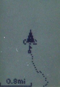
為地標編號Some devices (usually GPS receivers that have no keyboard) allow you to insert sequentially numbered points of interest by clicking a button. In the example shown, the cartographer stopped in a pub car park, and marked a waypoint which was stored as number 206. Use a notepad, or dictating-machine, to record what that waypoint corresponds to. Although it's sometimes possible to type this information into the GPS itself, it can be very fiddly. Some GPS models allow you take an 'average' point. This will take multiple GPS points and then average all the points, in theory creating a more accurate waypoint. Usually this is used when accuracy is higher priority with the data collection and time isn't as much as a factor but this can still be done quickly.
拍攝包含位置資訊的影像Photos and voice recordings can be automatically correlated with a location using many techniques. This usually involves transferring the media files to the computer and importing them to JOSM for processing. We'll only explain the most common techniques briefly here. Please see Photo_mapping, Audio_mapping for more detailed info and specific instructions. 含有地理資訊的圖片現在有許多的手機和相機都可以在拍攝相片時同時將地理資訊加入至相片檔案中,你只要在拍攝前開啟你的裝置內的設定,並匯入 JOSM 編輯器中,即會在正確的位置顯示圖片,在製圖時比對資料非常方便。 Tracelog synchronizationFor photos that have no embedded geo-location data, or for any audio file, you need to synchronize the media with a GPX log. This allows JOSM to place them on the proper place on the map. There are two primary ways to do it: Explicit WaypointsSome smartphone apps can record GPX logs, and can also be used to take photos voice notes and text. They then embed the media file names and the time they were taken inside the GPX file as explicit waypoints. This ensures the media can be properly located on the map when imported to JOSM.
TimestampsThis technique allows you to use separate devices. (It can still be used on a single device, too) For instance, you can record tracelogs with a smartphone or a GPS receiver, and take photos with a regular camera, and the photo can still be located on the map! Every file has a timestamp indicating its creation date. If you are recording a tracelog and you take a photo or record a voice note during that time, a capable editor like JOSM can put that media on the proper location on the map by correlating the file's time stamp with the tracelog. The neat thing here is that the device that took the media and the device recording the tracelog don't have to be the same device. Beware that some file transfer techniques modify and ruin the file's timestamp. Refer to Photo_mapping, Audio_mapping for more details. Upload street view dataYou can use Mapillary or OpenStreetCam to upload data (through Android/iPhone apps or through the web). You can then use that data as described in Pick_your_mapping_technique#Street_view_data. The advantage is that others can use your media as well. 下一步 |
||||||||||||||||||||
