Sv:Vandring

|
| Beskrivning |
| Om taggning av linjer, punkter, områden och relationer relaterade till vandring och löpning. |
| Taggar |
På den här sidan kommer vi att beskriva hur man taggar linjer, punkter, områden och relationer relaterade till vandring och löpning.
Tagging ways, points and areas
| Key | Value | Element | Comment | Photo | |||
|---|---|---|---|---|---|---|---|
Ways | |||||||
| highway | path | Preferably used for a hiking path/trail. Follow the photo guide for help with tagging. |

| ||||
| footway | For designated footpaths, i.e. mainly/exclusively for pedestrians. | 
| |||||
| track | Rough roads normally used for agricultural or forestry uses etc. Use tracktype=* to describe the surface. | 
| |||||
| ford | yes stepping_stones |
The way crosses through stream or river. | 
| ||||
Attributes of ways | |||||||
| surface (optional) | asphalt cobblestone sett concrete wood compacted ground dirt grass gravel etc. |
The surface of the trail. | 
| ||||
| sac_scale (optional) | hiking mountain_hiking demanding_mountain_hiking alpine_hiking demanding_alpine_hiking difficult_alpine_hiking |
A difficulty rating scheme for hiking trails. | 
| ||||
| trail_visibility (optional) | excellent good intermediate bad horrible no |
This key describes attributes regarding trail visibility and orientation. | 
| ||||
| incline (optional) | value% up down |
For marking a way's incline (or steepness/slope). | 
| ||||
| tracktype (optional) | grade1 grade2 grade3 grade4 grade5 |
Paved track surface of gravel or densely packed dirt/sand an even mixture of hard and soft materials prominently dirt/sand/grass, but with some hard materials only grass, sand and/or soil |

| ||||
| assisted_trail (optional) | yes | Way segment with various safety measures | 
| ||||
| trailblazed (optional) | yes | Way segment with frequent way markings (examples; tape/ribbon, painted arrows, metal arrow signs) | 
| ||||
Infrastructure | |||||||
| tourism | alpine_hut | An alpine hut is a remote building located in the mountains intended to provide board and lodging. It is managed during the opening period. | 
| ||||
| tourism | wilderness_hut | A wilderness hut is a remote building with fireplace intended to provide shelter and sleeping accommodation. | 
| ||||
| amenity | shelter | A small shelter against bad weather conditions. To additionally describe the kind of shelter use shelter_type=*. | 
| ||||
| shelter_type (optional) | basic_hut | A basic hut is a remote building intended to provide basic shelter and sleeping accommodation. | 
| ||||
| lean_to | A lean-to is a shed with typically three walls located in the countryside intended to provide shelter. | 
| |||||
| picnic_shelter | Structure on picnic sites to protect from rain. Normally open to all sides. | 
| |||||
| rock_shelter | Shallow cave-like opening at the base of a bluff or cliff. | 
| |||||
| tourism | camp_site | Backcountry camping without facilities. The access is usually restricted to foot, bicycle, canoe or ski. Set backcountry=yes. | 
| ||||
| tourism | information | Information resource for tourists and visitors. To additionally describe the kind of information use information=*. | 
| ||||
| information (optional) | board | A board with information. | 
| ||||
| map | A board with a map. | 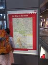
| |||||
| guidepost | Signpost/Guidepost See also Relation:destination sign |

| |||||
| amenity | parking | Parking place. Often found at trailheads. | 
| ||||
| amenity | bench | Bench | 
| ||||
| amenity | toilets | Toilets | 
| ||||
| tourism | picnic_site | A place where you can have an outdoor picnic. Optional: fireplace=yes. See also fire pit: leisure=firepit | 
| ||||
| barrier | gate | An entrance that can be opened or closed to get through the barrier. | 
| ||||
| checkpoint | hiking | Checkpoint for hiking. | |||||
| man_made | cairn | An artificial pile of stones, often in a conical form. It is used by hikers, villagers, pilgrims, etc. as a mark to show the way, a border, or peak of mountain. | 
| ||||
| man_made | footwear decontamination | A facility to decontaminate footwear for hikers. | 
| ||||
| shop | outdoor | Shop focused on selling camping, walking, climbing, and other outdoor sports equipment (GPSes, etc.) | 
| ||||
| safety_rope | yes/length in m | a chain or rope as safety measure on the trail | 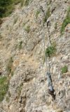
| ||||
| ladder | yes/length in m | a ladder as safety measure on the trail | 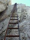
| ||||
| rungs | yes/amount | rungs, stemples or pins as safety measure on the trail | |||||
Nature | |||||||
| natural | peak | Top of a hill or mountain (summit) add: name=* ele=* |

| ||||
| natural | volcano | A volcano, either dormant, extinct or active | 
| ||||
| natural | saddle | The lowest point along a ridge or between two mountain tops. add: name=* ele=* |

| ||||
| mountain_pass | yes | The highest point of a mountain pass. add, if node is not identical to natural=saddle: name=* ele=* |

| ||||
| natural | valley | A valley | 
| ||||
| natural | ridge | A mountain or hill ridge | 
| ||||
| natural | arete | A thin, almost knife-like, ridge of rock which is typically formed when two glaciers erode parallel U-shaped valleys | 
| ||||
| natural | water | Lakes, etc. | 
| ||||
| tourism | viewpoint | A place with a good view of surrounding countryside. | 
| ||||
| amenity | drinking_water | A source of drinking water. | 
| ||||
| natural | spring | A point where water flows to the surface of the earth from underground naturally. | 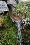
| ||||
| seasonal | yes, no, spring, summer, autumn, winter, wet_season, dry_season | Useful for natural features which appear or disappear with differing seasonal conditions. | |||||
Additional tags | |||||||
| place | locality | For an unpopulated named place. | 
| ||||
| name | Text | The common default name. | 
| ||||
| ele | Number | Elevation above sea level in metres. | 
| ||||
Tagging walking and hiking Route Networks
Foot and hiking routes are walking routes, an established course of travel along a set of ways between destinations. They are often named, numbered or otherwise identifiable. A foot route is generally a shorter, easier route, often intended for leisure. A hiking route is generally longer and/or more strenuous and may require experience to be navigated safely.
Routes that are suitable for inclusion in OSM should usually match one or more of the following guidelines:
- The route is signed or otherwise identifiable on the ground.
- The route is established, documented and/or maintained by an organization that is well known or officially responsible for this function (e.g. mountaineering clubs, tourism boards, ...).
- The route itself is shared common knowledge among a significant number of people that are not all mutually connected. This usually means that it is easy to find different sources of information about it online or many people living in the area know about it. Examples for routes matching this criteria include the Haute Randonnée Pyrénéenne or the Greater Patagonia Trail, which are both unofficial and mostly unsigned, but are well known among long distance hikers.
If in doubt, suitability of a route for inclusion in OSM should be discussed with the relevant OSM community.
User contributed routes uploaded to trip planning and travel guide websites should typically not be added to OSM unless other criteria are met.
To tag a foot or hiking route you create a relation with the appropriate tags and add all different ways of the foot/hiking route to this relation. The order of the ways matters. Please see Relation:route#Order matters
Tags of the relation
| Key | Value | Explanation |
|---|---|---|
| Required | ||
| type | route | This relation represents a route. |
| route | hiking | route=foot is used for routes which are walkable without any limitations regarding fitness, equipment or weather conditions. As a guideline, you could say that ordinary shoes or trainers (at a pinch, even flip-flops) are adequate for this type of walking trail.
route=hiking is used for routes that rather match Wikipedia's definition: "A long, vigorous walk, usually on trails, in the countryside"). As a guideline, you could say that a hiking trail needs walking shoes or hiking boots because you will encounter sharp rocks and/or heavy undergrowth and/or muddy terrain and/or have to wade through shallow streams. Don't use route=pilgrimage (almost non-existent). Instead, add pilgrimage=yes to a hiking-route. |
| Recommended | ||
| network | iwn | International walking network: long distance paths that cross several countries
National walking network: used for walking routes that are nationally significant and long distance paths Regional walking network: used for walking routes that cross regions and are regionally significant Local walking network: used for small local walking routes |
| Useful and tags. These tags are not at all required, but can provided additional and valuable information | ||
| ascent | ascent | The ascent covered by a route in metres. If a route has start and end point at different altitude use descent too |
| colour | a hex triplet | The major colour of the symbol used on the route. Colour code noted in hex triplet format or as CSS/HTML colour name. Example: "#008080" for teal colour in hex triplet, or simply "teal" as a css colour name. |
| descent | descent | The descent covered by a route in metres. Use it only if it differs from the ascent (different altitude at start/endpoint of a route). |
| description | a short description | What is special about this route |
| distance | distance | The distance covered by this route, if known. For information of users and automatic evaluation e.g. of completeness. Given including a unit and with a dot for decimals. (e.g. 12.5 km) |
| educational | yes/no | When the route is Educational trail |
| historic | yes/no | When the route is a historic or heritage trail |
| name | a name | The route is known by this name (e.g., "Westweg") |
| name:code=* | localised name | For adding localized names in different languages, add additional name:code=* tags with a suffix on the name key, where code is a language's ISO code. |
| operator | operator name | The route is operated by this authority/company etc. e.g. "Schwarzwaldverein", "Alpenverein" |
| osmc:symbol | * | Represents the symbol used on the route. Some renderers uses the osmc:symbol=* to indicate a route on the map. |
| ref | a reference | The route is known by this reference (e.g. "E1"). Node network routes use ref=mm-nn where mm and nn are the node reference numbers. |
| roundtrip | yes/no | Use roundtrip=no to indicate that a route goes from A to B and instead of being circular (roundtrip=yes). |
| signed_direction | yes/no | Use signed_direction=yes to indicate that the route is to be walked in only one direction, according to the signposts on the ground. The ways within the relation should be ordered, as they are used to determine the direction of the signposts. (Note: Since 2019, it's preferred not to use oneway=yes anymore, as it could cause confusion with oneway=* as a legal restriction. See discussion on tagging mailinglist). |
| stage | a reference to a stage | Sometimes longer routes are divided into stages. With this tag a stage reference can be indicated. |
| state | alternate | Sometimes routes may not be permanent or may be in a proposed state. See also the life cycle tags for this usage. |
| survey:date | yyyy-mm-dd | Date of the most recent survey |
| symbol | symbol description | Consider using osmc:symbol=* instead. Describes the symbol that is used to mark the way along the route, e.g., "Red cross on white background" for the "Frankenweg" in Franconia, Germany |
| website | * | Website that describes the route |
| wikipedia | language:page title | Wikipedia page that describes the route |
Elements of a relation
Routes consist of ways that mark where it leads. For hiking and walking relations it will by typically primarily highway=path, highway=footway, highway=track, highway=steps with some highway=cycleway, highway=service, highway=residential. Sometimes also highway=unclassified and other roads higher in road importance will appear.
A route relation may have one or more ways as elements. A route relation can also have other route relations as elements, called parent relation containing child relations or super relations.
Some mappers also add nodes as relation members, e.g. for major guideposts on the route.
Roles
Most of the time, elements will be added with an empty role. For recreational route relations, a basic functional role set has been approved, see Roles for recreational route relations. The approved roles are: main, alternative, approach, excursion, and connection. When no role is set, main is assumed. The roles are applicable to way members and relation members.
| Role value | Explanation |
|---|---|
| None or |
The role value for the main section(s) of a signposted or in any way waymarked route. |
| A signposted or otherwise waymarked alternative branching off then rejoining the main route at a significantly different point. The alternative is used instead of a section of the main route. | |
| A signposted or otherwise waymarked side track which rejoins the main track at or close to the same point where it left, e.g. to visit a place of interest. The excursion is an optional addition to the main route. | |
| Signposted or otherwise waymarked access route to or from transport infrastructure e.g. parking, train station, bus station, cable car. An approach is used in addition to the main route. | |
| Signposted or otherwise waymarked link route from one recreational route to another recreational route and vice versa. A connection is used to switch from one route to another. Note that an approach might act as a connection, e.g. when it ends/begins at a major train station where other routes also pass through. In that case, use the role approach. Given this definition, the connection should appear in both routes involved. | |
| A guidepost with directions regarding the path in question. |
(the above table is a template, you can edit it directly via this link)
Usage
Hiking routes are extensively mapped with route relations, and the Lonvia map will render route relations following this proposal and the osmc:symbol=*
Hiking routes are rendered for selected areas in Germany in a Hiking and Trail riding map (german). The tags required for rendering are:
- type=route
- route=hiking
- name=* Meaningful route name suitable for identifying this route.
- symbol=* Verbal description of the route marker symbols.
- osmc:symbol=* Coded description of the route marker symbols.
Since the tagging is generic, it is up to each country to decide how to map the hiking networks that exist in their country onto the hierarchy of national/regional/local. For countries with no specific local/regional/national "walking network", it may be helpful to consider whether different trails are managed or funded by government bodies at different levels.
See also Walking Routes.
Hiking trails that cross or touch normal roads should be connected to the road ways on the map. This will allow mixed routing applications to be built on OSM.
Mapping Projects
To compare and choose your favorite hiking map, there is a dedicated page :
Relief Mapping Projects
- Ideas for a new Hiking Map gather feature ideas for a new OSM Slippy map layer especially for hikers
- Shaded relief maps using mapnik Documentation about rendering a topographical map
- Relief maps Overwiew
- Hillshading with Mapnik Howto
Offline-Maps
- OpenAndroMaps - mostly Android, desktop viewer available
- haihui - offline hiking maps in the browser
- Trekarta - offline maps for Android with hiking mode that visualizes trail difficulty, visibility, OSMC symbols and hiking routes.
Maps for Garmin-devices
- OSM_Map_On_Garmin/Download Here are maps in Garmin image file format people have created from OSM data.
Online-Maps
- 4UMaps Outdoor maps for Mountainbiking and Hiking. Support the SAC hiking tags as well as track attributes. Additionally it has elevation lines, hill shading, accommodation etc.
- OSMC Wanderreitkarte shows OSM with contour lines and hill shading and hiking routes (Europe only)
- WayMarked Trails (ex-Lonvia's Weltwanderkarte) shows OSM with hill shading and hiking routes, among other interesting layers like MTB and rollerblades.
- Hikebikemap shows OSM with contour lines and hiking and biking routes
- Cyclemap shows OSM with contour lines and biking routes
- WORLD OSM WMS shows OSM with hill shading for Europe
- Hiking/openhikingmap shows OSM with contour lines and hill shading
- BeyondTracks.com/map Bushwalking maps for Australia, Tramping maps for New Zealand.
See Also
- Relief maps
- US National Park Service Tagging
- Proposed features/trailhead
- Proposed relation: Region Topographical use: mountain range / massive / mountain/ valleys
- Proposed features/trailblazed
- Route altitude profiles SRTM Create an altitude profile for routes based on the freely available NASA SRTM3 altitude data.
- OpenTrail OpenTrail aims to be an OSM-based Android app for UK hiking/walking.
- Managing waypoints with OSM Extract waypoints from OSM database.
- [1] Making Your Own Hiking Maps With Kosmos.
- hikingbook.pl This program will create hiking books out of osm files.
- UK Leisure Map A ruleset for Maperitive showing relevant features and UK public rights of way
- GB Leisure Carto A CartoCSS style and Python script for creating maps which use the OSGB projection and grid
