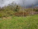
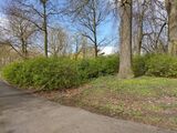
NL:Tag:natural=shrubbery
 |
| Omschrijving |
|---|
| Een gebied van houtige struiken dat actief wordt onderhouden en bijgewerkt door mensen. Het uiterlijk kan ook iets wilder zijn. |
| Groep: natural |
| Gebruikt op deze elementen |
| Nuttige combinaties |
| Zie ook |
| Status: in gebruik |
| Gereedschappen voor deze tag |
De tag natural=shrubbery wordt toegepast voor gebieden van houtig struikgewas dat actief onderhouden wordt. Bijvoorbeeld gesnoeide heggebieden of decoratief struikgewas. Deze gebiedjes van struiken hebben typisch een decoratieve functie en/of worden toegepast als scheiding tussen bijvoorbeeld wegen en recreatieve gebieden. Het struikgewas kan door mensen aangelegd en onderhouden worden met een iets wilder uiterlijk (zie voorbeelden hieronder). Dit in tegenstelling tot natural=scrub, dat is bedoeld voor ungecultiveerde gebieden met voornamelijk struiken, waar geen of minimale menselijke bemoeienis is.
Tagging hiervoor is twee keer voorgesteld — namelijk als natural=shrubbery en als uitbreiding van natural=scrub — maar deze voorstellen zijn om uiteenlopende redenen niet aanvaard. Toch groeit het gebruik organisch als alternatief voor natural=scrub waar het gaat om gesnoeid en onderhouden struikgewas. The proposal summary geeft uitleg over de diverse standpunten, en verklaart waarom waarschijnlijk geen enkel voorstel op dit punt kans van slagen heeft.
Hoe te mappen
Teken een gebied ![]() en tag het met
en tag het met natural=shrubbery. Extra tags zijn optioneel. Merk op dat area=yes niet nodig is omdat natural=shrubbery per definitie een gebied is en alleen op gebieden ![]() toegepast hoort te worden.
toegepast hoort te worden.
De standaard OSM tegellaag rendert natural=shrubbery niet. Daarom gebruiken sommige mappers liever natural=scrub voor zowel struikgewasperken als wild struikenland. Zie de documentatie van natural=scrub voor meer informatie. Zie Rendering voor ondersteuning van natural=shrubbery op diverse OSM-gebaseerde kaarten.
Wanneer niet toepassen?
- Voor wild, ongecultiveerd struikenland, gebruik
natural=scrub. Als er soms gesnoeid wordt, bijvoorbeeld om een overgroeide weg vrij te maken, is het nog steedsnatural=scrub. - Voor losse struiken, gebruik
natural=shrubop een node .
. - Voor heide. Heide [1] is een onderscheiden habitat die een eigen tag heeft
natural=heath. Zie ook de voorbeelden hieronder. - Voor gebieden met grassen en niet-houtige planten. Overweeg hiervoor bijvoorbeeld
landuse=flowerbed,landuse=grassennatural=grassland. - Voor groepjes afgetopte of nieuw aangeplante bomen; gebruik
natural=woodoflanduse=forest. - Voor lineaire heggen, te smal om als struikenperk gemapt te worden; gebruik
barrier=hedge.
Additional tags
Het gemapte struikenperk kan verder gedetailleerd worden met tags zoals hieronder uitgelegd.
Effective density
While natural=shrubbery should be considered an impassable object for most traffic unless a highway=* is mapped through it (unlike, say, a grass lawn), the effective density of these areas when mapped serves a number of purposes. For orienteering oneself using a map, this detail can be useful, and may be employed by renderers to highlight it. shrubbery:density=dense in particular is useful to indicate that a natural=shrubbery area acts as a hedge.
Note that the following descriptions are (of course) just a rule of thumb for a rough, general categorisation. Mappers should not barge through shrubberies to figure out its density.
| Value | Definition |
|---|---|
sparse
|
Sparsely planted shrubbery. Generally speaking able-bodied persons could walk through them (although this is usually not desirable). |
medium
|
Shrubbery with a medium density. Able-bodied persons might be able to barge through it, but it takes some effort and might result in scratches or soiled clothing. |
dense
|
Densely planted shrubbery. Effectively impassible without damaging the shrubbery (which at this point often acts as a hedge) and getting your clothes torn. |
This table is a wiki template with a default description in English. Editable here.
Plant-life and shape tags
Shrubberies can be enriched with the usual plant-life tags such as genus=*, species=* and leaf_type=*, similar to natural=scrub.
height=* can be added to all shrubby areas as well; it may be particularly useful for hedges which act like a barrier.
For natural=shrubbery which fall in the category of a neatly clipped hedge or a topiary op Wikipedia, shrubbery:shape=* can be used to indicate its shape. For a typical box-hedge this will be a basic shrubbery:shape=box, but any fanciful shape one might prune a topiary into can be described (e.g., shrubbery:shape=dragon or shrubbery:shape=spiral).
Heggen
Voor lineaire heggen, tag een lijn met barrier=hedge.
Voorheen werd vaak area=yes toegevoegd aan een rondgesloten lijn getagd met barrier=hedge. Daarmee werd een struikenperk aangeduid dat een fysieke en/of visuele barrière vormt. Dit wordt nog steeds wel gedaan, maar de standaardkaart heeft besloten dat niet meer te renderen. (Zie bijvoorbeeld https://github.com/gravitystorm/openstreetmap-carto/issues/4111</ref>).
Als vervanging kan natural=shrubbery gebruikt worden in combinatie met shrubbery:density=dense en height=*. Helaas wordt ook dat vooralsnog niet gerenderd op de standaardkaart.
This use of natural=shrubbery can also be combined with shrubbery:shape=* — e.g., shrubbery:shape=box for a box hedge.
Examples
Below, some examples of natural=shrubbery are illustrated.
And a few examples of natural features that are not shrubbery.
- ↑ Heat, Wikipedia
- ↑ https://nl.wikipedia.org/wiki/Maasheggen

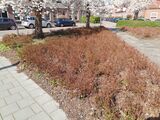
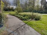


![natural=scrub Even though some overgrowth is sometimes trimmed away to keep the road clear [2].](https://upload.wikimedia.org/wikipedia/commons/thumb/c/c2/Maasheggen_bij_oeffelt_2.jpg/160px-Maasheggen_bij_oeffelt_2.jpg)
