Talk:Key:smoothness
interpretation
At first, thanks for having created this page, but there are a few points I do not agree with your interpretation of the proposal :
Some are written there Talk:Proposed_features/Smoothness
other comments are :
"Should be used in conjunction with surface=*."
I don't think so, a "could" would have been far enough but I would prefere not talking about surface at all.
If someone wants to tag a surface, he'll go to surface=* while smoothness=* might be used without surface with no problem. ( I personnaly don't, because I completly don't care about the surface ) Sletuffe 17:31, 2 November 2008 (UTC)
- Yes, "Useful combination" like in Template:ValueDescription needs to be added to Template:KeyDescription. I just added that, because I think the surface-tag needs to be mentioned. --Phobie 01:29, 4 November 2008 (UTC)
Photos
I could provide other photos if needed to show different cases specialy to show those very_bad and very_horrible, which, even if they might not be used too much, can exist. ( I'll show you a way where 4wd would not pass where a tractor could ) Sletuffe 17:36, 2 November 2008 (UTC)
- All photos are welcome! I just took existing ones.
- Yes, I believe that we can find many examples, also for even_more_horrible and smooth_like_glass but more than 5 values are impractical for mappers, renderer and navigation-tools! I think school-marks are a good criterion (excellent/good/satisfactory/adequate/inadequate).
- I once saw a way were a a high-clearance-4wd drove but no tractor could... We should not try to be exact with imprecise values like god or bad!
- Everything which can only be used by high clearance, 4wd, tractor or tank is inadequate for me. No need for a distinction. --Phobie 01:25, 4 November 2008 (UTC)
- inadequate for you doesn't mean inadequate for every one, and at least, it is not for me. Keep in mind that "quite" complex can easily be downgraded to "less" complex while the opposite is not possible. Renderers or navigation tools are not forced in anyway to observ all keys. But other use might. So, yeah, please keep them.
- Also I'll be glad to see your "way were a a high-clearance-4wd drove but no tractor could" or maybe we don't use the same tractors ;-) Sletuffe 08:56, 4 November 2008 (UTC)
- With all respect to Alv, his photo of an "horrible" way is not what I would call an "horrible" way ;-) It rather looks like that my personnal car could drive on such a flat way made of grass. I'll try to provide an more horrible way's photo if I find one Sletuffe 10:44, 4 November 2008 (UTC)
- The picture is poor I admit, the way was definitively not flat and only grass but impassable by normal cars - that's why I didn't go closer to take a better picture :). It was the intention that someone will find a better picture. Alv 10:50, 4 November 2008 (UTC)
- It look like I have the same problem with mine ;-) In fact it is quite hard to show, in one photo the usability of a way. A video on the whole way would be cool, but that would make it impossible to use.
- The picture is poor I admit, the way was definitively not flat and only grass but impassable by normal cars - that's why I didn't go closer to take a better picture :). It was the intention that someone will find a better picture. Alv 10:50, 4 November 2008 (UTC)
- I'll try to see what I can do with my 4Go of mountain photos along several different type of tracks Sletuffe 11:00, 4 November 2008 (UTC)
alternative definition by example on the "good" side of things
I'm saving this from the mailing list archives [1]; one problem with the current definition is that for paved roads, smoothness=* is more a matter of whether the road is comfortably usable with a type of vehicle, and less if it is usable at all. A racing bike can go almost anywhere a mountain bike can go, but not comfortably. Robx 16:15, 13 February 2009 (UTC)
- I totally agree with your first statement, the excellent/good/intermediate part of this proposal doesn't looks good to me. The proposal is about usability or passability, and I can't find examples where a racing bike will fail driving where a city bike will. That distinction seams to me it is only a matter of comfort. Therefore, the only bad value I see now is intermediate which should be merged with intermediate to me. But I'm still ok with excellent because I have examples in mind (unpaved roads but very compact) where roller blade can't roll will racing bikes can.
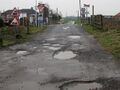
- however, your second statement : "A racing bike can go almost anywhere a mountain bike can go" is only true because of the "almost". Watch again the picture on top of the smoothness page and imagine the poor guy driving this up-hill with a racing bike. I wouldn't tag that as "good" ! Sletuffe 16:53, 13 February 2009 (UTC)
excellent: this is what well paved new cycle ways tend to be like; some fine type of asphalt; good for roller-skating, a pleasure on a road bike
- okay with that Sletuffe 16:53, 13 February 2009 (UTC)
good: your typical road in good state; a cycleway like above but with some small bumps from tree roots because they didn't care to put a proper foundation (?) underneath; a high-quality non-paved footway in a park
- okay with that too, only if a roller blade guy will certainly fall Sletuffe 16:53, 13 February 2009 (UTC)
intermediate: a road the has been worn down and could use a new cover, some unevenness from heavy traffic; motorway made of slabs of concrete with annoying bumps when passing to a new slab (you'd really want to use the fast lane exclusively if that's recently been repaved); lots of tree root induced bumps on a cycleway; a footway in a park with coarser gravel or uneven enough that there'll be puddles when it rains; high-quality cobblestoned road (small stones with flat surface, or perhaps some filling of the gaps); the average motorist wouldn't mind, the average cyclist wouldn't complain (at least not loudly), you wouldn't want to skate here.
- well, what, in terms of usability, is the difference with the above ? even if the cyclist will complain but still can pass, I'll tag this as "good". Looks to me here we have a black sheep, that might be the one that makes people think it's about comfort Sletuffe 16:53, 13 February 2009 (UTC)
- No difference in terms of usability, but a clear difference in terms of smoothness! The above definition could be tied into a definition by planograph. Robx 17:01, 13 February 2009 (UTC)
- Yep, but smoothness is not for defining smoothness. Maybe a lot of complains comes from the fact that the name is badly choosen see here : Talk:Proposed_features/Smoothness#Accessibility_.2F_Usability.3F. But my attempt to change that didn't got help probably because many are deeply fighting an edit-war, and also maybe because the "word" doesn't matter that much in other's view Proposed_features/usability Sletuffe 17:48, 13 February 2009 (UTC)
- If "smoothness is not for defining smoothness", then it's badly named. Other tags are badly named ("created_by" comes to mind), but that's not an excuse for introducing another badly-named tag. If you still can't understand why the concept is broken, then I bid you a day usable by racing bikes. Chriscf 18:00, 13 February 2009 (UTC)
- No one (even native English speaker) has been able to suggest a better word for the concept (except "usability" but that was somewhere deemed also unsuitable). Alv 18:14, 13 February 2009 (UTC)
- One must name the demon to slay it. We can't map it if we can't pin it down. Chriscf 18:28, 13 February 2009 (UTC)
- No one (even native English speaker) has been able to suggest a better word for the concept (except "usability" but that was somewhere deemed also unsuitable). Alv 18:14, 13 February 2009 (UTC)
- If "smoothness is not for defining smoothness", then it's badly named. Other tags are badly named ("created_by" comes to mind), but that's not an excuse for introducing another badly-named tag. If you still can't understand why the concept is broken, then I bid you a day usable by racing bikes. Chriscf 18:00, 13 February 2009 (UTC)
- Yep, but smoothness is not for defining smoothness. Maybe a lot of complains comes from the fact that the name is badly choosen see here : Talk:Proposed_features/Smoothness#Accessibility_.2F_Usability.3F. But my attempt to change that didn't got help probably because many are deeply fighting an edit-war, and also maybe because the "word" doesn't matter that much in other's view Proposed_features/usability Sletuffe 17:48, 13 February 2009 (UTC)
- No difference in terms of usability, but a clear difference in terms of smoothness! The above definition could be tied into a definition by planograph. Robx 17:01, 13 February 2009 (UTC)
- These definitions are all broken, in that those values do not have those meanings. Chriscf 16:38, 13 February 2009 (UTC)
- Sure they do, if we define them to have those meanings. Compare all of the
highway=*values (none of them have any intrinsic meaning, only being defined by OSM -- in some cases by reference to the definitions used by a government) andwaterway=river,waterway=stream. --Hawke 19:24, 13 February 2009 (UTC)- "Other shit exists" is not an excuse for more shit. The values used for Key:highway have specific legal definitions, whereas "good" does not and cannot mean "usable by racing bikes". Chriscf 15:36, 15 February 2009 (UTC)
- Most of the values used for
highway=*have specific legal definitions in the UK. "Good" means "usable by racing bikes" if it is defined as such (which it is). --Hawke 19:56, 16 February 2009 (UTC)- Odd, I can't find that definition in my dictionary. Whereas if you look in the relevant legislation and documents produced by the Highways Agency, the highway values do generally have the definitions for which we use them in the UK. They are well-defined terms with a well-defined meaning. Adding a new meaning to "good" is a bad idea, and the meaning "usable by racing bikes" is neither well-defined nor easily observable. Chriscf 15:33, 26 February 2009 (UTC)
- Similarly, I cannot find anything relating to roads in the definition of "primary", "secondary", et cetera in my dictionary. "track" does manage (barely) with "A road; a beaten path." Not a very useful definition for the purposes of OSM. Nor can I find it in the legislation and documents produced by the Wisconsin Department of Transportation. I do not argue the fact that highway values may have specific legal definitions in the UK which are useless to those of us outside the UK. But just like we have "within the context of OSM (implied) and the context of 'highway' (the key), the value 'primary' means any road that is classified as an A road in the UK or (insert other country-specific definition here)" we can have "within the context of OSM (implied) and the context of 'smoothness', the value 'good' means that the road is judged usable by racing bikes". OSM uses its own definitions for things all over the place. Smoothness is not an unusual case in this regard. --Hawke 17:38, 26 February 2009 (UTC)
- This doesn't change the fact that "good" is not intuitive, and is an arbitrary descriptor. "usable by racing bikes" is also not a well-defined measurement. How does one test it? By my reckoning, to definitively state that a road is "good", you would need to test it with a wheelchair, a scooter, a rickshaw, a tank, four cars and five bikes. Chriscf 17:55, 26 February 2009 (UTC)
- Have you any better suggestions for the values? Numbers are equally unintuitive and arbitrary, but I don't see you objecting to tags that use them. And just because you can't make a decision about what kind of vehicle you'd be willing to use on a given route, doesn't mean that others also can't. --Hawke 18:39, 26 February 2009 (UTC)
- Also, stop comparing this to
highway=*. That tag is used somewhere in the order of 10^6 to 10^7 times, generally well-understood, and several years old. I have pointed out before that we have some other bad tags - I have also pointed out that the fact that we have these bad tags is not an excuse for more bad tags. Regardless of whether or not this is a "bad tag", what exactly is the problem in understanding this? Chriscf 18:01, 26 February 2009 (UTC)- So I just have to use this a lot and/or wait a couple of years and your objections go away. Glad to hear it. Is there some specific minimum number where that happens? By the way, don't forget to add "...and Chriscf must approve" to Proposed_features#Approved. --Hawke 18:39, 26 February 2009 (UTC)
- This doesn't change the fact that "good" is not intuitive, and is an arbitrary descriptor. "usable by racing bikes" is also not a well-defined measurement. How does one test it? By my reckoning, to definitively state that a road is "good", you would need to test it with a wheelchair, a scooter, a rickshaw, a tank, four cars and five bikes. Chriscf 17:55, 26 February 2009 (UTC)
- Similarly, I cannot find anything relating to roads in the definition of "primary", "secondary", et cetera in my dictionary. "track" does manage (barely) with "A road; a beaten path." Not a very useful definition for the purposes of OSM. Nor can I find it in the legislation and documents produced by the Wisconsin Department of Transportation. I do not argue the fact that highway values may have specific legal definitions in the UK which are useless to those of us outside the UK. But just like we have "within the context of OSM (implied) and the context of 'highway' (the key), the value 'primary' means any road that is classified as an A road in the UK or (insert other country-specific definition here)" we can have "within the context of OSM (implied) and the context of 'smoothness', the value 'good' means that the road is judged usable by racing bikes". OSM uses its own definitions for things all over the place. Smoothness is not an unusual case in this regard. --Hawke 17:38, 26 February 2009 (UTC)
- Odd, I can't find that definition in my dictionary. Whereas if you look in the relevant legislation and documents produced by the Highways Agency, the highway values do generally have the definitions for which we use them in the UK. They are well-defined terms with a well-defined meaning. Adding a new meaning to "good" is a bad idea, and the meaning "usable by racing bikes" is neither well-defined nor easily observable. Chriscf 15:33, 26 February 2009 (UTC)
- Most of the values used for
- "Other shit exists" is not an excuse for more shit. The values used for Key:highway have specific legal definitions, whereas "good" does not and cannot mean "usable by racing bikes". Chriscf 15:36, 15 February 2009 (UTC)
- Sure they do, if we define them to have those meanings. Compare all of the
- Okay, back to this section's topic : haven't we a problem with good<->intermediate ? what might make this key be something about comfort (something we don't want, right ?) if two values are not to be distinguished by the passability they mean ?
- meaning of "good" is : usable by racing bike, meaning of "intermediate" is usable by city bike, sport cars, wheel chair, Scooter. Are there any ways someone can think of where a city bike/sport car/... could drive where a racing bike cannot (even uncomfortably) ? I don't. So what about removing "intermediate" and merge it with "good". The "comfort" problem might then be put more appart ? Sletuffe 20:41, 13 February 2009 (UTC)
- Cool, where getting somewhere :) The word Intermediate between to extreems DOES seem better than stating something as good. As it's clearly a value greater than the least, and less than the best. It would realy help by posting specific sugestions onto each page http://wiki.openstreetmap.org/wiki/Tag:smoothness%3Dgood I would like to merge the page with this one, to show all the examples. I added the reference to verifiability as that page gets to the root of this discussion :)
--acrosscanadatrails 22:38, 13 February 2009 (UTC)
smoothness=good
Hi, I'm still not fine with removing those pages. Here's why; This page STILL needs to be fixed. Why not move the section 'Controversy' to 'see also' with a direct link to the talk page???
We know that it has a useful combination of 'access=*' and implies 'highway=*'. That in it's self should mean that the tag should not be used ALONE. The See also Verifiability makes the page clearer. (it also implies that there is conflict with the tag) and people should know the reasons why. Once this page gets fixed, then im ok with removing the page. :) --acrosscanadatrails 00:35, 5 March 2009 (UTC)
Some more illustration photos
Some (more) photo matérials to illustrate mountain tracks, surface/smoothness/tractype/4wd_only/...
Not too steep, but rocks of medium size, high clearance is needed so smoothness=very_bad

Quite a steep turn, strong engine plus clearance needed so smoothness=horrible


Really big rocks, plus steep turn, even a off road vehicle would stop so smoothness=very_horrible

The template is broken
Hi! Can somebody fix the template Template:Map Features:smoothness? It looks that the outer switch does not work. -- Zkir 17:10, 14 November 2010 (UTC)
- I can confirm the problem, but I don't have the skills to repair the template sletuffe 13:36, 15 November 2010 (UTC)
- Got it, there was some missing } in the middle sletuffe 16:52, 30 November 2010 (UTC)
Renaming current values
From this long discussion I've felt that many people find the naming of smoothness=* values inadequate. I think that replacing its values with the suggestions in the text (as I've copied below) would make this tag much more popular and very useful.
| Current name | New name |
|---|---|
| excellent | thin_rollers |
| good | thin_wheels |
| intermediate | wheels |
| bad | robust_wheels |
| very_bad | high_clearance |
| horrible | off_road_wheels |
| very_horrible | specialized_off_road_wheels |
| impassable | no_wheeled_vehicle |
--Fernando Trebien (talk) 18:56, 20 March 2014 (UTC)
- Just querying to see if any progress has been made with regards to renaming smoothness values? This tag and the descriptions against each value are very useful, but there is significant subjectivity associated with terms such as 'good' / 'bad' and the like. Particularly for less abled users who face different challenges when navigating surfaces - what is considered good for an abled user might be totally different to that of a less abled user. While the descriptions go most of the way to describe smoothness values more objectively (noting potholes, revetments etc), it would be good to see the values renamed. --Olivia Ragone (talk) 14:45, 12 Feb 2025 (GMT)
- Unfortunately no. There's timid usage of
robust_wheelsandhigh_clearance, which is a bit of a shame. Since I proposed this change 12 years ago, the number ofsmoothness=*values in the database multiplied by 10, and now it is much harder to switch to the better-named values that would have avoided a lot of confusion. Still, it's never too late. If people simply start using the new values, apps will eventually have to support them. Just keep in mind that migrating the old values to these new proposed values automatically now would have to follow the automated edit guidelines. --Fernando Trebien (talk) 20:54, 27 February 2026 (UTC)
- Unfortunately no. There's timid usage of
Something is needed
This is just a note to say that I'm in need of a tag like 'smoothness' or 'usability' but it seems currently that there is disagreement about the best way forward. What strikes me is that the tagging needs strongly to take account of more than one factor at a time - in particular, usability/smoothness depends on vehicle type (or indeed walking/disability), and also the speed/comfort that can be maintained (there's a broad range of path which can be 'used' on a road bike for instance), and also things like incline and surface looseness. I'm keen to hear from anyone else. currently considering best options about this. Rostranimin (talk) 14:34, 29 August 2014 (UTC)
Quality of (modern) paved and compacted surfaces
Thie concept of smoothness is good, if you look at the whole range of paths, but for the description of modern paved roads as well as urban and roadside cylepaths, it is not appropriate: An ill kept roadside cyclepath can be usable with intermediate or even narrow tyres, but is too uncomfortable to be called "good".
Therefore a tag damages=* is afforded for surfaces that ought to be excellent or good if they are well built and well kept.
--Ulamm (talk) 09:19, 3 September 2014 (UTC)
- Hmm, I would think that damages need no extra tag which adds more complexity. An "excellent" asphalt road which was build 25 years ago and which is now in bad maintenance simply is not "excellent" any more but maybe only "bad". From the page "Usability by a particular type of vehicle means that the vehicle can traverse the route without significant risk of damage (e.g. to vehicle undercarriage/drivetrain) or injury (e.g. by falling).". --Aseerel4c26 (talk) 13:10, 3 September 2014 (UTC)
- I suggest the tag
damages=*not additional but instead ofsmoothness=*(without the desire to abolish it),- in order to describe every kind of surface in relation to its optimal version,
- because besides aging there are also problems caused by principles of layout, see
- --Ulamm (talk) 13:55, 3 September 2014 (UTC)
- I suggest the tag
- Hmm, I would understand if it is additional ... but "instead"? How do you want to specify the smoothness of the way where there are no damages? E.g. File:Newport Whitepit Lane pot hole.JPG looks like it is smoothness=intermediate if we do not assume that those two potholes are not significant. Hmm, yes, what is significant... hard for potholes. ;-) Single-tracked vehicles can easily drive around the potholes, but two-tracked vehicles can't. I will have a look at your proposal at another day. --Aseerel4c26 (talk) 16:14, 3 September 2014 (UTC)
- There are roads (like Spanish roads before they were improved with European money) with so many pot-holes that you can't cycle around them. I've cycled to Spain an in Spain in 1987, 1990, and 1995.
- Again on "smoothness": The more global a parameter is, the more the ranking depends on the inidividual views of the mappers.--Ulamm (talk) 16:46, 3 September 2014 (UTC)
Damaged
Say how to use "damaged" etc. tags to differentiate roads that have been bombed or earthquaked vs. just the usual not smooth. Jidanni (talk) 07:29, 15 June 2018 (UTC)
Other definitions of the values in Key:smoothness
I noticed that the Indonesian Tagging Guidelines give a different scale for smoothness, which focuses more on potholes and road type for the top few values. I'm curious of other countries have also developed different interpretations for this key?
| Information | Key | Value | Description |
|---|---|---|---|
| Road Condition | smoothness |
|
Road condition describes the smoothness of the road and the type of vehicles that can pass the road without any damage. For example, the mapped road is in a quite good condition with some small potholes that usually found on main road, user can give additional tag smoothness=intermediate for that road. For further information, see this link. |
Perhaps the main page should mention if the tags are used in different ways in other places as well? --Jeisenbe (talk) 06:29, 20 August 2019 (UTC)
Smoothness can vary a lot between different parts of the road
I’ve found that in a number of cases the bike lanes near where I live are literally impassible on electric scooter, though the roads would fall under “excellent”. This makes it hard to tag the road as chances are people looking for that smoothness data are looking for it in regards to not cars, and while a rough terrain may be “impassible” for some vehicles it can be easily passed by others. Joeybab3 (talk) 00:30, 18 November 2019 (UTC)
- You could use a key like
cycleway:right:smoothness=*- see taginfo https://taginfo.openstreetmap.org/keys/cycleway%3Aright%3Asmoothness and https://taginfo.openstreetmap.org/keys/cycleway%3Aleft%3Asmoothness --Jeisenbe (talk) 03:24, 19 November 2019 (UTC)
Extremely useful!
I think smoothness is about the single most useful piece of information about a highway, i.e. can I use this road with my vehicle? I'm planning an overland trip in Asia, and wish there was more information available on which roads are passable for my car. That smoothness is not very verifiable is not nice, but can be remedied with good guidelines for it, incl. good photos. At the moment, the roads on the photo for "good" smoothness seems to be less smooth than the one for "intermediate", the one for "very_bad" would still be quite passable for a normal car (with care), while the one for "horrible" would be no problem for my Suzuki SX4 (which I think is light-duty off road).--Rhhsmits (talk) 19:30, 21 November 2019 (UTC)
not verifyable
see arguments here http://blog.imagico.de/verifiability-and-the-wikipediarization-of-openstreetmap/ --PangoSE (talk) 08:30, 27 March 2020 (UTC)
- Well, smoothness is an approved key with more than 1.8 M objects in use since 2008. Even if the referenced blog post had questioned the verifiability of smoothness (which is IMHO not the case) this would not justify marking the key/verifiability as disputed. I agree that most experienced mappers are aware that smoothness is not a mathematically unambiguous feature and can be more or less subjective depending on experience, judgement or preferences. In addition, the smoothness of unsealed surfaces can vary depending on water saturation, traffic load, road maintenance and season. Nevertheless, reality shows that the majority of mappers who care about this property at all are correct by +/- 1 step when mapping, the same applies to tracktype, by the way. Smoothness is therefore usually verifiable - cum grano salis - like lots of stuff in the OSM world.
- I would therefore kindly ask you to remove the disputed flag. Thanks! --geow (talk) 21:06, 10 June 2020 (UTC)
- If you look at the previous discussion on this Talk page, it's clear that there is not a clear definition of each value of smoothness. See: Talk:Key:smoothness#Other_definitions_of_the_values_in_Key:smoothness and Talk:Key:smoothness#alternative_definition_by_example_on_the_.22good.22_side_of_things and [[2]].
I think this is an extremely useful key. This is the best key to distinguish between a rough high clearance road, a smooth road that any car can drive on, or a 4wd road. Tracktype is not very good for a hard surface region like the rocky mountains (and is just as subjective). A strict verifiability requirement is not helpful to creating a good map. There are many other tags that are more subjective than this one. I think the disputed comment should be removed. --Bradrh (talk) 01:48, 6 July 2020 (UTC)
Finding the 'invisible' millions who are not on maps
[[3]] The BBC on how influential Openstreetmap can be for developing countries. "Google and Apple maps do not differentiate between a good road and a bad road - but that's so important". Smoothness or whatever we choose to call our parameter for road quality is extremely useful for the developing world: they can't afford to bother about verifiability... It would be useful, however, if we could indicate how road quality is influenced by season: an unpaved road in a developing country could be quite passable by even a normal car in the dry season, while even a tank would get stuck on it in the rainy season. Rhhsmits (talk) 07:54, 3 July 2020 (UTC)
I've seen signs on the road, and notes on maps that say something like "Impassible when wet". I think that could be a value for the surface key.--Bradrh (talk) 01:54, 6 July 2020 (UTC)
- The key
surface=*is helpful, but also seetracktype=*which descripes how solid is the surface and underlying roadbed: this is usually what matters if it is rainy. That tag is actually a little more verifiable than this one.--Jeisenbe (talk) 21:36, 6 July 2020 (UTC)
Making smoothness more verifiable
I’ve been going through the discussions over the years about this tag: I think the main problem is its verifiability, and the best solution to it would be to improve the description of the degrees of smoothness that have been in use so that its application is as uniform in the world as possible. This tag will never be completely objective, but that is valid for most tags used on OSM so should not be an argument for not using it.
I think the aim of this tag should be that navigation software developers can use its information to propose an optimal route depending on the vehicle the user is using. Many are already offering routing for cars, bicycles, pedestrians and public transport: wouldn’t it be nice if they could add routing for roller skaters, SUVs, 4WD, etc.? Therefore, as a mapper, when you use this tag you should ask yourself: “Will most people be happy if their routing software suggests to take this way with their rollers/racing bike/sports car/normal passenger car/SUV/4WD/tractor, or would they prefer to take an alternative way (assume there is one) with a smoother surface that is 30% longer?” I’ve added the 30% on purpose: by adding quantified values to the use instructions, the tag becomes more verifiable. For the same reason I’ve used the practical speed to determine smoothness in the intermediate-bad range (addressing some of the motives behind the Key:maxspeed:practical proposal) and ground clearance in the bad-very horrible range.
I propose to add the following text to the tag description table as an additional column, with appropriate illustrative photos in the photo column (looking forward to your feedback!):
Excellent: as-new asphalt or concrete, smooth paving stones with seamless connections, etc.
Good: asphalt or concrete showing the first signs of wear, such as narrow (<2 cm) cracks, wider cracks filled up with tar, shallow dents in which rainwater may collect, etc. that may cause trouble for rollers but not for racing bikes. The best roads paved with bricks, sett, etc. also fall in this category.
Intermediate: asphalt and equivalent that shows signs of maintenance such as patches of repaired pavement, wider cracks (>2 cm), etc. that may cause trouble for racing bikes. The pavement may contain potholes, but these are small, shallow (<3cm deep) and few so they are easily avoided, or the road shows damage due to subsidence (depressions of a scale >50 cm) or heavy traffic (shallow ruts in asphalt caused by trucks in summer). The quality of the surface starts to affect the speed of most passenger cars, so they will slow down to make the ride more comfortable (but still above 50% of the speed they would drive at if the road was smooth). The best unpaved but compacted roads fall in this category.
Bad: heavily damaged paved roads that badly need maintenance: many potholes, some of them so deep that the underlying gravel bed shows through. The average speed of cars is less than 50% of what it would be on a smooth road. However, it isn’t so rough that ground clearance becomes a problem. A ground clearance of a normal passenger car (>14 cm) is sufficient. Good unpaved roads without risk of damage to normal passenger cars are also included here.
Very bad: unpaved roads with potholes and ruts, but still passable with an average SUV with a ground clearance of at least 18 cm. [footnote] Note that some unpaved tracks can be so steep that a car designed mostly for on-road use does not have the gear ratios and engine power needed to drive up a slope slow enough not to cause damage without the engine stalling. The track may still be smooth enough that such cars can drive down that slope without problem, so in such cases the track should be marked smoothness:very_bad but the steep section tagged with incline=
Horrible: unpaved tracks with ruts, rocks etc that need a ground clearance of at least 20 cm (Toyota Landcruiser, Landrover, Lada Niva, bukhanka, etc.).
Very horrible: tracks with deep ruts and other obstacles that need a ground clearance of at least 24 cm.
Impassable: ways that used to be passable roads and can still be recognised as such in the landscape (useful for hikers), but have deteriorated so much because of fallen trees, being overgrown, severely eroded, etc. that no 4-wheeled vehicle can pass it. Consider to map narrow parts as path, and the whole way as disused: or abandoned:
[further explanatory text] Roads will vary in smoothness along their length. If a road is good in one part, but gets worse later on, it’s worth splitting the road and tag each one with the appropriate smoothness tag. If for instance a dead-end road up a mountain valley needs a 4WD to reach the end, but a nice lake half way up can be reached by normal car, then split the road at the lake and tag the first part as bad or better, and the second part as horrible. But don’t overdo it: if there’s a small “intermediate” section with a few repaired patches in an otherwise “good” road, most racing bike riders will not want to take a detour to avoid it but just be careful on the bad section, so such a road should be tagged good. Roads can also vary in smoothness along their width. Such a road should be tagged with the quality of its best passable part. If for instance an unpaved road has deep ruts, but there’s enough space next to the ruts on one side so a normal car can drive on it with one rut in between the wheels, it should be tagged as smoothness:bad
--Rhhsmits (talk) 10:20, 19 November 2020 (UTC)
- I think what you're proposing is pretty good as long as you're keeping the existing text too. I agree with you're intent to add it as another column. The existing column 'usable by' can give the impatient reader the quick definition, and additional description in the next column. For 'Horrible', I would increase the ground clearance to 22 cm, and add something about skid plate protection is usually advisable. --Bradrh (talk) 22:47, 19 November 2020 (UTC)
- The proposed descriptions seem to be ignoring bicycles, motorcycles and other types of wheeled transportation other than 4-wheel motorcars. They also seem overly specific. Since this tag has already been used thousands of times, it would be important to check how it is actually being used in the real world right now, and try to get descriptions that match this. Remember that any one country is only going to be 10% of global usage at most - even the USA is very small compared to the world of OpenStreetMaap - so it is necessary to check usage in several different countries before coming to any conclusions about what this tag means. --Jeisenbe (talk) 05:57, 21 November 2020 (UTC)
- Thanks for your remarks. Of course the present text should largely remain, but may need some adjustment. I hope some day we can remove the "disputed" status of this tag. Maybe the descriptions are overly specific; I had in mind to "silence" the critics of verifyability but of course it should still be flexible enough to be applicable out in the field. The limiting values for ground clearance should be discussed depending on the data for what we think are "typical" vehicles for each smoothness class. A Land Cruiser has a clearance of 22 cm so the limit for horrible should be that or less. Maybe 21 cm? I think a choice has to be made to focus on 4-wheeled vehicles because they need a wider strip of surface: 2-m wide potholes in a road are unavoidable for 4-wheeled vehicles, but a bicycle only needs 30 cm of good surface around the potholes to have no problems with them. Information on smoothness focussed on 4-wheeled vehicles is still very useful for 2-wheeled vehicles such as motorbikes. For bicycles on rougher and narrow ways, there is Key:mtb:scale (good to mention on this page). Of course it would have been better to introduce a better description earlier, before mappers each developed their own standards. My proposal is based on my impression of previous years' discussions, which I think is the best representation of what is used worldwide. But there are bound to be many deviations, which will need resurvey. Anyway surface smoothenss changes with time so resurveys are needed, and we should start applying a more uniform standard as soon as possible. --Rhhsmits (talk) 10:31, 21 November 2020 (UTC)
- I don't think the tag ignores bikes, or motorcycles (& I ride both) the current 'usable by' column mention bikes for good, bad, and intermediate. When you get less smooth than that it becomes more about the riders ability. The smoothness tag is rarely used with highway=path or footway, and only 6.1% of the time with cycleway, where it is usually excellent, good, or intermediate. In my opinion, the tag doesn't need to make sense for path or footway.
- I do a lot of my mapping riding my 140 kg dual sport motorcycle or my 200 kg adventure motorcycle. You could add to the 'very_bad' text: usually passable by an average rider on an offroad capable heavy motorcycle. As you can see it only gets more subjective, so I'm not sure it's appropriate.
- A couple of suggestions:
- You have this: "The best roads paved with bricks, sett, etc. also fall in this category." as Good. This could be a misunderstanding on my part, since those types of roads are rare in the US, but I would put that as 'Intermediate'. It seems that the constant bumpiness of a brick or sett road is much worse than a paved road with some cracks.
- Under 'Very_Bad' you have this: Note that some unpaved tracks can be so steep that a car designed mostly for on-road use does not have the gear ratios and engine power needed to drive up a slope slow enough not to cause damage without the engine stalling. The track may still be smooth enough that such cars can drive down that slope without problem, so in such cases the track should be marked smoothness:very_bad but the steep section tagged with incline=. I think that is getting to be too much and could be deleted. Personally if I couldn't drive it with an average SUV, I would tag it as 4wd_only=yes, or smoothness=horrible.
- --Bradrh (talk) 18:22, 22 November 2020 (UTC)
- @Jeisenbe I agree it will need some extrapolation of the proposed descriptions to apply them to narrow ways, but I think it can still be applied to them. For pedestrians, smoothness doesn't really matter very much until it becomes so rough it's getting difficult, but for that we have Key:sac_scale while for rough cycleways we have Key:mtb:scale (would be nice if we had similar keys for offroad motorcycles?). @Bradrh Roads that I know of that are paved with bricks or sett are usually in urban areas and are often smooth enough not to need to reduce your speed much below the speed limit (50 km/h), so that would make them fall in the "good" category. They are also often fine for racing bikes. I agree that the text you quote is quite long, that's why I propose to add it only as a footnote. I think it would be good to mention an example of other reasons than smoothness that could make a road impassible for some vehicles. --Rhhsmits (talk) 20:24, 24 November 2020 (UTC)
- Re: "For pedestrians, smoothness doesn't really matter very much” - agreed for able-bodied adults, but not for the pedestrians who used wheelchairs or wheeled walkers or pushing a baby stroller. These are still pedestrians.
- Re: "for rough cycleways we have Key:mtb:scale" - the tag
mtb:scale=*is a "scheme for mapping the difficulty of trails suitable for mountain-biking" which combines smoothness, tracktype, incline, sharpness of turns, and presence of obstacles such as fallen logs and trees. Because of this it is more subjective and less verifiable than usingsmoothness=*+tracktype=*+incline=*+surface=*. --Jeisenbe (talk) 19:43, 25 November 2020 (UTC)
I'm sorry there are responses from only 2 persons... maybe if I "just do it" and implement my proposed edits, there will be more reaction. @Jeisenbe: I see you are involved in the Verifiability project; do you think the more detailed key descriptions will remove the objections of those worried about the verifiability? --Rhhsmits (talk) 14:51, 26 December 2020 (UTC)
- While it would be nice if we could have a more verifiable tag, it's not easy to re-define a tag like this which has been used >100,000 times. You would need to make a proposal (see Proposal process) and discuss it widely first. Perhaps a better option is to add a new tag which is more precise, like "min_clearance=22cm" if you want to tag the minimum clearance needed to use the road, for example. --Jeisenbe (talk) 05:20, 28 December 2020 (UTC)
- I agree it's not easy finding a re-definition of this tag which has been interpreted in such a broad range and that hits the middle of that range. But I don't think it is completely changing the tag, so I don't think a new proposal procedure is appropriate. We just want to narrow down the range of interpretations. I did find the Tagging mailing list through the link you gave, and will post a request for comments there. --Rhhsmits (talk) 14:58, 5 January 2021 (UTC)
Someone on the Tagging mailing list asked for an example of what I intend to show on the page. In the introduction, I would like to add the text The aim of this tag should be that navigation software developers can use its information to propose an optimal route depending on the vehicle the user is using. Many are already offering routing for cars, bicycles, pedestrians and public transport: wouldn’t it be nice if they could add routing for roller skaters, SUVs, 4WD, etc.? Therefore, as a mapper, when you use this tag you should ask yourself: “Will most people be happy if their routing software suggests to take this way with their rollers/racing bike/sports car/normal passenger car/SUV/4WD/tractor, or would they prefer to take an alternative way (assume there is one) with a smoother surface that is 30% longer?” and the table and text below it under the "Values" heading. You'll see I re-used some of the photos from the original table, but some of them are for a different category now that I think better represent the description. Others are from a quick search on Wikimedia Commons; I'm sure much better images can be found. In fact, we could start a category "OSM smoothness images" on Commons with sub-categories for each smoothness level so there will be plenty of examples for each, and an "uncategorised" sub-category where mappers can upload photos of surfaces they're not sure about, and others can then determine (or vote) in which class these belong, thereby generating a consensus.--Rhhsmits (talk) 18:39, 14 January 2021 (UTC)
| Key | Value | Element | Usable by | Explanation | Photo |
|---|---|---|---|---|---|
| smoothness | excellent | (thin_rollers) roller blade, skate board and all below | as-new asphalt or concrete, smooth paving stones with seamless connections, etc. | .jpg)
| |
| smoothness | good | (thin_wheels) racing bike and all below | asphalt or concrete showing the first signs of wear, such as narrow (<2 cm) cracks, wider cracks filled up with tar, shallow dents in which rainwater may collect, etc. that may cause trouble for rollers but not for racing bikes. The best roads paved with bricks, sett, etc. also fall in this category. | 
| |
| smoothness | intermediate | (wheels) city bike, sport cars, wheel chair, Scooter and all below | asphalt and equivalent that shows signs of maintenance such as patches of repaired pavement, wider cracks (>2 cm), etc. that may cause trouble for racing bikes. The pavement may contain potholes, but these are small, shallow (<3cm deep) and few so they are easily avoided, or the road shows damage due to subsidence (depressions of a scale >50 cm) or heavy traffic (shallow ruts in asphalt caused by trucks in summer). The quality of the surface starts to affect the speed of most passenger cars, so they will slow down to make the ride more comfortable (but still above 50% of the speed they would drive at if the road was smooth). The best unpaved but compacted roads fall in this category. | 
| |
| smoothness | bad | (robust_wheels) trekking bike, normal cars, Rickshaw and all below | heavily damaged paved roads that badly need maintenance: many potholes, some of them so deep that the underlying gravel bed shows through. The average speed of cars is less than 50% of what it would be on a smooth road. However, it isn’t so rough that ground clearance becomes a problem. A ground clearance of a normal passenger car (>14 cm) is sufficient. Good unpaved roads without risk of damage to normal passenger cars are also included here. | 
| |
| smoothness | very_bad | (high_clearance) Car with high clearance, light-duty off road vehicles | unpaved roads with potholes and ruts, but still passable with an average SUV with a ground clearance of at least 18 cm.* | 
| |
| smoothness | horrible | (off_road_wheels) heavy-duty off road vehicles and all below | unpaved tracks with ruts, rocks etc that need a ground clearance of at least 20 cm (Toyota Landcruiser, Landrover, Lada Niva, bukhanka, etc.). |
| |
| smoothness | very_horrible | (specialized_off_road_wheels) tractor, ATV, tanks, trial, Mountain bike and all kind of off-highway vehicles (see also mtb:scale=*) | tracks with deep ruts and other obstacles that need a ground clearance of at least 24 cm. | 
| |
| smoothness | impassable | No wheeled vehicle (see also sac_scale=*) | ways that used to be passable roads and can still be recognised as such in the landscape (useful for hikers), but have deteriorated so much because of fallen trees, being overgrown, severely eroded, etc. that no 4-wheeled vehicle can pass it. Consider to map narrow parts as path, and the whole way as disused: or abandoned: | 
|
*Note that some unpaved tracks can be so steep that a car designed mostly for on-road use does not have the gear ratios and engine power needed to drive up a slope slow enough not to cause damage without the engine stalling. The track may still be smooth enough that such cars can drive down that slope without problem, so in such cases the track should be marked smoothness:very_bad but the steep section tagged with incline=
Roads will vary in smoothness along their length. If a road is good in one part, but gets worse later on, it’s worth splitting the road and tag each one with the appropriate smoothness tag. If for instance a dead-end road up a mountain valley needs a 4WD to reach the end, but a nice lake half way up can be reached by normal car, then split the road at the lake and tag the first part as bad or better, and the second part as horrible. But don’t overdo it: if there’s a small “intermediate” section with a few repaired patches in an otherwise “good” road, most racing bike riders will not want to take a detour to avoid it but just be careful on the bad section, so such a road should be tagged good. Roads can also vary in smoothness along their width. Such a road should be tagged with the quality of its best passable part. If for instance an unpaved road has deep ruts, but there’s enough space next to the ruts on one side so a normal car can drive on it with one rut in between the wheels, it should be tagged as smoothness:bad
- I haven't read the discussion here (too much text, too little time), but I would like to mention a smoothness table that we use in Berlin. It contains figures and parameters for the most important smoothness values in urban areas. Unfortunately it is in german language, but online translators will certainly help. Central principles are listed at the end.--Supaplex030 (talk) 23:46, 17 January 2021 (UTC)
- Thanks, it looks great! I think it shows that there is a need for more detailed descriptions on how to use this tag. However, instead of starting local initiatives like Berlin and Indonesia, it would be better to have a description that is applicable worldwide. I like the table and especially the great photos. I could create a "details" subpage and translate it to English. --Rhhsmits (talk) 18:45, 22 January 2021 (UTC)
I really like the idea to make smoothness more verifiable. Good idea to give a quantitative criterion (30% detour), although that figure itself comes out of thin air; that's fine by me, though. I'm a little worried, like others before me, that the proposed text is too car-centric. I should add that my main interest in OSM is to provide input for bicycle routers, so my view is biased. I do know, though, that bike routing is one major use case of OSM and that some OSM-based bike routers (e.g., Komoot and Naviki, there are others) offer different profiles for racing bikes / city bikes / MTBs. While they don't disclose their algorithms, I found that smoothness tags I've added to the map make a huge difference. This motivates me to add smoothness to any cyclable way I get my wheels on, especially cycleway and path. In my experience, paths show the largest variety in smoothness: I've tagged anywhere between smoothness=excellent (brand-new asphalt on an urban unsigned path) and smoothness=horrible (surface=sand). So, in a way, it's on paths that smoothness is most important: without smoothness, data users can't predict whom they should send there (whereas highway=tertiary is a pretty safe bet where I'm at). In practice, I follow pretty much the scheme referenced by Supaplex (which I didn't know -- great table!). To me, excellent/good/intermediate means: the way can be used at regular speed, without worrying too much about falling, even by novice users of roller blades / road bikes / city bikes. One notch down: the way is still practicable, but you'll have to reduce speed to be safe. Two notches down: you really don't want to be here, and you'll have to reduce speed significantly unless you're a Belgian pro (that's my standard reply to people who want to tag surfaces like that https://en.wikipedia.org/wiki/Koppenberg as good because road bikers do use them; it's still smoothness=bad in my book). I suggest the following changes to the proposed smoothness table:
- Intermediate: "... that are safe for city bikes but force racing bikes to reduce speed somewhat. ..."
- Bad: "A rugged surface (most cobblestone, degraded bricks) or heavily damaged paved roads ..." I would delete the text on the gravel bed showing (too specific if you ask me). Picture 1 (asphalt road that's more potholes than asphalt) strikes me as too dramatic to be a useful example; I'd prefer the asphalt and/or sett pic from the Berlin table.
- Very_bad: "... or a mountain bike"
I hope this helps! --SmootheFiets (talk) 10:46, 2 February 2021 (UTC)
- While I agree with idea of clarification, I disagree with current proposal to do it. As SmootheFiets says, it looks very car-centric (bicycles are barely mentioned), and seems to go into redefining what values mean. For example, idea of defining "up 2cm cracks" as "good" and thus "for thin racing bicycle wheel" does not look realistic. At first I even though it was "up to 2mm cracks", which I though might be little strict but OKish! I mean, racing bicycle going at it's native speed of about 40-50km/h with its thin highly-inflated tires over 19.9mm cracks equals broken racing bicycle (and/or cyclist). Even with wider and softer tires of trekking bike at lower speed of 25km/h 19.9mm crack can be very problematic if they happen with higher regularity and are deep enough (2mm depth is not a problem, 2cm most definitely is!). So 2cm cracks are at least between "intermediate" and "bad" (and much closer to "smoothness=bad", judging by the original "intermediate" wiki tag picture). Also the tag is very much used, one cannot just decide to move pictures up/down (making original "horrible" picture new "very bad" picture etc). If it meant one thing 8 years ago, it has to mean that same thing today, no matter if one feels the name of the value is poorly chosen. Berlin smoothness clarification page seems to have done a better job; perhaps that work can be reused? --mnalis (talk) 19:12, 2 February 2021 (UTC)
- I made the descriptions car-centric on purpose: I think the description should be applicable world wide, so we should use a class of vehicles that are used world wide in the primary descriptions, and then add info on how to use it for other vehicles like bikes. I'd be happy to add descriptions for bicycles and motorbikes as well, but am afraid that this will give even more complaints that the text is getting too long, so maybe it should be moved to a sub-page? @SmootheFiets the 30% detour number indeed comes out of thin air and I don't mind changing it. I don't think it should be taken exactly either. Where I am (Bulgaria) there are quite a few tertiary roads that you want to make a detour for to avoid with a normal car. And there are lots of countries in the world where even primary roads can be impassable for normal cars. I cycled on Koppenberg myselfː my brother's saddle broke off on that surface and he had to cycle the next 50 km without it ː) Indeed the "bad" asphalt image is a bit too extreme, maybe this one
 is better? I don't like the image for very_horrible either, it's not very clear and I'm looking for a better one. @Mnalis you're right that 2 cm cracks can be quite uncomfortable for a racing bike. I had in mind that the narrowest racing bike tyres are 23 mm, so they won't go into it and cause a fall. I don't mind reducing it to 1.5 or 1 cm. I think that this image
  that is obviously passable with a normal car was added to illustrate a high_clearance road is an obvious mistake that should be corrected as soon as possible, even though it has been there for a long time. I think it is the text description that defines the smoothness grade, not the picture, and if there is a discrepancy between the text description and the picture, this is a mistake that should be resolved by changing the picture. If you find a better picture that illustrates the text, I don't mind at all to change it. --Rhhsmits (talk) 17:59, 7 February 2021 (UTC)
- I made the descriptions car-centric on purpose: I think the description should be applicable world wide, so we should use a class of vehicles that are used world wide in the primary descriptions, and then add info on how to use it for other vehicles like bikes. I'd be happy to add descriptions for bicycles and motorbikes as well, but am afraid that this will give even more complaints that the text is getting too long, so maybe it should be moved to a sub-page? @SmootheFiets the 30% detour number indeed comes out of thin air and I don't mind changing it. I don't think it should be taken exactly either. Where I am (Bulgaria) there are quite a few tertiary roads that you want to make a detour for to avoid with a normal car. And there are lots of countries in the world where even primary roads can be impassable for normal cars. I cycled on Koppenberg myselfː my brother's saddle broke off on that surface and he had to cycle the next 50 km without it ː) Indeed the "bad" asphalt image is a bit too extreme, maybe this one

I translated Berlin/Verkehrswende/smoothness at Key:smoothness_details, so it can be used to refer to from the main Keyːsmoothness page. Comments pleaseǃ --Rhhsmits (talk) 18:10, 13 February 2021 (UTC)
- I don't speak German so I cannot attest to accuracy of those translations, but I think it is quite wrong to put it as Key:smoothness_details ?! There is no tag "smoothness_details", so it is in completely wrong namespace in wiki! And it seems from the preface there like you want to rename current usage of Key:smoothness to Key:smoothness_details, and use currently existing key Key:smoothness to mean something else, like "car_smoothness" or "car_clearance_height". Please don't do that, currently used tag should only be more clearly explained (if possible), and never redefined. Otherwise both "old" and "new" meanings will become completely useless (as one wouldn't know which "version" was used). If you want to make car-centric "min_clearance=22cm" tag by all means feel free to do so, but as a new tag, not as a redefining existing one. So, IMHO, Berlin/Verkehrswende/smoothness can be used as a additional explanation/examples for Key:smoothness as it tries to better clarify current tag - if your purpose is not a new tag but better clarify existing one, than perhaps this is the better route to go. Also, you say "we should use a class of vehicles that are used world wide in the primary descriptions" and the completely ignore the fact that bicycles are more common around the world than cars. So while the original Key:smoothness was not perfect, it was much better in that respect that it used multiple vehicles (rollerblades, road bicycles. MTBs. cars, rickshaws, tractors, ATVs etc.) instead of being just car-centric (making it much less useful for everyone else). Also note how the original Key:smoothness defined usability: to use a mode of transport as it was intended to be used. Sure, you can use roller blades as uncomfortable shoes and walk even on smoothness=very_horrible or even smoothness=impassable (sometimes without falling down even once if you are good at it!). But that was obviously not an intent - so "Usable by" (as originally defined with pictures and text) and "Explanation" should always match, not be at odds. --mnalis (talk) 01:55, 25 February 2021 (UTC)
- I've moved the page to User:Rhhsmits/Smoothness_details --Jeisenbe (talk) 08:53, 25 February 2021 (UTC)
- Jeisenbe, thanks for moving it. I'm not aware of namespace rules, so I just named it because I thought it was a nice descriptive title, without intending to add a new key. Mnalis, I'm aware bicycle ownership is much more widespread around the world; my intention is to choose a category for the primary descriptions that is understood worldwide by the mappers that use the descriptions. I guess that there are more parts of the world where mappers might have difficulties understanding descriptions for bikes (thinking of USA mainly) than parts of the world where mappers have difficulties understanding descriptions for cars. Users of the data (navigation software users) are also more likely to be car owners than cyclists, I guess. We could add descriptions aimed at 2-wheeled vehicles (to the explanations column, or as a new column), but I'm afraid we'll get even more complaints that there is too much text. The "usable by" column with all the vehicles you mention is still there by the way, so I don't understand why you're describing it in past tense. Where do you think the "usable by" and "explanation" columns are at odds? And is there room for improvement of what is now User:Rhhsmits/Smoothness_details? Improvements could be translated back into German and added to Berlin/Verkehrswende/smoothness. --Rhhsmits (talk) 10:26, 25 February 2021 (UTC)
- Rhhsmits, I think it would be best to proceed in this way: (a) expand User:Rhhsmits/Smoothness_details with missing columns ("horrible", "very_horrible", "impassable"); (b) add "speed (for cars)", "speed (for SUVs)" etc. rows in the same way as there is "speed for bicycle" and "speed (for roller blades)" (this way both cars are other vehicles are nicely represented and explained); (c) do not shuffle pictures from one to other category - no matter how misplaced you think the pictures are - it is extremely problematic and confusing for users when one picture used to mean one thing and now same picture means something different. If you think picture is bad, find completely new picture which is in accordance with original/old textual explanation
- Thanks, I'll work on a and b, and already replaced images previously used for another smoothness category with ones that I could quickly find on Wikimedia or had myself. --Rhhsmits (talk) 18:52, 8 March 2021 (UTC)
- I've been thinking a bit more about User:Rhhsmits/Smoothness_details and now think that it's not a good idea to expand it with additional columns and rows. Ways that are horrible or worse are nearly always unpaved, I think, so it will be near impossible to find pictures of paved roads in such a state, and it will hardly ever be applied to roads with paved surface. The distinguishing feature of such ways is ground clearance, not speed, and any vehicle that can pass such roads will do so at a very low speed (<20 km/h). In fact I have my doubts about the photos in the very_bad column: the surfaces are pretty bad, but not impassable by a normal car. They don't need high clearance, so by the description in the "Usable by" column (which is unchanged), they are "bad", not "very_bad". I propose to delete the photos for paved surfaces, and only have unpaved road photos in this column. Supaplex030, what do you think? I can imagine that roads that are only passable by cars with high clearance are very rare for a city environment, so you re-purposed the category for a "pretty-bad" class of smoothness, but I think it's a deviation from the original definition of that grade of smoothness. As for additional rows, one for cars could be added that repeats what's given about speed on the main page, and is similar to what is already there for bicycles. It won't depend on whether the car is a normal/SUV/heavy duty off road car, either. For MTBs, we could suggest that roads where their speed is affected by the smoothness should additionally be tagged with a suitable MTB-scale tag. --Rhhsmits (talk) 06:55, 28 April 2021 (UTC)
- I think we should not interpret the wiki definition too strictly – then there is not much conflict between the wiki definition and the table. "Car with high clearance" means, for example, that you could have problems with a sports car on such roads – but not with most normal passenger cars, because they have "high clearance".
- From the point of view of a cyclist, but also of another road user such as a pram/baby stroller or wheelchair, there is a significant difference between the two levels "bad" and "very bad" shown in the table, and I don't think there is any need for a new category. Perhaps with a slight softening of the wiki definition of "very_bad" and a bit less "extreme" image selection, this can already be harmonised well.--Supaplex030 (talk) 21:22, 28 April 2021 (UTC)
- By the way: I was made aware that the image for sett / very_bad is not clearly "sett", but could also be interpreted as "unhewn_cobblestone". I am currently looking for a better image.--Supaplex030 (talk) 21:27, 28 April 2021 (UTC)
- Rhhsmits, I do not think it is good to use definitions like "normal car" - those differ wildly among cultures/countries, and also they change over time. For some, it is luxury compact or sedan or sports car, for others it is SUV. That is why I proposed to add at least two (or three) rows for cars (and other motorized vehicles). Surely Tesla Roadster has different requirements and handling of surfaces than Jeep Wrangler? Same as difference between racing road bike and MTB. As for the horrible etc. columns in User:Rhhsmits/Smoothness_details, I still think they should be added. If the pictures are not applicable, we already have '-' (meaning "n/a") in such boxes (like for example for "excellent"+"sett"), the same can be used for "very_horrible" + "asphalt". But it would allow to use text rows to fill that colors (eg. so you can say that horrible is usable by xx% reduced speed SUV, but not at all by sports car, or you could specify minimum clearance etc. - this data will differ between sports car / SUV!) --mnalis (talk) 00:00, 4 May 2021 (UTC)
- Supaplex030 I agree that the wiki definition should have some flexibility, so it works well in the field. But I think the wiki has always been clear that "normal cars" can just pass a "bad"-category road, while a "Car with high clearance" is typical for the "very_bad" category, so normal passenger cars are not cars with high clearance. Sport cars are mentioned at the "intermediate" category, so they can't pass a "bad" smoothness road. I also agree that there can be significant differences between roads that are in the same category, but considering that there have been complaints in the past that there are too many categories already, we shouldn't try to solve this by creating new categories (it will be a never ending story). I am wondering how many way of the "very_bad" category there are in your project, and how much work it would be to re-survey them and change their tags to "bad" for most of them?
- mnalis Maybe we need to clarify what the vehicles in the "Usable by" column are by adding pictures of them (or links to relevant Wikipedia articles)? Or is it sufficient that a sports car is mentioned for the "intermediate" category and that I added the mention of a SUV for the "very_bad" category, so it is clear that they are not "normal cars"? --Rhhsmits (talk) 07:13, 13 May 2021 (UTC)
- Rhhsmits Yes, I think it would be best to add two lines - "sport car" and "SUV", and making those words be links to wikipedia articles. Then each line is explained by wikipedia, and has its own category, which is suitable for different smoothness --mnalis (talk) 11:47, 20 May 2021 (UTC)
- Rhhsmits, I think it would be best to proceed in this way: (a) expand User:Rhhsmits/Smoothness_details with missing columns ("horrible", "very_horrible", "impassable"); (b) add "speed (for cars)", "speed (for SUVs)" etc. rows in the same way as there is "speed for bicycle" and "speed (for roller blades)" (this way both cars are other vehicles are nicely represented and explained); (c) do not shuffle pictures from one to other category - no matter how misplaced you think the pictures are - it is extremely problematic and confusing for users when one picture used to mean one thing and now same picture means something different. If you think picture is bad, find completely new picture which is in accordance with original/old textual explanation
- Jeisenbe, thanks for moving it. I'm not aware of namespace rules, so I just named it because I thought it was a nice descriptive title, without intending to add a new key. Mnalis, I'm aware bicycle ownership is much more widespread around the world; my intention is to choose a category for the primary descriptions that is understood worldwide by the mappers that use the descriptions. I guess that there are more parts of the world where mappers might have difficulties understanding descriptions for bikes (thinking of USA mainly) than parts of the world where mappers have difficulties understanding descriptions for cars. Users of the data (navigation software users) are also more likely to be car owners than cyclists, I guess. We could add descriptions aimed at 2-wheeled vehicles (to the explanations column, or as a new column), but I'm afraid we'll get even more complaints that there is too much text. The "usable by" column with all the vehicles you mention is still there by the way, so I don't understand why you're describing it in past tense. Where do you think the "usable by" and "explanation" columns are at odds? And is there room for improvement of what is now User:Rhhsmits/Smoothness_details? Improvements could be translated back into German and added to Berlin/Verkehrswende/smoothness. --Rhhsmits (talk) 10:26, 25 February 2021 (UTC)
- I've moved the page to User:Rhhsmits/Smoothness_details --Jeisenbe (talk) 08:53, 25 February 2021 (UTC)
I've started to implement some of the changed I proposed hereː I added an aim section to the intro, and replaced the photos in the table. I hope it will stimulate others to participate in the discussion. I couldn't figure out how change the column head "Rendering" to "Explanation" and how to add the explanations to that column (do I need to create new templates for this?). I'd appreciate help with this. --Rhhsmits (talk) 11:59, 6 March 2021 (UTC)
- I've made some more edits to the page. I replaced 3 photos in the table with what I think are better illustrations from my own collection. I also added a photo to illustrate what to do in case of lateral smoothness variation. I don't expect to have time in the foreseeable future to do further work on this, so I hope someone else can move the page at https://wiki.openstreetmap.org/wiki/User:Rhhsmits/Smoothness_details to public space so all can work on it and it can be linked to from this page. --Rhhsmits (talk) 13:13, 24 August 2021 (UTC)
Extreme smoothness
There seems to be an inherent bias in the grades as used/ proposed. An extremely smooth surface would be tagged as "excellent", even if it is a footpath that cannot be walked in when wet, due to slipperiness. We need to cater for this use case. Andy Mabbett (User:Pigsonthewing); Andy's talk; Andy's edits 11:28, 27 January 2021 (UTC)
- I guess that such surfaces are extremely rare: if they occur, one should contact the path owner to complain and ask them to do something about it. I also don't think OSM should take responsibility to give safety warnings, especially when they would be weather dependent. Should we also warn that some surfaces can be slippery when covered with snow? --Rhhsmits (talk) 08:48, 30 January 2021 (UTC)
- Yes, we should mark surfaces which are dangerous when covered with snow/water. But for that there is
hazard=slippery--mnalis (talk) 16:48, 2 February 2021 (UTC)
- Yes, we should mark surfaces which are dangerous when covered with snow/water. But for that there is
International roughness index (IRI)
I just want to mention that there are several international/American standards for recording the surface roughness. All of these have wikipedia sites, but none is very extensive. A summary:
International roughness index (IRI)
- Most used one, least subjective one
- measured from road profile with an instrumented vehicle
- Possible to measure using other means, but these would need to be calibrated against such an instrumented vehicle
- condition classified from 0 (unusable) to 100 (excellent)
- based on visual survey: counting and estimating the severity of different types of damages on the road
- condition classified from 0 (unusable) to 5 (excellent)
- based on visual survey. Three factors enter into the equation: slope variance, depth of rut and cracking+patching
Conclusion: IRI is the most precise and least subjective one, but not really possible to record this for the average Joe. It could only either be imported from official sources or an effort could be made (if IRI data is available for the neighbourhood) to create calibration data so that the IRI could be measured. Related: https://www.openstreetmap.org/user/Supaplex030/diary/393565
The other standards are both based on survey but still more objective than the OSM smoothness tag. On the other hand, at the same time also not really easily time-efficiently surveyable. So, none is a candidate to replace the smoothness tag, but at least IRI could be a nice addition if we found a way to reliably measure or import this data.
--Westnordost (talk) 14:38, 7 May 2021 (UTC)
- This is interesting material, but we have to consider its practicality for the average mapper. IRI cannot be easily measured, so is only interesting if open databases exist where IRI of road sections can be found. We could then correlate the IRI data with our smoothness categories, so that for each IRI range, there is a corresponding smoothness value. Roads could also be tagged directly with their IRI value. A quick search gave links to IRI data for Michigan [4] and Alberta [5]. PSI is less interesting for us, because the value for a road depends on "the traffic it is meant to serve", i.e. it depends on the road type so we would have to develop separate guidelines for each way and each vehicle it could be applied to. PCI is the most interesting, I think, because it is based on visual survey like our smoothness tag. Its methods are described in ASTM standard D6433ː the current version is from 2020 and is copyrighted, with paid access. The 2011 version can be read here [6]. It's 48 pages of very technical text so again not for the average Mapper Joe, but it could be an inspiration to improve our smoothness tag definition. --Rhhsmits (talk) 10:12, 20 May 2021 (UTC)
Single point of damage
Maybe it is a single disastrous pothole in a road. Maybe it is a gap in a trail due to erosion. Mention how to deal with single point (node) problems. Jidanni (talk) 07:02, 21 May 2021 (UTC)
- I think you should consider if you would recommend your friend to take this road, or take another route that is 30% longer, just to avoid it. Of course if the single damage to the road makes it completely impassable to the specific vehicle, it should be tagged accordingly. Maybe you could split the way and tag only the very damaged part with a different smoothness. --Rhhsmits (talk) 07:20, 21 May 2021 (UTC)
- I agree. Also, there exist related Key:obstacle and Key:hazard --mnalis (talk) 22:15, 21 May 2021 (UTC)
Description of impassable
I propose a small change to the description of impassable. Currently the summary description says "No wheeled vehicle", then the description says "Ways that used to be passable roads and can still be recognised as such in the landscape (useful for hikers), but have deteriorated so much because of fallen trees, being overgrown, severely eroded, etc. that no 4-wheeled vehicle can pass it. Consider to map narrow parts as highway=path, and the whole way as disused:=* or abandoned:*=*" But from my experience, the tag is often used on hiking paths that were never roads, but are so uneven that no vehicle can use them. So I suggest updating the description to something like "Ways, most commonly highway=path (combinations on TagInfo), that are not passable by any vehicles, not even mountain bikes or specialised off-road vehicles, but are recognisable in the landscape and may still be useful for hikers." Thoughts? Osmuser63783 (talk) 13:48, 20 October 2024 (UTC)
- I agree because the proposed definition refers only to the current state, not to previous states ("have deteriorated" implies that the way should have been in better condition, which may not be the case and may be difficult to verify). But I would keep the suggestion of a lifecycle prefix when appropriate. --Fernando Trebien (talk) 23:13, 20 October 2024 (UTC)
I agree that it should also apply to highway=path and I use it this way, however beware that this can be very subjective, what may look impassable to someone, may well be possible by trial/dirt bikes, or MTB riders. --julcnx (talk) 14:59, 20 October 2024 (UTC)
- Thanks both. Yes @CMoffroad: you are right, but I don't think there is much we can do about this. Expert mountainbikers do all sorts of crazy things, and we can't ask the average mapper to judge that. A lot of mappers don't actually own a "tractor, ATV, tanks, trial, mountain bike and all kind of off-highway vehicles", so in practice
smoothness=very_horribleon ahighway=pathwill just be used for what mappers imagine mountain bikes and trials bikes are fine with, andsmoothness=impassablewill be used for what looks like it's impassable. It's not of much use to tag a path as very_horrible because "well actually Danny MacAskill managed". And for a more fine-grained level of detail, there are always specialised scales likemtb:scale=*anddirtbike:scale=*. What do you think? Osmuser63783 (talk) 18:08, 21 October 2024 (UTC)
I agree with you on that. The positive side is that routers already prevent users from navigating through smoothness=impassable, which helps avoid potential danger before the path is surveyed again and more detailed scale information is added. --julcnx (talk) 03:20, 22 October 2024 (UTC)
"Usable by" definition?
See this community discussion -- in short, majority thinks it means Comfortably usable while few think it is about it being Just passable. Should it perhaps be documented on main wiki page? --mnalis (talk) 21:04, 18 February 2025 (UTC)
Why Restrict smoothness on Nodes?
I find it puzzling why `smoothness` cannot be applied to a node, especially when other tags support multiple uses (e.g mtb:scale). This restriction seems unnecessary, particularly for a tag that is primarily used by routers rather than renderers. Moreover, `smoothness` isn't limited to `highway`—it could also be highly relevant for features like `ford`, `barrier`, `hazard`, `obstacle`... Forcing mappers to split a segment just to apply the tag to a way feels unnatural and counterintuitive. Why add extra complexity when a simple node-level tag would be far more practical and intuitive? --julcnx (talk) 04:21, 23 March 2025 (UTC)
Steepness impact on smoothness (due to engine strength, gear ratio, ...)
In 2021 a note was added at the bottom of the table template :
*Note that some unpaved tracks can be so steep that a car designed mostly for on-road use does not have the gear ratios and engine power needed to drive up a slope slow enough not to cause damage without the engine stalling. The track may still be smooth enough that such cars can drive down that slope without problem, so in such cases the track should be marked bad but the steep section tagged with incline=*.
And I think this addition needs a deeper discussion on varying smoothness when a slope is traveled up or down. I'm removing this note for now, but people are welcome to talk about it here. My thought is that if a smoothness=bad tag is present, it means "can be traveled by passenger car", a safe bet would be that this would be true whatever the direction of travel. To further refine, something like smoothness:downhill=bad should be added sly (talk) 21:21, 3 February 2026 (UTC)
- I added this 5 years ago based on a personal experience: I found that I couldn't drive a track with my light-duty SUV (Suzuki SX4) because the engine stalled when I tried to slowly drive up a steep slope. I realised that the primary reason I couldn't drive it was the steepness of the slope in combination with lack of engine power, and that the smoothness=very_bad of the track was only indirectly contributing to it (if it had been smoothness=intermediate, I could have speeded up to build up momentum and in that way reach the top of the slope). If I had had more engine power, or had come down on that slope, it would have been usable for my car. I think the primary reason for a way not being usable should be described by the tagging, and in this case, incline=* is that description. In the description of the smoothness values table, it is sometimes mentioned that a car has to slow down. This should be only when the smoothness is the primary reason for slowing down. If you have to slow down because of sharp curves or because there's loose gravel on the road, that is not a reason to tag smoothness=bad. --rhhs (talk) 07:31, 4 February 2026 (UTC)
- I do get your reasoning, but I don't get to the same conclusion. If I understand correctly your past situation : the highway=whatever you went thru was tagged smoothness=very_bad and your Suzuki SX4 was not able to drive uphill, while there wouldn't be any problem driving downhill with the same car. Well, since "smoothness of a way should be assessed solely based on whether the way is usable by the vehicles mentioned above", then my understanding is that is wasn't correctly tagged. You suggest tagging it with smoothness=bad (because, I assume, driving it downhill, even with a average passenger car would be possible) but that wouldn't solve the uphill problem ? My suggestion is then to tag that road with smoothness=horrible (a safe bet so that no one assume it would be ok to drive it uphill without heavy duty off road vehicule with stronger engine power and low gear ration). But to depict the fact that, however, it is drivable downhill with a passenger car, we would need to refine the distinction uphill/downhill, and I'd suggest a smoothness:downhill=bad + smoothness=horrible. Or, if it make more sense as mapping, a smoothness:way_direction=bad sly (talk) 08:15, 4 February 2026 (UTC)
- My note is an elaboration on the first sentence of the main smoothness wiki page: "particularly regarding surface regularity/flatness". Smoothness should be tagged depending on which vehicles can use it due to the smoothness, disregarding anything else. We sould describe the smoothness, and judging which vehicles can use it is actually only a tool to determine the correct smoothness=* value. There are plenty of other reasons why a way may not be usable for certain vehicles. If there's a track with a deep ford that is only usable for cars with a snorkel (usually only available on heavy-duty off road vehicles), then tag ford=yes + depth=1.5, if it can't be used because there's a log lying across, then add barrier=log, if the track is overgrown add obstacle=vegetation, etc. The track I was driving had irregularities in the 18-21 cm scale, so it was properly tagged smoothness=very_bad, but I still couldn't drive it with my "light-duty off road vehicle". Maybe it would be better to describe this in a more general way as a paragraph in the smoothness wiki instead of putting it in a note about one particular case. --rhhs (talk) 08:52, 4 February 2026 (UTC)
- I understand your point, and disagree. "particularly regarding surface regularity/flatness" was not part of the historical definition of this key, it was added later. And that key was used for a long time without this definition. Adding it later on only calls for confusion. The 2008 sentence that was the whole point of this tag was : "the smoothness of a way should be assessed solely based on whether the way is usable by the vehicles mentioned above. This is my whole point: as a user of a certain road or path I am only interested whether I can drive on this road or not."
- It was meant since the beginning to me a mixing tag because tacktype/surface/track/incline was not giving a simple answer to the Ultimate Question of Life, the Universe, and Everything :"what vehicle do I need to drive this road ?"
- I know some people would like this tag to be something else and try to redefine it toward it's surface smoothness, but it wasn't meant to be. An asphalt vertical wall no matter what is still smoothness=impassable . And if those people really wants a tag for surface of way, then the surface tag or a new one if they dare should be used, not slowly redfining this one. sly (talk) 09:27, 4 February 2026 (UTC)
I do not think it was a good idea to mix up incline=* and smoothness=*: they are very different attributes of the road. Smoothness is not about drivability, it is about how even the road surface is; we just use drivability as a helper for humans to qualify various surface states, because it would be harder to require statistical analysis of the surface discontinuities and height variations. :-) When a road is smooth (smoothness=excellent) and very steep (incline=50% + incline=up for direction, which is raising 5 meters on 10 meter distance, or 26.5° slope) then is it an obvious sign of (not-)usability with a Suzuki SX4 in the upwards direction. There are various vehicles which can still go up on such a slope (meet Unimog :-)), as well as pedestrians, who may or may not care about smoothness. Please do not use smoothness key for different attributes. -- grin ✎ 09:06, 4 February 2026 (UTC)
- maybe or maybe not, for better or for worst, that's how it has been used by following the definition for years. Those who seek to describe how even a road is should define or use another tag, don't hijack this one. sly (talk) 09:27, 4 February 2026 (UTC)
- Or, actually the other way, incline has its own well established key. -- grin ✎ 20:04, 4 February 2026 (UTC)
I started a thread about this issue on the community forum so we can get some more feedback --rhhs (talk) 20:05, 17 February 2026 (UTC)
- I proposed on that thread to add this text to the wiki:
There are other reasons than surface regularity/flatness that can cause a way not to be usable for certain vehicles. These ways may still be tagged with smoothness, but it is preferable to map the specific reason why a way is difficult to use. If a way is too steep to pass for certain vehicles, add incline=*. If a way has a deep ford that is only usable for cars with a snorkel (usually only available on heavy-duty off road vehicles), then tag the ford with ford=yes + depth=*. If a way can’t be used because there’s a log lying across, add barrier=log. If the way is overgrown, add obstacle=vegetation, etc.
- Would that resolve the dispute? --rhhs (talk) 16:31, 2 March 2026 (UTC)
- I'll be fine with that. sly (talk) 21:24, 3 March 2026 (UTC)
Tracktype maintenance
Discussions about whether tracktype=* is used to represent "maintenance" are occurring at the tracktype discussion page and in the linked forum threads. --Fernando Trebien (talk) 01:25, 23 February 2026 (UTC)