Template:Et:Map Features:boundary
Jump to navigation
Jump to search
Piirid
| võti | väärtus | element | kirjeldus | renderdus | foto | |
|---|---|---|---|---|---|---|
Boundary types | ||||||
| boundary | aboriginal_lands | A boundary representing official reservation boundaries of recognized aboriginal / indigenous / native peoples. |  |
 | ||
| boundary | administrative | administratiivpiir Selleks, et täpsustada, kas tegemist on riigi-, maakonna- vms piiriga, kasuta silti admin_level=*.
|
 |
 | ||
| boundary | border_zone | A border zone is an area near the border where special restrictions on movement apply. Usually a permit is required for visiting. |  | |||
| boundary | census | A census-designated boundary delineating a statistical area, not necessarily observable on the ground. |  | |||
| boundary | forest | A delimited forest is a land which is predominantly wooded and which is, for this reason, given defined boundaries. It may cover different tree stands, non-wooded areas, highways… but all the area within the boundaries are considered and managed as a single forest. |  | |||
| boundary | forest_compartment | A forest compartment is a numbered sub-division within a delimited forest, physically materialized with visible, typically cleared, boundaries. |  | |||
| boundary | hazard | A designated hazardous area, with a potential source of damage to health, life, property, or any other interest of value. |  | |||
| boundary | health | Health division boundaries. Some mappers use health_level=* instead of admin_level=* to specify level in the health system hierarchy.
|
||||
| boundary | historic | A historic administrative boundary (use judiciously). |  | |||
| boundary | limited_traffic_zone | Describes an officially designated area that requires authorization for the entry of certain vehicles. |  | |||
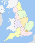
| boundary | local_authority | Describes the territory of a local authority. | ||||
| boundary | low_emission_zone | A geographically defined area which seeks to restrict or deter access by certain polluting vehicles with the aim of improving the air quality. |  | |||
| boundary | maritime | merepiir |  | |||
| boundary | marker | A boundary marker, border marker, boundary stone, or border stone is a robust physical marker that identifies the start of a land boundary or the change in a boundary, especially a change in direction of a boundary. See also historic=boundary_stone
|
 | |||
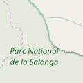
| boundary | national_park | rahvuspark |  |
 | ||
| boundary | place | boundary=place is commonly used to map the boundaries of a place=*, when these boundaries can be defined but these are not administrative boundaries.
|
||||
| boundary | political | valimispiirkondade piirid | ||||
| boundary | postal_code | Postal code boundaries. Some mappers use postal_code_level=* instead of admin_level=* to specify level in the postal hierarchy.
|
||||
| boundary | protected_area | kaitseala Täpsustamiseks vaata boundary=protected_area
|
 | |||
| boundary | religious_administration | A religious administration boundary, eg. of a catholic diocese or parish. Use religion=* and denomination=* to specify the church to which the boundary applies. Some mappers use religious_level=* instead of admin_level=* to specify level in the church hierarchy.
|
||||
| boundary | special_economic_zone | A government-defined area in which business and trade laws are different. |  | |||
| boundary | statistical | An official boundary recognised by government for statistical purposes. |
 | |||
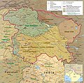
| boundary | disputed | An area of landed claimed by two or more parties (use with caution). See also Disputed territories. |  | |||
| boundary | timezone | Boundaries of time zone |  | |||
| boundary | public_transport | An operating area of a transit authority. | ||||
| boundary | user defined | All commonly used values according to Taginfo | ||||
Attributes | ||||||
| admin_level | (number) | Defines level of the division described by the boundary in the hierarchy system to which the division belongs. Usually in the range 1 to 10 (except for several countries, where it is in the range 1 to 11 – Bolivia, Germany, Mozambique, Netherlands, Philippines, Poland, Turkmenistan, Venezuela – see boundary). |  | |||
| health_level | (number) | Used by some mappers instead of admin_level=* in conjunction with boundary=health and is usually in the range 1 to 10.
|
||||
| postal_code_level | (number) | Used by some mappers instead of admin_level=* in conjunction with boundary=postal_code and is usually in the range 1 to 10.
|
||||
| religious_level | (number) | Used by some mappers instead of admin_level=* in conjunction with boundary=religious_administration and is usually in the range 1 to 10.
|
||||
| border_type | * | To distinguish between types of boundary where admin_level isn't enough. Used in several different ways e.g in maritime contexts. | ||||
| start_date | (date) | Useful if the boundary is very recent (or if it will become effective in a near future). |  | |||
This table is a wiki template with a default description in English. Editable here.