Template:Ko:Map Features:boundary
Jump to navigation
Jump to search
경계선
행정 구역 및 기타 경계를 설명하는 데 사용됩니다. 사용법에 대한 소개는 boundary 를 참조하세요.
| 키 | 값 | 요소 | 설명 | 렌더링 | 이미지 | |
|---|---|---|---|---|---|---|
Boundary types | ||||||
| boundary | aboriginal_lands | 정부에서 공인한 원주민, 토착민의 보호구역 경계를 나타냅니다. |  |
 | ||
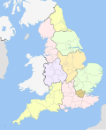
| boundary | administrative | 행정 상의 경계입니다. 정부나 기타 기관에서 행정 상의 목적으로 공인한 지역과 영토, 관할구역의 세세한 경계에 사용됩니다. 경계의 범위는 국가 전체와 같은 큰 단위부터 작은 행정구역과 동네에 이르기까지 다양하며, admin_level=* 태그로 그 단계를 나타낼 수 있습니다.
|
 |
 | ||
| boundary | border_zone | 국경 인근 지역으로서 이동제한이 적용되는 국경 지대에 해당됩니다. 일반인의 방문은 사전 승인이 필요합니다. |  | |||
| boundary | census | 인구조사에서 적용되는 통계 구역의 경계로, 꼭 지상에서 확인할 수 있는 것은 아닙니다. |  | |||
| boundary | forest | 산림 지대의 경계로, 수목이 들어차 있기 때문에 관리를 위해 명확한 경계가 부여된 토지를 말합니다. 경계 내에는 산발적인 수목 군락, 비수목지역, 길목 등도 들어와 있을 수는 있지만, 경계 안에 들어온 이상 하나의 산림으로서 관리되는 지역을 말합니다. |  | |||
| boundary | forest_compartment | 산림 구획의 경계로, 눈에 들어올 만큼 정비가 이루어진 것이 일반적이며, 산림번호를 매겨서 구체적인 경계로 구획된 하위 구역에 해당됩니다. |  | |||
| boundary | hazard | 방문객의 건강이나 생명, 재산 등의 이익에 피해를 끼칠 가능성이 존재하여 위험 지역으로 지정된 구역에 해당됩니다. |  | |||
| boundary | health | 의료 구역의 경계입니다. 편집자들 가운데서는 의료체계 계층구조의 단위를 지정하기 위해 admin_level=* 대신 health_level=*을 사용하기도 합니다.
|
||||
| boundary | historic | 옛날부터 사용되어 유서 깊은 행정 경계. 신중히 사용할 필요가 있습니다. |  | |||
| boundary | limited_traffic_zone | 당국이 지정한 교통 제한 구역으로, 특정 차량의 진입에 허가를 받아야 하는 구역에 해당됩니다. |  | |||
| boundary | local_authority | 주로 해외 지방당국의 관할 구역 경계에 해당됩니다. | ||||
| boundary | low_emission_zone | 대기환경의 개선을 목적으로 특정 오염유발 차량의 접근을 제한하거나 통행을 금지하기 위해 설정된 구역의 경계에 해당됩니다. |  | |||
| boundary | maritime | 기선과 접속구역, 배타적 경계구역 (EEZ) 등 국경이나 행정경계에 해당되지 않는 해상 경계에 해당됩니다. |  | |||
| boundary | marker | 경계 표지석, 표식석, 경계석 등으로 토지경계의 시작점이나 경계 변화, 방향 변화를 나타내기 위해 견고하게 세워둔 물리적 표식에 해당됩니다. historic=boundary_stone을 참고해 주세요.
|
 | |||
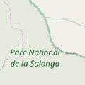
| boundary | national_park | 자연 경관을 보존하고 재생하기 위한 목적에서 지정된 국립공원의 경계에 해당됩니다. |  |
 | ||
| boundary | place | 익히 알려진 지역 경계이지만 행정구역은 아닐 경우, place=*의 경계를 설정함에 있어 널리 사용됩니다.
|
||||
| boundary | political | 선거구의 경계에 해당됩니다. | ||||
| boundary | postal_code | 우편번호의 관할 경계에 해당됩니다. 일부 편집자들은 해당 구역의 지위와 단계에 따라 admin_level=* 대신 postal_code_level=*을 사용하기도 합니다.
|
||||
| boundary | protected_area | 보호구역의 경계에 해당됩니다. 국립공원, 해양보존구역, 문화유산 구역, 야생보호구역, 문화전승 구역 등이 해당됩니다. |  | |||
| boundary | religious_administration | 특정 종교에서 행정적인 목적에서 사용하는 구역 경계에 해당됩니다. 대표적으로 가톨릭교의 교구가 있습니다. 해당 경계를 사용하는 종교를 나타내려면 religion=*과 denomination=*을 사용하세요. 일부 편집자들은 해당 구역의 지위와 단계에 따라 admin_level=* 대신 religious_level=*을 사용하기도 합니다.
|
||||
| boundary | special_economic_zone | 기업과 무역활동의 보장을 위해 정부에서 설정한 특별경제구역의 경계에 해당됩니다. |  | |||
| boundary | statistical | 통계 상의 목적으로 정부 당국에서 설정한 경계에 해당됩니다. |
 | |||
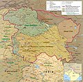
| boundary | disputed | 2개 이상의 국가나 당국에서 영유권을 주장하는 구역의 경계에 해당됩니다. 사용에 주의해 주세요. 영토분쟁 문서도 참고하세요. Disputed territories. |  | |||
| boundary | timezone | 시간대의 경계에 해당됩니다. |  | |||
| boundary | public_transport | 교통 당국의 관할범위 경계에 해당됩니다. | ||||
| boundary | user defined | All commonly used values according to Taginfo | ||||
보조 태그 | ||||||
| admin_level | (숫자) | 해당 경계로 정의된 특정 구역이 속해 있는 행정구역의 상하위 단계를 설정합니다. 1에서 10까지 설정할 수 있으며 숫자가 적을 수록 큰 단위의 행정구역을 뜻합니다. 일부 국가에서는 1~11까지 설정되어 있기도 합니다. Key:boundary를 참고하세요. |  | |||
| health_level | (number) | Used by some mappers instead of admin_level=* in conjunction with boundary=health and is usually in the range 1 to 10.
|
||||
| postal_code_level | (number) | Used by some mappers instead of admin_level=* in conjunction with boundary=postal_code and is usually in the range 1 to 10.
|
||||
| religious_level | (number) | Used by some mappers instead of admin_level=* in conjunction with boundary=religious_administration and is usually in the range 1 to 10.
|
||||
| border_type | * | admin_level=*만으로 충분치 못한 경계의 유형을 구분하기 위해 사용합니다. 해상 경계나 해외 여러 국가의 고유 행정구역을 나타낼 때 사용합니다.
|
||||
| start_date | (날짜) | 해당 경계가 최근에 지정되었거나 추후 설정될 경우에 유용합니다. |  | |||
This table is a wiki template with a default description in English. Editable here. 한국어 번역은 여기에 있습니다.