Template:Hu:Map Features:boundary
Jump to navigation
Jump to search
Boundary
These are used to describe administrative and other boundaries. See the page Boundaries for an introduction on its usage.
| Kulcs | Érték | Alapelem | Magyarázat | Megjelenítés | Fotó | |
|---|---|---|---|---|---|---|
Boundary types | ||||||
| boundary | aboriginal_lands | A boundary representing official reservation boundaries of recognized aboriginal / indigenous / native peoples. |  |
 | ||
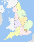
| boundary | administrative | An administrative boundary. Subdivisions of areas/territories/jurisdictions recognised by governments or other organisations for administrative purposes. These range from large groups of nation states right down to small administrative districts and suburbs, as indicated by the admin_level=* combo tag.
|
 |
 | ||
| boundary | border_zone | A border zone is an area near the border where special restrictions on movement apply. Usually a permit is required for visiting. |  | |||
| boundary | census | A census-designated boundary delineating a statistical area, not necessarily observable on the ground. |  | |||
| boundary | forest | A delimited forest is a land which is predominantly wooded and which is, for this reason, given defined boundaries. It may cover different tree stands, non-wooded areas, highways… but all the area within the boundaries are considered and managed as a single forest. |  | |||
| boundary | forest_compartment | A forest compartment is a numbered sub-division within a delimited forest, physically materialized with visible, typically cleared, boundaries. |  | |||
| boundary | hazard | A designated hazardous area, with a potential source of damage to health, life, property, or any other interest of value. |  | |||
| boundary | health | Health division boundaries. Some mappers use health_level=* instead of admin_level=* to specify level in the health system hierarchy.
|
||||
| boundary | historic | A historic administrative boundary (use judiciously). |  | |||
| boundary | limited_traffic_zone | Describes an officially designated area that requires authorization for the entry of certain vehicles. |  | |||
| boundary | local_authority | Describes the territory of a local authority. | ||||
| boundary | low_emission_zone | A geographically defined area which seeks to restrict or deter access by certain polluting vehicles with the aim of improving the air quality. |  | |||
| boundary | maritime | Maritime boundaries which are not administrative boundaries: the Baseline, Contiguous Zone and EEZ (Exclusive Economic Zone). |  | |||
| boundary | marker | A boundary marker, border marker, boundary stone, or border stone is a robust physical marker that identifies the start of a land boundary or the change in a boundary, especially a change in direction of a boundary. See also historic=boundary_stone
|
 | |||
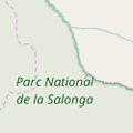
| boundary | national_park | Area of outstanding natural beauty, set aside for conservation and for recreation (Other languages). |  |
 | ||
| boundary | place | boundary=place is commonly used to map the boundaries of a place=*, when these boundaries can be defined but these are not administrative boundaries.
|
||||
| boundary | political | Electoral boundaries | ||||
| boundary | postal_code | Postal code boundaries. Some mappers use postal_code_level=* instead of admin_level=* to specify level in the postal hierarchy.
|
||||
| boundary | protected_area | Protected areas, such as for national parks, marine protection areas, heritage sites, wilderness, cultural assets and similar. |  | |||
| boundary | religious_administration | A religious administration boundary, eg. of a catholic diocese or parish. Use religion=* and denomination=* to specify the church to which the boundary applies. Some mappers use religious_level=* instead of admin_level=* to specify level in the church hierarchy.
|
||||
| boundary | special_economic_zone | A government-defined area in which business and trade laws are different. |  | |||
| boundary | statistical | An official boundary recognised by government for statistical purposes. |
 | |||
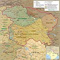
| boundary | disputed | An area of landed claimed by two or more parties (use with caution). See also Disputed territories. |  | |||
| boundary | timezone | Boundaries of time zone |  | |||
| boundary | public_transport | An operating area of a transit authority. | ||||
| boundary | user defined | All commonly used values according to Taginfo | ||||
Attributes | ||||||
| admin_level | (number) | Defines level of the division described by the boundary in the hierarchy system to which the division belongs. Usually in the range 1 to 10 (except for several countries, where it is in the range 1 to 11 – Bolivia, Germany, Mozambique, Netherlands, Philippines, Poland, Turkmenistan, Venezuela – see boundary). |  | |||
| health_level | (number) | Used by some mappers instead of admin_level=* in conjunction with boundary=health and is usually in the range 1 to 10.
|
||||
| postal_code_level | (number) | Used by some mappers instead of admin_level=* in conjunction with boundary=postal_code and is usually in the range 1 to 10.
|
||||
| religious_level | (number) | Used by some mappers instead of admin_level=* in conjunction with boundary=religious_administration and is usually in the range 1 to 10.
|
||||
| border_type | * | To distinguish between types of boundary where admin_level isn't enough. Used in several different ways e.g in maritime contexts. | ||||
| start_date | (date) | Useful if the boundary is very recent (or if it will become effective in a near future). |  | |||
This table is a wiki template with a default description in English. Editable here. A táblázat fordítását ezen az oldalon szerkesztheted.