IT:Relation:route
 |
| Descrizione |
|---|
| utilizzata per descrivere percorsi di vario genere |
| Gruppo: routes |
| Membri |
|
| Combinazioni utili |
| Vedi anche |
| Stato: de facto |
| Strumenti |
Le rotte sono percorsi di trasporto o itinerari di viaggio abituali o fissi, spesso riconoscibili grazie a segnaletica e portati a conoscenza del pubblico mediante pubblicazioni di vario tipo.
Le rotte devono essere costituite da tracciati ripetutamente seguiti da persone e veicoli: una nave sulla rotta del Nord Atlantico, un'auto su una strada numerata, un autobus sul suo percorso, un ciclista su un itinerario nazionale o un escursionista su un cammino contrassegnato e denominato.
Una rotta (o una sua variante) può appartenere ad una relazione di tipo route master (rotta principale). Una rotta principale contiene tutte le direzioni, le rotte alternative e le informazioni per quella rotta. Essa permette a OSM di distinguere le due rotte di un percorso a doppio senso.
Si precisa che a volte un certo percorso ha più di una numerazione; numerose rotte europee "E" condividono il tracciato (a volte esattamente lo stesso tracciato) con itinerari nazionali numerati (quali, per esempio, le autostrade).
-
 Percorsi ciclabili organizzati con le relazioni
 -
 Percorsi di tram e autobus organizzati con le relazioni
 -
 Percorsi pedonali organizzati con le relazioni


Etichette
| Chiave | Valore | Spiegazione |
|---|---|---|
| type | route | Indica che la Relazione rappresenta un itinerario (route) |
| route | road / bicycle / foot / hiking / bus / ferry / detour / train / tram / trolleybus / mtb (mountainbike) / roller_skate / running / marathon / horse / parade / protest march (only recurring) / , ... |
una strada (es. i percorsi che compongono la SS12 dell'Abetone e del Brennero), itinerari ciclistici, sentieri (itinerari) CAI o trekking o qualsiasi altro itinerario. L'importante è che l'itinerario sia pubblico, non individuale (il proprio giro in bici non va bene). |
| name | un nome | Il nome per cui è conosciuto l'itinerario (es. "Sentiero della Pace") |
| ref | un codice di riferimento | L'itinerario è noto per quel codice (es "431" (sentiero CAI), "SS12", "5" (il numero del bus)) |
| network | ncn / rcn / lcn / nwn / rwn / ... | La rete di itinerari di cui fa parte. (es. rete ciclabile regionale = rcn) |
| operator | nome gestore | Il nome della compagnia/associazione che gestisce l'itinerario (ne fa la manutensione etc.) |
| state | proposed / alternate / temporary / connection | Talvolta gli itinerari non sono permanenti (ci può essere una deviazione), o possono esistere solo come proposte. state=connection è usato per itinerari che collegano due itinerari diversi o che collegano un itinerario con una destinazione, come il centro di un villaggio.
|
| symbol | descrizione del simbolo | Descrive a parole il simbolo usato per indicare il percorso dell'itinerario, ad es. "Red cross on white ground" per la "Frankenweg" in Franconia, Germania. |
| colour | una tripletta esadecimale per il colore | (opzionale) Codice di colore nel formato tripletta esadecimale. Utile specialmente per il trasporto pubblico. Esempio: "#008080" per il turchese. |
| description | breve descrizione | Caratteristiche rilevanti dell'itinerario |
| distance | distance | (opzionale) La distanza coperta dall'itinerario, se nota. Per informare gli utenti e per valutazioni automatizzate, in generale per completezza. Va indicata con i decimali e l'unità di misura apprpriata (per es. 12.5 km)
|
Membri
| Percorso o nodo | Ruolo | Quantità | Spiegazione |
|---|---|---|---|
| (blank)/route | zero o più | i percorsi che compongono l'itinerario. | |
| forward/backward | zero o più | se un itinerario deve essere seguito solo in una direzione, in tutta la sua lunghezza o solo per un tratto, il ruolo può indicare il senso di percorrenza per ciascun percorso che lo costituisce. "Forward" significa che l'itinerario segue la strada solo nella direzione del percorso e "backward" significa che l'itinerario corre solo in direzione contraria. Renderizzato sulla Cycle Map (esempio). | |
| link | zero o più | Strade di collegamento (tipo highway=*_link) da e verso l'itinerario. Vedi highway=motorway_link.
| |
| stop:<number> | zero o più | Una fermata dell'autobus o del treno lungo l'itinerario. Il numero inizia con 0. Questo non è necessario per preservare l'ordine delle fermate nelle API v0.6, basta usare role=stop e cambiare l'ordine delle fermate nella relazione.
| |
| forward/backward:stop:<number> | zero o più | Una fermata dell'autobus o del treno lungo l'itinerario, che è usata solo in una direzione. La direzione è relativa alla direzione della strada, e non a quella verso o da un certo capolinea. Questo non è necessario per preservare l'ordine delle fermate nelle API v0.6, basta usare role=forward/backward:stop e cambiare l'ordine delle fermate nella relazione.
| |
| stop | zero o più | Una fermata dell'autobus o del treno lungo l'itinerario. | |
| forward/backward:stop | zero o più | Una fermata dell'autobus o del treno lungo l'itinerario, che è usata solo in una direzione. La direzione è relativa alla direzione della strada, e non a quella verso o da un certo capolinea. |
Tipi di itinerario in uso
Itinerari degli autobus (inclusi i filobus)
- Voce principale: Buses
| Chiave | Valore | Commento |
|---|---|---|
| type | route |
(Obbligatorio) |
| route | bustrolleybus |
(Obbligatorio) |
| ref | Reference | Il numero dell'itinerario nella forma nota al pubblico: 4, 4A, X13, IR 3114 etc (raccomandato) |
| operator | operator | Nome della compagnia che fornisce il servizio es: Deutsche Bahn AG, Connex, Interconnex usw. |
| name | Individual Name | Il nome dell'itinerario o del percorso es: "Orient Express" "Thalys" (opzionale) |
| network | local/ regional network | Nome (Abbr.) della compagnia a livello locale es: BVG, RMV (opzionale) |
| wheelchair | yes / no / limited |
Indica se gli autobus dell'itinerario sono equipaggiati con rampe o facilitazioni per le sedie a rotelle. (opzionale) |
| colour | ex: rosso / #FFEEDD | Il colore "ufficiale" per il percorso del bus. In alcune città è identificativo del percorso. (opzionale) |
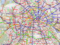
öpnvkarte and openstreetbrowser.org render public transportation routes.
Some examples in use:
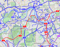
- Bus route 82 in Quebec City, Canada
 Bus route 82 in Quebec City, Canada
Cycle routes (also mountain bike)
- Voce principale: Cycle routes
Cycle routes are extensively mapped with route relations, and the OSM cycle map will render route relations following this proposal.
In general it is probably a good idea to add the tags: "type => route" and "route => bicycle". However, the cycle map will still render a route if they are not present.
The following tags are used in rendering:
| Key | Value | Comment |
|---|---|---|
| ref | a reference | (optional) NCN, RCN, and LCN references work best on the map if just the number is used, so for NCN 4: "4". The network tag correctly distinguishes the type, so just use "ref" and not "ncn_ref" or similar. |
| network | ncn / rcn / lcn | Specify the network as a national route, a regional route, or a local route, as per the normal tagging of cycle routes |
| state | proposed | (optional) Routes are sometimes not official routes pending some negotiation or development -- the map renders these routes dotted. |
| route | network | Description |
|---|---|---|
| bicycle | ncn | National cycling network: long distance routes used for cycling routes that cross countries |
| bicycle | rcn | Regional cycling network: used for cycling routes that cross regions In Belgium and the Netherlands this is used for the cycle node networks |
| bicycle | lcn | Local cycling network: used for small local cycling routes. Could be touristic loops or routes crossing a city |
Some examples in use:
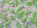
- Part of UK NCN Route 4 Part of UK NCN Route 4
- Part of London Route 5 Part of London Route 5
Railway routes (light rail, metro, mainline, monorail etc)
- Voce principale: Railway
Railway routes can both be used to describe a particular part of the infrastructure that known by a distinct name (for example East Coast Main Line) or for a railway service which is identified to the public with a particular identifier or name (such as the Orient Express). Discussion on tagging for different purposes is taking place on talk transit (Aug09).
| Key | Value | Comment |
|---|---|---|
| type | route | |
| route | train (regional/ national train) subway (mainly underground) |
|
| ref | Reference | The number of the line e.g. IR 3114 |
| operator | operator | Name of the company that operates the route e.g. Deutsche Bahn AG, Connex, Interconnex usw. |
| name | Individual Name | Only if there is a special name of the route or line e.g. "Orient Express" "Hammersmith and City" (optional) |
| network | local/ regional network | Name (Abbr.) of the network e.g. BVG, RMV (optional) |
| wheelchair | yes / no / limited | If the trains on the route are equipped with ramps or elevators for wheelchairs. Note that even if the trains are that the not all stations on the route may be suitable, or not all platforms may be accessible (optional) |
| colour | ex: red / #FFEEDD | If the railway route has an "official" colour, for example metro lines in some cities. (optional) |
Route relations could also be used to designate railway lines that are operated by one (perhaps more) train operators. Some examples can be found at Open Rail Map/NL.
öpnvkarte and openstreetbrowser.org render public transportation routes.
Some examples in use:
- Please add here...
Road Routes
| route | network | Description |
|---|---|---|
| road | e-road | European E-road network |
| road | US:I | Interstate Highways Relations, USA |
| road | US:US | United States Numbered Highway Relations, USA |
| road | US:xx | State highways in the United States, where xx is the state's postal abbreviation. Many states also have county route networks, and some have several tiers of state-owned roads. |
| road | BAB | German Autobahn |
| road | ca_transcanada | Canadian Trans-Canada highways |
| road | ca_on_primary | Ontario primary highways |
| road | pl:national | Polish Road Network - national roads |
| road | by:national [1] | Belarusian Road Network - national roads |
| road | BR | Brazilian Federail Highways |
| road | BR:xx | Brazilian state highways, where xx is replaced by state code (RJ = Rio de Janeiro, MG = Minas Gerais, etc.) |
| road | bg:national | Bulgarian Road Network - national roads |
Some examples in use:
- Please add here...
Tram routes
- Voce principale: Trams
| Key | Value | Comment |
|---|---|---|
| type | route | |
| route | tram | |
| ref | Reference | The number of the line e.g. IR 3114 |
| operator | operator | Name of the company that operates the route e.g. Deutsche Bahn AG, Connex, Interconnex usw. |
| name | Individual Name | Only if there is a special name of the route or line e.g. "Orient Express" "Thalys" (optional) |
| network | local/ regional network | Name (Abbr.) of the network e.g. BVG, RMV (optional) |
| wheelchair | yes / no / limited | If the buses on the route are equipped with ramps or elevators for wheelchairs. |
| colour | ex: red / #FFEEDD | The tram, subways and buses might have "official" colour identifiers in some cities. |
öpnvkarte and openstreetbrowser.org render public transportation routes.
Some examples:
- Please add here...
Walking routes (also hiking and pilgrimage)
- Voce principale: Walking Routes
The tag route=hiking is frequently used synonymously with route=foot.
Hiking routes are rendered for selected areas in Germany in a Hiking and Trail riding map (german). The tags required for rendering are:
| Tag | Description |
|---|---|
|
|
Meaningful route name suitable for identifying this route. |
|
|
Verbal description of the route marker symbols. |
| route | network | Description |
|---|---|---|
| foot | nwn | National walking network: long distance paths used for walking routes that cross countries |
| foot | rwn | Regional walking network: used for walking routes that cross regions In Belgium and the Netherlands this is used for the walking node networks |
| foot | lwn | Local walking network: used for small local walking routes. Could be touristic loops or routes crossing a city |
| pilgrimage | Camino de Santiago | Main, second, third or variant ways to Santago de Compostella. |
Some examples:
- Please add here...
Detours
| route | network | Descrizione |
|---|---|---|
| detour | Deviazioni locali (utilizzate in Olanda e Germania) |
Tipologia di route utilizzate
Tabella con le etichette applicabili alle route e utilizzate finora
| route | Descrizione | |
|---|---|---|
| bicycle | ||
| bus | bus routes over ways | |
| detour | a named, permanent detour | |
| ferry | ferry routes over water | |
| foot | ||
| hiking | ||
| horse | ||
| mtb (mountainbike) | ||
| pilgrimage | ||
| power | where power lines use the same towers (the same way) | |
| railway | ||
| road | long roads with a common name or ref.
e.g. a european motorway made up of many segments of national motorways or |
|
| roller_skate | ||
| running | ||
| taxi | ||
| tram | A tram service. See trams. | |
| trolleybus | See bus | |
| cycling | Used for cycling events (like stages of the Tour de France). For (recreational) cyclenetwork use bicycle | |
| please add here |
Guida passo passo
Potlatch
- Assicurati che esistano tutte le way lungo le quali si dipana il percorso (route) e che siano appropriatamente taggate.
- Seleziona la prima way e clicca sul secondo simbolo a destra, che appare come un tratto di catena.
- Seleziona una relazione dal menu a tendina se ne esiste già una appropriata nell'area. Se la relazione che interessa è troppo lontana, usare la funzione di ricerca. Se non esiste già la relazione voluta, seleziona Crea una nuova relazione e clicca Aggiungi
- Aggiungi il tag type con il valore route.
- Aggiungi tag addizionali se necessario usando l'icona +.
- Clicca OK
- La relazione è stata aggiunta alla way. Il box grigio a destra dei dettagli della relazione e a sinistra della x è il campo di input per il ruolo della way all'interno della relazione. vedi la sezione Members per dettagli sui ruoli all'interno della relazione di tipo route.
- Ripeti i passi 2-7, selezionando la relazione appropriata (quella appena creata) nello step 3.
JOSM
- Assicurati che esistano tutte le way lungo le quali si dipana il percorso (route) e che siano appropriatamente taggate.
- Assicurati che il pannello per le relazioni sia aperto
Alt+R. - Seleziona
Nuovanel pannello per le relazioni per crearne una nuova. - Inserisci nella tabella come minimo type=route ed ulteriori tag addizionali.
- Clicca
OK - Adesso seleziona qualcuna o tutte le way che vuoi aggiungere alla relazione usando il normale tool Seleziona (
S), poi clicca suModificanel pannello delle relazioni con la relazione di interesse evidenziata. Apparirà la tabella per la modifica delle relazioni. - Clicca su
Aggiungi selezionenella tabella per aggiungere alla relation le way selezionate.
Mapping practice
Especially with bicycle routes it can happen very often that multiple routes run along the same ways for a far distance. There exist so many different bicycle route networks that are operated by different institutes that it is not unusual that some of these networks overlap. The EuroVelo routes for example use the already-existing infrastructure in many countries. There are two practices at the moment how to process if segments of multiple routes share the same way.
- Add the ways to all relations of the routes that they belong to.
- Split the routes into part relations and make super-relations (relations that don’t contain ways but instead other relations). Then add the segment that is shared by the routes to all of them.
Both practices each have different advantages and disadvantages.
Adding the ways to multiple relations
- When many routes share one path, it can be a lot of work to map a new part of the route, as you have to add the ways to all relations.
- People might not see that the path is also used by other routes and might forget to apply their changes to all relations. Thus the data may get inconsistent.
- This is probably the easier way, as it is somewhat hard for beginners to split relations into parts and to find out which part they have to edit.
- Relations might become very big, which makes it hard to work with them (analyzers need more time to process them, drawing them into the map will take a lot of JavaScript CPU time).
- If you don’t use super-relations at all, you also have to add alternative routes and excursions to your relation. This makes it hard for analyzers and tools to understand the route. role=excursion and role=alternative have been suggested, but they still don’t say which way belongs to which excursion (if there are multiple ones).
- It is the purpose of relations to group objects. When two primary roads share the same street at some part, we don’t create two ways for them that share the same nodes. So we shouldn’t create two relations that share the same ways.
Creating super-relations
- Current renderers (like the CycleMap) don’t support super-relations, so they don’t show the ref and the network tag of a super-relation. Currently, all these tags have to be added to all part relations, which is a lot of work (especially as the parts need to have the different refs of all the routes they belong to).
- It is said to be good mapping practice to keep relations one way, so alternative routes and excursions need to be put into a different relation anyway. So you often need a super-relation even without splitting the route into parts.
- Tools and analyzers (like the OSM Relation Analyzer, especially the GPX export function) don’t support super-relations yet. This makes it hard to analyze a route as a whole (which is important for example to calculate how much of a route has already been mapped).
- There is no documented convention on how to handle super-relations. On first glance it appears simple, just take over all tags to all members, but it is not. There are tags where this just makes no sense or which change the context and meaning when handed over to a member relation, e.g. distance or note.
- Super-relations can become very confusing when a relation belongs to multiple super-relations or a way belongs to multiple relations. In that case it is no longer deterministic from which relation a certain relation or way will receive its tags.
- When someone maps a new route, they might have to split other routes that share ways with it. People editing these other routes might get confused when the number of sub-relations keeps changing the whole time.
- Current editors miss advanced relation editing features, such as “Split relation” (and also super-relation rendering). Things can get very confusing when one route consists of hundreds of small part relations.
- One motto of OSM is “Don’t map for the renderers”. If is considered the more natural way of mapping to create super-relations, then the missing support in the renderers and tools should not stop us from doing so.
- Consider that super-relations are not necessarily included when requesting a set of data from the server. So depending on whether or not super-relations were included, the data is interpreted differently. As you cannot tell from a way or relation whether it is member of another relation, you're never quite sure whether you see all relevant data.
- It is common sense to create super-relations if one complete route is part of another route (like the German “D6” is with EuroVelo EV6). If EV6 now shares only a part of another way in another country, we will have to create segments anyway (else we end up with a relation that contains both sub-relations and ways). We should either use the one method or the other.
- People only need to know the route that they are mapping. When someone maps the German D6 route, he doesn’t even need to know the EuroVelo network (as EV signs might not exist in his area), as with a super-relation his part of the route gets automatically added to all parent relations. This fits the OSM concept better: When everyone maps the places and things he knows, a “complete” map of the world evolves.
At the moment it seems to be practice to create part-relations if the shared segment is relatively big compared to the total length of a route. For a national bicycle route, 20 km might be a good limit. For shorter parts the single ways might be added to all relations they belong to. (Of course this is only a rule of thumb, nothing of this is the “official” way of mapping.) It might also be important of how many different way objects a segment consists in OSM, it might be not very useful to create segments if the route consists of motorways (as they only contain of a few, long ways), while bicycle routes often go through cities and residential areas where many ways would have to be added if there were multiple relations.
Another point to decide which tagging method to use is to find out if the routes only use the same ways by coincidence. Thus, if in the case that one route is changed, the other route will likely still be using the old way, using part-relations would not be appropriate.