Proposal talk:Barriers
Images
|
Here's what bollards look like (from defunct proposal for bollards.)  
|
Some more barrier images:   |
Minor examples of the art ;) -- see some real bollards ... !
General, meta
Borders was added with the intention of being able to fit a large amount of tags under that key. Barriers would fit into that fine I think, and therefore barriers is unnessesery. Either that or border tags would go under barriers, but then barrier inply's more than border I think. Although gatehouse (If im thinking of the same thing as you) would be a building rather than a barrier, and the gate is the border. Ben 04:22 18th Decemeber 2006 (UTC)
More old discussion removed, the concerns raised have been addressed. --Hawke 17:45, 4 January 2008 (UTC)
- Good proposal SlowRider 18:47, 4 January 2008 (UTC)
i think we should tag only physical barriers. legal barriers elsewhere.
also not only impediments to a given "way", but also to free movements such as a walk (not following a path) in the countryside. also barriers to all types of "beings" such as vehicles, humans or animals.
if we take this as the rationale then there are some values for barriers that may not match
all that can be considered just traffic_calming (cycle_barrier or chicane); gatehouse is more a building, maybe needs renaming to portcullis or drawbridge;
tool_booth and ford are the other two I doubt
Specific issues
Noise barriers
Noise barriers frequently run along motorways or bigger streets or railways. In most cases they serve as an obstacle for people as well as for noise. How should we tag those? Ipofanes 15:36, 30 January 2009 (UTC)
- I just tagged such wall-"ways" just as barrier=wall. Unfortunatly they will not be rendered by Mapnik or Osmarender :-/ --Cbm 07:14, 31 January 2009 (UTC)
- Do not tag for renders. if enough people uses what ever tag, finally it will be rendered. it is better to find the proper name (eg. barrier=noise_wall) and tag as such.--Sergionaranja 08:41, 6 March 2009 (UTC)
- That's not tagging for the renderer.
barrier=wallexists, noise barriers are walls, and so it is a fine thing to use. --Hawke 17:18, 6 March 2009 (UTC) - you are right, i was just thinking that it was a pitty to loose that info.(that a wall is also a noise wall)--Sergionaranja 17:45, 6 March 2009 (UTC)
- Agreed. Maybe some other key could be used to describe the purpose or type of wall.--Hawke 18:02, 6 March 2009 (UTC)
- "That's not tagging for the rendered": given that neither tag is currently rendered, one would wonder how that argument works. Circeus 03:45, 8 March 2009 (UTC)
Add anti-four-wheeler booms and bars
- I think this is a good thing, but I also see the need for another type of barrier, a bar over the street, see http://de.wikipedia.org/wiki/Bild:Moderne_Schranke.jpg . Although I'm not a native English speaker I suggest barrier=bar or barrier=barrier. --ramack 19:19, 17 December 2007 (UTC)
- I think barrier=boom should be better.
- Why another value? That's just a gate, or a gate:lift maybe (I don't know why the distinction about which way it swings is important). --SiliconFiend 18:12, 4 January 2008 (UTC)
- I agree with SiliconFiend - that's the sort of construction that I visualised when reading the description of gate:lift --DavidJames 19:08, 4 January 2008 (UTC)
- This would be fine with me, but I'd prefer gate_lift over gate:lift --ramack 16:39, 13 January 2008 (UTC)
- I think this is a good thing, but I also see the need for another type of barrier, a bar over the street, see http://de.wikipedia.org/wiki/Bild:Moderne_Schranke.jpg . Although I'm not a native English speaker I suggest barrier=bar or barrier=barrier. --ramack 19:19, 17 December 2007 (UTC)
Tag ease of access?
- I would think the most important thing about barriers/gates is how easily they can be crossed. If a gate just needs to be opened but closed behind it will slow you down but not stop you. Some how the bars/lift-gates aren't locked but are for emergency access only. Some are locked and only for maintaince/emergency/authorised_users (I'm not sure how keys are managed in such places like half way down a road). I think it's this sort of thing that needs to be done and let's not just create loads of values just for visually differing barriers. Also it may be good to use the operator tag in connection with barriers that have a padlock. - LastGrape 18:49, 4 January 2008 (UTC)
- Good idea - I've touched on it below, because I think ease of use needs to be organised by mode of transport used as well as by the degree of hindrance. Bollards, for example, don't hold up most pedestrians. Something like the access tags could probably be used meaningfully alongside any barrier tags. --achadwick 16:28, 25 April 2008 (UTC)
Use highway= instead?
- It is not stated here why the highway= tag presently widely in use on a node is insufficient, especially since the barrier key is not intended to cover other types of way (eg waterway) blackadder 19:06, 4 January 2008 (UTC)
- I also see no need for a new key. But I would like to see bollard, spikes and speedbump as new highway node values. Toralf 16:55, 5 January 2008 (UTC)
- I would say it is because barriers and highways have very little in common. One is linear, the other is almost always non-linear. One is a route to travel on, while the other impedes travel along a route. --Hawke 18:35, 28 February 2008 (UTC)
- Agreed, for the same reason that the Road crossings proposal deserves a different top-level tag. Crossings and barriers are where you stop, highways are for travel. --achadwick 16:54, 23 April 2008 (UTC)
- Plus if a barrier is linear, it is not even part of a highway. A robot checking if all highways are connected to each other will mark a wall as isolated. Ipofanes 09:00, 31 January 2009 (UTC)
- It should include waterways, but at the time of approval seemed too much change to pass trough or discuss at the same time. maybe that should be talked again.
Add Rising bollards
- What about "rising bollards"? See http://www.pawsawhile.net/York.html - this is a metal bollard which descends into the road surface to allow buses and taxis to pass DavidJames 19:14, 4 January 2008 (UTC)
- The second picture below is a rising bollard. I think it would be
barrier=bollardpsv=yesaccording to this proposal (if it lowered for buses and taxis). --Cartinus 20:43, 9 February 2008 (UTC)- I'm in favour of representing rising bollards this way too, i.e. using existing concepts about access generally. Note that some rising bollards exist solely for ambulance or fire-engine access, but this fact is largely irrelevant to the general public. --achadwick 11:58, 16 September 2008 (UTC)
- The second picture below is a rising bollard. I think it would be
Linear and area barrier (Add Walls)
- walls are also barriers e.g. for prisons, monasteries etc... --Cbm 12:04, 5 January 2008 (UTC)
You are describing barrier points as obstacles to the way, but they can also be seen as "holes" to pass through a bigger barrier. In any case those holes always intersect with a way so its fine how you are describing them. But from this point of view I would include the bigger barriers, physical boundaries, to this tag (there is huge need for it).
I would tag ways and areas with values like fence, wall, hedge, city_wall
  barrier=hedge
  barrier=fence
  barrier=wall
  barrier=retaining_wall
  barrier=city_wall
they can be mixed with land type when areas:
  leisure=park
  barrier=wall
  landuse=farm
  barrier=fence
they can be rendered as lines of different thickness, in the case of city_wall as described there
see city_wall and border, why not deprecate or add those? --Sergionaranja 18:00, 15 September 2008 (UTC)
- Do linear/area barriers affect routing? Serious question. If a road-Way crosses a barrier without sharing a Node with it, does that mean that passage is blocked or not? Assume we'll want to represent both cases. My own thoughts: if a road-Way crosses a barrier (but does not share a Node), assume the road-Way goes either over or under the barrier and isn't interrupted by it for backwards compatibility and ease of implementation. If a Node is shared, assume the barrier acts as a barrier to further progress. Corner cases like roads ending at city walls (which can be walked along, and to which there is step access from the road), or long city walls with multiple routes through (with different classes of permitted access, bollards on ways inside the tunnel through, etc.) are welcome! --achadwick 11:36, 16 September 2008 (UTC)
- i agree that a way that crosses a linear or area barrier should share a node and the node must have barrier=gate or whatever type of node barrier. the tag should be placed on the way shared node as is a limitation of the way. so maybe don´t assume a node shared by a way and a linear barrier is an impediment unless the node is tagged, it can be a hole in the fence with no limitations to pass through.
- The "can be walked along" issue is a tricky one. i would do barrier=city_wall independent of a foot way that goes over, placing the barrier on both sides.--Sergionaranja 13:24, 16 September 2008 (UTC)
- 0 barrier (barrier=hedge) at the crossing way (highway=residential) at the crossing way node (barrier=bollards)
- 1 barrier (barrier=fence) at the crossing way (highway=residential) at the crossing way node (barrier=cattle_grid)
- 2 barrier (barrier=wall) at the crossing way (highway=residential) at the crossing way node nothing
- 3 barrier (barrier=retaining_wall) should never cross a way
- 4 barrier (barrier=city_wall) at the crossing way (highway=residential;tunnel=yes;layer=-1) at the crossing way node nothing
- 5 barrier (barrier=city_wall;two_sided=yes) at the crossing way (highway=residential;tunnel=yes;layer=-1) at the crossing way node nothing
- 6 2 separate barriers (barrier=city_wall) at the top way (highway=footpath) at the crossing way (highway=residential;tunnel=yes;layer=-1) at the crossing way node nothing
- 7 barrier and footway share same way (highway=footpath;barrier=city_wall) at the crossing way (highway=residential;tunnel=yes;layer=-1) at the crossing way node nothing

- just in cases 1 and 2 there is shared node.
- both sides of the wall are at same level in 1, 2 and 5.
- a way is at top level inside the wall in 6 and 7
- --Sergionaranja 15:11, 16 September 2008 (UTC)
- As for explicitly representing archways/passages through big walls, I suggest we keep it simple and backwards-compatible: use tunnel=yes on a short segment of the road-Way as you might for a footway passing through an embankment on the top of which there is a motorway, for example. And don't share nodes with the wall. --achadwick 11:36, 16 September 2008 (UTC)
- i totally agree. for example a way that crosses a city_wall does not need to share a node and the way can be tagged with tunnel=yes layer=-1 and if it has a bollard under the arch then the way has a node barrier=bollards, but not the linear barrier=city_wall.--Sergionaranja 13:24, 16 September 2008 (UTC)
Namespace colons
- gate:lift is good, but why introducing colons in values? I'd like gate_lift much better, or only bar for this tag. --ramack 19:31, 5 January 2008 (UTC)
(moved some of the later discussion up here: --achadwick 16:53, 23 April 2008 (UTC))
Having three different ways to write the values: gatehouse, gate:lift, cattle_grid makes it extremely hard to remember the right spelling. What's the benefit of gate:lift over traditional OSM spelled gate_lift? - Ulfl 04:02, 20 March 2008 (UTC)
- gatehouse, gate:lift, and cattle_grid are each completely different things. The situation with gate:lift vs. gate_lift is that "lift" is a type of "gate"; "gate_lift" would be for a two-word "gate lift" thing, whatever that might be. (compare gate:lift, where lift is a type of gate, to cattle_grid, where a "cattle grid" is a thing referred to using two words. If we used the other terminology for a cattle grid, a "Texas gate", it would be valid to use gate:Texas) Does that make sense?--Hawke 15:55, 24 March 2008 (UTC)
Calls for additional explanation
- what exactly is fence and gatehouse - please add explanations for none native speakers ;-) -- Ulfl 00:39, 6 January 2008 (UTC)
Distinguish by type of access rather than physical type?
- Instead of the barrier values representing the physical object, they could describe the type of barrier. Thus being more abstract, and it then wouldn't matter much which direction they swing etc. English is not my native tongue, so maybe someone could assist on the following. How about: barrier=full for all type of full size gates that can be opened (if you are allowed/able), barrier=car for rigid bollards, barrier=half for removable bollards and half size gates, barrier=one_way for spikes, barrier=speed for speedbumps and other physical objects that should enforce lower speed. Toralf 14:17, 6 January 2008 (UTC)
I'm beginning to come round to this idea in general. It's clear that there's an awful lot of different types of these things worldwide, and trying to make a single taxonomy for all of them up front is going to be difficult to do while simultaneously missing the point that highway-related stuff should be primarily about denoting access and use, and only secondarily about specific typologies and denoting landmarks. In either case, you have to concede that gates and bollards make a poor landmark from a moving car (up until the point where you have to get out and open them, or turn around!). I'd want to say stuff about how different modes of transport can get through the barrier, and which get turned away. Here's how I might do it for myself: --achadwick 16:22, 25 April 2008 (UTC)
IMO the various access keys currently in use, or the access namespace I proposed allow you to specify what level of access the barrier in question gives. This proposal is more about describing what the barrier actually is. For example, a tag of "barrier=gate" doesn't say anything about whether a car (for example) could get past the gate. One of the access tags would still be necessary to indicate that. So, yes, this tag doesn't describe what Toralf suggests, but we already have a system in use, as well as a proposal which would do that. --Hawke 04:22, 28 April 2008 (UTC)
- barrier=yes - any Point or Way structure which prevents some sort of access, sometimes allowing some modes of transport a greater degree of freedom than others.
- barrier:static={yes,no} - a value of yes means that this barrier has no moving parts. For 'permitted' vehicle users or riders (those with good degrees of freedom), this means that the barrier may be negotiated slowly without having to get out or dismount.
- Examples {yes}: stiles, cycle chicanes, bollards.
- Example {no}: pedestrian turnstiles, kissing gates, lowerable/raisable booms, gates, rising bollards at the borders of congestion zones.
- Some means of denoting accessibility. I don't much care what gets used provided we distinguish between modes of use that are supposed to be able to have access through the barrier, and optionally how unobstructed the access really is. Some possibilities:
- Modification of the existing access scheme:
- * access={yes,no,limiting}, foot={yes,no,limiting}, bicycle={yes,no,limiting}, motorcar={yes,no,?oneway?,limiting} etc., the extra limiting value meaning the barrier imposes an extra burden or difficulty on its users, e.g. bicycle users having to dismount or ride slowly through a tight chicane, motorists having to open gates, pedestrians having to climb over a stile.
- * wheelchair=..., with values defined by Metehyi's wheelchair proposal.
- Same as above, with a namespace prefix of barrier:.
- Whatever Hawke's access: name space proposal gives us.
- Do we need to represent lockability, or whether the barrier might be locked when somebody tries to use it?
- Some means of giving an optional localised name for the type of barrier. This would be a field without any predefined values, but maybe the wiki page could give some suggestions. Examples:
- barrier:ref=cycle_chicane / barrier:ref:de=drängelgitter
- barrier:ref=rising_bollard
- TODO: make some fleshed-out examples if people make positive noises about this
- The default icon for a barrier:static=yes should be something bollard-like, that for a non-static barrier should look somewhat gate-like in a similar style. A plain line or a dotted or faint grey line or a short bit of diagonal hatching across the Way would probably work too. Renderers like the OSM cycle map would probably add different icons for different types of bicycle, foot or wheelchair access.
- --achadwick 16:22, 25 April 2008 (UTC) that was long, sorry.
Footway Chicane/zig-zag barriers


- I don't know the English term for this, but there are "zig-zag" barriers which are supposed to stop bicyclists from driving through. These should be included, too --Wabba 15:26, 7 January 2008 (UTC)
- I think you might be referring to a Kissing Gate. I think these should be included too as they are pretty common on footways. how about barrier=kissing_gate Thewanderer 17:47, 13 January 2008 (UTC)
- I think you are talking about a "Drängelgitter" (it's the German word - I don't know the English one, too). Some examples can be found on that page: [1] (scroll to the bottom half). They should get a tag. --Streckensucher 20:20, 28 January 2008 (UTC)
- I don't think that there's a specific word for them other than barrier.
- Do you mean like the images to the right? I'd call those a barrier=chicane or a barrier=zigzag. They allow pedestrians to pass, but not bicycles - quite why they're on a segregated cycle/footway I'm not sure. They're a bloody nuisance. --achadwick 01:35, 4 April 2008 (BST)
- SNH (linked below) calls them a Cycle Chicane. --achadwick 17:04, 23 April 2008 (UTC)
I think the headline (anti-two-wheeler) is not correct, at least not for those "Drängelgitters" I referred to. In In our region they are often used on cycleways to prevent bigger vehicles to go on those ways. --Streckensucher 19:27, 23 April 2008 (UTC)
- yes, you're probably right. I've changed the topic-headline to a more neutral and descriptive term. In this region, this type of barrier in different sizes can have multiple uses: stopping vehicles of any sort (pedal cycles included) from using footways, slowing cyclists on cycleways, and preventing motor{car,cycle}s having access to foot- or cycleways. --achadwick 15:26, 25 April 2008 (UTC)
An online German-English dictionary gives me {Umlaufsperre, Drängelgitter} <=> {Cycle barrier}. "Cycle chicane" sounds more descriptive to me, but I think we're talking about the same thing: a series of obstructions across the Way which you can't go through in a straight line and may have to slow for, but where there's no opening of gates or operation of locks. Would you say this was an accurate translation despite the slight difference in form between the two pictures? --achadwick 15:26, 25 April 2008 (UTC)
Free-form vs. predefined values
As a more general point, I don't see the point in there being a plethora of defined values for this tag. I believe that a few specific cases should be handled (gates and possibly fords) which may have an extended meaning to routing tools etc. Otherwise, I think we should just allow a freeform set of values and the yes value. Along with the appropriate access tagging, we should just about cover all types of barrier without the need to predefine them all. --Thomas Wood 00:07, 20 March 2008 (UTC)
- If you want to have different symbols for different barriers (which makes perfect sense), there should be some defined values. I would expect a renderer to show a generic barrier icon for unknown barrier values. So it makes sense to have defined values for known barriers - that doesn't mean you can use barrier=whatever for things not in the list. - Ulfl 04:02, 20 March 2008 (UTC)
- I had assumed that "user defined" was implied, since the feature doesn't prevent people from tagging however they want. --Hawke 15:55, 24 March 2008 (UTC)
Fords: really a barrier?
I have a concern about ford being included as a barrier. Clearly, some fords are trickier to negotiate than others, but the most prominent example I can think of is no more difficult to traverse than a railway level crossing. --Mackerski 01:59, 20 March 2008 (UTC)
- Agreed. Fords are crossings not barriers, and might sit better in a slightly modified version of User:Frankie Roberto's road crossings proposal. Look at it this way:
- A ford is a construction to permit travel across a river where travel would otherwise be impossible. Fords enable.
- A barrier is a construction put up to prevent or hinder travel. Barriers hinder.
- The contrast is pretty evident. --achadwick 20:23, 25 April 2008 (UTC)
- (Although to keep these two proposals cruft-free, I may keep quiet about this for now because then we'd have to revisit bridges as well. Shh, tell no-one I said this!) --achadwick 20:25, 25 April 2008 (UTC)
- For someone on foot or bicycle, many fords* are more difficult to traverse than gates, bollards, fences or stiles. So no need to demote their difficulty... Ojw 21:22, 25 April 2008 (UTC) * e.g. wading across the river great ouse at clapham
- Yes, any ford that comes up to your bottom bracket* can be difficult to traverse. I merely mean to argue that fords aren't as easily typified as the current proposal makes out. To clarify, I think that fords do not belong in this proposal, and I do not think that this proposal should be deprecating
highway=ford. --achadwick 20:02, 26 April 2008 (UTC) * no matter what your mode of transport.- ill take ford out of the list, it should be highway=ford--Sergionaranja 07:59, 4 October 2008 (UTC)
- Yes, any ford that comes up to your bottom bracket* can be difficult to traverse. I merely mean to argue that fords aren't as easily typified as the current proposal makes out. To clarify, I think that fords do not belong in this proposal, and I do not think that this proposal should be deprecating
- For someone on foot or bicycle, many fords* are more difficult to traverse than gates, bollards, fences or stiles. So no need to demote their difficulty... Ojw 21:22, 25 April 2008 (UTC) * e.g. wading across the river great ouse at clapham
- wouldn't crossing=ford be better, especially as a node? --Cbm 09:29, 4 October 2008 (UTC)
- I'd say you are misinterpreting
crossing=*, which is for crossings of a road by people not on cars. "ford" would be quite out of place there IMHO. Circeus 06:25, 5 October 2008 (UTC)- but what if the stream is used for kayak-sports? ;) --Cbm 09:13, 6 October 2008 (UTC)
- I'd say you are misinterpreting
- wouldn't crossing=ford be better, especially as a node? --Cbm 09:29, 4 October 2008 (UTC)
- A better way to tag
ford=*s --Gorm 11:35, 4 May 2010 (UTC)
How to tag combinations of barrier types (e.g. gate with cattle grid)
- I've a question - how are gates that also contain a cattle grid handled? I've come across some recently but neither existing tags nor this proposed one seemed to indicate how these should be tagged. Thewanderer 17:27, 23 March 2008 (UTC)
- Good question. I believe it is usual to combine the values with a semicolon, so
barrier=cattle_grid;gatewould be the way to go. --Hawke 15:55, 24 March 2008 (UTC)
- I suppose we can also add Proposed_features/Bus_Sluice to this? Osm@floris.nu 21:31, 1 April 2008 (BST)
- Added. Feel free to add a description as well. --Hawke 21:54, 1 April 2008 (BST)
Motorcycle 'squeeze' barriers

A fairly uncommon style of barrier in the UK is the 'squeeze'-style barrier shown to the right, sometimes called a "K Barrier" or a "Three Valleys Barrier" by the manufacturers. According to the SNH site linked below, the manufacturer's blurb, and GB patent 2392192, they're designed to let though pedestrians and cyclists, while preventing access for cars and motorcyclists. Could we add these using a suitably vendor-neutral term like barrier=squeeze or barrier=squeeze_style? --achadwick 21:04, 26 April 2008 (UTC)
- And in my region there are two simliar barriers: It's just two big stones on either side of the road which leave enough space for two-wheeled vehicles to pass through. I have tagged this as
barrier=bottleneckfor now... What do you think? --Dwi Secundus 16:42, 16 September 2008 (UTC)
Paled doors to hinder animals from accessing the Autobahn
How should these be called? Unfortunately I don't have a picture and I don't know how these are called: It's a paled door made of steel which only opens away from the protected area and which automatically closes itself. It does not have a doorhandle, so that no animal can pull it backwards to open it. Do you know what I mean? --Dwi Secundus 20:20, 18 September 2008 (UTC)
Deprecation list
- highway
-
- highway=gate > to barrier=gate
- highway=stile > to barrier=stile
- highway=cattle_grid > to barrier=cattle_grid
- highway=toll_booth > to barrier=toll_booth
- highway=ford > to barrier=ford
- proposed
-
- city_wall=* > to barrier=city_wall
- structures=* > deprecate (steal) values that are "barriers"
- *=checkpoint > to barrier=checkpoint
- amenity=border_control > to barrier=border_control (is the same as checkpoint?)
- border=* > to barrier=*
- natural=hedge > to barrier=hedge
- http://www.snh.org.uk/publications/on-line/accessguide/gaps_list.asp contains some neutral-sounding terms and PDF plans for many different styles of barrier --achadwick 16:53, 23 April 2008 (UTC)
Here's a related forum discussion -- Harry Wood 14:50, 23 April 2008 (UTC)
City Wall Discussion (previous)
taken from man_made=city_wall draft:
- I'm ok with the value, but I don't particularly like the man_made key. I think this could go fine under the key I proposed some while ago, which is border=, as the wall definitely a border. Ben. 01:23, 9 March 2007 (UTC)
- I'm not sure that a city wall must be a border. For example while London Wall may have been a border 200 years ago it isn't now (although I think the remaining sections are significant enough to be included in OSM.) Tjpayne 16:47, 9 March 2007 (UTC)
- border refers to physical things, rather than political boundaries. Political boundaries are currently under the 'Place' key. London wall is still London 'wall' regardless of its current use. In places it still obstructs, and for that reason it is still a border, just like a fence, or a hedge. The tourism, and Place keys can go along side where necessary, but for just a wall, I think it's a border value. If a wall was no longer there at all, then maybe it would have to go under historic, assuming it was justified as being necessary to map.Ben. 00:11, 10 March 2007 (UTC)
- My preference would be for man_made - if I go there, I expect to see something significant; border= would also work as defined as something physical, though I'm a bit uneasy that it will be confused with things like country boundaries. If the wall is also a political boundary, then the way can also be tagged appropriately. MikeCollinson 00:41, 18 March 2007 (UTC)
- FYI, the Intramuros walls, old Spanish city walls here in Manila, are shown on a local map in a thick casselated brown. It looks quite attractive. MikeCollinson 00:41, 18 March 2007 (UTC)
In the case of London, would there be any intent to show the line of the wall in areas where it no longer physically exists? If so, are you intending to differentiate? MikeCollinson 00:41, 18 March 2007 (UTC)
- I could see the simple broken line indicating the parts where it used to exist. That is in the example drawing the upper left half would be the existing wall, the lower right half would be the destroyed/former location of the wall. --Hawke 23:53, 11 June 2007 (BST)
- That makes sense to me ... we will need some extra tagging to indicate "former line of" city wall. I'm trying to think of an easy and logical way, any ideas? MikeCollinson 07:58, 4 January 2008 (UTC)
- We could simply use border=former_city_wall, couldn't we?
From a different angle, what about other bits of wall? For example in Veralamium Park in St Albans there is a small bit of Roman Wall left standing (the locals demolished the rest to build the Cathedral ;-). It's hardly a border, but I've made it border=city_wall with historic=ruins and "name=Roman Wall" for now. TomChance 16:13, 21 March 2007 (UTC)
- * It is "hardly a border" but it is in the physical sense, as you can't walk threw it, and it once was in the political sense, and thats why it was originally built. I would agree with those tags you used though. I agree that border and political borders may be confused, but I think thats just because of the multiple uses of the word in English, rather than border being the incorrect term to be used for physical dividing features. Ben. 19:45, 21 March 2007 (UTC)
- Border sounds like the more correct key to me as well. How do the towers on the wall get tagged? --Polyglot 07:57, 1 February 2008 (UTC)
- I'm wondering why I would map something that does not exist and has no use anymore ...?? And how would I get the data ? The ruins of an old wall can of course be mapped and tagged as historic. --PhilippeP 09:17, 1 February 2008 (UTC)
- For all walls of the past, ruin or not (Hadrian Wall, middle age cities, Berlin wall, etc..) I would prefer historic=wall (period=roman, greek, hellenistic, etc.), and for those still in active duty, something like military=wall or fence --Gummibaerli 18:32, 8 February 2008 (UTC)
- I don't agree with Gummibaerli's definition because active duty is hard to define. Any historic wall that is still complete (e.g. medieval city wall) is on one hand historic but is still a border that cannot be crossed besides it's gates. But the military function is in most of the cases neglectable for hundreds of years. Here in Rome there are different citywalls of different historic periods and even more gates. I consider the man_made=city_wall key as appropriate, but I like Gummibaerli's idea for period=roman, or even more precise Constantin, Hadrian, baroque, etc. How could we put gates in the walls? I propose to tag segments with the additional keys (gate=yes, layer=1), just like we tag bridges with streets. The Gates would surely have names (at least the historic ones) and be lots of times also historic monuments of touristic attraction (with sculptural features). therefore it would be helpful to add information like name=xy, period as mentioned before by Gummibaerli could also be applied on these segments, as it may differ from the wall --dieterdreist 17:17, 21 February 2008 + 27 March 2008(UTC)
- We could also represent gates as nodes in which the wall and another way intersect, which is what usually happens in the reality. I agree in marking the name of the gates and the period of the walls, but I would suggest also to being more precise about it including also the year or the century (period_year=1250 or period_century=XIII). --G.mascellani 10:56, 24 July 2008 (UTC)
- My personal opinion on city_wall describes something of ancient build wall of defense. But what about any new build walls which just have the sense of supporting some steep breakup of different heights. (don't know if this is the right english description? - Just meaning prevention of moving ground, when the height difference within some meters is as heigh as about 10 or more meters) Those supporting walls may be of actual dates be build and are a very clear sign of visual confirmation of positioning. --Michael 00:08, 7 April 2008 (BST)
- I don't like restricting this to city walls, what about walls like those around old castles and fortresses? I'd suggest man_made=wall instead. Bobkare 19:08, 16 June 2008 (UTC)
- prisons are also walled ;) --Cbm 09:46, 20 June 2008 (UTC)
- i agree with bobkare, man_made=wall is more flexible. Also i think we need the gate property. But not sure how to handle complex ways like this one http://www.flickr.com/photos/orlok/68471232/ cross by a footway and a highway, with a footway in the top and internal steps joining the two footways PerroVerd 12:02, 14 August 2008 (UTC)
- I agree with Bobkare. I would prefer to tag any wall as such and maybe add some additional tags to specify it as a city wall. I don't like the man_made key. I suggest to merge this with the proposal for a barrier key. In the talk page for barrier Cbm suggested to use this for walls. The barrier proposal page already describes tagging a way with barrier=bollards for a line of bollards. So I suggest barrier=wall. Bomm 07:33, 18 August 2008 (UTC)
- I think it is important, to show somehow, if the wall can be used as a way or not. Here in Ulm we have a rather new city wall (from about 19th century), parts of which are a really popular footway (about 2-3m wide on top of the wall). How can such a wall be distinguished from a wall that is only a landmark for orientation but not relevant for routing? I think it would be a good idea to see such a wall as an area (like building=yes) and to draw a way on top of it - but this is not possible if the wall is only seen as a line. --Kalauer 09:42, 26 July 2008 (UTC)
- I think, there should be a (great) difference between medieval city walls, the Berlin Wall and the Baghdad Wall. Mediaeval city walls and today the tiny rest of Berlin Wall are cultural heritage and mostly attractions for tourists, which you can pass if you want. You can go for to take a picture ore something else. Modern "city walls" are so called separation barriers, which you cant compare with the others: http://en.wikipedia.org/wiki/Separation_barrier
So I like to make 2 proposals: historic=city_wall and man_made=separation_barrier. Krtek76 20:06, 25 September 2008 (UTC)
- nice point here there is difference. so there should be a tag for them. In the barrier=* line it could be:
- · barrier=city_wall ; tourism=yes ; historic=yes ; name=Old Medieval Wall
- · barrier=separation_barrier ; tourism=yes ; historic=yes ; name=Berlin Wall
- · barrier=separation_barrier ; name=Baghdad Wall
- --Sergionaranja 08:43, 26 September 2008 (UTC)
- rendering
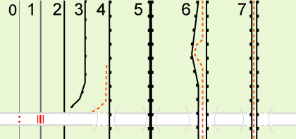
It might be impossible for a renderer to distinguish which is the internal and which is the external side in case of incomplete / partially demolished city walls, so the proposed rendering can't do dashes on the inner side, solid line on the outer. I propose it is always rendered as solid line with a dashed line just above it (adjacent, on the northern side) --Stefanb 15:57, 12 June 2007 (BST)
- Just as the renderer currently knows that water is at the right hand side of segments with coastlines we could agree that the walls are drawn clock-wise. In this sense, the inner side of the wall would be the right side of the segment (or additionally allow for a wall-direction=-1 or something if that is not possible, a la the oneway=-1 tag). So renderers can know what the inside and what the outside is. --spaetz 19:55, 12 June 2007 (BST)
- I don´t think there is a need for wall direction tags. Just render a line with the dashed side thing allways at the right (or left, but allways the same). Then the side is just a matter of direction of the way. it doesen´t matter either, if is closed or not, it will work for both.--Sergionaranja 18:38, 31 July 2008 (UTC)
i think rendering should go like this:
- 0 barrier (barrier=hedge) at the crossing way (highway=residential) at the crossing way node (barrier=bollards)
- 1 barrier (barrier=fence) at the crossing way (highway=residential) at the crossing way node (barrier=cattle_grid)
- 2 barrier (barrier=wall) at the crossing way (highway=residential) at the crossing way node nothing
- 3 barrier (barrier=retaining_wall) should never cross a way
- 4 barrier (barrier=city_wall) at the crossing way (highway=residential;tunnel=yes;layer=-1) at the crossing way node nothing
- 5 barrier (barrier=city_wall;two_sided=yes) at the crossing way (highway=residential;tunnel=yes;layer=-1) at the crossing way node nothing
- 6 2 separate barriers (barrier=city_wall) at the top way (highway=footpath) at the crossing way (highway=residential;tunnel=yes;layer=-1) at the crossing way node nothing
- 7 barrier and footway share same way (highway=footpath;barrier=city_wall) at the crossing way (highway=residential;tunnel=yes;layer=-1) at the crossing way node nothing
- just in cases 1 and 2 there is shared node.
- both sides of the wall are at same level in 1, 2 and 5.
- a way is at top level inside the wall in 6 and 7
- i think this tag should be merged to Proposed_features/barriers
- --Sergionaranja 15:29, 16 September 2008 (UTC)
speed_*
there's already a Proposed_features/Traffic_Calming on the way for these (and they are in any way a barrier) --PhilippeP 13:48, 9 July 2008 (UTC)
Awkward, inconvenient, or funny
- barrier=telephone
- barrier=street_light
- barrier=footpath
- barrier=sign
Ojw 08:35, 4 April 2008 (BST)
- http://www.camcycle.org.uk/campaigning/subgroups/obstructions/ - various photos --achadwick 16:53, 23 April 2008 (UTC)
- http://www.flickr.com/photos/93173492@N00/2315036364/ - innovative squeeze-and-crash barrier from Stoke-on-Trent City Council --achadwick 21:04, 26 April 2008 (UTC)
Bollards
I've expanded the RFC to allow for linear lines of bollards (as often found around the edge of plazas and pedestrian(ised) areas, This could be rendered in the same way as a power-line; a linear gray dashed line with (optionally) an extra dot at each node or first/last node.
Proposal to change bollard to bollards (plural), they rarely come in ones and in general speech it's generally spoken in plural. --11:34, 3 July 2008 (UTC)
Concrete
I need to add a barrier to a way, but I haven't found the appropriate value to use. The barrier is a vertical concrete barrier often used to divide highways, commonly referred to (in the US) as a "J-rail" or "Jersey barrier". — Val42 20:02, 27 September 2008 (UTC)
- How about "blocks"? There doesn't seem to be a need to separate these movable walls and massive concrete blocks. Possibly this could apply to any barrier that is movable, but only with the help of heavy equipment.
- The UK version is called a "concrete step barrier" apparently -- but it's slightly different from the Jersey barrier, which is in turn different from the "F shape barrier" and the "K-rail"barrier. Each of these types have a different shape. The UK variant seems to be a permanent, solid piece, while many of the jersey versions are modular.[2] I couldn't find any reference for a "J rail" barrier. As to terminology: "step" seems kind of not helpful, as it could be taken to mean stairs and of course is UK-specific. "concrete" seems too vague. --Hawke 16:11, 2 October 2008 (UTC)
Render
 for barrier:bollard, svg files are at http://svn.openstreetmap.org/applications/share/map-icons/svg/vehicle/restrictions/
--Grenzdebil 14:06, 10 November 2007 (UTC)
for barrier:bollard, svg files are at http://svn.openstreetmap.org/applications/share/map-icons/svg/vehicle/restrictions/
--Grenzdebil 14:06, 10 November 2007 (UTC)
Comment: It may be better to render a line across the way as is currently once was done with highway=gate in osmarender. --Edgemaster 12:24, 29 December 2007 (UTC)
- i think the general render rule, valid for all node barriers should be a red dot. the key access is the one to complement how is passed and by whom --Sergionaranja 17:05, 3 October 2008 (UTC)
if we want to do some taxonomy then:

?--Sergionaranja 09:03, 30 September 2008 (UTC)
- Looks great to me...though what are each of 1-10? --Hawke 15:55, 2 October 2008 (UTC)
- Shooting in the dark: bollards, cattle grid, chicane, speed cushion, speed bump, speed hump, speed table, gate, stile in a fence, spike row. Circeus 17:28, 2 October 2008 (UTC)
- 1 bollards, 2 cattle grid, 3 cycle_barrier, 4 blocks,5-6 traffic_calming, 8 gate, 9 stile, 10 spike_row. that was first intention but they have aproved traffic calming. also can be: 3 kissing gate 4 chicane. is just a hint to whoever wants to make the render style --Sergionaranja 18:37, 2 October 2008 (UTC)
- The cycle_barrier is called a chicane in English too, at least that's the name I've seen on cycling sites. A pinch stile (two bollards with extra tightening at the top [3]) would probably make a good addition too. However, these two things are ultimately traffic_calming, applied to cycleways, IMHO. Circeus 00:24, 3 October 2008 (UTC)
- guess you are right from that point of view. if it can´t be a barrier to other type of vehicles then it should be added there and not here.--Sergionaranja 10:44, 3 October 2008 (UTC)
- 1 bollards, 2 cattle grid, 3 cycle_barrier, 4 blocks,5-6 traffic_calming, 8 gate, 9 stile, 10 spike_row. that was first intention but they have aproved traffic calming. also can be: 3 kissing gate 4 chicane. is just a hint to whoever wants to make the render style --Sergionaranja 18:37, 2 October 2008 (UTC)
- Shooting in the dark: bollards, cattle grid, chicane, speed cushion, speed bump, speed hump, speed table, gate, stile in a fence, spike row. Circeus 17:28, 2 October 2008 (UTC)
- Late responce, but these work well, well done. I could tell exactly what 1-4 and 8 were with no additional reading, and the rest make sense, but didn't come to mind as I've never seen them in reality. the last 2 are the only 2 that I would need to check out a map key to understand. Ben 12:39, 10 December 2008 (UTC)
![[3]](http://www.camcycle.org.uk/campaigning/subgroups/obstructions/images/P0004273_small.JPG)
May need re-tooling
The proposal may need some re-tooling as, I just found out, there is a traffic_calming=* tag already approved covering that aspect of the proposal. Circeus 03:42, 2 October 2008 (UTC)
- Good call; I've removed them. --Hawke 15:54, 2 October 2008 (UTC)
Final RFC
for me there are just two questions unsolved
- one is to add here city_wall, my vote is yes
- second is the gate:kissing instead of kissing_gate syntax; my vote is no : that is kissing_gate format for all.
- Agree on both counts, FWIW. Circeus 17:12, 5 October 2008 (UTC)
- Actually, I just had a thought shouldn't we add a tag "barrier=entrance" which can receive the
access=*key for nodes on the barrier way? The mapping software should assume that there is an unimpeded entrance whenever a way crosses a barrier (unless the crossing node has a barrier node added), but a way to mark entrances not linked to a crossing way is necessary. Say a large playground is fenced on three sides where it borders streets, but there are entrances at both corners, the map would make it look as if nobody could get in. Circeus 17:46, 6 October 2008 (UTC)- Correct, I have added entrance in the proposal. I don´t agree in your example though. I think the corner of the playground should be connected to the street by a way (footpath?) because that way, you allow routing services to find the shortest walking way from A to B straight through the park and not surrounding it. but I agree there should be a way to tag "doors" on a fence that may not have a path crossing it.
- Well, I'd draw the example with the park attached directly to the street (it technically goes right up to the sidewalk), so a path could not necessarily be drawn between the street and barrier, Similarly, if a path runs alongside the barrier, surrounding a playground, and there is no path inside (e.g. because the inside is all sand), there cannot be a path-barrier intersection. I would not assume an entrance if a path merely stops at the barrier unless the node is specifically tagged. Circeus
- Correct, I have added entrance in the proposal. I don´t agree in your example though. I think the corner of the playground should be connected to the street by a way (footpath?) because that way, you allow routing services to find the shortest walking way from A to B straight through the park and not surrounding it. but I agree there should be a way to tag "doors" on a fence that may not have a path crossing it.
- [4] cycle_barrier a steel barrier to slow down cyclists at dangerous spots or to keep bigger vehicles from passing (in German: Umlaufgitter, Drängelgitter)
use key:traffic_calming
- ok??? The chicane at http://en.wikipedia.org/wiki/Image:One-lane_chicane_1.jpg referenced in trafic_calming does not look like a barrier discussed here as "Umlaufgitter".
- A "traffic calming"-chicane isn't a barrier, because every vehicle can pass it, it only has to slow down (or not if it is small enough like a bicyle :-) )
- A "barrier"-chicane is a real impassable barrier for wider vehicles (motor cars) and might be for some special bicycles, wheelchairs or prams ...
- --Mueck 14:06, 9 October 2008 (UTC)
- It's simultaneous barrier for vehicles and traffic_calming for the bicycles. Just as Pinch Stiles are also bollards. I suspect no matter how we put it it's not going to be entirely satisfying. Circeus 15:50, 9 October 2008 (UTC)
- It's documented on
barrier=*now, along with a request that everyone say what kinds of vehicles can pass through easily. Further discussion onbarrier=cycle_barrier, please! --achadwick 02:03, 26 April 2009 (UTC)
- It's documented on
Gate Normally Open
I would like to see a secondary gate tag with the egress status. Many gates on highways are only closed in exceptional circumstances, and rendering the gate is confusing at best. Possibly "open=norma|no|locked" would suffice.
thanks, Baden