File:Mapping Features Motorway service area.jpg
Jump to navigation
Jump to search

No higher resolution available.
Mapping_Features_Motorway_service_area.jpg (493 × 498 pixels, file size: 151 KB, MIME type: image/jpeg)
Summary
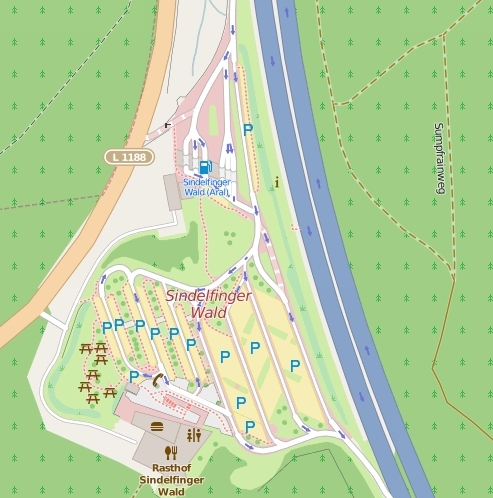
Image of motorway services area
Licensing
![]()
![]()
This screenshot contains OpenStreetMap Carto rendering.
The OpenStreetMap Carto map style is made available under the Creative Commons CC-0 1.0 Universal Public Domain Dedication.
- Attribution to the map data:
| Contains map data © OpenStreetMap contributors, made available under the terms of the Open Database License (ODbL).
The ODbL does not require any particular license for maps produced from ODbL data, produced maps may be subject also to other licences. |
File history
Click on a date/time to view the file as it appeared at that time.
| Date/Time | Thumbnail | Dimensions | User | Comment | |
|---|---|---|---|---|---|
| current | 06:51, 5 June 2015 | | 493 × 498 (151 KB) | Rza31 (talk | contribs) | Image of motorway services area Category:Mapnik Rendering Examples |
You cannot overwrite this file.
File usage
More than 100 pages use this file. The following list shows the first 100 pages that use this file only. A full list is available.
- Ar:Map Features
- Ast:Map Features
- Bg:Map Features
- Bs:Map Features
- Ca:Elements cartogràfics
- Cs:Key:highway
- Cs:Map Features
- Da:Map Features
- El:Map Features
- Eo:Map Features
- Et:Key:highway
- Et:Map Features/old
- Fa:Key:highway
- Fa:Map Features
- Fi:Kartan ominaisuudet
- HOT - PDC InaWARE Indonesia Project (Surabaya & Jakarta)
- He:Map Features
- Hr:Map Features
- Hu:Key:highway
- Hu:Map Features
- Id:Jalan
- Id:Map Features
- Ka:Map Features
- Key:highway
- Ko:Key:highway
- Ko:지도 지물
- Lt:Map Features
- Lv:Map Features
- Map features
- Mk:Map Features
- Ne:Map Features
- Oc:Elements cartografics
- PDC InaWARE Indonesia Project Tagging Guidelines
- Pl:Key:highway
- Pt:Key:highway
- Pt:Map Features
- Ro-md:Map Features
- Ro:Map Features
- Sq:Key:highway
- Sq:Map Features
- Sr:Map Features
- Sv:Map Features
- Tr:Key:highway
- Tr:Map Features
- Uk:Key:highway
- Uk:Об'єкти мапи
- Vi:Map Features
- Yue:Key:highway
- Zh-hans:Key:highway
- Zh-hans:Map Features
- Zh-hant:Key:highway
- Zh-hant:Map Features
- User:Chillly/Simple Map Features
- User:EdLoach/TMFP Highway
- User:Gmbo/Motorrad
- User:H4ck3rm1k3/OSMKeys
- Template:Ar:Map Features:highway
- Template:BG:Map Features:highway
- Template:Bs:Map Features:highway
- Template:Ca:Map Features:highway
- Template:Cs:Map Features:highway
- Template:DE:Map Features:highway
- Template:Da:Map Features:highway
- Template:El:Map Features:highway
- Template:Et:Map Features:highway
- Template:FR:Map Features:highway
- Template:Fa:Map Features:highway
- Template:Fi:Map Features:highway
- Template:Hr:Map Features:highway
- Template:Hu:Map Features:highway
- Template:IT:Map Features:highway
- Template:Id:Map Features:highway
- Template:JA:Map Features:highway
- Template:Ka:Map Features:highway
- Template:Ko:Map Features:highway
- Template:Map Features:highway
- Template:Mk:Map Features:highway
- Template:NL:Map Features:highway
- Template:Pl:Map Features:highway
- Template:Pt:Map Features:highway
- Template:RU:Map Features:highway
- Template:Ro:Map Features:highway
- Template:Sq:Map Features:highway
- Template:Tr:Map Features:highway
- Template:Uk:Map Features:highway
- Template:Vi:Map Features:highway
- Template:Yue:Map Features:highway
- Template:Zh-hans:Map Features:highway
- Template:Zh-hant:Map Features:highway
- Template:Zh-tw:Map Features:highway
- Template talk:Et:Map Features:highway
- DE:Key:highway
- DE:Map Features
- FR:Key:highway
- FR:Éléments cartographiques
- IT:Key:highway
- IT:Map Features
- NL:Kaartelementen
- RU:Key:highway
- RU:Объекты карты
View more links to this file.