Zh-hans:Key:highway
| 说明 |
|---|
| highway标签是用于任何类型道路的主要标签。 |
| 组: 道路 |
| 用于这些元素 |
| 已记载的值: 69 |
| 暗含 |
|
| 状态:已批准 |
| 此标签的工具 |
用途
键 highway=* 是用于分辨道路类型的主要标签。此标签的值表明了公路网内公路的等级。下面的表格展示了OSM的道路分级。
在Highway:International equivalence页面中查看不同国家的公路等级与OSM公路等级的匹配。
请注意,highway=*通过功能和重要性,而不是通过它们的物理特性和法定分类来区分道路。通常这些东西是高度相关的,但 OSM 没有义务复制官方的道路分类。
此标签还可用于公交站、服务区、人行横道以及其它与道路相关的要素。
值
下面的表格展示了更多关于道路分级的细节。
公路
highway是用于表示道路的主要标签。此标签在不同的国家或地区有相应的公约和使用方法,参见公路标签用法和公路。
| 键(key) | 值(value) | 可应用的元素 | 说明 | 地图渲染 | 场景照片 | |
|---|---|---|---|---|---|---|
道路 | ||||||
|
以下是道路的主要标签,按等级和重要性由高到低排序(在绘制时请首先考虑道路等级)。 | ||||||
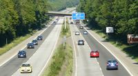
| highway | motorway | 国家级/省级高速公路。专供机动车分方向、分车道通行的,全封闭或半封闭,出入口受控制的公路,通常是双向4车道及以上的收费公路。 | ||||
| highway | trunk | 国道/城市快速路。国家公路系统中重要性仅次于高速公路的公路,以及城市道路系统中的快速路。 | ||||
| highway | primary | 省道/主干道。连接主要区域或城镇的道路,以及城市内较为重要的市政道路。 | ||||
| highway | secondary | 县道/次干道。连接主要区域或村镇的道路,但不及省道。城市道路系统中的次干道也用此值表示。 | ||||
| highway | tertiary | 乡道/支路。一般为连接村与村的道路,或市政道路中比较狭窄的双向、单向2车道道路。 | ||||
| highway | unclassified | 小型道路。最普通的道路,通常很窄,如中国大陆的村道。 | ||||
| highway | residential | 居住区道路。通常为小区内部道路,村中的道路或单向狭窄单车道的市政道路,路旁一般伴有住房。 | ||||
道路连接线 | ||||||
| highway | motorway_link | 其他公路通往高速公路的连接道路,高速公路之间的连接匝道。 | ||||
| highway | trunk_link | 连接国道/快速路与其他国道/快速路或更低级道路的连接路。 | ||||
| highway | primary_link | 连接省道/主干道与其他省道/主干道或更低级道路的连接路。 | ||||
| highway | secondary_link | 连接县道/次干道与其他县道/次干道或更低级道路的连接路。 | ||||
| highway | tertiary_link | 连接乡道/支路与其他乡道/支路或更低级道路的连接路。 | ||||
特殊道路 | ||||||
| highway | living_street | 生活性街道。行人优先,儿童可以在街上玩,最高限速较低的街道,常为5km/h。 | ||||
| highway | service | 服务性道路。通常为通往建筑物、海滩、营地、工厂、商业园等的道路,不常被称为胡同。可与service=*配合使用以标明使用类型,与access=*配合使用以标明使用对象和使用范围。 | ||||
| highway | pedestrian | 步行街。这些道路可能仅允许在一天中非常有限的时间内使用机动车或不准机动车或单车通行。若用于广场,则须沿广场边缘创建封闭路径,另加上area=yes。 | ||||
| highway | track | 小径。指通常未铺设路面,主要用于农业、林业、建筑、生产而非居民步行出行的道路,如农用机耕道、林区采伐道、电力工程临时道路等。此标签主要描述道路的用途,如需描述道路铺砌质量须与tracktype=*标签配合使用,如标记普通用途的小型道路,请选用highway=unclassified或highway=residential等代替。 | ||||
| highway | bus_guideway | 有轨公交专用道,其他交通工具不可驶入。注意普通的公交专用道不应使用此标签,而应添加 access=no、psv=yes标签。 | ||||
| highway | escape | 避险车道。包括上坡避险车道,水平避险车道或砂堆型避险车道。通常设置于公路的长陡下坡路段行车道外侧,供刹车失灵的车辆驶出公路正线并安全减速。 | ||||
| highway | raceway | 赛道。汽车比赛专用道。 | ||||
| highway | road | 未知分类的道路。此标签为临时标签,当找到道路的分类后须以其他值取代。 | ||||
| highway | busway | A dedicated roadway for bus rapid transit systems | ||||
小路 | ||||||
| highway | footway | 步行道路。行人为主或行人专用的道路。包括人行道和碎石小路。如果允许自行车通行,须加上 bicycle=yes 标签,商业步行街、住宅区步行道须改用 highway=pedestrian标签,允许农业机械车辆通行的道路改用 highway=track标签。 | ||||
| highway | bridleway | 马道。供马匹奔走的道路。等效于 highway=path+horse=designated组合标签。 | ||||
| highway | steps | 阶梯。在人行道的楼梯(阶梯)。用 step_count=* 来表示阶梯数目。 | ||||
| highway | corridor | For a hallway inside of a building. | ||||
| highway | path | 小道。一个非特定的或共享使用的路径。 | ||||
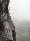
| highway | via_ferrata | A via ferrata is a route equipped with fixed cables, stemples, ladders, and bridges in order to increase ease and security for climbers. These via ferrata require equipment : climbing harness, shock absorber and two short lengths of rope, but do not require a long rope as for climbing. | ||||
When sidewalk/crosswalk is tagged as a separate way | ||||||
| footway | sidewalk | Sidewalk that runs typically along residential road. Use in combination with highway=footway or highway=path | ||||
| footway | crossing | 人行过街通道,一般称作斑马线、人行横道。 | ||||
| footway | traffic_island | 人行过街通道,一般称作斑马线、人行横道。 | ||||
在主路中附注人行道 | ||||||
| sidewalk | both | left | right | no | Specifies that the highways has sidewalks on both sides, on one side or no sidewalk at all | ||||
单独描绘非机动车道(参见 Bicycle) | ||||||
| highway | cycleway | 非机动车道,自行车为主或自行车专用道路。仅当 默认行驶方式限制 不适用时,添加 foot=*标签。 | ||||
在主路中附注非机动车道(参见 Bicycle) | ||||||
| cycleway | lane | 用于机动车与非机动车同向行驶的路段,机非车道间无物理隔离设施,通常仅标记机非分界虚实线。机非混行路段通常无需标注cycleway=*,默认允许非机动车靠边通行。 | ||||
| cycleway | 用于机动车单向行驶(带有oneway=yes标签)且非机动车双向行驶的路段,机非车道间无物理隔离设施。须与oneway:bicycle=no标签配合使用。 | |||||
| cycleway | 用于机动车单向行驶(带有oneway=yes标签)且非机动车单向对向行驶的路段,机非车道间无物理隔离设施。须与oneway:bicycle=no标签配合使用。 | |||||
| cycleway | track | 用于机动车与自行车同向行驶的路段,机非车道间有物理隔离设施。物理隔离设施可以是绿化带、隔离桩、隔离栏、停车位等。此标注可以替代单独描绘且标记highway=cycleway的、位于汽车道外侧的同向路线。 | ||||
| cycleway | 用于机动车单向行驶(带有oneway=yes标签)且非机动车单向对向行驶的路段,机非车道间有物理隔离设施。须与oneway:bicycle=no标签配合使用。 | |||||
| cycleway | share_busway | 用于设有公交车非机动车混行专用道的路段。 | ||||
| cycleway | 用于机动车单向行驶(带有oneway=yes标签)且公交车非机动车混行专用道单向对向行驶的路段,须与oneway:bicycle=no标签配合使用。 | |||||
| cycleway | shared_lane | 交通标志或标线规定非机动车与其他车种混用(兼作机动车停车位、分时段供机动车通行等)的路段。 | ||||
| busway | lane | 用于两侧都设有公交车专用道的路段。 | ||||
Street parking tagged on the main roadway (see Street parking) | ||||||
| parking:left / :right / :both (hereafter: parking:side) |
lane | street_side | on_kerb | half_on_kerb | shoulder | no | separate | yes | 用于机动车与非机动车同向行驶的路段,机非车道间无物理隔离设施,通常仅标记机非分界虚实线。机非混行路段通常无需标注cycleway=*,默认允许非机动车靠边通行。 | ||||
| parking:sideorientation=* | parallel | diagonal | perpendicular | 用于机动车与非机动车同向行驶的路段,机非车道间无物理隔离设施,通常仅标记机非分界虚实线。机非混行路段通常无需标注cycleway=*,默认允许非机动车靠边通行。 | ||||
未建成的道路 (see also lifecycle prefixes) | ||||||
| highway | proposed | 规划道路。与proposed=*标签(取highway主要值,如proposed=motorway 规划中的高速公路,请不要标注远长期规划的道路,建议标注已经批准还未动工的道路)配合使用。 | ||||
| highway | construction | 在建道路。与construction=*标签(取highway主要值,如 construction=motorway建设中的高速公路)配合使用。 | different colours | |||
属性 | ||||||
| abutters | commercial | industrial | mixed | residential | retail etc. | 沿线土地用途。详情参见 Key:abutters 。 | ||||
| bicycle_road | yes | 指定用于自行车行驶的道路。通常在住宅区道路上以特定标志规定自行车优先,但也允许当地居民的机动车低速行驶。 | ||||
| bus_bay | both | left | right | A bus bay outside the main carriageway for boarding/alighting | ||||
| change | yes | no | not_right | not_left | only_right | only_left | Specify the allowed/forbidden lane changes | ||||
| destination | <place name of destination> | Destination when following a linear feature | ||||
| embankment | yes | dyke | A dyke or a raised bank to carry a road, railway, or canal across a low-lying or wet area. | ||||
| embedded_rails | yes | <type of railway> | 标示单独描绘的嵌于机动车路面的铁轨。 | ||||
| ford | yes | 过水路面或漫水桥。道路横穿水流,车辆须淌水通过。 | ||||
| ice_road | yes | 修建在冰面或季节性冻土上的道路,夏季道路融化无法通行。 | ||||
| incline | Number % | ° | up | down | 道路的纵向坡度。以百分比或角度表示,正值为上坡,负值为下坡。 | ||||
| junction | roundabout | 环岛交叉路口。默认为单向道路,适用于已标记highway=*标签的道路。仅在路面绘设环形标线的环形交叉路口建议改用highway=mini_roundabout标签。 | ||||
| lanes | <number> | 车道数。通常包括普通机动车道、公交车或其他机动车种专用的车道。不包括导流车道、停车道、应急停车带、非机动车道、人行道。无车道线的较宽道路也可标记为多车道。 | ||||
| lane_markings | yes | no | Specifies if a highway has painted markings to indicate the position of the lanes. | ||||
| lit | yes | no | 标记道路是否有夜间照明设施。 | ||||
| maxspeed | <number> | Specifies the maximum legal speed limit on a road, railway or waterway. | ||||
| motorroad | yes | no | 用于描述通行限制类似高速公路但不属于高速公路的公路。 | ||||
| mountain_pass | yes | 道路通过山口/山脊的最高点。 | ||||
| mtb:scale | 0-6 | 山地自行车骑行难度指数,适用于标记highway=path 或 highway=track的道路,具体分级参见 Key:mtb:scale 。 | ||||
| mtb:scale:uphill | 0-5 | 山地自行车上坡骑行难度指数,适用于标记highway=path 或 highway=track的道路,具体分级参见 Key:mtb:scale 。 | ||||
| mtb:scale:imba | 0-4 | 自行车公园里的人工障碍山道的山地自行车骑行难度指数,适用于标记highway=path 或 highway=track的道路,详情参见 Key:mtb:scale:imba 。 | ||||
| mtb:description | Text | 针对山地自行车骑行的备注,适用于标记highway=path 或 highway=track的道路。 | ||||
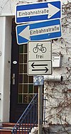
| oneway | yes | no | reversible | Oneway streets are streets where you are only allowed to drive in one direction. | ||||
| oneway:bicycle | yes | no | | Used on ways with oneway=yes where it is legally permitted to cycle in both directions. | ||||
| overtaking | yes | no | caution | both | forward | backward | 超车限制路段。允许/禁止/谨慎/双向允许/本向允许/对向允许,或按行驶方向不同用 overtaking:forward=yes/no/caution 或 overtaking:backward=yes/no/caution 标签。 | ||||
| parallel | diagonal | perpendicular | marked | no_parking | no_stopping | fire_lane. | 路边停车规定:平行/斜列/垂直/按车位标记/禁止长时停车/禁止停车/消防通道。详情参见 parking:lane=* 。 | |||||
| free | ticket | disc | residents | customers | private | 路边停车限制:免费/凭票/限时长/住户专属/顾客专属/私人专属。详情参见 parking:condition=* 。 | |||||
| passing_places | yes | 一条有多处错车空间的狭窄道路。 | ||||
| priority | forward | backward | Traffic priority for narrow parts of roads, e.g. narrow bridges. | ||||
| priority_road | designated | yes_unposted | end | Specifying roads signposted as priority roads. | ||||
| sac_scale | hiking | mountain_hiking | demanding_mountain_hiking | alpine_hiking | demanding_alpine_hiking | difficult_alpine_hiking | 步道的步行难度分级,从平坦步道到攀岩通道。适用于标记highway=path 或 highway=footway的道路。 | ||||
| service | alley | driveway | parking_aisle etc. | 服务型道路,巷道/入户道/停车场通道。详情参见Key:service。 | ||||
| shoulder | no | yes | right | both | left | Presence of shoulder in highway | ||||
| smoothness | excellent | good | intermediate | bad | very_bad | horrible | very_horrible | impassable | 路面平整程度,优秀/良好/一般/较差/很差/恶劣/非常恶劣/极度恶劣。详情参见Key:smoothness 。 | ||||
| surface | paved | unpaved | asphalt | concrete | paving_stones | sett | cobblestone | metal | wood | compacted | fine_gravel | gravel | pebblestone | plastic | grass_paver | grass | dirt | earth | mud | sand | ground | 路面状态,已铺/未铺/沥青/水泥混凝土/砖石砌块/大缝砖石砌块/卵石/金属/木材/压实(沙碎石/水碎石)/细碎石/碎石/碎卵石/塑胶/草皮砖/草皮/泥石/泥土/湿泥/沙/天然。详情参见Key:surface。 | ||||
| tactile_paving | yes | no | 盲道,辅助盲人利用导盲杖行走的道路设施。 | ||||
| tracktype | grade1 | grade2 | grade3 | grade4 | grade5 | 小径类型,具体取值参见Key:tracktype。 | ||||
| traffic_calming | bump | hump | table | island | cushion | yes | etc. | 减速带。有/减速丘/减速台(大型减速丘)/减速垫/人行横道减速台。详情参见Key:traffic calming。 | ||||
| trail_visibility | excellent | good | intermediate | bad | horrible | no | 路径的可辨性分级,轻易/较易/尚可/较难/很难/不可辨认。适用于标记 highway=path、highway=footway、highway=cycleway 和 highway=bridleway。 | ||||
| trailblazed | yes | no | poles | cairns | symbols | Applies to highway=*. Describing trail blazing and marking. See Key:trailblazed for more information. | ||||
| trailblazed:visibility | excellent | good | intermediate | bad | horrible | no | Applies to trailblazed=*. A classification for visibility of trailblazing. See Key:trailblazed:visibility for more information. | ||||
| turn | left | slight_left | through | right | slight_right | merge_to_left | merge_to_right | reverse | 用于指定道路或车道的行进方向。左转/左弯/直行/右转/右弯/向左并道/向右并道/掉头。 | ||||
| width | <number> | The width of a feature. | ||||
| winter_road | yes | 用于冬季行驶的道路,一般在夏季无法行驶。水域上的季节性冰面道路须改用 ice_road=yes。 | ||||
其他道路特征 | ||||||
| highway | bus_stop | 一个小公共汽车站。较大的车站则用 amenity=bus_station 代替。 | ||||
| highway | crossing | A.k.a. crosswalk. Pedestrians can cross a street here; e.g., zebra crossing | ||||
| highway | cyclist_waiting_aid | Street furniture for cyclists that are intended to make waiting at esp. traffic lights more comfortable. | ||||
| highway | elevator | 电梯,在建筑的不同楼层的通道之间给客货提供往来的垂直通道。 | ||||
| highway | emergency_bay | An area beside a highway where you can safely stop your car in case of breakdown or emergency. | ||||
| highway | emergency_access_point | 紧急位置号,紧急情况下可用于求援报告自己所处位置的数字编号标识,常出现于人迹罕至处如森林、草原等。与 ref=标志显示的编号标签配合使用。 | ||||
| highway | give_way | 减速让行标志。 | ||||
| emergency | phone | 紧急电话,紧急情况下可用于请求援助的单键式固定通讯设备,多出现于户外,如高速公路上。 | ||||
| highway | ladder | A vertical or inclined set of steps or rungs intended for climbing or descending of a person with the help of hands. | ||||
| highway | milestone | 公路里程标志,如里程碑,里程牌。配合distance=*标记里程数字。 | ||||
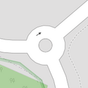
| highway | mini_roundabout | 环形交叉路口。类似于环岛路口,但在路口中心仅划设圆形中心圈标线,或设置了车辆可以驶越的低矮环岛。如果是车辆无法驶越的环岛则改用junction=roundabout 。默认为逆时针行进 direction=anticlockwise,如须改为顺时针行进则添加 direction=clockwise标签。 | ||||
| highway | motorway_junction | 指定高速公路出口,一般标记在出口匝道与主线的分流处。配合ref=*标记出口编号、name=*标记出口的名称、destination=*标记出口的指示地点(目的地)。 | ||||
| highway | passing_place | 错车道(或称避车道、会车道)。在双向错车困难的狭窄道路上用于双向车辆交错通过的一段加宽车道。 | ||||
| highway | platform | 停靠站。位于公路外侧,供乘客上下汽车的站台,一般用于公交车、校车等。与public_transport=platform不同,它不一定是公交配套设施,但一定是高出路面的实体平台。 | ||||
| highway | rest_area | 停车区(或称观景台、休息区)。通常位于高速公路上,不同于设施完善的服务区,驾驶员可以离开道路休息,但没有加油、购物、用餐的地方。 | ||||
| highway | services | 服务区。通常位于高速公路或快速公路上,为司机和乘员提供补充车辆能源、休息、用餐、购物、如厕等服务的场所。 | ||||
| highway | speed_camera | 测速点,固定在路边或门架上的测速摄像机。 | ||||
| highway | speed_display | A dynamic electronic sign that displays the speed of the passer-by motorist. | ||||
| highway | stop | 停车让行标志。 | ||||
| highway | street_lamp | 路灯,位于道路边缘或隔离带高处的夜间照明设施。 | ||||
| highway | toll_gantry | ETC门架。位于道路上(通常是高速公路)用于电子收费的门架,通常位于高速公路出口或立交前,是电子收费系统的一部分。有关任何带阻拦设施需停车缴费的收费站亭请参见后:barrier=toll_booth。 | ||||
| highway | traffic_mirror | 道路反光镜。用于视野不足的弯道、路口,帮助司机识别交通事故隐患的反光镜装置。 | ||||
| highway | traffic_signals | 交通信号灯。 | ||||
| highway | trailhead | 标记一条路径起始的地方。 | ||||
| highway | turning_circle | 回车环场。便于车辆转弯或掉头的环形加宽区域,通常设在道路末端。 | ||||
| highway | turning_loop | 回车环岛。便于车辆转弯或掉头的环岛区域,车辆无法驶越环岛。通常设在道路末端。 | ||||
| highway | User Defined | 全部常用值 参照 Taginfo。 | ||||
Assumptions
Only highway=motorway and highway=motorway_link indicate quality. Other road types, from trunk to tertiary to residential, service, path, footway, cycleway or track, do not imply anything about road quality, only importance and intended main use.
In a region with poor infrastructure, a road of highest importance, forming the main road network there, should be highway=trunk, regardless of being a high-quality wide asphalt road or a low-quality narrow track worse than highway=service in other regions. Examples include, the Kolyma Highway (P-504), Magadan - Anadyr road and Vilyui ice road (A-331) in the Russian Far East, a long stretch of the Trans-Amazonian Highway (BR-230) and BR-319 in the North Region of Brazil, Juba - Rumbek Road (69) in South Sudan, Vohemar Road (RN5a) in Madagascar, both in Africa.
A typical highway=primary can also vary drastically between different regions on the planet. Some highway=primary roads in parts of Africa, Asia, South America, Canada, Alaska, Australia and Iceland are unpaved.
It is highly recommended to add tags describing road quality, such as surface=*. In one region, it may be obvious that all highway=tertiary are paved and all highway=track are not paved, but this kind of assumption does not work worldwide. Tagging at least some common values allows building a set of default values for each area.
In the absence of surface=*, tracktype=* and other tags describing road quality, one may try to extrapolate this information from the value of the highway tag. This should be fine-tuned for each region.
也可以看看
可能的标记错误
| ||||||||||||||||||||||||||||||
