Template:Id:Map Features:highway
Jalan Raya
Digunakan untuk mendeskripsikan jalan dan jalan setapak. Lihat Highways untuk panduan lebih lanjut dan Restrictions untuk rincian batasan akses oleh jenis kendaraan / waktu / hari / muatan / tujuan dll.
| Key | Value | Elemen | Deskripsi | Rendering carto | Foto | |
|---|---|---|---|---|---|---|
Jalan | ||||||
|
This group lists the 7 main tags for the road network, from most to least functionally important for motor vehicle traffic. | ||||||
| highway | motorway | Jalan tol, sebuah jalan besar yang terpisah dengan akses yang terbatas. Jalan ini umumnya memiliki dua lajur atau lebih untuk tiap arahnya ditambah dengan lajur darurat di sampingnya. |  |
|||
| highway | trunk | Jalan nasional, jalan penting non-tol yang mengubungkan ibukota negara dengan ibukota provinsi atau dari satu ibukota provinsi ke ibukota provinsi lainnya. Jalan ini dikelola oleh pemerintah pusat dan bukan pemerintah daerah. Jalan nasional ditandai dengan keberadaan marka jalan berwarna kuning di tengah jalan serta diklasifikasikan sebagai kelas Jalan Arteri Primer (JAP) atau Jalan Kolektor Primer 1 (JKP-1). |  |
|||
| highway | primary | Jalan provinsi, jalan yang menghubungkan ibukota provinsi ke ibukota kabupaten/kota atau antarpusat pemerintahan kabupaten/kota. Jalan ini umumnya diklasifikasikan sebagai Jalan Kolektor Primer 2 (JKP-2) atau Kolektor Primer 3 (JKP-3).
Untuk kawasan perkotaan, jalan arteri yang diklasifikasikan sebagai Jalan Arteri Sekunder (JAS) juga dapat diklasifikasikan sebagai jalan primary. Jalan ini merupakan kewenangan Pemerintah Kota. |
 |
|||
| highway | secondary | Jalan kabupaten, menghubungkan pusat pemerintahan kota/kabupaten dengan kecamatan di sekelilingnya atau antarkecamatan. Jalan dengan fungsi ini biasanya diklasifikasikan sebagai Jalan Kolektor 4 (JKP-4).
Untuk wilayah perkotaan, jalan sekunder umumnya diklasifikasikan sebagai Jalan Kolektor Sekunder (JKS). |
 |
|||
| highway | tertiary | Jalan antardesa atau penghubung antara pusat kecamatan dengan desa. Jalan ini umumnya diklasifikasikan sebagai Jalan Lokal Primer (JLP). Untuk jalan antardesa yang lebih sempit dan sepi, pertimbangkan untuk menggunakan highway=unclassified.
Untuk wilayah perkotaan, jalan tersier diklasifikasikan sebagai Jalan Lokal Sekunder (JLS). Jalan ini menghubungkan wilayah permukiman dengan kelas jalan yang lebih tinggi dan umumnya dapat diakses umum. |
 |
|||
| highway | unclassified | Digunakan untuk jalan kecil di jaringan jalan umum yang bukan merupakan jalan di dalam wilayah permukiman. Jalan ini memiliki klasifikasi yang lebih rendah daripada jalan tersier. Tolong jangan gunakan untuk menandakan jalanan dimana klasifikasinya tidak diketahui, sebaiknya gunakan highway=road. Gunakan highway=residential untuk jalanan kecil yang bertautan dengan rumah. Lihat highway=service untuk jalan akses.
|
 |
|||
| highway | residential | Jalan yang berhubungan langsung dengan rumah atau di dalam wilayah permukiman. Kelas jalan ini merupakan klasifikasi yang lebih rendah dari jalan tersier dan lebih lebar/ramai dibandingkan jenis jalan living streets. Gunakan abutters=residential bersamaan dengan tersier, sekunder, dll untuk jalan besar yang sejajar dengan rumah.
|
 |
|||
Link roads | ||||||
| highway | motorway_link | Jalan yang menyambungkan jalan tol dari/menuju jalan dengan kelas jalan yang lebih rendah. Biasanya memiliki serangkaian aturan dan larangan yang sama dengan jalan tol. |  |
 | ||
| highway | trunk_link | Jalan yang menghubungkan jalan nasional dari/ke jalan nasional lainnya atau jalan dengan kelas jalan yang lebih rendah. Jalan seperti ini umumnya merupakan jalan tembus belok kiri di persimpangan atau ramp. |  |
 | ||
| highway | primary_link | Jalan yang menyambungkan jalan primer dari/ke sesama jalan primer lainnya atau jalan dengan kelas jalan yang lebih rendah. |  |
 | ||
| highway | secondary_link | Jalan yang menyambungkan jalan sekunder menuju jalan sekunder lainnya atau jalan dengan kelas jalan yang lebih rendah. |  |
 | ||
| highway | tertiary_link | Jalan yang menyambungkan jalan tersier menuju jalan tersier atau jalan dengan kelas jalan yang lebih rendah. |  |
|||
Special road types | ||||||
| highway | living_street | living streets, merupakan jalan perumahan dimana pejalan kaki mempunyai prioritas legal, kecepatan kendaraan bermotor yang sangat rendah dan dimana anak kecil diperbolehkan bermain di jalan. Biasa dikenal dengan zona perumahan di Inggris. |  |
 | ||
| highway | service | Untuk jalan akses ke, atau dalam daerah industri, perkemahan, kawasan bisnis, parkir mobil, dll. Bisa digunakan dengan service=* untuk mengindikasikan tipe kegunaan dan dengan access=* untuk mengindikasikan siapa yang bisa menggunakan dan dengan tujuan apa.
|
 |
 | ||
| highway | pedestrian | Untuk jalan yang dikhususkan untuk pejalan kaki ditempat belanja dan di perumahan yang memungkinkan akses untuk kendaraan bermotor tetapi dibatasi setiap harinya. Untuk membuat 'alun-alun' buatlah polygon tertutup dan beri tag dengan ini dan juga tambahkan dengan area=yes.
|
 |
 | ||
| highway | track | Jalanan kasar, biasanya memiliki permukaan yang tidak teraspal dan masih berbatu yang biasanya digunakan untuk akses ke agrikultural atau hutan. Gunakan tracktype=* dalam pemberian tag untuk menjelaskan permukaannya.
|
 |
|||
| highway | bus_guideway | Jalan untuk bus dimana kendaraan diarahkan menggunakan jalur (bukan menggunakan rel) dan tidak cocok untuk kendaraan lain. Harap diingat ini bukan merupakan jalur bus normal, gunakanlah access=no, psv=yes!
|
 |
 | ||
| highway | escape | For runaway truck ramps, runaway truck lanes, emergency escape ramps, or truck arrester beds. It enables vehicles with braking failure to safely stop. |  | |||
| highway | raceway | Trek untuk kompetisi kendaraan bermotor. |  |
 | ||
| highway | road | Jalan untuk klasifikasi yang belum diketahui. Digunakan untuk sementara memberi tag sebagai jalan sampai sudah di survei. Ketika sudah disurvei, klasifikasinya sudah harus diperbaharui sesuai dengan tag yang ada. |  |
 | ||
| highway | busway | A dedicated roadway for bus rapid transit systems |  | |||
Jalur | ||||||
| highway | footway | For designated footpaths; i.e., mainly/exclusively for pedestrians. This includes walking tracks and gravel paths. If bicycles are allowed as well, you can indicate this by adding a bicycle=yes tag. Should not be used for paths where the primary or intended usage is unknown. Use highway=pedestrian for pedestrianised roads in shopping or residential areas and highway=track if it is usable by agricultural or similar vehicles. For ramps (sloped paths without steps), combine this tag with incline=*.
|
 |
 | ||
| highway | bridleway | For horse riders. Pedestrians are usually also permitted, cyclists may be permitted depending on local rules/laws. Motor vehicles are forbidden. |  |
 | ||
| highway | steps | Untuk tangga di jalur pejalan kaki. Kombinasikan dengan step_count=* untuk mengidentifikasi jumlah anak tangga.
|
 |
 | ||
| highway | corridor | For a hallway inside of a building. |  | |||
| highway | path | Jalan kecil yang tidak spesifik. Lebih baik gunakan highway=footway untuk jalan kecil yang digunakan untuk pejalan kaki, highway=cycleway untuk sepeda, highway=bridleway untuk kuda dan pejalan kaki dan highway=track untuk yang dapat dilalui oleh kendaraan agrikultur atau sejenisnya.
|
 |
 | ||
| highway | via_ferrata | A via ferrata is a route equipped with fixed cables, stemples, ladders, and bridges in order to increase ease and security for climbers. These via ferrata require equipment : climbing harness, shock absorber and two short lengths of rope, but do not require a long rope as for climbing. | 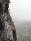 | |||
When sidewalk/crosswalk is tagged as a separate way | ||||||
| footway | sidewalk | Sidewalk that runs typically along residential road. Use in combination with highway=footway or highway=path
|
 |
 | ||
| footway | crossing | Pejalan kaki dapat melintasi jalan disini (misalnya zebra cross). |  |
 | ||
| footway | traffic_island | The way between two crossings, safespot for pedestrians, has micromapping characteristics as a detailed alternative to =*. Use in combination with highway=footway or highway=path.
|
 |
|||
When sidewalk (or pavement) is tagged on the main roadway (see Sidewalks) | ||||||
| sidewalk | both | left | right | no | Specifies that the highways has sidewalks on both sides, on one side or no sidewalk at all |  | |||
When cycleway is drawn as its own way (see Bicycle) | ||||||
| highway | cycleway | Ditujukan untuk jalur sepeda. Tambahkan foot=* saja jika default-access-restrictions tidak diaplikasikan.
|
 |
 | ||
Cycleway tagged on the main roadway or lane (see Bicycle) | ||||||
| cycleway | lane | A lane is a route that lies within the roadway |  | |||
| cycleway | Deprecated variant for ways with oneway=yes where it is legally permitted to cycle in both directions. Replaced by oneway:bicycle=no.
|
 | ||||
| cycleway | Deprecated variant for ways with oneway=yes that have a cycling lane going the opposite direction of normal traffic flow (a "contraflow" lane). Replaced by oneway:bicycle=no + cycleway:left=lane/cycleway:right=lane + cycleway:left:oneway=-1/cycleway:right:oneway=-1.
|
 | ||||
| cycleway | track | A track provides a route that is separated from traffic. In the United States, this term is often used to refer to bike lanes that are separated from lanes for cars by pavement buffers, bollards, parking lanes, and curbs. Note that a cycle track may alternatively be drawn as a separate way next to the road which is tagged as highway=cycleway.
|
 | |||
| cycleway | Deprecated variant for ways with oneway=yes that have a cycling track going the opposite direction of normal traffic flow. Replaced by oneway:bicycle=no + cycleway:left=track/cycleway:right=track + cycleway:left:oneway=-1/cycleway:right:oneway=-1.
|
 | ||||
| cycleway | share_busway | There is a bus lane that cyclists are permitted to use. |  | |||
| cycleway | Deprecated variant for ways with oneway=yes that have a bus lane that cyclists are also permitted to use, and which go in the opposite direction to normal traffic flow (a "contraflow" bus lane). Replaced by oneway:bicycle=no + cycleway:left=share_busway/cycleway:right=share_busway + cycleway:left:oneway=-1/cycleway:right:oneway=-1.
|
 | ||||
| cycleway | shared_lane | Cyclists share a lane with motor vehicles, there are markings reminding about this. In some places these markings are known as "sharrows" ('sharing arrows') and this is the tag to use for those. |  | |||
Busways tagged on the main roadway or lane (see Bus lanes) | ||||||
| lane | Deprecated variant to tag bus lanes. Replaced by bus/psv lane tagging lanes:bus=* / lanes:psv=*) / bus:lanes=* / psv:lanes=*
|
 | ||||
| opposite | Deprecated variant for ways with oneway=yes where buses are legally permitted to travel in both directions. Replaced by oneway:bus=no
|
|||||
| opposite_lane | Deprecated variant for ways with oneway=yes that have a bus lane which go in the opposite direction to normal traffic flow (a "contraflow" bus lane). Replaced by oneway:bus=no and lanes:bus=* / lanes:psv=*) / bus:lanes=* / psv:lanes=*
|
|||||
Street parking tagged on the main roadway (see Street parking) | ||||||
parking:left / :right / :both(hereafter: parking:side) |
lane | street_side | on_kerb | half_on_kerb | shoulder | no | separate | yes | Primary key to record parking along the street. Describes the parking position of parked vehicles in the street. |  | |||
parking:sideorientation=*
|
parallel | diagonal | perpendicular | To specify the orientation of parked vehicles if there is street parking. | ||||
Lifecycle (see also lifecycle prefixes) | ||||||
| highway | proposed | Untuk jalan yang akan direncanakan, gunakan dengan proposed=* dan proposed=* dengan nilai dari tujuan jalan tersebut.
|
||||
| highway | construction | Untuk jalan yang masih diperbaiki/dibuat. Gunakan construction=* untuk menyimpan nilai untuk jalan yang sudah selesai.
|
 |
 | ||
Atribut | ||||||
| abutters | commercial | industrial | mixed | residential | retail etc. | Lihat Key:abutters untuk detailnya. |  | |||
| bicycle_road | yes | A bicycle road is a road designated for bicycles. If residential streets get the status of bicycle roads, normally, by special signs, motor traffic is admitted with limited speed, often only for residents. |  | |||
| bus_bay | both | left | right | A bus bay outside the main carriageway for boarding/alighting |  | |||
| change | yes | no | not_right | not_left | only_right | only_left | Specify the allowed/forbidden lane changes |  | |||
| destination | <place name of destination> | Destination when following a linear feature |  | |||
| embankment | yes | dyke | A dyke or a raised bank to carry a road, railway, or canal across a low-lying or wet area. |  | |||
| embedded_rails | yes | <type of railway> | A highway on which non-railway traffic is also allowed has railway tracks embedded in it but the rails are mapped as separate ways. |  | |||
| ford | yes | Jalur yang melintasi sungai, kendaraan harus masuk kedalam sungai. Lihat ford=*.
|
 | |||
| frontage_road | yes | A frontage road. | ||||
| ice_road | yes | Untuk jalan yang berdiri diatas danau yang membeku, biasanya tidak muncul saat musim panas. |  | |||
| incline | Number % | ° | up | down | Jalan yang menuju lereng dengan persentase kecuraman ("5%") atau derajat ("20°"). Nilai positif/negatif menunjukkan pergerakan menanjak atau menurun sesuai dengan arah jalurnya. |  | |||
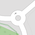
| junction | roundabout | Ini secara otomatis menggunakan oneway=yes, arah satu jalur ini didefinisikan dengan jumlah node yang ada pada jalur. Ini sudah diaplikasikan menjadi satu jalur dengan tag highway=*.
|
 |
 | ||
| lanes | <number> | Jumlah lintasan yang ada untuk tujuan lalu lintas, baik kendaraan mobil, bus atau kendaraan bermotor yang spesifik dipisahkan jalurnya. |  | |||
| lane_markings | yes | no | Specifies if a highway has painted markings to indicate the position of the lanes. |  | |||
| lit | yes | no | Lampu jalan |  | |||
| maxspeed | <number> | Specifies the maximum legal speed limit on a road, railway or waterway. |  | |||
| motorroad | yes | no | Tag motorroad digunakan untuk menjelaskan jalan raya yang mempunyai larangan seperti jalan tol tapi bukan merupakan jalan tol. |  | |||
| mountain_pass | yes | Titik tertinggi melewati gunung. |  | |||
| mtb:scale | 0-6 | Diterapkan pada highway=path dan highway=track. Klasifikasi skema untuk jalur MTB (dengan beberapa lereng yang menanjak dan lereng yang menurun).
|
 | |||
| mtb:scale:uphill | 0-5 | Klasifikasi untuk jalur MTB yang akan menuju puncak jika terdapat derajat atau persentase nilai kecuraman yang signifikan. |  | |||
| mtb:scale:imba | 0-4 | Sistem peringkat IMBA yang digunakan untuk taman sepeda. Diadaptasi dari trek MTB dengan penghalang buatan. | ||||
| mtb:description | Text | Diaplikasikan ke highway=path dan highway=track. Kata kunci untuk informasi variabel input terkait dengan MTB pada jalur dengan menggunakan bahasa sehari-hari.
|
||||
| oneway | yes | no | reversible | Oneway streets are streets where you are only allowed to drive in one direction. | 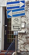 | |||
| oneway:bicycle | yes | no | | Used on ways with oneway=yes where it is legally permitted to cycle in both directions.
|
 | |||
| overtaking | yes | no | caution | both | forward | backward | Menentukan bagian dari jalan dimana menyalip secara hukum dilarang. |  | |||
| parallel | diagonal | perpendicular | marked | no_parking | no_stopping | fire_lane. | Deprecated variant to map parking along streets. See section on street parking above or the street parking page for more details. | |||||
| free | ticket | disc | residents | customers | private | Deprecated variant to map parking conditions along streets. See section on street parking above or the street parking page for more details. |  | ||||
| passing_places | yes | Sebuah jalur yang memiliki tempat-tempat yang sering dilewati. |  | |||
| priority | forward | backward | Traffic priority for narrow parts of roads, e.g. narrow bridges. |  | |||
| priority_road | designated | yes_unposted | end | Specifying roads signposted as priority roads. |  | |||
| sac_scale | strolling | hiking | mountain_hiking | demanding_mountain_hiking | alpine_hiking | demanding_alpine_hiking | difficult_alpine_hiking | Diterapkan untuk highway=path dan highway=footway. Skema klasifikasi untuk jalur pendakian.
|
 | |||
| service | alley | driveway | parking_aisle etc. | Lihat Key:service untuk lebih detail. |  | |||
| shoulder | no | yes | right | both | left | Presence of shoulder in highway | ||||
| side_road | yes | A side road. | ||||
| smoothness | excellent | good | intermediate | bad | very_bad | horrible | very_horrible | impassable | Specifies the physical usability of a way for wheeled vehicles due to surface regularity/flatness. See Key:smoothness for more details. | 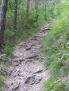 | |||
| surface | paved | unpaved | asphalt | concrete | paving_stones | sett | cobblestone | metal | wood | compacted | fine_gravel | gravel | pebblestone | plastic | grass_paver | grass | dirt | earth | mud | sand | ground | Lihat Key:surface untuk lebih detail. |  | |||
| tactile_paving | yes | no | Sebuah jalur trotoar yang ditujukan untuk diikuti oleh orang tuna netra. |  | |||
| tracktype | grade1 | grade2 | grade3 | grade4 | grade5 | Untuk mendeskripsikan kualitas dari permukaan. Lihat Key:tracktype dan Key:surface untuk informasi lebih lanjut. | 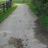 | |||
| traffic_calming | bump | hump | table | island | cushion | yes | etc. | Lihat Key:traffic_calming untuk lebih detail. |  | |||
| trail_visibility | excellent | good | intermediate | bad | horrible | no | Diterapkan ke highway=path, highway=footway, highway=cycleway dan highway=bridleway. Klasifikasi untuk jalur pendakian yang terlihat.
|
 | |||
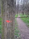
| trailblazed | yes | no | poles | cairns | symbols | Applies to highway=*. Describing trail blazing and marking. See Key:trailblazed for more information.
|
 | |||
| trailblazed:visibility | excellent | good | intermediate | bad | horrible | no | Applies to trailblazed=*. A classification for visibility of trailblazing. See Key:trailblazed:visibility for more information.
|
||||
| turn | left | slight_left | through | right | slight_right | merge_to_left | merge_to_right | reverse | The key turn can be used to specify the direction in which a way or a lane will lead. |  | |||
| width | <number> | The width of a feature. | 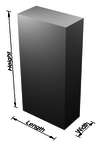 | |||
| winter_road | yes | Jalur dengan fungsi pada musim dingin, yang tidak bisa dilalui saat musim panas. |  | |||
Fitur lainnya | ||||||
| highway | bus_stop | Tempat pemberhentian bus sementara, dapat dipetakan dengan menggunakan public_transport=stop_position untuk posisi dimana mobil berhenti dan public_transport=platform Untuk dimana penumpang menunggu. Lihat public_transport=* untuk lebih detail.
|
 | |||
| highway | crossing | A.k.a. crosswalk. Pedestrians can cross a street here; e.g., zebra crossing |  | |||
| highway | cyclist_waiting_aid | Street furniture for cyclists that are intended to make waiting at esp. traffic lights more comfortable. |  | |||
| highway | elevator | An elevator or lift, used to travel vertically, providing passenger and freight access between pathways at different floor levels. |  | |||
| highway | emergency_bay | An area beside a highway where you can safely stop your car in case of breakdown or emergency. |  | |||
| highway | emergency_access_point | Petunjuk dengan nomor yang dapat dihubungi sesuai dengan posisi anda jika sewaktu-waktu terjadi keadaan darurat. Gunakan dengan ref=NUMBER_ON_THE_SIGN.
|
 | |||
| highway | give_way | Tanda give way. | 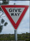 | |||
| emergency | phone | Tempat telepon untuk melakukan panggilan sesuai dengan posisi anda saat itu jika terjadi keadaan darurat. Gunakan dengan ref=NUMBER_ON_THE_SIGN.
|
 | |||
| highway | hitchhiking | Like a bus_stop but for free, uncertain, spontaneous rides with strangers. |  | |||
| highway | ladder | A vertical or inclined set of steps or rungs intended for climbing or descending of a person with the help of hands. |  | |||
| highway | milestone | Highway location marker | ||||
| highway | mini_roundabout | Sama seperti roundabouts, tetapi bagian tengah dari jalan ini digambar lingkaran atau benda yang dapat digeser( traversable). Jika tidak, gunakan junction=roundabout.
Rendered as anti-clockwise by default |
 |
|||
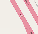
| highway | motorway_junction | Menunjukkan sebuah persimpangan (Inggris) atau jalan keluar (Amerika). ref=* harus ditetapkan pada nomor keluar atau persimpangan (Pada beberapa jalan misalnya A14 juga membawa jumlah persimpangan, sehingga tag dapat ditemui di tempat lain meskipun hanya nama).
|
 |
 | ||
| highway | passing_place | Lokasi untuk tempat berhenti sementara. |  | |||
| highway | platform | A platform at a bus stop or station. |  |
 | ||
| highway | rest_area | Tempat dimana pengendara bisa meninggalkan jalur utama sejenak tapi bukan untuk mengisi bensin (biasanya beristirahat sejenak). | 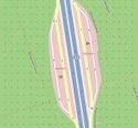 |
 | ||
| highway | services | Stasiun jasa untuk mendapatkan makanan, biasanya terdapat di jalan tol. | 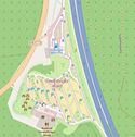 |
 | ||
| highway | speed_camera | Tempat dengan kamera yang dapat mendeteksi kecepatan kendaraan bermotor. |  | |||
| highway | speed_display | A dynamic electronic sign that displays the speed of the passer-by motorist. |  | |||
| highway | stop | Tanda untuk berhenti. |  | |||
| highway | street_lamp | Lamput jalan raya, lampu standar yang digunakan untuk menerangi jalan yang berada di pinggir jalan, yang menyala/dinyalakan setiap malan. |  | |||
| highway | toll_gantry | A toll gantry is a gantry suspended over a way, usually a motorway, as part of a system of electronic toll collection. For a toll booth with any kind of barrier or booth see: barrier=toll_booth
|
 | |||
| highway | traffic_mirror | Mirror that reflects the traffic on one road when direct view is blocked. |  | |||
| highway | traffic_signals | Lampu lalu lintas. |  | |||
| highway | trailhead | Designated place to start on a trail or route |  | |||
| highway | turning_circle | Jalan buntu yang digunakan untuk berputar, biasanya dengan area yang lebar, namun tidak perlu, jalan buntu biasanya difasilitasi untuk memudahkan kendaraan berputar. |  |
 | ||
| highway | turning_loop | A widened area of a highway with a non-traversable island for turning around, often circular and at the end of a road. |  | |||
| highway | User Defined | Semua "value" yang umum digunakan sesuai dengan Taginfo. | ||||


