Israel
| V・T・E |
| latitude: 31.417, longitude: 35.079 |
| Browse map of The State of Israel (دولة إسرائيل, מְדִינַת יִשְׂרָאֵל) 31°25′01.20″ N, 35°04′44.40″ E |
| Edit map |
|
External links:
|
| Use this template for your locality |


|
The State of Israel (دولة إسرائيل, מְדִינַת יִשְׂרָאֵל) Mapping Project, the home of The State of Israel (دولة إسرائيل, מְדִינַת יִשְׂרָאֵל) on the OpenStreetMap wiki. |
| Hello! Welcome to the project for mapping efforts in The State of Israel (دولة إسرائيل, מְדִינַת יִשְׂרָאֵל)! You can find here national events, ongoing projects, map status and mapping guidelines, as well as links to other pages directly related to the mapping of The State of Israel (دولة إسرائيل, מְדִינַת יִשְׂרָאֵל). You may also find a list of contacts and mappers involved with the OpenStreetMap community in The State of Israel (دولة إسرائيل, מְדִינַת יִשְׂרָאֵל). |
This page contains information relating to mapping activity that is specific to Israel. Any guides or conventions on this page should be discussed in the forum, feel free to comment or help (mapping your area, tagging streets or correcting this page).
Discussion and communication
Forum
The Israel users forum is the main communication method. English only. Sign in with your OpenStreetMap DB account.
Mailing list
Talk-il is a mailing list for discussions about mapping Israel, and for easy communication between mappers from Israel. English & Hebrew are allowed. The list is not as active as the forum, but it may still be useful especially for those who do not have an OSM account.
Talk page
The talk page can be used for communication, but the forum is more active.
IRC
Telegram
The telegram group is great for quick questions. The daily conversations are usually in Hebrew, yet English is more than welcome.
Conventions and guidelines
This section covers conventions and guidelines. Note that there are also additional guidelines for hiking and biking trails in the next section.
Naming
- name=* and name:=* tags:
- The name=* tag should be used as the primary name, given in the language most common in the area. The name=* tag contains the name only in that common language.
- Additionally, the name should be stated using name:=* tags:
- For example, the city of Tel Aviv-Yafo
 Tel Aviv-Yafo has its main name as name=תל אביב-יפו and name:he=תל אביב-יפו in Hebrew, as well as name:en=Tel Aviv-Yafo, name:ar=تل أبيب-يافا and several other languages. The run of a bot will copy the name value from name=* to name:he=* or name:ar=*.
- Add the full name written on the sign without including "rehov", "street", etc.
- Do not use abbreviations, leave that for rendering.
- Many streets in Arab or Druze villages do not have an official name. If there's a de-facto name, use it. Otherwise leave it blank. Do not make up a name yourself. Note that bus-stop names do not necessarily reflect the street name in such areas.
Inter-city roads
- First rule for numbered roads: The category is determined by the color of the sign, not by the number of digits!
- Different sections with the same road number can have different categories.
- Speed limits stated below are the defaults by law, though can be altered in a specific road section by a "special speed limit" sign.
| Key | Value | Element | Description | Color | Example sign | Default speed limit | Key:ref tag on way | Remark |
|---|---|---|---|---|---|---|---|---|
| highway | motorway | All freeways - National and Inter-City roads | Blue | 110 km/h | mandatory for all highway=motorway | Usually a single-digit road number (e.g. road 2) or a double-digit road number (e.g. road 20). Mapnik color: Blue.
Motorways mostly have an | ||
| highway | trunk | National roads | Red | 100 km/h | mandatory for all highway=trunk (including roundabout) | Expressways / trunk in Israel can look very much like a freeway. Many of them have double-digit road number (e.g. road 10). Mapnik color: Green | ||
| highway | primary | All regional roads | Green | 90 km/h | mandatory for all highway=primary (including roundabout) | Many of them have triple-digit road number (e.g. road 412). Mapnik color: Red | ||
| highway | secondary | All regional roads | Black | 80 km/h | only if exist | Many of them have quadruple-digit road number (e.g. road 4111) and priority over other crossing roads (i.e. crossing drivers encounter a stop sign).
Exception for the priority rule: unnumbered roads that are important for routing connections may have crossing priority over secondary roads. Mapnik color: Orange | ||
| highway | tertiary | important (connection-) roads | not numbered and without a colored sign | no sign | 80 km/h | no | Priority over other crossing roads (crossing drivers encounter a stop sign). Main roads inside cities are tertiary. Mapnik color: Yellow |
Other road types
Also see next section for trails conventions.
| Key | Value | Element | Description | Implied access |
|---|---|---|---|---|
| highway | unclassified | Smaller paved roads in non-residential places. e.g. agricultural roads, forest roads, roads from behind one village to behind another village, etc. | motor_vehicle=yes, bicycle=yes, foot=yes | |
| highway | residential | Roads in residential places (city, town, village, etc.) | motor_vehicle=yes, bicycle=yes, foot=yes | |
| highway | service | Short access roads: roads in parking lots, fuel stations, inside universities, inside factories, etc. | motor_vehicle=yes, bicycle=yes, foot=yes | |
| highway | track | Unpaved road suitable for motor vehicles (Double). | motor_vehicle=yes, bicycle=yes, foot=yes | |
| highway | path | A pathway too narrow for vehicles, accessible by foot, bicycle, and horse. Usually Unpaved. Add bicycle=designated where the path is part of a bicycle trail. Add foot=designated if the path is to be shared by bikers and hikers. |
motor_vehicle=no, bicycle=yes, foot=yes, horse=yes | |
| highway | footway | Mainly, or exclusively for pedestrians. Add bicycle=yes or change to highway=path if bicycles are also allowed. | motor_vehicle=no, bicycle=no, foot=designated | |
| highway | cycleway | Exclusively for bicycles. Usually paved. | motor_vehicle=no, bicycle=designated, foot=no | |
| highway | pedestrian | Where people walk and there are many shops. Like "Midrahov", or "Passage", etc. | motor_vehicle=no, bicycle=yes, foot=yes, horse=yes | |
| highway | living_street | "רחוב הולנדי" - Residential road where there is no sidewalk or other separation between pedestrians and vehicles. | motor_vehicle=yes, bicycle=yes, foot=yes, horse=yes | |
| highway | road | Temporary tagging, if the type is unknown. Try to add a "note" tag. | motor_vehicle=yes bicycle=yes, foot=yes, horse=yes | |
| bridge | yes | A bridge. Useful with layer=* | ||
| tunnel | yes | A tunnel. Useful with layer=* |
Please see He:Map Features, this forum thread, and default access restrictions
Transportation
| Key | Value | Element | Description | Hiking map rendering | Cycling map rendering |
|---|---|---|---|---|---|
| railway | rail | Full sized passenger or freight trains in the standard gauge for the country or state. For a tunnel add tunnel=yes. | TBA | TBA | |
| railway | station | Railway passenger and/or cargo station. Use in addition to public_transport=station. | TBA | TBA | |
| aeroway | runway | Runway of an airfield | TBA | TBA | |
| aerialway | cable_car | Cablecar or Tramway. Just one or two large cars. The traction cable forms a loop, but the cars do not loop around, they just move up and down on their own side, rolling along static cables over which they are suspended. See also: aerialway=chair_lift. | TBA | TBA |
Points of interest
| Key | Value | Element | Description | Hiking map rendering | Cycling map rendering |
|---|---|---|---|---|---|
| tourism | viewpoint | A place worth visiting, often high, with a good view of surrounding countryside or notable buildings. | TBA | ||
| ele | Number | Elevation (also known as altitude or height) above mean sea level in metre, based on the EGM96 geoid. Note that this elevation is different than the WGS84 height, as reported by some GPS receivers. (See ele for more information.) | TBA | TBA | |
| historic | ruins | Remains of structures that were once complete, but have fallen into partial or complete disrepair. If the type of original structure is known or apparent it can be described using ruins=*, e.g. ruins=castle. | TBA | TBA | |
| historic | archaeological_site | A place in which evidence of past activity is preserved | TBA | TBA | |
| natural | cave_entrance | An entrance to a cave | TBA | TBA | |
| natural | tree | A single tree | TBA | TBA | |
| amenity | place_of_worship | Synagogue. Use religion=jewish | TBA | ||
| amenity | place_of_worship | Church. Use religion=christian | TBA | ||
| amenity | place_of_worship | Mosque. Use religion=muslim | TBA | ||
| amenity | place_of_worship | Holy place. Use religion=bahai | TBA | TBA | |
| historic | memorial | Much like a monument, but smaller. Might range from a WWII memorial to a simple plate on a wall. | TBA | TBA | |
| historic | monument | A memorial object, wich is especially large (one can go inside, walk on or through it) or high enough, built to remember, show respect to a person or group of people or to commemorate an event. | TBA | TBA | |
| power | line | A way following the path of (overground) power cables. | TBA | TBA | |
| leisure | park | A park, usually municipal. | TBA | TBA |
Barriers
| Key | Value | Element | Description | Hiking map rendering | Cycling map rendering |
|---|---|---|---|---|---|
| barrier | gate | A section in a wall or fence which can be opened to allow access. Closed gate: access=private. For a vehicles barrier set: bicycle=yes, foot=yes, motor_vehicle=no. | TBA | TBA | |
| barrier | cattle_grid | A hole in the road surface covered in a series of bars that allow pedestrians and wheeled vehicles but not animals to cross. | TBA | TBA | |
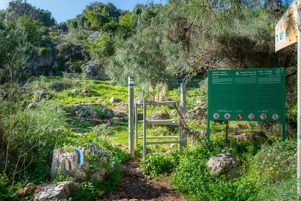
| barrier | hampshire_gate | A section of wire fence which can be removed temporarily.
Hampshire gates are quite common in Israel on both hiking trails and general-use unpaved tracks in non-urban areas. |
TBA | TBA | |
| barrier | stile | A stile allows pedestrians to cross "over" or "through" a wall or fence, but never actually "opens" the barrier.
In Israel, the most common type of stile seen on hiking paths is a narrow passage between metal rods/tubes, triangular in plan (like this: ———<———; an example can be seen here or here). This kind of stile should be mapped with Another common type looks like a small rounded "bridge" (example); these should be mapped with |
TBA | TBA | |
| barrier | fence | A freestanding structure designed to restrict or prevent movement across a boundary, generally distinguished from a wall by the lightness of its construction. | TBA | TBA | |
| barrier | wall | A freestanding structure, designed to restrict or prevent movement across a boundary, typically made from solid brick, concrete or rocks, and almost always built so that it is opaque to vision. | TBA | TBA | |
| natural | cliff | A vertical or almost vertical natural drop in terrain, usually with a bare rock surface | TBA | TBA |
Borders and special areas
| Key | Value | Element | Description | Hiking map rendering | Cycling map rendering |
|---|---|---|---|---|---|
| boundary | protected_area | used to mark boundaries of protected areas including national parks, marine protection areas, heritage sites, wilderness, indigenous and other, similar areas. For national parks: boundary=national_park. | TBA | TBA | |
| landuse | military | For land areas owned/used by the military for whatever purpose | TBA | TBA | |
| way | (Area A) | Elements of Area A are members of 3791783 |
TBA | TBA | |
| way | (Area B) | Elements of Area B are members of 3791784 |
TBA | TBA | |
| boundary | administrative | An administrative boundary. Subdivisions of areas/territories/jurisdictions recognized by governments or other organisations for administrative purposes.
|
TBA | TBA |
Services
| Key | Value | Element | Description | Hiking map rendering | Cycling map rendering |
|---|---|---|---|---|---|
| tourism | picnic_site | A locality that is pleasant and suitable for outdoors eating, with a number of facilities to aid a picnic. | TBA | ||
| tourism | camp_site | An area where people can camp overnight using tents, camper vans or caravans. | TBA | ||
| amenity | drinking_water | Drinking water is a place where humans can obtain potable water for consumption. Typically, the water is used for only drinking. | TBA | TBA | |
| amenity | parking | Car park. Nodes and areas (without access tag) will get a parking symbol. Areas will be coloured. Streets on car parking are often tagged highway=service and service=parking_aisle. | TBA | TBA | |
| amenity | fuel | Petrol station; gas station. | TBA | TBA | |
| information | guidepost | Guideposts are often found along official hiking/cycling/skiing routes to indicate the directions to different destinations. Additionally they are often named after a region or place and shows the altitude. tourism=information is also required. | TBA | TBA |
Areas
| Key | Value | Element | Description | Hiking map rendering | Cycling map rendering |
|---|---|---|---|---|---|
| landuse | residential | Predominantly houses or apartment buildings. | 
|
TBA | |
| landuse | orchard | intentional planting of trees or shrubs maintained for food production | TBA | TBA | |
| landuse | farmland | An area of farmland used for tillage and pasture (animals, crops, vegetables, flowers, fruit growing). | TBA | TBA | |
| landuse | forest | Managed forest or woodland plantation. | TBA | TBA | |
| דשא | TBA | TBA | |||
| צמחית בר | TBA | TBA | |||
| natural | sand | An area covered by sand with no or very little vegetation. | TBA | TBA | |
| landuse | quarry | Surface mineral extraction. | 
|
TBA |
Water
| Key | Value | Element | Description | Hiking map rendering | Cycling map rendering |
|---|---|---|---|---|---|
| waterway | stream | A naturally-forming waterway that is too narrow to be classed as a river. For an intermittent stream add intermittent=yes. | TBA | TBA | |
| landuse | reservoir | There was considerable confusion whether landuse=reservoir is deprecated, but it turned out to be not deprecated and landuse=reservoir is used much wider than "new" way natural=water + water=reservoir. It may be a good idea to tag the actual water body with natural=water + water=reservoir in addition or instead of landuse=reservoir. See also the approved water details proposal and pointers to discussion on talk page. For an intermittent reservoir add intermittent=yes. | TBA | TBA | |
| שטח הצפה יבש | TBA | TBA | |||
| natural | waterhole | A depression in which water collects, especially one where wild animals come to drink. | TBA | TBA | |
| man_made | water_well | A structural facility to access ground water. | TBA | TBA | |
| man_made | cistern | A waterproof receptacle for holding liquids, usually water. Cisterns are often built to catch and store rainwater. Cisterns are distinguished from wells by their waterproof linings. | TBA | TBA | |
| man_made | water_tower | Water tower | TBA | TBA |
Places
A place should have a node and a polygon.
The node tells the renderer where to draw the name of the place. It also should have all the tags related to the place, like population, wikipedia, etc. It should have all the various names with different spelling, e.g. name, name:en, name* and name:* tags.
The polygon should only have the following tags:
- landuse=residential
- place=*
- name tags
All the other tags belong to the node. A place often has a related administrative boundary, too.
For neighborhoods a polygon isn't always used and a node can be sufficient.
Administrative boundaries
The boundary=administrative tag is used on ways or relations to separate districts, cities, etc. Below is Israel-specific rules for the admin_level of the boundary.
- 2 - National border
- 4 - District (מחוז)
- 5 - Sub-District (נפה) - Click for a Wikipedia list.
- 6 - Natural region (אזור טבעי) (currently unmapped in OSM), Oslo Accord Areas A, B, and C
- 7 - metropolitan area (מטרופולין) - Currently unmapped in OSM. Click for a Wikipedia list.
- 8 - Municipalites (cities), local councils, regional councils
- 9 - Borough (רובע)
- 10 - Neighborhood (שכונה)
Municipalities
Thanks to the MOIN Import. We are able to map townhalls, local municipalities, and regional municipalities.
A municipality should have a relation with one node with role admin_centre, and one or more ways, to form closed polygon(s).
The relation should have the following tags:
- type=boundary
- boundary=administrative
- admin_level=8
- name=*
- name:* = *
The nodeadmin_centre node should be a place node, or an amenity=townhall node in the case of a regional council.
The ways that comprise the polygon that are sourced from the MOIN import should have the following tags:
- admin_level=8
- boundary=administrative
- date=08/2010
- source=MOIN
Nature reserves
Nature Reserves should be tagged as follows:
- boundary=protected_area
- protect_class=1
- protection_title=Nature Reserve
- name=*
- type=multipolygon (only for relations)
- ref=* the officially approved plan - מספר תוכנית בניין ערים מאושרת, if available
Because Nature Reserves are governed by Israeli law,
- Do not map Nature Reserves that have not completed the official declaration process.
- Do not use leisure=nature_reserve as it is incompatible with the meaning and legal implications in Israel.
National parks
National Parks should be tagged as follows:
- boundary=protected_area
- protect_class=2
- protection_title=National Park
- name=*
- type=multipolygon (only for relations)
- ref=* the officially approved plan - מספר תוכנית בניין ערים מאושרת, if available
Because National Parks are governed by Israeli law,
- Do not map National Parks that have not completed the official declaration process.
- Do not use leisure=* as it is incompatible with the meaning and legal implications in Israel.
Conventions for hiking and biking trails
For some general info see Walking Routes and cycle routes. Specific information about Israel can be found on Wikipedia and here (both in Hebrew).
A trail is represented by one or several ways ![]() , all belonging to the trail's relation
, all belonging to the trail's relation ![]() . Generally speaking, the ways of a trail describe its geographical path and physical grade, while the trail relation holds its administrative information. Trails should be mapped according the following guidelines:
. Generally speaking, the ways of a trail describe its geographical path and physical grade, while the trail relation holds its administrative information. Trails should be mapped according the following guidelines:
 Ways belonging to a trail
- Add a colour=* tag to ways belonging to local and regional trails. Note that the spelling is "colour" and not "color"!
- When a trail has different Israel Trails Committee (ITC) and JNF (KKL) colors, use only the ITC color.
- When a way belongs to local and regional trails, use the color of the local trail.
- When a way belongs to two local ITC trails, use multi-value tagging with a semicolon, such as colour=red;green.
- When a way has a transparent shield would be tagged with colour=transparent.
- Try to add a source=* tag to ways belonging to the trail. Common tag values are source=GPS and source=Bing. The source tag is an indicator of the accuracy of the trail position. GPS-based mapping is preferred and it can replace Bing-based mapping.
- For highway=track ways please try to add a tracktype=* tag, indicating which kinds of vehicles can use the track:
Key Value Description tracktype grade1 High quality unpaved road. Usable, for example, by low-clearance cars - דרך עפר באיכות גבוהה tracktype grade2 All vehicle unpaved road - דרך עפר לכל כלי רכב tracktype grade3 All-wheel-drive unpaved road - "דרך עפר לרכב שטח "רך tracktype grade4 Unpaved road requiring high clearance and/or low gear - (דרך עפר לרכב שטח "קשוח" (מוגבה ו/או עם הילוך כח tracktype grade5 Unpaved road requiring a locking differential and high clearance - "דרך עפר לרכב שטח "נעול
- Ways should not have any of the trail relations tags below.
Trail relations
Every marked trail should be represented by a relation ![]() and tagged according to the guidelines below. The ways
and tagged according to the guidelines below. The ways ![]() belonging to the trail are the members of the relation.
belonging to the trail are the members of the relation.
| Key | Value | Explanation | ||||||||||||||||||||||||
|---|---|---|---|---|---|---|---|---|---|---|---|---|---|---|---|---|---|---|---|---|---|---|---|---|---|---|
| type=* | route | Mandatory. The relation represents a route. | ||||||||||||||||||||||||
| route=* | hiking / bicycle / mtb (mountainbike) | Mandatory. The trail kind of the route. | ||||||||||||||||||||||||
| network=* | nwn / rwn / lwn / ncn / rcn / lcn | Mandatory. Level of the trail.
| ||||||||||||||||||||||||
| operator=* | itc/kkl/rtg/user-defined | Mandatory. The authority that built and maintains the route.
| ||||||||||||||||||||||||
| osmc:symbol=* | The shield of the route, used for rendering. | Mandatory for ITC trails. Machine readable value for the route's colors and how the marking (shield) should look like.
For the single-colored routes, the value should follow this example: red:white:red_stripe, which means: red colored way is drawn with white background and a red vertical stripe. In particular, the foreground color and the stripe color should be equal to the "colour" tag of every way in the trail ("red" in the above example). The shield background color should always be "white". A transparent shield would be tagged with osmc:symbol=blank:white. Tags for three-colored trail marks, such as Israel Trail and Golan Trail, should follow this example: blue:white:blue_stripe:orange_stripe_left, which means: blue colored way, white background shield, a blue vertical stripe in the middle, and an orange vertical stripe on the left. | ||||||||||||||||||||||||
| name=* | a name | Highly recommended. The route is known by this name (e.g. "Shvil Israel", "Golan Trail"). The name should be preferably specified in Hebrew. | ||||||||||||||||||||||||
| name:en=* | a name | Optional. The English route name. | ||||||||||||||||||||||||
| name:he=* | a name | Optional. Identical to the name attribute above. | ||||||||||||||||||||||||
| ref=* | a reference | Optional. The route number as specified by the Israel Trail Committee. |
See also
The original discussions can be seen here and also here.
Names of unofficial MTB single-tracks
Official mountain-bike (MTB) trails are represented using relations, as described above. In addition there are many unofficial single-tracks that have been named by the MTB community. Such single-tracks do not have relations. Instead, the mtb:name=* mtb:name:he=*, and mtb:name:en=* (optional) are placed on the way(s) themselves.
The mtb:name=* tags can also capture the name of a special segment within an official MTB trail. For example, the "סינגל הכלניות" segment of Beeri Single.
Lists and features of interest
Major boundaries
Country boundaries
- Israel 1473946 1473946
Districts
- Northern District 1375620 1375620
- Haifa District 1400966 1400966
- Central District 1400928 1400928
- Judea and Samaria1803010 1803010 (See note)
- Tel-Aviv District 1400916 1400916
- Jerusalem District 1384720 1384720
- Southern District 1473952 1473952
Note: [1] are legal, administrative boundaries. In OSM, Judea and Samaria relation represents areas under Israeli civilian control, but without being annexed by Israel.
- Oslo Accords areas:
- Palestine 1703814 1703814 - A relation consisting of Gaza Strip and areas of West Bank that are under civilian control of the Palestinian Authority.
- Gaza Strip 1473938 1473938 - De jure Palestinian Authority control, de facto Hamas control.
- West Bank 1613659 1613659 - consisting of areas of West Bank that are under civilian control of the Palestinian Authority.
- (See also: 12331025 12331025 The West Bank as a governorate of Jordan in the years 1949 to 1967)
- (See also: 12331025
- Gaza Strip 1473938
- 1949 Armistice Line (הקו הירוק - The Green Line) 7304999 7304999 - Do not exclusively rely on this for travel / passport related activities.
- Separation wall 1410327 1410327 - Physical separation barrier.
Non-boundary features
- Israel & Palestine 6195356 6195356
This multipolygon has no boundary-related tags. It is used for map maintenance purposes to define the combined areas of Israel and Palestine, regardless of any disputes between them. Among other things, it is useful for various extracts (such as Geofabrik), and Overpass queries. This polygon does not show on the map. Please avoid modifying it for any political agenda.
Places
Wikipedia has up to date lists for Local Councils, Regional Councils, Municipalites (cities), sub-districts, and Districts.
cbs.gov.il has lists of all populated places. (Last update 31/12/2015)
Here is a list of all OSM places in Israel in Hebrew and English. (Last update 2011 - discuss)
Here is a list of all OSM municipalities (cities) in Israel in Hebrew and English. (Last update 2011 - discuss)
Trails
List of all trails (Last update 2011 - discuss)
National and regional trails
| Trail | Relation | Trail mark |
|---|---|---|
| Israel National Trail | 282071 |
|
| Israel Bike Trail | 6639060 |
|
| Golan Trail | 568661 |
|
| Upper Galilee Trail | 2193374 |
|
| Sea to Sea Trail | 2860967 |
|
| Jesus Trail | 364191 |
|
| Sovev Kineret Trail | 5145441 |
|
| Lower Galilee Trail | 3929958 |
|
| Haifa Wadis Trail | 3734116 |
|
| Ramat Menashe Trail | 3418441 |
|
| Jerusalem Trail | 1314299 |
|
| TLV JM Bike Route | 947776 |
|
| Har HaNegev Trail | 6148872 |
|
| Makhtesh Ramon Trail | 6148296 |
Branches and brands
For a list of common brands and company branches, see the bot templates. When tagging a brand, adding "name" or "brand" should be enough, SafwatHalaby bot will eventually add all the other needed tags.
Tel Aviv bicycle rentals
Tel Aviv Bicycle Rentals (Last update 2011 - discuss)
Forests
List of Forests in Israel (Last update 2011 - discuss)
Trains
List of Trains in Israel (last update 2011 - discuss)
Mapping tools
Israel permalinks
The following list has Israel-specific permalinks to QA and monitoring tools:
- Israel edits by New mappers by Osmcha
- All Israel edits by Osmcha
- Israel changeset discussions (Feed version) by Neis-One
- Notes feed API - (See also: The standard note map)
- Ministry of Transportation GTFS vs OSM bus stop comparison by safwat.xyz
- Way and node geometry issues by OSM Inspector: self-intersecting ways, single node in way, duplicate node in way
- Area issues by OSM Inspector:
- issues by Osmose.openstreetmap.fr
Note that some tools may show entries from neighboring countries, because they're based on a rectangle bounding box.
Useful QA tools
The following are general QA tools that can be helpful:
- Route relations analyzer
- Visual History - Allows easily seeing all historic tags and positions of an element.
- History viewer - Displays a list of all tag changes in a changeset.
- Achavi - See all changes in an area between two time periods. It can also display a single changeset.
- How did you contribute to OpenStreetMap? by Neis-One: user's changesets with discussions, user's participation in discussions, and lots of statistics
Statistics
The following are Israel-specific statistics:
- Active user and edit statistics by Neis-One
- Note statistics by Neis-One
Alternative map
The Israel Hiking Map features a built-in editor. It is simpler than iD and is tuned for hiking and cycling. Use iD or JOSM for more complex edits.
Aerial maps
Bing
The most recent layer is Bing.
Forum discussion: https://forum.openstreetmap.org/viewtopic.php?id=59935
The precise date is unclear, and it may be varying by place. According to the Bing Imagery Analyzer, the minimum year is 2009 and the maximum year is 2016, but it's unclear whether or not the actual range is a subset of that.
Bots and imports
Below is a list of major imports and active bots.
Bot
In the past, SafwatHalaby's scripts used to update bus stops and name tags in Israel.
GEOnet Names Server (gns) import
On 14 July 2008, in changeset 486478, BaruchEven imported "all locations based on the GEOnet Names Server" at that time. The imported nodes had a source=GEOnet Names Server (gns) tag, a unique gns_ref tag, and the accuracy of their location was captured with an accuracy=minutes tag. Translations of the names were not part of the import. For more information, see an historic version of this page.
KKL Forest import
KKL donated shape files for its managed forests.
KKL declined a subsequent request to import its trails data.
Bus stop import
Between November 2017 and November 2020, the bus stops were automatically updated periodically. See: https://forum.openstreetmap.org/viewtopic.php?id=60149. The last known update import was in changeset 93373309, dated 2020-11-01.
Israel public GTFS data was used. Changeset #12028672. Discussion: https://forum.openstreetmap.org/viewtopic.php?pid=653719
Tel Aviv address import
Todo info.
MOIN import
https://forum.openstreetmap.org/viewtopic.php?id=10756
Maps
Cities
- Jerusalem map
- Netanya map
- Tel-Aviv map
- Raanana map
- Haifa map
- Or-Yehuda map
- Quiryat Ono map
- Hadera (חדרה) map
People involved
See also: Category:Users in Israel
Note: Both lists may be out of date. See the active user statistics by Neis-One for an up-to-date picture.
- Arie Skliarouk
- Edoardo Marascalchi
- Talba
- Baruch Even
- mr_Israel
- Elihadad
- Yuri Magrisso
- HaKetem
- Ophir Oren
- Monya
- dimka
- Haifa Wadis Trail
- Zeev Stadler - Israel Hiking Map
- Harel M - Israel Hiking Map
- valleyofdawn - Israel Hiking Map
- SafwatHalaby
- Ynhockey (talk)
- yrtimiD (Dmitry Gurovich)