Hu:Key:aeroway
Jump to navigation
Jump to search
 |
| Leírás |
|---|
| Az 'aeroway' címkével a légi közlekedéssel kapcsolatos objektumokat és utakat jelölhetünk. |
| Csoport: aeroways |
| Használható elemtípusok |
| Hasznos kombinációk |
| Státusz: de facto |
| Eszközök a címkéhez |
Használata
- Lásd még: Aerowaysen
Az aeroway címkével a légi közlekedéshez kapcsolódó elemeket jelöljük, ilyenek például a reptéren található elemek, helikopter leszállók, stb.
Értékei
Légi közlekedés
Az 'aeroway' címkével a légi közlekedéssel kapcsolatos objektumokat és utakat jelölhetünk.
| Kulcs | Érték | Alapelem | Magyarázat | Megjelenítés | Fotó |
|---|---|---|---|---|---|
| aeroway | aerodrome | Repülőtér Lásd még military=airfield.
|
 | ||
| aeroway | airstrip | A field or area where light aircraft can land and take off from. |  | ||
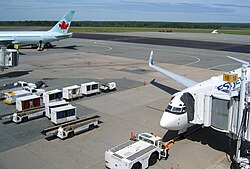
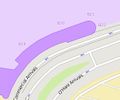
| aeroway | apron | Forgalmi előtér: olyan terület, ahol repülőgépek parkolnak. |  |
 | |
| aeroway | control_center |  | |||
| aeroway | fuel | Fuelling station for aircraft. |  | ||
| aeroway | gate | Kapuszám: kapuk számának jelöléséhez használható a repülőtereken. |  |
 | |
| aeroway | hangar |  | |||
| aeroway | helipad | Helikopter le- és felszállóhely |  | ||
| aeroway | heliport |  | |||
| aeroway | highway_strip |  | |||
| aeroway | holding_position | A point behind which aircraft are considered clear of a crossing way |  | ||
| aeroway | jet_bridge | Passenger boarding bridge |  | ||
| aeroway | model_runway | Take-off and landing runway for model aircraft |  | ||
| aeroway | navigationaid | A facility that supports visual navigation for aircraft |  | ||
| airmark | beacon |  | |||
| aeroway | parking_position | A location where an aeroplane can park |  | ||
| aeroway | runway | Kifutópálya: föld egy olyan sávja, ahol a repülőgépek le és fel szállhatnak. (Más nyelveken) |  |
 | |
| aeroway | spaceport | A spaceport or cosmodrome: a site for launching or receiving spacecraft |  | ||
| aeroway | stopway | Stopway is a rectangular surface beyond the end of a runway used during an aborted takeoff. |  | ||
| aeroway | taxilane | Taxilane is a path in an airport that is part of the aircraft parking area or apron (Proposed feature with low usage as of 2015-10; use with an eye towards the question correct usage). | |||
| aeroway | taxiway | Gurulóút: olyan út, melyen repülőgépek a kifutópálya és a parkolóhelyek között közlekednek. |  |
 | |
| aeroway | terminal | Utasterminál |  |
 | |
| aeroway | tower | See also aeroway=control_tower or combination of man_made=tower + service=aircraft_control for similar schemes.
|
 | ||
| aeroway | windsock | Szélzsák pozíciójának megjelölése. |  | ||
| aeroway | User defined | Néhány további értékhez lásd a Címkefigyelőt. |
This table is a wiki template with a default description in English. Editable here. A táblázat fordítását ezen az oldalon szerkesztheted.

