JA:Key:kerb
 |
| 説明 |
|---|
| 縁石の高さや通りやすさを示すために使用します。 |
| グループ: 道路 |
| 適用できる要素 |
| よく併用されるタグ |
| 状態:事実上の標準 |
| ツール |
縁石(kerb や curb)は、道路と歩道の境界です。表面や高さが違うところに渡ることができる地点がある場合、縁石の位置は歩行者、自転車、特に移動が制約された人(車いすなど)にとって重要です。
縁石そのものはほとんどの場合barrier=kerbを用いてマッピングされます。このページで説明されているkerb=*キーは縁石に関する追加情報についてのもので、どこで使われているかによって意味が変わってきます(以下参照)。
注: 慣習として OSM は大部分のタグにおいて北米英語よりもイギリス英語を使用しています。この場合、 curb ではなく kerb=* が使われます。
使用法
As a subkey of barrier=kerb
On a way
The kerb itself can be mapped as a way tagged barrier=kerb along the length of the kerb. Optionally, kerb=* can be used to provide additional information about the type or approximate height of the kerb (see values below). The exact height of the kerb is most commonly mapped using height=*, though kerb:height=* is also sometimes seen on ways.
On a node
barrier=kerb is also used on nodes at the exact location where a highway crosses the kerb. kerb=* can be used to provide additional information about the type or approximate height of the kerb (see values below). On nodes, the exact height of the kerb is most commonly mapped using kerb:height=*, though height=* is also sometimes seen.
As an example, at a pedestrian crossing, the footway=crossing way might cross a kerb that has been lowered to facilitate wheelchair access; the node at the point where the kerb crosses the path should be tagged with barrier=kerb and kerb=lowered. There are also examples of service roads, especially driveways, that cross the kerb and even for minor regular roads, in some areas there may be a kerb where it joins a more important road[1].
By itself
The key kerb=* is also sometimes used by itself on a node at the exact location where a highway (such as a highway=footway or highway=path) crosses the kerb (e.g., a curb cut). When encountering this usage, it is advisable to add barrier=kerb to avoid confusion with other uses of the key kerb=* (see below).
In addition, kerb=raised is sometimes encountered on its own on nodes where one might expect a pedestrian crossing, because a path, footway or similar meets a road, but the kerb is not lowered to help pedestrians cross. The tag is used this way by StreetComplete[2] but this usage is not without controversy because it is easily confused with other uses of the key kerb=* on nodes. If it is clearly impossible or illegal for a pedestrian to cross the road at this point, crossing=no can be added to such a node for clarity. If there is some other infrastructure that makes it easier for pedestrians to cross the road here, such as road markings or a pedestrian island, then crossing=* can be added with the appropriate value, such as crossing=unmarked. For situations where pedestrians are neither encouraged to cross nor forbidden from crossing, there is, as of March 2023, no well established alternative. In any case, the tag barrier=kerb should not be added at such a point even if it is suggested by an editor, because the node is also part of the road, so it would mean that someone travelling on the road (e.g. a car) also has to cross the kerb.
To add information to another map feature
kerb=* is also used on a highway=crossing, highway=bus_stop or similar to provide information about the kerb at this point. This usage indicates that there is a kerb somewhere near this node that someone visiting the node might want to know about, but it does not imply that everyone visiting this point has to cross the kerb, so barrier=kerb should not be used on such nodes. (In fact, a raised kerb at a bus stop may exist to make it easier for people to get on the bus.)
On crossings, the use of kerb=* on the highway=crossing node is an alternative to placing two barrier=kerb on each side at the actual location of the kerb (e.g., due to a lack of high resolution imagery or because the crossing path is not mapped separately as a highway=footway). This sacrifices accuracy for simplicity. If you map the area in more detail by placing separate barrier=kerb nodes, please remove the kerb=* tag from that node (otherwise a router might think that there are four kerbs to cross).
値
kerb=*に使われる値を以下の表にまとめてあります。ここに書かれている「高さ」は参考値なので、値を選ぶときには縁石の機能面によって判断してください。重要なのは、縁石の高さよりも、車椅子や自転車で通行できるかどうかです。
These documented values imply wheelchair=yes or wheelchair=no; this means you can omit wheelchair=* unless its value differs from the implied value below.
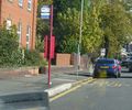
| 値 | 代表的な高さ | Implies | 代表的な用途 | 説明 | 例 |
|---|---|---|---|---|---|
flush
|
~0 cm | wheelchair=yes
|
横断歩道や引き込み通路 | loweredに似ていますが、高低差を視覚障碍者が触知で認識しにくいものです。
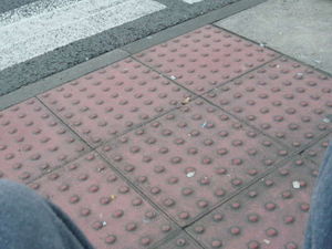
こうした場所では点字ブロックのマッピングを行うことが重要です。 |
|
lowered
|
~3 cm | wheelchair=yes
|
横断歩道や引き込み通路 | 低くなっている縁石は横断歩道や引き込み通路によくあります。これによって車椅子の利用者が横断歩道を利用でき、また引き込み通路に出入りできるようになります。
このカテゴリーに該当するものの名前として、driveway apron、curb cut (U.S.)、curb ramp、dropped kerb (UK)、pram ramp や kerb ramp (Australia) などがあります。
|
|
no
|
— | wheelchair=yes
|
縁石がありません。以前縁石があった場所や、(航空写真から縁石があると判断される可能性があるなどの理由で)通常なら縁石が期待される場所で、縁石が無いことを明確にするのに役立ちます。 | ||
raised
|
>3 cm | wheelchair=no†
|
バス停や古い縁石 | 高い縁石で、高さのために車椅子や自転車が乗り越えることが難しいものです。多くの場所で横断歩道の現代的基準には適合しません。バスへ同じ高さで乗り降りできるようにするため、バス停によくあります。
アメリカ合衆国では、近年アクセシビリティ規制ができるまでは最も一般的な縁石でした。 バス停で使われるKassel kerbs(訳注: ドイツのカッセル市発祥のバス停向け縁石のデザイン)の主な特徴は、バスが停車するときにタイヤを擦りにくいような形状ですが、それを特定したマッピングはされていません。 †: 歩行者用の経路で使われた場合には暗黙に |
|
rolled
|
— | wheelchair=no
|
居住地内道路 | Rolled kerbは排水用の溝として機能しつつ、自動車や自転車のように車輪の大きな乗り物は(車椅子は違いますが)乗り越えることができる縁石です。商工業的な道路には不十分なため、一般的に交通量の少ない地域、たとえば都市計画上の居住地域で使われています。 | |
yes
|
any | wheelchair=no‡
|
何らかの縁石があるものの、それが迫り上がっているか、下がっているか、ゆるい坂になっているかがわからない場合に使用します。これは、(現地調査の前に) 航空写真でマッピングする場合や、縁石がどうなっていたか厳密に思い出せない場合に使います。
‡: 注意深い経路検索ソフトウェアはこれを |
縁石の高さ
もし縁石の正確な高さが判る場合には、kerb:height=*(または、barrier=kerbウェイの場合にはheight=*)で記録できます。高さや幅の単位はデフォルトでは(つまり単位を省略した場合)メートルです。代わりにセンチメートルやインチを使いたい場合には単位を明記してください。
例:
0.12– 高さ 12 cm の縁石をメートル単位で記述。4 cm– 高さ 4 cm の縁石。6"– 高さ 6 inch の縁石。
例
| タイプ | タグ付け |
|---|---|
|
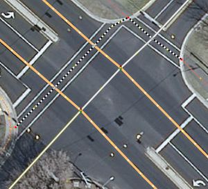
赤いノードは kerb=lowered でタグ付けされ、横断歩道は highway=footway と footway=crossing で、横断地点のノードは highway=crossing と crossing=traffic_signals でタグ付けされます。
|
|
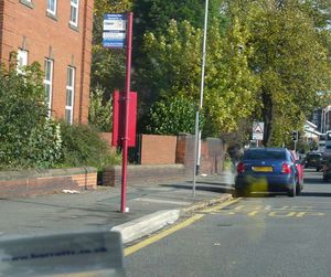
バス停またはプラットフォームに kerb=raised を追加します。この場合、道路とプラットフォームの間に縁石があるとみなされます。明示的にマッピングしたい場合は、プラットフォームをエリアとして描き、その一部のウェイとして縁石をタグ付けします。
|
|
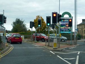
歩道上の縁石の位置のノードに kerb=lowered をつけます。また、横断歩道の両側が同じ状態である場合は、横断地点 (crossing) のノードに付与することもできます。
|
|
歩道上の縁石の位置に kerb=flush と tactile_paving=yes のタグをつけます。また、横断歩道の両側が同じ状態である場合は、横断地点 (crossing) のノードに付与することもできます。
|
関連タグ
The kerb=* node can also be tagged with tactile_paving=* to assist vision impaired individuals, and is especially important on kerb=flush nodes.
Editing with JOSM
In JOSM the Map Paint Style Sidewalks and footways (with knobs on) can be used to visualize kerb=* when used on nodes ![]() :
:
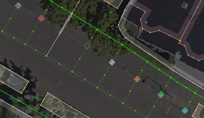
kerb=* values are rendered with icons representing them.Possible tagging mistakes
関連項目
- Steps features
- 点字ブロック
- Forward & backward, left & right
- 障害物
- 車いす
barrier=step- Steps are physically similar to kerbs but aren't used next to roads.- Proposed features/Traffic island,
traffic_calming=islandandcrossing:island=*are features that have kerbs in the middle of roads. - Relations/Proposed/Area
- Proposed features/sloped curb, an older, simpler proposal to tag flush kerbs.
- Proposed features/kerb=regular where
kerb=regularand redefinition ofkerb=raisedwas proposed and rejected
外部リンク
- Many of the recommendations on this page are the result of a community discussion on how
kerb=*is and should be used - Wikipedia articles on kerb, and curb cut
- FHWA: Designing Sidewalks and Trails for Access, Chapter 7. Curb Ramps - From the US Federal Highways Administration, more than you could ever want to know about curb ramps. Other chapters from this guide might also be useful.


