JA:Tag:amenity=place_of_worship
| 説明 |
|---|
| 宗教行事が行われる場所 |
| OSM Cartoでのレンダリング |
| OSM Cartoでのレンダリング |

|
| グループ: 宗教 |
| 適用できる要素 |
| よく併用されるタグ |
|
| 状態:事実上の標準 |
| ツール |
マッピング方法
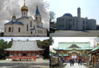
すべての宗教施設は、宗教・宗派に関係なく amenity=place_of_worship でタグ付けします。これで、モスク、教会、聖堂、シナゴーグ、寺院などを表します。 religion=*(宗教) denomination=*(宗派)、 service_times=*(拝観時間)でより詳細な情報を追加することができます。もし小さなグループのみが利用できる場合、たとえば修道院の中にあって修道士のみが用いる教会には、access=privateを追加することが有用です。宗教や宗旨が合っている場合にのみ利用できる宗教施設に対するタグ付け方法は確立していませんが、この目的のためにaccess=adherentsが提案されています[1]。
amenity=place_of_worshipを囲う敷地を明確にするためにlanduse=religiousを使うことができます。
church:type=*で教会の所属を追加することができ、これはカトリック教会の場合によく使われています。
建物または広場
建物
amenity=place_of_worship タグは、宗教行事が行われる場所を囲むエリアに追加してください。エリアが不明な場合は、建物のみに(building=* キーとともに)追加することができます。
宗教施設が多目的の建物の一部にある場合、 amenity=place_of_worship タグは建物の輪郭の内側にあるノードまたはエリアに配置してください。例えば、公共施設の中にある祈りの部屋や、商業ビルの中で宗教目的で借りている部屋などです。
建物が1つ以上の鐘楼を備えている場合は、鐘楼ごとにman_made=towerとtower:type=bell_towerでタグ付けされたノードまたはエリアを追加します。
建物が1つ以上のミナレットを備えている場合には、ミナレットごとにman_made=towerとtower:type=minaretでタグ付けされたノードまたはエリアを追加します。
宗教施設の建築様式
building=* は建築様式に従って適用します。 そのような建物は、よくランドマークとして認識されます。
この意味でよく使われるタグは以下の通りです。
- building=church
- building=cathedral
- building=chapel
- building=mosque
- building=synagogue
- building=temple
上記のタグは建築物の種別を表しており、実際の様式についてはbuilding:architecture=*で表すことができます。
例えば、カトリック教会は建物の輪郭に amenity=place_of_worship + religion=christian + denomination=catholic + building=church でタグ付けします。
従って、特定の建築様式を持たない建物は、 building の値をそのような値にしないでください。 例えば、ショッピングモールにある一般目的の商店の建物が、現在は宗教施設として使われている場合、building=church としてタグ付けしないでください。その代わりに、建物の本来の主な目的に従って、適切な building=* を使用してください。既定では building=yes です。
なお、建物が宗教目的で利用されなくなったとしても、 様式別の building=* のタグ付けを残します。 例えば、教会の建物がコンサートホールとして使われるようになった場合は、 building=church + amenity=theatre とタグ付けすることができます。
広場
宗教行事が建物ではなく定常的に特定の区域で行われる場合、このエリアは閉じたウェイ(または、形が分からない場合はノード)として描き、 amenity=place_of_worship と宗教施設の詳細をタグ付けしてください。
同じ敷地にある複数の礼拝施設
境内に複数の礼拝施設がある場合、境内の輪郭をlanduse=religiousでタグ付けできます。その中の礼拝施設(建物、祠、広場)はそれぞれamenity=place_of_worshipでタグ付けするべきです。
Usage
Cathedral / Collegiate Church / Church / Chapel
- building=<type of building>
- amenity=place_of_worship
- name=<name of object> – (Do not confuse the name of the object with its title which is "Basilica", which is a common mistake)
- religion=<religion name>
- denomination=<denomination name>
- diocese=<name of the diocese under which the facility is subject>
- deanery=<name of the deanery under which the facility is subject>
optional
- parish=* - name of the parish under which the branch church or chapel is subject.
- operator=* - name of the order governing the parish.
- church:type=* - church affiliation
- alt_name=<Cathedral ...., Collegiate ..., etc.>
- wikipedia=* - link to the church Wikipedia
- operator:wikipedia=* - link to the parish Wikipedia under which church or chapel is subject
Presbytery
We mark this place where priests live and work as a building.
- building=presbytery
- name=Presbytery
Parish office
We mark the parish office or the bishop's curia office as a node inside the outline of the object or near the node with the address (we do not add an address) and mark it as follows::office=religion
- name=Parish office.
- description=<full name of the office and parishes served by this office>.
- religion=<religion namei>.
- denomination=<denomination name>.
optional
- opening_hours=<opening hours>.
- operator=<the name of the order or religious institution in charge of the office>.
- phone=*.
- email=*.
- fax=*.
- website=*.
- wheelchair=*.
Bell tower
optional
- bell:multiple=<number of bells>
- bell:name= <the name of the individual bells>
- bell:service_times=* – some call at a specific time, e.g. every day at noon. See service_times=* for data format.
More in Optional tags for towers
Shrine
It is proposed to use for an area independent of the temple:
- shrine=international
- shrine=national
- shrine=regional – regional, in conjunction with denomination=roman_catholic means a diocesan shrine
- shrine=yes – other, undefined, of unknown rank
Place of worship and adjacent facilities
We mark as:
The area surrounding the main site is a better choice than ![]() node. This area may be closed, or it may be a set of external paths that form the multipolygon (with or without holes). This mapping method is already widespread.
node. This area may be closed, or it may be a set of external paths that form the multipolygon (with or without holes). This mapping method is already widespread.
Alternatively, relationships can also be used. E.g:
or
Example rendering
OpenStreetMap Carto renders places of worship at zoom levels:
- >=13 area tagged as amenity=place_of_worship or landuse=religious, gray (#cdccc9)
- >=13 building tagged as amenity=place_of_worship, 20% darker than others
- >=16 includes symbol, depending on religion=* and denomination=*:


- >=17 includes name
関連項目
- parish=* - 教会や礼拝堂が属する教区の名前。
- amenity=grave_yard その宗教施設に関係がある埋葬場所。
- landuse=religious 宗教施設がある場所のエリア。
- (まだ提案ではない)草案が、コミュニティにあります(宗教的かどうか)。
タグ付け間違いの可能性があるもの
- ↑ mailing list discussion, example of explicit sign forbidding access for nonmuslims to a mosque [1], see also note about default access


