Philippines Tropical Storm 2010
| old unmaintained page, kept for archival purpose only |
This is a HOT activation in the Philippines
Tropical Storm Megi (Philippine Local name: Juan) is the first typhoon of 2010 in the Pacific Basin to achieve "Super Typhoon" status, and the first in the Western Pacific after Nida in 2009.[4] It is also the first tropical cyclone since Hurricane Wilma of the 2005 Atlantic hurricane season confirmed to have a pressure below 900 millibars. Megi was also the strongest storm thus far in the 2010 Pacific typhoon season, and thus far is the strongest tropical cyclone recorded worldwide in 2010, with a pressure of 885 hPa (mbar). It made landfall early on October 18 in northeastern Luzon at Sierra Madre becoming one of the strongest storms ever to make landfall anywhere in the world.
OSM map link: http://osm.org/go/42hP@l--
Using Openstreetmap data - Downloads
- Geofabrik Philippines Downloads
- Garmin maps for the Philippines (OSM data and 10m Elevation Contour )
Affected Areas
2010-11-04
Currently affected by flooding due to continuous rains are low-lying areas of Cagayan and Isablea news link
Barangays in the municipality of Ilagan, Isabela
- Cabiseria 2, 3, 4 and 6-24
- Alinguigan 1st, 2nd and 3rd
- Aggasian
- Fugu
- Bagumbayan
- Sta. Barbara
- Camunatan
- Guinatan; and
- Calamagui 2nd
Roads and bridges are also impassable due to the floods:
- Baybayog Provincial Road in San Jose, Baggao town;
- Abusag Bridge in Baggao;
- Pinacanaunan Overflow Bridge in Tuguegarao City;
- Itawes Bridge in Tuao town;
- Tawi Bridge in Peñablanca town;
- Cabasan Bridge in Peñablanca, Cagayan
- Bagunot Bridge in Baggao, Cagayan
- Mauanan Bridge in Rizal, Cagayan
- Maguilling Bridge in Piat, Cagayan
- Sta. Maria Overflow Bridge in Cabagan, Isabela, and
- Alicaocao Bridge in Cauayan City, Isabela.
Critically damaged areas due storm winds are the remote towns facing the Pacific
- Province of Isabela was declared in a State of Calamity. Heavily damaged are the coastal towns of:
- Tuguegarao City, Cagayan - http://osm.org/go/42mCRSl
Mapping coordination

No imagery is available in the area, other than landsat.
Mapping priorities
- Large rivers and tributaries (use Landsat for rivers and 250K and 50K topo maps for river names)
- Move place=town/city node location to the town proper.
- Roads and bridges (visible roads in Landsat are most likely primary and secondary, unknown roads should be tagged as highway=roads)
- Hospital locations (an aid group is transporting medical supplies, but needs actual locations and contacts of hospitals in the area)
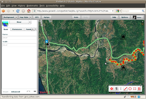
Map large rivers from Landsat
Track progress with OpenStreetBugs
- Use this to help find where there are largish rivers (hopefully visible in Landsat) which still need sketching in
- Label bugs as fixed if you have done a river, or if you find that somebody else has done it (osmarender layer is good for checking)
- Add new bugs. Currently Harry has layed a load of bugs around the Western mountain range, but not the Eastern one.
List of Rivers with potential for flooding:
- Chico River Basin
- Agno http://bit.ly/AgnoRiver http://en.wikipedia.org/wiki/Agno_River
- Cagayan http://bit.ly/CagayanRiver http://en.wikipedia.org/wiki/Cagayan_River
- Abra http://bit.ly/AbraRiver http://en.wikipedia.org/wiki/Abra_River
- Magat http://bit.ly/MagatRiver http://en.wikipedia.org/wiki/Magat_River
- Vintar Laoag River
Basin Flood Bulletins/Advisories
Under Flood Watch (2010-10-19 - 4:30 and 5 am local time):
Other data sources
- rectified US Army 1:250K topo maps from 1954 in WMS
- WMS URL is http://hyperquad.telascience.org/cgi-bin/mapserv?map=/home/sderle/ph250k/ph250k.map&
- maintained by User:SchuylerErle at Telascience -- please contact if questions/assistance needed
- Rectified 1:50 topo maps in WMS
The 1:50K topo maps are copyrighted to NAMRIA. Leonard Soriano manually scanned them and gave permission to OSM for tracing ( talk-ph thread ). Original scans are available below:
 Download link: http://www.4shared.com/dir/8CI8Nulj/Juan_Topomaps.html
 Folder Juan_topomaps
 Password: juan_topo_maps
- To add a new WMS Server in JOSM, use the Menu: 'Edit' menu -> 'Preferences' and click on the WMS tab. Now you can add / remove WMS server URL's. Use either of the following WMS
http://maps.nypl.org/relief/layers/wms/12?request=GetMap&version=1.1.1&styles=&format=image/png&srs=epsg:4326&exceptions=application/vnd.ogc.se_inimage&
Telascience
http://hyperquad.telascience.org/cgi-bin/mapserv?map=/data/sderle/ph50k/ph50k.map&FORMAT=image/jpeg&VERSION=1.1.1&SERVICE=WMS&REQUEST=GetMap&Layers=ph50k&
- NOTES on using the maps: The topomaps are old (ca 1950s), much of the roads, trails, in some case even rivers and other features have changed since. This useful for tracing and naming natural features. The WMS are shifted in some areas, move the layer in JOSM, using the "Adjust the position of the WMS layer". Add the tag: source=1:50k NAMRIA topo maps.
- Georeferenced 1:250k topo maps
(with manually set ground control points)
 Download link: http://www.lib.utexas.edu/maps/ams/philippines/
 Index map: http://www.lib.utexas.edu/maps/ams/philippines/txu-oclc-6539351-index-450.jpg
- Download the map and use http://maps.nypl.org/relief to rectify. Add tags ph_topo, hot and 250k.
- Post the link here and the wms.
- NOTES on using these maps: DON'T TRACE ROADS. The maps are old (ca 1950s), much of the roads, trails, in some case even rivers and other features have changed since. This can be useful for tracing and naming natural features.
- These maps are public domain ([1], [2]), and come from the Perry-Castaneda Map Library.
- A mosaic of these maps is available as layer http://maps.nypl.org/relief/layers/13 (WMS link for JOSM: http://maps.nypl.org/relief/layers/wms/13?request=GetMap&version=1.1.1&styles=&format=image/png&srs=epsg:4326&exceptions=application/vnd.ogc.se_inimage&)
| Name | Mapwarper Page | WMS link (for JOSM) |
|---|---|---|
| Dagupan City (NE 51-13, 1955) | http://maps.nypl.org/relief/maps/310 | http://maps.nypl.org/relief/maps/wms/310?request=GetMap&version=1.1.1&styles=&format=image/png&srs=epsg:4326&exceptions=application/vnd.ogc.se_inimage& |
| Tarlac (ND 51-1, 1955) | http://maps.nypl.org/relief/maps/311 | http://maps.nypl.org/relief/maps/wms/311?request=GetMap&version=1.1.1&styles=&format=image/png&srs=epsg:4326&exceptions=application/vnd.ogc.se_inimage& |
Imagery sources
Imagery posted by humanitarian agencies
- UNOSAT - http://unosat.web.cern.ch/unosat/asp/prod_free.asp?id=46
- UN-SPIDER - http://un-spider.org/page/3769/un-spider-spaceaid-space-based-information-tropical-cyclone-philippines
- JAXA Sentinel - http://dmss.tksc.jaxa.jp/sentinel2/thumbnailEmob.action?subset_name=Emergency+Observation&requestId=ERPHVS000008#
Existing 2.5 Spot5 images archive
NOTE: These are the Spot5 Color images around the affected areas. Will require further investigation to prioritize which of the images should be requested
| Scene ID | Catalog Link | Description/Evaluation |
|---|---|---|
| 53043160902240228132J | http://137.132.39.138/cgi-bin/cat_bin/sp5_sat?ID1=53043160902240228132J | Ilagan and Cauayan City, Ilagan municipality is Isabela's provincial capital |
| 53043150902240228052J | http://137.132.39.138/cgi-bin/cat_bin/sp5_sat?ID1=53043150902240228052J | Tuguegarao City, Cagayan's provincial capital |
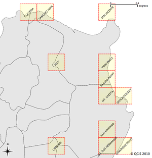
| 53053150908100220382J | http://137.132.39.138/cgi-bin/cat_bin/sp5_sat?ID1=53053150908100220382J | Divilacan area |
| 53053160807010205562J | http://137.132.39.138/cgi-bin/cat_bin/sp5_sat?ID1=53053160807010205562J | Palanan area |
| |||||||||||||||||||||||||||||||||||||||||


