Tag:natural=shingle
 |
| Description |
|---|
| An accumulation of rounded rock fragments on a beach or riverbed. |
| Rendering in OSM Carto |

|
| Group: natural |
| Used on these elements |
| See also |
| Status: de facto |
| Tools for this tag |
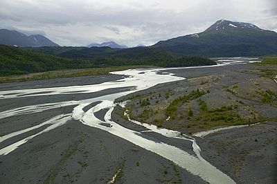
![]() Shingle is an accumulation of rounded rock fragments, usually pebbles and gravel, but sometimes larger, deposited and shaped by movement of water. It is used in two contexts: shingle beach and river shingle.
Shingle is an accumulation of rounded rock fragments, usually pebbles and gravel, but sometimes larger, deposited and shaped by movement of water. It is used in two contexts: shingle beach and river shingle.
In contrast to natural=scree which results from rockfall and in-situ weathering shingle is produced by water transport. The water flow in a river or the waves at a coast transport and segregate rock fragments and deposit them according to water currents. As a result, the rock fragments are usually well-rounded and lack sharp corners and edges. They can vary in size between millimetres and centimetres. The English term “shingle” illustrates that — due to the water flow — gravel deposits often are aligned like roof tiles.
For finer grains (< 2 mm), use natural=sand.
How to map
To map an ![]() area of shingle you can just draw a line closing on itself, marking the area of shingle and tag it
area of shingle you can just draw a line closing on itself, marking the area of shingle and tag it natural=shingle. To map larger or more complex areas you can use Relation:multipolygon with the same tag.
Example
Rendering
Currently rendered in OSM standard layer like natural=scree in bright gray-brown colour with a dot pattern at high zoom levels.
See also
- Shingle beach on Wikipedia
natural=beachnatural=sandnatural=screenatural=blockfield
| ||||||||||||||||||||||||||||||||

