Zh-hans:上传
| 帮助 | 关于 | 浏览 | 如何贡献 | 贡献地图数据 | 编辑器 | 术语表 | 新手指南 | ||||||||||||||||||||||||||||||||||||||||
|
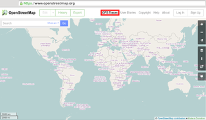
帮助贡献 OpenStreetMap 项目的一个好方法是上传 GPS 轨迹。 GPS轨迹是由GPS设备自动生成的一系列点,可以以此生成路径并在编辑时显示在背景上,来显示出一些卫星地图还没更新的道路,进而方便编辑。如果你在上传 GPX 文件时遇到问题,FAQ页面也许可以帮助你。 有关使用 GPS 设备和创建 GPX 文件的更多信息,可查看Recording GPS tracks和Making GPX Tracks页面(英语)。 需要注意的是,上传GPS轨迹和editing以及导入均不同。 如何上传一个 GPX 文件
文件将会被上传到 OSM 服务器,等待被插入数据库,加入到文件队列。 标签Tags provide a simple way to describe your GPS traces. They make your GPX file findable with a single word and allow you to group the trace alongside other similar traces. For example, all the traces tagged 'Melbourne' are listed at http://www.openstreetmap.org/traces/tag/Melbourne. You may have seen tags elsewhere on the web, attached to photos, bookmarks, blog entries, and so on, and these follow a similar principle. 每个文件可以有很多个标签,你可以使用逗号 (",") 分隔你想要的标签。通常标签可以是国家,城市,或其他轨迹关注的地名。 Tagging traces is completely separate from tagging OSM data itself. Don't get the two confused! 在我的文件上传后,会发生什么?你不会看到任何沿着你的轨迹绘制的街道,除非你(或其他人)用一个编辑器去绘制点或路径。 Your GPX file is parsed by the OSM server and points are extracted and inserted into the database. These uploads go into a queue on the server, and occasionally there is a backlog. Once completed however, you will be able to...
压缩的文件单个文件也可以在被 gzip 压缩后上传(拥有.gpx.gz的扩展名)。如果你有一个大文件或多个文件要上传,你可以压缩它们为一个 zip 包,然后上传。它会被作为一个大的 GPX 文件(这样只会创建一个记录在你的轨迹列表)。 上传路点GPS 路点 不能被直接上传到 OSM 数据库。但例如,它们可以被转换为轨迹,然后被临时上传,就能在 Potlatch 作为背景对象显示。参见 上传路点。 直接上传 GPS 轨迹记录的应用程序软件开放者可能对在 GPX upload API 的文档感兴趣。 以下的应用程序可以直接上传到 OpenStreetMap:
|
|||||||||||||||||||||||||||||||||||||||||||||||