FR:Android
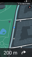
![]()
Android est un système d'exploitation, basé sur Linux et destiné aux terminaux mobiles (téléphones, smartphones, etc ...). Les terminaux Android peuvent être utilisés pour voir et éditer des cartes basées sur OpenStreetMap, et enregistrer les traces GPS (qu'on peux envoyer vers OSM pour aider lors de l'édition).
Pour des informations générales voyez les pages de Wikipédia sur Android ou le site officiel Android.com en français (sauf section développeurs en anglais).
OpenStreetMap.org
De façon basique, ouvrir avec son navigateur le site https://www.openstreetmap.org/. Le site est optimisé pour les petits écrans, mais le Slippy Map (ou carte glissante) est très limité. OpenTouchMap (page en anglais) est un peu meilleur. Pour une lecture proche de Google Maps, voir la partie applications OSM ci-dessous. Pour contribuer à OpenStreetMap (OSM), l'iD du rédacteur (en js) permet un support basique mais il est plus pratique d'utiliser une application d'édition pour Android.
Applications OSM
Les applications suivantes sont basées sur OSM pour les fonctionnalités de base et elles sont la meilleur façon d'utiliser OSM sous Android. Elles sont mises à jour régulièrement (tous les 18 mois au minimum). Voir aussi Comparaison des applications android (en anglais).
Réalité augmentée
Ces applications utilisent un calque avec les données OSM, superposé sur une vue en temps réel de la caméra arrière du mobile.
Vers les pages en anglais : ARnav, Data4All (http://data4all.github.io/) et Layar Reality Browser.
Ces applications ont une aide au déplacement étape par étape et souvent un guide vocal :
- ont une page wiki en français : FR:OsmAnd~
- pages wiki en anglais (mai 2018) :
- Galileo Offline Maps main.png
Citons aussi (page wiki en Russe seul) Navitel.
Édition de cartes
Ces applications sont des éditeurs avancés, qui permettent de contribuer directement aux cartes :
- OSM Contributor
- Osm Go!
- Vespucci (page wiki en anglais)
Ces applications ont aussi des fonctionnalités d'éditions limitées : Data4All, MAPS.ME, OsmAnd, OSMBugs, OSMapTuner, StreetComplete (page wiki en Français) et Kort.
Ces applications permettent d'envoyer des images géolocalisées : Mapillary et OpenStreetCam.
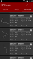
Enregistrer les mouvements GPS
On peux envoyer à OSM ses mouvements GPS pour s'aider à enrichir ses cartes. La plupart de ces applications ont aussi des fonctionnalités d'orientation, qui sont utilise pour se déplacer mais pas aussi fine que les applications de déplacement "étape par étape".
Vers les pages du wiki en français :
Vers les autres pages du wiki (en général en anglais) :
- Galileo Offline Maps main.png


Prévoir un voyage
Ces applications permettent la recherche et la découverte de lieux. Beaucoup permettent l'utilisation des carte hors connexion.
Page wiki en anglais:


Jeux
Vers une autre page du wiki anglais : Games#In the game itself
Ces jeux s'appuient sur les données OSM : pages wiki en anglais BucketMan et Pokémon Go.
J'ajoute FR:StreetComplete :
- https://framalibre.org/content/street-complete
- disponible sur F-Droid https://f-droid.org/packages/de.westnordost.streetcomplete/
Divers
Pages wiki en français :

Wiki anglais :

Applications qui utilisent OSM
Ces applications utilisent aussi OpenStreetMap d'une certaine façon :
Librairies pour les développeurs
Archives (en cours de trad)
Logiciels Android supportant OpenStreetMap
Informations générales
| Name | Screenshot | Display map | Navigate | Make track | Monitor | License | Price | Languages | Version | Description |
|---|---|---|---|---|---|---|---|---|---|---|
| AFTrack GPS-Tracking [1] | 
|
oui | oui | oui | oui | nonfreeproprietary | nonfree3.90€;4.95$;free | EN; DE; IT | 2014-08-02 1.6.4 |
Offline navigation with many map formats - BSB3 (*.kap), NV-digital (*.eap), Bitmaps with calibration file (format: map, gmi, kml, kal, cal, pwm), OSZ (zipped osm tile collection), mbtiles, sqlitedb, Mapsforge vector format and online maps |
| AlpineQuest GPS Hiking [2] | 
|
oui | non | oui | oui | nonfreeproprietary | nonfree3€ | EN,FR, | 2012-10-02 1.3.2 |
Orienteering focused |
| AndNav2 [3] | 
|
oui | oui | oui | non | GPL | free | EN | ?
|
No longer actively developed, map (online/offline-"andnav_atlas_format"), routing (online) |
| AndRoad [4] | 
|
oui | oui | oui | non | GPL | free | EN | ?
|
Open-source fork of AndNav2 |
| Androzic [5] | 
|
oui | oui | oui | oui | GPLv3 | free | EN; FR; DE; ES; CS; BG; FI; HU; IT; NL; PL; TR; RU | 2012-02-05 1.4 |
Android navigation client that uses OziExplorer maps (ozf2, ozfx3) |
| Ape@map [6] | 
|
oui | non | oui | oui | nonfreeproprietary | free | EN | ?
|
|
| ARnav [7] | 
|
oui | oui | non | non | nonfreeProprietary | free | EN | 2012-03-03 0.9RC2 |
ARnav is an app for Android mobile devices that shows OpenStreetMap points of interest around you in augmented reality mode. |
| B.iCycle [8] | 
|
oui | non | oui | oui | nonfreeProprietary | nonfree9.99$ (iOS) $4 (android), | EN | 2013-04-03 4.0.1 |
MTB centered bike computer software |
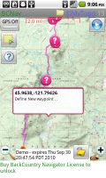
| BackCountry Navigator [9] | 
|
oui | oui | oui | oui | nonfreeproprietary | nonfree9.99$ (fully functional time limited free demo available) | EN | 2011-05-26 4.0.6 |
Hiking focused. Many map formats available; including OpenStreetMaps, NASA landsat, MyTopo.com topo maps of US and Canada, OpenCycleMaps showing terrain worldwide, USGS Color Aerial photography, UK Ordinance Survey Explorer Maps, Topographic Maps of Spain and Italy, Topo maps of New Zealand. |
| be-on-road [10] | 
|
oui | oui | oui | ?
|
nonfreeproprietary | nonfreeFree | DE; EN; CS; NL; FR; EL; HU; IT; PL; PT; RO; RU; SK; ES; TR; UK | 2013-11-13 3.9.26385 |
Offline multi-language voice navigation app with lane-guidance assistant. Data from OSM and propietary maps. |
| Big Planet Tracks [11] | oui | non | oui | oui | GPLv3 | free | EN; ZH-TW; ZH-CN | 2011-07-09 2.1 |
maps (online/offline-"big_planet_tracks") | |
| BikeAtor [12] | 
|
oui | non | oui | oui | nonfreeproprietary | free | DE,EN | 2013-09-26 0.1.1 |
Show Maps, Caches, Speedometer, log GPX... |
| BikeCityGuide http://getfinn.com/ | 
|
oui | oui | oui | non | nonfreeproprietary | nonfree5Eur per city | EN,DE,FR | 2014-07-24 3.1 |
Designed for cyclists in urban areas incl. Insider tours. |
| BucketMan - coloring your city [13] | 
|
oui | non | non | non | ?
|
free | EN; DE; PT | 2014-10-03 2.0 |
A game similar to Pacman but in the streets of the world |
| CartoType [14] | 
|
oui | oui | non | non | nonfreecommercial | ?
|
EN | 2013-07-17 2.9 |
portable library |
| City Maps 2Go [15] | 
|
oui | non | non | non | nonfreeproprietary | nonfreeiPhone: 2.99$ / 2.69€ Android: free | EN,DE,FR,IT,ES | 2013-07-17 4.5.7 |
City Maps 2Go |
| Compass Navigator 3D [16] | 
|
non | oui | non | non | nonfreeproprietary | free | EN; DE | 2014-08-19 1.0 |
3D compass with a GPS navigation "arrow". Line-of-sight-navigation to OSM POIs and addresses. |
| Cruiser [17] | 
|
oui | oui | non | oui | nonfreeproprietary | free | EN; EL | 2014-10-17 1.2.12 |
Cruiser is an Android map and navigation application using offline vector maps. |
| CycleStreets Android App [18] | 
|
oui | oui | non | non | GPL; | nonfreeFree | EN | 2011-11-17 1.1 |
UK only |
| Dedee GpsLogger [19] | 
|
?
|
non | oui | non | nonfreeproprietary | free | EN | 2011-03-19 1.1 |
|
| ForeverMap [20] | 
|
oui | oui | non | non | nonfreeproprietary | nonfreeiPhone: 1,59€, Android: 1,59€ (Free Android version available) | EN; DE; FR; SP; IT; RU | 2013-10-05 3.2 |
ForeverMap is an offline navigation app, providing address/POI search and route calculation |
| Gaia GPS [21] | 
|
oui | oui | oui | oui | nonfreeproprietary | nonfree19.99$ iOS / $9.99 Android | EN | 2012-07-05 6.4 |
hiking focused logger |
| Geobucket [22] | 
|
non | non | oui | non | GPL | free | EN | 2012-10-30 1.1 |
Tool to make it dead simple to collect tracks and upload to Geobucket.org for tracing |
| Geopaparazzi [23] | 
|
oui | oui | oui | oui | GPL v3 | free | EN; IT; FI; EL; KO; JA; PL; PT; DE | 2014-05-10 3.9.5 |
|
| Glob [24] | 
|
oui | ?
|
?
|
?
|
nonfreeFree | ?
|
EN,FR, | 2014-02-01 2.04 |
|
| Goosm [25] | 
|
oui | ?
|
non | non | nonfreeproprietary | free | FR; EN; ... | 2014-02-26 1.0.2 |
Contains an advanced search engine for POIs. Search any tags and display matching results, then send their position to any application that support intent filters if needed (google streetview, waze, navit, etc.). Create, Update or delete a POI, in two clicks. Autocomplete with most often-used tags, or use custom tags. |
| GoPenS [26] | 
|
oui | oui | oui | non | GPL | free | EN | 2011-01-10 0.7.5 |
Open source Android GPS for OpenStreetMap, map (online/offline), routing (online) |
| Gosmore [27] | 
|
oui | oui | oui | oui | BSD | free | EN; DE | 2011-11-22 - |
|
| GPS Essentials [28] | 
|
oui | oui | oui | oui | nonfreeproprietary | free | EN | 2012-08-27 3.0 |
All-in-one solution |
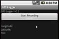
| GPS Logger for Android [29] | 
|
non | non | oui | non | GPL | free | EN | 2014-06-12 49 |
Battery efficient GPX logger. |
| GPS-Tracks [30] | 
|
oui | oui | oui | oui | nonfreeproprietary | free | EN; DE; FR; IT | 2012-01-26 1.61 (iPhone); 1.52 (Windows Mobile); 1.30 (Android) |
|
| GpsMid [31] | 
|
oui | oui | oui | oui | GPLv2 | free | EN; DE; FI; CS; PL; RU; FR; IT; ES; SK | 2012-09-08 0.8.2 |
very portable navi for Android and J2ME mobile phones, uses offline vector maps, audio navigation |
| GpsTicker3 [32] | 
|
oui | oui | oui | oui | nonfreeproprietary | free | DE; EN; | 2014-05-11 3.0 |
Android offline navigation |
| GraphHopper [33] | 
|
oui | ?
|
?
|
?
|
Apache License 2.0 | free | EN | 2014-05-13 0.3 |
Routing server and Android library |
| gvSIG Mini [34] | 
|
oui | oui | non | non | GPL | free | EN; ES | 2011-03-30 1.2.2 |
supports WMS services, too; maps (online/offline-"custom") |
| inViu routes [http://ENAiKOON GmbH] | oui | oui | oui | oui | nonfreeproprietary | free | EN; DE; ES; FR | 2013-08-22 3.5.7 |
GPS swiss knife | |
| JPSTrack [35] | 
|
oui | non | oui | ?
|
BSD (source available) | free | EN | ? early release |
Track logging for OSM w/ photo, voice, text notes |
| Keypad-Mapper 3 [36] | non | non | oui | non | BSD | free | DE; EN; ES; FR; GR; IT; NL; PL; RU | 2013-06-13 3.1.00 |
Bardzo wydajne mapowanie numerów domów. | |
| Keypad-Mapper 3 [37] | non | non | oui | non | BSD | free | DE; EN; ES; FR; GR; IT; NL; PL; RU | 2013-06-13 3.1.00 |
highly efficient mapping of house numbers | |
| KeypadMapper2 [38] | 
|
non | non | oui | non | BSD | free | EN; DE; RU | 2012-06-08 1.8 |
Dedicated to housenumber mapping |
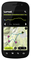
| komoot - Outdoor Routplaner [39] | 
|
oui | oui | oui | oui | nonfreeproprietary | free | DE | 2012-11-12 4.3 |
|
| Layar Reality Browser | oui | non | non | non | nonfreeproprietary | free | EN | ? 4.0.4 |
Augmented Reality browser mixes camera image with virtual reality | |
| LocA [40] | 
|
oui | oui | oui | oui | nonfreeproprietary | free | EN; CZ | ? 0.1.1. |
Geocaching focused logger |
| LockOnMe [41] | 
|
oui | non | non | oui | nonfreeproprietary | free | EN | ?
|
Location-sharing app, displaying targets and/or associated Points Of Interest on OSM & fun radars |
| Locus [42] | 
|
oui | oui | oui | oui | nonfreeproprietary | nonfreefree, paid | EN; AR; CZ; DA; DE; EL; ES; FI; FR; HU; IT; JA; KO; NL; PL; PT; RU; SK | 2014-02-21 v2.19.1 |
Online/Offline map viewer (area downloader or tile cache), support slippy (non-free too) and vector maps (MapsForge library), guiding, routing and basic navigation (online only), track recording with detailed POIs (including photos) and altitude correction, extensive geocaching support, WMS maps and more |
| Mapdroid [43] | 
|
oui | non | non | non | LGPL | free | EN | ? alpha |
Open Source proof-of-concept Android OpenStreetMap viewer. |
| MapDroyd [44] | 
|
oui | non | non | non | nonfreeproprietary | free | EN; DE | 2012-05-23 v1.1.6 |
Offline vector map viewer for Android. Compact one-off data downloads |
| mapFactor Navigator free [45] | 
|
oui | oui | oui | oui | nonfreeproprietary | free | CZ; DE; EN; RU; ... | 2013-05-20 12.1.10 |
professional framework for OSM-based car navigation |
| mAPPedplanet [46] | 
|
oui | oui | oui | non | nonfreeproprietary | nonfreefree, paid | EN; DE | 2012-10-21 v3.0 |
Online/Offline map viewer (own area vector maps with special informations), many standard tools build in |
| MapQuest [47] | oui | non | non | non | nonfreeproprietary | free | EN | 2011-02-19 1.0.0-beta |
||
| Maps (-) [48] | oui | non | non | non | Apache License 2.0 | free | EN | 2010-04-19 1.6.0 |
Map viewer only. Caches tiles to SD card for offline viewing. | |
| MAPS.ME [49] | 
|
oui | non | non | non | Propriétaire Code source ouvert |
Free | EN; RU; CS; DE; ES; FR; IT; JA; KO; NL; UK; ZH-HANT; PL; PT; HU; TH; ZH-HANS; AR; DA; TR | 2016-04-08-Google 6.0.7 |
Offline maps of all countries, fast renderer, offline search, whole planet fits to 12Gb |
| Mapsforge [50] | 
|
oui | non | non | non | LGPL3 | free | EN; DE; FI; IT | 2014-05-08 0.4.0 |
map application library |
| Mapzen POI Collector [51] | 
|
oui | non | non | non | nonfreeproprietary | free | EN | 2010-12-19 1.2.5 |
Easy to use app to map just POIs |
| Maverick [52] | 
|
oui | oui | oui | oui | nonfreeproprietary | nonfreefree, pd version available | EN | ? 1.95 |
Geocaching support, POI Radar |
| My Tracks [53] | 
|
non | non | oui | oui | Apache License 2.0 | free | EN; | 2012-08-04 2.0 |
recording tracks (no OSM features) |
| MyTrails [54] | 
|
oui | oui | oui | oui | nonfreeproprietary | nonfreefree;paid | DE; EN; FR; IT; ES; PT; NL | 2012-05-31 1.2.40 |
MyTrails is an Android application that makes it easy and fun to view online and offline maps, and to record and share GPS tracks. It is designed to offer an uncluttered map area, and the smoothest map navigation (drag, pinch-zooming, etc.) on a mobile device. |
| NavDroyd [55] | 
|
oui | oui | non | non | nonfreeproprietary | nonfree5€ | DE; EN; FR; IT; SP; PO | 2012-03-27 1.4.2 |
|
| NavFree [56] | 
|
oui | oui | non | non | nonfreeproprietary | nonfreeFor Android is free. For iOS the first country is free, then €2.69. | EN; ES; DA; DE; FR; SW; IT and others | ? 1.9.8.8675 |
Free satnav app. Maps available: Andorra, Argentina, Australia, Austria, Benelux (Belgium, Netherlands, Luxembourg), Brazil, Canada, Croatia, Czech Republic, Denmark, Estonia, Finland, France, Germany, Hungary, India, Ireland, Italy, Latvia, Lithuania, Mexico, Monaco, Netherlands, New Zealand, Norway, Poland, Portugal, Slovakia, Slovenia, South Africa, Spain, Sweden, Switzerland, UK. |
| Naviki [57] | 
|
oui | non | oui | non | nonfreeproprietary | free | DE | 2011-02-24 1.5 |
Only Germany supported |
| Navit [58] | 
|
oui | oui | oui | oui | GPLv2 | free | 43 | 2013-01-13 0.2.0 |
Most popular OpenSource Car navigation tool; maps (offline-"custom"), vector-rendered |
| Navitel [59] | 
|
oui | oui | oui | non | nonfreeproprietary | nonfree17€ | EN; RU | 2011-06-10 5.0.0.1620 |
Popular in Russia |
| Nogago [60] | 
|
oui | oui | oui | oui | nonfreeOpenSource | nonfreefree, offline maps: 4,95 Euro; licence key: 7,99 Euro | DE; EN; NE | 2012-12-22 3.14 |
Topographic Offline-Maps and Navigation for Hiking, Cycling and Biking |
| Open GPS Tracker [61] | oui | non | oui | oui | GPLv3 | free | EN; NL; DE; IT; FR; CH | 2012-01-02 1.3.1 |
Offline GPS tracker with optional osmdroid map activity | |
| OpenFixMap [62] | 
|
oui | non | non | non | GPL | free | EN; FR; ET; DE; RU | 2014-04-06 0.5.4 |
Display errors from keepright, mapdust and openstreetbugs |
| OpenSatNav [63] | 
|
oui | oui | oui | non | GPLv3 | free | EN | 2009-12-29 0.9 |
Routing and recording trip; maps (online+cache); navigation (online) |
| OpenTrail [64] | 
|
oui | oui | oui | non | GPL | free | EN | 2013-02-10 0.1 beta |
Freemap for Android |
| OpenTripPlanner for Android [65] | .png)
|
oui | non | oui | non | Apache License v2.0 | free | EN; DE; ES; FR; GL; PT; RO | 2014-07-07 v2.0.5 |
An Android app for multi-modal trip planning using any OpenTripPlanner server |
| OruxMaps [66] | 
|
oui | oui | oui | non | nonfreefreeware | free | EN; DE | 2013-10-06 v5.5.11 |
OruxMaps is a map viewer. It can work in two modes: online with google, microsoft, yandex,... maps, and offline, with calibrated maps for OruxMaps, or online maps which have been saved |
| OSG-Explorer [67] | 
|
oui | non | non | non | nonfreeproprietary | free | EN | 2013-10-27 1.1.x |
OpenStreetMap 3D on Android |
| OSM Gpx Uploader [68] | 
|
non | non | non | non | nonfreeproprietary | free | EN | 2013-05-23 1.4 |
Generic GPX file uploader |
| osm-android [69] | oui | non | oui | non | GPLv3 | free | ?
|
2009-10-21 0.0.9 |
renders OpenStreetMap maps and calculates routes | |
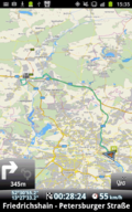
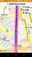
| OsmAnd [70] | 
|
oui | oui | oui | oui | GPL v3 | nonfreefree or 5.99€ | EN; RU; DE; FR; AR; BG; BS; CS; DA; ES; EU; FI; HE; HI; HU; HY; ID; IT; JP; KA; KO; IT; LV; MR; NL; NO; PL; PT; RO; SK; SR; SV; UK; VI; ZH | 2014-07-16 1.8.2 |
|
| OSMapTuner [71] | 
|
oui | non | non | non | nonfreeproprietary | free | ?
|
2012-03-14 1.0 |
Simple editor for manipulating tags on your smartphone |
| OSMBugs [72] | 
|
oui | non | non | non | GPL | free | EN; DE | 2013-10-19 0.5.3 |
Display and edit Bugs from Notes, Keepright and Mapdust |
| osmdroid [73] | 
|
?
|
non | non | non | Apache License 2.0 | free | EN | 2014-01-24 4.1 |
Replaces GMaps views; maps (online/offline-"andnav2") |
| OSMfocus | 
|
oui | non | non | non | ?
|
free | EN | 2014-10-09 0.1.1rc1 |
Shows details of nearby objects from OSM so they can be verified during a survey |
| OsmPad [74] | 
|
oui | non | non | non | ?
|
free | EN; DE | 2012-04-19 1.0 |
Utility to gather house numbers for OpenStreetMap |
| OsmSharp [75] | 
|
?
|
?
|
?
|
?
|
GPLv3 | free | EN | 2013-04-06 3.1 |
OSM routing and optimisation library. |
| OSMTracker for Android [76] | oui | non | oui | oui | GPLv3 | free | AR; DA; DE; EL; ES; EU; EN; FI; FR; GL; HY; IT; IW; JA; MY; NB; NL; NN; PL; PT; RU; SK; SV; TH; UK; ZH | 2013-09-16 0.6.6 |
Offline GPS tracker with fast POI placement shortcuts. Exports in GPX format with waypoints, suitable for editing in JOSM. Clone of OSMtracker (Windows Mobile) | |
| PocketNavigator [77] | 
|
oui | oui | non | non | nonfreeproprietary | free | EN | 2012-03-16 3.3 |
Android navigation application, aiming at pedestrians. Information on the next waypoint can be encoded in tactile feedback. |
| RMaps [78] | 
|
oui | non | oui | oui | GPL | free | EN; RU | 2011-08-28 0.8.9 |
Maps and a compass, maps (online/offline-"rmaps") |
| RTKLIB [79] | 
|
?
|
?
|
?
|
?
|
Free | free | EN | 2013-04-29 2.4.2 |
Open source program package for GNSS positioning |
| Run.GPS [80] | oui | non | oui | oui | nonfreeproprietary | nonfree20€ | DE; EN; ... | 2010-07-07 2.37 |
Sport focused logger | |
| ShareNav [81] | 
|
oui | oui | oui | oui | GPLv2 | nonfree€2.99 on Google Play Store (may vary depending on local taxes) | EN; DE; FI; CS; PL; RU; FR; IT; ES; SK | 2012-11-12 0.8.8 |
very portable navi for Android&J2ME mobile phones, uses offline vector maps, audio navigation |
| Skobbler GPS Navigation [82] | 
|
oui | oui | non | non | nonfreeproprietary | nonfreeAndroid: €1.00, free Version available (no offline maps); iOS: €1.79 | EN; DA; NL; FR; DE; HU; IT; PO; RO; RU; ES; SV; TR | 2014-09-11 6.0 |
Online and offline worldwide turn-by-turn navigation. Includes pedestrian and cyclist route planner, TripAdvisor, Foursquare and speed camera warning integration. |
| Track@Way [83] | 
|
oui | oui | oui | oui | GPL | free | DE; EN; EUS; NL; FR; IT; NO; ES; RU; FI; RO; . | 2014-05-29 2.1.5 |
A fast and easy to use map and tracking software. Ability to export tracks in GPX including your recorded POIs. Different maps to choose (OSM, Mapquest etc.). Many options and a support forum. |
| Trackator Lite [84] | oui | oui | oui | non | nonfreeproprietary | free | ES; EN | 2013-07-13 1.01 |
Trackator is an application to record all your outdoor activities. You can record your route, add waypoints with comments, pictures, ... You can also report the equipment used in each activity. | |
| Trafficman Maps [85] | 
|
oui | non | non | non | nonfreeproprietary | free | EN | 2009-07-30 1.2 |
Displays maps and lets you share a link by email |
| TravelDroyd [86] | 
|
oui | non | non | non | nonfreeproprietary | nonfree5€+books | 20 | ?
|
Combining offline OSM+wikipedia articles for travelguides that you have to buy |
| TrekBuddy [87] | 
|
oui | oui | oui | oui | nonfreenonfree | free | EN, localizations | 2014-07-29 1.2.6 |
Highly customizable navigation/map display tool |
| TripAdvisor [88] | oui | non | non | non | nonfreeproprietary | free | EN | 2011-11-11 1.3.3 |
Dedicated Apps for 20 huge cities to find hotels | |
| TripGo [89] | 
|
oui | non | non | non | nonfreeproprietary | ?
|
EN | 2014-08-29 4.0.1 |
Calendar-aware trip planner with real-time transport suggestions |
| Turbo GPS [90] | 
|
oui | oui | oui | oui | nonfreeproprietary | free | DE; EN; ... | 2012-09-07 2.73 |
TurboGPS is a fast all in one GPS tool. Moving maps custom or online, tracks, way points. |
| Vectorial Map [91] | 
|
oui | non | oui | non | nonfreeproprietary | nonfreedepends on platform | EN | 2014-03-15 1.0 |
Vectorial Map is map viewer and track logger for Mapsforge offline vector maps (*.map) with support for custom XML styles like provided by OpenAndroMaps.org. It is based on a platform independent custom render engine. |
| Vespucci [92] | 
|
oui | non | oui | oui | Apache license 2.0 | free | EN; ZH; FR; DE; JA; PT; VI; IT; RU; IS; HU; PL; CA; ES; EL; HR; FA; EU; UK; CL; CS; NO; DA; RO; TR | 2014-09-01 0.9.5 |
OSM editor |
| VGPS [93] | 
|
oui | oui | non | non | nonfreeproprietary | nonfree5$ | EN | 2011-11-28 8.0 |
OSM and Garmin offline map with routing turn-by-turn navigation for Android and J2ME mobile phones |
| ViewRanger GPS [94] | oui | ?
|
oui | ?
|
nonfreeproprietary | nonfreefree (purchases available) | EN,DE | 2011-04-14 ?
|
proprietary outdoors-oriented map app for mobile phones, OSM & cycle & piste maps | |
| Wisepilot [95] | 
|
oui | oui | non | non | nonfreeproprietary | nonfree€1.79 monthly | EN; DE; ES; FR; SV; and much more | 2014-04-03 5.0.2 |
online turn-by-turn navigation |
| YourPocketMap [96] | 
|
oui | non | non | oui | nonfreeproprietary | free | EN | 2010-11-11 0.1.3 |
|
| ZANavi [97] | 
|
oui | oui | non | oui | GPL | free | many | 2013-07-12 2.0.15 |
Offline Navigation System for Android |

This table in the past was generated automatically by a bot. Learn more.
Affichage de carte
| Name | Shows map as vector | Shows map as bitmap | Stores map-data on-board | Stores map-data off-board (downloads from internet) | Rotate map | 3D view |
|---|---|---|---|---|---|---|
| AFTrack GPS-Tracking | non | oui | oui | oui | oui | non |
| AlpineQuest GPS Hiking | non | oui | oui | oui | oui | non |
| AndNav2 | non | oui | oui (cache) | oui | ?
|
?
|
| AndRoad | non | oui | oui (cache) | oui | ?
|
?
|
| Androzic | non | oui | oui | oui | non | non |
| Ape@map | non | oui | oui (cache) | non | oui | non |
| ARnav | non | oui | oui (cache) | oui | non | non |
| B.iCycle | non | oui | oui (cache) | oui | ?
|
non |
| BackCountry Navigator | ?
|
?
|
oui | oui | oui | non |
| be-on-road | oui | non | oui | non | oui | oui |
| Big Planet Tracks | non | oui | oui | non | ?
|
non |
| BikeAtor | non | oui | oui | oui | oui | non |
| BikeCityGuide | oui | non | oui | non | oui | non |
| BucketMan - coloring your city | non | oui | oui | oui | non | non |
| CartoType | oui | oui | oui | oui | oui | oui |
| City Maps 2Go | oui | oui | oui | non | non | non |
| Cruiser | oui | oui | oui | oui | non | ?
|
| CycleStreets Android App | non | oui | oui (cache) | oui | non | non |
| ForeverMap | oui | non | oui | non | oui | non |
| Gaia GPS | non | oui | oui (cache) | oui | oui | non |
| Geopaparazzi | oui | oui | oui | oui | oui | non |
| Glob | ?
|
?
|
oui (cache) | oui | oui | oui |
| Goosm | non | non | non | oui | oui | ? |
| GoPenS | non | oui | oui (cache) | oui | oui | non |
| Gosmore | oui | non | oui | non | oui | oui |
| GPS Essentials | non | oui | oui (cache) | oui | non | non |
| GPS-Tracks | non | oui | oui (cache) | oui | oui | non |
| GpsMid | oui | oui | oui | oui | oui | oui |
| GpsTicker3 | oui | non | oui | non | oui | ?
|
| GraphHopper | ?
|
?
|
oui | non | ?
|
?
|
| gvSIG Mini | oui | oui | oui (cache) | oui | oui | non |
| inViu routes | non | oui | oui (cache) | oui | non | non |
| JPSTrack | ?
|
?
|
?
|
?
|
?
|
non |
| komoot - Outdoor Routplaner | non | oui | oui (cache) | oui | oui | non |
| Layar Reality Browser | oui | non | non | oui | oui | oui |
| LocA | non | oui | oui | oui | oui | non |
| LockOnMe | oui | oui | non | oui | non | non |
| Locus | oui | oui | oui | oui | oui | non |
| Mapdroid | non | oui | oui (cache) | oui | non | non |
| MapDroyd | oui | non | oui | non | oui | non |
| mapFactor Navigator free | oui | non | oui | non | oui | oui |
| mAPPedplanet | oui | oui | oui | oui | oui | non |
| MapQuest | non | non | non | oui | oui | non |
| Maps (-) | non | oui | oui (cache) | oui | ?
|
non |
| MAPS.ME | oui | non | oui | non | oui | non |
| Mapsforge | oui | oui | oui | oui | non | non |
| Mapzen POI Collector | ?
|
?
|
?
|
?
|
?
|
?
|
| Maverick | non | oui | oui | oui | oui | non |
| MyTrails | non | oui | oui | oui | oui | non |
| NavDroyd | oui | non | oui | non | oui | oui |
| NavFree | oui | non | oui (cache) | non | oui | oui |
| Naviki | ?
|
?
|
?
|
?
|
?
|
?
|
| Navit | oui | non | oui | non | oui | oui |
| Navitel | oui | non | oui | non | oui | oui |
| Nogago | oui | oui | oui | oui | oui | Contour Lines |
| Open GPS Tracker | non | oui | oui (cache) | oui | non | non |
| OpenFixMap | ?
|
?
|
?
|
?
|
?
|
?
|
| OpenSatNav | non | oui | oui (cache) | oui | non | non |
| OpenTrail | non | non | non | non | oui | planned |
| OpenTripPlanner for Android | non | oui | non | oui | oui | oui |
| OruxMaps | oui | oui | oui | oui | oui | non |
| OSG-Explorer | oui | oui | non | oui | oui | oui |
| osm-android | ?
|
?
|
?
|
?
|
?
|
?
|
| OsmAnd | oui | oui | oui | oui | oui | non |
| OSMapTuner | oui | non | oui (cache) | non | non | non |
| OSMBugs | ?
|
?
|
?
|
?
|
?
|
?
|
| OSMfocus | oui | oui | non | oui | non | non |
| OsmPad | non | oui | oui | oui | non | non |
| OSMTracker for Android | non | oui | oui (cache) | oui | non | non |
| PocketNavigator | non | oui | oui (cache) | oui | oui | non |
| RMaps | non | oui | oui | non | oui | non |
| Run.GPS | non | oui | oui (cache) | oui | ?
|
non |
| ShareNav | oui | oui | oui | oui | oui | oui |
| Skobbler GPS Navigation | oui | non | oui | oui | oui | oui |
| Track@Way | non | oui | oui | oui | ? | non |
| Trackator Lite | non | oui | oui | oui | non | non |
| Trafficman Maps | non | oui | non | oui | non | non |
| TravelDroyd | oui | non | oui | non | oui | non |
| TrekBuddy | non | oui | oui | non | oui | non |
| TripAdvisor | non | oui | oui (cache) | oui | ?
|
oui |
| TripGo | oui | non | oui (cache) | oui | non | non |
| Turbo GPS | non | oui | oui | oui | oui | non |
| Vectorial Map | oui | oui | oui | oui | non | non |
| Vespucci | oui | oui | oui (cache) | non | non | non |
| VGPS | oui | non | oui | non | oui | non |
| ViewRanger GPS | non | non | non | non | ? | ? |
| Wisepilot | oui | oui | non | oui | oui | oui |
| YourPocketMap | non | oui | oui (cache) | oui | oui | oui |
| ZANavi | oui | non | oui | non | oui | oui |
This table in the past was generated automatically by a bot. Learn more.
| Name | Navigate to point | Find location | Find nearby POIs | Navigate along predefined route | Create route manually | Calculate route | Calculate route without internet | Car routing | Bike routing | Foot routing | Turn restrictions | Navigation with voice | Keep on road | Works without GPS |
|---|---|---|---|---|---|---|---|---|---|---|---|---|---|---|
| AFTrack GPS-Tracking | oui | oui | oui | ?
|
?
|
oui | oui | ?
|
?
|
?
|
?
|
non | ?
|
?
|
| AndNav2 | non | oui | oui | non | ?
|
oui | ?
|
oui | oui | oui | ?
|
oui | ?
|
?
|
| AndRoad | ?
|
oui | oui | non | ?
|
oui | non | oui | oui | oui | ?
|
oui | ?
|
?
|
| Androzic | oui | oui | oui | oui | ?
|
non | non | ?
|
?
|
?
|
non | non | non | oui |
| ARnav | oui | non | oui | ?
|
?
|
?
|
?
|
non | non | oui | non | non | non | non |
| BackCountry Navigator | non | oui | non | ?
|
?
|
non | non | ?
|
?
|
?
|
?
|
non | ?
|
?
|
| be-on-road | oui | oui | oui | ?
|
?
|
oui | oui | oui | non | oui | oui | oui | yes;no | oui |
| BikeCityGuide | oui | oui | oui | ?
|
?
|
oui | oui | non | oui | non | ?
|
oui | ?
|
?
|
| CartoType | oui | oui | oui | oui | ?
|
oui | oui | oui | oui | oui | oui | ?
|
oui | oui |
| Compass Navigator 3D | oui | oui | oui | ?
|
?
|
non | non | non | non | non | non | non | ?
|
?
|
| Cruiser | oui | oui | oui | non | ?
|
oui | oui | oui | oui | oui | oui | non | non | oui |
| CycleStreets Android App | oui | oui | oui | non | ?
|
oui | non | non | oui | non | non | non | non | oui |
| ForeverMap | oui | oui | oui | non | ?
|
oui | ?
|
oui | oui | oui | ?
|
non | non | non |
| Gaia GPS | oui | oui | ?
|
non | ?
|
non | non | non | non | non | non | ?
|
?
|
?
|
| Geopaparazzi | non | oui | oui | non | ?
|
non | non | non | non | non | non | non | non | oui |
| GoPenS | oui | ?
|
?
|
non | ?
|
oui | ?
|
oui | oui | oui | ?
|
oui | ?
|
?
|
| Gosmore | oui | oui | oui | non | ?
|
oui | ?
|
oui | oui | oui | oui | oui | ?
|
?
|
| GPS Essentials | oui | oui | non | non | ?
|
oui | non | ?
|
?
|
?
|
non | oui | oui | non |
| GPS-Tracks | oui | oui | oui | non | ?
|
non | non | non | non | non | non | ?
|
non | oui |
| GpsMid | oui | oui | oui | non | non | oui | oui | oui | oui | oui | oui | oui | non | oui |
| GpsTicker3 | oui | non | oui | oui | ?
|
oui | oui | oui | oui | oui | non | non | non | oui |
| gvSIG Mini | oui | oui | oui | non | ?
|
oui | non | ?
|
?
|
?
|
?
|
?
|
?
|
?
|
| inViu routes | oui | non | non | non | ?
|
oui | non | oui | non | non | oui | non | non | oui |
| komoot - Outdoor Routplaner | oui | oui | oui | ?
|
?
|
?
|
?
|
non | oui | oui | non | oui | oui | oui |
| LocA | oui | non | oui | non | ?
|
non | non | non | non | non | non | ?
|
?
|
oui |
| Locus | oui | oui | oui | oui | oui | oui | with co-app | oui | oui | oui | non | oui | non | oui |
| mapFactor Navigator free | oui | oui | oui | non | ?
|
oui | oui | oui | non | oui | oui | oui | yes;no | oui |
| mAPPedplanet | oui | oui | oui | oui | non | oui | non | oui | oui | oui | non | oui | non | non |
| Maverick | oui | oui | oui | non | ?
|
non | non | non | non | non | non | ?
|
?
|
?
|
| MyTrails | oui | oui | oui | oui | ?
|
oui | non | oui | oui | oui | oui | oui | non | non |
| NavDroyd | oui | oui | ?
|
non | ?
|
oui | ?
|
oui | non | oui | non | oui | ?
|
?
|
| NavFree | ?
|
?
|
?
|
?
|
?
|
?
|
?
|
?
|
?
|
?
|
?
|
?
|
?
|
?
|
| Navit | oui | oui | oui | non | ?
|
oui | oui | oui | non | oui | oui | oui | oui | non |
| Navitel | oui | oui | oui | non | ?
|
oui | oui | oui | oui | oui | oui | oui | oui | oui |
| Nogago | oui | oui | oui | oui | ?
|
oui | oui | non | oui | oui | oui | oui | non | oui |
| OpenSatNav | non | non | oui | non | ?
|
oui | ?
|
oui | oui | oui | ?
|
?
|
?
|
?
|
| OpenTrail | ?
|
oui | oui | ?
|
?
|
?
|
?
|
?
|
?
|
?
|
?
|
?
|
?
|
?
|
| OruxMaps | ?
|
?
|
?
|
oui | ?
|
non | non | ?
|
?
|
?
|
?
|
?
|
?
|
?
|
| OsmAnd | oui | oui | oui | oui | ?
|
oui | oui | oui | oui | oui | oui | oui | oui | oui |
| PocketNavigator | oui | oui | non | non | ?
|
oui | ?
|
oui | oui | oui | non | non | oui | non |
| ShareNav | oui | oui | oui | non | non | oui | oui | oui | oui | oui | oui | oui | oui | oui |
| Skobbler GPS Navigation | oui | oui | oui | ?
|
?
|
oui | oui | oui | oui | oui | oui | oui | oui | non |
| Track@Way | oui | non | non | oui | ?
|
non | non | non | non | non | non | non | non | non |
| Trackator Lite | oui | oui | ye | oui | ?
|
oui | oui | oui | non | non | non | non | oui | oui |
| TrekBuddy | ?
|
?
|
?
|
?
|
?
|
?
|
?
|
?
|
?
|
?
|
non | non | non | oui |
| Turbo GPS | oui | oui | oui | ?
|
?
|
?
|
?
|
?
|
?
|
?
|
?
|
?
|
?
|
oui |
| VGPS | oui | oui | oui | non | ?
|
oui | ?
|
oui | non | non | oui | oui | oui | oui |
| Wisepilot | oui | oui | oui | ?
|
?
|
?
|
?
|
oui | non | oui | oui | oui | ?
|
non |
| ZANavi | oui | oui | oui | non | ?
|
oui | oui | oui | non | non | oui | oui | oui | non |
This table in the past was generated automatically by a bot. Learn more.
Calculateurs de routes
| Name | Offline routing | CloudMade | Yours | MapQuest | OpenRouteService |
|---|---|---|---|---|---|
| AndRoad | non | oui | oui | non | oui |
| be-on-road | oui | non | non | non | non |
| BikeCityGuide | oui | non | non | non | non |
| Cruiser | oui | non | non | oui | non |
| CycleStreets Android App | non | non | non | non | non |
| ForeverMap | ?
|
non | non | non | non |
| Goosm | non | non | non | non | non |
| GoPenS | ?
|
oui | non | non | non |
| GPS Essentials | non | non | non | oui | non |
| GpsTicker3 | oui | non | non | non | non |
| gvSIG Mini | non | non | oui | non | non |
| inViu routes | non | non | non | non | non |
| LockOnMe | non | non | non | oui | non |
| Locus | with co-app | oui | oui | oui | non |
| mapFactor Navigator free | oui | non | non | non | non |
| mAPPedplanet | non | non | non | oui | non |
| MyTrails | non | non | non | non | non |
| Navit | oui | non | non | non | non |
| Nogago | oui | non | non | non | non |
| OpenSatNav | ?
|
oui | non | non | non |
| OsmAnd | oui | oui | oui | non | oui |
| Track@Way | non | non | non | non | non |
| Trackator Lite | oui | oui | non | oui | oui |
| TripGo | non | non | non | non | non |
This table in the past was generated automatically by a bot. Learn more.
Voir aussi Routing/OnlineRouters pour comparaison.
Outils de création de routes
| Name | Customizable log interval | GPX format | KML format | NMEA format | All formats | Geo-tagged notes | Geo-tagged photos | Geo-tagged audio | Fast POI buttons |
|---|---|---|---|---|---|---|---|---|---|
| AFTrack GPS-Tracking | oui | oui | oui | non | gpx;kml;pcx;igc;ovl | oui | non | non | oui |
| AlpineQuest GPS Hiking | ?
|
oui | non | non | gpx | ?
|
?
|
?
|
?
|
| AndNav2 | non | oui | non | non | gpx | non | oui | non | non |
| AndRoad | ?
|
?
|
?
|
?
|
?
|
?
|
?
|
?
|
?
|
| Androzic | oui | oui | oui | non | gpx,kml | ?
|
?
|
?
|
oui |
| Ape@map | oui | oui | non | oui | gpx;nmea | oui | non | non | non |
| B.iCycle | non | oui | oui | non | gpx;kml | ?
|
?
|
?
|
non |
| BackCountry Navigator | ?
|
oui | non | non | gpx | ?
|
?
|
?
|
oui |
| be-on-road | ?
|
?
|
?
|
?
|
?
|
?
|
?
|
?
|
?
|
| Big Planet Tracks | ?
|
oui | non | non | gpx | non | non | non | oui |
| BikeAtor | non | non | non | non | no | ?
|
?
|
?
|
non |
| BikeCityGuide | ?
|
?
|
?
|
?
|
?
|
?
|
?
|
?
|
?
|
| Dedee GpsLogger | ?
|
?
|
?
|
?
|
?
|
?
|
?
|
?
|
?
|
| Gaia GPS | ?
|
?
|
?
|
?
|
?
|
?
|
?
|
?
|
?
|
| Geobucket | non | non | non | non | wkt | ?
|
?
|
?
|
?
|
| Geopaparazzi | oui | oui | non | non | gpx;mbtiles;spatialite | non | non | non | oui |
| GoPenS | ?
|
oui | non | non | gpx | ?
|
?
|
?
|
?
|
| Gosmore | ?
|
?
|
?
|
?
|
?
|
?
|
?
|
?
|
?
|
| GPS Essentials | oui | oui | oui | non | gpx;kml | oui | oui | non | oui |
| GPS Logger for Android | oui | oui | oui | non | gpx;kml | non | non | non | non |
| GPS-Tracks | non | oui | non | non | gpx | non | oui | non | oui |
| GpsMid | oui | oui | non | oui | gpx;nmea | non | oui | oui | oui |
| GpsTicker3 | ?
|
?
|
?
|
?
|
?
|
?
|
?
|
?
|
?
|
| inViu routes | oui | oui | oui | non | gpx;jpg;kml | oui | oui | oui | oui |
| JPSTrack | ?
|
?
|
?
|
?
|
?
|
?
|
?
|
?
|
?
|
| Keypad-Mapper 3 | non | oui | non | non | gpx,osm,jpg | oui | oui | non | non |
| Keypad-Mapper 3 | non | oui | non | non | gpx,osm,jpg | oui | oui | non | non |
| KeypadMapper2 | non | oui | non | non | gpx,osm | ?
|
?
|
?
|
non |
| komoot - Outdoor Routplaner | ;no | oui | non | non | gpx | oui | oui | non | oui |
| LocA | oui | oui | oui | non | gpx;kml;loc | ?
|
?
|
?
|
?
|
| Locus | oui | oui | oui | oui | gpx;kml;nmea | non | oui | oui | oui |
| mapFactor Navigator free | ?
|
non | non | oui | nmea | ?
|
?
|
?
|
?
|
| mAPPedplanet | oui | oui | non | non | gpx | non | oui | non | oui |
| Maverick | ?
|
oui | oui | non | gpx;kml | oui | oui | oui | oui |
| My Tracks | ?
|
oui | oui | non | gpx;kml | non | non | non | oui |
| MyTrails | oui | oui | non | non | gpx | oui | non | non | oui |
| Naviki | ?
|
?
|
?
|
?
|
?
|
?
|
?
|
?
|
?
|
| Navit | ?
|
oui | non | oui | bin, garmin, gpx, nmea | ?
|
?
|
?
|
?
|
| Navitel | oui | oui | non | non | gpx | ?
|
?
|
?
|
?
|
| Nogago | oui | oui | oui | non | gpx;kml;csv;tcx | non | non | non | oui |
| Open GPS Tracker | oui | oui | oui | non | gpx;kml | oui | oui | oui | non |
| OpenSatNav | non | oui | non | non | gpx | non | non | non | non |
| OpenTrail | ?
|
?
|
?
|
?
|
?
|
?
|
?
|
?
|
?
|
| OpenTripPlanner for Android | non | ?
|
?
|
?
|
?
|
non | non | non | non |
| OruxMaps | oui | oui | oui | non | gpx;kml | non | non | non | non |
| osm-android | ?
|
?
|
?
|
?
|
?
|
?
|
?
|
?
|
?
|
| OsmAnd | oui | oui | non | non | gpx | non | non | non | oui |
| OSMTracker for Android | oui | oui | non | non | gpx | oui | oui | oui | oui |
| RMaps | ?
|
oui | oui | non | gpx,kml | non | non | non | ?
|
| Run.GPS | ?
|
?
|
?
|
?
|
?
|
non | oui | non | ?
|
| ShareNav | oui | oui | non | oui | gpx;nmea | oui | oui | oui | oui |
| Track@Way | oui | oui | non | non | gpx | oui | non | non | oui |
| Trackator Lite | oui | oui | oui | non | gpx;kml;igc | non | oui | non | oui |
| TrekBuddy | oui | oui | non | oui | gpx;nmea | oui | oui | oui | non |
| Turbo GPS | oui | oui | oui | non | gpx;kml;loc | non | non | non | ?
|
| Vectorial Map | oui | oui | oui | non | jpg;png;gpx;kml;kmz | oui | non | non | oui |
| Vespucci | oui | oui | non | non | gpx | non | non | non | non |
| ViewRanger GPS | ? | non | non | non | ? | non | non | non | ? |
This table in the past was generated automatically by a bot. Learn more.
Surveillance
| Name | Show current track | Open existing track | Altitude diagram | Show DOP value | Satellite view | Show live NMEA data | Send current position via SMS | Upload current position |
|---|---|---|---|---|---|---|---|---|
| AFTrack GPS-Tracking | oui | oui | oui | oui | oui | non | oui | oui |
| AlpineQuest GPS Hiking | oui | ?
|
oui | ?
|
non | non | non | non |
| Androzic | oui | oui | non | ?
|
?
|
?
|
oui | oui |
| Ape@map | oui | oui | oui | ?
|
oui | non | oui | oui |
| B.iCycle | oui | yes? | oui | non | non | non | non | oui |
| BackCountry Navigator | oui | oui | ?
|
?
|
non | non | non | non |
| Big Planet Tracks | oui | ?
|
non | ?
|
?
|
?
|
non | non |
| BikeAtor | oui | oui | non | oui | oui | non | non | non |
| Cruiser | ?
|
?
|
?
|
?
|
?
|
?
|
?
|
?
|
| Gaia GPS | ?
|
?
|
?
|
?
|
?
|
?
|
?
|
?
|
| Geopaparazzi | oui | oui | non | non | ?
|
non | ?
|
?
|
| Gosmore | ?
|
?
|
?
|
?
|
?
|
?
|
?
|
?
|
| GPS Essentials | oui | oui | oui | oui | oui | non | non | non |
| GPS-Tracks | oui | oui | non | oui | non | non | non | non |
| GpsMid | oui | oui | oui | oui | oui | oui | oui | non |
| GpsTicker3 | ?
|
?
|
?
|
?
|
?
|
?
|
?
|
?
|
| inViu routes | oui | oui | oui | oui | oui | non | oui | oui |
| komoot - Outdoor Routplaner | oui | oui | oui | non | non | non | oui | oui |
| LocA | ?
|
?
|
?
|
?
|
?
|
?
|
?
|
?
|
| LockOnMe | non | non | non | non | non | non | oui | non |
| Locus | oui | oui | oui | oui | oui | record | oui | oui |
| mapFactor Navigator free | oui | oui | ?
|
?
|
oui | ?
|
non | non |
| Maverick | oui | oui | ?
|
?
|
?
|
?
|
non | oui |
| My Tracks | oui | oui | oui | oui | non | non | non | oui |
| MyTrails | oui | oui | non | oui | non | non | non | non |
| Navit | oui | ?
|
non | oui | non | non | non | non |
| Nogago | oui | oui | oui | non | non | non | oui | oui |
| Open GPS Tracker | oui | oui | non | ?
|
?
|
?
|
non | non |
| OsmAnd | oui | oui | non | non | ?
|
non | non | oui |
| OSMTracker for Android | oui | oui | non | oui | non | non | non | non |
| RMaps | oui | ?
|
non | ?
|
?
|
?
|
non | non |
| Run.GPS | ?
|
?
|
?
|
?
|
?
|
?
|
non | oui |
| ShareNav | oui | oui | oui | oui | oui | oui | oui | non |
| Track@Way | oui | oui | oui | oui | oui | ?
|
non | non |
| TrekBuddy | oui | oui | oui | oui | oui | non | non | non |
| Turbo GPS | oui | oui | oui | oui | oui | oui | non | oui |
| Vespucci | oui | oui | non | oui | non | non | non | non |
| YourPocketMap | non | non | non | non | non | non | ?
|
?
|
| ZANavi | ?
|
?
|
?
|
?
|
?
|
?
|
?
|
?
|
This table in the past was generated automatically by a bot. Learn more.
Édition d'OpenStreetMap
| Name | Add POIs | Edit / Delete POIs | Edit arbitrary tags of existing OSM objects | Edit geometries | Support imagery offset DB | Upload to OSM |
|---|---|---|---|---|---|---|
| BikeAtor | non | non | non | non | ?
|
non |
| Geopaparazzi | oui | oui | ?
|
?
|
?
|
non |
| Goosm | oui | oui | oui | non | ?
|
oui |
| GpsMid | oui | oui | oui | not directly, will open web browser editor for area | ?
|
oui |
| Mapzen POI Collector | oui | oui | oui | non | ?
|
oui |
| OSM Gpx Uploader | non | non | non | non | ?
|
non |
| OsmAnd | oui | oui | yes for nodes | ?
|
?
|
oui |
| OSMapTuner | non | oui | oui | non | ?
|
oui |
| OSMTracker for Android | oui | non | non | non | ?
|
non |
| QGIS | ?
|
?
|
?
|
?
|
?
|
?
|
| ShareNav | oui | oui | oui | not directly, will open web browser editor for area | ?
|
oui |
| Trackator Lite | ?
|
?
|
?
|
?
|
?
|
?
|
| Vespucci | oui | oui | oui | oui | oui | oui |
This table in the past was generated automatically by a bot. Learn more.
| Nom | Speech output (generated by the app) | Speech output (using Talkback) | All buttons and menus accessible for blind (If text is hidden in images, there is an alternative text to be read by TalkBack) |
All icons (like GPS number of satellites in view) can be alternatively queried using a hotkey/menu | Speech input (by app) | Speech input (using Siri) | App is usable on keyboard devices without touchscreen | App is usable on touchscreen devices without keyboard | App is usable without hearing (All spoken texts are also written on the screen) |
Handsgratuit navigation (no user interaction with hands is needed during navigation as long as user is following the proposed way) (Needed for blind persons with guide dog at one hand and white cane in the other hand.) | Accessibility certifications, test reports, etc. (link) |
|---|
| Name | Targeted at blind users | Targeted at wheelchair users | Complete non graphics text output | Braille interface | Exploration modus (tell all objects approaching) | Danger Warnings | Public Transport mode | Screenreader | Screenreader languages |
|---|---|---|---|---|---|---|---|---|---|
| BikeAtor | non | non | non | non | non | non | non | no | no |
| Goosm | non | non | non | non | ? | non | ? | no | no |
| mapFactor Navigator free | non | non | ?
|
?
|
?
|
?
|
?
|
?
|
?
|
| OSM Gpx Uploader | oui | oui | oui | non | non | non | non | ?
|
?
|
| OsmAnd | oui | non | ?
|
non | ?
|
?
|
oui | Talkback, TomTom voices | ?
|
| PocketNavigator | oui | non | ?
|
?
|
?
|
?
|
?
|
?
|
?
|
| Track@Way | non | non | non | non | non | non | non | ?
|
?
|
| TripAdvisor | non | non | ?
|
?
|
?
|
?
|
?
|
?
|
?
|
| TripGo | oui | non | non | non | non | non | oui | ?
|
?
|
This table in the past was generated automatically by a bot. Learn more.
Images
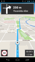
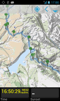
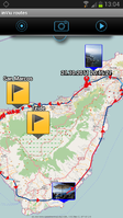
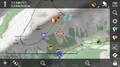
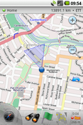
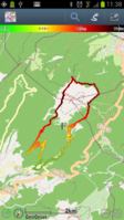
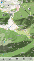
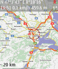
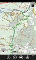
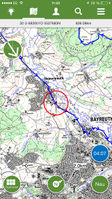
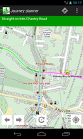
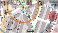
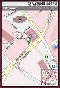
- OSM on Android
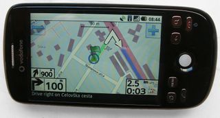
AndNav2 routing on HTC Magic
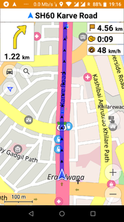
OsmAnd routing
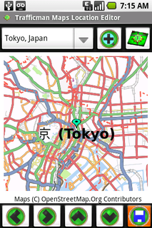
Trafficman Maps 1.0
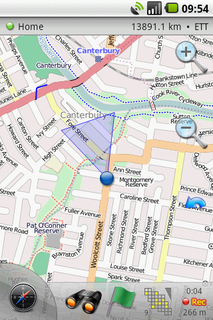
Maverick 1.1.7
Oruxmaps v2.3.4beta with HikeBike Map in Track Logging Mode

VGPS v5.2 is runing on Android

ZANavi ZANavi running on Android


Videos:
- OpenStreetMap, from the Kabul Airport to Jalalabad - Describes OSM in general and using MapDroyd to view maps.
Adaptations Android dans d'autres pages
Assistance aux handicapés
- Talkback, a gratuit Google speech synthesizer is available from the Android Market.
- "Eoui gratuit" - How to make programs accessible for the blind.
- Android accessibility.
Outils de développement
- There are a number of projects on Google Code with both 'android' and 'openstreetmap' tags: Search Google Code.
- Nutiteq maps Lib - Nutiteq Android, (also J2ME and BlackBerry)
- OpenTouchMap is a slippy map with basic gesture-capabilities using TouchMapLight. Also supports displaying your current location using the geolocation api and allows to set permalinks.
Problèmes avec Android
The Internet is obviously full of information regarding solving problems that you may face using Android devices. However, since some issues are especially important for mappers below are some solutions to some of these problems.
Amélioration du fix GPS
Some users have problems with getting a GPS fix on their Android device(s). Some of these fix problems start straight out of box, sometimes they start after using the device for some time.
A discussion on the HOT list provides two solutions to these problems (both solutions seem to have to do with AGPS information):
1) "changing the NTP server in the 'gps.conf' file" on the device [98] with either an app that does it or manually. (Rooting is required for both options.)
2) using an app (GPS Status & Toolbox = gratuit) do download up-to-date AGPS data [99] (download link). (No rooting required.)