File:20210104 152558.jpg
Jump to navigation
Jump to search

Size of this preview: 800 × 600 pixels. Other resolutions: 320 × 240 pixels | 640 × 480 pixels | 1,024 × 768 pixels | 1,280 × 960 pixels | 2,560 × 1,920 pixels | 4,128 × 3,096 pixels.
Original file (4,128 × 3,096 pixels, file size: 5.92 MB, MIME type: image/jpeg)
Summary
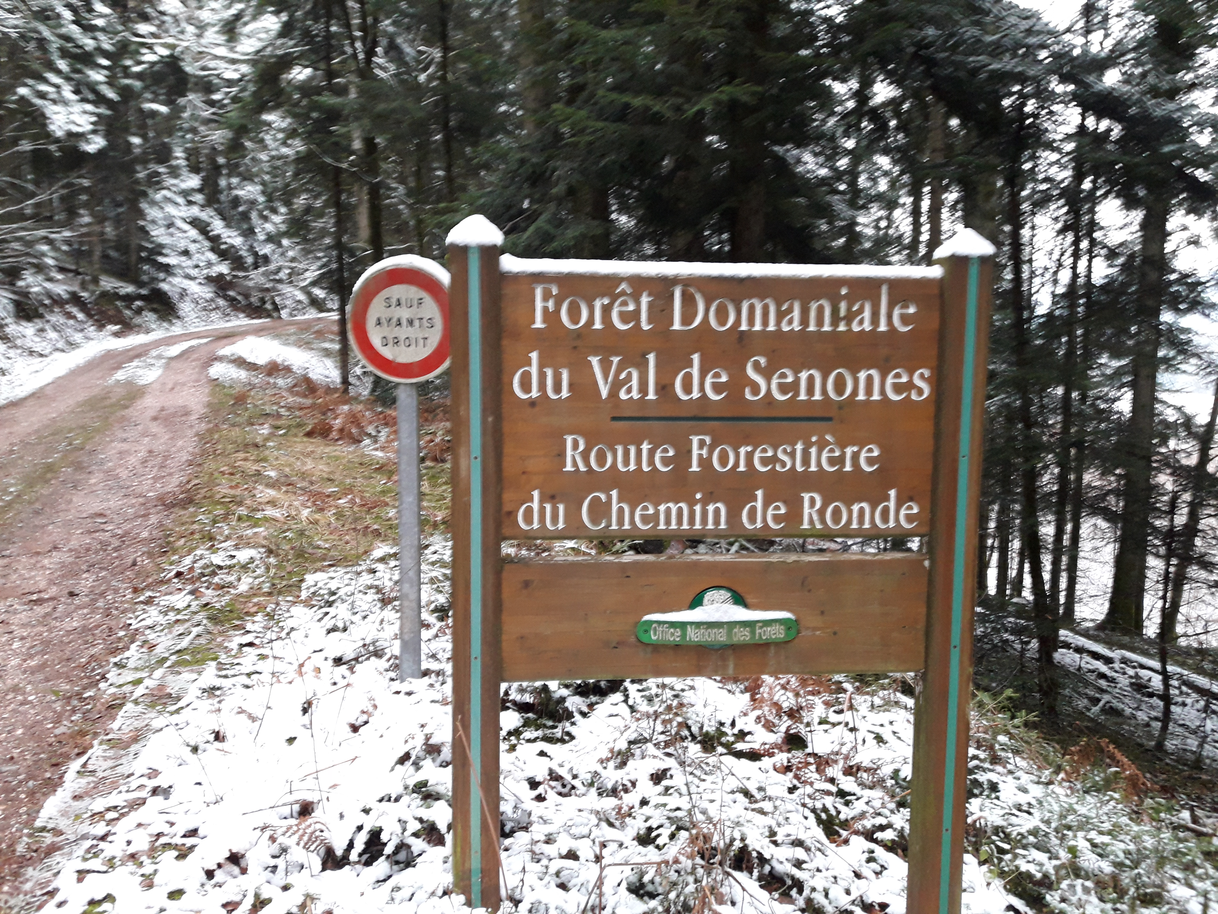
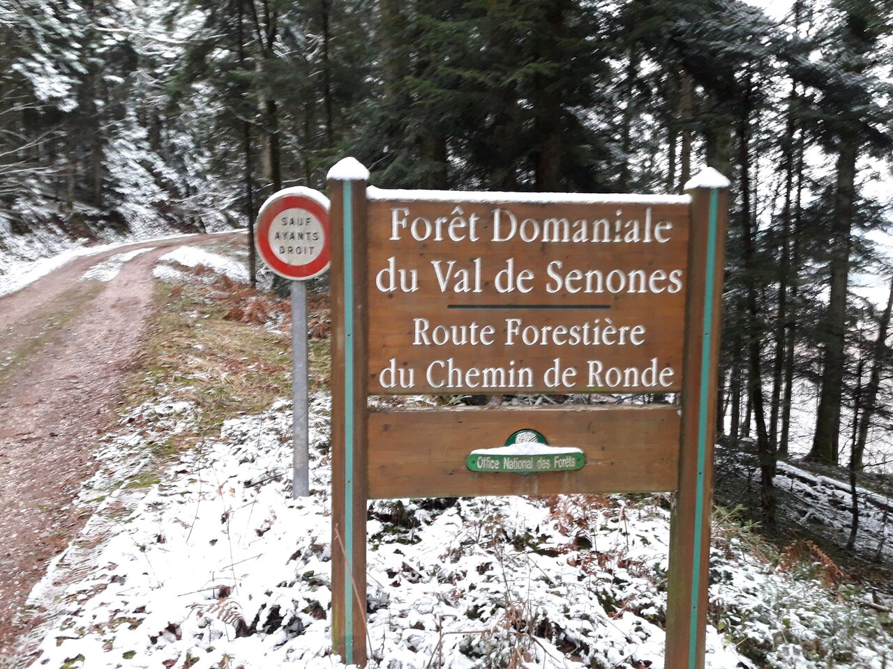
Sign at the boundary of a forêt domaniale; those signs can also give the name of the track, as here.
Licensing
- This media file was uploaded by author of the work and its copyright holder.
![]()
![]()
![]()
This work is licensed under the Creative Commons Attribution-ShareAlike 4.0 License.
Attribution: Penegal
Attribution: Penegal
File history
Click on a date/time to view the file as it appeared at that time.
| Date/Time | Thumbnail | Dimensions | User | Comment | |
|---|---|---|---|---|---|
| current | 06:41, 6 January 2021 | | 4,128 × 3,096 (5.92 MB) | Penegal (talk | contribs) | Sign at the boundary of a ''forêt domaniale''; those signs can also give the name of the track, as here. |
You cannot overwrite this file.
File usage
The following 65 pages use this file:
- Ar:Map Features
- Ast:Map Features
- Az:Map Features
- Bg:Map Features
- Ca:Elements cartogràfics
- Cs:Key:boundary
- Cs:Map Features
- Da:Map Features
- El:Map Features
- Eo:Map Features
- Fa:Map Features
- Fi:Kartan ominaisuudet
- He:Map Features
- Hu:Map Features
- Key:boundary
- Lv:Map Features
- Map features
- Ne:Map Features
- Pl:Key:boundary
- Pt:Map Features
- Ro-md:Map Features
- Ro:Map Features
- Sr:Map Features
- Sv:Map Features
- Tag:boundary=forest
- Tr:Key:boundary
- Uk:Key:boundary
- Uk:Об'єкти мапи
- Zh-hans:Map Features
- Zh-hant:Map Features
- User:Chillly/Simple Map Features
- User:H4ck3rm1k3/OSMKeys
- Wiki:Files used by data items/1
- Template:Ar:Map Features:boundary
- Template:Az:Map Features:boundary
- Template:Ca:Map Features:boundary
- Template:Cs:Map Features:boundary
- Template:DE:Map Features:boundary
- Template:Da:Map Features:boundary
- Template:El:Map Features:boundary
- Template:Eo:Map Features:boundary
- Template:Et:Map Features:boundary
- Template:FR:Map Features:boundary
- Template:Fi:Map Features:boundary
- Template:Generic:ES:Map Features:boundary
- Template:Hu:Map Features:boundary
- Template:IT:Map Features:boundary
- Template:JA:Map Features:boundary
- Template:Map Features:boundary
- Template:NL:Map Features:boundary
- Template:Pl:Map Features:boundary
- Template:Pt:Map Features:boundary
- Template:RU:Map Features:boundary
- Template:Sv:Map Features:boundary
- Template:Uk:Map Features:boundary
- Template:Zh-hant:Map Features:boundary
- DE:Key:boundary
- FR:Éléments cartographiques
- ES:Tag:boundary=forest
- IT:Map Features
- NL:Kaartelementen
- RU:Key:boundary
- JA:Key:boundary
- JA:Map Features
- Proposal:Boundary=forest( compartment) relations (v3)