Climbing

|
| Description |
| Climbing and related features |
| Group |
| Tags |
|
climbing=* , climbing:*=*, sport=climbing |
A set of tags to describe climbing facilities, routes and crags.
Climbing sites
The general location of natural or man made climbing sites can be marked with sport=climbing. This can be applied to ![]() nodes for artificial climbing walls or to
nodes for artificial climbing walls or to ![]() ways in conjunction with natural=cliff or
ways in conjunction with natural=cliff or ![]() areas for climbing halls with building=yes. It can be also applied to boulders attached to bedrock natural=rock and free standing boulders natural=stone.
areas for climbing halls with building=yes. It can be also applied to boulders attached to bedrock natural=rock and free standing boulders natural=stone.
Basic tags
The most important, basic tags to describe a climbing site:
| Tag = Value | Description |
|---|---|
| sport=climbing | Climbing is possible here. |
| name=* | Name of the crag/climbing hall/boulder, if applicable. |
| leisure=sports_centre | Artificial climbing wall. In combination with building=yes or similar it is indoors, otherwise outdoors, for example on a playground. For tower-like structures, man_made=tower and tower:type=climbing can be added. |

Climbing Areas
All of the crags within a climbing area can be grouped into a relation and must be tagged with climbing=area.
To indicate what different climbing styles are part of the site use the Climbing styles tag.
| Key | Value | Element | Comment | Example | Icon |
|---|---|---|---|---|---|
| climbing | area | A region with numerous climbing routes. | |||
| name | * | Name of the area |
Crags
All of the routes within a crag can be grouped into a relation and must be tagged with climbing=crag.
To indicate what different climbing styles are part of the crag use the Climbing styles tag.
| Key | Value | Element | Comment | Example | Icon |
|---|---|---|---|---|---|
| climbing | crag | A small area with climbing routes, often just a small cliff face or a few boulders. | |||
| name | * | Name of the crag |
Boulders
Boulders are small rocks that have "problems" instead of routes. Sometimes they can be climbed with less protection than other areas to practice moves. There are two possibilities to map them:
A freestanding rock with a single "route" could be mapped as eg natural=stone + sport=climbing +
| Key | Value | Element | Comment | Example | Icon |
|---|---|---|---|---|---|
| climbing | boulder | This is a boulder | |||
| name | * | Name of the boulder |
Crags or sites with more routes can be mapped as site or crag in combination with climbing:boulder=yes.
Climbing Routes
Climbing routes can be mapped with a single node marking the bottom of the route, tagged as climbing=route_bottom, or two nodes tagged with climbing=route_bottom and climbing=route_top connected by a way tagged as climbing=route.
Since climbing routes are generally quite vertical, the start and end nodes may be almost on top of each other. The rationale behind allowing two nodes and a connecting way, even though they may be extremely close on the map, is to allow a path connecting to the bottom of the route to be differentiated from a path connecting to the top. As such, if there is no top-access to the route, only a single node, marking the start, is probably preferable - see discussion.
If the climbing route is more or less horizontal or doesn't have a clear top/bottom it may be mapped only with a way or node climbing=route
| Key | Value | Element | Comment | Example | Icon |
|---|---|---|---|---|---|
| name | * | Name of the route. | |||
| climbing | route_bottom | This is the bottom of a climbing route. | |||
| climbing | bolt | This is a point of protection permanently installed in a hole drilled into the rock, to which a metal hanger is attached, with a hole for a carabiner or ring. | |||
| climbing | route_top | This is the top of a climbing route. | |||
| climbing | route | This is the route itself (but see the note above). | |||
| climbing:bolts | <number> | The number of bolts in the route (indicates how much gear you have to take). | |||
| climbing:length | * | The length of the route (in metres). | |||
| climbing:pitches | * | How many pitches make up the route? (Defaults to 1). |
Climbing styles
Tags for multiple climbing styles can be combined and more tags can be invented as needed, the list of wikipedia:Climbing serves as first indication. If any of those tags is not stated explicitly, it defaults to 'no'.
Can be applied to single routes, boulders, crags or general climbing sites.
| Tag | Value | Description |
|---|---|---|
| climbing:boulder=* | yes / no / <Number of routes> | Bouldering is possible. |
| climbing:sport=* | yes / no / <Number of routes> | Sport climbing (relies on permanent, fixed anchors) is possible. |
| climbing:speed=* | yes / no / <Number of routes> | Speed climbing Facility has a Standardized Speed Climbing Wall. |
| climbing:toprope=* | yes / no / <Number of routes> | Top rope climbing (approach at the route top and letting the rope down) is possible. Fixed or natural anchors may be placed at the top, but routes may not have protection for leading. |
| climbing:trad=* | yes / no / <Number of routes> | Traditional climbing (no fixed anchors, gear has to be placed by yourself) is possible. Cannot be expressed by climbing:bolted=no if a climbing site also offers sport climbing. |
| climbing:multipitch=* | yes / no / <Number of routes> | There are multi-pitch routes. |
| climbing:ice=* | yes / no / <Number of routes> | Icefalls or the like enable Ice climbing. In contrast to mixed climbing, no rock climbing is involved here. |
| climbing:mixed=* | yes / no / <Number of routes> | mixed climbing on partially iced rocks is possible. |
| climbing:deepwater=* | yes / no / <Number of routes> | Steep cliffs with deep enough water below permit Deep-Water-Soloing. |
Grading
Can be applied to single routes, boulders, crags or general climbing sites.
When used for crags or regions, we have to specify a difficulty, aid or danger range from easiest to most difficult route. The main character of a climbing area is tagged using mean.
Numerous grading systems exist. Map the usual one(s) for the climbing spot, i.e. commonly used ones - grades in other systems can be derived by conversion. In this tagging scheme, you can use any system by deriving the key from the system's name or acronym similar to the following examples.
| Description | |
|---|---|
| climbing:grade:uiaa=* | grade according to the UIAA grading system, e.g. 1-, 1, 1+, 2-, 2 etc. The UIAA system is the system used by the International Climbing and Mountaineering Federation and should be preferred over other systems. |
| minimum/maximum/average grade according to the UIAA grading system, e.g. 1-, 1, 1+, 2-, 2 etc. | |
| climbing:grade:french=* | grade according to the french grading system, e.g. 4, 5a, 5b etc. Here, we do not distinguish between bouldering (FB) and climbing. |
| minimum/maximum/average grade according to the french grading system, e.g. 4, 5a, 5b etc. Here, we do not distinguish between bouldering (FB) and climbing. | |
| climbing:grade:saxon=* | grade according to the saxon grading system, e.g. VI, VIIa, VIIb etc, predominantly used in the Saxon Switzerland, Germany |
| minimum/maximum/average grade according to the saxon grading system, e.g. VI, VIIa, VIIb etc, predominantly used in the Saxon Switzerland, Germany | |
| ...aid... | A0 to A5 for aid routes (DE: Technisches Klettern) |
| ...hueco... | V-scale used with bouldering in the United States. |
| ...yds_class... | Yosemite Decimal System class |
| ... | ... |
Additional information
Most of this can be applied to single routes, boulders, crags or general climbing sites, for some details climbing routes have more options - see the section about climbing routes.
| Tag | Value | Description |
|---|---|---|
| climbing:bolt=* | abseil / anchor | Is the bolt designed for abseiling / fixed anchors? Abseiling points can also be mapped as separate points to allow easier location. |
| climbing:bolts=* | yes / no / <nr of bolts> | Are there fixed anchors? If so, how many bolts are there? How much gear is needed? |
| climbing:bolted=* | yes / no / <average bolt distance in meters> | Are there fixed anchors? If so, what is their average distance (by default in meter, other units overview)? Provides a first indication how well the routes are secured. |
| climbing:length=* | Average, minimum and maximum length of routes in meters (for other units refer to units overview).
May significantly differ from wall height for roofs or slanted walls. This values is important for deciding, which rope to take. | |
| climbing:orientation=* |
etc. |
Orientation of the rock/wall face. Helps to asses at what hour of the day it might be sunny and how long it takes a wall to get dry after rain. If the cliffs are also tagged, too, this information may be derived but tagging still gives a quicker overview and limits to the climbable parts of cliffs. |
| climbing:quality=* |
etc. |
Quality of the rock/ice. |
| climbing:rock=* |
etc. |
For rock climbing this tag describes the kind of rock available. This information is irrelevant for e.g. ice climbing. |
| climbing:routes=* | Positive integer number | Amount of routes on this crag (if not tagged in the climbing styles). |
| climbing:summit_log=* | yes | The climbing feature has a route / summit log (summit register, de:Gipfelbuch). This tag is clearer in describing the purpose than summit:register=yes. |
| ele=* | When used with the general climbing site average elevation (height above sea level) at the bottom of the routes in meters. This is not the length of a route or the elevation of the route's top end. When used on other nodes specific to the marked point. | |
| indoor=*
outdoor=* |
yes / no | Artificial climbing structures can have routes indoor, outdoor or both. Natural climbs may be placed inside caves. In the absence of this tag, outdoor should be assumed as default. |
| website=* | URL | Official website, e.g. operator |
| url=* | URL | Unofficial website with useful information like topos |
| opening_hours=* |
etc. |
Artificial walls often have fixed opening hours. For rocks there might be restrictions due to breeding birds, etc. |
| fee=* | yes / no / interval | Artificial walls or climbing halls may charge an entrance fee, natural climbing sites may require a membership in a club (may be day based). |
Approach
The tag ![]() path=climbing_access should be used for paths dedicated to access climbing crags, not for general hiking.
path=climbing_access should be used for paths dedicated to access climbing crags, not for general hiking.
Tag approach paths using access=destination within nature reserves etc. where leaving of hiking paths is forbidden [1].
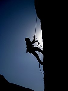
Pictogram Examples

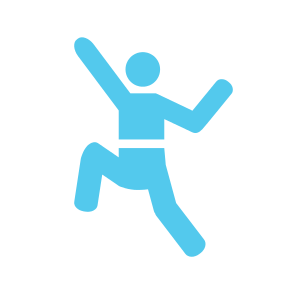
A pictogram for Rock climbing
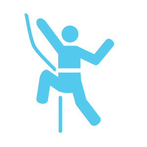
An icon for Rock/Sports climbing and bouldering
An icon for Rock/Sports climbing

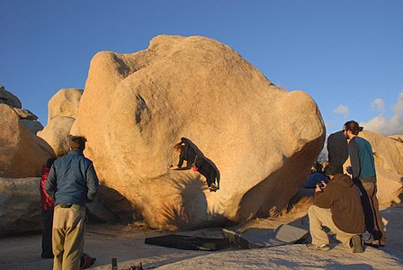
Photo Examples
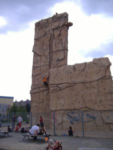
Artificial climb in Berlin, Germany
Boulder Bridge area at Morialta, Australia

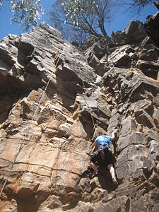
5.10b route on The Sentinel Rock at The Real Hidden Valey, Joshua Tree National Park USA
Kamar Zard Buzhan - Hiker - Nishapur
Climber on Stem Gem a classic V4 boulder problem in Joshua Tree National Park in Hidden Valley Campground

Climbing in Saxon Switzerland

Indoor climbing
- 2014-04-19 Kletterturm Berlin-Spandau.jpg
Climbing tower in Berlin-Spandau


Renderer and applications
Like other specialised sports, these tags are not rendered in the standard OpenCarto style. Therefore, these engines visualise them:
- http://openclimbingmap.bstegmaier.de/#14/48.3943/9.7821 (live data through Overpass-API; only for zoom levels 12 and up)
- http://martinkoeller.github.io/ClimbingMap/example1.html (manually synced data; current data: 11-05-2014; all zoom levels)
- https://openbeta.io (manually synced data as of April-18-2017. Auto-sync Draft proposal)
- https://xyz-relativity.github.io/ClimbTheWorld/ Uses overpass-API to display climbing locations.
- Climb The World an Android app that will display climbing places and routes.
- kletterspots.de uses MapComplete to show a map with climbing spots and allows users to complete the data.
The following renderer displays these tags
Related tags
Map Features
- natural=bare_rock
- natural=cliff
- natural=stone
- natural=scree
- natural=glacier
- highway=path
- sac_scale=*
 path=climbing_access for paths dedicated to access climbing crags, not for general hiking.
- sport=climbing_adventure exists in the wiki and is said to be a special way of organizing climbing in a dedicated man-made facility or built outdoors.
Proposals
Proposed Features where we could share ideas and maybe re-use common tags:
- Proposed features/Climbing source for most of the content on this page
- via ferrata proposal, now with a ferrata relation that may also include climbing sections
- Proposed features/high rope course
- See also the German version of sport=climbing - it contains a JOSM tagging preset and the nucleus of a proposal aiming to map climbing sites like climbing areas, sectors, crags/boulders/... and of course halls
Statistics
The tags are in active use - see https://taginfo.openstreetmap.org/search?q=climbing#keys
pangoSE estimate that, as of September 2018, at least 14000 real world climbing sites exist (estimated from sport=climbing and leisure=climbing) and out of these 10-20% are mapped more detailed with the more detailed keys. climbing=*: