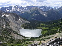
Tag:natural=water
Jump to navigation
Jump to search
| Description |
|---|
| Any inland body of water, from natural such as a lake or pond to artificial like a moat or canal. |
| Rendering in OSM Carto |

|
| Group: natural |
| Used on these elements |
| Useful combination |
|
| See also |
| Status: approved |
| Tools for this tag |
|
Used to map all inland bodies of water, both naturally occurring & man made.
How to use
Draw a closed way creating an area, and tag it with natural=water. If the area contains islands or is too big to map with a single way, create a relation:multipolygon .
It is acceptable, but undesirable, to map this feature with a single node, if its extents aren't known.
natural=water is a parent tag to generally describe inland areas of water. It works as a stand alone tag, but if the type/usage of the water body is known it's preferable to specify it by additionally adding water=*.
For details on how to map specific features refer to the list in water=* and then select the required feature.
Water features not using the natural=* tag
- natural=coastline - For the sea (ocean), including marginal areas such as tidal channels, bays, lagoons and estuaries.
- natural=wetland - A land area that is saturated with water, either permanently or seasonally.
- landuse=salt_pond - For salt evaporation ponds.
- leisure=swimming_pool - For open-air, man-made swimming pools.
See also
- Key:waterway - To map the linear flow of water, such as rivers, canals, streams, using a way.
- JOSM plugin scanaerial works like OCR for water. You need 1 click per lake.
Possible tagging mistakes
| ||||||||||||||||||||||||||||||||
