User:Heddam/Indoor Mapping
This is the user sandbox of Heddam. A user sandbox is a subpage of the user's user page. It serves as a testing spot and page development space for the user and is not an OpenStreetMap article.
Software/projects
for indoor activities outside OpenStreetMap, see Indoor/Projects
| Screenshot | Indoor mapping tool | Description | Developer | Licence | Release date | Latest version | Latest version date | Website |
|---|---|---|---|---|---|---|---|---|

|
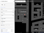
OsmInEdit | A simple web indoor editor, focused on making things easier (floor plan management, dedicated editing modes) | Adrien Pavie | ISC | 2019-09-19 | v1.0.0 | website | |

|
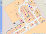
OpenLevelUp | A web viewer display indoor data level by level, written in JavaScript, supports both indoor=* and buildingpart=* tag schemes.
|
Adrien Pavie | AGPL 3 | 2015-02-18 | v3.0 alpha | website source code | |

|
indoor= | a map that display indoor data from OpenStreetMap | François de Metz | BSD | 2020-07-29 | 0.1.1 | website | |

|
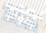
OpenStationMap | for (Railway) Stations including the indoors with the Simple Indoor Tagging, but also extensions, e.g. for doors and for stairwells (steps). Example stations are Berlin Hauptbahnhof, Sydney Central or Tokyo Ueno JR Station. | Roland Wagner, Roland Olbricht | ? | ? | ? | website | |
| A personal assisted navigation to disabled people within the Polytechnic of Bari facilities of the university campus. | Eugenio Di Sciascio, Emilia Conte, Michele Ruta, Saverio Ieva | ? | ? | ? | website map | |||
| Mapbox GL Indoor Plugin | A mapboxgl-js plugin to enable multi-floors maps | MIT | 2020-05-08 (pre-release) | 0.0.4-rc1 | 2020-05-27 (pre-release) | source code | ||

|
Open Indoor | Clement.igonet | MIT | 2020-07-04 | website demo | |||
| indrz | Open Source backend (Django python web framework) to manage indoor data for buildings, rooms spaces | 2016-01-12 (v. 1.0) | 2018-06-15 (latest change in master branch) | source code website | ||||
| FootPath | infrastructureless indoor navigation on OSM data for smart Android) | Aachen University, COMSYS, RWTH | GPL-3.0 | 2010-2011 [licence] | 2011-07-23 (last change on github) | YouTube | ||
| Ways4All | Barrier-free travel for everyone - support for people with special needs in public transport | |||||||
| OSMTools Indoor | 2012 [licence] | website [ dead link ] | ||||||
| OpenStreetMap Indoor Mapping browser | Fork of OSMTools Indoor, fully functional indoor building browser, js only. | 2012-2014 [licence] | source code demo | |||||

|
ID-indoor | A web indoor editor based on iD, with indoor dedicated features (level filtering, specific map and presets). | Adrien Pavie | ISC | ? | ? | website | |
| Leadme | a software & hardware project to create indoor maps without the availability of GPS signals, in the style of OpenStreetMap | Richard Atterer | website | |||||
| Termite | an editor specialized for indoor maps. This has been . | |||||||
| Indoor Webapp | Levelable indoor maps from OSM data implemented with Kothic JS | website [ dead link ] YouTube | ||||||
| OpenCaveMap | It's caving mapping and all other underground places | website [ dead link ] | ||||||
| Indoor Navigation Market spreadsheet | A list of resources for indoor mapping and positioning | Nick Such | 2013-09 | Google Sheets | ||||
| BuildingLayer | indoor mapping startup | Nick Such | 2011 | 2014-11 | website |
Use cases
Indoor maps or information can be used for various applications, e.g.
- Indoor Navigation/Routing
- 3D Visualization
- 2D Maps
- Public Participation
- Emergency response
- Interested Amenities Display (e.g. Toilets, Fire Extinguisher, First Aid Box)
for different venues, e.g.
- Airports
- Hospitals
- Hotels
- Universities
- Schools
- Museums
- Train and subway stations
- Shopping Malls
- multi storey parking decks
- other public buildings
The indoor/use cases page contains a list of venue use case examples, with sample maps from the venues.
Communication
There is now a new subforum for Indoor-Mapping:
Let's try to increase the communication in this project. --Andi 12:03, 3 October 2012 (BST)
There is an API proposal you can implement on your backend to ensure other apps can link to your indoor navigation app.
Talks
- State of the Map 2016
- FOSSGIS 2012: http://www.fossgis.de/konferenz/2012/programm/events/468.de.html
Tagging
For the current consensus see Simple Indoor Tagging. The tags below may be outdated or no longer used.
Tags in use
Please see Tagging above for more detailed information
level=n- indicates floor level; interpretation of the values varies (see key page)- <n> is usually an integer number, sometimes also one or two characters, sometimes combined (e.g. A,B,C,1,2,3).
- in any case, <n> should be ascending (towards the sky).
- in some cultures base level is indicated by level 0, in other cultures ground floor is level 1 (or A).
- there are also usages reported where fraction numbers are used (e.g. level=2.5) indicating a "mezzanine" or "intermediate level" (e.g. intermediate stairway platforms).
room=yes- see key wiki page for additional values to describe the type more detailed. Room numberref=*and room namename=*are tagged as appropriate.entrance=yes- building entrancedoor=yes/hinged/sliding/no- interior doorwayscapacity=*- the occupant capacity of a room, storey, building or part of a building defined as the maximum number of persons it is designed to holdhighway=elevator- elevatorshighway=steps- stairwaysconveying=yes/forward/backward/reversible- escalators
indoormark=beacon- Bluetooth, NFC, or QR beacon for indoor positioning.
Proposed Tags
indoor=yes- Indicates any osm object being inside a room, a building (or both) or a shelter.highway=corridor- Indoor ways, under some previous indoor tagging schemes, and as of 2019 a de facto standard. Another de facto standard for mapping interior routes ishighway=footway+indoor=yes.
Discontinued
- AddICT Compound facility (CompoundFacility)
- Saerdnaer Indoor Proposal (Proposed features/indoor), Rendering (modified Kothic JS), Routing (modified OSRM, JavaScript UI with Leaflet)
- Gomar1985 Indoor Proposal (IndoorOSM), Rendering of multi-level building maps in 2D (http://indoorosm.uni-hd.de/) and 3D, Indoor Routing/Navigation (http://indoorosm.uni-hd.de/)
- andreas.balzer Extension and aggregation of indoor proposals, see andreas.balzer, Rendering (own render engine in C#, yet to be published), Routing (modified OsmSharp)
- IndoorOSM from University of Heidelberg (same as gomar above)
here are also some abandoned and inactive proposals (oldest last):
- IndoorOSM
- Proposed_features/indoor
- Termite#Indoor_Model
- CompoundFacility
- Relations/Proposed/Level_Map
- Relations/Proposed/Level
Taging proposals more concerned with the 3D shape of the building
Rendering
An Overpass API based renderer is available : OpenLevelUp
Routing
- The altitude value of GPS devices could be used to identify in which level of a parking multi storey a car is located.
Devices / Technologies
- High sensitivity GPS device
- Step counter
- Compass
- Acceleration sensor
- Counting the number of wheel turns in cars / Tachometer
- Counting the number of floor tiles
- RFID
- WLAN
- Bluetooth
- Camera
- Audio footprint for rooms
- Laser rangefinder (e.g. Hector SLAM [1])
Challenges
There is a discussion of challenges of adding indoor maps to OSM at Challenges for Indoor Maps.