File:Greenfields - geograph.org.uk - 1202824.jpg
Jump to navigation
Jump to search


No higher resolution available.
Greenfields_-_geograph.org.uk_-_1202824.jpg (640 × 480 pixels, file size: 85 KB, MIME type: image/jpeg)
This file and its description are from Wikimedia Commons.
Summary
| Description |
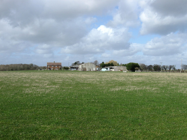
English: Greenfields Farm located on a small hillock north of Steyning. Viewed from the former trackbed of the Shoreham-Horsham railway. |
| Date | |
| Source | From geograph.org.uk |
| Author | Simon Carey |
| Attribution (required by the license) | Simon Carey / Greenfields / |
| Camera location | | View this and other nearby images on: OpenStreetMap |
|---|
_heading:337.00&language=en)
| Object location | | View this and other nearby images on: OpenStreetMap |
|---|
_heading:337.00&language=en)
Licensing

|
This image was taken from the Geograph project collection. See this photograph's page on the Geograph website for the photographer's contact details. The copyright on this image is owned by Simon Carey and is licensed for reuse under the Creative Commons Attribution-ShareAlike 2.0 license.
|
This file is licensed under the Creative Commons Attribution-Share Alike 2.0 Generic license.
Attribution: Simon Carey
- You are free:
- to share – to copy, distribute and transmit the work
- to remix – to adapt the work
- Under the following conditions:
- attribution – You must give appropriate credit, provide a link to the license, and indicate if changes were made. You may do so in any reasonable manner, but not in any way that suggests the licensor endorses you or your use.
- share alike – If you remix, transform, or build upon the material, you must distribute your contributions under the same or compatible license as the original.
File history
Click on a date/time to view the file as it appeared at that time.
| Date/Time | Thumbnail | Dimensions | User | Comment | |
|---|---|---|---|---|---|
| current | 03:33, 26 February 2011 | | 640 × 480 (85 KB) | wikimediacommons>GeographBot | == {{int:filedesc}} == {{Information |description={{en|1=Greenfields Farm located on a small hillock north of Steyning. Viewed from the former trackbed of the Shoreham-Horsham railway.}} |date=2009-03-08 |source=From [http://www.geograph.org.uk/photo/1202 |
File usage
The following 88 pages use this file:
- Ar:Map Features
- Ast:Map Features
- Az:Map Features
- Bg:Map Features
- Bs:Map Features
- Cs:Key:landuse
- Cs:Map Features
- Cs:Tag:landuse=greenfield
- Da:Map Features
- El:Map Features
- Eo:Map Features
- Fa:Map Features
- Fi:Kartan ominaisuudet
- He:Map Features
- Hr:Map Features
- Hu:Key:landuse
- Hu:Map Features
- Key:landuse
- Ko:Key:landuse
- Ko:지도 지물
- Lt:Map Features
- Lv:Map Features
- Map features
- Ne:Map Features
- Pl:Key:landuse
- Pl:Tag:landuse=greenfield
- Projet Garrigue
- Pt:Key:landuse
- Pt:Map Features
- Pt:Tag:landuse=greenfield
- Ro-md:Map Features
- Ro:Map Features
- Sr:Map Features
- Sv:Map Features
- Tag:landuse=greenfield
- Uk:Key:landuse
- Uk:Tag:landuse=greenfield
- Uk:Об'єкти мапи
- WikiProject SUD/foncier eco
- Zh-hans:Key:landuse
- Zh-hans:Map Features
- Zh-hans:Tag:landuse=greenfield
- Zh-hant:Map Features
- User:Chillly/Simple Map Features
- User:H4ck3rm1k3/OSMKeys
- Wiki:Files used by data items/2
- Template:Ar:Map Features:landuse
- Template:Az:Map Features:landuse
- Template:Bs:Map Features:landuse
- Template:Ca:Map Features:landuse
- Template:Cs:Map Features:landuse
- Template:DE:Map Features:landuse
- Template:Da:Map Features:landuse
- Template:El:Map Features:landuse
- Template:Eo:Map Features:landuse
- Template:Et:Map Features:landuse
- Template:FR:Map Features:landuse
- Template:Fi:Map Features:landuse
- Template:Generic:ES:Map Features:landuse
- Template:Hr:Map Features:landuse
- Template:Hu:Map Features:landuse
- Template:IT:Map Features:landuse
- Template:JA:Map Features:landuse
- Template:Ko:Map Features:landuse
- Template:Map Features:landuse
- Template:Map Features:landuse/doc
- Template:NL:Map Features:landuse
- Template:Pl:Map Features:landuse
- Template:Pt:Map Features:landuse
- Template:RU:Map Features:landuse
- Template:Uk:Map Features:landuse
- Template:Zh-hans:Map Features:landuse
- Template:Zh-hant:Map Features:landuse
- DE:Key:landuse
- DE:Map Features
- DE:Tag:landuse=greenfield
- FR:Key:landuse
- FR:Éléments cartographiques
- ES:Tag:landuse=greenfield
- IT:Key:landuse
- IT:Map Features
- NL:Kaartelementen
- NL:Key:landuse
- RU:Key:landuse
- RU:Tag:landuse=greenfield
- JA:Key:landuse
- JA:Map Features
- JA:Tag:landuse=greenfield