Hr:Map Features
OpenStreetMap nema strogo definirana pravila po kojima se opisuju Točke ![]() , Putevi
, Putevi ![]() ili Relacije
ili Relacije ![]() ). Možete koristi bilo koji tag/oznaku, ali samo ako se vrijednost može provjeriti. Međutim, preporuka je da se koriste opće prihvaćeni tagovi kako bi prikaz karte bio unificiran, tj. podjednak za sve zemlje. Na ovoj stranici predstavljamo preporuke na koji način iscrtavati i opisivati objekte (Features) na OSM karti.
). Možete koristi bilo koji tag/oznaku, ali samo ako se vrijednost može provjeriti. Međutim, preporuka je da se koriste opće prihvaćeni tagovi kako bi prikaz karte bio unificiran, tj. podjednak za sve zemlje. Na ovoj stranici predstavljamo preporuke na koji način iscrtavati i opisivati objekte (Features) na OSM karti.
Ukoliko u preporukama niste pronašli odgovarajući tag za objekt koji želite postaviti na kartu ili želite grupirati puteve ili točke u komponentu većeg nivoa, pogledajte Relations. Obratite se i zajednici Wiki projekt Croatia ili posjetite stranicu Proposed features na kojoj možete saznati više kako osnovati novi objekt ili tag.
- Ukoliko želite saznati više o vrstama objekata točka/put/polja, pogledajte Elements.
- Neki objekti na karti dodatno su pojašnjeni, pogledajte Feature Index.
- Ukoliko želite predložiti novu ikonu za objekt, pogledajte Proposed Icons.
- Popis objekata koji su prije bili u upotrebi (valjani), a sada više nisu, pogledajte Deprecated features.
- Za opća pravila uređivanja i smjernice, pogledajte Editing Standards and Conventions.
Opaska oko renderiranja:
- Korištenjem ovih oznaka (tagova) znači da će vaš trud editiranja vjerojatnije prikazati u različitim rendererima. Ali, to nije garancija da će tag koji je izlistan ovdje biti renderiran (neće ga biti na karti - vidljivo) s nekim rendererom na glavnoj karti. Za specifične informacije kako osigurati da se simboli rendaju u Mapnik i Osmarender pločicama (tiles), pogledajte Symbol Rendering.
- Također moguće je da će se na glavnoj karti renderirati tagovi koji nisu izlistani ovdje. Ova lista se ne ažurira sa tagovima implementiranim u renderere.
- Kolona 'Rendering' u ovim tablicama je samo primjer kako izgleda pojedini tag kada se renderira. To ne diktira kako ju rendereri mogu izrenderirati.
Tablice su grupirane po temama, prvo sa najčešće korištenim.
Fizičke značajke
Highway
Highway tag se primarno koristi za ceste. Najčešće je to i jedini tag. Pogledajte Highway tag usage i Road za upute.
| Key | Vrijednost | Element | Komentar | Rendering | Fotografija | |
|---|---|---|---|---|---|---|
Ceste | ||||||
|
This group lists the 7 main tags for the road network, from most to least functionally important for motor vehicle traffic. | ||||||
| highway | motorway | Za označavanje autoceste u Hrvatskoj - A1, A2, A3 itd...Cesta s ograničenim pristupom (nema bicikala, sporih vozila), s 2 ili više traka plus 1 zaustavnom trakom. Ekvivalentno američkom Freeway, njemačkom Autobahn, itd.. |  |
|||
| highway | trunk | The most important roads in a country's system that aren't motorways. (Need not necessarily be a divided highway.) |  |
|||
| highway | primary | Prema klasifikaciji u Hrvatskoj sve državne ceste. Brzim cestama i cestama namijenjenim za promet samo motornih vozila dodati motorroad=yes.
|
 |
|||
| highway | secondary | Prema klasifikaciji u Hrvatskoj sve županijske ceste. |  |
|||
| highway | tertiary | Prema klasifikaciji u Hrvatskoj sve lokalne ceste. |  |
|||
| highway | unclassified | Nerazvrstane ceste - nema administrativne klasifikacije. Unclassified ceste su obično najniži oblik mreže cesta. Obično uske ceste, da se ne mogu normalno mimoići 2 automobila. Opaska: Ovo nije oznaka za ceste gdje se još treba utvrditi highway tag (pogledaj highway=road za ceste koje trebaju dobiti klasifikaciju).
|
 |
|||
| highway | residential | Ceste tj. ulice koje su unutar i oko naselja, nisu klasificirane niti nerazvrstane (unclassified)... |  |
|||
Link roads | ||||||
| highway | motorway_link | Spojne ceste (rampe ili izlazi) koji vode na i sa autoceste ili nai sa drugog autoceste sa istim restrikcijama kao i autoput. |  |
 | ||
| highway | trunk_link | The link roads (sliproads/ramps) leading to/from a trunk road from/to a trunk road or lower class highway. |  |
 | ||
| highway | primary_link | Spojne ceste (rampe ili izlazi) koji vode na i sa državne ceste ili na i sa druge ceste. |  |
 | ||
| highway | secondary_link | Spojne ceste (rampe ili izlazi) koji vode na i sa sekundarne ceste ili na i sa druge ceste. |  |
 | ||
| highway | tertiary_link | The link roads (sliproads/ramps) leading to/from a tertiary road from/to a tertiary road or lower class highway. |  |
|||
Special road types | ||||||
| highway | living_street | Ulica gjde pješaci imaju prednost nad automobilima, gjde se djeca igraju na ulici, maksimalna brzina je mala. U Hrvatskoj ih zovemo »područje smirenog prometa«, koje označuje mjesto u naselju na kojem se ulazi u područje u kojem se ne smije voziti brže od brzine hoda pješaka jer je dječja igra svugdje dopuštena. |  |
 | ||
| highway | service | Općenito cesta za pristup zgradama, servisnim stanicama, plažama, kampovima, industrijskim pogonima, poslovnim zonama, itd.. Također se koristi i za pristup parkingu i odvozu otpada. koristi se sa service=*, npr. service=parking_aisle kako bi označili put unutar parkingaamenity=parking.
|
 |
 | ||
| highway | pedestrian | Ceste - šetališta koje su uglavnom/isključivo za pješake. Za označavanje pješačkih zona, trgova i sl.(u tom slučaju, dodajte area=yes.
|
 |
 | ||
| highway | track | Ceste za poljoprivredne svrhe (kameni put,makadam,kaldrme,lenije), šljunčane ceste u šumi, itd.; obično neasfaltirane ceste. Za više pogledaj Hr:Key:tracktype. |  |
|||
| highway | bus_guideway | A busway where the vehicle guided by the way (though not a railway) and is not suitable for other traffic. Please note: this is not a normal bus lane, use access=no, psv=yes instead! If the buses are not guided, consider highway=busway.
|
 |
 | ||
| highway | escape | For runaway truck ramps, runaway truck lanes, emergency escape ramps, or truck arrester beds. It enables vehicles with braking failure to safely stop. |  | |||
| highway | raceway | A course or track for (motor) racing |  |
 | ||
| highway | road | Cesta za koju ne znamo klasifikaciju. Ovo je privremena oznaka za ceste dok se pravilo ne istraže. Kada su istražene, treba ažurirati pripadajuću klasifikaciju. |  |
 | ||
| highway | busway | A dedicated roadway for bus rapid transit systems |  | |||
Staze | ||||||
| highway | footway | Pješačke staze koje su uglavnom/isključivo za pješake. Ovo uključuje šetnice i šljunčane staze. Ako je dozvoljeno biciklima, možete dodati oznaku bicycle=yes. Ne bi trebali koristiti za staze gdje se nezna primarna namjena.
|
 |
 | ||
| highway | bridleway | Za konje, pješake i bicikliste. Ekvivalentno oznakama highway=path + horse=designated.
|
 |
 | ||
| highway | steps | Za stepenice na pješačkim stazama. Koristite sa step_count=* kako bi označli broj stepenica.
|
 |
 | ||
| highway | corridor | For a hallway inside of a building. |  | |||
| highway | path | Staza koja nije specifična i koristi se pješke, biciklom, konjem itd. |  |
 | ||
| highway | via_ferrata | A via ferrata is a route equipped with fixed cables, stemples, ladders, and bridges in order to increase ease and security for climbers. These via ferrata require equipment : climbing harness, shock absorber and two short lengths of rope, but do not require a long rope as for climbing. |  | |||
When sidewalk/crosswalk is tagged as a separate way | ||||||
| footway | sidewalk | Sidewalk that runs typically along residential road. Use in combination with highway=footway or highway=path
|
 |
 | ||
| footway | crossing | Pješački prelazi,npr. zebra (vidi i crossing=). |  |
 | ||
| footway | traffic_island | The way between two crossings, safespot for pedestrians, has micromapping characteristics as a detailed alternative to =*. Use in combination with highway=footway or highway=path.
|
 |
|||
When sidewalk (or pavement) is tagged on the main roadway (see Sidewalks) | ||||||
| sidewalk | both | left | right | no | Specifies that the highways has sidewalks on both sides, on one side or no sidewalk at all |  | |||
When cycleway is drawn as its own way (see Bicycle) | ||||||
| highway | cycleway | For designated cycleways. Add foot=*, though it may be avoided if default-access-restrictions do apply.
|
 |
 | ||
Cycleway tagged on the main roadway or lane (see Bicycle) | ||||||
| cycleway | lane | A lane is a route that lies within the roadway |  | |||
| cycleway | Deprecated variant for ways with oneway=yes where it is legally permitted to cycle in both directions. Replaced by oneway:bicycle=no.
|
 | ||||
| cycleway | Deprecated variant for ways with oneway=yes that have a cycling lane going the opposite direction of normal traffic flow (a "contraflow" lane). Replaced by oneway:bicycle=no + cycleway:left=lane/cycleway:right=lane + cycleway:left:oneway=-1/cycleway:right:oneway=-1.
|
 | ||||
| cycleway | track | A track provides a route that is separated from traffic. In the United States, this term is often used to refer to bike lanes that are separated from lanes for cars by pavement buffers, bollards, parking lanes, and curbs. Note that a cycle track may alternatively be drawn as a separate way next to the road which is tagged as highway=cycleway.
|
 | |||
| cycleway | Deprecated variant for ways with oneway=yes that have a cycling track going the opposite direction of normal traffic flow. Replaced by oneway:bicycle=no + cycleway:left=track/cycleway:right=track + cycleway:left:oneway=-1/cycleway:right:oneway=-1.
|
 | ||||
| cycleway | share_busway | There is a bus lane that cyclists are permitted to use. |  | |||
| cycleway | Deprecated variant for ways with oneway=yes that have a bus lane that cyclists are also permitted to use, and which go in the opposite direction to normal traffic flow (a "contraflow" bus lane). Replaced by oneway:bicycle=no + cycleway:left=share_busway/cycleway:right=share_busway + cycleway:left:oneway=-1/cycleway:right:oneway=-1.
|
 | ||||
| cycleway | shared_lane | Cyclists share a lane with motor vehicles, there are markings reminding about this. In some places these markings are known as "sharrows" ('sharing arrows') and this is the tag to use for those. |  | |||
Busways tagged on the main roadway or lane (see Bus lanes) | ||||||
| lane | Deprecated variant to tag bus lanes. Replaced by bus/psv lane tagging lanes:bus=* / lanes:psv=*) / bus:lanes=* / psv:lanes=*
|
 | ||||
| opposite | Deprecated variant for ways with oneway=yes where buses are legally permitted to travel in both directions. Replaced by oneway:bus=no
|
|||||
| opposite_lane | Deprecated variant for ways with oneway=yes that have a bus lane which go in the opposite direction to normal traffic flow (a "contraflow" bus lane). Replaced by oneway:bus=no and lanes:bus=* / lanes:psv=*) / bus:lanes=* / psv:lanes=*
|
|||||
Street parking tagged on the main roadway (see Street parking) | ||||||
parking:left / :right / :both(hereafter: parking:side) |
lane | street_side | on_kerb | half_on_kerb | shoulder | no | separate | yes | Primary key to record parking along the street. Describes the parking position of parked vehicles in the street. |  | |||
parking:sideorientation=*
|
parallel | diagonal | perpendicular | To specify the orientation of parked vehicles if there is street parking. | ||||
Lifecycle (see also lifecycle prefixes) | ||||||
| highway | proposed | For planned roads, use with proposed=* and a value of the proposed highway value.
|
||||
| highway | construction | Ceste u izgradnji/rekonstrukciji označite sa construction=*.
|
 |
 | ||
Attributes | ||||||
| abutters | commercial | industrial | mixed | residential | retail etc. | See Key:abutters for more details. |  | |||
| bicycle_road | yes | A bicycle road is a road designated for bicycles. If residential streets get the status of bicycle roads, normally, by special signs, motor traffic is admitted with limited speed, often only for residents. |  | |||
| bus_bay | both | left | right | A bus bay outside the main carriageway for boarding/alighting |  | |||
| change | yes | no | not_right | not_left | only_right | only_left | Specify the allowed/forbidden lane changes |  | |||
| destination | <place name of destination> | Destination when following a linear feature |  | |||
| embankment | yes | dyke | A dyke or a raised bank to carry a road, railway, or canal across a low-lying or wet area. |  | |||
| embedded_rails | yes | <type of railway> | A highway on which non-railway traffic is also allowed has railway tracks embedded in it but the rails are mapped as separate ways. |  | |||
| ford | yes | Cesta se križa s potokom ili rijekom, vozila moraju ući u vodu! |  | |||
| frontage_road | yes | A frontage road. | ||||
| ice_road | yes | A highway is laid upon frozen water basin, definitely doesn't exist in summer. |  | |||
| incline | Number % | ° | up | down | Incline steepness as percents ("5%") or degrees ("20°"). Positive/negative values indicate movement upward/downwards in the direction of the way. |  | |||
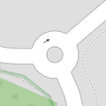
| junction | roundabout | Ova oznaka automatski podrazumjeva oneway=yes, jednosmjerna cesta je definirana slijedom složenih točaka u smjeru u kojem cesta ide. Ova oznaka se koristi na pu, koji je već označen sahighway=*.
|
 |
 | ||
| lanes | <number> | The number of traffic lanes for general purpose traffic, also for buses and other specific classes of vehicle. |  | |||
| lane_markings | yes | no | Specifies if a highway has painted markings to indicate the position of the lanes. |  | |||
| lit | yes | no | Street lighting |  | |||
| maxspeed | <number> | Specifies the maximum legal speed limit on a road, railway or waterway. |  | |||
| motorroad | yes | no | The motorroad tag is used to describe highways that have motorway-like access restrictions but that are not a motorway. |  | |||
| mountain_pass | yes | The highest point of a mountain pass. |  | |||
| mtb:scale | 0-6 | Applies to highway=path and highway=track. A classification scheme for mtb trails (few inclination and downhill).
|
 | |||
| mtb:scale:uphill | 0-5 | A classification scheme for mtb trails for going uphill if there is significant inclination. |  | |||
| mtb:scale:imba | 0-4 | The IMBA Trail Difficulty Rating System shall be used for bikeparks. It is adapted to mtb trails with artificial obstacles. | ||||
| mtb:description | Text | Applies to highway=path and highway=track. A key to input variable infos related to mtbiking on a way with human words
|
||||
| oneway | yes | no | reversible | Oneway streets are streets where you are only allowed to drive in one direction. |  | |||
| oneway:bicycle | yes | no | | Used on ways with oneway=yes where it is legally permitted to cycle in both directions.
|
 | |||
| overtaking | yes | no | caution | both | forward | backward | Specifying sections of roads where overtaking is legally forbidden. Use overtaking:forward=yes/no/caution and overtaking:backward=yes/no/caution when it depends on driving direction.
|
 | |||
| parallel | diagonal | perpendicular | marked | no_parking | no_stopping | fire_lane. | Deprecated variant to map parking along streets. See section on street parking above or the street parking page for more details. | |||||
| free | ticket | disc | residents | customers | private | Deprecated variant to map parking conditions along streets. See section on street parking above or the street parking page for more details. |  | ||||
| passing_places | yes | Put koji ima česta mjesta za prolaz. |  | |||
| priority | forward | backward | Traffic priority for narrow parts of roads, e.g. narrow bridges. |  | |||
| priority_road | designated | yes_unposted | end | Specifying roads signposted as priority roads. |  | |||
| sac_scale | strolling | hiking | mountain_hiking | demanding_mountain_hiking | alpine_hiking | demanding_alpine_hiking | difficult_alpine_hiking | Applies to highway=path and highway=footway. A classification scheme for hiking trails.
|
 | |||
| service | alley | driveway | parking_aisle etc. | Servisna cesta koja se obično nalazi između posjeda za pristup komunalijama. koristiti s highway=service.
|
 | |||
| shoulder | no | yes | right | both | left | Presence of shoulder in highway |  | |||
| side_road | yes | A side road. | ||||
| smoothness | excellent | good | intermediate | bad | very_bad | horrible | very_horrible | impassable | Specifies the physical usability of a way for wheeled vehicles due to surface regularity/flatness. See Key:smoothness for more details. |  | |||
| surface | paved | unpaved | asphalt | concrete | paving_stones | sett | cobblestone | metal | wood | compacted | fine_gravel | gravel | pebblestone | plastic | grass_paver | grass | dirt | earth | mud | sand | ground | See Key:surface for more details. |  | |||
| tactile_paving | yes | no | A paving in the ground to be followed with a blindman's stick. |  | |||
| tracktype | grade1 | grade2 | grade3 | grade4 | grade5 | To describe the quality of the surface. See Key:tracktype for more information. | 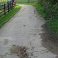 | |||
| traffic_calming | bump | hump | table | island | cushion | yes | etc. | Za označavanje objekata koji su napravljeni kako bi usporili promet u naseljima. |  | |||
| trail_visibility | excellent | good | intermediate | bad | horrible | no | Applies to highway=path, highway=footway, highway=cycleway and highway=bridleway. A classification for hiking trails visibility
|
 | |||
| trailblazed | yes | no | poles | cairns | symbols | Applies to highway=*. Describing trail blazing and marking. See Key:trailblazed for more information.
|
 | |||
| trailblazed:visibility | excellent | good | intermediate | bad | horrible | no | Applies to trailblazed=*. A classification for visibility of trailblazing. See Key:trailblazed:visibility for more information.
|
||||
| turn | left | slight_left | through | right | slight_right | merge_to_left | merge_to_right | reverse | The key turn can be used to specify the direction in which a way or a lane will lead. |  | |||
| width | <number> | The width of a feature. |  | |||
| winter_road | yes | A highway functions during winter, probably can't be driven in summer. |  | |||
Other features | ||||||
| highway | bus_stop | Autobusno stajalište. Veće stanice treba označiti oznakom amenity=bus_station.
|
 | |||
| highway | crossing | A.k.a. crosswalk. Pedestrians can cross a street here; e.g., zebra crossing |  | |||
| highway | cyclist_waiting_aid | Street furniture for cyclists that are intended to make waiting at esp. traffic lights more comfortable. |  | |||
| highway | elevator | An elevator or lift, used to travel vertically, providing passenger and freight access between pathways at different floor levels. |  | |||
| highway | emergency_bay | An area beside a highway where you can safely stop your car in case of breakdown or emergency. |  | |||
| highway | emergency_access_point | Sign number which can be used to define your current position in case of an emergency. Use with ref=NUMBER_ON_THE_SIGN. See also emergency=access_point
|
 | |||
| highway | give_way | A "give way," or "Yield" sign |  | |||
| emergency | phone | A calling device can be used to tell on your current position in case of an emergency. Use with ref=NUMBER_ON_THE_SIGN
|
 | |||
| highway | hitchhiking | Like a bus_stop but for free, uncertain, spontaneous rides with strangers. |  | |||
| highway | ladder | A vertical or inclined set of steps or rungs intended for climbing or descending of a person with the help of hands. |  | |||
| highway | milestone | Highway location marker | ||||
| highway | mini_roundabout | Vrlo mali kružni tok, veći se označavaju sa junction=roundabout.
Renderira se obrnutno o kazaljke na satu po defaultu. Da se rendereira u smjeru kazaljke na satu dodajte oznaku |
 |
 | ||
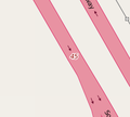
| highway | motorway_junction | Označava izlaze/ulaze s autoceste. ref=* Potrebno je staviti broj izlaza i/ili ime izlaza.
|
 |
 | ||
| highway | passing_place | Lokacija mjesta za prolaz (obično na uskim brdskim cestama, gdje jedno vozilo staje da propusti drugo). |  | |||
| highway | platform | A platform at a bus stop or station. |  |
 | ||
| highway | rest_area | Place where drivers can leave the road to rest, but not refuel. | 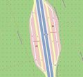 |
 | ||
| highway | services | Servisna stanica gdje možete nešto pojesti, a koje se obično nalaze na autocestama. |  |
 | ||
| highway | speed_camera | Fiksna policijska kamera koja prati ograničenje brzine. |  | |||
| highway | speed_display | A dynamic electronic sign that displays the speed of the passer-by motorist. |  | |||
| highway | stop | A stop sign |  | |||
| highway | street_lamp | A street light, lamppost, street lamp, light standard, or lamp standard is a raised source of light on the edge of a road, which is turned on or lit at a certain time every night |  | |||
| highway | toll_gantry | A toll gantry is a gantry suspended over a way, usually a motorway, as part of a system of electronic toll collection. For a toll booth with any kind of barrier or booth see: barrier=toll_booth
|
 | |||
| highway | traffic_mirror | Mirror that reflects the traffic on one road when direct view is blocked. |  | |||
| highway | traffic_signals | Semafori koji kontroliraju promet. |  | |||
| highway | trailhead | Designated place to start on a trail or route |  | |||
| highway | turning_circle | Krug za okretanje, okrugli, prošireni dio ceste koji je obično na kraju ceste da bi olakšalo okretanje vozila. |  |
 | ||
| highway | turning_loop | A widened area of a highway with a non-traversable island for turning around, often circular and at the end of a road. |  | |||
| highway | User Defined | Pogledajte Taginfo |
||||
Barijere
Oznaka barijera uglavnom se odnosi na točke koje su na putevima, gdje je ograničeno kretenje preprekom. Također ovo se odnosi i na puteve (npr. ograde)koje su same po sebi prepreke.
| Key | Vrijednost | Element | Kometar | Rendering | Slika | |
|---|---|---|---|---|---|---|
| Linearne barijere | ||||||
| barrier | hedge | Živica, red gustog grmlja, posađenog i obrezanog tako da stvara barijeru ili granicu neke površine. | 
| |||
| barrier | fence | Ograda, konstrukcija napravljena tako da ograniči ili spriječi kretanje preko neke površine. Razlikuje se od zida po lakoći konstrucije. | 
|

| ||
| barrier | wall | Zid, konstrukcija napravljena tako da ograniči ili spriječi kretanje preko neke površine, napravljena od cigle, betona, kamena, gotovo uvijek sagrađena tako da se iza ne vidi. | 
| |||
| barrier | ditch | rov, jarak ili usjek, obično da potokom ili vodom na dnu, koji se ne može lako preći, pogotovo especially pješice. Može biti u kombinaciji s waterway=stream-potok ili waterway=drain-odvod
|
 | |||
| Linearne barijere ovisne o stranama | ||||||
| barrier | retaining_wall | potporni zid je konstrukcija koja zadržava tlo ili stijene da se ne odranja na zgradu, strukturu ili površinu. .
|

| |||
| barrier | city_wall | Gradske zidine je utvrđenje koje se koristilo za obranu gradova ili naselja od napadača. Od davnih do modernih vremena oni okružuju naselja. npr. zidine Dubrovnika, Tvrđa u Osijeku, Zidine u Zadru itd...
|

| |||
| Barijere - primjena na točki | ||||||
| barrier | bollard | čvrsti (betonski ili metalni) stupac ili stupci u sredini puta, koji spriječava promet određenim vozilima. | 
|

| ||
| barrier | cycle_barrier | Prepreke za bicikliste, obično savijene željezne šipke koje dozvoljavaju prolaz samo pješaka. | 
|

| ||
| barrier | cattle_grid | Šipke na površini ceste ili mosta, koji dozvoljavaju promet vozila, aili ne i životinja. Negdje se zove kao Texas Gate, čak i izvan Texasa | ||||
| barrier | toll_booth | Naplatne kućice - naplata cestarine | 
| |||
| Pristupne točke | ||||||
| barrier | entrance | Ulaz - rupa u linearnoj barijeri koja nema neku konstrukciju koja ograničava ulaz. access=yes se podrazumjeva. Ograničenja su kao i put koji dolazi do ulaza, ako ga ima.
|

| |||
| barrier | gate | vrata (kapija)- ulaz koji može biti otvoren ili zatvoren. Kombinirajte sa access=* gdje je primjereno.
|

|

| ||
| barrier | stile | dopušta pješacima prelaz preko ograde, ali nema mehanizam za otvaranje kao kapija. | 
| |||
| barrier | sally_port | A En:sally_port prolaz kroz devele ili gradske zidine, a ima dvoja vrata. | 
| |||
This table is a wiki template with a default description in English. Editable here.
Biciklistički putevi
| Key | Value | Element | Comment | Rendering | Photo |
|---|---|---|---|---|---|
| cycleway | lane | prometni trak koji je označen na cesti | 
| ||
| cycleway | track | Traka koja je odvojena od ceste. | 
|

| |
| cycleway | opposite_lane | prometni trak u suprotnom smjeru | 
| ||
| cycleway | opposite_track | traka u suprotnom smjeru, ali odvojena od ceste) | |||
| cycleway | opposite | dozvoljeno samo za bicikle (jednosmjerna ulica osim za bicikle).. | 
| ||
| cycleway | User Defined | pogledajte Taginfo |
See also: Cycle routes
This table is a wiki template with a default description in English. Editable here.
Tip poljoprivrednog puta (kaldrme, lenije itd.)
'Važno: ovaj key se dodatno upotrebljava na put/way koji je označen s highway=track'
| Key/Ključ | Value/Vrijednost | Element | Komentar | Rendering | Fotografija |
|---|---|---|---|---|---|
| tracktype | grade1 | Asfaltirani put ili čvrsto sabijeno kamenje. |  |
 | |
| tracktype | grade2 | Neasfaltirani put; šljunčani ili čvrsto zbijeni pijesak/zemlja. |  |
 | |
| tracktype | grade3 | Neasfaltirani put; mješavina čvrstih i mekih mateijala. |  |
 | |
| tracktype | grade4 | Neasfaltirani put; uglavnom zemlja/pijesak/trava, ali ima i nešto tvrđeg materijala zamješanog ili zbijenog. |  |
 | |
| tracktype | grade5 | Neasfaltirani put; nema tvrdog materijala, nije tvrdi put, uglavnom trava,pijesak i/ili zemlja. |  |
 |
This table is a wiki template with a default description in English. Editable here.
Vodeni tokovi
Kod svih rijeka, kanala, potoka, itd., put/way treba ići u smjeru u kojem toka rijeke.
| Key | Value | Element | Comment | Rendering | Photo |
|---|---|---|---|---|---|
| waterway | stream | Potok - priodni vodeni tok koji preuzak da bi bi rijeka. Aktivna osoba bi ga mogla preskočiti. |  |
 | |
| waterway | river | rijeka - za uže rijeke koje se renderiraju kao linija. Za veće rijeke (defiunirane širinom korita većom od 12m) vidi waterway=riverbank (Drugi jezici).
|

|
 | |
| waterway | riverbank | Obala rijeke - koristi se kod većih rijeka, da bi se definirla površina između obala. | 
|
||
| waterway | canal | Kanal - umjetni vodeni tok za transport, hidroelektrane ili navodnjavanje.([http://www.omegawiki.org/DefinedMeaning:canal_(478) Drugi jezici. |  | ||
| waterway | drain | Odvod - umjetni vodeni put za odvođenje vode iz industrije ili većeg nevremena. |  | ||
| waterway | dock | Pristanište - zatvorena površina za utovar, istovar, gradnju ili popravak brodova. |  | ||
| waterway | lock_gate | Vratnice - kapija, koristite lock=yes. A z avrlo velike , bolje bi bilo koristiti tag na svakom kraju,
|
 | ||
| waterway | turning_point | Okretište - mjesto gdje se plovila okreću. Koristiti maxlength=* za najveću dopuštenu dužinu plovila.
|
|||
| waterway | boatyard | mjesto gdje se grade, popravljaju ili skladište plovila na suhom. | |||
| waterway | weir | ustava - barijera sagrađena preko rijeke, ponekad da preusmjeri tok za industrijske potrebe. Voda može teći preko vrha. |  | ||
| waterway | dam | Brana - zid izgrađen preko rijeke ili potoka da zadržava vodu. Preko brane se voda ne preljeva. |  | ||
| waterway | User Defined | ||||
| Waterway-related features | |||||
| lock | yes | A lock is used for moving boats between waterways at two different levels. Can tag either the section of the way between the gates (detailed) or just a single node in the waterway (less detailed). |  | ||
| mooring | yes/private/no | A length of bank where boats are explicitly permitted to moor. maxstay=* should be used for timing information.
|
|||
Željeznica
- Main article: Railways
This key includes all kinds of railways ranging from heavily used mainline railways to an abandoned rail line.
| Key | Value | Element | Comment | Rendering carto | Photo | |
|---|---|---|---|---|---|---|
Tracks | ||||||
| railway | abandoned | The course of a former railway which has been abandoned and the track removed. The course is still recognized through embankments, cuttings, tree rows, bridges, tunnels, remaining track ties, building shapes and rolling or straight ways. Demolished rails that are no longer identifiable are better mapped in OpenHistoricalMap (they are controversial in OSM).[1] |  | |||
| railway | construction | Railway under construction. |  |
 | ||
| railway | proposed | Railway being proposed but haven't started construction. Please see the proposed page regarding verifiability on the ground of this value. | ||||
| railway | disused | Dio pruge koji se više ne koristi no infrastruktura je ostala. Vidi disused=yes za drugačije označavanje.
|
 |
 | ||
| railway | funicular | Uspinjača (npr. ZET-ova uspinjača) |  |
 | ||
| railway | light_rail | A higher-standard tram system, normally in its own right-of-way. Often it connects towns and thus reaches a considerable length (tens of kilometres). |  |
 | ||
| railway | miniature | Minijaturna željeznica koja prometuje prugom užom od uskotračne željeznice te prevozi putnike (najčešće djecu). Može se naći u parkovima. |  |
 | ||
| railway | monorail | Jednotračna pruga. Vidi Wuppertal Schwebebahn (Germany) za primjer. |  |
 | ||
| railway | narrow_gauge | Narrow-gauge passenger or freight train tracks. Narrow gauge railways can have mainline railway service like the Rhaetian Railway in Switzerland or can be a small light industrial railway. Use gauge=* to specify the actual width of rails in mm.
|
 |
 | ||
This is the old tag for historic trains. Use railway:preserved=yes for historical railway instead.
|
 |
 | ||||
| railway | rail | Željeznica pune veličine za putničke ili teretne vlakove standardne širine pruge za pojedinu državu. |  |
 | ||
| railway | subway | Podzemna željeznica). |  |
 | ||
| railway | tram | Tramvajska pruga, uobičajeno se nalazi na cesti. |  |
 | ||
Dodatne značajke | ||||||
| bridge | yes | Most za prijelaz preko kanala, rijeke, ceste. |  |
 | ||
| cutting | yes | Područje gdje je pruga niže od razine zemlje |  | |||
| electrified | contact_line rail yes no |
contact_line: električni vod iznad vlaka rail: treća tračnica daje opskrbu strujom yes: elektrificirana pruga, no nema detalja no: pruga nije elektrificirana |
 | |||
| embankment | yes | Nasip, dio pruge gdje je pruga iznad razine zemlje |  | |||
| embedded_rails | yes / <type of railway> | Specifies that a highway on which non-railway traffic is also allowed has railway tracks embedded in it but the rails are mapped as separate ways. |  | |||
| frequency | <number> [Hz] | Frekvencija struje na elektrificiranoj dionici. Koristi 0 za istosmjernu struju. Vidi također oznaku voltage |  | |||
| passenger_lines | <number> | Used to describe number of tracks of the railway line a certain track segment belongs to. | ||||
| railway:track_ref | <number> | Track number |  | |||
| service | crossover | Relatively short lengths of track which switch traffic from one parallel line to another | ||||
| service | siding | Bočni kolosijek, najčešće služi pristupu peronu |  |
|||
| service | spur | Industrijski kolosijek. |  |
 | ||
| service | yard | Ranžirni kolosijek |  |
 | ||
| tunnel | yes | tunel, ako pruga ide ispod zemlje. Treba biti uvijek pristuno kod podzemne željeznice |  | |||
| tracks | <number> | Number of parallel tracks in close proximity when mapped as one single way representing all tracks. If not given means unknown and defaults to 1. In many parts of the world the tracks are being drawn out separately so that there is more detail, in which case this tag isn't used. |  | |||
| usage | main branch industrial military tourism scientific test |
Način korištenja main line: glavna pruga branch line: povezuje sporedne pruge s glavnom |
||||
| voltage | <number> | Napon elektrificirane linije. Vidi također oznaku frequency. |  | |||
Postaje i stanice | ||||||
| railway | halt | Mala postaja, može, ali ne mora imati peron, vlakovi staju na zahtjev. |  | |||
| public_transport | stop_position | The position on the railway track where the train (its centre) stops at a platform. This is useful for routing on long platforms where also short trains stop and on long platforms where multiple trains stop behind each other. See also public_transport=stop_area.
|
 | |||
| public_transport | platform | Peron, stoji paralelno uz prugu. Također valja označiti gdje se može prijeći s jednog perona na druge te povezati pješačkom stazom (footway). |  | |||
| railway | platform | This is parallel to the rail line for showing where the actual platforms are. It is also to know where you can change platform and enter the station, so use footpaths to connect them. This is really useful for routing too. Use in addition to public_transport=platform.
|
 | |||
| public_transport | station | Railway passenger-only station. |  | |||
| railway | station | Željeznički kolodvor |  | |||
| railway | stop | Marks the position where trains stop at a station. It should be added as a node on a railway=rail way. |  | |||
| railway | subway_entrance | Ulaz u podzemnu željeznicu, najčešće s površine. |  | |||
| railway | tram_stop | Tramvajska stanica |  | |||
Infrastructure | ||||||
| landuse | railway | Područje oko kolosijeka i kolodvora | 
|
 | ||
| railway | buffer_stop | Zaustavlja vlak na kraju pruge, tzv. bik. |  | |||
| railway | crossing | Mjesto gdje pješaci smiju prijeći prugu. |  | |||
| railway | depot | A rail yard used to store and deploy passenger rail cars. It should be added as a area on a landuse=railway. | ||||
| railway | derail | Iskliznica, spriječava da vlak prođe prugom kojom ne bi smio. |  | |||
| railway | level_crossing | Željezničko-cestovni prijelaz, mjesto gdje se pruga i cesta sijeku |  | |||
| railway | railway_crossing | Crossing rails with no interconnection. |  | |||
| railway | roundhouse | Polukružna zgrada u koju se spremaju lokomotive |  | |||
| railway | signal | Any kind of railway signal. |  | |||
| railway | switch | Full connections between railways (aka 'points'). |  | |||
| railway | tram_level_crossing | A point where trams and roads cross. |  | |||
| railway | traverser | These are used for changing trains between railways. Also known as transfer table. |  | |||
| railway | turntable | Okretnica, mjesto gdje lokomotive i vagoni mjenjaju smijer. |  | |||
| railway | ventilation_shaft | A structure that allows ventilation in underground tunnels |  | |||
| railway | wash | A railroad carriage/car wash |  | |||
| railway | water_crane | A structure to deliver water to steam locomotives |  | |||
| railway | workshop | Repair shop' for (rail) rolling stock' is a place where maintenance or overhaul of these vehicles (rail vehicles, metro, tram, light rail, monorail) is carried out. It should be added as a area on a building=yes. |  | |||
| railway | user defined | All commonly used values according to Taginfo | ||||
This table is a wiki template with a default description in English. Editable here. This table is a wiki template with a default description in English. Editable here.
Zračne luke
These are mainly related to aerodromes, airfields other ground facilities that support the operation of airplanes and helicopters. See the page Aeroways for an introduction on mapping these features.
| Key | Value | Element | Comment | Rendering | Photo |
|---|---|---|---|---|---|
| aeroway | aerodrome | Zračna luka i pristanište, vidi i military=airfield-za vojna pristaništa Potrebno: icao=*
|
 | ||
| aeroway | airstrip | A field or area where light aircraft can land and take off from. |  | ||
| aeroway | apron | Stajanka |  |
 | |
| aeroway | control_center |  | |||
| aeroway | fuel | Fuelling station for aircraft. |  | ||
| aeroway | gate | Aerodromski ulaz (en:gate) | 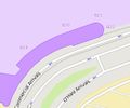 |
 | |
| aeroway | hangar |  | |||
| aeroway | helipad | Uzletište/sletište za helikoptere (FATO; final approach and takeoff area) |  | ||
| aeroway | heliport |  | |||
| aeroway | highway_strip |  | |||
| aeroway | holding_position | A point behind which aircraft are considered clear of a crossing way |  | ||
| aeroway | jet_bridge | Passenger boarding bridge |  | ||
| aeroway | model_runway | Take-off and landing runway for model aircraft |  | ||
| aeroway | navigationaid | A facility that supports visual navigation for aircraft |  | ||
| airmark | beacon |  | |||
| aeroway | parking_position | A location where an aeroplane can park |  | ||
| aeroway | runway | USS (uzletno-sletna staza; pista) (Drugi jezici) | 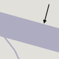 |
 | |
| aeroway | spaceport | A spaceport or cosmodrome: a site for launching or receiving spacecraft |  | ||
| aeroway | stopway | Stopway is a rectangular surface beyond the end of a runway used during an aborted takeoff. |  | ||
| aeroway | taxilane | Taxilane is a path in an airport that is part of the aircraft parking area or apron (Proposed feature with low usage as of 2015-10; use with an eye towards the question correct usage). | |||
| aeroway | taxiway | Staza za voženje (vožnju po zemlji) |  |
 | |
| aeroway | terminal | Putnički terminal |  |
 | |
| aeroway | tower | See also aeroway=control_tower or combination of man_made=tower + service=aircraft_control for similar schemes.
|
 | ||
| aeroway | windsock | Koristi se za označavanje pozicije vjetrulja |  | ||
| aeroway | User defined | pogledajte Taginfo |
This table is a wiki template with a default description in English. Editable here.
Žičare
This is used to tag different forms of transportation for people or goods by using aerial wires. For example these may include cable-cars, chair-lifts and drag-lifts. See the page Aerialway for more information on the usage of these tags.
This table is a wiki template with a default description in English. Editable here.
Električna energija
These are used to map electrical power generation and distributions systems. See the page titled Power for an introduction on its usage.
| Key | Value | Element | Comment | Rendering | Photo |
|---|---|---|---|---|---|
| power | cable | A way following the path of underground cables, such as the local 0.4 kV network between transformer stations, distribution boxes and cable connection points, or sea cables. Not to be confused with non-power supply cables such as cables for telecommunication. May be combined with voltage=*, circuits=* and location=*.
|
 | ||
| power | catenary_mast | A catenary mast supports system of overhead wires used to supply electricity to electrically powered vehicle equipped with a pantograph. |  | ||
| power | compensator | Several kind of power devices used to insure of power quality and network resilience. |  | ||
| power | connection | A freestanding electrical connection between two or more overhead wires |  | ||
| power | converter | An HVDC converter converts electric power from high voltage alternating current (AC) to high-voltage direct current (HVDC), or vice-versa. |  | ||
| power | generator | Elektrana, mjesto gjde se pravi struja. Koristiti u kombinaciji s generator:source=*; možete koristiti i power_rating=*.
|
 |
 | |
| power | heliostat | A mirror of a heliostat device. |  | ||
| power | insulator | A device to protect a power line from grounding on supports |  | ||
| power | line | Putanja koja pravi put energetskih kablova (dalekovodi, tornjevi). Za manje linije na stupcima koristite power=minor_line.
|
 |
 | |
| line | busbar | Specifies that a power=line is a busbar in a substation.
|
 | ||
| line | bay | Specifies a power=line is a bay which connects an incoming circuit to a busbar assembly.
|
 | ||
| power | minor_line | A way following the path of (overground) minor power cables, supported by poles and not towers/pylons. (This isn't quite so simple, as sometimes larger towers are replaced by smaller poles made with a stronger material; a better distinction might be based on voltage). |  |
 | |
| power | plant | A place/industrial facility where power is generated (electricity, heat, cold water, biogas...). Individual generating units within the facility should be tagged as power=generator.
|
 |
 | |
| power | pole | Poles supporting low to medium voltage lines (power=minor_line) and high voltage lines (power=line) up to 161,000 volts (161 kV).
|
 | ||
| power | portal | Power supporting structure composed of vertical legs with cables between them attached to a horizontal crossarm |  | ||
| power | substation | Male trafostanice. Obično izgledaju kao male kućice ili kutije pored ceste. |  |
 | |
| power | switch | A tag for electricity switches which are devices which allow operators to power up & down lines and transformer in substations or outside. | 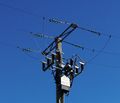 | ||
| power | switchgear | The switchgear comprises one or more busbar assemblies and a number of bays each connecting a circuit to the busbar assembly. |  | ||
| power | terminal | Point of connection between overhead power lines to buildings or walls | 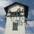 | ||
| power | tower | Za dalekovode ili tornjeve nosača kablova visokog napona električne energije. Uobičajeno je konstruiran od čeličnih profila. Ne treba koristiti za drvene ili betonske stupove koji nose elektro ili telefonske kablove, oni se mogu ozbačiti s power=pole.
|
 |
 | |
| power | transformer | A static device for transferring electric energy by inductive coupling between its windings. Large power transformers are typically located inside substations. |  | ||
| power | User Defined | Vidi Taginfo |
This table is a wiki template with a default description in English. Editable here.
This table is a wiki template with a default description in English. Editable here.
Ljudske tvorevine
Oznaka za označavanje ljudskih tvorevina u okolišu.
| Key | Value | Element | Comment | Rendering | Photo |
|---|---|---|---|---|---|
| man_made | adit | A type of entrance to an underground mine which is horizontal or nearly horizontal. |  | ||
| man_made | advertising | A generic advertising device. |  | ||
| man_made | antenna | An antenna to transmit and/or receive wireless signals. |  | ||
| man_made | avalanche_protection | A feature to protect from avalanches or to keep them from going off. |  | ||
| man_made | beacon | Pomaže pomorcima u navigaciji. |  | ||
| man_made | beehive | Beehive |  | ||
| man_made | borehole | A bore used for a purpose not covered by man_made=petroleum_well or man_made=water_well.
|
 | ||
| man_made | breakwater | Lukobran, štiti obalu i luku od valova. |  |
 | |
| man_made | bridge | The outline of a bridge, grouping together all features for that bridge.
Please also add |
 |
 | |
| man_made | bunker_silo | An open-sided structure that can be used with vehicles to fill and empty them. |  | ||
| man_made | cairn | A mound of stones, usually conical or pyramidal, raised as a landmark or to designate a point of importance in surveying. |  | ||
| man_made | carpet_hanger | A construction to hang carpets for cleaning with the help of carpet beaters. |  | ||
| man_made | cellar_entrance | An entrance into artificially created vault. |  | ||
| man_made | charge_point | A device for charging electric vehicles. |  | ||
| man_made | chiller | industrial cooling construction with large diameter fans |  | ||
| man_made | chimney | Industrijski dimnjakcommunication:mobile_phone=yes.
|
 | ||
| man_made | clarifier | A clarifier of a wastewater treatment plant. |  | ||
| man_made | clearcut | An area where all trees have been uniformly cut down. |  | ||
| man_made | column | A column used to support a structure or for decoration. |  | ||
| man_made | communications_tower | A huge tower for transmitting radio applications. |  | ||
| man_made | compass_rose | A compass rose or wind rose. |  | ||
| man_made | compressor | Industrial equipment used to compress a gas by reducing its volume. |  | ||
| man_made | cooling | Industrial cooling facility. |  | ||
| man_made | cooling_tower | A cooling tower |  | ||
| man_made | courtyard | An area that is usually enclosed by walls or buildings. |  | ||
| man_made | crane | Kran, kao u lukama. |  | ||
| man_made | cross | Cross with little historical or religion value, e.g. summit cross. |  | ||
| man_made | cutline | Označava usjek, granicu razdvajanja, šume. |  |
 | |
| man_made | dolphin | A marine structure for berthing and mooring of vessels. |  | ||
| man_made | dovecote | A place where doves are farmed or stored. |  | ||
| man_made | dyke | A dyke is a an embankment built to restrict the flow of water or other liquids. |  | ||
| man_made | embankment | Nasip, za obranu od poplave ili za cestu i željeznicu. |  | ||
| man_made | flagpole | Stup za zastavu. |  | ||
| man_made | flare | A tower constructed to burn off excess gas. | 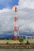 | ||
| man_made | footwear_decontamination | A facility to decontaminate footwear for hikers. |  | ||
| man_made | frost_fan | A device to stop frosts from damaging crops. |  | ||
| man_made | fuel_pump | A fuel pump (petrol pump, gas pump) |  | ||
| man_made | gantry | An overhead structure across a major road usually for holding signs, often variable-message signs. |  | ||
| man_made | gas_well | A natural gas well |  | ||
| man_made | gasometer | A large container in which natural gas or town gas is stored near atmospheric pressure at ambient temperatures. |  | ||
| man_made | geoglyph | A large design or motif (generally longer than 4 metres) produced on the ground |  | ||
| man_made | goods_conveyor | A conveyor system for transporting materials |  |
 | |
| man_made | groyne | A rigid structure built from a shoreline or riverbank that interrupts water flow and limits the movement of sediment. See also: man_made=breakwater.
|
 |
 | |
| man_made | guard_stone | A guard stone: a stone built onto or into the corner of a building or wall to prevent carriages from damaging the structure, often found on either side of an entrance to a laneway, or alongside a wall to protect it. | 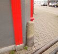 | ||
| man_made | guy_wire | Guy wire designed to add stability to a freestanding structure. |  |
 | |
| man_made | heap | A large pile of material |  | ||
| man_made | hongsalmun | A gate for entering a sacred place in Korea. The gate indicates entry to a sacred realm. |  | ||
| man_made | iljumun | The first gate at the entrance to many Korean Buddhist temples |  | ||
| man_made | insect_hotel | A structure intended to provide shelter for insects. |  | ||
| man_made | kiln | Peć za sušenje, pušnica. |  | ||
| man_made | lighthouse | Tower that emits light to serve as a navigational aid at sea or on inland waterway. |  | ||
| man_made | manhole | Hole with a cover that allows access to an underground service location, just large enough for a human to climb through. | 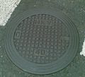 | ||
| man_made | mast | A mast is a vertical structure built to hold, for example, antennas. |  | ||
| man_made | maypole | A tall wooden pole erected as a part of various European folk traditions to celebrate the beginning of summer. |  | ||
| man_made | milk_churn_stand | A current or former collection point for milk churns. |  | ||
| man_made | mineshaft | Okomiti ulaz u rudnik. |  | ||
| man_made | monitoring_station | Nadzorna stanica. |  | ||
| man_made | nesting_site | A man made nesting aid that is mounted on a support device. |  | ||
| man_made | obelisk | Tall, narrow, four-sided, tapered monument which usually ends in a pyramid-like shape at the top. |  | ||
| man_made | observatory | Observatory: a location used for observing terrestrial or celestial events |  | ||
| man_made | offshore_platform | Offshore platform, oil platform or offshore drilling rig |  | ||
| man_made | oil_gas_separator | Industrial equipment used to separate liquid and gaseous components (oil and gas) produced from a petroleum well. |  | ||
| man_made | oxidation_ditch | An oxidation ditch of a wastewater treatment plant. |  | ||
| man_made | paifang | A traditional style of Chinese architectural arch or gateway structure. |  | ||
| man_made | petroleum_well | Oil well: a hole bored in the earth, designed to bring petroleum oil or gas to the surface |  | ||
| man_made | pier | Mol - most u more, obično za rekreaciju. |  |
 | |
| man_made | pipeline | Cjevovod za razne fluide, vodu, plin, naftu, ... |  | ||
| man_made | planter | A structure for planting flowers or other ornamental plants. |  | ||
| man_made | pump | A device in charge of moving or raising the level of liquids. |  | ||
A pumping rig for producing oil. Use of this tag is discouraged. See man_made=petroleum_well instead.
|
 | ||||
| man_made | pumping_station | Pumping station: a facility including pumps and equipment for pumping fluids from one place to another |  | ||
| man_made | quay | A man-made structure alongside navigable water used for loading and unloading vessels. |  | ||
| man_made | reservoir_covered | Pokriveni rezervoar. |  | ||
| man_made | satellite_dish | A dish-shaped parabolic antenna designed to receive or transmit radio waves to or from a satellite |  | ||
| man_made | sewer_vent | A sewer ventilation shaft |  | ||
| man_made | sign | A permanent physical object displaying messages, like entrance sign of place or city, political sign, but otherwise not covered by advertising=*, tourism=information or historic=epigraph.
|
 | ||
| man_made | silo | A storage container for bulk material, often grains such as corn or wheat |  | ||
| man_made | snow_fence | Snježna ograda, smanjuje rizik i utjecaj lavine. |  | ||
| man_made | spoil_heap | Spoil heap, piles of waste rock removed during mining. |  | ||
| man_made | spring_box | A structure designed for protecting and catching groundwater from a natural spring. |  | ||
| man_made | storage_tank | Spremnik za tekućine i naftu. |  | ||
| man_made | street_cabinet | A cabinet located in the street and hosting technical equipment to operate facilities such as electricity or street lights. |  | ||
| man_made | stupa | A Buddhist dome-shaped structure with a spire on top |  | ||
| man_made | surveillance | Oznaka za mjesta i zgrade s videonadzorom. |  | ||
| man_made | survey_point | Geodetske oznake. |  | ||
| man_made | tailings_pond | Tailings pond: A body of liquid or slurry used to store byproducts of mining operations |  | ||
| man_made | telescope | Telescope: an instrument that aids in the observation of remote objects by collecting light or radio waves |  | ||
| man_made | torii | The gate structure found at the entrance of Shinto shrines and (rarely) Japanese Buddhist temples. |  | ||
| man_made | tower | Toranj, vrlo visoka, često uska konstrukcija. Po mogućnosti dodajte tower:type=*. Vidi također historic=* .
|
 | ||
| man_made | threshing_floor | An open air paved area created to thresh the grain harvest and then winnow it. |  | ||
| man_made | trough | A long, narrow container, open on top, for feeding or watering animals. The water from a trough usually would not be considered drinkable, however, it may be filled from a pipe providing drinkable water. |  | ||
| man_made | utility_pole | A single pole supporting elevation of any of various and unspecified public utilities, such as power transmission, lighting or telephony. |  | ||
| man_made | ventilation_shaft | A vertical space in mines, tunnels, or buildings allowing stale air to leave the space underneath and/or fresh air to enter it. |  | ||
| man_made | video_wall | A digital screen, typically constructed out of smaller LED panels. |  | ||
| man_made | wastewater_plant | Pogon za pročišćavanje otpadnih voda, kanalizacije. |  |
 | |
| man_made | water_tap | Publicly usable water tap, providing access to water and usually equipped with a valve. |  | ||
| man_made | water_tower | Vodotoranj, toranj za skladištenje vode, obično na povišenju. |  | ||
| man_made | water_well | Bunar. |  | ||
| man_made | water_works | A place where drinking water is found and applied to the local waterpipes network. |  |
 | |
| man_made | watermill | Vodenica, većinom stare i van funkcije. |  | ||
| man_made | wildlife_crossing | Structure that allow animals to cross human barriers safely. |  | ||
| man_made | windmill | Vjetrenjača, većinom stare i van funkcije, vidi power=generator u kombinaciji s generator:source=wind za vjetroelektrane.
|
 | ||
| man_made | windpump | A device that pumps natural gas or water using the wind, typically mass produced. |  | ||
| man_made | works | Industrijska zgrada koja nešto proizvodi. |  | ||
| man_made | yes | General tag for man-made (artificial) structures. | |||
| man_made | user defined | Vidi Taginfo za druge česte vrijednosti. |
This table is a wiki template with a default description in English. Editable here. This table is a wiki template with a default description in English. Editable here.
Amenity Koristiti za usluge za posjetitelje i stanovnike: zahod, telefon, banke, ljekarne, škole.
| Key | Value | Element | Comment | Rendering | Photo | |
|---|---|---|---|---|---|---|
Prehrana | ||||||
| amenity | bar | Mjesto gdje se prodaje pivo i alkohlna pića,može ponuditi i smještaj i hranu (UK). Pogledaj opis amenity=bar i amenity=pub za razlike između bara i puba.
|
 | |||
| amenity | biergarten | Mjesto na otvorenom gdje se poslužuje pivo i ostala pića te lokalna hrana. |  | |||
| amenity | cafe | Kafić. |  | |||
| amenity | fast_food | Restoran brze hrane (vidi i amenity=restaurant). Koja se kuhinja služi može se označiti sa cuisine=* te diet:*=*.
|
 | |||
| amenity | food_court | Područje s više različitih restorana koji dijele prostor za sjedenje. Često u trgovačkim centrima, zračnim lukama itd. |  | |||
| amenity | ice_cream | Ice cream shop or ice cream parlour. A place that sells ice cream and frozen yoghurt over the counter |  | |||
| amenity | pub | Mjesto gdje se poslužuju povo i druga alkoholna pića: također može nuditi hranu i smještaj (UK). Pogleaj opis za amenity=bar iamenity=pub za razlike između bara i puba.
|
 | |||
| amenity | restaurant | Restoran (ne restoran brze hrane, vidi amenity=fast_food). Kuhinja koja se poslužuje može se označiti sa cuisine=* te diet:*=*.
|
 | |||
Obrazovanje | ||||||
| amenity | college | Visokoškolske ustanove (veleučilišta). Vidjeti i amenitiy=university.
|
 | |||
| amenity | dancing_school | A dancing school or dance studio |  | |||
| amenity | driving_school | Driving School which offers motor vehicle driving lessons |  | |||
| amenity | first_aid_school | A place where people can go for first aid courses. | ||||
| amenity | kindergarten | Vrtić, za djecu predškolske dobi. |  | |||
| amenity | language_school | Language School: an educational institution where one studies a foreign language. |  | |||
| amenity | library | Knjižnica ( gradska, nacionalna, sveučilišna, ...). |  | |||
| amenity | surf_school | A surf school is an establishment that teaches surfing. |  | |||
| amenity | toy_library | A place to borrow games and toys, or play with them on site. |  | |||
| amenity | research_institute | An establishment endowed for doing research. |  | |||
| amenity | training | Public place where you can get training. |  | |||
| amenity | music_school | A music school, an educational institution specialized in the study, training, and research of music. |  | |||
| amenity | school | Škola. |  | |||
| amenity | traffic_park | Juvenile traffic schools |  | |||
| amenity | university | Sveučilišni campus ili zgrade. Sveučilišni fakulteti. Koristiti i operator=*, te multipoligon za kampus s više zgrada.
|
 | |||
Transport | ||||||
| amenity | bicycle_parking | Parkiralište za bicikle. |  | |||
| amenity | bicycle_repair_station | General tools for self-service bicycle repairs, usually on the roadside; no service |  | |||
| amenity | bicycle_rental | Iznajmljivanje bicikla. |  | |||
| amenity | bicycle_wash | Clean a bicycle |  | |||
| amenity | boat_rental | Rent a Boat |  | |||
| amenity | boat_storage | A place to store boats out of the water. |  | |||
| amenity | boat_sharing | Share a Boat |  | |||
| amenity | bus_station | May also be tagged as public_transport=station.
|
 | |||
| amenity | car_rental | Iznajmljivanje automobila. |  | |||
| amenity | car_sharing | Automobili za javno korištenje. |  | |||
| amenity | car_wash | Autopraonica. |  | |||
| amenity | compressed_air | A device to inflate tires/tyres (e.g. motorcar, bicycle) |  | |||
| amenity | vehicle_inspection | Government vehicle inspection |  | |||
| amenity | charging_station | Uređaji za punjenje elektičnih automobila. |  | |||
| amenity | [[ Too many Data Items entities accessed. | driver_training ]] | A place for driving training on a closed course |  | |||
| amenity | ferry_terminal | Trajektni terminal. Gdje se automobili, ljudi i slično ukrcavaju na trajekt. |  | |||
| amenity | fuel | Benzinska stanica, pumpa, priključne ceste do benzinske su označene kao highway=service.
|
 | |||
| amenity | grit_bin | Spremnik kamene soli za posipanje cesta zimi. |  | |||
| amenity | motorcycle_parking | Parking for motorcycles |  | |||
| amenity | parking | Parkiralište za automobile. Točke i područja će dobtit "P" simbol. Područja će biti obojana. Ceste na parkiralištu su označene highway=service i service=parking_aisle.
|
 | |||
| amenity | parking_entrance | Ulaz ili izlaz u podzemnu garažu ili garažnu s nekoliko katova. Grupu ulaza zajedno označiti s relacijom koristeći oznake type=site i site=parking. Ne zamjenjivati s amenity=parking.
|
Underground |
 | ||
| amenity | parking_space | Pojedinačno parkirno mjesto . Grupu parkirnih mjesta zajedno označiti s relacijom koristeći oznake type=site i site=parking. Ne zamjenjivati s amenity=parking.
|
 |
 | ||
| amenity | taxi | Mjesto gdje taksi čeka putnike. |  | |||
| amenity | weighbridge | A large weight scale to weigh vehicles and goods |  | |||
Financije | ||||||
| amenity | atm | Bankomat |  | |||
| amenity | payment_terminal | Self-service payment kiosk/terminal |  | |||
| amenity | bank | Banka (za banku koja ima i bankomat, poželjno je da se doda točka za svaki bankomat). |  | |||
| amenity | bureau_de_change | Mjenječnica currency exchange, Wechsel, cambio – mjesto gdje se novac može promjeniti u drugu valutu. |  | |||
| amenity | money_transfer | A place that offers money transfers, especially cash to cash |  | |||
| amenity | payment_centre | A non-bank place, where people can pay bills of public and private services and taxes. |  | |||
Zdravstvo | ||||||
| amenity | baby_hatch | Mjesto gdje se novorođenče može anonimono ostaviti za posvajanje. |  | |||
| amenity | clinic | A medium-sized medical facility or health centre. |  | |||
| amenity | dentist | Stomatološka ordinacija/ kirurgija. |  | |||
| amenity | doctors | Liječnička ordinacija, poliklinika. |  | |||
| amenity | hospital | Bolnica; često zajedno s emergency=* da se naznači ima li bolnica hitnu službu ili ne (A&E (brit.) or ER (am.)).
|
 | |||
| amenity | nursing_home | Dom za stare i nemoćne osobe. Vidi social_facility=* za više detalja.
|
 | |||
| amenity | pharmacy | Ljekarna dispensing=yes (ako prodaje i lijekove na recept) dispensing=no or omitted (ako se prodaju samo lijekovi bez recepta). |
 | |||
| amenity | social_facility | Mjesto koje pruža socijalne usluge. |  | |||
| amenity | veterinary | Veterinarska stanica. |  | |||
Zabava, umjetnost i kultura | ||||||
| amenity | arts_centre | Umjetnički centar. |  | |||
| amenity | brothel | Bordel – javna kuća |  | |||
| amenity | casino | A gambling venue with at least one table game(e.g. roulette, blackjack) that takes bets on sporting and other events at agreed upon odds. |  | |||
| amenity | cinema | Kino dvorana, kino na otvorenom. |  | |||
| amenity | community_centre | Mjesto gdje se održavaju sastanci, priredbe, festivali, radionice. Poznato kao vatrogasni dom. |  | |||
| amenity | conference_centre | A large building that is used to hold a convention |  | |||
| amenity | events_venue | A building specifically used for organising events |  | |||
| amenity | exhibition_centre | An exhibition centre |  | |||
| amenity | fountain | Fontana povijesna/ukrasna. |  | |||
| amenity | gambling | A place for gambling, not being a shop=bookmaker, shop=lottery, Lua error in mw.title.lua at line 230: too many expensive function calls., or Lua error in mw.title.lua at line 230: too many expensive function calls..
Games that are covered by this definition include bingo and pachinko. |
 | |||
| amenity | love_hotel | A love hotel is a type of short-stay hotel operated primarily for the purpose of allowing guests privacy for sexual activities. |  | |||
| amenity | music_venue | An indoor place to hear contemporary live music. |  | |||
| amenity | nightclub | Noćni klub. |  | |||
| amenity | planetarium | A planetarium. |  | |||
| amenity | public_bookcase | A street furniture containing books. Take one or leave one. |  | |||
| amenity | social_centre | A place for free and not-for-profit activities. |  | |||
| amenity | stage | A raised platform for performers. |  | |||
| amenity | stripclub | Mjesto koje nudi striptiz ili ples u krilu (za seksualne usluge koristite amenity=brothel). |  | |||
| amenity | studio | TV, radio ili diskografski studio. |  | |||
| amenity | swingerclub | Klub gdje se sastaju osobe za grupni seks. |  | |||
| amenity | theatre | Kazalište ili opera. |  | |||
Public Service | ||||||
| amenity | courthouse | Sud, zgrada suda. |  | |||
| amenity | fire_station | Vatrogasna postaja. |  | |||
| amenity | police | Policijska postaja. |  | |||
| amenity | post_box | Poštanski sandučić, alternativni nosači pošte mogu se označiti preko operator=*.
|
 | |||
| amenity | post_depot | Post depot or delivery office, where letters and parcels are collected and sorted prior to delivery. |  | |||
| amenity | post_office | Poštanski ured. |  | |||
| amenity | prison | Zatvor. |  | |||
| amenity | ranger_station | National Park visitor headquarters: official park visitor facility with police, visitor information, permit services, etc |  | |||
| amenity | townhall | Zgrada gradske vjećnice. |  | |||
Facilities | ||||||
| amenity | bbq | Roštilj (na izletištima i sl.), može se staviti i oznaka za ogrijev Lua error in mw.title.lua at line 230: too many expensive function calls.. Za logorske vatre korisititi Lua error in mw.title.lua at line 230: too many expensive function calls..
|
 | |||
| amenity | bench | Klupa za sjedenje i odmor. |  | |||
| amenity | check_in | Place where passengers can get their boarding passes before travel (typically found in airports). |  | |||
| amenity | dog_toilet | Area designated for dogs to urinate and excrete. |  | |||
| amenity | dressing_room | Area designated for changing clothes. |  | |||
| amenity | drinking_water | Pitka voda. |  | |||
| amenity | give_box | A small facility where people drop off and pick up various types of items in the sense of free sharing and reuse. |  | |||
| amenity | lounge | A comfortable waiting area for customers, usually found in airports and other transportation hubs. Typically has extra amenities or sustenance. |  | |||
| amenity | mailroom | A mailroom for receiving packages or letters. |  | |||
| amenity | parcel_locker | Machine for picking up and sending parcels |  | |||
| amenity | shelter | Sklonište u slučaju lošeg vremena za bicikliste, planinare, ... Za dodatni opis koristiti Lua error in mw.title.lua at line 230: too many expensive function calls..
|
 | |||
| amenity | shower | Javni tuš. |  | |||
| amenity | telephone | Telefonska govornica. |  | |||
| amenity | toilets | Javni zahod (može zahtjevati naknadu). |  | |||
| amenity | water_point | Place where you can get large amounts of drinking water |  | |||
| amenity | watering_place | Mjesto na kojemu životinje mogu piti vodu. |  | |||
Waste Management | ||||||
| amenity | sanitary_dump_station | A place for depositing human waste from a toilet holding tank. |  | |||
| amenity | recycling | Objekti za reciklažu. Kombinirati s Lua error in mw.title.lua at line 230: too many expensive function calls. za kontjnere ili Lua error in mw.title.lua at line 230: too many expensive function calls. za reciklažne centre.
|
 | |||
| amenity | waste_basket | Ulična kanta za otpad. |  | |||
| amenity | waste_disposal | Mjesto na kojem se odlaže otpad (javni kontejner). |  | |||
| amenity | waste_transfer_station | A waste transfer station is a location that accepts, consolidates and transfers waste in bulk. | ||||
Ostalo | ||||||
| amenity | animal_boarding | Mjesto gdje se dovode kućni ljubimci te za određeni novac mogu boraviti (hrana i održavanje uključeni) – Hotel za životinje. | 
| |||
| amenity | animal_breeding | A facility where animals are bred, usually to sell them | 
| |||
| amenity | animal_shelter | Sklonište gdje se životinje oporavljaju. |  | |||
| amenity | animal_training | A facility used for non-competitive animal training |  | |||
| amenity | baking_oven | An oven used for baking bread and similar, for example inside a Lua error in mw.title.lua at line 230: too many expensive function calls..
|
 | |||
| amenity | clock | Sat na javnom mjestu. |  | |||
| amenity | crematorium | Krematorij. |  | |||
| amenity | dive_centre | A dive center is the base location where sports divers usually start scuba diving or make dive guided trips at new locations. |  | |||
| amenity | funeral_hall | A place for holding a funeral ceremony, other than a place of worship. |  | |||
| amenity | grave_yard | Manje mjesto za pokope, obično uz samu crkvu/kapelicu. Veća groblja (gradsko groblje i sl.) trebaju biti označena sa Lua error in mw.title.lua at line 230: too many expensive function calls..
|
 |
 | ||
| amenity | hunting_stand | Čeka - natkrivena platforma za lovce koji čekaju divljač. | 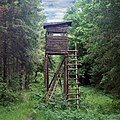 | |||
| amenity | internet_cafe | A place whose principal role is providing internet services to the public. |  | |||
| amenity | kitchen | A public kitchen in a facility to use by everyone or customers |  | |||
| amenity | kneipp_water_cure | Outdoor foot bath facility. Usually this is a pool with cold water and handrail. Popular in German speaking countries. | 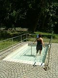 | |||
| amenity | lounger | An object for people to lie down. |  | |||
| amenity | marketplace | Tržnica, štandovi na otvorenom. |  | |||
| amenity | monastery | Monastery is the location of a monastery or a building in which monks and nuns live. |  | |||
| amenity | mortuary | A morgue or funeral home, used for the storage of human corpses. |  | |||
| amenity | photo_booth | A stand to create instant photos. |  | |||
| amenity | place_of_mourning | A room or building where families and friends can come, before the funeral, and view the body of the person who has died. |  | |||
| amenity | place_of_worship | Crkva, džamija, hram i sl. Treba dodati oznake Lua error in mw.title.lua at line 230: too many expensive function calls., Lua error in mw.title.lua at line 230: too many expensive function calls. te je poželjno Lua error in mw.title.lua at line 230: too many expensive function calls. kao i Lua error in mw.title.lua at line 230: too many expensive function calls.. Vidi the article za detalje.
|
 | |||
| amenity | public_bath | A location where the public may bathe in common, etc. japanese onsen, turkish bath, hot spring |  | |||
Ne korisititi! Pogledaj Lua error in mw.title.lua at line 230: too many expensive function calls..
|
||||||
| amenity | refugee_site | A human settlement sheltering refugees or internally displaced persons |  | |||
| amenity | vending_machine | Automat za prodaju dobara - karti, cigareta, slatkiša... Dodati tip dobara koja se prodaju Lua error in mw.title.lua at line 230: too many expensive function calls..
|
 | |||
| amenity | hydrant | Similar to a Lua error in mw.title.lua at line 230: too many expensive function calls., but for gardening and other municipal purposes other than fire extinction
|
 | |||
| amenity | user defined | All commonly used values according to Taginfo | ||||
This table is a wiki template with a default description in English. Editable here. This table is a wiki template with a default description in English. Editable here.
| To add missing translations, go to Template:Map Features:shop/doc, copy missing parameters, paste into your language template and complete translations (the link to edit is at the bottom of the table). |
Trgovina
Trgovina je mjesto gdje se prodaju proizvodi i usluge
| Key | Value | Comment | Rendering | Photo | ||
|---|---|---|---|---|---|---|
Hrana i piće | ||||||
| shop | alcohol | Trgovina s alkoholnim pićem (u nekim državama zahtjeva se dozvola ili su državne). Vidi također Lua error in mw.title.lua at line 230: too many expensive function calls..
|
 | |||
| shop | bakery | Pekara, prodaje kruh i peciva |  | |||
| shop | beverages | Trgovina s pićem. Vidi također Lua error in mw.title.lua at line 230: too many expensive function calls..
|
 | |||
| shop | brewing_supplies | Shop focused on selling supplies for home brewing of beer, wine and spirits (where permitted). |  | |||
| shop | butcher | Mesnica, prodaje meso |  | |||
| shop | cheese | Shop focused on selling cheese. |  | |||
| shop | chocolate | Shop focused on selling chocolate. |  | |||
| shop | coffee | Shop focused on selling coffee. |  | |||
| shop | confectionery | Trgovina slatkišima i kolačima |  | |||
| shop | convenience | Mala trgovina (kvartovska), prodaje prehrambene artikle i ostalo za kućanstvo. |  | |||
| shop | dairy | Shop focused on selling dairy products. |  | |||
| shop | deli | Prodavaonica delikatesa (ukusne hrane), također moguće i vrhunskog vina. | 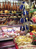 | |||
| shop | farm | Prodavaonica na farmi koja prodaje svoje proizvode |  | |||
| shop | food | Shop focused on selling food, more specific value should be used if possible.
|
 | |||
| shop | frozen_food | Shop focused on selling frozen food. |  | |||
| shop | greengrocer | Voćarna, prodaje voće i povrće |  | |||
| shop | health_food | A health food shop; selling wholefoods, vitamins, nutrition supplements and meat and dairy alternatives. |  | |||
| shop | ice_cream | Shop selling ice cream. See also Lua error in mw.title.lua at line 230: too many expensive function calls..
|
 | |||
| shop | nuts | Shop selling dried nuts/fruits, edible seeds, etc. Not to be confused with Lua error in mw.title.lua at line 230: too many expensive function calls..
|
 | |||
| shop | pasta | Shop focused on selling (fresh) pasta, ravioli, etc. |  | |||
| shop | pastry | Shop focused on selling baked sweets like cakes, biscuits, strudel and pies. |  | |||
| shop | seafood | Ribarnica, prodaje ribu i morske plodove |  | |||
| shop | spices | Shop focused on selling spices. |  | |||
| shop | tea | Shop focused on selling tea. |  | |||
| shop | tortilla | Shop focused on selling tortillas. |  | |||
| shop | water | Shop focused on selling drinking water. |  | |||
| shop | wine | Shop selling wine. |  | |||
Trgovački centar, robna kuća | ||||||
| shop | department_store | Robna kuća, jedna trgovina na više katova koja ima široku ponudu, npr. NaMa (vidi također Lua error in mw.title.lua at line 230: too many expensive function calls.)
|
 | |||
| shop | general | A store that carries a general line of merchandise. (see also Lua error in mw.title.lua at line 230: too many expensive function calls. if it sells food).
|
 | |||
| shop | kiosk | Mala trgovina koja prodaje novine, časopise, duhanske proizvode, poštanske marke. |  | |||
| shop | mall | Trgovački centar - puno trgovina pod jednim krovom npr. City center One u Zagrebu, a kako urediti područje i zgradu vidi Hr:Trgovacki centri. |  | |||
| shop | supermarket | Trgovački centar npr. Plodine, kako urediti područje i zgradu vidi Hr:Trgovacki centri |  | |||
| shop | wholesale | Wholesale/warehouse club or cash and carry – a store that sells items in bulk to retailers. The branch of industry can be defined with Lua error in mw.title.lua at line 230: too many expensive function calls..
|
 | |||
Odjeća, obuća, modni dodaci | ||||||
| shop | baby_goods | Prodavaonica artikala za novorođenčad (odjeća, obuća, igračke, ...). |  | |||
| shop | bag | Prodavaonica torbama |  | |||
A small shopping outlet, especially one that specializes in elite and fashionable items. This is deprecated, please use Lua error in mw.title.lua at line 230: too many expensive function calls.
|
 | |||||
| shop | clothes | Prodavaonica odjeće |  | |||
| shop | fabric | Prodavaonica tkanina |  | |||
Shop focused on selling fashion. This is deprecated, please use Lua error in mw.title.lua at line 230: too many expensive function calls..
|
 | |||||
| shop | fashion_accessories | Shop focused on selling fashion accessories. |  | |||
| shop | jewelry | Zlatar |  | |||
| shop | leather | Shop focused on selling products made out of leather. |  | |||
| shop | sewing | A shop that sells sewing supplies (fabric, thread, yarn, knitting needles, sewing machines, etc.) |  | |||
| shop | shoes | Prodavaonica cipela. |  | |||
| shop | shoe_repair | Shop focused on repairing shoes. |  | |||
| shop | tailor | A place where clothing is made, repaired, or altered professionally, especially suits and men's clothing |  | |||
| shop | watches | Shop focused on selling watches. |  | |||
| shop | wool | Shop selling wool for making of clothes or other products. |  | |||
Trgovine sniženom artiklima | ||||||
| shop | charity | A charity shop is a shop operated by a charity, for the purposes of fundraising. |  | |||
| shop | second_hand | Prodavaonica rabljenom robom. Vidi također Lua error in mw.title.lua at line 230: too many expensive function calls.
|
 | |||
| shop | variety_store | A variety store retailer is a retail store that sells inexpensive items, sometimes with a single price point for all items in the store. |  | |||
Zdravlje i ljepota | ||||||
| shop | beauty | Salon za uljepšavanje. Vidi također Lua error in mw.title.lua at line 230: too many expensive function calls..
|
 | |||
| shop | chemist | Drogeria, trgovina koja prodaje osobnu higijenu, kozmetiku, proizvode za čišćenje (za onu trgovinu koja može prodavati lijekove na recept, ljekarna, vidi Lua error in mw.title.lua at line 230: too many expensive function calls.)
|
 | |||
| shop | cosmetics | Shop focused on selling cosmetics |  | |||
| shop | erotic | Prodavaonica seks igračkama |  | |||
| shop | hairdresser | Frizer, šišanje i bojanje kose. Vidi također Lua error in mw.title.lua at line 230: too many expensive function calls.
|
 | |||
| shop | hairdresser_supply | A shop, where you can buy hairdressing supplies. |  | |||
| shop | hearing_aids | Prodavaonica slušnih pomagala |  | |||
| shop | herbalist | Prodavaonica ljekovitim biljem |  | |||
| shop | massage | Maser |  | |||
| shop | medical_supply | Shop focused on selling medical supplies. |  | |||
| shop | nutrition_supplements | Shops that sells one or more nutritional supplements (of vitamins, minerals and/or herbs) |  | |||
| shop | optician | Optičar, prodaje naočale i leće (može provjeravati vid). |  | |||
| shop | perfumery | Shop focused on selling perfumery |  | |||
| shop | piercing | A piercing studio. |  | |||
| shop | tattoo | Salon za tetoviranje |  | |||
Uradi sam, kućanske potrepštine, građevinski materijal, proizvodi za vrtlarstvo | ||||||
| shop | agrarian | Shop focused on selling agrarian products, like seeds, agricultural machinery, animal feed, etc. |  | |||
| shop | appliance | Shop focused on selling large electrical items (aka white goods) washing machines, fridges, cookers, ovens, fans, etc. |  | |||
| shop | bathroom_furnishing | Prodavaonica kupaonskog namještaja i dodataka |  | |||
| shop | country_store | Shop focused on selling rural supplies – a range of goods specifically aimed at country dwellers |  | |||
| shop | doityourself | Prodavaonica alata i opreme da nešto sami napravimo |  | |||
| shop | electrical | Shop focused on selling electrical supplies and devices |  | |||
| shop | energy | Shop focused on selling energy |  | |||
| shop | fireplace | Shop focused on selling electric fireplaces, stoves or masonry heaters and required fuels |  | |||
| shop | florist | Cvjećarnica, prodaje bukete cvijeća (vidi Lua error in mw.title.lua at line 230: too many expensive function calls. za cvijeće u teglama).
|
 | |||
| shop | garden_centre | Vrtni centar, prodaje cvijeće i drveće u teglama. |  | |||
| shop | garden_furniture | Shop focused on selling garden furniture (sheds, outdoor tables, gates, fences, ...). See Lua error in mw.title.lua at line 230: too many expensive function calls. if also plants are sold.
|
 | |||
| shop | gas | Prodavaonica tehničkim plinovima, npr. argon, kisik, acetilen, dušik, ugljični dioksid |  | |||
| shop | glaziery | Staklar, prodaje i postavlja stakla za prozore i vrata. |  | |||
| shop | groundskeeping | Shop focused on selling outdoor groundskeeping equipment (lawnmowers, chainsaws, small tractors, ... |  | |||
| shop | hardware | Željezarija, prodaje vijke, matice i slično.. Vidi također Lua error in mw.title.lua at line 230: too many expensive function calls.
|
 | |||
| shop | houseware | Shop focused on selling crockery, cutlery, kitchenware, small household appliances. |  | |||
| shop | locksmith | Shop focused on selling keys, see also Lua error in mw.title.lua at line 230: too many expensive function calls. and Lua error in mw.title.lua at line 230: too many expensive function calls.
|
 | |||
| shop | paint | Shop focused on selling paints. |  | |||
| shop | pottery | Shop focused on selling earthenware, stoneware and porcelain and other ceramic ware. |  | |||
| shop | security | Shop focused on selling security items like burglar alarms, vaults, locking systems, video surveillance cameras, firefighting equipment, alarm systems, warning systems, etc. |  | |||
| shop | tool_hire | Shop hiring out tools |  | |||
| shop | trade | Trgovina sirovinama, drvetom, ciglom i sličnim. Vidi također |  | |||
Namještaj i interijer | ||||||
| shop | antiques | Prodavaonica antiknog namještaja |  | |||
| shop | bed | Prodavaonica kreveta i madraca |  | |||
| shop | candles | Shop focused on selling candles and candle accessories (holders, etc) |  | |||
| shop | carpet | Prodavaonica tepiha |  | |||
| shop | curtain | Prodavaonica zastora i zavjesa (vidi također Lua error in mw.title.lua at line 230: too many expensive function calls.)
|
 | |||
| shop | doors | Shop focused on selling doors |  | |||
| shop | flooring | Shop focused on selling floorings |  | |||
| shop | furniture | Prodavaonica namještaja |  | |||
| shop | household_linen | Shop focused on selling household linen. |  | |||
| shop | interior_decoration | Prodavaonica dekoracija za interijer |  | |||
| shop | kitchen | Prodavaonica kuhinja, gdje se može isplanirati kuhinja i napraviti po narudžbi) |  | |||
| shop | lighting | A shop selling lighting fixtures and lamps. |  | |||
| shop | tiles | Shop focused on selling tiles. |  | |||
| shop | window_blind | Prodavaonica roleta i žaluzina |  | |||
Elektronika | ||||||
| shop | computer | Prodavaonica računala, periferije, računalnih programa,... |  | |||
| shop | electronics | Prodavaonica potrošačke elektronike (televizori, radioprijamnici, ... |  | |||
| shop | hifi | Prodavaonica visokokvalitetne audio opreme |  | |||
| shop | mobile_phone | Prodavaonica mobilnih uređaja i dodatne opreme |  | |||
| shop | printer_ink | A shop that sells or refills printer ink cartridges. |  | |||
| shop | radiotechnics | Prodavaonica elektroničkim komponentama, radio mjernim uređajima i ostalom opremom za radio. |  | |||
| shop | telecommunication | Shop selling internet, television or similar services, and related hardware. |  | |||
| shop | vacuum_cleaner | Prodavaonica usisivača i opreme |  | |||
Aktivnosti na otvorenom, sport i vozila | ||||||
| shop | atv | Shop focused on selling |
 | |||
| shop | bicycle | Prodavaonica bicikla, opreme ili ih popravlja |  | |||
| shop | boat | Shop focused on selling boats, boat equipment and may rent or repair them |  | |||
| shop | car | Prodavaonica automobila - mjesto gdje se može kupiti automobili ili popraviti |  | |||
| shop | car_parts | Prodavaonica rezevnim djelovina, lubrikantima, sredstvima za održavanje automobila |  | |||
| shop | car_repair | Automehaničarska radionica, često neovisna o proizvođaču vozila |  | |||
| shop | caravan | A shop for caravans, motorhomes & similar recreational vehicles. |  | |||
| shop | fishing | Shop focused on selling fishing equipment. |  | |||
| shop | fuel | Shop selling fuels (motor fuel, wood, coal, gas) that can't be considered a Lua error in mw.title.lua at line 230: too many expensive function calls. (fuel station). Use fuel:*=yes/no to indicate which fuels are available.
|
 | |||
| shop | golf | Shop focused on selling golf equipment. |  | |||
| shop | hunting | Prodavaonica oružja i lovačke opreme |  | |||
| shop | military_surplus | Shop selling used military equipment |  | |||
| shop | motorcycle | Prodavaonica motocikala i popratne opreme |  | |||
| shop | motorcycle_repair | Shop focused on motorcycle repair. |  | |||
| shop | outdoor | Prodavaonica opremom za kampiranje, planinarenje i ostale aktivnosti na otvorenom |  | |||
| shop | scooter | Shop focused on selling scooters (small 2 wheeled, low platformed motorcycles). |  | |||
| shop | scuba_diving | Shop focused on selling scuba diving equipment. |  | |||
| shop | ski | Shop focused on selling skis, ski equipment and may rent or repair them |  | |||
| shop | snowmobile | Shop focused on selling snowmobiles, snowmobile equipment and may rent or repair them |  | |||
| shop | sports | Prodavaonica sportske opreme |  | |||
| shop | surf | Shop selling surfboards, sailboards, wakeboards, and other types of surf style boards. and/or related accessories, clothes, parts, repair and rental services. |  | |||
| shop | swimming_pool | A store that sells swimming pool equipment and supplies. |  | |||
| shop | trailer | Shop focused on selling trailers and parts and/or repairing / renting them |  | |||
| shop | truck | Shop focused on selling trucks and other commercial vehicles |  | |||
| shop | tyres | Shop focused on selling tyres. |  | |||
Umjetnost, glazba i hobi | ||||||
| shop | art | Privatna umjetnička galerija koja prodaje umjetnička djela. |  | |||
| shop | camera | A shop mainly selling cameras and lenses |  | |||
| shop | collector | A shop for different collector's items like stamps, coins, action figures, etc. |  | |||
| shop | craft | Prodavaonica opreme za umjetnost |  | |||
| shop | frame | Prodavaonica okvira |  | |||
| shop | games | Shop focused on selling board games, card games and/or role-playing games. |  | |||
| shop | model | Shop specialising in the sale of scale models. |  | |||
| shop | music | Shop focused on selling recorded music (vinyl/CDs/...) |  | |||
| shop | musical_instrument | Prodavaonica glazbenih instrumenata i opreme. |  | |||
| shop | photo | Shop focused on selling products or services related with photography. |  | |||
| shop | trophy | Store selling trophies, awards, plaques etc. |  | |||
| shop | video | Videoteka |  | |||
| shop | video_games | Shop focused on selling video games. |  | |||
Knjižare, pokloni, knjige i novine | ||||||
| shop | anime | Specijalizirana prodavaonica anima tematike |  | |||
| shop | books | Krnjižara (za posuđivanje knjiga vidi Lua error in mw.title.lua at line 230: too many expensive function calls.)
|
 | |||
| shop | gift | Prodavaonica poklona, suvenira, čestitaka |  | |||
| shop | lottery | A shop of which the main or only purpose is the sale of lottery tickets. |  | |||
| shop | newsagent | Prodavaonica tiska (novine, časopisi) |  | |||
| shop | stationery | Papirnica |  | |||
| shop | ticket | Prodavaonica karata (za utakmice, koncerte, predstave, ...) |  | |||
Ostalo | ||||||
| shop | bookmaker | A shop that takes bets on sporting and other events at agreed upon odds. |  | |||
| shop | cannabis | a shop primarily and legally selling non-medical cannabis products |  | |||
| shop | copyshop | Fotokopiraonica; fotokopira i ispisuje dokumente |  | |||
| shop | dry_cleaning | Kemijska čistionica |  | |||
| shop | e-cigarette | Shop focused on selling electronic cigarettes. |  | |||
| shop | funeral_directors | Pogrebno poduzeće |  | |||
| shop | laundry | Praonica rublja, može biti na kovvanice ili žetone. |  | |||
| shop | money_lender | Poslovnica za davanje zajmova |  | |||
| shop | outpost | Shop primarily used to pick-up items ordered online. |  | |||
| shop | party | A shop for party and festival supplies, like costumes, etc. |  | |||
| shop | pawnbroker | Zalagaonica, poslovnica koja nudi ljudima novac za njihovu robu koju kasnije mogu vratiti. Vidi također Lua error in mw.title.lua at line 230: too many expensive function calls.
|
 | |||
| shop | pest_control | Shop selling pest control goods to exterminate rats, insects etc. |  | |||
| shop | pet | Prodavaonica kućnim ljubimcima i potrepštinama |  | |||
| shop | pet_grooming | A shop offering grooming services for pets (most frequently dogs) |  | |||
| shop | pyrotechnics | Store of pyrotechnics: fireworks, firecrackers, sparklers etc. |  | |||
| shop | religion | Prodavaonica religijskim predmetima. Vidi također Lua error in mw.title.lua at line 230: too many expensive function calls.
|
 | |||
| shop | rental | Shop that rents different kinds of vehicles or (sport) equipment |  | |||
| shop | storage_rental | self storage |  | |||
| shop | tobacco | Prodavaonica duhanskih proizvoda i popratne opreme |  | |||
| shop | toys | Prodavaonica igračkama. |  | |||
| shop | travel_agency | Shop focused on selling tickets for travelling. Also known as a tour operator. |  | |||
| shop | vacant | An unused vacant shop. Can be used for an empty or abandoned retail space that seems to be available for lease or purchase where a retail store (or similar businesses) may be opened. No store is being operated in a vacant shop, and neither goods nor services are being offered. This tag can be used after a store was closed or for a newly built shop before any busisness was operated in the shop. |  | |||
| shop | vending_machine | Shop with multiple vending machines in a room, usually without employees |  | |||
| shop | weapons | Shop focused on selling weapons like knives, guns etc. |  | |||
| shop | A shop of unspecified type – it is always better to use another value that gives info about shop type, if possible. Used also as indicator that feature such as fuel station has a shop. | |||||
| shop | user defined | Slobodno koristite/izmislite vrijednosti prikladne za vašu zemlju.Vidi Taginfo |
||||
This table is a wiki template with a default description in English. Editable here. This table is a wiki template with a default description in English. Editable here.
=== Povjesne znamenitosti===Koristi se za opisivanje raznih arheoloških nalazišta, ruševina, dvoraca, antičkih građevina i olupina.
This table is a wiki template with a default description in English. Editable here.
Landuse
This is used to describe the purpose for which an area of land is being used. See the page Landuse for an introduction on its usage.
| Key | Value | Element | Comment | Rendering | Photo | |
|---|---|---|---|---|---|---|
Common landuse key values - developed land | ||||||
| landuse | commercial | Pretežno uredi, poslovni parkovi, itd. |  |
 | ||
| landuse | construction | Područje "U izgradnji", trebalo bi postati nešto drugo kada je završena izgradnja
~railway:desc=Područje za uporabu željeznica, općenito nije dostupno za javnost |
 |
 | ||
| landuse | education | An area predominately used for educational purposes/facilities. |  |
 | ||
| landuse | fairground | A site where a fair takes place |  | |||
| landuse | industrial | Pretežno radionice, tvornice ili skladišta. |  |
 | ||
| landuse | residential | Pretežno kuće ili stanovi |  |
 | ||
| landuse | retail | Pretežno trgovine (maloprodaja) |  |
 | ||
| landuse | institutional | Land used for institutional purposes, see Lua error in mw.title.lua at line 230: too many expensive function calls., Lua error in mw.title.lua at line 230: too many expensive function calls., Lua error in mw.title.lua at line 230: too many expensive function calls., Lua error in mw.title.lua at line 230: too many expensive function calls. and their associated infrastructure (car parks, service roads, yards and so-on) inside the area. |
 | |||
| Key | Value | Element | Comment | Rendering | Photo | |
Common landuse key values - rural and agricultural land | ||||||
| landuse | aquaculture | Warning: currently, there is no convention on the exact meaning of this tag. Therefore, it makes sense to treat it like "boundary of aquaculture" (without implication of water body), which means, water body should be tagged by its own, using |
 | |||
| landuse | allotments | Vrtovi Komad zemljišta gdje lokalno stanovništvo uzgaja povrće i cvijeće.. |  |
 | ||
| landuse | farmland | An area of farmland used for tillage (cereals, vegetables, oil plants, flowers). |  |
 | ||
| landuse | farmyard | Gospodarsko dvorište, seoska kuća, zgrade staja, konjušnice, svinjci, spremišta itd. plus otvoreni prostor između njih. |  |
 | ||
| landuse | animal_keeping | An area of land that is used to keep animals, particularly horses and livestock. |  | |||
| landuse | flowerbed | An area designated for flowers |  |
 | ||
| landuse | forest | Šume kojima upravlja šumarija (glavnina šuma u Hrvatskoj) ili šume nasada (Other languages). See also Lua error in mw.title.lua at line 230: too many expensive function calls..
|
 |
 | ||
| landuse | logging | An area where some or all trees have been cut down |  | |||
| landuse | greenhouse_horticulture | Staklenici, prostori koji se koriste za uzgoj bilja u staklenicima. |  |
 | ||
| landuse | meadow | Livada, površina zemljišta u prvom redu vegetacije trave i ostalih ne-drvenastih biljaka (Other Languages). (Other Languages). |  |
 | ||
| landuse | orchard | Voćnjaci. Možete dodati i Lua error in mw.title.lua at line 230: too many expensive function calls. (vrijednosti vidi na stranici za voćnjake).
|
 |
 | ||
| landuse | plant_nursery | intentional planting of plants maintaining for the production of new plants |  |
 | ||
| landuse | vineyard | Vinograd - komad zemlje na kojima se uzgaja vinova loza. |  |
 | ||
| Key | Value | Element | Comment | Rendering | Photo | |
Common landuse key values - traffic and transportation | ||||||
| landuse | depot | An area used as a depot for e.g. vehicles (trains, buses or trams). Consider using rather standard landuse tags like Lua error in mw.title.lua at line 230: too many expensive function calls., Lua error in mw.title.lua at line 230: too many expensive function calls., Lua error in mw.title.lua at line 230: too many expensive function calls., with subtag like Lua error in mw.title.lua at line 230: too many expensive function calls..
|
 | |||
| landuse | garages | One level buildings with boxes commonly for cars, usually made of brick and metal. Usually this area belong to garage cooperative with own name, chairman, budget, rules, security, etc. |  |
 | ||
| landuse | highway | Area of land used for a highway, including all auxiliary areas like associated footways, verges and ditches. |  | |||
| landuse | port | coastal industrial area where commercial traffic is handled. Consider using Lua error in mw.title.lua at line 230: too many expensive function calls. + Lua error in mw.title.lua at line 230: too many expensive function calls. for this type of industrial area.
|
 | |||
| landuse | railway | Area for railway use |  |
 | ||
| Key | Value | Element | Comment | Rendering | Photo | |
Common landuse key values - waterbody | ||||||
| landuse | basin | Bazen (ne za kupanje) koja ispušta vodu u rijeku. Zajedno sa Lua error in mw.title.lua at line 230: too many expensive function calls. za bazene kišnice.Other languages |
 |
 | ||
Rezervoar, čuva vodu, može biti natkriven. Za natkrivene vidi i Lua error in mw.title.lua at line 230: too many expensive function calls. (Other languages).
|
 |
 | ||||
| landuse | salt_pond | Solana, mjesto gdje je isparila morska voda za izdvajanje soli. |  |
 | ||
| Key | Value | Element | Comment | Rendering | Photo | |
Other landuse key values | ||||||
| landuse | brownfield | Opisuje zemljište predviđeno za novi razvoj, gdje su stare zgrade porušene i očišćene. |  |
 | ||
| landuse | cemetery | Groblje npr. gradsko, mjesno, itd. Možete dodati Lua error in mw.title.lua at line 230: too many expensive function calls. (vrijednosti izlistane u na stranici za crkve). Manja mjesta (e.g. groblje uz crkvu) mogu se označiti kao Lua error in mw.title.lua at line 230: too many expensive function calls..
|
 |
 | ||
Protected areas (deprecated) Alternate tagging of same thing: Lua error in mw.title.lua at line 230: too many expensive function calls., Lua error in mw.title.lua at line 230: too many expensive function calls.
|
||||||
| landuse | grass | An area of mown and managed grass not otherwise covered by a more specific tag. Some view this as not a landuse, see the main page Lua error in mw.title.lua at line 230: too many expensive function calls. for discussion.
|
 |
 | ||
| landuse | greenfield | Opisuje zemljište predviđeno za novi razvoj, gdje nije bilo nikakvih objekata prije |  |

| ||
| landuse | landfill | Deponija - mjesto gdje je odbačen otpad Other languages |  |
 | ||
| landuse | military | Za zemljište površine u vlasništvu vojske, koristi za vojne svrhe bez obzira. |  |
 | ||
| landuse | quarry | Kamenolom - površinsko vađenje minerala (Other languages) |  |
 | ||
| landuse | recreation_ground | Zelena otvorena površina za opću rekreaciju, koja može uključivati terene za sport, mreže itd. Obično na općinskim, eventualno i na privatnim fakultetima ili tvrtkama. |  |
 | ||
| landuse | religious | An area used for religious purposes |  |
 | ||
| landuse | village_green | Područje zajedničkoga zemljišta, uglavnom trave, u centru sela. |  |
 | ||
| landuse | greenery | Used for any area covered with landscaping or decorative greenery, regardless of it being on a roundabout, along a street or in a park/garden, This tag has been used for vegetation that is hard to classify, either because its kind or because its diversity. |  | |||
| landuse | winter_sports | An area dedicated to winter sports (e.g. skiing) |  | |||
| landuse | user defined | Vidi Taginfo |
||||
This table is a wiki template with a default description in English. Editable here. This table is a wiki template with a default description in English. Editable here.
Vojska
Koristi se za označavanje vojnih objekata i zemljišta u vlasništvu vojske.
| Key | Value | Element | Comment | Rendering | Photo |
|---|---|---|---|---|---|
| military | airfield | Vojna zračna luka, gdje uzlijeću i slijeću vojni zrakoplovi |  | ||
| military | bunker | Zgrade, obično betonske, izgrađene da izdrže jaču vatru. Vidi također WW2 pillboxes. |  | ||
| military | barracks | Vojarna, zgrada gdje vojnici rade i žive. | 
|
 | |
| military | danger_area | Vojni poligoni i slično. Zabranjena zona za civile. | |||
| military | naval_base | Mornarička baza |  | ||
| military | range | Streljana, gdje vojnici vježbaju s oružjem (puškama, bombama, topovima). |  | ||
| military | checkpoint | Mjesto gdje je moguće pristupiti ograničenom ili osigurnoj zoni, gdje su civili i vozila kontrolirana od strane vojnog osoblja.. | |||
| military | user defined | Taginfo |
This table is a wiki template with a default description in English. Editable here.
Prirodne značajke
Koristi se za opisivanje prirodnih fizičkih značajki, uključujući one koje su stvorene posredovanjem ljudi.
| Key | Value | Element | Comment | Carto rendering |
Photo |
|---|---|---|---|---|---|
Vegetation | |||||
| natural | fell | Habitat above the tree line covered with grass, dwarf shrubs and mosses. | No, see #545. |  | |
| natural | grassland | Areas where the vegetation is dominated by grasses (Poaceae) and other herbaceous (non-woody) plants. For mown/managed grass see Lua error in mw.title.lua at line 230: too many expensive function calls., for hay/pasture see Lua error in mw.title.lua at line 230: too many expensive function calls..
|
 |
 | |
| natural | heath | A dwarf-shrub habitat, characterised by open, low growing woody vegetation, often dominated by plants of the Ericaceae. Note. This is not for parks whose name contains the word "heath". |
 |
 | |
| natural | moor | Don't use, see wikipage. Upland areas, characterised by low-growing vegetation on acidic soils. | currently not rendered by OSM Carto |  | |
| natural | scrub | Neobrađeno zemljište prekriveno grmljem ili malim drvećem. |  |
 | |
| natural | shrubbery | An area of shrubbery that is actively maintained or pruned by humans. A slightly wilder look is also possible | currently not rendered by OSM Carto |  | |
| natural | tree | A single tree. |  | ||
| natural | tree_row | A line of trees. |  |
 | |
| natural | tree_stump | A tree stump, the remains of a cut down or broken tree. |  | ||
| natural | tundra | Habitat above tree line in alpine and subpolar regions, principally covered with uncultivated grass, low growing shrubs and mosses and sometimes grazed. |  | ||
| natural | wood | Prirodna šuma, prašuma. Vidi također Lua error in mw.title.lua at line 230: too many expensive function calls..
|
 |
 | |
Grupa 2 | |||||
| natural | bay | Zaljev |  |
 | |
| natural | beach | Plaža; pješčana, šljunčana ili obluci. |  |
 | |
| natural | blowhole | An opening to a sea cave which has grown landwards resulting in blasts of water from the opening due to the wave action |  | ||
| natural | cape | A piece of elevated land sticking out into the sea or large lake. Includes capes, heads, headlands and (water) promontories. |  | ||
| natural | coastline | The mean high water springs line between the sea and land (with the water on the right side of the way.) |  |
 | |
| natural | crevasse | A large crack in a glacier |  | ||
| natural | geyser | A spring characterized by intermittent discharge of water ejected turbulently and accompanied by steam. |  | ||
| natural | glacier | Glečer, područja ili vrhovi prekriveni ledom tjekom cijele godine. |  |
 | |
| natural | hot_spring | A spring of geothermally heated groundwater |  | ||
| natural | isthmus | A narrow strip of land, bordered by water on both sides and connecting two larger land masses. |  | ||
| natural | mud | Area covered with mud: water saturated fine grained soil without significant plant growth. Also see Lua error in mw.title.lua at line 230: too many expensive function calls. + Lua error in mw.title.lua at line 230: too many expensive function calls..
|
 |
 | |
| natural | peninsula | A piece of land projecting into water from a larger land mass, nearly surrounded by water |  | ||
| natural | reef | A feature (rock, sandbar, coral, etc) lying beneath the surface of the water |  | ||
| natural | shingle | An accumulation of rounded rock fragments on a beach or riverbed |  |
 | |
| natural | shoal | An area of the sea floor near the sea surface (literally, becomes shallow) and exposed at low tide. See Lua error in mw.title.lua at line 230: too many expensive function calls. as well.
|
 |
 | |
| natural | spring | Izvor, mjesto gdje voda izvire. |  | ||
| natural | strait | A narrow area of water surrounded by land on two sides and by water on two other sides. |  |
 | |
| natural | water | Jezera, bare i slično. |  |
 | |
| natural | wetland | A natural area subject to inundation or with waterlogged ground, further specified with Lua error in mw.title.lua at line 230: too many expensive function calls.
|
 |
 | |
Grupa 3 | |||||
| natural | arch | A rock arch naturally formed by erosion, with an opening underneath. | currently not rendered by OSM Carto |  | |
| natural | arete | An arête, a thin, almost knife-like, ridge of rock which is typically formed when two glaciers erode parallel U-shaped valleys. |  |
 | |
| natural | bare_rock | An area with sparse/no soil or vegetation, so that the bedrock becomes visible. |  |
 | |
| natural | blockfield | A surface covered with boulders or block-sized rocks, usually the result of volcanic activity or associated with alpine and subpolar climates and ice ages. | Currently not rendered by OSM Carto |  | |
| natural | cave_entrance | Ulaz u spilju. |  | ||
| natural | cliff | Stijena, hrid, litica |  |
 | |
| natural | dune | A hill of sand formed by wind, covered with no or very little vegetation. See also Lua error in mw.title.lua at line 230: too many expensive function calls. and Lua error in mw.title.lua at line 230: too many expensive function calls.
|
currently not rendered by OSM Carto |  | |
| natural | earth_bank | Large erosion gully or steep earth bank |  | ||
| natural | fumarole | A fumarole is an opening in a planet's crust, which emits steam and gases |  | ||
| natural | gully | Small scale cut in relief created by water erosion |  | ||
| natural | hill | A hill. | currently not rendered by OSM Carto |  | |
| natural | peak | Vrh brda ili planine |  | ||
| natural | ridge | Hrbat planine/brda |  |
 | |
| natural | rock | Ova oznaka se preoruča za označavanje područja kamenja koje može polužiti za navigaciju ili može predstavljati opasnost u navigaciji. | currently not rendered by OSM Carto |  | |
| natural | saddle | Prijevoj |  | ||
| natural | sand | An area covered by sand with no or very little vegetation. See Lua error in mw.title.lua at line 230: too many expensive function calls. and Lua error in mw.title.lua at line 230: too many expensive function calls. as well.
|
 |
 | |
| natural | scree | Stijene s odronima |  |
 | |
| natural | sinkhole | Prirodna depresija ili rupa u zemljinoj površini | currently not rendered by OSM Carto |  | |
| natural | stone | Kamen koji slobodno stoji na zemlji | currently not rendered by OSM Carto |  | |
| natural | valley | A natural depression flanked by ridges or ranges of mountains or hills | currently not rendered by OSM Carto |  | |
| natural | volcano | Vulkan, neaktivan, aktivan ili nekadašnji |  | ||
| natural | user defined | Vidi Taginfo |
|||
This table is a wiki template with a default description in English. Editable here. This table is a wiki template with a default description in English. Editable here.
Ne-Fizičke značajke
Rute
Vidi Relation:route za drugi način označavanja ruta.
| Key | Value | Element | Comment | Rendering | Photo |
|---|---|---|---|---|---|
| route | bus | Autobusne rute, gradske, međugradske. Vidi Autobusi | |||
| route | detour | Rute fiksnih obilaska. Primjeri Bedarfsumleitung u Njemačkoj i uitwijkroute u Nizozemskoj | |||
| route | ferry | Trajektrna ruta od terminala do terminala. Dodajte barem jednu točku po "pločici" (na zoom-u 12) , ili bolje svakih par kilometara, kako bi ih mogli "uhvatiti" offline editori sa bbox zahtjevima. |  |
||
| route | hiking | Planinarske rute, i kako ih označavati | |||
| route | bicycle | Biciklističke rute i kako ih označavati | |||
| route | mtb | Mountainbike rute i označavanje | |||
| route | road | Može se koristiti za označavanje raznih cesta ruta/dugačkih cesta | |||
| route | ski | Skijaške staze, rute | |||
| route | railway | Imenovane željezničke pruge (npr. Channel Tunnel). Vidi Railways | |||
| route | train | Željezničke rute (npr. London-Paris Eurostar) Vidi Railways | |||
| route | tram | Vidi Trams za više detalja o označavanju tramvaja | |||
| route | User Defined | Vidi Taginfo |
This table is a wiki template with a default description in English. Editable here.
Granice
| Key | Value | Element | Comment | Rendering | Photo |
|---|---|---|---|---|---|
| boundary | administrative | npr. granice država, županije, općina itd. Na nivo granice koristite Lua error in mw.title.lua at line 230: too many expensive function calls. (klik za detalje)
|
 | ||
| boundary | civil | ||||
| boundary | political | Izborne jedinice | |||
| boundary | maritime | Morska granica | |||
| boundary | national_park | Nacionalni parkovi, zaštićeno područje prirodne ljepote, (Other languages) |  |
This table is a wiki template with a default description in English. Editable here.
Dodaci
| Key | Value | Element | Comment | Rendering | Photo |
|---|---|---|---|---|---|
| fenced | yes/no | Ograđeno, je li objekt kao man_made=works ograđen ili nije. Za kartiranje samo ograde vidi Lua error in mw.title.lua at line 230: too many expensive function calls..
|
 | ||
| internet_access | public/service/terminal/wired/wlan/ | Ova oznaka je za označavanje zgrada, trgovina, restorana, kafića koji nude Internet pristup. Besplatni ili na plaćanje. |  | ||
| lit | yes/no | Ulična rasvjeta (da/ne) |  |
This table is a wiki template with a default description in English. Editable here.
Karakteristike
Properties are those keys and tags which, in contrast to top-level tags, are used to give additional information of a general nature about another element.
| Key | Value | Element | Comment | Photo |
|---|---|---|---|---|
| area | yes | Znači da je objekt koji je inače linija sada područje (tj. površina). Ovo ne trebate dodavati značajkama koje su same po sebi definirane kao područje. Npr. korisno za trgove - okružite cestama i dodate area=yes. |  | |
| brand | user defined | Brand of the feature. |  | |
| bridge | yes / aqueduct / viaduct / cantilever / movable / covered / … | Most, koristi se sa oznakom layer=*. Vrijednost Lua error in mw.title.lua at line 230: too many expensive function calls. je općenita, a možete specificirati vijatudukt, aquadukt i sl.
|
 | |
| capacity | amount | Used for specifying capacity of a facility. |  | |
| charge | amount | Used for specifying how much is charged for use/access to a facility. See Lua error in mw.title.lua at line 230: too many expensive function calls. or Lua error in mw.title.lua at line 230: too many expensive function calls..
|
 | |
| clothes | see key's page | Tagged on shops and other features to denote if they sell clothes or not and what type of clothes they sell. |  | |
| covered | yes | Used to denote that a node, way or area is covered by another entity (or in some cases the ground), when the use of layers is inappropriate, or additional clarification is needed. |  | |
| crossing | no / traffic_signals / uncontrolled / island / unmarked | Pješački ili drugi prijelaz preko ceste |  | |
| crossing:island | yes / no | Specifies whether a pedestrian crossing has a refuge island |  | |
| cutting | yes / left / right | Usijek u kojem je cesta ili pruga. Najčešće u brdovitim krajevima. Source |  | |
| disused | yes | For features that are useful for navigation, yet are unused. See Lua error in mw.title.lua at line 230: too many expensive function calls. if infrastructure is removed.
|
 | |
| drinking_water | yes / no | Describes whether a drinking water is available |  | |
| drive_through | yes / no | Used to indicate if a pharmacy, bank, atm, or fast_food, or post_box offers drive_thru service. Lua error in mw.title.lua at line 230: too many expensive function calls. is different than Lua error in mw.title.lua at line 230: too many expensive function calls.
|
 | |
| drive_in | yes / no | Used to indicate if a cinema is a drive-in cinema or a restaurant offers drive-in service. Lua error in mw.title.lua at line 230: too many expensive function calls. is different than Lua error in mw.title.lua at line 230: too many expensive function calls.
|
 | |
| electrified | contact_line / rail | Indicates infrastructure to supply vehicles with electricity on rail tracks |  | |
| ele | Number | Nadmorska visina (mean sea level) u metrima, bazirano na geoid model EGM 96 koji se koristi sa WGS 84 (GPS). (vidi i Altitude) |  | |
| embankment | yes | Nasip, izdignuta cesta, pruga na nasipu, obično preko niskih ili poplavnih područja. Source | 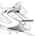 | |
| end_date | Date | Datum kada je maknut |  | |
| energy_class [en] | code | An energy class of the feature |  | |
| est_width | Number | Gruba procjena širine puta u metrima |  | |
| fee | yes / no | Used for specifying whether fee is charged for use/access to a facility. See also Lua error in mw.title.lua at line 230: too many expensive function calls..
|
 | |
| fire_object:type | poo / szo | Potentially dangerous and socially significant objects | ||
| fire_operator | Name | Fire station, which serves the object | ||
| fire_rank | 1bis / 2 to 5 | Rank fire, defined for a particular object | ||
| frequency | Number | Frequency in Hz |  | |
| gutter [en] | yes/no | Presence of the gutter |  | |
| hazard | see hazard | Indicates of the hazards. |  | |
| hot_water | yes / no | Describes whether a hot water is available | ||
| inscription | User Defined | The full text of inscriptions, which can be found on buildings, memorials and other objects. |  | |
| internet_access | yes / wired / wlan / terminal / no | This tag is for indication that a map entity such as a building, a shop, restaurant, etc. offers internet access to the public, either as a paid service or even for free. |  | |
| layer | -5 to 5 | Ova brojčana oznaka koristi se da bi odredili nivo nekog objekta. 0: površina zemlje; -1:ispod površine zemlje; 1 (not +1):iznad površine zemlje Ovo se koristi za stvarno fizičko stanje (npr. kod petlji - viadukti, preko ceste), a ne da bi utjecali na redosljed renderiranja. |
 | |
| leaf_cycle | evergreen / deciduous / semi_evergreen / semi_deciduous / mixed | Describes the phenology of leaves |  | |
| leaf_type | broadleaved / needleleaved / mixed / leafless | Describes the type of leaves |  | |
| location | underground / overground / underwater / roof / indoor | Location |  | |
| narrow | yes | Relative indication that a way (waterway, highway, cycleway) gets narrower. |  | |
| nudism | yes / obligatory / designated / no / customary / permissive | Indicates if the described object provides the possibility of nudism |  | |
| opening_hours | 24/7 or mo md hh:mm-hh:mm. (read described syntax) | opening_hours describes when something is open. |  | |
| opening_hours:drive_through | 24/7 or mo md hh:mm-hh:mm. (read described syntax) | opening_hours describes when something is open for drive-through services. |  | |
| operator | User Defined | The operator tag can be used to name a company or corporation who's responsible for a certain object or who operates it. | ||
| power_supply | yes / no | Describes whether a power supply is available |  | |
| produce | User Defined | Describes a feature's agricultural output produced though a natural process of growing or breeding. |  | |
| rental | see key's page | Tagged on shops and other features to denote if they rent something or not and what they rent. |  | |
| sauna | yes / no | Describes whether a sauna is available |  | |
| service_times | see opening_hours | Times of service of a given feature e.g. church service |  | |
| shower | yes / no | Describes whether a shower is available |  | |
| sport | soccer / tennis / basketball / baseball / multi / ... | Describes which sports are placed on a facility such as a pitch or stadium. |  | |
| start_date | Date | Datum kreiranja objekta |  | |
| tactile_paving | yes /no | Indicate if a specific place can be detected or followed with a blindman's stick. |  | |
| tidal | yes | Area is flooded by the tide |  | |
| toilets | yes / no | Describes whether a toilets is available |  | |
| topless | yes / no | Indicates if the described object provides the possibility of female topless practice |  | |
| tunnel | yes | Tunel, koristiti s oznakom |  | |
| toilets:wheelchair | yes / no | States if a location has a wheelchair accessible toilet or not. |  | |
| wheelchair | yes / no / limited | Indicates if a place is accessible using a wheelchair. |  | |
| width | Number | Širina puta u metrima |  | |
Applies to Lua error in mw.title.lua at line 230: too many expensive function calls. and Lua error in mw.title.lua at line 230: too many expensive function calls. detailing the sort of trees found within each landuse. Makes most sense when applied to areas. Be careful : this tag is now deprecated, please use instead Lua error in mw.title.lua at line 230: too many expensive function calls.
|
 |
This table is a wiki template with a default description in English. Editable here. {{Hr:Map Features:restrictions}}
Imenovanje
Imena
| Key | Value | Element | Comment | Rendering | Photo |
|---|---|---|---|---|---|
| name | korisnički unos | Ime koje se najčešće i uobičajeno koristi. (Bilješka: Za sporna područja, molimo Vas da koristite ime kako je i prikazano, npr. na znakovima imena ulica. Stavite sve alternative u bilo lokalizirano ime oznake (npr. ili name:hr/name:sl,name:tr/name:el) ili druge varijante (npr. loc_name/old_name/alt_name). Hvala!.) | |||
| alt_name | korisnički unos | Drugo ime pod kojim je poznat taj objekt npr. name=Field Fare Road i alt_name=Fieldfare Road, ili name=University Centre i alt_name=Grad Pad | |||
| int_name | korisnički unos | Internacionalno ime (bilješka: bolje je koristiti specifična imena za jezik, npr. name:en=, name:hu=, name:de=... - vidi ispod - International ne znači obavezno Engleski | |||
| nat_name | korisnički unos | Nacionalno ime | |||
| reg_name | korisnički unos | Regionalno ime | |||
| loc_name | korisnički unos | Lokalno ime | |||
| old_name | korisnički unos | Povijesno ime | |||
| name:xx | korisnički unos | Ime na drugom jeziku npr. name:fr=Londres. Vidi: Dvojezična imena ulica |
This table is a wiki template with a default description in English. Editable here.
Reference (brojevi cesta)
| Key | Value | Element | Comment | Rendering | Photo |
|---|---|---|---|---|---|
| ref | korisnički unos | Najčešća oznaka broja ceste (npr. za državnu cestu D34 -> D34,  Oznake se nalaze ili na malim znakovima uz cestu ili na putokazima |

| ||
| int_ref | korisnički unos | Međunarodni broj ceste (npr. E 30) | 
| ||
| nat_ref | korisnički unos | Nationalna referenca | |||
| reg_ref | korisnički unos | Regionalna referenca | |||
| loc_ref | korisnički unos | Lokalna referenca | |||
| old_ref | korisnički unos | Povijesna referenca | |||
| ncn_ref | korisnički unos | The number reference (eg 54) of a National Cycle Network route. In the UK, national routes have single-or double-digit numbers with a red background on the signs. | 
| ||
| rcn_ref | korisnički unos | The number of the regional cycle network. In the UK the regional routes have double-digit numbers with a blue background on the signs. |  (Sign showing both national and regional spur). | ||
| lcn_ref | korisnički unos | Broj lokalne biciklističke mreže | 
| ||
| source_ref | korisnički unos | Izvor podataka, za bilježenje URI, izvora (npr. Bing, GPS) ili link na fizičke izvore. | |||
| icao | korisnički unos | ICAO međunarodna oznaka zračne luke | |||
| iata | korisnički unos | IATA međunarodna oznaka zračne luke |
This table is a wiki template with a default description in English. Editable here.
Mjesta
| Key | Value | Element | Comment | Rendering | Photo |
|---|---|---|---|---|---|
| place | continent | Kontinent, jedan od: Azija, Afrika, Sjeverna Amerika, Južna Amerika, Antartika, Europa, Australija (od najvećeg do najmanjeg) |
|||
| place | country | država (na područjima i putevima se koristi Lua error in mw.title.lua at line 230: too many expensive function calls.
|
|||
| place | state | kanton, savezna država, i sl. | |||
| place | region | regija | |||
| place | county | županija | |||
| place | city | Grad s više od over 50.000 stanovnika | |||
| place | town | Gradovi, definirani zakonom i imaju status grada. Općenito gradovi koji imaju do 50.000 stanovika. Popis gradova na Wikipediji | |||
| place | village | Sva druga mjesta koja nemaju status grada. | |||
| place | hamlet | mjesta sa samo nekoliko kuća, pustare i slično | |||
| place | suburb | Gradska četvrt, kotar ili kvart | |||
| place | locality | Lokalitet, nenaseljeno mjesto koje ima ime. | |||
| place | island | otok (vidi i Lua error in mw.title.lua at line 230: too many expensive function calls.), a imajte na umu i Lua error in mw.title.lua at line 230: too many expensive function calls. za vrlo male otoke
|
Vidi OSM_tags_for_routing for the guideline to automatic interpretation of this tag.
See also the FAQ for a description how to use areas and nodes when tagging a place.
| Key | Value | Element | Comment | Rendering | Photo |
|---|---|---|---|---|---|
| place_name | User Defined | Samo za područja (površine). Za točke korisite točku 'name' (vidi Notes). Ali možete koristiti i obje. | |||
| place_numbers | User Defined | Kućni broj. Bilješka: Većina ljudi sada koristi Karlsruhe Schema umjesto ove oznake. | |||
| postal_code | User Defined | Poštanski broj. Bilješka: Većina ljudi sada koristi Karlsruhe Schema umjesto ove oznake. | |||
| is_in | User Defined | Za kategorizaciju - na primjer Lua error in mw.title.lua at line 230: too many expensive function calls.; Lua error in mw.title.lua at line 230: too many expensive function calls.; Lua error in mw.title.lua at line 230: too many expensive function calls.
|
|||
| population | Number | Broj stanovnika mjesta. Međuostalim, može se koristiti za izbor veličine renderiranja naziva mjesta |
This section is a wiki template with a default description in English. Editable here.
Adrese
| Key | Value | Element | Comment | Photo |
|---|---|---|---|---|
| Oznake za pojedinačne kuće | ||||
| addr:housenumber | user defined | En:Kućni broj (može sadržavati slova). Ako jedan unos ima više kućnih brojeva, odvojite ih zarezom ",". npr. "12b,12c". Jedini ključ (key) koji se zahtjeva kod unosa adrese (osim kada se koristi addr:housename), sve drugo je opcionalno. | 
| |
| addr:housename | user defined | Ime kuće. Ovo se ponekad korsiti u nekim zemljama, npr. Engleskoj umjesto ili se doda kućnom broju. | ||
| addr:street | user defined | Ime (glavno) ulice. Put s highway=* i pripadajućim imenom.
|

| |
| addr:postcode | user defined | Poštanski broj zgrade ili područja. | ||
| addr:city | user defined | Klon Lua error in mw.title.lua at line 230: too many expensive function calls.! Ime grada je dano u poštanskoj adresi zgrade ili područja.
|

| |
| addr:country | user defined | Klon Lua error in mw.title.lua at line 230: too many expensive function calls.! ISO 3166-1 alpha-2 dvoslovna oznaka države pisana VELIKIM SLOVIMA. Npr.: "HR" za Hrvatsku, "DE" za Njemačku, "FR" for Francusku, "IT" for Italiju. "GB" za Veliku Britaniju
|
||
| Oznake za interpolaciju | ||||
| addr:interpolation | all/even/odd/ alphabetic | Kako interpolirati kućne brojeve pripadajućem putu uz ulicu na koju se odnosi. Vidi za detaljni opis. | ||
| addr:interpolation | Number | Svaka kuća između krajeva interpoliranog puta je predstavljena interpoliranim putem (way). | ||
This section is a wiki template with a default description in English. Editable here. {{Hr:Map Features:annotation}} {{Hr:Map Features:editor keys}}
- ↑ Some mappers add them to OpenStreetMap with
Lua error in mw.title.lua at line 230: too many expensive function calls., but this is controversial.


