Template:Map Features:railway
Jump to navigation
Jump to search
Railway
- Main article: Railways
This key includes all kinds of railways ranging from heavily used mainline railways to an abandoned rail line.
| Key | Value | Element | Comment | Rendering carto | Photo | |
|---|---|---|---|---|---|---|
Tracks | ||||||
| railway | abandoned | The course of a former railway which has been abandoned and the track removed. The course is still recognized through embankments, cuttings, tree rows, bridges, tunnels, remaining track ties, building shapes and rolling or straight ways. Demolished rails that are no longer identifiable are better mapped in OpenHistoricalMap (they are controversial in OSM).[1] |  | |||
| railway | construction | Railway under construction. |  |
 | ||
| railway | proposed | Railway being proposed but haven't started construction. Please see the proposed page regarding verifiability on the ground of this value. | ||||
| railway | disused | A section of railway which is no longer used but where the track and infrastructure remains in place. The track is likely overgrown with endemic vegetation, but could be brought back into useful service with only minor effort. |  |
 | ||
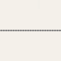
| railway | funicular | Cable driven inclined railways on a steep slope, with a pair of cars connected by one cable |  |
 | ||
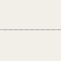
| railway | light_rail | A higher-standard tram system, normally in its own right-of-way. Often it connects towns and thus reaches a considerable length (tens of kilometres). |  |
 | ||
| railway | miniature | Miniature railways are narrower than narrow gauge and carry passengers, frequently at an exact scale of "standard-sized" rail (for example "1/4 scale"). They can often be found in parks. |  |
 | ||
| railway | monorail | A railway with only a single rail. A monorail can run above the rail like in Las Vegas and Disneyland or can suspend below the rail like the Wuppertal Schwebebahn (Germany). |  |
 | ||
| railway | narrow_gauge | Narrow-gauge passenger or freight train tracks. Narrow gauge railways can have mainline railway service like the Rhaetian Railway in Switzerland or can be a small light industrial railway. Use gauge=* to specify the actual width of rails in mm.
|
 |
 | ||
This is the old tag for historic trains. Use railway:preserved=yes for historical railway instead.
|
 |
 | ||||
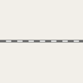
| railway | rail | Full sized passenger or freight train tracks in the standard gauge for the country or state. |  |
 | ||
| railway | subway | A city passenger rail service running mostly grade separated (see Wikipedia:rapid transit). Often a significant portion of the line or its system/network is underground. |  |
 | ||
| railway | tram | One or two carriage rail vehicle tracks, usually sharing motor road, sometimes called "street running" (Other languages). |  |
 | ||
Additional track features or attributes | ||||||
| bridge | yes | If the railway goes over a street, waterway or other railway on an elevated structure. |  |
 | ||
| cutting | yes | A section where the railway is significantly lower than ground level, but not underground. |  | |||
| electrified | contact_line rail yes no |
contact_line: a power line over the train head rail: a third rail near the track supplying the train with power yes: electrified track, but no details available no: track with no power supply. |
 | |||
| embankment | yes | A section where the railway is raised significantly higher than ground level. |  | |||
| embedded_rails | yes / <type of railway> | Specifies that a highway on which non-railway traffic is also allowed has railway tracks embedded in it but the rails are mapped as separate ways. |  | |||
| frequency | <number> [Hz] | The frequency with which a line is electrified. Use 0 for DC. Also see the voltage tag. |  | |||
| passenger_lines | <number> | Used to describe number of tracks of the railway line a certain track segment belongs to. | ||||
| railway:track_ref | <number> | Track number |  | |||
| service | crossover | Relatively short lengths of track which switch traffic from one parallel line to another | ||||
| service | siding | Relatively short lengths of track, running parallel to (and connected to) a main route |  |
|||
| service | spur | Relatively short lengths of track, built to give one company or entity access to a main or branch line. |  |
 | ||
| service | yard | Tracks within railway company operated marshalling or maintenance yards. |  |
 | ||
| tunnel | yes | If the railway goes below ground. Most subways have this tag. |  | |||
| tracks | <number> | Number of parallel tracks in close proximity when mapped as one single way representing all tracks. If not given means unknown and defaults to 1. In many parts of the world the tracks are being drawn out separately so that there is more detail, in which case this tag isn't used. |  | |||
| usage | main branch industrial military tourism scientific test |
main line: heavy traffic branch line: connecting places with a mainline industrial: servicing large plants (iron, chemical etc.), surface mining, … military: servicing military area tourism: most mountain rails (rack-rails, funicular) and preserved railways scientific: rail transport at spaceports, large array telescopes, etc. test: track for testing new wheels, rails, tracks and rail technologies. |
||||
| voltage | <number> | The voltage with which a line is electrified. Also see the frequency tag. |  | |||
Stations and stops | ||||||
| railway | halt | A small station without switches |  | |||
| public_transport | stop_position | The position on the railway track where the train (its centre) stops at a platform. This is useful for routing on long platforms where also short trains stop and on long platforms where multiple trains stop behind each other. See also public_transport=stop_area.
|
 | |||
| public_transport | platform | This is parallel to the rail line for showing where the actual platforms are. It is also to know where you can change platform and enter the station, so use footpaths to connect them. This is really useful for routing too. Use only if the platform is served by public transport. |  | |||
| railway | platform | This is parallel to the rail line for showing where the actual platforms are. It is also to know where you can change platform and enter the station, so use footpaths to connect them. This is really useful for routing too. Use in addition to public_transport=platform.
|
 | |||
| public_transport | station | Railway passenger-only station. |  | |||
| railway | station | Railway passenger and/or cargo station. Use in addition to public_transport=station.
|
 | |||
| railway | stop | Marks the position where trains stop at a station. It should be added as a node on a railway=rail way. |  | |||
| railway | subway_entrance | The entrance to a subway station, usually going from surface to underground. |  | |||
| railway | tram_stop | A tram stop is a place where a passenger can embark / disembark a tram. |  | |||
Infrastructure | ||||||
| landuse | railway | Ground used around railways and railwaystations. | 
|
 | ||
| railway | buffer_stop | Stops the train at the end of a track. See buffer stop. |  | |||
| railway | crossing | A point where pedestrians may cross. |  | |||
| railway | depot | A rail yard used to store and deploy passenger rail cars. It should be added as a area on a landuse=railway. | ||||
| railway | derail | A device used to prevent fouling of a rail track by unauthorized movements of trains or unattended rolling stock. See Derail (railroad). |  | |||
| railway | level_crossing | A point where rails and roads cross. |  | |||
| railway | railway_crossing | Crossing rails with no interconnection. |  | |||
| railway | roundhouse | A semicircular building with many stalls for servicing engines. |  | |||
| railway | signal | Any kind of railway signal. |  | |||
| railway | switch | Full connections between railways (aka 'points'). |  | |||
| railway | tram_level_crossing | A point where trams and roads cross. |  | |||
| railway | traverser | These are used for changing trains between railways. Also known as transfer table. |  | |||
| railway | turntable | These are used for changing the direction that part of a train is pointing in. |  | |||
| railway | ventilation_shaft | A structure that allows ventilation in underground tunnels |  | |||
| railway | wash | A railroad carriage/car wash |  | |||
| railway | water_crane | A structure to deliver water to steam locomotives |  | |||
| railway | workshop | Repair shop' for (rail) rolling stock' is a place where maintenance or overhaul of these vehicles (rail vehicles, metro, tram, light rail, monorail) is carried out. It should be added as a area on a building=yes. |  | |||
| railway | user defined | All commonly used values according to Taginfo | ||||
This table is a wiki template with a default description in English. Editable here.
Template for the Railway table in the Map Features page. Use the default English text or use the template arguments for your translations
Usage
All parameters are optional. By default, text is in English. English writers shall write their comments in the template itself (avoiding double edition). Other languages are translated in template arguments, not in the template itself.
section header
|name=        (section header line)
|description= (displayed before and/or after the table; optional)
== One key/value row ==
|railway:key=   |station:value=   |station:desc=   |station:render=   |station:photo=


