Tag:railway=subway_entrance
| Description |
|---|
| The entrance point of a subway |
| Rendering in OSM Carto |
| Group: railways |
| Used on these elements |
| Useful combination |
|
| Status: approved |
| Tools for this tag |
|
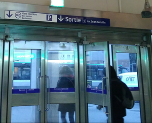
A subway entrance is a place where people enter or exit a train station
It is not the point where you validate your ticket. A subway entrance might get you to underground shops before you reach the platform, or it might get you to an overpass/underpass crossing a street.
This tag is also used to map subway exits.
Mapping subway entrances can be used by pedestrian routing softwares: when exiting a station, it can tell the name of the exit the nearest to your destination (as there is likely no GPS signal to guide you through an underground station).
How to map
A subway entrance is tagged as a node on a way leading to (or exiting from) the station: an entrance in a building, start of stairs...
Node attributes:
| Key | Value | Description |
|---|---|---|
| railway | subway_entrance | |
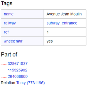
| name | Name | Recommended. Name of the exit if is known. Not the name of the station (use the public_transport=stop_area relation instead to link with the station). This doesn't include the reference either. |
| ref | Reference | Optional. Reference of the entrance if it has one. Some subway networks use numbers or codes to identify exits, e.g. "2" or "B1". |
| wheelchair | yes / no | Optional. Accessible by wheelchair. |
| bicycle | yes / no | Optional. Accessible with bicycles (default is no). |
Add this node to a relation public_transport=stop_area without role. Optionally you may set the role to "entrance", but this information is already held by the node itself.
Note that an entrance may lead to more than one stop area, in which case add it to the relevant stop areas.
If the node is an entrance-only or exit-only, add oneway=yes to the way going through this entrance.
Example
Tools
A MapContrib theme (in French) dedicated to subway entrances : https://www.mapcontrib.xyz/t/fe7ce8-Sorties_de_metro#
See also
- amenity=ticket_validator - A device to scan or validate your ticket. Can be combined with for example barrier=gate or barrier=turnstile
- public_transport=station - Tag for public transport stations.
- Railways - Page all about mapping the various features of railways (including subways).
- railway=train_station_entrance - The entrance point of a train station
| ||||||||||||||||||||||||||||||||||||||||||||||


