Ko:Map features
오픈스트리트맵은 기본 데이터 구조(마디, 길, 관계)에 태그를 사용하여 물리적 특징(예: 도로 또는 건물)을 표현합니다. 각 태그는 해당 지물의 지리적인 속성을 표현합니다.
오픈스트리트맵의 자유로운 태그 시스템은 지도에 각 지물을 설명하는 속성을 제한 없이 사용할 수 있도록 허용합니다. 커뮤니티에서 합의된 일반적으로 사용되는 지물에 대한 특정 키와 값 조합이 있으며, 이는 비공식적인 표준 역할을 하고 있지만, 지도의 스타일을 개선하거나 이전에 매핑되지 않은 속성을 표현하기 위해 새로운 태그를 만들 수도 있습니다. 특정 주제와 관련된 태그에 대한 설명은 지물을 참조하세요.
대부분의 지물은 highway=footway와 같은 분류 태그나 name=*과 같은 소수의 태그만 사용하여 표현할 수 있습니다. 오픈스트리트맵은 전 세계를 아우르는 지도이기 때문에, 오픈스트리트맵에는 다양한 유형의 지물이 있으며 거의 모든 지물을 태그로 설명할 수 있습니다.
기존 태그에 대한 변경 제안, 비활성화된 태그 및 더 이상 사용되지 않는 태그에 대한 목록에서 적절한 태그를 찾을 수 없고 태그 값이 검증할 수 있는 것이라면, 태그를 자유롭게 만들어 보세요. 시간이 지나면서 태그는 더 폭넓은 합의에 따라 변경되었지만, 많은 태그가 먼저 사용된 후에 문서화되었습니다. 태그 체계의 최신 업데이트는 변경 사항을 참조하세요.
주요 지물
공중 케이블
사람이나 화물을 공중 케이블을 사용해 운반할 때 사용하는 여러 종류의 대중 교통에 사용됩니다. 예를 들어 케이블카, 체어 리프트, 드래그 리프트 등이 있습니다. 이 태그를 사용하는 방법은 aerialway 를 참조하세요.
| 종류 | 태그 | 요소 | 설명 | 렌더링 | 이미지 | |
|---|---|---|---|---|---|---|
| 공중 케이블의 종류 | ||||||
| aerialway | cable_car | 케이블카, 한 쌍의 선에 객실을 매달고 사람이나 짐을 운반하는 장치. |  |
 |
||
| aerialway | gondola | 곤돌라, 하나의 선에 객실을 매단 리프트의 일종. |  |
 |
||
| aerialway | chair_lift | 체어리프트, 주로 스키장에서 사람들을 실어나르는 장치. |  |
 |
||
| aerialway | mixed_lift | 체어리프트와 곤돌라를 혼합한 새로운 종류의 리프트. |  |
 |
||
| aerialway | drag_lift | 산 위로 사람들을 끌어 올리는 장치 |  |
 |
||
| aerialway | t-bar | T자형 스키 리프트. |  |
 |
||
| aerialway | j-bar | J자형 스키 리프트. |  |
 |
||
| aerialway | platter | aerialway=drag_lift의 종류.
|
 |
 |
||
| aerialway | rope_tow | aerialway=drag_lift의 종류. 스키어들이 잡고 슬로프 위로 오르는 회전 로프.
|
 |
 |
||
| aerialway | magic_carpet | 매직 카펫, 무빙워크와 비슷한 스키 리프트의 일종. | 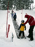 |
|||
| aerialway | zip_line | 짚라인, 객실 없이 선에 연결된 벨트를 잡고 이동하는 장치. |  |
 |
||
| aerialway | goods | 화물 전용의 리프트. |  |
 |
||
| 장비 | ||||||
| aerialway | pylon | 리프트나 케이블카의 선을 지탱하는 철탑. |  |
|||
| aerialway | station | '리프트나 케이블카에 탑승하거나 빠져나올 수 있는 곳. | 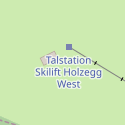
|
 |
||
| 기타 | ||||||
| aerialway | 사용자 정의 | Taginfo에서 자주 사용하는 값을 확인할 수 있습니다. | ||||
This table is a wiki template with a default description in English. Editable here.
한국어 번역은 여기에 있습니다.
항공
주로 비행기나 헬리콥터의 운항에 사용하는 공항이나 비행장입니다. 이 태그를 사용하는 방법은 Aeroway를 참조하세요.
| 키 | 값 | 요소 | 설명 | 렌더링 | 이미지 |
|---|---|---|---|---|---|
| aeroway | aerodrome | 공항, 비행장 |  | ||
| aeroway | airstrip | A field or area where light aircraft can land and take off from. |  | ||
| aeroway | apron | 계류장. 비행기가 멈추거나, 비행기를 타고 내리는 영역. |  |
 | |
| aeroway | control_center |  | |||
| aeroway | fuel | Fuelling station for aircraft. |  | ||
| aeroway | gate | 탑승객이 탑승하기 전에 기다리는 게이트 번호. | 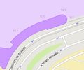 |
 | |
| aeroway | hangar | 기체를 넣기 위해 넓은 영역을 차지하는 큰 공항 건물. |  | ||
| aeroway | helipad | 헬리콥터가 착륙하는 영역 또는 플랫폼. |  | ||
| aeroway | heliport | 헬리콥터용으로 지어진 특별한 이착륙장. |  | ||
| aeroway | highway_strip |  | |||
| aeroway | holding_position | A point behind which aircraft are considered clear of a crossing way |  | ||
| aeroway | jet_bridge | Passenger boarding bridge |  | ||
| aeroway | model_runway | Take-off and landing runway for model aircraft |  | ||
| aeroway | navigationaid | 항공기에게 시각적으로 안내를 도와주는 시설. |  | ||
| airmark | beacon |  | |||
| aeroway | parking_position | A location where an aeroplane can park |  | ||
| aeroway | runway | 이착륙장의 활주로. | 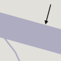 |
 | |
| aeroway | spaceport | A spaceport or cosmodrome: a site for launching or receiving spacecraft |  | ||
| aeroway | stopway | Stopway is a rectangular surface beyond the end of a runway used during an aborted takeoff. |  | ||
| aeroway | taxilane | 계류장 등에 있는 경로. | |||
| aeroway | taxiway | 공항의 유도로. | 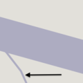 |
 | |
| aeroway | terminal | 공항의 승객용 건물. |  |
 | |
| aeroway | tower | See also aeroway=control_tower or combination of man_made=tower + service=aircraft_control for similar schemes.
|
 | ||
| aeroway | windsock | 파일럿이 풍향과 풍속을 볼 수 있게 해 주는 지물. |  | ||
| aeroway | 사용자 정의 | Taginfo에서 자주 사용하는 값을 확인할 수 있습니다. |
This table is a wiki template with a default description in English. Editable here. 한국어 번역은 여기에 있습니다.
편의 시설
방문자나 거주자가 사용하는 시설을 매핑하는 데 사용됩니다. 예를 들어 화장실, 전화, 은행, 약국, 카페, 주차장, 학교 등이 있습니다. 사용법은 amenity 를 참조하세요.
| 키 | 값 | 요소 | 설명 | Carto rendering | 이미지 | |
|---|---|---|---|---|---|---|
Sustenance | ||||||
| amenity | bar | Bar is a purpose-built commercial establishment that sells alcoholic drinks to be consumed on the premises. They are characterised by a noisy and vibrant atmosphere, similar to a party and usually don't sell food. See also the description of the tags amenity=pub;bar;restaurant for a distinction between these.
|
 | |||
| amenity | biergarten | Biergarten or beer garden is an open-air area where alcoholic beverages along with food is prepared and served. See also the description of the tags amenity=pub;bar;restaurant. A biergarten can commonly be found attached to a beer hall, pub, bar, or restaurant. In this case, you can use biergarten=yes additional to amenity=pub;bar;restaurant.
|
 | |||
| amenity | cafe | Cafe is generally an informal place that offers casual meals and beverages; typically, the focus is on coffee or tea. Also known as a coffeehouse/shop, bistro or sidewalk cafe. The kind of food served may be mapped with the tags cuisine=* and diet:*=*. See also the tags amenity=restaurant;bar;fast_food.
|
 | |||
| amenity | fast_food | Fast food restaurant (see also amenity=restaurant). The kind of food served can be tagged with cuisine=* and diet:*=*.
|
 | |||
| amenity | food_court | An area with several different restaurant food counters and a shared eating area. Commonly found in malls, airports, etc. |  | |||
| amenity | ice_cream | Ice cream shop or ice cream parlour. A place that sells ice cream and frozen yoghurt over the counter |  | |||
| amenity | pub | A place selling beer and other alcoholic drinks; may also provide food or accommodation (UK). See description of amenity=bar and amenity=pub for distinction between bar and pub
|
 | |||
| amenity | restaurant | Restaurant (not fast food, see amenity=fast_food). The kind of food served can be tagged with cuisine=* and diet:*=*.
|
 | |||
Education | ||||||
| amenity | college | Campus or buildings of an institute of Further Education (aka continuing education) |  | |||
| amenity | dancing_school | A dancing school or dance studio |  | |||
| amenity | driving_school | Driving School which offers motor vehicle driving lessons |  | |||
| amenity | first_aid_school | A place where people can go for first aid courses. | ||||
| amenity | kindergarten | For children too young for a regular school (also known as preschool, playschool or nursery school), in some countries including afternoon supervision of primary school children. |  | |||
| amenity | language_school | Language School: an educational institution where one studies a foreign language. |  | |||
| amenity | library | A public library (municipal, university, …) to borrow books from. |  | |||
| amenity | surf_school | A surf school is an establishment that teaches surfing. |  | |||
| amenity | toy_library | A place to borrow games and toys, or play with them on site. |  | |||
| amenity | research_institute | An establishment endowed for doing research. |  | |||
| amenity | training | Public place where you can get training. |  | |||
| amenity | music_school | A music school, an educational institution specialized in the study, training, and research of music. |  | |||
| amenity | school | School and grounds - primary, middle and secondary schools |  | |||
| amenity | traffic_park | Juvenile traffic schools |  | |||
| amenity | university | A university campus: an institute of higher education |  | |||
Transportation | ||||||
| amenity | bicycle_parking | Parking for bicycles |  | |||
| amenity | bicycle_repair_station | General tools for self-service bicycle repairs, usually on the roadside; no service |  | |||
| amenity | bicycle_rental | Rent a bicycle |  | |||
| amenity | bicycle_wash | Clean a bicycle |  | |||
| amenity | boat_rental | Rent a Boat |  | |||
| amenity | boat_storage | A place to store boats out of the water. |  | |||
| amenity | boat_sharing | Share a Boat |  | |||
| amenity | bus_station | May also be tagged as public_transport=station.
|
 | |||
| amenity | car_rental | Rent a car |  | |||
| amenity | car_sharing | Share a car |  | |||
| amenity | car_wash | Wash a car |  | |||
| amenity | compressed_air | A device to inflate tires/tyres (e.g. motorcar, bicycle) |  | |||
| amenity | vehicle_inspection | Government vehicle inspection |  | |||
| amenity | charging_station | Charging facility for electric vehicles |  | |||
| amenity | driver_training | A place for driving training on a closed course |  | |||
| amenity | ferry_terminal | Ferry terminal/stop. A place where people/cars/etc. can board and leave a ferry. |  | |||
| amenity | fuel | Petrol station; gas station; marine fuel; … Streets to petrol stations are often tagged highway=service.
|
 | |||
| amenity | grit_bin | A container that holds grit or a mixture of salt and grit. |  | |||
| amenity | motorcycle_parking | Parking for motorcycles |  | |||
| amenity | parking | Parking area for vehicles. Streets on car parking are often tagged highway=service and service=parking_aisle.
|
 | |||
| amenity | parking_entrance | An entrance or exit to an underground or multi-storey parking facility. Group multiple parking entrances together with a relation using the tags type=site and site=parking
|
Underground |
 | ||
| amenity | parking_space | A single parking space within a car park. Parking spaces should be mapped within an amenity=parking area. Group multiple parking spaces together with a relation using the tags type=site and site=parking
|
 |
 | ||
| amenity | taxi | A place where taxis wait for passengers. |  | |||
| amenity | weighbridge | A large weight scale to weigh vehicles and goods |  | |||
Financial | ||||||
| amenity | atm | Automated teller machine (ATM) or cashpoint: a device that provides the clients of a financial institution with access to financial transactions. |  | |||
| amenity | payment_terminal | Self-service payment kiosk/terminal |  | |||
| amenity | bank | Bank or credit union: a financial establishment where customers can deposit and withdraw money, take loans, make investments and transfer funds. |  | |||
| amenity | bureau_de_change | Bureau de change, money changer, currency exchange, Wechsel, cambio – a place to change foreign bank notes and travellers cheques. |  | |||
| amenity | money_transfer | A place that offers money transfers, especially cash to cash |  | |||
| amenity | payment_centre | A non-bank place, where people can pay bills of public and private services and taxes. |  | |||
Healthcare | ||||||
| amenity | baby_hatch | A place where a baby can be, out of necessity, anonymously left to be safely cared for and perhaps adopted. |  | |||
| amenity | clinic | A medium-sized medical facility or health centre. |  | |||
| amenity | dentist | A dentist practice / surgery. |  | |||
| amenity | doctors | A doctor's practice / surgery. |  | |||
| amenity | hospital | A hospital providing in-patient medical treatment. Often used in conjunction with emergency=* to note whether the medical centre has emergency facilities (A&E (brit.) or ER (am.))
|
 | |||
| amenity | nursing_home | Discouraged tag for a home for disabled or elderly persons who need permanent care. Use amenity=social_facility + social_facility=nursing_home now.
|
 | |||
| amenity | pharmacy | Pharmacy: a shop where a pharmacist sells medicationsdispensing=yes/no - availability of prescription-only medications
|
 | |||
| amenity | social_facility | A facility that provides social services: group & nursing homes, workshops for the disabled, homeless shelters, etc. |  | |||
| amenity | veterinary | A place where a veterinary surgeon, also known as a veterinarian or vet, practices. |  | |||
Entertainment, Arts & Culture | ||||||
| amenity | arts_centre | A venue where a variety of arts are performed or conducted |  | |||
| amenity | brothel | An establishment specifically dedicated to prostitution |  | |||
| amenity | casino | A gambling venue with at least one table game(e.g. roulette, blackjack) that takes bets on sporting and other events at agreed upon odds. |  | |||
| amenity | cinema | A place where films are shown (US: movie theater) |  | |||
| amenity | community_centre | A place mostly used for local events, festivities and group activities; including special interest and special age groups. . |  | |||
| amenity | conference_centre | A large building that is used to hold a convention |  | |||
| amenity | events_venue | A building specifically used for organising events |  | |||
| amenity | exhibition_centre | An exhibition centre |  | |||
| amenity | fountain | A fountain for cultural / decorational / recreational purposes. |  | |||
| amenity | gambling | A place for gambling, not being a shop=bookmaker, shop=lottery, amenity=casino, or leisure=adult_gaming_centre.
Games that are covered by this definition include bingo and pachinko. |
 | |||
| amenity | love_hotel | A love hotel is a type of short-stay hotel operated primarily for the purpose of allowing guests privacy for sexual activities. |  | |||
| amenity | music_venue | An indoor place to hear contemporary live music. |  | |||
| amenity | nightclub | A place to drink and dance (nightclub). The German word is "Disco" or "Discothek". Please don't confuse this with the German "Nachtclub" which is most likely amenity=stripclub. |  | |||
| amenity | planetarium | A planetarium. |  | |||
| amenity | public_bookcase | A street furniture containing books. Take one or leave one. |  | |||
| amenity | social_centre | A place for free and not-for-profit activities. |  | |||
| amenity | stage | A raised platform for performers. |  | |||
| amenity | stripclub | A place that offers striptease or lapdancing (for sexual services use amenity=brothel). |  | |||
| amenity | studio | TV radio or recording studio |  | |||
| amenity | swingerclub | A club where people meet to have a party and group sex. |  | |||
| amenity | theatre | A theatre or opera house where live performances occur, such as plays, musicals and formal concerts. Use amenity=cinema for movie theaters.
|
 | |||
Public Service | ||||||
| amenity | courthouse | A building home to a court of law, where justice is dispensed |  | |||
| amenity | fire_station | A station of a fire brigade |  | |||
| amenity | police | A police station where police officers patrol from and that is a first point of contact for civilians |  | |||
| amenity | post_box | A box for the reception of mail. Alternative mail-carriers can be tagged via operator=*
|
 | |||
| amenity | post_depot | Post depot or delivery office, where letters and parcels are collected and sorted prior to delivery. |  | |||
| amenity | post_office | Post office building with postal services |  | |||
| amenity | prison | A prison or jail where people are incarcerated before trial or after conviction |  | |||
| amenity | ranger_station | National Park visitor headquarters: official park visitor facility with police, visitor information, permit services, etc |  | |||
| amenity | townhall | Building where the administration of a village, town or city may be located, or just a community meeting place |  | |||
Facilities | ||||||
| amenity | bbq | BBQ or Barbecue is a permanently built grill for cooking food, which is most typically used outdoors by the public. For example these may be found in city parks or at beaches. Use the tag fuel=* to specify the source of heating, such as fuel=wood;electric;charcoal. For mapping nearby table and chairs, see also the tag tourism=picnic_site. For mapping campfires and firepits, instead use the tag leisure=firepit.
|
 | |||
| amenity | bench | A bench to sit down and relax a bit |  | |||
| amenity | check_in | Place where passengers can get their boarding passes before travel (typically found in airports). |  | |||
| amenity | dog_toilet | Area designated for dogs to urinate and excrete. |  | |||
| amenity | dressing_room | Area designated for changing clothes. |  | |||
| amenity | drinking_water | Drinking water is a place where humans can obtain potable water for consumption. Typically, the water is used for only drinking. Also known as a drinking fountain or bubbler. |  | |||
| amenity | give_box | A small facility where people drop off and pick up various types of items in the sense of free sharing and reuse. |  | |||
| amenity | lounge | A comfortable waiting area for customers, usually found in airports and other transportation hubs. Typically has extra amenities or sustenance. |  | |||
| amenity | mailroom | A mailroom for receiving packages or letters. |  | |||
| amenity | parcel_locker | Machine for picking up and sending parcels |  | |||
| amenity | shelter | A small shelter against bad weather conditions. To additionally describe the kind of shelter use shelter_type=*.
|
 | |||
| amenity | shower | Public shower. |  | |||
| amenity | telephone | Public telephone |  | |||
| amenity | toilets | Public toilets (might require a fee) |  | |||
| amenity | water_point | Place where you can get large amounts of drinking water |  | |||
| amenity | watering_place | Place where water is contained and animals can drink |  | |||
Waste Management | ||||||
| amenity | sanitary_dump_station | A place for depositing human waste from a toilet holding tank. |  | |||
| amenity | recycling | Recycling facilities (bottle banks, etc.). Combine with recycling_type=container for containers or recycling_type=centre for recycling centres.
|
 | |||
| amenity | waste_basket | A single small container for depositing garbage that is easily accessible for pedestrians. |  | |||
| amenity | waste_disposal | A medium or large disposal bin, typically for bagged up household or industrial waste. |  | |||
| amenity | waste_transfer_station | A waste transfer station is a location that accepts, consolidates and transfers waste in bulk. | ||||
Others | ||||||
| amenity | animal_boarding | A facility where you, paying a fee, can bring your animal for a limited period of time (e.g. for holidays) | 
| |||
| amenity | animal_breeding | A facility where animals are bred, usually to sell them | 
| |||
| amenity | animal_shelter | A shelter that recovers animals in trouble |  | |||
| amenity | animal_training | A facility used for non-competitive animal training |  | |||
| amenity | baking_oven | An oven used for baking bread and similar, for example inside a building=bakehouse.
|
 | |||
| amenity | clock | A public visible clock |  | |||
| amenity | crematorium | A place where dead human bodies are burnt |  | |||
| amenity | dive_centre | A dive center is the base location where sports divers usually start scuba diving or make dive guided trips at new locations. |  | |||
| amenity | funeral_hall | A place for holding a funeral ceremony, other than a place of worship. |  | |||
| amenity | grave_yard | A (smaller) place of burial, often you'll find a church nearby. Large places should be landuse=cemetery instead.
|
 |
 | ||
| amenity | hunting_stand | A hunting stand: an open or enclosed platform used by hunters to place themselves at an elevated height above the terrain | 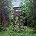 | |||
| amenity | internet_cafe | A place whose principal role is providing internet services to the public. |  | |||
| amenity | kitchen | A public kitchen in a facility to use by everyone or customers |  | |||
| amenity | kneipp_water_cure | Outdoor foot bath facility. Usually this is a pool with cold water and handrail. Popular in German speaking countries. | 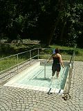 | |||
| amenity | lounger | An object for people to lie down. |  | |||
| amenity | marketplace | A marketplace where goods and services are traded daily or weekly. |  | |||
| amenity | monastery | Monastery is the location of a monastery or a building in which monks and nuns live. |  | |||
| amenity | mortuary | A morgue or funeral home, used for the storage of human corpses. |  | |||
| amenity | photo_booth | A stand to create instant photos. |  | |||
| amenity | place_of_mourning | A room or building where families and friends can come, before the funeral, and view the body of the person who has died. |  | |||
| amenity | place_of_worship | A church, mosque, or temple, etc. Note that you also need religion=*, usually denomination=* and preferably name=* as well as amenity=place_of_worship. See the article for details.
|
 | |||
| amenity | public_bath | A location where the public may bathe in common, etc. japanese onsen, turkish bath, hot spring |  | |||
A generic public building. Don't use! See office=government.
|
||||||
| amenity | refugee_site | A human settlement sheltering refugees or internally displaced persons |  | |||
| amenity | vending_machine | A machine selling goods – food, tickets, newspapers, etc. Add type of goods using vending=*
|
 | |||
| amenity | hydrant | Similar to a fire_hydrant=*, but for gardening and other municipal purposes other than fire extinction
|
 | |||
| amenity | user defined | All commonly used values according to Taginfo | ||||
This table is a wiki template with a default description in English. Editable here. 한국어 번역은 여기에 있습니다.
장벽
이동에 일반적으로 발생하는 장애물과 장벽을 설명하는 데 사용됩니다. 사용법에 대한 소개는 Barriers을 참조하세요.
| 키 | 값 | 요소 | 설명 | 렌더링 | 이미지 |
|---|---|---|---|---|---|
| aeroway | aerodrome |  | |||
| aeroway | airstrip | A field or area where light aircraft can land and take off from. |  | ||
| aeroway | apron |  |
 | ||
| aeroway | control_center |  | |||
| aeroway | fuel | Fuelling station for aircraft. |  | ||
| aeroway | gate |  |
 | ||
| aeroway | hangar |  | |||
| aeroway | helipad |  | |||
| aeroway | heliport |  | |||
| aeroway | highway_strip |  | |||
| aeroway | holding_position | A point behind which aircraft are considered clear of a crossing way |  | ||
| aeroway | jet_bridge | Passenger boarding bridge |  | ||
| aeroway | model_runway | Take-off and landing runway for model aircraft |  | ||
| aeroway | navigationaid | A facility that supports visual navigation for aircraft |  | ||
| airmark | beacon |  | |||
| aeroway | parking_position | A location where an aeroplane can park |  | ||
| aeroway | runway |  |
 | ||
| aeroway | spaceport | A spaceport or cosmodrome: a site for launching or receiving spacecraft |  | ||
| aeroway | stopway | Stopway is a rectangular surface beyond the end of a runway used during an aborted takeoff. |  | ||
| aeroway | taxilane | Taxilane is a path in an airport that is part of the aircraft parking area or apron (Proposed feature with low usage as of 2015-10; use with an eye towards the question correct usage). | |||
| aeroway | taxiway |  |
 | ||
| aeroway | terminal |  |
 | ||
| aeroway | tower | See also aeroway=control_tower or combination of man_made=tower + service=aircraft_control for similar schemes.
|
 | ||
| aeroway | windsock |  | |||
| aeroway | User defined | All commonly used values according to Taginfo |
This table is a wiki template with a default description in English. Editable here. 한국어 번역은 여기에 있습니다.
경계선
행정 구역 및 기타 경계를 설명하는 데 사용됩니다. 사용법에 대한 소개는 boundary 를 참조하세요.
| 키 | 값 | 요소 | 설명 | 렌더링 | 이미지 | |
|---|---|---|---|---|---|---|
Boundary types | ||||||
| boundary | aboriginal_lands | 정부에서 공인한 원주민, 토착민의 보호구역 경계를 나타냅니다. |  |
 | ||
| boundary | administrative | 행정 상의 경계입니다. 정부나 기타 기관에서 행정 상의 목적으로 공인한 지역과 영토, 관할구역의 세세한 경계에 사용됩니다. 경계의 범위는 국가 전체와 같은 큰 단위부터 작은 행정구역과 동네에 이르기까지 다양하며, admin_level=* 태그로 그 단계를 나타낼 수 있습니다.
|
 |
 | ||
| boundary | border_zone | 국경 인근 지역으로서 이동제한이 적용되는 국경 지대에 해당됩니다. 일반인의 방문은 사전 승인이 필요합니다. |  | |||
| boundary | 인구조사에서 적용되는 통계 구역의 경계로, 꼭 지상에서 확인할 수 있는 것은 아닙니다. |  | ||||
| boundary | forest | 산림 지대의 경계로, 수목이 들어차 있기 때문에 관리를 위해 명확한 경계가 부여된 토지를 말합니다. 경계 내에는 산발적인 수목 군락, 비수목지역, 길목 등도 들어와 있을 수는 있지만, 경계 안에 들어온 이상 하나의 산림으로서 관리되는 지역을 말합니다. |  | |||
| boundary | forest_compartment | 산림 구획의 경계로, 눈에 들어올 만큼 정비가 이루어진 것이 일반적이며, 산림번호를 매겨서 구체적인 경계로 구획된 하위 구역에 해당됩니다. |  | |||
| boundary | hazard | 방문객의 건강이나 생명, 재산 등의 이익에 피해를 끼칠 가능성이 존재하여 위험 지역으로 지정된 구역에 해당됩니다. |  | |||
| boundary | health | 의료 구역의 경계입니다. 편집자들 가운데서는 의료체계 계층구조의 단위를 지정하기 위해 admin_level=* 대신 health_level=*을 사용하기도 합니다.
|
||||
| boundary | historic | 옛날부터 사용되어 유서 깊은 행정 경계. 신중히 사용할 필요가 있습니다. |  | |||
| boundary | limited_traffic_zone | 당국이 지정한 교통 제한 구역으로, 특정 차량의 진입에 허가를 받아야 하는 구역에 해당됩니다. |  | |||
| boundary | local_authority | 주로 해외 지방당국의 관할 구역 경계에 해당됩니다. | ||||
| boundary | low_emission_zone | 대기환경의 개선을 목적으로 특정 오염유발 차량의 접근을 제한하거나 통행을 금지하기 위해 설정된 구역의 경계에 해당됩니다. |  | |||
| boundary | maritime | 기선과 접속구역, 배타적 경계구역 (EEZ) 등 국경이나 행정경계에 해당되지 않는 해상 경계에 해당됩니다. |  | |||
| boundary | marker | 경계 표지석, 표식석, 경계석 등으로 토지경계의 시작점이나 경계 변화, 방향 변화를 나타내기 위해 견고하게 세워둔 물리적 표식에 해당됩니다. historic=boundary_stone을 참고해 주세요.
|
 | |||
| boundary | national_park | 자연 경관을 보존하고 재생하기 위한 목적에서 지정된 국립공원의 경계에 해당됩니다. | 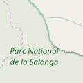 |
 | ||
| boundary | place | 익히 알려진 지역 경계이지만 행정구역은 아닐 경우, place=*의 경계를 설정함에 있어 널리 사용됩니다.
|
||||
| boundary | political | 선거구의 경계에 해당됩니다. | ||||
| boundary | postal_code | 우편번호의 관할 경계에 해당됩니다. 일부 편집자들은 해당 구역의 지위와 단계에 따라 admin_level=* 대신 postal_code_level=*을 사용하기도 합니다.
|
||||
| boundary | protected_area | 보호구역의 경계에 해당됩니다. 국립공원, 해양보존구역, 문화유산 구역, 야생보호구역, 문화전승 구역 등이 해당됩니다. |  | |||
| boundary | religious_administration | 특정 종교에서 행정적인 목적에서 사용하는 구역 경계에 해당됩니다. 대표적으로 가톨릭교의 교구가 있습니다. 해당 경계를 사용하는 종교를 나타내려면 religion=*과 denomination=*을 사용하세요. 일부 편집자들은 해당 구역의 지위와 단계에 따라 admin_level=* 대신 religious_level=*을 사용하기도 합니다.
|
||||
| boundary | special_economic_zone | 기업과 무역활동의 보장을 위해 정부에서 설정한 특별경제구역의 경계에 해당됩니다. |  | |||
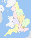
| boundary | statistical | 통계 상의 목적으로 정부 당국에서 설정한 경계에 해당됩니다. |
 | |||
| boundary | disputed | 2개 이상의 국가나 당국에서 영유권을 주장하는 구역의 경계에 해당됩니다. 사용에 주의해 주세요. 영토분쟁 문서도 참고하세요. Disputed territories. | 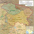 | |||
| boundary | timezone | 시간대의 경계에 해당됩니다. |  | |||
| boundary | public_transport | 교통 당국의 관할범위 경계에 해당됩니다. | ||||
| boundary | user defined | All commonly used values according to Taginfo | ||||
보조 태그 | ||||||
| admin_level | (숫자) | 해당 경계로 정의된 특정 구역이 속해 있는 행정구역의 상하위 단계를 설정합니다. 1에서 10까지 설정할 수 있으며 숫자가 적을 수록 큰 단위의 행정구역을 뜻합니다. 일부 국가에서는 1~11까지 설정되어 있기도 합니다. Key:boundary를 참고하세요. |  | |||
| health_level | (number) | Used by some mappers instead of admin_level=* in conjunction with boundary=health and is usually in the range 1 to 10.
|
||||
| postal_code_level | (number) | Used by some mappers instead of admin_level=* in conjunction with boundary=postal_code and is usually in the range 1 to 10.
|
||||
| religious_level | (number) | Used by some mappers instead of admin_level=* in conjunction with boundary=religious_administration and is usually in the range 1 to 10.
|
||||
| border_type | * | admin_level=*만으로 충분치 못한 경계의 유형을 구분하기 위해 사용합니다. 해상 경계나 해외 여러 국가의 고유 행정구역을 나타낼 때 사용합니다.
|
||||
| start_date | (날짜) | 해당 경계가 최근에 지정되었거나 추후 설정될 경우에 유용합니다. |  | |||
This table is a wiki template with a default description in English. Editable here. 한국어 번역은 여기에 있습니다.
건물
This is used to identify individual buildings or groups of connected buildings. See the page Buildings for further details on the usage of this tag and man_made=* for tagging of various other structures. The building tags are intended for the physical description of a building. For functions in the building (e.g. police station, church, townhall, museum) you should add object with tags like amenity=*, tourism=*, shop=* etc must exist.
For example mapping building=supermarket is not enough to mark place as having an active supermarket shop, it just marks that building has form typical for supermarket buildings. shop=supermarket must be mapped to indicate an active supermarket shop. On the other hand shop=*/amenity=* is not indicating building by itself, building must be mapped with building=* tag.
| 종류 | 태그 | 설명 | 이미지 |
|---|---|---|---|
Accommodation | |||
| building | apartments | A building arranged into individual dwellings, often on separate floors. May also have retail outlets on the ground floor. |  |
| building | barracks | Buildings built to house military personnel or laborers. | 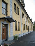 |
| building | bungalow | A single-storey detached small house, Dacha. |  |
| building | cabin | A cabin is a small, roughly built house usually with a wood exterior and typically found in rural areas. |  |
| building | detached | A detached house, a free-standing residential building usually housing a single family. |  |
| building | annexe | An annexe is a small self contained apartments, collages, or small residential building on the same property as the main residential unit. |  |
| building | dormitory | A shared building intended for college/university students (not a share room for multiple occupants as implied by the term in British English). Alternatively, use building=residential plus residential=university and loose the information that it is for students.
|
 |
| building | farm | A residential building on a farm (farmhouse). For other buildings see below building=farm_auxiliary, building=barn, … If in your country farmhouse looks same as general residential house then you can tag as building=house as well. See also landuse=farmyard for the surrounding area
|
 |
| building | ger | A permanent or seasonal round yurt or ger. |  |
| building | hotel | A building designed with separate rooms available for overnight accommodation. Normally used in conjunction with tourism=hotel for the hotel grounds including recreation areas and parking.
|
 |
| building | house | A dwelling unit inhabited by a single household (a family or small group sharing facilities such as a kitchen). Houses forming half of a semi-detached pair, or one of a row of terraced houses, should share at least two nodes with joined neighbours, thereby defining the party wall between the properties. |  |
| building | houseboat | A boat used primarily as a home |  |
| building | residential | A general tag for a building used primarily for residential purposes. Where additional detail is available consider using 'apartments', 'terrace', 'house', 'detached' or 'semidetached_house'. |  |
| building | semidetached_house | A residential house that shares a common wall with another on one side. Typically called a "duplex" in American English. |  |
| building | static_caravan | A mobile home (semi)permanently left on a single site |  |
| building | stilt_house | A building raised on piles over the surface of the soil or a body of water |  |
| building | terrace | A single way used to define the outline of a linear row of residential dwellings, each of which normally has its own entrance, which form a terrace ("row-house" or "townhouse" in North American English). Consider defining each dwelling separately using 'house'. |  |
| building | tree_house | An accommodation, often designed as a small hut, sometimes also as a room or small apartment. Built on tree posts or on a natural tree. A tree house has no contact with the ground. Access via ladders, stairs or bridgeways. |  |
| building | trullo | A stone hut with a conical roof. |  |
Commercial | |||
| building | commercial | A building for non-specific commercial activities, not necessarily an office building. Consider tagging the surrounding area using landuse=commercial if there is such use. Use 'retail' if the building consists primarily of shops.
|
 |
| building | industrial | A building for industrial purposes. Use warehouse if the purpose is known to be primarily for storage/distribution. Consider using landuse=industrial for the surrounding area and appropriate tags like man_made=works to describe the industrial activity.
|
 |
| building | kiosk | A small one-room retail building. |  |
| building | office | An office building. Use office=* where applicable for the business(es) that use the building. Consider tagging the surrounding area using landuse=commercial if it applies. Prefer landuse=retail if the building consists primarily of shops.
|
 |
| building | retail | A building primarily used for selling goods that are sold to the public; use shop=* to identify the sort of goods sold or an appropriate amenity=* (pub, cafe, restaurant, etc.). Consider use landuse=retail for the surrounding area.
|
 |
| building | supermarket | A building constructed to house a self-service large-area store. |  |
| building | warehouse | A building primarily intended for the storage or goods or as part of a distribution system. |  |
Religious | |||
| building | religious | Unspecific building related to religion. Prefer more specific values if possible. |  |
| building | cathedral | A building that was built as a cathedral. Used in conjunction with amenity=place_of_worship, religion=*, denomination=* and landuse=religious for the cathedral grounds where it is in current use.
|
 |
| building | chapel | A building that was built as a chapel. Used in conjunction with amenity=place_of_worship, religion=*, denomination=* and landuse=religious for the chapel grounds where it is in current use.
|
 |
| building | church | A building that was built as a church. Used in conjunction with amenity=place_of_worship, religion=* , denomination=* and landuse=religious for the church grounds where it is in current use.
|
 |
| building | kingdom_hall | A building that was built as a amenity=place_of_worship, religion=christian, denomination=jehovahs_witness and landuse=religious for the grounds where it is in current use.
|
 |
| building | monastery | A building constructed as amenity=monastery, for the grounds of a former monastery, have a look at historic=monastery
|
 |
| building | mosque | A building errected as mosque. Used in conjunction with amenity=place_of_worship, religion=*, denomination=* and landuse=religious for the grounds where it is in current use.
|
 |
| building | presbytery | A building where priests live and work. |  |
| building | shrine | A building that was built as a shrine. Used in conjunction with amenity=place_of_worship, religion=*, denomination=* and landuse=religious for the grounds where it is in current use. Small structures should consider historic=wayside_shrine.
|
 |
| building | synagogue | A building that was built as a synagogue. Used in conjunction with amenity=place_of_worship, religion=*, denomination=* and landuse=religious for the grounds where it is in current use.
|
 |
| building | temple | A building that was built as a temple. Used in conjunction with amenity=place_of_worship, religion=*, denomination=* and landuse=religious for the grounds where it is in current use.
|
 |
Civic/amenity | |||
| building | bakehouse | A building that was built as a bakehouse (i.e. for baking bread). Often used in conjunction with another node amenity=baking_oven and oven=wood_fired.
|
 |
| building | bridge | A building used as a bridge (skyway). To map a gatehouse use building=gatehouse. See also bridge=yes for highway=*. Don't use this tag just for marking bridges (their outlines). For such purposes use man_made=bridge.
|
 |
| building | civic | A generic tag for a building created to house some civic amenity, for example amenity=community_centre, amenity=library, amenity=toilets, leisure=sports_centre, leisure=swimming_pool, amenity=townhall etc. Use amenity=* or leisure=* etc. to provide further details. See building=public and more specific tags like building=library as well.
|
 |
| building | clock_tower | Clock towers are very high towers, visible from its surroundings, usually in central parts of town and squares, housing a turret clock with one or more clock faces, most often four. They are freestanding structures but can also be adjoined or located on top of another building. |  |
| building | college | A college building. Use amenity=college on the whole college area to represent the college as an institution.
|
 |
| building | fire_station | A building constructed as fire station, i.e. to house fire fighting equipment and officers, regardless of current use. Add amenity=fire_station on the grounds for an active fire station.
|
 |
| building | government | For government buildings in general, including municipal, provincial and divisional secretaries, government agencies and departments, town halls, (regional) parliaments and court houses. |  |
| building | gatehouse | An entry control point building, spanning over a highway that enters a city or compound. |  |
| building | hospital | A building errected for a hospital. Use amenity=hospital for the hospital grounds.
|
 |
| building | kindergarten | For any generic kindergarten buildings. Buildings for specific uses (sports halls etc.) should be tagged for their purpose. If there is currently a kindergarten in the building, use amenity=kindergarten on the perimeter of the kindergarten grounds.
|
 |
| building | museum | A building which was designed as a museum. |  |
| building | public | A building constructed as accessible to the general public (a town hall, police station, court house, etc.). |  |
| building | school | A building errected as school. Buildings for specific uses (sports halls etc.) should be tagged for their purpose. If there is currently a school, use amenity=school on the perimeter of the school grounds.
|
 |
| building | toilets | A toilet block. |  |
| building | train_station | A building constructed to be a train station building, including buildings that are abandoned and used nowadays for a different purpose. |  |
| building | transportation | A building related to public transport. You will probably want to tag it with proper transport related tag as well, such as public_transport=station. Note that there is a special tag for train station buildings - building=train_station.
|
 |
| building | university | A university building. Use amenity=university for the university as an institution.
|
 |
Agricultural/plant production | |||
| building | barn | An agricultural building that can be used for storage and as a covered workplace. |  |
| building | conservatory | A building or room having glass or tarpaulin roofing and walls used as an indoor garden or a sunroom (winter garden). |  |
| building | cowshed | A cowshed (cow barn, cow house) is a building for housing cows, usually found on farms. |  |
| building | farm_auxiliary | A building on a farm that is not a dwelling (use 'farm' or 'house' for the farm house). |  |
| building | greenhouse | A greenhouse is a glass or plastic covered building used to grow plants. Use landuse=greenhouse_horticulture for an area containing multiple greenhouses
|
 |
| building | [[ Too many Data Items entities accessed. | slurry_tank ]] | A circular building built to hold a liquid mix of primarily animal excreta (also known as slurry). |  |
| building | stable | A building constructed as a stable for horses. |  |
| building | sty | A sty (pigsty, pig ark, pig-shed) is a building for raising domestic pigs, usually found on farms. |  |
| building | livestock | A building for housing/rising other livestock (apart from cows, horses or pigs covered above), or when the livestock changes. | |
Sports | |||
| building | grandstand | The main stand, usually roofed, commanding the best view for spectators at racecourses or sports grounds. |  |
| building | pavilion | A sports pavilion usually with changing rooms, storage areas and possibly an space for functions & events. Avoid using this term for other structures called pavilions by architects (see |
 |
| building | riding_hall | A building that was built as a riding hall. |  |
| building | sports_hall | A building that was built as a sports hall. |  |
| building | sports_centre | A building that was built as a sports centre. |  |
| building | stadium | A building constructed to be a stadium building, including buildings that are abandoned and used nowadays for a different purpose. |  |
Storage | |||
| building | allotment_house | A small outbuilding for short visits in a allotment garden. |  |
| building | boathouse | A boathouse is a building used for the storage of boats. |  |
| building | hangar | A hangar is a building used for the storage of airplanes, helicopters or space-craft. Consider adding aeroway=hangar, when appropriate.
|
 |
| building | hut | A hut is a small and crude shelter. Note that this word has two meanings - it may be synonym of building=shed, it may be a residential building of low quality.
|
 |
| building | shed | A shed is a simple, single-storey structure that is used for storage, hobbies, or as a workshop. |  |
Cars | |||
| building | carport | A carport is a covered structure used to offer limited protection to vehicles, primarily cars, from the elements. Unlike most structures a carport does not have four walls, and usually has one or two. |  |
| building | garage | A garage is a building suitable for the storage of one or possibly more motor vehicle or similar. See building=garages for larger shared buildings. For an aircraft garage, see building=hangar.
|
 |
| building | garages | A building that consists of a number of discrete storage spaces for different owners/tenants. See also building=garage.
|
 |
| building | parking | Structure purpose-built for parking cars. |  |
Power/technical buildings | |||
| building | digester | A digester is a bioreactor for the production of biogas from biomass. |  |
| building | service | Service building usually is a small unmanned building with certain machinery (like pumps or transformers). |  |
| building | tech_cab | Small prefabricated cabin structures for the air-conditioned accommodation of different technology. |  |
| building | transformer_tower | A transformer tower is a characteristic tall building comprising a distribution transformer and constructed to connect directly to a medium voltage overhead power line. Quite often the power line has since been undergrounded but the building may still serve as a substation. If the building is still in use as a substation it should additionally be tagged as power=substation + substation=minor_distribution.
|
 |
| building | water_tower | A water tower. |  |
| building | storage_tank | Storage tanks are containers that hold liquids |  |
| building | silo | A silo is a building for storing bulk materials |  |
Other buildings | |||
| building | beach_hut | A small, usually wooden, and often brightly coloured cabin or shelter above the high tide mark on popular bathing beaches. |  |
| building | bunker | A hardened military building. Also use military=bunker.
|
 |
| building | castle | A building constructed as a castle. Can be further specified with historic=castle + castle_type=*.
|
 |
| building | construction | Used for buildings under construction. Use construction=* to hold the value for the completed building.
|
 |
| building | container | For a container used as a permanent building. Do not map containers placed temporarily, for example used in shipping or construction. |  |
| building | guardhouse | Poste de garde. |  |
| building | military | A military building. Also use military=*.
|
|
| building | outbuilding | A less important building near to and on the same piece of land as a larger building. |  |
| building | pagoda | A building constructed as a pagoda. | 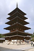 |
| building | quonset_hut | A lightweight prefabricated structure in the shape of a semicircle. |  |
| building | roof | A structure that consists of a roof with open sides, such as a rain shelter, and also gas stations |  |
| building | ruins | Frequently used for a house or other building that is abandoned and in poor repair. However, some believe this usage is incorrect, and the tag should only be used for buildings constructed as fake ruins (for example sham ruins in an English landscape garden). See also lifecycle tagging. |  |
| building | ship | A decommissioned ship/submarine which stays in one place. |  |
| building | tent | For a permanently placed tent. Do not map tents placed temporarily. |  |
| building | tower | A tower-building. Best combined with tower:type=*. See also man_made=tower for a tag with a similar definition.
|
 |
| building | triumphal_arch | A free-standing monumental structure in the shape of an archway with one or more arched passageways. |  |
| building | windmill | A building constructed as a traditional windmill, historically used to mill grain with wind power. |  |
| building | yes | Use this value where it is not possible to determine a more specific value. | |
| building | user defined | All commonly used values according to Taginfo, generally building types | |
Additional attributes
| 종류 | 태그 | Element | 설명 | 이미지 |
|---|---|---|---|---|
| building:architecture | <architectural style> | Architectural style of a building |  | |
| building:colour | <RGB hex triplet> | <W3C colour name> | Indicates colour of the building |  | |
| building:fireproof | yes | no | Fire-resistance information. | ||
| building:flats | <number> | The number of residential units (flats, apartments) in an apartment building (building=apartments), residential building (building=residential), house (building=house), detached house (building=detached) or similar building. | ||
| building:levels | <number> | The number of visible levels (floors) in the building as used in the Simple 3D buildings scheme |  | |
| building:material | <material type> | Outer material for the building façade |  | |
| building:min_level | <number> | For describing number of values, "filling" space between ground level and bottom level of building or part of building |  | |
| building:part | As building | To mark a part of a building, which has attributes, different from such ones at other parts |  | |
| building:soft_storey | yes | no | reinforced | A building where any one level is significantly more flexible (less stiff) than those above and below it | ||
| construction_date | <date> | The (approximated) date when the building was finished. |  | |
| entrance | yes | main | exit | service | emergency | An entrance in a building. Replaces the deprecated tag building=entrance.
|
 | |
| height | <number> | The height of the building in meters. |  | |
| max_level | <number> | Maximum indoor level (floor) in the building as used in the Simple Indoor Tagging scheme | ||
| min_level | <number> | Minimum indoor level (floor) in the building as used in the Simple Indoor Tagging scheme | ||
| non_existent_levels | <number> | List of indoor levels (floors) that do not exists in the building as used in the Simple Indoor Tagging scheme | ||
| start_date | <date> | The (approximated) date when the building was finished. |  |
This table is a wiki template with a default description in English. Editable here. 한국어 번역은 여기에 있습니다.
Craft
맞춤 상품을 생산하거나 가공하는 장소입니다. 사용법에 대한 소개는 craft 를 참조하세요.
| 키 | 값 | 설명 | 렌더링 | 이미지 |
|---|---|---|---|---|
| craft | agricultural_engines | Planning and constructing engines and tools for agricultural use. |  | |
| craft | atelier | A place where visual artists work |  | |
| craft | bag_repair | A place where bags/luggage are repaired. |  | |
| craft | bakery | A workplace for fresh bakery goods. No shop. |  | |
| craft | basket_maker | Producing baskets, often made from Willow. |  | |
| craft | beekeeper | A place where honey bees are kept for the purposes of securing commodities such as honey, beeswax or pollen. |  | |
| craft | blacksmith | A place where a blacksmith forges tools, horseshoes, etc. from iron. |  | |
| craft | boatbuilder | Planning and constructing boats. |  | |
| craft | bookbinder | Physically assembling a book from a number of sheets of paper. |  | |
| craft | brewery | A brewery is a dedicated building for the making of beer |  | |
| craft | builder | Constructs buildings, streets and other objects. |  | |
| craft | cabinet_maker | A person who makes fine wooden furniture. |  | |
| craft | candlemaker | A person who makes candles or a manufactory where candles were made. |  | |
| craft | carpenter | Workplace or office of Carpenters that work with timber to construct, install and maintain buildings, furniture, and other objects. |  | |
| craft | carpet_layer | Workplace or office of carpet layers that bring carpet on your floor. |  | |
| craft | caterer | Workplace or office of one who prepares customized meals for takeout, or provides prepared meals or supplies to a group at social gatherings. |  | |
| craft | chimney_sweeper | Workplace or office of a person who cleans chimneys for a living. |  | |
| craft | clockmaker | Workplace or office of a clockmaker that is building or repairing clocks but not watches. See also craft=watchmaker
|
 | |
| craft | confectionery | A place where the set of food items that are rich in sugar, any one or type of which is called a confection is produced. |  | |
| craft | distillery | Distillery |  | |
| craft | door_construction | A workplace of someone constructing doors. |  | |
| craft | dressmaker | A place where clothes are created, repaired or altered to fit personal needs. |  | |
| craft | electrician | Workplace or office of an electrician which is a tradesman specialized in electrical wiring of buildings, stationary machines and related equipment. |  | |
| craft | floorer | Workplace or office of a floorer which is a tradesman specialized in laying floors. See also craft=parquet_layer craft=carpet_layer craft=tiler
|
 | |
| craft | gardener | Workplace or office of a garden designer or a landscape gardener. |  | |
| craft | glaziery | A place where residential, commercial, and artistic glass is selected, cut, installed, replaced, and removed |  | |
| craft | handicraft | A place where useful and decorative devices are made completely by hand or using only simple tools |  | |
| craft | hvac | Workplace or office of an HVAC system designer (Heating, Ventilating, and Air Conditioning) |  | |
| craft | insulation | Workplace or office of a person who does thermal insulation in buildings. |  | |
| craft | jeweller | A place where necklaces, rings, brooches, earrings and bracelets and other personal adornments are created or repaired. |  | |
| craft | joiner | An artisan who builds things by joining pieces of wood, particularly furniture or ornamental work. |  | |
| craft | key_cutter | A place where keys can be duplicated from originals. |  | |
| craft | locksmith | A place where locks and keys are created or repaired. |  | |
| craft | metal_construction | A place where handrails, gates, ramps and similar things from metal are made. |  | |
| craft | optician | A place where lenses for the correction of a person's vision are designed, fitted and dispensed. |  | |
| craft | painter | Workplace or office of a house painter which is a tradesman responsible for the painting and decorating of buildings. |  | |
| craft | parquet_layer | Workplace or office of a parquet layer. |  | |
| craft | photographer | Workplace or office of a person who takes photographs using a camera. |  | |
| craft | photographic_laboratory | A place where photos taken on a film or digital images are transformed into a more permanent form, often on paper or plastic foil. |  | |
| craft | piano_tuner | A piano tuner or technician. A professional that tunes, regulates and makes the maintenance of pianos. Most of them repair simple problems and some restore a whole piano. |  | |
| craft | plasterer | Workplace or office of a tradesman who works with plaster, such as forming a layer of plaster on an interior wall or plaster decorative moldings on ceilings or walls. |  | |
| craft | plumber | Workplace or office of a tradesman who specializes in installing and maintaining systems used for potable (drinking) water, sewage, and drainage. |  | |
| craft | pottery | A place where earthenware, stoneware and porcelain and other ceramic ware is made by potters. |  | |
| craft | rigger | Workplace or office of a person who makes masts, yards, sails, and cordage for sailboats and sailing ships. | ||
| craft | roofer | Workplace or office of a tradesman who is specialized in roof construction. |  | |
| craft | saddler | A place where saddles or accessories for cars and boats are produced or repaired. |  | |
| craft | sailmaker | Workplace or office of a person who makes and repairs sails for sailboats and sailing ships, typically working on shore in a sail loft. |  | |
| craft | sawmill | A workplace where logs are cut into boards. |  | |
| craft | scaffolder | Workplace or office of a tradesman who builds temporary structure used to support people and material in the construction or repair of buildings and other large structures. |  | |
| craft | sculptor | A place where sculptures are made. |  | |
| craft | shoemaker | A place where shoes, boots, sandals, clogs and moccasins are created, repaired or altered to fit personal needs. See also shop=shoes for a place where shoes are sold, but not made or altered
|
 | |
| craft | stand_builder | Workplace of a company that builds stands/booths for fairs. |  | |
| craft | stonemason | A place where rough pieces of rock are shaped into accurate geometrical shapes. |  | |
| craft | stove_fitter | A workplace/office of a person/company who designs and builds stoves/tiled stoves. |  | |
| craft | sun_protection | A place where sun protection is made, repaired, or delivered for assembly, especially awnings and shutters. |  | |
| craft | tailor | A place where clothing is made, repaired, or altered professionally, especially suits and men's clothing. |  | |
| craft | tiler | Workplace or office of a person who lays tiles on floors, swimming pools and such. |  | |
| craft | tinsmith | A tinsmith, or tinner or tinker or tinplate worker. Workplace or office of a person who makes and repairs things made of light-coloured metal, particularly tinware. |  | |
| craft | turner | A turner or wood turner. |  | |
| craft | upholsterer | A place where furniture, especially seats are provided with padding, springs, webbing, and fabric or leather covers. |  | |
| craft | watchmaker | A watchmaker is an artisan who makes and repairs watches. Today due to industrial production they mostly repair watches. For other kinds of clocks see craft=clockmaker
|
 | |
| craft | window_construction | Construct windows |  | |
| craft | winery | Produces wine |  | |
| craft | user defined | All commonly used values according to Taginfo |
This table is a wiki template with a default description in English. Editable here.
한국어 번역은 여기에 있습니다.
긴급 시설
비상 시설 및 장비의 위치를 설명하는 데 사용됩니다. 사용법에 대한 소개는 Emergency facilities and amenities를 참조하세요.
| 키 | 값 | 요소 | 설명 | 렌더링 | 이미지 | |
|---|---|---|---|---|---|---|
Emergency services | ||||||
| emergency | ambulance_station | A ambulance station is a structure or other area set aside for storage of ambulance vehicles, medical equipment, personal protective equipment, and other medical supplies. |  | |||
| emergency | defibrillator | Defibrillator, an external and portable electronic device that diagnoses and can correct arrhythmia of the heart automatically (aka Automated External Defibrillator, AED). Previously tagged as emergency=aed or medical=aed.
|
 | |||
Brandweer | ||||||
| emergency | fire_extinguisher | A fire extinguisher is an active fire protection device used to extinguish or control small fires, often in emergency situations. |  | |||
| emergency | fire_flapper | A wildland firefighting tool also called a swatter or a beater. It is designed for extinguishing minor fires in rural areas such as heaths. |  | |||
| emergency | fire_hose | A high-pressure hose used to carry water or other fire retardant (such as foam) to a fire to extinguish it. |  | |||
| emergency | fire_hydrant | An active fire protection measure, and a source of water provided in most urban, suburban, and rural areas with municipal water service to enable fire fighters to tap into the municipal water supply to assist in extinguishing a fire. |  | |||
| emergency | water_tank | A large water basin or tank for a fire department to take water. |  | |||
| emergency | fire_water_pond | A man made or natural pond with water for a fire department. |  | |||
| emergency | suction_point | A preferred point to pump water off a river or other waters for a fire department. | ||||
Reddingsbrigade en strandwacht | ||||||
| emergency | lifeguard_base | The central place for vehicles and facilities of the lifeguard. Can also serve for central communication point. |  | |||
| emergency | lifeguard_tower | A guard tower that lifeguards use to watch and monitor swimmers, in order to prevent drowning or other dangers from occurring. |  | |||
| emergency | lifeguard_platform | A platform used by lifeguards. |  | |||
| emergency | lifeguard_place | The central hub for lifeguards. |  | |||
| emergency | life_ring | An inflatable floating device. |  | |||
Others | ||||||
| emergency | assembly_point | Assembly point or area in case of emergency |  | |||
| emergency | access_point | Sign with an ID which can be used to define your current position in case of an emergency, or as an assembly point for emergency services. (replaces highway=emergency_access_point)
|
 | |||
| emergency | phone | An emergency telephone to call the emergency services. | 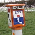 | |||
| emergency | ses_station | State Emergency Service is an Australian non-profit organization that provides assistance during and after explicitly declared natural or man-made disasters. |  | |||
| emergency | siren | Instrument capable of producing loud sounds to alert people in case of emergencies. The most modern use case is for civil defense as "air raid" sirens or tornado sirens. |  | |||
| emergency | user defined | All commonly used values in base a Taginfo | ||||
한국어 번역은 여기에 있습니다.
Geological
This is used to describe the geological makeup of an area. See the page Geological for an introduction on its usage.
This table is a wiki template with a default description in English. Editable here. 한국어 번역은 여기에 있습니다.
Healthcare
Healthcare features.
Also see Map features#Healthcare which includes healthcare features under amenity=*. There is a full list of healthcare features at Healthcare.
See additional details at Key:healthcare such as healthcare:speciality=* and healthcare:counselling=*.
| Key | Value | Description |
|---|---|---|
| healthcare [en] | alternative [en] | Someone practising healthcare=yes)
|
| healthcare | audiologist [en] | shop=hearing_aids instead
|
| healthcare | birthing_centre [en] | A non-clinical |
| healthcare | blood_bank [en] | |
| healthcare | blood_donation [en] | A facility where you can donate blood, plasma and/or platelets, and possibly have stem cell samples taken. |
| healthcare | counselling [en] | Healthcare counselling, e.g. an addiction centre, a nutritionist, or a sex therapist. Also see healthcare=nutrition_counselling
|
| healthcare | dialysis [en] | A clinic for day patients to get a haemodialysis |
| healthcare | hospice [en] | A Hospice which provides palliative care to terminal ill people and support to their relatives. |
| healthcare | laboratory [en] | Medical laboratory also called (analytical, diagnostic) is a place that analyses body fluids such as blood, urine, faeces etc . |
| healthcare | midwife [en] | A |
| healthcare | nurse [en] | |
| healthcare | occupational_therapist [en] | Someone who practices |
| healthcare | optometrist [en] | shop=optician instead.
|
| healthcare | physiotherapist [en] | Someone who practices |
| healthcare | podiatrist [en] | Someone who practices |
| healthcare | psychotherapist [en] | Someone who practices |
| healthcare | rehabilitation [en] | |
| healthcare | sample_collection [en] | Site or dedicated healthcare facility where samples of blood/urine/etc are obtained or collected for purpose of analysing them for healthcare diagnostics. |
| healthcare | speech_therapist [en] | Someone who practices |
| healthcare | vaccination_centre [en] | a healthcare facility specifically dedicated to administering vaccinations to individuals, to provide immunisation against infectious diseases. |
This table is a wiki template with a default description in English. Editable here. 한국어 번역은 여기에 있습니다.
도로
도로와 보도를 표현하는데 사용됩니다. 사용 방법은 도로를 참조하세요. 교통수단의 종류, 시간, 날짜, 혼잡도와 용도 별 접근 제한에 관해서는 제한을 참조하세요.
한국의 도로 체계를 오픈스트리트맵에 맞게 정리한 글은 한국의 도로 체계를 확인하세요.
| 키 | 값 | 요소 | 설명 | Rendering carto | 사진 | |
|---|---|---|---|---|---|---|
도로 | ||||||
|
도로망의 주요 태그입니다. | ||||||
| highway | motorway | 진입이 제한된 주요 분리 고속도로로, 일반적으로 2개 이상의 차선과 비상 갓길이 있습니다. 프리웨이나 아우토반 등이 이에 속합니다. |  |
|||
| highway | trunk | 국가 교통 체계에서 `motorway` 다음으로 가장 중요한 도로입니다. (반드시 중앙 분리대가 있을 필요는 없습니다.) |  |
|||
| highway | primary | 국가 교통 체계에서 그 다음으로 중요한 도로입니다. (주로 큰 도시들을 연결합니다) |  |
|||
| highway | secondary | 국가 교통 체계에서 그 다음으로 중요한 도로입니다. (주로 시내를 연결합니다.) |  |
|||
| highway | tertiary | 국가 교통 체계에서 그 다음으로 중요한 도로입니다. (주로 더 작은 마을과 시내를 연결합니다.) |  |
|||
| highway | unclassified | 국가 교통 체계에서 가장 중요하지 않은 도로입니다. 즉, `tertiary`보다 낮은 분류의 도로이지만, 소유지 출입 이외의 목적을 제공합니다. (종종 마을과 작은 마을을 연결합니다.)
단어 `unclassified`는 영국 도로 시스템의 역사적인 유물이며, 분류를 알 수 없다는 의미가 아닙니다. 분류를 알 수 없는 도로는 |
 |
|||
| highway | residential | 마을을 연결하는 기능 없이, 주거지로의 접근을 제공하는 도로입니다. 종종 주택가에 있습니다. |  |
|||
연결 도로 | ||||||
| highway | motorway_link | `motorway`와 `motorway` 또는 그 이하의 도로를 잇는 연결 도로(진입로/램프)입니다. 일반적으로 동일한 통행 제한이 적용됩니다. |  |
 | ||
| highway | trunk_link | `trunk`와 `trunk` 또는 그 이하의 도로를 잇는 연결 도로입니다. |  |
 | ||
| highway | primary_link | `primary`와 `primary` 또는 그 이하의 도로를 잇는 연결 도로입니다. |  |
 | ||
| highway | secondary_link | `secondary`와 `secondary` 또는 그 이하의 도로를 잇는 연결 도로입니다. |  |
 | ||
| highway | tertiary_link | `tertiary`와 `tertiary` 또는 그 이하의 도로를 잇는 연결 도로입니다. |  |
|||
Special road types | ||||||
| highway | living_street | 생활 도로는 보행자가 자동차에 대해 법적 우선권을 가지며, 속도가 매우 낮게 유지되고 어린이가 거리에서 놀 수 있는 주거 도로입니다. |  |
 | ||
| highway | service | 산업 단지, 캠핑장, 비즈니스 파크, 주차장 등으로의 진입로, 또는 그 내부의 길입니다. 유형을 나타내기 위해 service=*와 함께 사용할 수 있으며, 누가 어떤 상황에서 사용할 수 있는지를 나타내기 위해 access=*와 함께 사용할 수 있습니다.
|
 |
 | ||
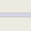
| highway | pedestrian | 상가 및 주거 지역에서 주로/전적으로 보행자를 위해 사용되는 도로로, 하루 중 매우 제한된 시간 동안만 차량의 접근이 허용될 수 있습니다. 광장 또는 플라자를 만드려면 닫힌 길을 만들고 이 태그와 area=yes를 같이 사용하세요.
|
 |
 | ||
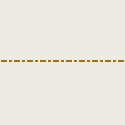
| highway | track | 주로 농업 또는 임업용 도로입니다. 도로의 품질을 설명하려면 tracktype=*을 참조하세요. 참고: track은 보통 비포장 도로이지만, 이 태그는 도로의 품질이 아닌 용도를 설명합니다. 일반적인 용도의 도로를 태그하려면 track 대신 일반 highway 값 중 하나를 사용하세요.
|
 |
|||
| highway | bus_guideway | 차량이 도로에 의해 유도되고(철도는 아님) 다른 교통수단에는 적합하지 않은 버스 전용 차로입니다. 참고: 이 태그는 일반적인 버스 전용 차선을 위한 것이 아닙니다, 대신 access=no, psv=yes를 사용하세요!
|
 |
 | ||
| highway | escape | 비상 경사로, 긴급 제동 시설, 트럭 어레스터 베드 또는 탈출 램프를 나타냅니다. 제동 불능 차량이 안전하게 정지할 수 있도록 합니다. |  | |||
| highway | raceway | (자동차) 경주를 위한 코스 또는 트랙 | 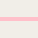 |
 | ||
| highway | road | 알 수 없는 유형의 도로/길/거리/고속도로입니다. 보행자 도로에서 고속도로에 이르기까지 모든 것을 나타낼 수 있으며, 도로/길이 제대로 조사될 때까지 임시로만 사용해야 합니다. 도로의 유형을 아는 경우 이 값을 사용하지 말고, 더 구체적인 highway=* 값 중 하나를 사용하세요.
|
 |
 | ||
| highway | busway | 버스 전용 차로입니다. |  | |||
길 | ||||||
| highway | footway | 지정된 보행로, 주로/전적으로 보행자를 위한 도로입니다. 여기에는 산책로와 자갈길이 포함되며, 자전거도 허용되는 경우 bicycle=yes 태그를 추가할 수 있습니다. 주 목적 및 의도된 용도를 알 수 없는 길에는 사용해서는 안 됩니다. 상가 또는 주거 지역의 보행자 전용 도로에는 highway=pedestrian을 사용하고, 농기계 또는 그와 유사한 차량이 사용할 수 있는 경우 highway=track을 사용하세요. 계단이 없는 경사로의 경우, incline=*와 함께 사용하세요.
|
 |
 | ||
| highway | bridleway | 말과 승마자를 위한 길입니다. 일반적으로 보행자도 허용되며, 현지 규정에 따라 자전거 이용이 허용될 수 있으며, 자동차는 금지됩니다. |  |
 | ||
| highway | steps | 보행자 도로의 계단용입니다. 계단 수를 나타내려면 step_count=*와 함께 사용하세요.
|
 |
 | ||
| highway | corridor | 건물 내부의 복도입니다. |  | |||
| highway | path | 용도를 알 수 없는 길입니다. 보행자를 위한 경로에는 highway=footway를 사용하고, 자전거 이용자도 사용할 수 있는 경로에는 highway=cycleway를 사용하고, 말과 승마자도 사용할 수 있는 경로에는 highway=bridleway를 사용하고, 농기계 또는 그와 유사한 차량이 통행할 수 있는 경로에는 highway=track을 사용하세요.
|
 |
 | ||
| highway | via_ferrata | 비아 페라타는 등반가의 편의성과 안전성을 높이기 위해 고정 케이블, 스템플, 사다리, 다리가 설치된 루트입니다. 비아 페라타에는 등반용 하네스, 충격 흡수 장치, 짧은 길이의 로프 2개 등의 장비가 필요하지만 등반용 로프처럼 긴 밧줄은 필요하지 않습니다. |  | |||
인도(보도)를 별개의 길로 표현하기 | ||||||
| footway | sidewalk | 일반적으로 주거 도로를 따라 이어지는 보도입니다. highway=footway 또는 highway=path와 함께 사용하세요.
|
 |
 | ||
| footway | crossing | 도로 반대편에 있는 두 개의 보도를 연결하는 횡단보도입니다. 도로의 페인트 표시, 도로 표지판 또는 신호등으로 확인되는 경우가 많습니다. highway=footway 또는 highway=path와 함께 사용하세요. tactile_paving=*, wheelchair=*, kerb=* 마디가 유용할 수 있습니다.
|
 |
 | ||
| footway | traffic_island | The way between two crossings, safespot for pedestrians, has micromapping characteristics as a detailed alternative to =*. Use in combination with highway=footway or highway=path.
|
 |
|||
도로에 인도(보도)를 표현하기 (인도 참조) | ||||||
| sidewalk | both | left | right | no | 인도가 도로 양쪽에 있는지, 한쪽에만 있는지, 또는 전혀 없는지를 표현합니다. |  | |||
자전거 도로를 별개의 길로 그리기 (자전거 참조) | ||||||
| highway | cycleway | 지정된 자전거 도로입니다. 기본 접근 제한이 적용되지 않는 경우에만 foot=*를 추가하세요.
|
 |
 | ||
도로 또는 차선에 자전거 통행을 표현하기 (자전거 참조) | ||||||
| cycleway | lane | 자전거 도로가 차도 내에 있다는 것을 나타냅니다. |  | |||
| cycleway | oneway=yes 태그가 지정된 도로에서 양방향 자전거 통행이 법적으로 허용되는 경우에 사용됩니다. oneway:bicycle=no와 함께 사용하세요.
|
 | ||||
| cycleway | oneway=yes 태그가 지정된 도로에 일반 교통 흐름과 반대 방향으로 가는 자전거 도로(역방향 도로)가 있는 경우 사용됩니다. oneway:bicycle=no와 함께 사용하세요.
|
 | ||||
| cycleway | track | 자전거 도로가 일반 교통으로부터 분리된 경로를 제공하는 경우 사용됩니다. 미국에서는 이 용어가 인도 버퍼(pavement buffers), 볼라드(진입억제용 말뚝), 주차 차선 및 연석으로 차선과 분리된 자전거 도로를 지칭하는 데 자주 사용됩니다. 참고: 자전거 도로는 도로 옆에 highway=cycleway로 별도의 길로도 그릴 수 있습니다.
|
 | |||
| cycleway | oneway=yes 태그가 지정된 도로에서 일반 교통 흐름과 반대 방향으로 진행하는 자전거 도로가 있는 경우에 사용됩니다. oneway:bicycle=no와 함께 사용하세요.
|
 | ||||
| cycleway | share_busway | 버스 차선에 자전거가 통행할 수 있는 경우 사용됩니다. |  | |||
| cycleway | oneway=yes 태그가 지정된 자전거가 통행할 수 있는 버스 차선에서 일반 교통 흐름과 반대 방향으로 진행하는 경우(버스 역방향)에 사용됩니다. oneway:bicycle=no와 함께 사용하세요.
|
 | ||||
| cycleway | shared_lane | 자전거가 자동차와 차선을 공유해야 함을 나타내는 표시가 있는 경우 사용됩니다. 일부 지역에서는 이러한 표시를 "sharrows"('sharing arrows')라고 합니다. |  | |||
Busways tagged on the main roadway or lane (버스 차선 참조) | ||||||
| lane | 버스 차선에 대한, 이제 사용하지 않는 변형입니다. 버스/공공서비스차량 태그 lanes:bus=* / lanes:psv=* / bus:lanes=* / psv:lanes=*로 대체되었습니다.
|
 | ||||
| opposite | oneway=yes가 있는 도로에서 버스가 양방향으로 통행할 수 있는 경우 사용했던, 이제 사용하지 않는 변형입니다. oneway:bus=no로 대체되었습니다.
|
|||||
| opposite_lane | oneway=yes 태그가 지정된 도로에서 일반 교통 흐름과 반대 방향으로 가는 버스 차선(역방향 버스 차선)이 있는 경우 사용했던, 이제 사용하지 않는 변형입니다. oneway:bus=no 및 lanes:bus=* / lanes:psv=*) / bus:lanes=* / psv:lanes=*로 대체되었습니다.
|
|||||
Street parking tagged on the main roadway (노상 주차 참조) | ||||||
parking:left / :right / :both(hereafter: parking:side) |
lane | street_side | on_kerb | half_on_kerb | shoulder | no | separate | yes | 도로변 주차를 표현하는데 사용됩니다. 도로의 주차 위치를 설명합니다. |  | |||
parking:sideorientation=*
|
parallel | diagonal | perpendicular | 주차된 차량의 방향을 지정하는데 사용됩니다. | ||||
수명 주기 | ||||||
| highway | proposed | 계획된 도로입니다. 계획된 도로의 종류는 proposed=*로 표현하세요.
|
||||
| highway | construction | 건설 중인 도로입니다. 완공될 도로의 종류는 construction=*로 표현하세요.
|
 |
 | ||
속성 | ||||||
| abutters | commercial | industrial | mixed | residential | retail etc. | 자세한 내용은 Key:abutters를 참조하세요. |  | |||
| bicycle_road | yes | 자전거 전용으로 지정된 도로입니다. 주거 도로가 자전거 도로로 지정되는 경우, 일반적으로 전용 표지판을 통해 거주자에 한해 자동차 통행이 제한된 속도로 허용됩니다. |  | |||
| bus_bay | both | left | right | A bus bay outside the main carriageway for boarding/alighting |  | |||
| change | yes | no | not_right | not_left | only_right | only_left | 차선 변경이 허용/금지되는지 표현합니다. |  | |||
| destination | <place name of destination> | 선형의 지물을 따라갔을 때 나오는 도착지입니다. |  | |||
| embankment | yes | dyke | A dyke or a raised bank to carry a road, railway, or canal across a low-lying or wet area. |  | |||
| embedded_rails | yes | <type of railway> | 철도 선로가 내장되어 있지만 철도 외 교통도 허용되는 도로의 경우 사용됩니다. |  | |||
| ford | yes | 도로가 시내나 강을 가로지르며, 차량이 물 속으로 진입해야 하는 경우 사용됩니다. |  | |||
| frontage_road | yes | A frontage road. | ||||
| ice_road | yes | 얼어붙은 수역 위에 놓인 도로로, 여름에는 확실히 존재하지 않습니다. |  | |||
| incline | Number % | ° | up | down | 경사도를 백분율("5%") 또는 도수("20°")로 나타냅니다. 양수/음수 값은 도로 방향으로의 오르막/내리막을 나타냅니다. |  | |||
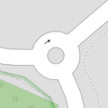
| junction | roundabout | 암시적으로 oneway=yes를 의미하며, 일방 통행 방향은 길(Way) 내 마디의 순서에 의해 정의됩니다. highway=* 태그가 지정된 길에 사용하세요.
|
 |
 | ||
| lanes | <number> | 버스 등에 대한 일반 교통용 차선 수입니다. |  | |||
| lane_markings | yes | no | Specifies if a highway has painted markings to indicate the position of the lanes. |  | |||
| lit | yes | no | 가로등입니다. |  | |||
| maxspeed | <number> | 도로/철도/수로의 최대 법적 제한 속도입니다. |  | |||
| motorroad | yes | no | 고속도로와 비슷한 통행 제한이 있지만 고속도로는 아닌 도로에 사용됩니다. |  | |||
| mountain_pass | yes | 산길의 가장 높은 지점입니다. |  | |||
| mtb:scale | 0-6 | highway=path 및 highway=track에 적용됩니다. 오르막이 거의 없는 산악 자전거 노선에 대한 분류 체계입니다.
|
 | |||
| mtb:scale:uphill | 0-5 | 상당한 오르막이 있는 산악 자전거 노선에 대한 분류 체계입니다. |  | |||
| mtb:scale:imba | 0-4 | IMBA 노선 난이도 등급 시스템은 바이크 파크에 사용됩니다. 이는 인공 장애물이 있는 산악 자전거 노선에 맞춰 조정되었습니다. | ||||
| mtb:description | Text | highway=path 및 highway=track에 적용됩니다. 산악 자전거 노선과 관련된 정보를 사람이 읽을 수 있는 형태로 입력하세요.
|
||||
| oneway | yes | no | reversible | Oneway streets are streets where you are only allowed to drive in one direction. |  | |||
| oneway:bicycle | yes | no | | Used on ways with oneway=yes where it is legally permitted to cycle in both directions.
|
 | |||
| overtaking | yes | no | caution | both | forward | backward | 추월이 법적으로 금지된 도로 구간을 지정하는데 사용됩니다. 주행 방향에 따라 달라지는 경우 overtaking:forward=yes/no/caution 및 overtaking:backward=yes/no/caution를 사용하세요.
|
 | |||
| parallel | diagonal | perpendicular | marked | no_parking | no_stopping | fire_lane. | Deprecated variant to map parking along streets. See section on street parking above or the street parking page for more details. | |||||
| free | ticket | disc | residents | customers | private | Deprecated variant to map parking conditions along streets. See section on street parking above or the street parking page for more details. |  | ||||
| passing_places | yes | 잦은 교행이 있는 길입니다. |  | |||
| priority | forward | backward | Traffic priority for narrow parts of roads, e.g. narrow bridges. |  | |||
| priority_road | designated | yes_unposted | end | Specifying roads signposted as priority roads. |  | |||
| sac_scale | strolling | hiking | mountain_hiking | demanding_mountain_hiking | alpine_hiking | demanding_alpine_hiking | difficult_alpine_hiking | highway=path 및 highway=footway에 적용됩니다. 등산 코스에 대한 분류 체계입니다.
|
 | |||
| service | alley | driveway | parking_aisle etc. | 자세한 내용은 Key:service을 참조하세요. |  | |||
| shoulder | no | yes | right | both | left | Presence of shoulder in highway |  | |||
| side_road | yes | A side road. | ||||
| smoothness | excellent | good | intermediate | bad | very_bad | horrible | very_horrible | impassable | 자세한 내용은 ko:Key:smoothness을 참조하세요. |  | |||
| surface | paved | unpaved | asphalt | concrete | paving_stones | sett | cobblestone | metal | wood | compacted | fine_gravel | gravel | pebblestone | plastic | grass_paver | grass | dirt | earth | mud | sand | ground | 자세한 내용은 Key:surface을 참조하세요. |  | |||
| tactile_paving | yes | no | 시각 장애인 지팡이로 따라갈 수 있도록 땅에 깔린 포장재의 여부입니다. |  | |||
| tracktype | grade1 | grade2 | grade3 | grade4 | grade5 | 노면의 품질을 설명합니다. 자세한 내용은 ko:Key:tracktype을 참조하세요. | 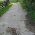 | |||
| traffic_calming | bump | hump | table | island | cushion | yes | etc. | 자세한 내용은 ko:Key:traffic calming을 참조하세요. |  | |||
| trail_visibility | excellent | good | intermediate | bad | horrible | no | highway=path, highway=footway, highway=cycleway 및 highway=bridleway에 적용됩니다. 등산 코스의 가시성에 대한 분류입니다.
|
 | |||
| trailblazed | yes | no | poles | cairns | symbols | Applies to highway=*. Describing trail blazing and marking. See Key:trailblazed for more information.
|
 | |||
| trailblazed:visibility | excellent | good | intermediate | bad | horrible | no | Applies to trailblazed=*. A classification for visibility of trailblazing. See Key:trailblazed:visibility for more information.
|
||||
| turn | left | slight_left | through | right | slight_right | merge_to_left | merge_to_right | reverse | 길 또는 차선이 이어질 방향을 지정하는데 사용됩니다. |  | |||
| width | <number> | 지물의 폭입니다. |  | |||
| winter_road | yes | 겨울에 기능하는 도로입니다. 여름에는 사용할 수 없을 수 있습니다. |  | |||
기타 | ||||||
| highway | bus_stop | 작은 버스 정류장입니다. 차량이 정지하는 위치에 대해 public_transport=stop_position을 사용하고, 승객이 기다리는 장소에 대해 public_transport=platform을 사용하여 더 자세하게 매핑할 수 있습니다. 자세한 내용은 public_transport=*를 참조하세요.
|
 | |||
| highway | crossing | 횡단보도입니다. 보행자가 여기서 길을 건널 수 있습니다. |  | |||
| highway | cyclist_waiting_aid | Street furniture for cyclists that are intended to make waiting at esp. traffic lights more comfortable. |  | |||
| highway | elevator | 엘리베이터 또는 리프트입니다. 수직으로 이동하며 다른 층 간의 승객이나 화물이 이동하는데 사용됩니다. |  | |||
| highway | emergency_bay | An area beside a highway where you can safely stop your car in case of breakdown or emergency. |  | |||
| highway | emergency_access_point | 비상 상황 시 현재 위치를 파악하는데 사용할 수 있는 표지판 번호입니다. ref=NUMBER_ON_THE_SIGN와 함께 사용하세요.
|
 | |||
| highway | give_way | 양보 표지판입니다. |  | |||
| emergency | phone | 비상 상황 시 현재 위치를 알리는 데 사용할 수 있는 통화 장치입니다. ref=NUMBER_ON_THE_SIGN와 함께 사용하세요.
|
 | |||
| highway | hitchhiking | Like a bus_stop but for free, uncertain, spontaneous rides with strangers.
ladder:desc=A vertical or inclined set of steps or rungs intended for climbing or descending of a person with the help of hands. |
 | |||
| highway | ladder | A vertical or inclined set of steps or rungs intended for climbing or descending of a person with the help of hands. |  | |||
| highway | milestone | 고속도로 위치 표지판입니다. | ||||
| highway | mini_roundabout | 회전교차로와 유사하지만, 중앙에 페인트 칠한 원이나 완전히 횡단할 수 있는 섬이 있습니다. 횡단할 수 없는 섬의 경우 Lua error in mw.title.lua at line 230: too many expensive function calls.을 사용해야 합니다. 방향은 Lua error in mw.title.lua at line 230: too many expensive function calls.이 기본값으로, 반시계 방향으로 렌더링됩니다. 시계 방향은 Lua error in mw.title.lua at line 230: too many expensive function calls. 태그를 사용하세요.
|
 |
 | ||
| highway | motorway_junction | 고속도로의 나들목(한국), 분기점(영국) 또는 출구(미국)입니다. ref=*는 출구 번호 또는 분기점 식별자로 설정해야 합니다.
|
 |
 | ||
| highway | passing_place | 교행할 수 있는 공간입니다. |  | |||
| highway | platform | 버스 정류장 또는 역의 승강장입니다. |  |
 | ||
| highway | rest_area | 운전자가 휴식을 취할 수 있는 장소입니다. 하지만 주유는 할 수 없습니다. |  |
 | ||
| highway | services | 휴게소입니다. 음식을 사거나 식사를 할 수 있는 서비스 스테이션으로, 주로 고속도로에 있습니다. |  |
 | ||
| highway | speed_camera | 고정된 과속 단속 카메라입니다. |  | |||
| highway | speed_display | 지나가는 운전자의 속도를 표시하는 전자 표지판입니다. |  | |||
| highway | stop | 정지 표지판입니다. |  | |||
| highway | street_lamp | 가로등입니다. 도로변 높이 있는 광원으로, 매일 특정 시간에 켜집니다. |  | |||
| highway | toll_gantry | 요금 징수 갠트리는 전자 요금 징수 시스템의 일부로, 도로(일반적으로 고속도로) 위에 매달려 있는 갠트리입니다. 통행에 방해가 되는 장벽이나 부스가 있는 요금소는 Lua error in mw.title.lua at line 230: too many expensive function calls.를 참조하세요.
|
 | |||
| highway | traffic_mirror | 직접적인 시야가 차단되었을 때 도로의 교통 상황을 반사하는 거울입니다. |  | |||
| highway | traffic_signals | 신호등입니다. 교통을 제어합니다. |  | |||
| highway | trailhead | 트레일 또는 도로가 시작되는 장소입니다. |  | |||
| highway | turning_circle | 일반적으로 차량이 쉽게 회전할 수 있도록 도로 끝에 둥글고 넓게 만들어진 영역이지만, 반드시 그럴 필요는 없습니다. 'cul de sac'으로도 알려져 있습니다. |  |
 | ||
| highway | turning_loop | 차량이 쉽게 회전하도록 만들어진, 가운데에 통행 불가능한 섬이 있는 도로 구역으로, 보통 원형이며 도로 끝에 있습니다. |  | |||
| highway | 사용자 지정 | 자주 사용되는 값을 Taginfo를 통해 확인할 수 있습니다. | ||||
한국어 번역은 여기에 있습니다.
Historic
다양한 역사적 장소를 설명하기 위해 사용합니다. 예를 들어 유적지, 유물, 폐허, 성, 고대 건물 등이 있습니다. 사용법은 Historic을 참조하세요.
| 키 | 값 | 요소 | 설명 | 렌더링 | 사진 |
|---|---|---|---|---|---|
| historic | aircraft | A decommissioned aircraft which generally remains in one place |  | ||
| historic | aqueduct | A historic structure to convey water |  | ||
| historic | archaeological_site | A place in which evidence of past activity is preserved |  | ||
| historic | battlefield | The site of a battle or military skirmish in the past. This could be on land or at sea. |  | ||
| historic | bomb_crater | A bomb crater. |  | ||
| historic | building | If it's not clear what type a historic building has, it can be tagged as a generic building. |  | ||
| historic | cannon | A historic/retired cannon. Usually found at on forts or battlefields. |  | ||
| historic | castle | Castles are (often fortified) buildings from medieval and modern times. Other languages |  | ||
| historic | castle_wall | A |
 |
 | |
| historic | charcoal_pile | Historic site of a charcoal pile. Often still in good condition in hilly forest areas. |  | ||
| historic | church | A building with historical value for Christian religious activities, particularly for worship services. |  | ||
| historic | city_gate | A |
 | ||
| historic | citywalls | A |
 |
 | |
| historic | farm | A historical farm, kept in its original state. |  | ||
| historic | fort | A military fort – distinct from a castle as it is generally more modern |  | ||
| historic | gallows | A structure designed for capital punishment by hanging. |  | ||
| historic | highwater_mark | A marker for indicating past flood. |  | ||
| historic | locomotive | A decommissioned locomotive which generally remains in one place. |  | ||
| historic | manor | Historic |
 | ||
| historic | memorial | Much like a monument, but smaller. Might range from a WWII memorial to a simple plate on a wall. |  | ||
| historic | mine | Abandoned underground mine workings for minerals such as coal or lead. |  | ||
| historic | minecart | A cart used to transport coal or ore from a mine. |  | ||
| historic | mine_shaft | Vertical shafts of a historic mine |  | ||
| historic | milestone | A historic marker that shows the distance to important destinations. |  | ||
| historic | monastery | An historic monastery. See Also amenity=monastery.
|
 | ||
| historic | monument | A memorial object, which is especially large (one can go inside, walk on or through it) or high enough (see the examples), built to remember, show respect to a person or group of people or to commemorate an event. Other languages |  | ||
| historic | optical_telegraph | Historic optical telegraph |  | ||
| historic | pillory | A construction designed to immobilitate and humiliate a person who was convicted in lower courts. |  | ||
| historic | railway_car | A decommissioned railway car which generally remains in one place. |  | ||
| historic | ruins | Remains of structures that were once complete, but have fallen into partial or complete disrepair. If the type of original structure is known or apparent it can be described using Lua error in mw.title.lua at line 230: too many expensive function calls., e.g. Lua error in mw.title.lua at line 230: too many expensive function calls..Alternative tagging is |
 | ||
| historic | rune_stone | A |
 | ||
| historic | ship | A decommissioned ship or submarine |  | ||
| historic | stone | A stone shaped or placed by man with historical value. |  | ||
| historic | tank | A decommissioned tank which generally remains in one place. |  | ||
| historic | tomb | Historic tomb |  | ||
| historic | tower | Historic tower | |||
| historic | Lua error in mw.title.lua at line 230: too many expensive function calls. + historic=wayside_shrine instead.
|
 | |||
| historic | vehicle | A decommissioned land-based vehicle which generally remains in one place |  | ||
| historic | wayside_cross | A historical (usually christian) cross. Frequently found along the way in Southern Germany, Austria and probably elsewhere. |  | ||
| historic | wayside_shrine | A historical shrine often showing a religious depiction. Frequently found along the way in Southern Germany, Austria and probably elsewhere. |  | ||
| historic | wreck | Nautical craft that has unintentionally been sunk or destroyed. |  | ||
| historic | yes | Used to add the historic significance of the objects described by other tags. | |||
| historic | user defined | All commonly used values according to Taginfo |
This table is a wiki template with a default description in English. Editable here.
한국어 번역은 여기에 있습니다.
토지 용도
토지가 어떤 용도로 사용되고 있는지를 설명하는 데 사용됩니다. 사용법에 대한 소개는 Land use를 참조하세요.
| 키 | 값 | 요소 | 설명 | 렌더링 | 이미지 | |
|---|---|---|---|---|---|---|
Common landuse key values - developed land | ||||||
| landuse | commercial | Predominantly commercial businesses and their offices. Commercial businesses which sell goods should be categorised as landuse=retail. Commercial businesses can sell services on site and may include private Doctor's Surgeries, and those non-government services for mental and physical health, such as a Counselor's or Physiotherapist's practice or Veterinary. Commercial businesses can also include office buildings and business parks which have limited interface with the public and sell their services either on site, or externally. Commercial businesses have low amounts of public foot traffic.
|
 |
 | ||
| landuse | construction | A site which is under active development and construction of a building or structure, including any purposeful alteration to the land or vegetation upon it. Abandoned construction projects and sites should not use this tag. |  |
 | ||
| landuse | education | An area predominately used for educational purposes/facilities. |  |
 | ||
| landuse | fairground | A site where a fair takes place |  | |||
| landuse | industrial | Predominantly industrial landuses such as workshops, factories, or warehouses. |  |
 | ||
| landuse | residential | Land where people reside; predominantly residential detached (single houses, grouped dwellings), or attached (apartments, flats, units) dwellings. For "Mixed-Use" areas where more than half of the land is residential, tag as residential. |  |
 | ||
| landuse | retail | Predominantly retail businesses such as shops. Retail businesses sell physical goods such as food (prepared or grocery), clothing, medicine, stationary, appliances, tools, or other similar physical items. Retail businesses have high amounts of public foot traffic. Retail businesses do not exclusively provide or sell their services. For businesses which sell services see landuse=commercial.
Generally a member of the public could freely walk into and access a retail business. Retail is a subset of commercial, but should be used and treated as mutually exclusive in OpenStreetMap. |
 |
 | ||
| landuse | institutional | Land used for institutional purposes, see office=government, Lua error in mw.title.lua at line 230: too many expensive function calls., Lua error in mw.title.lua at line 230: too many expensive function calls., amenity=social_facility and their associated infrastructure (car parks, service roads, yards and so-on) inside the area. |
 | |||
| 키 | 값 | 요소 | 설명 | 렌더링 | 이미지 | |
Common landuse key values - rural and agricultural land | ||||||
| landuse | aquaculture | Warning: currently, there is no convention on the exact meaning of this tag. Therefore, it makes sense to treat it like "boundary of aquaculture" (without implication of water body), which means, water body should be tagged by its own, using |
 | |||
| landuse | allotments | A piece of land given over to local residents for growing vegetables and flowers. |  |
 | ||
| landuse | farmland | An area of farmland used for tillage (cereals, vegetables, oil plants, flowers). |  |
 | ||
| landuse | farmyard | An area of land with farm buildings like farmhouse, dwellings, farmsteads, sheds, stables, barns, equipment sheds, feed bunkers, etc. plus the open space in between them and the shrubbery/trees around them. |  |
 | ||
| landuse | animal_keeping | An area of land that is used to keep animals, particularly horses and livestock. |  | |||
| landuse | flowerbed | An area designated for flowers |  |
 | ||
| landuse | forest | Managed forest or woodland plantation (Other languages). Some use this to map an area of trees rather than the use of the land. See Forest. |  |
 | ||
| landuse | logging | An area where some or all trees have been cut down |  | |||
| landuse | greenhouse_horticulture | Area used for growing plants in greenhouses |  |
 | ||
| landuse | meadow | A meadow or pasture: land primarily vegetated by grass and non-woody plants, mainly used for hay or grazing |  |
 | ||
| landuse | orchard | intentional planting of trees or shrubs maintained for food production |  |
 | ||
| landuse | plant_nursery | intentional planting of plants maintaining for the production of new plants |  |
 | ||
| landuse | vineyard | A piece of land where grapes are grown. |  |
 | ||
| 키 | 값 | 요소 | 설명 | 렌더링 | 이미지 | |
Common landuse key values - traffic and transportation | ||||||
| landuse | depot | An area used as a depot for e.g. vehicles (trains, buses or trams). Consider using rather standard landuse tags like Lua error in mw.title.lua at line 230: too many expensive function calls., landuse=commercial, landuse=industrial, with subtag like Lua error in mw.title.lua at line 230: too many expensive function calls..
|
 | |||
| landuse | garages | One level buildings with boxes commonly for cars, usually made of brick and metal. Usually this area belong to garage cooperative with own name, chairman, budget, rules, security, etc. |  |
 | ||
| landuse | highway | Area of land used for a highway, including all auxiliary areas like associated footways, verges and ditches. |  | |||
| landuse | port | coastal industrial area where commercial traffic is handled. Consider using landuse=industrial + Lua error in mw.title.lua at line 230: too many expensive function calls. for this type of industrial area.
|
 | |||
| landuse | railway | Area for railway use |  |
 | ||
| 키 | 값 | 요소 | 설명 | 렌더링 | 이미지 | |
Common landuse key values - waterbody | ||||||
| landuse | basin | An area artificially graded to hold water.
Together with |
 |
 | ||
A reservoir(위키백과). Deprecated variant of Lua error in mw.title.lua at line 230: too many expensive function calls. + Lua error in mw.title.lua at line 230: too many expensive function calls.. See Proposed features/Reservoir for details.
|
 |
 | ||||
| landuse | salt_pond | A place where salt (saline) water is evaporated to extract its salt. |  |
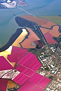 | ||
| 키 | 값 | 요소 | 설명 | 렌더링 | 이미지 | |
Other landuse key values | ||||||
| landuse | brownfield | Describes land scheduled for new development where old buildings have been demolished and cleared |  |
 | ||
| landuse | cemetery | Place for burials. You can add religion=* (values listed in the place of worship page). Smaller places (e.g. with a church nearby) may use Lua error in mw.title.lua at line 230: too many expensive function calls. instead.
|
 |
 | ||
Protected areas (deprecated) Alternate tagging of same thing: Lua error in mw.title.lua at line 230: too many expensive function calls., Lua error in mw.title.lua at line 230: too many expensive function calls.
|
||||||
| landuse | grass | An area of mown and managed grass not otherwise covered by a more specific tag. Some view this as not a landuse, see the main page Lua error in mw.title.lua at line 230: too many expensive function calls. for discussion.
|
 |
 | ||
| landuse | greenfield | Describes land scheduled for new development where there have been no buildings before. A greenfield is scheduled to turn into a construction site |  |

| ||
| landuse | landfill | Place where waste is dumped. |  |
 | ||
| landuse | military | For land areas owned/used by the military for whatever purpose |  |
 | ||
| landuse | quarry | Surface mineral extraction |  |
 | ||
| landuse | recreation_ground | An open green space for general recreation, which may include pitches, nets and so on, usually municipal but possibly also private to colleges or companies |  |
 | ||
| landuse | religious | An area used for religious purposes |  |
 | ||
| landuse | village_green | A village green is a distinctive area of grassy public land in a village centre. Not a generic tag for urban greenery. It is a typical English term – defined separately from 'common land' under the Commons Registration Act 1965 and the Commons Act 2006. |  |
 | ||
| landuse | greenery | Used for any area covered with landscaping or decorative greenery, regardless of it being on a roundabout, along a street or in a park/garden, This tag has been used for vegetation that is hard to classify, either because its kind or because its diversity. |  | |||
| landuse | winter_sports | An area dedicated to winter sports (e.g. skiing) |  | |||
| landuse | user defined | All commonly used values according to Taginfo | ||||
This table is a wiki template with a default description in English. Editable here. 한국어 번역은 여기에 있습니다.
여가
레저 시설이나 스포츠 시설을 나타내는 태그에 대해 다룹니다. 사용하는 방법은 leisure 를 참조하세요.
| 키 | 값 | 요소 | 설명 | 렌더링 | 사진 |
|---|---|---|---|---|---|
| leisure | adult_gaming_centre | 도박 기계들이 설치되어 있는 장소입니다. |  | ||
| leisure | amusement_arcade | 돈을 지불하고 할 수 있는 게임을 갖춘 장소입니다. |  | ||
| leisure | beach_resort | 관련 시설 경계 안쪽을 포함하는 관리되는 해변입니다. 입장료가 필요할 수 있습니다. |  | ||
| leisure | bandstand | 연주대는 음악 밴드가 연주할 수 있는 열린 시설입니다. |  | ||
| leisure | bird_hide | 특별히 새 같은 야생 동물을 관찰하기 위해 사용하는 장소입니다. |  | ||
| leisure | common | 대중이 특정 여가 시설의 일반적인 사용권을 부여하는 땅을 나타냅니다.(공유지) | |||
| leisure | dance | 춤을 추는 장소입니다. |  | ||
| leisure | disc_golf_course | 디스크 골프 코스입니다. |  | ||
| leisure | dog_park | 담장을 설치하거나 설치하지 않음으로써 견주가 반려동물을 억제를 받지 않으면서 운동시킬 수 있도록 고안된 공간입니다. |  | ||
| leisure | escape_game | 플레이어가 가까운 목표부터 완수하는 전략이나 단서, 힌트를 이용하면서 퍼즐을 해결하는 신체적인 모험 게임입니다. |  | ||
| leisure | firepit | 캠프나 소풍 장소에 있는 취사장입니다. |  | ||
| leisure | fishing | 낚시를 하는 장소입니다. |  | ||
| leisure | fitness_centre | 피트니스 센터입니다. |  | ||
| leisure | fitness_station | 사람들이 특정한 운동(피트니스)을 연습할 수 있는 야외 시설입니다. |  | ||
| leisure | garden | 꽃과 여타 식물들이 구조적으로, 혹은 과학적인(심리학 등) 의도로 장식되어 자라는 장소입니다. |  |
 | |
| leisure | hackerspace | 공통 관심사(과학, 기술, ...)를 가진 사람들이 만나는 장소입니다. |  | ||
| leisure | horse_riding | 보통 여가 시간에 사람들이 승마를 연습하는 장소입니다. |  | ||
| leisure | ice_rink | 스케이트나 아이스 하키를 할 수 있는 장소입니다. |  | ||
| leisure | marina | 여가용 요트나 보터 보트를 정박시켜 두는 시설입니다. | 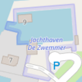 |
 | |
| leisure | miniature_golf | 미니 골프를 할 수 있는 장소나 영역입니다. |  | ||
| leisure | nature_reserve | 야생동물이나 동식물 군집, 지질학적이거나 여타 특별한 분야의 지물의 중요성으로 인해 보호받는 영역입니다. |  |
 | |
| leisure | paddling_pool [en] | A paddling pool is a shallow pool, typically less than 30cm (1 ft.) deep, for children to play in. |  | ||
| leisure | park | 주로 시군구에서 운영하는 공원입니다. |  |
 | |
| leisure | picnic_table | 음식을 먹거나 휴식을 취할 수 있는 벤치가 딸린 탁자입니다. |  | ||
| leisure | pitch | 보통 적절하게 선을 그어 놓아서 특정한 스포츠를 할 수 있도록 고안된 영역입니다. |  |
 | |
| leisure | playground | (학교)운동장, (공원)놀이터입니다. |  | ||
| leisure | slipway | 배를 올려 놓는 영역(조선대)입니다. |  | ||
| leisure | sports_centre | 스포츠 센터는 닫힌 공간에서 스포츠를 하도록 고안된 시설입니다. |  | ||
| leisure | stadium | 좌석을 높게 쌓아 올린 주요 스포츠 시설입니다. |  | ||
| leisure | summer_camp | 어린이나 10대들이 여름철에 하는 (감독되는) 캠프를 위한 장소입니다. |  | ||
| leisure | swimming_area | An area for swimming within a larger body of water (such as a river, lake or the sea) that is marked by a rope, buoys or similar. |  | ||
| leisure | swimming_pool | 수영장입니다.(물을 넣는 공간만 태그를 달아야 함) |  |
 | |
| leisure | track | 달리기나 사이클링용 트랙, 혹은 말이나 그레이하운드 같은 외부 동력을 사용하지 않는 경주에 사용하는 트랙입니다. |  | ||
| leisure | water_park | 워터 슬라이드, 파도풀 같은 놀이용 수영장, 유수풀 같은 놀이기구가 있는 워터파크입니다. |  |
This table is a wiki template with a default description in English. Editable here. 한국어 번역은 여기에 있습니다.
인공 구조물
인공 구조물을 식별하기 위한 태그입니다. 사용법에 대한 소개는 man made=*를 참조하세요.
| 키 | 값 | 요소 | 설명 | 렌더링 | 이미지 |
|---|---|---|---|---|---|
| man_made | adit | A type of entrance to an underground mine which is horizontal or nearly horizontal. |  | ||
| man_made | advertising | A generic advertising device. |  | ||
| man_made | antenna | An antenna to transmit and/or receive wireless signals. |  | ||
| man_made | avalanche_protection | A feature to protect from avalanches or to keep them from going off. |  | ||
| man_made | beacon | A structure for signalling on land and sea. |  | ||
| man_made | beehive | Beehive |  | ||
| man_made | borehole | A bore used for a purpose not covered by Lua error in mw.title.lua at line 230: too many expensive function calls. or Lua error in mw.title.lua at line 230: too many expensive function calls..
|
 | ||
| man_made | breakwater | A man-made structure designed to protect a shore or harbour from the sea and waves. |  |
 | |
| man_made | bridge | The outline of a bridge, grouping together all features for that bridge.
Please also add |
 |
 | |
| man_made | bunker_silo | An open-sided structure that can be used with vehicles to fill and empty them. |  | ||
| man_made | cairn | A mound of stones, usually conical or pyramidal, raised as a landmark or to designate a point of importance in surveying. |  | ||
| man_made | carpet_hanger | A construction to hang carpets for cleaning with the help of carpet beaters. |  | ||
| man_made | cellar_entrance | An entrance into artificially created vault. |  | ||
| man_made | charge_point | A device for charging electric vehicles. |  | ||
| man_made | chiller | industrial cooling construction with large diameter fans |  | ||
| man_made | chimney | A tall distinctive vertical conduit for venting hot gases or smoke, normally found near power stations or large factories. |  | ||
| man_made | clarifier | A clarifier of a wastewater treatment plant. |  | ||
| man_made | clearcut | An area where all trees have been uniformly cut down. |  | ||
| man_made | column | A column used to support a structure or for decoration. |  | ||
| man_made | communications_tower | A huge tower for transmitting radio applications. |  | ||
| man_made | compass_rose | A compass rose or wind rose. |  | ||
| man_made | compressor | Industrial equipment used to compress a gas by reducing its volume. |  | ||
| man_made | cooling | Industrial cooling facility. |  | ||
| man_made | cooling_tower | A cooling tower |  | ||
| man_made | courtyard | An area that is usually enclosed by walls or buildings. |  | ||
| man_made | crane | A stationary, permanent crane. |  | ||
| man_made | cross | Cross with little historical or religion value, e.g. summit cross. |  | ||
| man_made | cutline | A straight line cut in a forest. |  |
 | |
| man_made | dolphin | A marine structure for berthing and mooring of vessels. |  | ||
| man_made | dovecote | A place where doves are farmed or stored. |  | ||
| man_made | dyke | A dyke is a an embankment built to restrict the flow of water or other liquids. |  | ||
| man_made | embankment | An artificial steep slope. |  | ||
| man_made | flagpole | A long pole built to hold a flag. |  | ||
| man_made | flare | A tower constructed to burn off excess gas. | 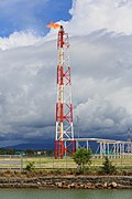 | ||
| man_made | footwear_decontamination | A facility to decontaminate footwear for hikers. |  | ||
| man_made | frost_fan | A device to stop frosts from damaging crops. |  | ||
| man_made | fuel_pump | A fuel pump (petrol pump, gas pump) |  | ||
| man_made | gantry | An overhead structure across a major road usually for holding signs, often variable-message signs. |  | ||
| man_made | gas_well | A natural gas well |  | ||
| man_made | gasometer | A large container in which natural gas or town gas is stored near atmospheric pressure at ambient temperatures. |  | ||
| man_made | geoglyph | A large design or motif (generally longer than 4 metres) produced on the ground |  | ||
| man_made | goods_conveyor | A conveyor system for transporting materials |  |
 | |
| man_made | groyne | A rigid structure built from a shoreline or riverbank that interrupts water flow and limits the movement of sediment. See also: Lua error in mw.title.lua at line 230: too many expensive function calls..
|
 |
 | |
| man_made | guard_stone | A guard stone: a stone built onto or into the corner of a building or wall to prevent carriages from damaging the structure, often found on either side of an entrance to a laneway, or alongside a wall to protect it. | 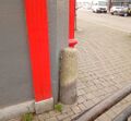 | ||
| man_made | guy_wire | Guy wire designed to add stability to a freestanding structure. |  |
 | |
| man_made | heap | A large pile of material |  | ||
| man_made | hongsalmun | A gate for entering a sacred place in Korea. The gate indicates entry to a sacred realm. |  | ||
| man_made | iljumun | The first gate at the entrance to many Korean Buddhist temples |  | ||
| man_made | insect_hotel | A structure intended to provide shelter for insects. |  | ||
| man_made | kiln | A kiln: an oven used for industrial processes such as hardening, drying, or smelting |  | ||
| man_made | lighthouse | Tower that emits light to serve as a navigational aid at sea or on inland waterway. |  | ||
| man_made | manhole | Hole with a cover that allows access to an underground service location, just large enough for a human to climb through. |  | ||
| man_made | mast | A mast is a vertical structure built to hold, for example, antennas. |  | ||
| man_made | maypole | A tall wooden pole erected as a part of various European folk traditions to celebrate the beginning of summer. |  | ||
| man_made | milk_churn_stand | A current or former collection point for milk churns. |  | ||
| man_made | mineshaft | A mineshaft: vertical tunnel into a mine where minerals are extracted. |  | ||
| man_made | monitoring_station | A station that monitors something. |  | ||
| man_made | nesting_site | A man made nesting aid that is mounted on a support device. |  | ||
| man_made | obelisk | Tall, narrow, four-sided, tapered monument which usually ends in a pyramid-like shape at the top. |  | ||
| man_made | observatory | Observatory: a location used for observing terrestrial or celestial events |  | ||
| man_made | offshore_platform | Offshore platform, oil platform or offshore drilling rig |  | ||
| man_made | oil_gas_separator | Industrial equipment used to separate liquid and gaseous components (oil and gas) produced from a petroleum well. |  | ||
| man_made | oxidation_ditch | An oxidation ditch of a wastewater treatment plant. |  | ||
| man_made | paifang | A traditional style of Chinese architectural arch or gateway structure. |  | ||
| man_made | petroleum_well | Oil well: a hole bored in the earth, designed to bring petroleum oil or gas to the surface |  | ||
| man_made | pier | A pier is a raised walkway over water, supported by widely spread piles or pillars. |  |
 | |
| man_made | pipeline | A major pipeline carrying gas, water, oil, etc. |  | ||
| man_made | planter | A structure for planting flowers or other ornamental plants. |  | ||
| man_made | pump | A device in charge of moving or raising the level of liquids. |  | ||
A pumping rig for producing oil. Use of this tag is discouraged. See Lua error in mw.title.lua at line 230: too many expensive function calls. instead.
|
 | ||||
| man_made | pumping_station | Pumping station: a facility including pumps and equipment for pumping fluids from one place to another |  | ||
| man_made | quay | A man-made structure alongside navigable water used for loading and unloading vessels. |  | ||
| man_made | reservoir_covered | A covered reservoir is a large man-made tank for holding fresh water |  | ||
| man_made | satellite_dish | A dish-shaped parabolic antenna designed to receive or transmit radio waves to or from a satellite |  | ||
| man_made | sewer_vent | A sewer ventilation shaft |  | ||
| man_made | sign | A permanent physical object displaying messages, like entrance sign of place or city, political sign, but otherwise not covered by Lua error in mw.title.lua at line 230: too many expensive function calls., Lua error in mw.title.lua at line 230: too many expensive function calls. or Lua error in mw.title.lua at line 230: too many expensive function calls..
|
 | ||
| man_made | silo | A storage container for bulk material, often grains such as corn or wheat |  | ||
| man_made | snow_fence | A solid fence-like structure built across steep slopes to reduce risk and severity of (snow) avalanches. |  | ||
| man_made | spoil_heap | Spoil heap, piles of waste rock removed during mining. |  | ||
| man_made | spring_box | A structure designed for protecting and catching groundwater from a natural spring. |  | ||
| man_made | storage_tank | A container that holds liquids or compressed gases. |  | ||
| man_made | street_cabinet | A cabinet located in the street and hosting technical equipment to operate facilities such as electricity or street lights. |  | ||
| man_made | stupa | A Buddhist dome-shaped structure with a spire on top |  | ||
| man_made | surveillance | A surveillance camera or other type of surveillance equipment. |  | ||
| man_made | survey_point | A triangulation pillar, geodetic vertex, or other piece of fixed equipment used by topographers. |  | ||
| man_made | tailings_pond | Tailings pond: A body of liquid or slurry used to store byproducts of mining operations |  | ||
| man_made | telescope | Telescope: an instrument that aids in the observation of remote objects by collecting light or radio waves |  | ||
| man_made | torii | The gate structure found at the entrance of Shinto shrines and (rarely) Japanese Buddhist temples. |  | ||
| man_made | tower | A tower is a free-standing structure which is higher than it is wide. Add tower:type=* if possible.
|
 | ||
| man_made | threshing_floor | An open air paved area created to thresh the grain harvest and then winnow it. |  | ||
| man_made | trough | A long, narrow container, open on top, for feeding or watering animals. The water from a trough usually would not be considered drinkable, however, it may be filled from a pipe providing drinkable water. |  | ||
| man_made | utility_pole | A single pole supporting elevation of any of various and unspecified public utilities, such as power transmission, lighting or telephony. |  | ||
| man_made | ventilation_shaft | A vertical space in mines, tunnels, or buildings allowing stale air to leave the space underneath and/or fresh air to enter it. |  | ||
| man_made | video_wall | A digital screen, typically constructed out of smaller LED panels. |  | ||
| man_made | wastewater_plant | A wastewater plant is a facility used to treat wastewater or sewage. |  |
 | |
| man_made | water_tap | Publicly usable water tap, providing access to water and usually equipped with a valve. |  | ||
| man_made | water_tower | Structure with a water tank at an altitude to increase pressure in water network |  | ||
| man_made | water_well | A structural facility to access ground water, created by digging or drilling. |  | ||
| man_made | water_works | A place where drinking water is found and applied to the local waterpipes network. |  |
 | |
| man_made | watermill | A mill driven by water power. |  | ||
| man_made | wildlife_crossing | Structure that allow animals to cross human barriers safely. |  | ||
| man_made | windmill | A traditional windmill, historically used to mill grain with wind power. See Lua error in mw.title.lua at line 230: too many expensive function calls. in combination with Lua error in mw.title.lua at line 230: too many expensive function calls. for modern wind turbines.
|
 | ||
| man_made | windpump | A device that pumps natural gas or water using the wind, typically mass produced. |  | ||
| man_made | works | A factory or industrial production plant. |  | ||
| man_made | yes | General tag for man-made (artificial) structures. | |||
| man_made | user defined | All commonly used values according to Taginfo |
This table is a wiki template with a default description in English. Editable here. 한국어 번역은 여기에 있습니다.
군사 시설
군에서 사용하는 시설과 토지입니다. 여기에는 해군, 육군, 공군 및 해병대가 포함될 수 있습니다. 사용법에 대한 소개는 Military를 참조하세요.
| 키 | 값 | 요소 | 설명 | 렌더링 | 이미지 |
|---|---|---|---|---|---|
| military | airfield | A place where military planes take off and land. |  | ||
| military | ammunition | Military ammunition storage area. | |||
| military | barracks | Buildings where soldiers live and work. |  | ||
| military | bunker | Buildings, often build from concrete, to stand even heavier fire. Also WW2 pillboxes. |  | ||
| military | checkpoint | Place of a possible access to a restricted or secured area, where civilian visitors and vehicles will be controled by a military authority. |  | ||
| military | danger_area | Usually a large marked area around something like a firing range, bombing range, etc which can be an exclusion zone. | 
|
 | |
| military | launchpad | Launchpads used for military purposes, see tag:aeroway=launchpad for civilian use |  | ||
| military | naval_base | A naval base |  | ||
| military | nuclear_explosion_site | Nuclear weapons test site |  | ||
| military | obstacle_course | A military obstacle course. |  | ||
| military | office | Military offices, e.g. general staff office, military recruitment office etc |  | ||
| military | range | Where soldiers practice with their weapons (firing, bombing, artillery, …). |  | ||
| military | training_area | An area where soldiers train and weapons or other military technology are experimented with or are tested. |  | ||
| military | trench | Trenches used for military purposes |  | ||
| military | user defined | All commonly used values according to Taginfo |
This table is a wiki template with a default description in English. Editable here.
한국어 번역은 여기에 있습니다.
자연물
자연과 지형지물입니다. 여기에는 사람이 만든 지형도 포함됩니다.
| 키 | 값 | 요소 | 설명 | 렌더링 | 이미지 |
|---|---|---|---|---|---|
Vegetation | |||||
| natural | fell | Habitat above the tree line covered with grass, dwarf shrubs and mosses. | No, see #545. |  | |
| natural | grassland | Areas where the vegetation is dominated by grasses (Poaceae) and other herbaceous (non-woody) plants. For mown/managed grass see Lua error in mw.title.lua at line 230: too many expensive function calls., for hay/pasture see Lua error in mw.title.lua at line 230: too many expensive function calls..
|
 |
 | |
| natural | heath | A dwarf-shrub habitat, characterised by open, low growing woody vegetation, often dominated by plants of the Ericaceae. Note. This is not for parks whose name contains the word "heath". |
 |
 | |
| natural | moor | Don't use, see wikipage. Upland areas, characterised by low-growing vegetation on acidic soils. | currently not rendered by OSM Carto |  | |
| natural | scrub | Uncultivated land covered with shrubs, bushes or stunted trees. |  |
 | |
| natural | shrubbery | An area of shrubbery that is actively maintained or pruned by humans. A slightly wilder look is also possible | currently not rendered by OSM Carto |  | |
| natural | tree | A single tree. |  | ||
| natural | tree_row | A line of trees. |  |
 | |
| natural | tree_stump | A tree stump, the remains of a cut down or broken tree. |  | ||
| natural | tundra | Habitat above tree line in alpine and subpolar regions, principally covered with uncultivated grass, low growing shrubs and mosses and sometimes grazed. |  | ||
| natural | wood | Tree-covered area (a 'forest' or 'wood'). Also see Lua error in mw.title.lua at line 230: too many expensive function calls.. For more detail, one can use Lua error in mw.title.lua at line 230: too many expensive function calls. and Lua error in mw.title.lua at line 230: too many expensive function calls..
|
 |
 | |
|
| |||||
| natural | bay | An area of water mostly surrounded by land but with a level connection to the ocean or a lake. |  |
 | |
| natural | beach | landform along a body of water which consists of sand, shingle or other loose material |  |
 | |
| natural | blowhole | An opening to a sea cave which has grown landwards resulting in blasts of water from the opening due to the wave action |  | ||
| natural | cape | A piece of elevated land sticking out into the sea or large lake. Includes capes, heads, headlands and (water) promontories. |  | ||
| natural | coastline | The mean high water springs line between the sea and land (with the water on the right side of the way.) |  |
 | |
| natural | crevasse | A large crack in a glacier |  | ||
| natural | geyser | A spring characterized by intermittent discharge of water ejected turbulently and accompanied by steam. |  | ||
| natural | glacier | A permanent body of ice formed naturally from snow that is moving under its own weight. |  |
 | |
| natural | hot_spring | A spring of geothermally heated groundwater |  | ||
| natural | isthmus | A narrow strip of land, bordered by water on both sides and connecting two larger land masses. |  | ||
| natural | mud | Area covered with mud: water saturated fine grained soil without significant plant growth. Also see Lua error in mw.title.lua at line 230: too many expensive function calls. + Lua error in mw.title.lua at line 230: too many expensive function calls..
|
 |
 | |
| natural | peninsula | A piece of land projecting into water from a larger land mass, nearly surrounded by water |  | ||
| natural | reef | A feature (rock, sandbar, coral, etc) lying beneath the surface of the water |  | ||
| natural | shingle | An accumulation of rounded rock fragments on a beach or riverbed |  |
 | |
| natural | shoal | An area of the sea floor near the sea surface (literally, becomes shallow) and exposed at low tide. See Lua error in mw.title.lua at line 230: too many expensive function calls. as well.
|
 |
 | |
| natural | spring | A place where ground water flows naturally from the ground (Other languages). |  | ||
| natural | strait | A narrow area of water surrounded by land on two sides and by water on two other sides. |  |
 | |
| natural | water | Any body of water, from natural such as a lake or pond to artificial like moat or canal. Also see Lua error in mw.title.lua at line 230: too many expensive function calls.
|
 |
 | |
| natural | wetland | A natural area subject to inundation or with waterlogged ground, further specified with Lua error in mw.title.lua at line 230: too many expensive function calls.
|
 |
 | |
|
| |||||
| natural | arch | A rock arch naturally formed by erosion, with an opening underneath. | currently not rendered by OSM Carto |  | |
| natural | arete | An arête, a thin, almost knife-like, ridge of rock which is typically formed when two glaciers erode parallel U-shaped valleys. |  |
 | |
| natural | bare_rock | An area with sparse/no soil or vegetation, so that the bedrock becomes visible. |  |
 | |
| natural | blockfield | A surface covered with boulders or block-sized rocks, usually the result of volcanic activity or associated with alpine and subpolar climates and ice ages. | Currently not rendered by OSM Carto |  | |
| natural | cave_entrance | The entrance to a cave: a natural underground space large enough for a human to enter. |  | ||
| natural | cliff | A vertical or almost vertical natural drop in terrain, usually with a bare rock surface (leave the lower face to the right of the way). |  |
 | |
| natural | dune | A hill of sand formed by wind, covered with no or very little vegetation. See also Lua error in mw.title.lua at line 230: too many expensive function calls. and Lua error in mw.title.lua at line 230: too many expensive function calls.
|
currently not rendered by OSM Carto |  | |
| natural | earth_bank | Large erosion gully or steep earth bank |  | ||
| natural | fumarole | A fumarole is an opening in a planet's crust, which emits steam and gases |  | ||
| natural | gorge | A gorge or canyon, including variants like ravine or slot canyon, is a narrow valley with steep, typically rocky walls. | currently not rendered by OSM Carto |  | |
| natural | gully | Small scale cut in relief created by water erosion |  | ||
| natural | hill | A hill. | currently not rendered by OSM Carto |  | |
| natural | peak | The top (summit) of a hill or mountain. |  | ||
| natural | ridge | A mountain or hill linear landform with a continuous elevated crest |  |
 | |
| natural | rock | A notable rock or group of rocks attached to the underlying bedrock. | currently not rendered by OSM Carto |  | |
| natural | saddle | The lowest point along a ridge or between two mountain tops |  | ||
| natural | sand | An area covered by sand with no or very little vegetation. See Lua error in mw.title.lua at line 230: too many expensive function calls. and Lua error in mw.title.lua at line 230: too many expensive function calls. as well.
|
 |
 | |
| natural | scree | Unconsolidated angular rocks formed by rockfall and weathering from adjacent rockfaces. |  |
 | |
| natural | sinkhole | A natural depression or hole in the surface topography. | currently not rendered by OSM Carto |  | |
| natural | stone | A single notable freestanding rock, which may differ from the composition of the terrain it lies in.; e.g., glacial erratic. | currently not rendered by OSM Carto |  | |
| natural | valley | A natural depression flanked by ridges or ranges of mountains or hills | currently not rendered by OSM Carto |  | |
| natural | volcano | An opening exposed on the earth's surface where volcanic material is emitted. |  | ||
| natural | user defined | All commonly used values according to Taginfo | |||
This table is a wiki template with a default description in English. Editable here. 한국어 번역은 여기에 있습니다.
사무실
사무실은 전문적인 업무가 수행되는 사업장입니다.
This table is a wiki template with a default description in English. Editable here. 한국어 번역은 여기에 있습니다.
Template:Ko:Map Features:place
전력
발전 및 배전 시스템을 표현하는 데 사용됩니다. 사용법에 대한 소개는 power 을 참조하세요.
| 키 | 값 | 요소 | 설명 | 렌더링 | 이미지 |
|---|---|---|---|---|---|
| power | cable | A way following the path of underground cables, such as the local 0.4 kV network between transformer stations, distribution boxes and cable connection points, or sea cables. Not to be confused with non-power supply cables such as cables for telecommunication. May be combined with Lua error in mw.title.lua at line 230: too many expensive function calls., Lua error in mw.title.lua at line 230: too many expensive function calls. and Lua error in mw.title.lua at line 230: too many expensive function calls..
|
 | ||
| power | catenary_mast | A catenary mast supports system of overhead wires used to supply electricity to electrically powered vehicle equipped with a pantograph. |  | ||
| power | compensator | Several kind of power devices used to insure of power quality and network resilience. |  | ||
| power | connection | A freestanding electrical connection between two or more overhead wires |  | ||
| power | converter | An HVDC converter converts electric power from high voltage alternating current (AC) to high-voltage direct current (HVDC), or vice-versa. |  | ||
| power | generator | A device used to convert power from one form to another. Use in combination with Lua error in mw.title.lua at line 230: too many expensive function calls., Lua error in mw.title.lua at line 230: too many expensive function calls. and Lua error in mw.title.lua at line 230: too many expensive function calls..
|
 |
 | |
| power | heliostat | A mirror of a heliostat device. |  | ||
| power | insulator | A device to protect a power line from grounding on supports |  | ||
| power | line | A way following the path of (overground) power cables. For minor power lines with poles and not towers, you may want to use Lua error in mw.title.lua at line 230: too many expensive function calls.. Useful combinations: Lua error in mw.title.lua at line 230: too many expensive function calls., Lua error in mw.title.lua at line 230: too many expensive function calls. and Lua error in mw.title.lua at line 230: too many expensive function calls.. Please see the respective feature pages for details.
|
 |
 | |
| line | busbar | Specifies that a Lua error in mw.title.lua at line 230: too many expensive function calls. is a busbar in a substation.
|
 | ||
| line | bay | Specifies a Lua error in mw.title.lua at line 230: too many expensive function calls. is a bay which connects an incoming circuit to a busbar assembly.
|
 | ||
| power | minor_line | A way following the path of (overground) minor power cables, supported by poles and not towers/pylons. (This isn't quite so simple, as sometimes larger towers are replaced by smaller poles made with a stronger material; a better distinction might be based on voltage). |  |
 | |
| power | plant | A place/industrial facility where power is generated (electricity, heat, cold water, biogas...). Individual generating units within the facility should be tagged as Lua error in mw.title.lua at line 230: too many expensive function calls..
|
 |
 | |
| power | pole | Poles supporting low to medium voltage lines (Lua error in mw.title.lua at line 230: too many expensive function calls.) and high voltage lines (Lua error in mw.title.lua at line 230: too many expensive function calls.) up to 161,000 volts (161 kV).
|
 | ||
| power | portal | Power supporting structure composed of vertical legs with cables between them attached to a horizontal crossarm |  | ||
| power | substation | A tag for electricity substations. These provide voltage step-up/step-down, switching, conditioning, etc. Substations may be large facilities (up to several acres) for very high voltage transmission lines or just small buildings or kiosks near the street for low voltage distribution lines. Useful combinations: Lua error in mw.title.lua at line 230: too many expensive function calls., substation=* and Lua error in mw.title.lua at line 230: too many expensive function calls., see the feature page for details.
|
 |
 | |
| power | switch | A tag for electricity switches which are devices which allow operators to power up & down lines and transformer in substations or outside. | 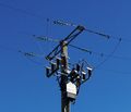 | ||
| power | switchgear | The switchgear comprises one or more busbar assemblies and a number of bays each connecting a circuit to the busbar assembly. |  | ||
| power | terminal | Point of connection between overhead power lines to buildings or walls | 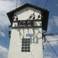 | ||
| power | tower | For towers or pylons carrying high voltage electricity cables. Normally constructed from steel latticework but tubular or solid pylons are also commonly used. Should not be used for medium or low voltage electricity conductors carried on single wooden poles which might be tagged Lua error in mw.title.lua at line 230: too many expensive function calls.. See Lua error in mw.title.lua at line 230: too many expensive function calls. for detailed tagging of tower types.
|
 |
 | |
| power | transformer | A static device for transferring electric energy by inductive coupling between its windings. Large power transformers are typically located inside substations. |  | ||
| power | User Defined | All commonly used values according to Taginfo |
This table is a wiki template with a default description in English. Editable here.
한국어 번역은 여기에 있습니다.
Template:Ko:Map Features:public transport
Template:Ko:Map Features:railway
Template:Ko:Map Features:route
Template:Ko:Map Features:shop
Template:Ko:Map Features:telecom
Template:Ko:Map Features:tourism
Template:Ko:Map Features:water
Template:Ko:Map Features:waterway
추가 속성
Template:Ko:Map Features:addr Template:Ko:Map Features:annotation Template:Ko:Map Features:name Template:Ko:Map Features:properties Template:Ko:Map Features:references Template:Ko:Map Features:restrictions
- ↑ Some mappers add them to OpenStreetMap with Template:Tag, but this is controversial.


