Template:Ko:Map Features:properties
Jump to navigation
Jump to search
속성
최상위 태그와 달리 다른 요소에 대한 일반적인 성격의 추가 정보를 제공하는 데 사용되는 태그입니다.
| 키 | 값 | 요소 | 설명 | 이미지 |
|---|---|---|---|---|
| area | yes | Means a feature that is normally linear is an area. You should not add this to features that are already defined as an area type. | 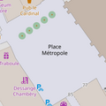 | |
| brand | user defined | Brand of the feature. |  | |
| bridge | yes / aqueduct / viaduct / cantilever / movable / covered / … | A bridge, use together with the tag layer=*. Value yes is generic, or you can specialize.
|
 | |
| capacity | amount | Used for specifying capacity of a facility. |  | |
| charge | amount | Used for specifying how much is charged for use/access to a facility. See toll=* or fee=*.
|
 | |
| clothes | see key's page | Tagged on shops and other features to denote if they sell clothes or not and what type of clothes they sell. |  | |
| covered | yes | Used to denote that a node, way or area is covered by another entity (or in some cases the ground), when the use of layers is inappropriate, or additional clarification is needed. |  | |
| crossing | no / traffic_signals / uncontrolled / island / unmarked | Further refinement for nodes already tagged with highway=crossing or railway=crossing
|
 | |
| crossing:island | yes / no | Specifies whether a pedestrian crossing has a refuge island |  | |
| cutting | yes / left / right | A cut in the land to carry a road or tram. Mostly in hilly landscape. See Cutting(위키백과) |  | |
| disused | yes | For features that are useful for navigation, yet are unused. See abandoned=* if infrastructure is removed.
|
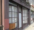 | |
| drinking_water | yes / no | Describes whether a drinking water is available |  | |
| drive_through | yes / no | Used to indicate if a pharmacy, bank, atm, or fast_food, or post_box offers drive_thru service. drive_through=* is different than drive_in=*
|
 | |
| drive_in | yes / no | Used to indicate if a cinema is a drive-in cinema or a restaurant offers drive-in service. drive_in=* is different than drive_through=*
|
 | |
| electrified | contact_line / rail | Indicates infrastructure to supply vehicles with electricity on rail tracks |  | |
| ele | Number | Elevation (also known as altitude or height) above mean sea level in metre, based on geoid model EGM 96 which is used by WGS 84 (GPS). (see also Altitude) | 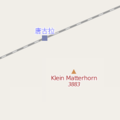 | |
| embankment | yes | A raised bank to carry a road, railway, or canal across a low-lying or wet area. See Embankment(위키백과) | 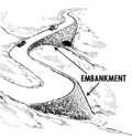 | |
| end_date | Date | Date feature was removed |  | |
| energy_class [en] | code | An energy class of the feature |  | |
| est_width | Number | A rough guess of the width of way in metres |  | |
| fee | yes / no | Used for specifying whether fee is charged for use/access to a facility. See also toll=*.
|
 | |
| fire_object:type | poo / szo | Potentially dangerous and socially significant objects | ||
| fire_operator | Name | Fire station, which serves the object | ||
| fire_rank | 1bis / 2 to 5 | Rank fire, defined for a particular object | ||
| frequency | Number | Frequency in Hz |  | |
| gutter [en] | yes/no | Presence of the gutter |  | |
| hazard | see hazard | Indicates of the hazards. |  | |
| hot_water | yes / no | Describes whether a hot water is available | ||
| inscription | User Defined | The full text of inscriptions, which can be found on buildings, memorials and other objects. |  | |
| internet_access | yes / wired / wlan / terminal / no | This tag is for indication that a map entity such as a building, a shop, restaurant, etc. offers internet access to the public, either as a paid service or even for free. |  | |
| layer | -5 to 5 | 0: ground (default); -1..-5:under ground layer; 1..5 (not +1):above ground layer This is intended to indicate actual physical separation, shouldn't be used just to influence rendering order. |
 | |
| leaf_cycle | evergreen / deciduous / semi_evergreen / semi_deciduous / mixed | Describes the phenology of leaves |  | |
| leaf_type | broadleaved / needleleaved / mixed / leafless | Describes the type of leaves |  | |
| location | underground / overground / underwater / roof / indoor | Location |  | |
| narrow | yes | Relative indication that a way (waterway, highway, cycleway) gets narrower. |  | |
| nudism | yes / obligatory / designated / no / customary / permissive | Indicates if the described object provides the possibility of nudism |  | |
| opening_hours | 24/7 or mo md hh:mm-hh:mm. (read described syntax) | opening_hours describes when something is open. |  | |
| opening_hours:drive_through | 24/7 or mo md hh:mm-hh:mm. (read described syntax) | opening_hours describes when something is open for drive-through services. |  | |
| operator | User Defined | The operator tag can be used to name a company or corporation who's responsible for a certain object or who operates it. | ||
| power_supply | yes / no | Describes whether a power supply is available |  | |
| produce | User Defined | Describes a feature's agricultural output produced though a natural process of growing or breeding. |  | |
| rental | see key's page | Tagged on shops and other features to denote if they rent something or not and what they rent. |  | |
| sauna | yes / no | Describes whether a sauna is available |  | |
| service_times | see opening_hours | Times of service of a given feature e.g. church service |  | |
| shower | yes / no | Describes whether a shower is available |  | |
| sport | soccer / tennis / basketball / baseball / multi / ... | Describes which sports are placed on a facility such as a pitch or stadium. |  | |
| start_date | Date | Date feature was created |  | |
| tactile_paving | yes /no | Indicate if a specific place can be detected or followed with a blindman's stick. |  | |
| tidal | yes | Area is flooded by the tide |  | |
| toilets | yes / no | Describes whether a toilets is available |  | |
| topless | yes / no | Indicates if the described object provides the possibility of female topless practice |  | |
| tunnel | yes | A tunnel, use together with a tag layer=*.
|
 | |
| toilets:wheelchair | yes / no | States if a location has a wheelchair accessible toilet or not. |  | |
| wheelchair | yes / no / limited | Indicates if a place is accessible using a wheelchair. |  | |
| width | Number | Width of way in metres |  | |
Applies to landuse=forest and natural=wood detailing the sort of trees found within each landuse. Makes most sense when applied to areas. Be careful : this tag is now deprecated, please use instead leaf_cycle=*
|
 |
This table is a wiki template with a default description in English. Editable here.
한국어 번역은 여기에 있습니다.