Template:Zh-hant:Map Features:properties
Jump to navigation
Jump to search
屬性 (properties)
標註一般元素上的附加屬性。
| 關鍵字(key) | 值 (value) | 幾何 (element) | 描述 (desc) | 照片 (photo) |
|---|---|---|---|---|
| area | yes | 意謂圖徵為區域。當圖徵已被定義為區域型態石時,您不須增加此標籤。 | 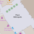 | |
| brand | user defined | Brand of the feature. |  | |
| bridge | yes / aqueduct / viaduct / cantilever / movable / covered / … | 橋梁,與layer=*一起使用。值"yes"為預設值,或可自訂。
|
 | |
| capacity | amount | Used for specifying capacity of a facility. |  | |
| charge | amount | 指定使用或進入特定設施的費用,參見toll=*或fee=*
|
 | |
| clothes | see key's page | Tagged on shops and other features to denote if they sell clothes or not and what type of clothes they sell. |  | |
| covered | yes | 用來區域或線段被其他元素覆蓋,但不適合使用layer=*時使用。
|
 | |
| crossing | no / traffic_signals / uncontrolled / island / unmarked | 路口類型,詳見crossing=*。
|
 | |
| crossing:island | yes / no | 行人庇護島 |  | |
| cutting | yes / left / right | 下沉式、地塹型道路或鐵路,常用於崎嶇的地表。 |  | |
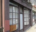
| disused | yes | 常用於導航的圖徵,但未被使用,當設施被移除時改用abandoned=*。
|
 | |
| drinking_water | yes / no | Describes whether a drinking water is available |  | |
| drive_through | yes / no | 是否提供免下車車道服務drive_in=*不同於drive_through=*
|
 | |
| drive_in | yes / no | 是否提供入場免下車服務drive_in=*不同於drive_through=*
|
 | |
| electrified | contact_line / rail | 軌道運輸電氣化程度 |  | |
| ele | Number | 海拔。 | 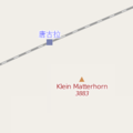 | |
| embankment | yes | 路堤式道路或鐵路 | 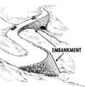 | |
| end_date | Date | 圖徵移除的日期 |  | |
| energy_class [en] | code | An energy class of the feature |  | |
| est_width | Number | 預估寬度(公尺) |  | |
| fee | yes / no | Used for specifying whether fee is charged for use/access to a facility. See also toll=*.
|
 | |
| fire_object:type | poo / szo | 具潛在危險的重要公共物件 | ||
| fire_operator | Name | 負責該物件的消防單位 | ||
| fire_rank | 1bis / 2 to 5 | 起火等級 | ||
| frequency | Number | 頻率(Hz) |  | |
| gutter [en] | yes/no | Presence of the gutter |  | |
| hazard | see hazard | Indicates of the hazards. |  | |
| hot_water | yes / no | Describes whether a hot water is available | ||
| inscription | User Defined | 建築、紀念碑等物件的全文銘文 |  | |
| internet_access | yes / wired / wlan / terminal / no | 標示元素(如商店、餐廳等)是否提供公共網路服務,無論屬付費或免費服務 |  | |
| layer | -5 to 5 | 0:地表(預設) -1...-5:地底層 1...5(非+1):地面以上 指定物理的實際分隔,無法影響渲染順序 |
 | |
| leaf_cycle | evergreen / deciduous / semi_evergreen / semi_deciduous / mixed | 描述樹葉物候特性 |  | |
| leaf_type | broadleaved / needleleaved / mixed / leafless | 描述樹葉種類 |  | |
| location | underground / overground / underwater / roof / indoor | 位置 |  | |
| narrow | yes | 水路、公路、自行車道是否在特定時間因故變窄 |  | |
| nudism | yes / obligatory / designated / no / customary / permissive | 是否允許天體者 |  | |
| opening_hours | 24/7 or mo md hh:mm-hh:mm. (read described syntax) | 營業時間。 |  | |
| opening_hours:drive_through | 24/7 or mo md hh:mm-hh:mm. (read described syntax) | opening_hours describes when something is open for drive-through services. |  | |
| operator | User Defined | 負責營運者 | ||
| power_supply | yes / no | Describes whether a power supply is available |  | |
| produce | User Defined | Describes a feature's agricultural output produced though a natural process of growing or breeding. |  | |
| rental | see key's page | Tagged on shops and other features to denote if they rent something or not and what they rent. |  | |
| sauna | yes / no | Describes whether a sauna is available |  | |
| service_times | see opening_hours | 服務時間 |  | |
| shower | yes / no | Describes whether a shower is available |  | |
| sport | soccer / tennis / basketball / baseball / multi / ... | Describes which sports are placed on a facility such as a pitch or stadium. |  | |
| start_date | Date | 該圖徵創設的日期。 |  | |
| tactile_paving | yes /no | 該地點設置導盲磚 |  | |
| tidal | yes | 潮汐氾濫區域 |  | |
| toilets | yes / no | Describes whether a toilets is available |  | |
| topless | yes / no | Indicates if the described object provides the possibility of female topless practice |  | |
| tunnel | yes | 隧道,與layer=*一起使用
|
 | |
| toilets:wheelchair | yes / no | 該地點是否具有供輪椅使用的廁所 |  | |
| wheelchair | yes / no / limited | 該場所允許輪椅通行 |  | |
| width | Number | 線段的寬度(公尺) |  | |
通常和landuse=forest、natural=wood同時使用,標示森林的林種(針葉林、闊葉林或混合林)。
|
 |
此表格由模版自動生成,協助改善中譯版本請按此。