Template:Ca:Map Features:landuse
Jump to navigation
Jump to search
| landuse | ||||||
|---|---|---|---|---|---|---|
Common landuse key values - developed land | ||||||
| landuse | commercial | Espai d'oficines i empreses |  |
 | ||
| landuse | construction | Zona en construcció. Espai en obres |  |
 | ||
| landuse | education | An area predominately used for educational purposes/facilities. |  |
 | ||
| landuse | fairground | A site where a fair takes place |  | |||
| landuse | industrial |  |
 | |||
| landuse | residential |  |
 | |||
| landuse | retail |  |
 | |||
| landuse | institutional | Land used for institutional purposes, see office=government, office=ngo, office=association, amenity=social_facility and their associated infrastructure (car parks, service roads, yards and so-on) inside the area. |
 | |||
| landuse | ||||||
Common landuse key values - rural and agricultural land | ||||||
| landuse | aquaculture | Warning: currently, there is no convention on the exact meaning of this tag. Therefore, it makes sense to treat it like "boundary of aquaculture" (without implication of water body), which means, water body should be tagged by its own, using |
 | |||
| landuse | allotments | Zona per plantar flors i plantes |  |
 | ||
| landuse | farmland | Camps de conreu o pastura d'animals |  |
 | ||
| landuse | farmyard | Equipaments agrícoles o ramaders, estables, corrals, magatzems,... |  |
 | ||
| landuse | animal_keeping | An area of land that is used to keep animals, particularly horses and livestock. |  | |||
| landuse | flowerbed | An area designated for flowers |  |
 | ||
| landuse | forest | Bosc gestionat o plantació per producció de fusta |  |
 | ||
| landuse | logging | An area where some or all trees have been cut down |  | |||
| landuse | greenhouse_horticulture |  |
 | |||
| landuse | meadow |  |
 | |||
| landuse | orchard |  |
 | |||
| landuse | plant_nursery |  |
 | |||
| landuse | vineyard |  |
 | |||
| landuse | ||||||
Common landuse key values - traffic and transportation | ||||||
| landuse | depot | An area used as a depot for e.g. vehicles (trains, buses or trams). Consider using rather standard landuse tags like landuse=railway, landuse=commercial, landuse=industrial, with subtag like industrial=depot.
|
 | |||
| landuse | garages |  |
 | |||
| landuse | highway | Area of land used for a highway, including all auxiliary areas like associated footways, verges and ditches. |  | |||
| landuse | port | coastal industrial area where commercial traffic is handled. Consider using landuse=industrial + industrial=port for this type of industrial area.
|
 | |||
| landuse | railway |  |
 | |||
| landuse | ||||||
Common landuse key values - waterbody | ||||||
| landuse | basin |  |
 | |||
 |
 | |||||
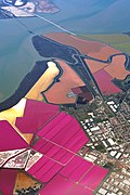
| landuse | salt_pond |  |
 | |||
| landuse | ||||||
Other landuse key values | ||||||
| landuse | brownfield |  |
 | |||
| landuse | cemetery |  |
 | |||
Protected areas (deprecated) Alternate tagging of same thing: boundary=protected_area, protected_area=*
|
||||||
| landuse | grass |  |
 | |||
| landuse | greenfield |  |

| |||
| landuse | landfill |  |
 | |||
| landuse | military |  |
 | |||
| landuse | quarry |  |
 | |||
| landuse | recreation_ground |  |
 | |||
| landuse | religious | An area used for religious purposes |  |
 | ||
| landuse | village_green |  |
 | |||
| landuse | greenery | Used for any area covered with landscaping or decorative greenery, regardless of it being on a roundabout, along a street or in a park/garden, This tag has been used for vegetation that is hard to classify, either because its kind or because its diversity. |  | |||
| landuse | winter_sports | An area dedicated to winter sports (e.g. skiing) |  | |||
| landuse | user defined | |||||
This table is a wiki template with a default description in English. Editable here.