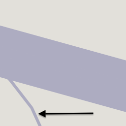
JA:Tag:aeroway=taxiway
Jump to navigation
Jump to search
| 説明 |
|---|
| 滑走路と駐機場の間の飛行機誘導路です |
| OSM Cartoでのレンダリング |

|
| グループ: 空路 |
| 適用できる要素 |
| よく併用されるタグ |
| 関連項目 |
| 状態:事実上の標準 |
| ツール |
空港内における滑走路と駐機場の間の飛行機誘導路です。
マッピング方法
誘導路の黄色いセンターラインに沿ってウェイ ![]() を描き、 aeroway=taxiway を追加します。
を描き、 aeroway=taxiway を追加します。
エリアとしてのマッピング
| aeroway=runway をエリアとしてマッピングするかどうかは議論中です。議論にはこちらおよびこちらから参加できます。 |
時々、追加で誘導路の輪郭が aeroway=taxiway + area=yes でタグ付けしたエリア ![]() としてマッピングされていることがあります。
としてマッピングされていることがあります。
タグ付け
追加情報は以下のキーで指定することができます。
- ref=* - 誘導路の名称
- width=* - 誘導路の幅(メートル単位)、なおこれは誘導路の地上での物理的な幅を設定するべきであり、間隔でありません。
- surface=asphalt/concrete/grass/... - 誘導路の表面の物理的な構成です。
- aeroway=holding_position - 誘導路の待合場所に
 でタグ付けします。
ライフサイクル
- 主な記事:JA:ライフサイクルの接頭辞
| 段階 | タグ付け | メモ |
|---|---|---|
| Proposed | aeroway=proposed proposed=taxiway |
計画中の誘導路で、建設間近のものです。このタグは純粋な願望に対して使うべきではありません。他に proposed:aeroway=taxiway の用法もあります。 |
| Construction | aeroway=construction construction=taxiway |
建設中の誘導路です。他に construction:aeroway=taxiway の用法もあります。 |
| In operation | aeroway=taxiway | 運用中の誘導路です。 |
| Disused | disused:aeroway=taxiway | 使われなくなった誘導路ですが、運用に戻すことができるものです。 |
| Abandoned | abandoned:aeroway=taxiway | 使えなくなった、またはほかの目的で再利用されている場合です。例えば highway=cycleway を追加します。 |
例
| 画像 | タグ | Mapnik |
|---|---|---|

|
aeroway=taxiway ref=A5 |
参考としてミュンヘン国際空港(Munich International Airport)を参照してください。
| ||||||||||||||||||||||||||||||||||||||||||||||

