Template:Generic:ES:Map Features:properties
Jump to navigation
Jump to search
Propiedades
Se usa para proporcionar información adicional de carácter general sobre otro elemento.
| Clave | Valor | Elemento | Comentarios | Foto |
|---|---|---|---|---|
| area | yes | Hace que una característica normalmente lineal se dibuje como área de color sólido. Se aplica a una vía cerrada. No añadir a características que ya son normalmente áreas. | 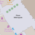 | |
| brand | user defined | Brand of the feature. |  | |
| bridge | yes / aqueduct / viaduct / cantilever / movable / covered / … | Puente. Usar con layer=*.
|
 | |
| capacity | amount | Used for specifying capacity of a facility. |  | |
| charge | amount | Used for specifying how much is charged for use/access to a facility. See toll=* or fee=*.
|
 | |
| clothes | see key's page | Tagged on shops and other features to denote if they sell clothes or not and what type of clothes they sell. |  | |
| covered | yes | Indica que un nodo, vía o área esta cubierto por otra entidad, o es subterráneo. Cuando el uso de layers=* no es apropiado.
|
 | |
| crossing | no / traffic_signals / uncontrolled / island / unmarked | Paso de peatones u otros. Añadir tipo |  | |
| crossing:island | yes / no | Especifica si un paso de peatones tiene una isleta. |  | |
| cutting | yes / left / right | Trinchera. Se aplica a la vía que discurre por debajo del nivel normal del suelo que la rodea. |  | |
| disused | yes | Para características que son útiles para la navegación u orientación a pesar de estar en desuso. ver abandoned=*.
|
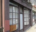 | |
| drinking_water | yes / no | Describes whether a drinking water is available |  | |
| drive_through | yes / no | Se usa para indicar que se usa la característica haciendo una parada momentánea después de una cola sin salir del coche. Ej: recogida de comida rápida o cajero automático desde coche. |  | |
| drive_in | yes / no | Se usa para indicar que se usa la característica mientras se está aparcado sin salir del coche. Ej: autocine. |  | |
| electrified | contact_line / rail | Indicates infrastructure to supply vehicles with electricity on rail tracks |  | |
| ele | Number | Altitud de la característica sobre el nivel del mar. No confundir con altura height=*.
|
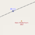 | |
| embankment | yes | Relleno o terraplén (Opuesto a la trinchera). Se aplica a la vía que discurre por encima del nivel normal del suelo que la rodea. | 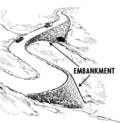 | |
| end_date | Date | Fecha en la que la característica fue eliminada. |  | |
| energy_class [en] | code | An energy class of the feature |  | |
| est_width | Number | Estimado del ancho de una vía en metros. |  | |
| fee | yes / no | Used for specifying whether fee is charged for use/access to a facility. See also toll=*.
|
 | |
| fire_object:type | poo / szo | Potentially dangerous and socially significant objects | ||
| fire_operator | Name | Fire station, which serves the object | ||
| fire_rank | 1bis / 2 to 5 | Rank fire, defined for a particular object | ||
| frequency | Number | Frequency in Hz |  | |
| gutter [en] | yes/no | Presence of the gutter |  | |
| hazard | see hazard | Indicates of the hazards. |  | |
| hot_water | yes / no | Describes whether a hot water is available | ||
| inscription | User Defined | The full text of inscriptions, which can be found on buildings, memorials and other objects. |  | |
| internet_access | yes / wired / wlan / terminal / no | This tag is for indication that a map entity such as a building, a shop, restaurant, etc. offers internet access to the public, either as a paid service or even for free. |  | |
| layer | -5 to 5 | Nivel. Se usa para indicar la relación de orden vertical físico (que está encima o debajo de que). -5 a -1· por debajo del suelo. 0 · nivel del suelo. por defecto si no se usa esta etiqueta. 5 a 1 · por encima del suelo. (no poner "+" delante del número). |
 | |
| leaf_cycle | evergreen / deciduous / semi_evergreen / semi_deciduous / mixed | Describes the phenology of leaves |  | |
| leaf_type | broadleaved / needleleaved / mixed / leafless | Describes the type of leaves |  | |
| location | underground / overground / underwater / roof / indoor | Location |  | |
| narrow | yes | Indica un estrechamiento en el tramo de vía. |  | |
| nudism | yes / obligatory / designated / no / customary / permissive | Indicates if the described object provides the possibility of nudism |  | |
| opening_hours | "24/7" ó "mo md hh:mm-hh:mm" |
Describe el horario de apertura. Consultar la sintaxis en la página de la etiqueta. |  | |
| opening_hours:drive_through | 24/7 or mo md hh:mm-hh:mm. (read described syntax) | opening_hours describes when something is open for drive-through services. |  | |
| operator | User Defined | Sirve para indicar el nombre de la empresa o compañía que es responsable o maneja una característica. | ||
| power_supply | yes / no | Describes whether a power supply is available |  | |
| produce | User Defined | Describes a feature's agricultural output produced though a natural process of growing or breeding. |  | |
| rental | see key's page | Tagged on shops and other features to denote if they rent something or not and what they rent. |  | |
| sauna | yes / no | Describes whether a sauna is available |  | |
| service_times | see opening_hours | Times of service of a given feature e.g. church service |  | |
| shower | yes / no | Describes whether a shower is available |  | |
| sport | soccer / tennis / basketball / baseball / multi / ... | Describes which sports are placed on a facility such as a pitch or stadium. |  | |
| start_date | Date | Fecha en que la característica fue creada. |  | |
| tactile_paving | yes /no | Pavimento tiflológico para invidentes. |  | |
| tidal | yes | Area is flooded by the tide |  | |
| toilets | yes / no | Describes whether a toilets is available |  | |
| topless | yes / no | Indicates if the described object provides the possibility of female topless practice |  | |
| tunnel | yes | Túnel. Usar con layer=*.
|
 | |
| toilets:wheelchair | yes / no | States if a location has a wheelchair accessible toilet or not. |  | |
| wheelchair | yes / no / limited | Indica si una característica puede ser usada en silla de ruedas. |  | |
| width | Number | Ancho de una característica en metros. |  | |
| Para describir el tipo árbol de un bosque. (de hoja perenne, caduca o mixto). |  |
This table is a wiki template with a default description in English. Editable here.