Australian Tagging Guidelines/Transportation
Overview
This page documents the Australian Mapping Community's preferred implementation of transpiration guidelines and to keep a common record of Australia-specific mapping methods for mapping railways, marine navigation, aeroways, and public transport networks.
Appropriate data sourcing
As with all contributions to OpenStreetMap, updates to public transportation infrastructure and routes need to be compatible with the OpenStreetMap license. Some states and territories' public transport authority do not have license-compatible data, and cannot be used as a source for updating the map. If in doubt, refer to the Australian Data Sources page, which includes all known license-compatible sources of Australian spatial data.
Infrastructure
Roads, paths and highways
For tagging guidelines for road, cycling, and pedestrian infrastructure refer to Australian Tagging Guidelines/Roads and Australian Tagging Guidelines/Cycling and Foot Paths.
Bus lanes
Each state and territory has their own laws and regulations restricting which vehicles can use bus lanes. These restrictions can be mapped using the appropriate transport mode restrictions in the table below
| S/T | Permitted vehicles | S/T | Permitted vehicles | |||
|---|---|---|---|---|---|---|
 |
 |
 |
 | |||
| ACT | motor_vehicle=nobus=designatedpsv=yesmotorcycle=yeshire_car=permitbicycle=yesemergency=yes |
not used | SA | motor_vehicle=nobus=designatedtaxi=yesbicycle=yesemergency=yes |
motor_vehicle=nobus=designatedemergency=yes
| |
| NSW | motor_vehicle=nobus=designatedpsv=yesbicycle=yesmotorcycle=yeshire_car=permitemergency=yes |
motor_vehicle=nobus=designatedemergency=yes
|
TAS | motor_vehicle=nobus=designatedbicycle=yesmotorcycle=yesemergency=yes |
not used | |
| NT | not used | VIC | motor_vehicle=nobus=designatedemergency=yesbicycle=yes*coach=yes** unless signed otherwise |
not used | ||
| QLD | motor_vehicle=nobus=designatedtaxi=yeslimousine=yesbicycle=yesemergency=yes |
motor_vehicle=nobus=designatedemergency=yes
|
WA | motor_vehicle=nobus=designatedemergency=yes |
not used | |
Example
access:lanes:conditional=|no| @ (Mo-Fr 06:00-20:00;Sa,Su,PH 10:00-18:00)psv:lanes:conditional=|designated| @ (Mo-Fr 06:00-20:00;Sa,Su,PH 10:00-18:00)Guided busways

 O-Bahn.
![]() Guided buses are not common features in Australia. The only guided busway in Australia is the
Guided buses are not common features in Australia. The only guided busway in Australia is the ![]() O-Bahn Busway in Adelaide, and other uses of the
O-Bahn Busway in Adelaide, and other uses of the highway=bus_guideway tag are almost certainly tagging errors.
Rail

 South Western Railway at Yarloop
 Yarloop.
Australian railways are tagged consistent with broader OpenStreetMap tags and standards, with country-specific tag values where appropriate. Railways in Australia are highly varied, from the major interstate rail network and the National Land Transport Network, to small, privately operated heritage railways and tramways. Electrified tracks are mapped with contact_line=*; electrified third rails are not used in Australia.
Nearly all "train systems" in Australia are considered mainline railway systems, and are accurately tagged using railway=rail. The railway=subway tag should only be applied to rapid transit systems which are operated separately from the wider rail network. Currently, only the ![]() Sydney Metro and the under-construction
Sydney Metro and the under-construction ![]() Metro Tunnel in Melbourne meets this criteria.
Metro Tunnel in Melbourne meets this criteria.
Rail infrastructure ownership
The ownership of the rail infrastructure should be captured using the standard ownership=* values.
| Ownership | Description | Common owners | Example |
|---|---|---|---|
ownership=federal |
Commonwealth-owned. This includes property of federal government-owned corporations such as the Australian Rail Track Corporation. | owner=Australian Rail Track Corporation |
|
ownership=state |
Owned by a state or territory government. This includes property of state government agencies or state-owned corporations. | owner=Transport Asset Holding Entityowner=VicTrack |
|
ownership=municipal |
Owned by a local government. This includes property of local government agencies or council-owned corporations. | ||
ownership=private |
Owned by a private entity. This can include corporations and companies, as well as not-for-profit tourist railways and museums. |
Rail gauges
| Tag | Rendering | Description | Example | |
|---|---|---|---|---|
railway=rail |
 |
gauge=1435 - standard gauge |
Full-sized passenger or freight trains in the standard gauge for the country or state. | Trans-Australian Railway |
gauge=1067 - narrow gauge
| ||||
gauge=1600 - broad gauge
| ||||
railway=subway |
 |
gauge=1435 |
A metro system is a rapid transit train system. | Sydney Metro Northwest |
Maximum railway speeds
Each state and territory has their own standards for railway speed limit signs. These speed limits can be captured with maxspeed=*, and maxspeed:conditional=* if the limit only applies to certain class of locomotives.
Trams and light rail
There is no clear distinction between railway=tram and railway=light_rail, and the general recommendations highlight the importance of consistency across networks. Existing rail networks should not be changed between different tags without general agreement from the Australian Mapping Community.
Monorail

 Sea World Monorail System.
![]() Monorails are not common features in Australia. There are currently no monorail systems operating in Australia. The last remaining operating system closed in 2022, being the
Monorails are not common features in Australia. There are currently no monorail systems operating in Australia. The last remaining operating system closed in 2022, being the ![]() monorail at SeaWorld (311851843
monorail at SeaWorld (311851843![]() 311851843) on the Gold Coast.
311851843) on the Gold Coast.
Public transport
Public transport schema
There are different tagging schema in use for mapping public transportation, and all have some level of use in Australia. In some cities and states routes have been systematically updated to the PTv2 schema (using such techniques as included in this guide), while routes in other parts of the country are being progressively updated as needed. When updating relations in Australia take note of the public_transport:version=* used for the route, and where possible update the relation to a newer schema.
Route Names
Per community discussion at https://community.openstreetmap.org/t/public-transport-route-names/131624, the PTv2 route name format of <type of transport><reference number>: <from> → <to> is not followed. Instead route names should be based on on the ground signage, commonly known as names, route names as appearing in timetabling and official documentation from the route operator.
Stops and platforms
Stop names
|
This section of the guidelines is still under consideration. Join the discussion |
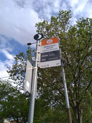
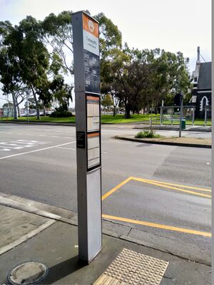
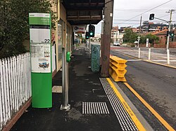
There is no established consensus for naming bus and tram stops in Australia. Stop names are not consistently applied within states (and some cities), and guidelines have previously documented conflicting advice. Local areas should be kept as consistently as possible until a naming standard is agreed among the Australian Mapping Community.
| S/T | Mode | Description | Examples | Image |
|---|---|---|---|---|
| VIC | bus | The name of a bus stop typically consists of two parts:
The parts are combined with a slash (
|
  | |
| tram | The name of a tram stop typically consists of three parts:
The parts are combined in this format: |
|
Stop numbering
While each state and territory is different, most stops and stations will have a unique identifier assigned by the network (for example in VIC it is PTV) or operators in the network that is shown on signs and information boards , which should be mapped using ref=*. At large interchanges or stations,
stops may also have unique platform or stand numbers, which should be mapped using local_ref=*.
 |
 |
ref=1128 Bus stop #1128
|
Stand 1, Bus stop #27658
|
| S/T | Mode | Description | Examples | Image |
|---|---|---|---|---|
| VIC | bus | Every bus stop has a unique ID across the entire network assigned and managed by PTV. This is a number between two and five digits (prefixed by ID.). This stop ID is consistently and clearly signed at every bus stop. Nearby bus stops for different directions of the same bus route (for example, bus stops that are opposite to each other) never have the same stop ID.
|
 | |
| tram | Currently most of the tram stops are not tagged with a unique ID. The value commonly tagged in ref=* is the same number that is also part of the tram stop name (see above).
|
|
Multiple reference numbers
There is no established consensus of how to tag networks with more than one reference number system for identifying stops and stations.
 |
proposedref=22ref:ptv=1525
|
Networks and operators
| The `network=` tags for Victorian Public Transport are in the process of being updated and cleaned up and are outdated here. See the forum post: https://community.openstreetmap.org/t/proposal-to-rename-and-standardise-vic-pt-tagging/140715/ |
The network=* and operator=* keys should be used consistently in each state and territory. Common values for each state and territory are listed below, and privately owned and operated services outside the public transportation network should be mapped with the appropriate values in a similar pattern.
Buses and coaches

 209 bus at UQ in Brisbane.
Most states and territories have contracted multiple different companies to operate part of their network. Where there are multiple operators servicing a network, the operator=* for each relation=route should be limited to only the operator (or operators) of the specific route.
| S/T | Networknetwork=* |
Operatoroperator=* |
Example |
|---|---|---|---|
| ACT | network=Transport Canberra |
operator=ACTION |
Bus 719 |
| NSW | network=TfNSW - Sydney Buses
|
Bus 136 | |
network=TfNSW - Regional Coaches
|
| ||
| NT | network=Darwinbusnetwork=AsBus
|
||
| QLD | network=Translink
|
South-East Queensland Network
|
Bus 680 |
Regional Network
|
Bus 841 | ||
network=Kelsian Group
|
|
Bus 880 | |
| SA | network=Adelaide Metronetwork=Mount Gambier City Bus Service
|
Bus 640 | |
| TAS | network=Metro Tasmania
|
||
| VIC | network=PTV – Metropolitan Busesnetwork=PTV – Regional Busesnetwork=PTV – Regional Coaches
|
|
Bus 788 |
| WA | network=Transperthnetwork=TransRegional
|
Green CAT 5F |
Trains

 Seaford line train at Goodwood railway station
 Goodwood railway station, Adelaide
| S/T | Networknetwork=* |
Operatoroperator=* |
Example |
|---|---|---|---|
| ACT | network=NSW TrainLink Regional |
operator=NSW TrainLink |
Canberra Line |
| NSW | network=Sydney Trains |
operator=Sydney Trains |
Airport & South Line |
network=NSW TrainLink Intercity
|
operator=NSW TrainLink
|
Southern Highlands Line | |
network=NSW TrainLink Regional
|
Dubbo Line | ||
| QLD | network=Translink |
operator=Queensland Rail |
Cleveland Line |
network=Queensland Rail Travel
|
Tilt Train | ||
| SA | network=Adelaide Metro |
operator=Office of the Rail Commissioner |
Grange Line |
| VIC | network=PTV – Metropolitan Trains |
operator=Metro Trains Melbourne |
Alamein Line |
network=PTV – Regional Trains
|
operator=V/Line
|
Albury Line | |
| WA | network=Transperth |
operator=Transperth |
Fremantle Line |
network=Transwa
|
operator=Transwa
|
Australind Line |
Rapid transit/metro

 Sydney Metro Northwest train at Chatswood
 Chatswood, Sydney
| S/T | Railway tag | Networknetwork=* |
Operatoroperator=* |
Example |
|---|---|---|---|---|
| NSW | railway=subway |
network=Sydney Metro |
operator=Metro Trains Sydney |
Sydney Metro Northwest |
Trams and light rail

 Route 70 tram travelling on Flinders Street, Melbourne
| S/T | Railway typerailway=* |
Name | Networknetwork=* |
Operatoroperator=*
|
|---|---|---|---|---|
| ACT | tram |
Canberra Metro |
network=Canberra Metro |
operator=Canberra Metro Operations
|
| NSW | light_rail |
Newcastle Light Rail |
network=Newcastle Transport |
operator=Keolis Downer
|
| Sydney Light Rail | network=Sydney Light Rail |
operator=Transdev Sydney
| ||
| QLD | light_rail |
G:Link |
network=Translink |
operator=Keolis Downer
|
| SA | tram |
Glenelg Tram |
network=Adelaide Metro |
operator=Department of Planning, Transport and Infrastructure
|
| Victor Harbor Horse Drawn Tram | operator=Victor Harbor Horse Drawn Tram
| |||
| VIC | tram |
Melbourne tram network | network=PTV – Metropolitan Trams |
operator=Yarra Trams
|
Ferries

 South Perth Ferry at the Elizabeth Quay Ferry Terminal
 Elizabeth Quay Ferry Terminal, Perth
| S/T | Networknetwork=* |
Operatoroperator=* |
Example |
|---|---|---|---|
| NSW | network=Sydney Ferries |
operator=Sydney Ferries |
Manly Ferry |
| QLD | network=Translink |
operator=RiverCity Ferries |
CityCat |
| SA | - | operator=Sealink |
Kangaroo Island Sealink |
| VIC | - | operator=Public Transport Victoria
|
Westgate Punt |
| WA | network=Transperth |
operator=Captain Cook Cruises |
Transperth Ferry |
"Park & Ride" Commuter Car Parks
Commuter car parks can be tagged with amenity=parking + park_ride=*.
| S/T | Type | Tagging | Example |
|---|---|---|---|
| NSW | Transport for NSW Park&Ride |
|
"Bike & Ride" Commuter Bicycle Parking
| S/T | Type | Tagging | Example |
|---|---|---|---|
| NSW | Bike Sheds |
|
|
| Bike Lockers |
|