Israel
| latitude: 31.417, longitude: 35.079 |
| Browse map of The State of Israel (دولة إسرائيل, מְדִינַת יִשְׂרָאֵל) 31°25′01.20″ N, 35°04′44.40″ E |
| Edit map |
|
External links:
|
| Use this template for your locality |
The State of Israel (دولة إسرائيل, מְדִינַת יִשְׂרָאֵל) is a country in Western Asia at latitude 31°25′01.20″ North, longitude 35°04′44.40″ East.
This page contains OSM mapping information that is specific to Israel. If you're new, start by reading The Basics section below.
The Israel relation is 1473946![]() 1473946. There are additional major boundaries.
1473946. There are additional major boundaries.
The basics
Welcome to OSM! The basics are also available in Hebrew, המדריך הבסיסי גם זמין בעברית.
To edit the map, visit the OSM website, sign in, zoom to an area, and click "edit". A built-in guide will explain the basics. You can also click the "?" button on the right for help. The Israel Hiking Map has an alternative editor for Israel. There are many more editors too.
The most important guidelines for mapping are as follows:
- Do not use copyrighted sources such as Govmap, Google Maps, Google Street View, Waze, municipality maps and GIS sites, etc.
- Add the real name if it exists, avoiding descriptions, notes, or other things. For example, "water tap" is a descriptive name; use the
amenity=drinking_watertag instead. There is a button in the editor which adds it. We also have guidelines for translations. - Only map things that are on the ground, and can be verified by other mappers who visit the same place. (There are certain exceptions, such as administrative boundaries)
- If you're doing something for the first time (for example, adding an address) you're strongly advised to look for other places on the map where this was already done, in order to learn how to do it properly.
- Avoid tagging for the renderer - Do not use incorrect tags to make the map look more pleasing in a particular app.
- Before moving objects that deviate from aerial footage, be sure to align the aerial footage. Unaligned aerial footage is almost never accurate.
- Avoid duplicating existing features. See One feature, one OSM element.
- Write meaningful Changeset Comment on Save - help other mappers better understand your edit.
- Use right angles when relevant. Right-click an object then choose "Square" to make perfect 90-degree corners.
Additional notes:
- Use the Wiki search to find information on specific topics or specific tags.
- There are Israel-specific conventions and guidelines for certain features and tags, please have a look before editing those. In particular, see the Israel naming standard.
- It's recommended you gradually familiarize yourself with the general OSM guidelines too, found in the following pages:
- The general OSM beginners' guide, covering more details and concepts.
- Editing Standards and Conventions.
- Good practice.
- Names.
- Scope.
- We all make mistakes! That's fine. The community is happy to help. Please be responsive to changeset comments, private messages, and forum replies (You will be notified via email).
- The full Israeli guidelines are in the following sections.
- For questions, see the section below.
Discussion and communication
Questions or discussions with the community can be made in the following communication channels:
- The forum - Login with your OSM account.
- Telegram, OSM_Israel.
- Changeset discussions.
- Note discussions.
It's mandatory to notify the community in advance via the forum, regarding the following topics:
- Significant changes to this Wiki page.
- Data imports or other forms of automated edits.
- Organized editing and mapping parties.
This is required for the purposes of archiving, openness, reach, adherence to the organized mapping guidelines, and preserving the community memory in OSM itself and not an external system.
It's also highly recommended to post other important topics to the forum (such as announcements and decisions) per your discretion.
Conventions and guidelines
This section covers conventions and guidelines specific to Israel. Note that there are also additional guidelines for hiking and biking trails in the next section.
Naming
Let's start with an easy, typical example: The city of Haifa![]() Haifa has its main name as
Haifa has its main name as name=חיפה and name:he=חיפה in Hebrew, as well as name:en=Haifa, name:ar=حيفا and several other languages.
Here are the complete guidelines, which also accommodate more complex examples.
- The
name=*tag should be used as the primary name, given in a single language selected like this:- If there is signage with only one language, or one language more prominent than others (e.g. a shop's sign or a street name sign), use that language. This is the normal rule for
name=*. - Otherwise, use the language most commonly spoken in the area (usually Hebrew or Arabic).
- If two or more languages are equally common in the area, use your judgement or use the same language as nearby objects.
- Deviation from the priorities listed here is sometimes justified, for example if the local population prefers a different language from the signed one. In those cases, the reason for the selected language should be documented in
note:name=*to inform other mappers.
- If there is signage with only one language, or one language more prominent than others (e.g. a shop's sign or a street name sign), use that language. This is the normal rule for
- Additionally, the same name should be added using a
name:lang=*tag in the same language as thename=*tag. This is usually one of: - Translations are added with additional
name:lang=*. Use one of the above languages,name:en=*for English,name:ru=*for Russian,name:am=*for Amharic, or see the full list.- Prefer exact spelling as seen on signs.
- Only use translations that are in actual use and/or can be seen on a sign. If there is no translation available, do not invent one!
- When there's no translation, transliteration can be used, but it has caveats. Please learn when to avoid transliteration before deciding to use it.
- Normally, transliteration is performed only on locally used languages and English.
- For Hebrew/Arabic, if both a native name and a name transliterated from the other language exist, use your judgement, bearing the following rules of thumb in mind.
- Generally, prefer the native name in
name:lang=*, and the transliterated name inalt_name:lang=*, especially if the former is the preferred name for the language’s speakers.- For example, Safed is commonly known as "Tzfat/צפת" in Hebrew, and this belongs to
name:he=*. The native Arabic name, "Safad/صفد" is commonly used, and is suitable forname:ar=*. The Hebrew-to-Arabic transliteration is suitable foralt_name:ar=*. Similarly, The Arabic-to-Hebrew Transliteration "Safad/ספד" can be added toalt_name:he=*.
- For example, Safed is commonly known as "Tzfat/צפת" in Hebrew, and this belongs to
- If the native name is archaic, historic, or not in common use, it may be more suitable to put the transliterated name in
name:lang=*, and the native name inold_name:lang=*oralt_name:lang=*.
- Generally, prefer the native name in
- As for the English name tag:
- Historic cities with well-known and accepted English names, different from both Hebrew and Arabic: Eg. Hebron, in Arabic it is "Al-Khalil/الخلیل", and in Hebrew it is "Hevron/חברון". Hebron is to be used as the English name tags. English transliterations of Arabic and Hebrew names can be added to alt name tags.
- Localities within 1948-Israeli borders (Excluding the first category): These are to have the English spelling recognized by the State of Israel as the English name tag.
- Israeli settlements in the West Bank (including East Jerusalem): These are to have the English spelling recognized by the State of Israel as the English name tag.
- Palestinian localities in the West Bank (including East Jerusalem) and the Gaza Strip (Excluding the first category): These are to have the English spelling recognized by the Palestinian Authority as the English name tag.
Additional notes:
- Add the full name written on the sign. Usually, without including prefixes such as "רחוב", "rehov", "street", etc., unless that prefix is not a generic prefix, but an integral part of the name and cannot be omitted, such as in שדרות קיש.
- Do not use abbreviations, leave that for rendering.
- Do not use the name tag for descriptions - for example,
name=ברז מיםis wrong. Instead there isamenity=drinking_water. If the tap is broken there is the Key:disused:* prefix. - Sometimes, a human readable sentence is a useful description beyond the tags, use
description=*.description:lang=*follows the same logic asname:lang=*. Use an identicaldescription:he=*ifdescription=*is Hebrew. Adddescription:en=*to translate to English, and so on.
- Many streets in Arab or Druze villages do not have an official name. If there's a de-facto name, use it. Otherwise leave it blank. Do not make up a name yourself. Note that bus-stop names do not necessarily reflect the street name in such areas.
- The naming guidelines were discussed at least twice: discussion 1, discussion 2
Inter-city roads
- First rule for numbered roads: The category is determined by the color of the sign, not by the number of digits!
- Different sections with the same road number can have different categories.
- Speed limits stated below are the defaults by law, though can be altered in a specific road section by a "special speed limit" sign.
| Key | Value | Element | Description | Colored sign | Mapnik color | Default speed limit | Key:ref tag on way | Remark |
|---|---|---|---|---|---|---|---|---|
| highway | motorway | All freeways - National and Inter-City roads | Blue. |
Red | 110 km/h | mandatory for all highway=motorway
|
Usually a single-digit road number (e.g. road 2) or a double-digit road number (e.g. road 20).
Motorways mostly have an | |
| highway | trunk | National roads | Red. |
Orange | 100 km/h | mandatory for all highway=trunk (including roundabout)
|
Expressways / trunk in Israel can look very much like a freeway. Many of them have double-digit road number (e.g. road 10). | |
| highway | primary | All regional roads | Green. |
Lighter orange | 90 km/h | mandatory for all highway=primary (including roundabout)
|
Many of them have triple-digit road number (e.g. road 412). | |
| highway | secondary | All regional roads | Black. |
Yellow | 80 km/h | only if exist | Many of them have quadruple-digit road number (e.g. road 4111) and priority over other crossing roads (i.e. crossing drivers encounter a stop sign).
Exception for the priority rule: unnumbered roads that are important for routing connections may have crossing priority over secondary roads. | |
| highway | tertiary | important (connection-) roads | Not numbered and without a colored sign | White | 80 km/h | no | Priority over other crossing roads (crossing drivers encounter a stop sign). Main roads inside cities are tertiary. |
Other road types
Also see next section for trails conventions.
| Key | Value | Element | Description | Implied access |
|---|---|---|---|---|
| highway | unclassified | Smaller paved roads in non-residential places. e.g. agricultural roads, forest roads, roads from behind one village to behind another village, etc. | motor_vehicle=yes, bicycle=yes, foot=yes
| |
| highway | residential | Roads in residential places (city, town, village, etc.) | motor_vehicle=yes, bicycle=yes, foot=yes
| |
| highway | service | Short access roads: roads in parking lots, fuel stations, inside universities, inside factories, etc. | motor_vehicle=yes, bicycle=yes, foot=yes
| |
| highway | track | Unpaved road suitable for motor vehicles (Double). | motor_vehicle=yes, bicycle=yes, foot=yes
| |
| highway | path | A pathway too narrow for vehicles, accessible by foot, bicycle, and horse. Usually Unpaved. Add bicycle=designated where the path is part of a bicycle trail.Add foot=designated if the path is to be shared by bikers and hikers.
|
motor_vehicle=no, bicycle=yes, foot=yes, horse=yes
| |
| highway | footway | Mainly, or exclusively for pedestrians. Add bicycle=yes or change to highway=path if bicycles are also allowed.
|
motor_vehicle=no, bicycle=no, foot=designated
| |
| highway | cycleway | Exclusively for bicycles. Usually paved. | motor_vehicle=no, bicycle=designated, foot=no
| |
| highway | pedestrian | Where people walk and there are many shops. Like "Midrahov", or "Passage", etc. | motor_vehicle=no, bicycle=yes, foot=yes, horse=yes
| |
| highway | living_street | "רחוב הולנדי" - Residential road where there is no sidewalk or other separation between pedestrians and vehicles. | motor_vehicle=yes, bicycle=yes, foot=yes, horse=yes
| |
| highway | road | Temporary tagging, if the type is unknown. Try to add a "note" tag. | motor_vehicle=yes bicycle=yes, foot=yes, horse=yes
| |
| bridge | yes | A bridge. Useful with layer=*
|
||
| tunnel | yes | A tunnel. Useful with layer=*
|
Please see He:Map Features, this forum thread, and default access restrictions
Other
Here are some Israel-specific clarifications unrelated to road tagging.
| Key | Value | Element | Description |
|---|---|---|---|
| amenity | place_of_worship | Use religion=jewish for synagogues, religion=christian for churches, religion=muslim for mosques. More options include religion=bahai, religion=druze
| |
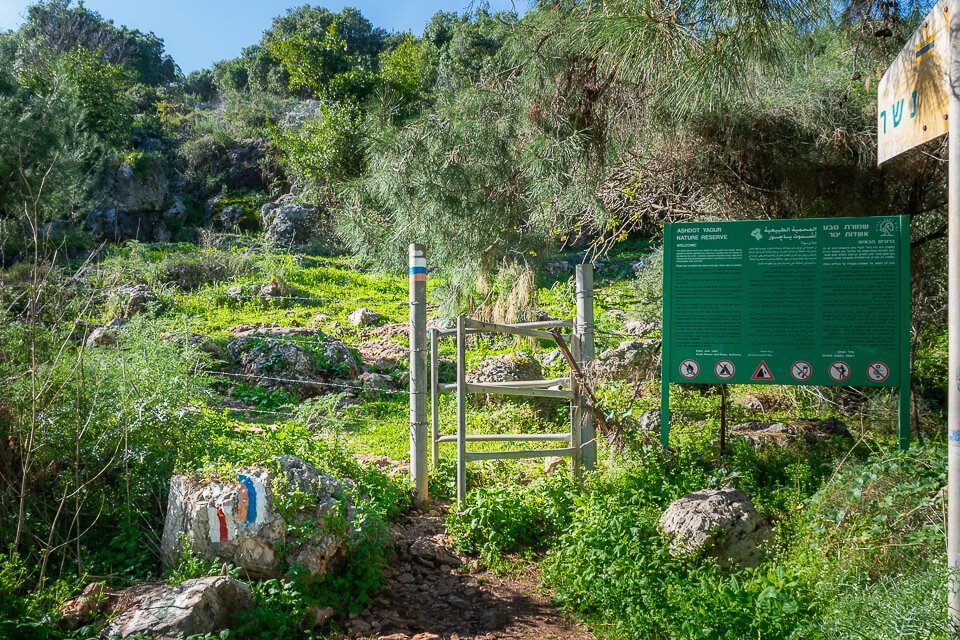
| barrier | gate | A section in a wall or fence which can be opened to allow access. Closed gate: access=private. For a vehicles barrier set: bicycle=yes, foot=yes, motor_vehicle=no. If it's a removable wire fence, the hampshire gate tagging below is more suitable.
| |
| barrier | hampshire_gate | A section of wire fence which can be removed temporarily. Hampshire gates are quite common in Israel on both hiking trails and general-use unpaved tracks in non-urban areas. | |
| barrier | cattle_grid | A hole in the road surface covered in a series of bars that allow pedestrians and wheeled vehicles but not animals to cross. Very common in Israel. | |
| barrier | stile | A stile allows pedestrians to cross "over" or "through" a wall or fence, but never actually "opens" the barrier. In Israel, the most common type of stile seen on hiking paths is a narrow passage between metal rods/tubes, triangular in plan (like this: ———<———; an example can be seen here or here). This kind of stile should be mapped with stile=squeezer and material=metal. Another common type looks like a small rounded "bridge" (example); these should be mapped with stile=stepover and material=metal.
| |
| historic | tomb | Ancient burial sites are common in Israel. If it's a tomb carved in rock, consider adding tomb=rock-cut too. natural=cave_entrance is not the proper tagging for man made burial sites.
| |
| tourism | camp_site | A "חניון לילה". An area where people can camp overnight using tents, camper vans or caravans. Often erroneously tagged as parking=* because of the Hebrew translation.
|
Places
A place should have a node and a polygon.
The node tells the renderer where to draw the name of the place.
It also should have all the tags related to the place, like population=*, wikipedia=*, etc.
It should have name=* and other name tags based on Israel#Naming guidelines.
The polygon should only have the following tags:
landuse=residentialplace=*name=*and other name tags based on Israel#Naming guidelines.
All the other tags belong to the node. A place often has a related administrative boundary, too.
For neighborhoods a polygon isn't always used and a node can be sufficient.
Administrative boundaries
The boundary=administrative tag is used on ways or relations to separate districts, cities, etc. Below is Israel-specific rules for the admin_level of the boundary.
- 2 - National border
- 4 - District (מחוז)
- 5 - Sub-District (נפה) - Click for a Wikipedia list.
- 6 - Natural region (אזור טבעי) (currently unmapped in OSM), Oslo Accord Areas A, B, and C
- 7 - metropolitan area (מטרופולין) - Currently unmapped in OSM. Click for a Wikipedia list.
- 8 - Municipalites (cities), local councils, regional councils
- 9 - Borough (רובע)
- 10 - Neighborhood (שכונה)
Wikipedia has up to date lists for Local Councils, Regional Councils, Municipalites (cities), sub-districts, and Districts.
Municipalities
A municipality should have a relation with one node with role ![]() admin_centre
admin_centre
The relation should have the following tags:
type=boundaryboundary=administrativeadmin_level=8name=*and other names based on Israel#Naming guidelines.- If imported, which should usually be the case, then also
source=Israel Ministry of Interiorandsource:date=*.
The ![]() admin_centre
admin_centreamenity=townhall node in the case of a regional council.
Nature reserves
Nature Reserves should be tagged as follows:
boundary=protected_areaprotect_class=1protection_title=Nature Reservename=*type=multipolygon(only for relations)ref=*the officially approved plan - מספר תוכנית בניין ערים מאושרת, if available
Because Nature Reserves are governed by Israeli law,
- Do not map Nature Reserves that have not completed the official declaration process.
- Do not use
leisure=nature_reserveas it is incompatible with the meaning and legal implications in Israel.
National parks
National Parks should be tagged as follows:
boundary=protected_areaprotect_class=2protection_title=National Parkname=*type=multipolygon(only for relations)ref=*the officially approved plan - מספר תוכנית בניין ערים מאושרת, if available
Because National Parks are governed by Israeli law,
- Do not map National Parks that have not completed the official declaration process.
- Do not use
leisure=*as it is incompatible with the meaning and legal implications in Israel.
Train and bus
- Bus stops are automatically managed by the gtfs2osm bot. But you are allowed to make some changes to them.
- Public transport lines should be mapped using the Public Transport Version 2 schema. See: Public transport#Service routes.
- Public transport routes are analyzed for quality assurance by Public Transport Network Analysis (PTNA for short). Common tagging or mapping errors are checked.
- PTNA uses data published by the Ministry of Transportation to know which routes are missing, and which routes are outdated. The PTNA output is divided by region. See the Israel PTNA index. Please take a look at the analysis page of the region you're editing. PTNA can be an invaluable tool for improving the quality of mapped routes.
- Old discussion in forum about train routes
Conventions for hiking and biking trails
For some general info see Walking Routes and cycle routes. Specific information about Israel can be found on Wikipedia and here (both in Hebrew).
A trail is represented by one or several ways ![]() , all belonging to the trail's relation
, all belonging to the trail's relation ![]() . Generally speaking, the ways of a trail describe its geographical path and physical grade, while the trail relation holds its administrative information. Trails should be mapped according the following guidelines.
. Generally speaking, the ways of a trail describe its geographical path and physical grade, while the trail relation holds its administrative information. Trails should be mapped according the following guidelines.
The original discussions can be seen here and also here.
 Ways belonging to a trail
- Add a
colour=*tag to ways belonging to local and regional trails. Note that the spelling is "colour" and not "color"!- When a trail has different Israel Trails Committee (ITC) and JNF (KKL) colors, use only the ITC color.
- When a way belongs to local and regional trails, use the color of the local trail.
- When a way belongs to two local ITC trails, use multi-value tagging with a semicolon, such as
colour=red;green. - When a way has a transparent shield would be tagged with
colour=transparent.
- Try to add a
source=*tag to ways belonging to the trail. Common tag values aresource=GPSandsource=Bing. The source tag is an indicator of the accuracy of the trail position. GPS-based mapping is preferred and it can replace Bing-based mapping. - For
highway=trackways please try to add atracktype=*tag, indicating which kinds of vehicles can use the track:
Key Value Description tracktype grade1 High quality unpaved road. Usable, for example, by low-clearance cars - דרך עפר באיכות גבוהה tracktype grade2 All vehicle unpaved road - דרך עפר לכל כלי רכב tracktype grade3 All-wheel-drive unpaved road - "דרך עפר לרכב שטח "רך tracktype grade4 Unpaved road requiring high clearance and/or low gear - (דרך עפר לרכב שטח "קשוח" (מוגבה ו/או עם הילוך כח tracktype grade5 Unpaved road requiring a locking differential and high clearance - "דרך עפר לרכב שטח "נעול
- Ways should not have any of the trail relations tags below.
 Trail relations
Every marked trail should be represented by a relation ![]() and tagged according to the guidelines below. The ways
and tagged according to the guidelines below. The ways ![]() belonging to the trail are the members of the relation.
belonging to the trail are the members of the relation.
| Key | Value | Explanation | ||||||||||||||||||||||||
|---|---|---|---|---|---|---|---|---|---|---|---|---|---|---|---|---|---|---|---|---|---|---|---|---|---|---|
type=* |
route | Mandatory. The relation represents a route. | ||||||||||||||||||||||||
route=* |
hiking / bicycle / mtb (mountainbike) |
Mandatory. The trail kind of the route. | ||||||||||||||||||||||||
network=* |
nwn / rwn / lwn / ncn / rcn / lcn | Mandatory. Level of the trail.
| ||||||||||||||||||||||||
operator=* |
itc/kkl/rtg/user-defined | Mandatory. The authority that built and maintains the route.
| ||||||||||||||||||||||||
osmc:symbol=* |
The shield of the route, used for rendering. | Mandatory for ITC trails. Machine readable value for the route's colors and how the marking (shield) should look like.
For the single-colored routes, the value should follow this example: red:white:red_stripe, which means: red colored way is drawn with white background and a red vertical stripe. In particular, the foreground color and the stripe color should be equal to the "colour" tag of every way in the trail ("red" in the above example). The shield background color should always be "white". A transparent shield would be tagged with Tags for three-colored trail marks, such as Israel Trail and Golan Trail, should follow this example: blue:white:blue_stripe:orange_stripe_left, which means: blue colored way, white background shield, a blue vertical stripe in the middle, and an orange vertical stripe on the left. | ||||||||||||||||||||||||
name=* |
a name | Highly recommended. The route is known by this name (e.g. "Shvil Israel", "Golan Trail"). The name should be preferably specified in Hebrew. | ||||||||||||||||||||||||
name:en=* |
a name | Optional. The English route name. | ||||||||||||||||||||||||
name:he=* |
a name | Optional. Identical to the name attribute above. | ||||||||||||||||||||||||
ref=* |
a reference | Optional. The route number as specified by the Israel Trail Committee. |
Names of unofficial MTB single-tracks
Official mountain-bike (MTB) trails are represented using relations, as described above. In addition there are many unofficial single-tracks that have been named by the MTB community. Such single-tracks do not have relations. Instead, the mtb:name=* mtb:name:he=*, and mtb:name:en=* (optional) are placed on the way(s) themselves.
The mtb:name=* tags can also capture the name of a special segment within an official MTB trail. For example, the "סינגל הכלניות" segment of Beeri Single.
Lists and features of interest
National and regional trails
| Trail | Relation | Trail mark |
|---|---|---|
| Israel National Trail | 282071 |
|
| Israel Bike Trail | 6639060 |
|
| Golan Trail | 568661 |
|
| Upper Galilee Trail | 2193374 |
|
| Sea to Sea Trail | 2860967 |
|
| Jesus Trail | 364191 |
|
| Sovev Kineret Trail | 5145441 |
|
| Lower Galilee Trail | 3929958 |
|
| Haifa Wadis Trail | 3734116 |
|
| Megiddo Trail | 15787317 |
|
| Jerusalem Trail | 1314299 |
|
| TLV JM Bike Route | 947776 |
|
| Har HaNegev Trail | 6148872 |
|
| Makhtesh Ramon Trail | 6148296 |
- As of 2023, The Ramot Menashe trail is replaced by the Megiddo trail. See the teva.org.il update and the changeset discussion.
Major boundaries
Other
- There is an incomplete road sign list for Israel.
Mapping tools
Israel permalinks
The following list has Israel-specific permalinks to QA and monitoring tools:
- Official note map (Feed version by Neis-One)
- Osmcha Israel edits
- Telegram notifications
- Neis-One tools
- Inspection tools
- Way and node geometry issues by OSM Inspector: self-intersecting ways, single node in way, duplicate node in way
- Area issues by OSM Inspector:
- issues by Osmose.openstreetmap.fr
- issues by KeepRight
Note that some tools may show entries from neighboring countries, because they're based on a rectangle bounding box.
Useful QA tools
The following are general QA tools that can be helpful:
- Route relations analyzer
- Visual History - Allows easily seeing all historic tags and positions of an element.
- Achavi - See all changes in an area between two time periods.
- Tools by Neis-one - Several useful tools. Notably:
- New contributors in Israel the last 7 days.
- How did you contribute to OpenStreetMap? - View a specific user's changesets with discussions, user's participation in discussions, and lots of statistics.
- Who's around - Easily find new contributors in an area.
Statistics
The following are Israel-specific statistics:
- Active user list and edit statistics by Neis-One
- Note statistics by Neis-One
Bots and imports
This is a list of major bots and imports.
National
- Bus imports
- Since August 2024, bus stops are being continuously updated by gtfs2osm.
- Historic bus imports can be found here.
- Administrative boundaries import (2011, 2019, 2021, 2025)
- KKL import (2011)
- GeoNET import (2008)
Regional
- Ongoing (as of 2025) - Import of Pardes Hanna-Karkur Addresses
- Golan Regional council (proposed in 2025. Currently stale)
- Tel Aviv address import (2012)