Key:oneway
 |
| Description |
|---|
| Linear features that users can only go one direction in. Used in highways, zip lines, and other features. |
| Group: restrictions |
| Used on these elements |
| Documented values: 5 |
| Useful combination |
|
| Status: de facto |
| Tools for this tag |
|
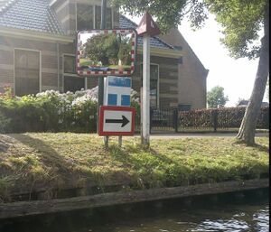
The oneway tag is used to indicate the access restriction on highways and other linear features for vehicles as appropriate. This means that this tag should be used when this way can only be used in one direction by vehicles. Note that a no entry sign prohibiting entry from one side or across one point of the road, does not automatically imply that the entire road is oneway (look for oneway signs or road markings).
Take a look on the access=* page to add more detailed restrictions.
How to map
Normal use
To mark a highway (or other linear feature) as oneway, simply add a oneway tag:
Note that the oneway tag is defined in relation to the direction the linear feature ("way") is drawn in OpenStreetMap. Identifying the direction of a way describes how to determine the direction of a way in the main OpenStreetMap editors.
If the oneway restriction is in the opposite direction to the drawn way, the fix in most cases is to turn the way around ("reverse way" tool in the map editors) and apply oneway=yes. If in a (very) rare case, the direction of the way cannot be changed, you can instead tag it as oneway=-1.
If the road is only a oneway road in certain parts, you'll have to split up the way in several parts.
Traffic signs
The world's major sign systems include signs for the beginning, middle, and end of a one-way restriction that you can often use as the basis for the oneway=* tag on a roadway:
- Signs indicating the beginning of a one-way restriction
-
United States
- Signs indicating a one-way restriction at an intersection
-
Central American Integration System, Ecuador
-
Southern African Development Community
-
Vienna Convention
-
Australia, Canada, United States
-
Canada, Colombia
-
United States
- Signs indicating an ongoing one-way restriction
-
Central American Integration System
-
Australia, Canada, New Zealand, United States
- Signs indicating the end of a one-way restriction
-
Vienna Convention
-
Some Vienna Convention countries
-
Most non–Vienna Convention countries, United States
-
United States
Implied oneway restriction
Some tags or tag combinations (such as junction=roundabout, highway=motorway and maybe others) imply oneway=yes by definition (separate carriageways for the two directions of traffic are part of the defining characteristics for motorways in the Vienna Convention on Road Traffic) and therefore the oneway tag is optional. If a tag implies a oneway value this may be noted on the implying tags wiki pages, but read implied on such pages with caution, since not all mentioned implied values are implied by definition. Besides the mentioned tags there is no general agreement which tags imply oneway=yes, different applications may handle this differently, so it is generally recommendable to be explicit whether there is a oneway restriction.
oneway = no
oneway=no is used to confirm that (a part of) a street is not a oneway street. (Use only in order to avoid mapping errors in areas where e.g. oneway streets are common, or to override defaults.)
False one-way streets (Faux oneway)

One-way streets are typically combined with a "no entry" sign on the other side to mark drivers that access there is forbidden. However, the latter can also be used without an actual one-way sign which merely prohibits entry from one side but allows vehicles to turn around. Such streets are sometimes called "false one-way streets" and shouldn't be mapped with oneway=yes.
However, you can use oneway=no to tell other mappers that this is indeed not a oneway street.
In order to map the entry prohibition, one can pick one of the three methods:
- Using a
no_entryrestriction where the no entry sign is located. This is the cleanest method but also is the least supported out of the methods (see tag page for more information). The tag of the relation is then e.g.restriction=no_entry, and exceptions can be mapped usingexcept=*(e.g. for bicycles, buses, etc.) - Use multiple turn restrictions but is more complex and thus is more prone to errors (e.g. forgetting
except=bicycleon one of the restrictions). - Split a small section (about 1 metre) at the entrance to the street and tag it with
oneway=yes. (Preferred by some, but perhaps less accurate since it is not a true oneway street).
Subkeys and exceptions
Oneway can be used in conjunction with vehicle type in order to tag exceptions e.g. oneway:moped=no for a one-way streets where mopeds are allowed to drive in the opposite direction, oneway:bicycle=no for the same for bicycles. Use cycleway:left=* / cycleway:right=* / cycleway:both=* to detail bicycle infrastructure. See Key:access for other possible sub-values.
Oneway can also be used as a suffix on certain properties such as cycleway:oneway=* if the one-way regulation only applies on the applied infrastructure (or doesn't).
Keep in mind that for cycleways (and bus lanes by extension), the default is cycleway:oneway=yes in the flow of traffic (e.g. cycleway:right=* in right hand traffic) and cycleway:oneway=-1 against the flow of traffic (e.g. cycleway:left=* in right hand traffic). This tagging is thus only used to on ambiguous cases and exceptions such as bidirectional cycle tracks (if they aren't drawn as separate ways) and contraflow lanes.
Oneway and pedestrians
There is some ambiguity related to the oneway key and pedestrian access (and routing). There is a clear consensus in the OSM community that when the tag oneway is used on a street, e.g. highway=unclassified , highway=residential or highway=pedestrian, it only applies to vehicles. However, the tag oneway=yes has also been used in some situations where the mapper who put the tag clearly meant pedestrians, such as highway=steps and highway=via_ferrata. This makes the use of the tag on highway=footway and highway=path somewhat awkward and the data hard to interpret (for more information, see below under “Data consumers”). There is ongoing discussion in the community about the best way forward [1]. Tags such as oneway:foot=yes, foot:backward=no, and oneway:bicycle=yes do not suffer from the same ambiguity.
At the break of 2025 a poll was held in the openstreetmap community forum: Please choose how you think a data consumer should interpret a plain oneway=yes on each of the following highway classes.
Choices were (notation used below):
- One-way for vehicles and pedestrians. (one/one)
- One-way for vehicles. Two-way for pedestrians. (one/two)
- Two-way for vehicles and pedestrians. (Too ambiguous. Treat as default.) (two/two)
| highway=… | % one/one | % one/two | % two/two | # votes |
|---|---|---|---|---|
| tertiary | 1 | 99 | 0 | 155 |
| residential | 1 | 99 | 0 | 149 |
| service | 1 | 99 | 0 | 148 |
| pedestrian | 38 | 60 | 2 | 136 |
| track | 4 | 96 | 0 | 138 |
| cycleway | 19 | 81 | 0 | 133 |
| footway | 79 | 20 | 1 | 133 |
| corridor | 75 | 23 | 2 | 124 |
| steps | 84 | 14 | 2 | 128 |
| path | 47 | 50 | 3 | 133 |
Time conditional restrictions
If a road is one-way at certain times of day, and one-way in the other direction at other times then it can be tagged with oneway=reversible along with applicable oneway conditional restrictions. If the direction changes often, oneway=alternating might be more appropriate.
On waterways

Legal oneway restrictions for a mandatory direction of travel for boats on waterways can be mapped with oneway= as well, for instance when signposted with a seamark or when this is part of legislation. The direction of flow of water is normally defined by the direction of the osm way. For special cases in areas with bi-directional water flow please consider different tags from oneway=, since oneway= describes the legal direction of travel, not the physical direction of flow.
flow_direction=both was used on natural waterways and pipelines to tag that flow can happen in both directions.
On aerial lifts
Some aerialway=* may carry passengers in both directions, some just in one. It may make sense to record oneway=* for example for aerialway=gondola where both possibilities are reasonable.
Data consumers
List of values
oneway=yes(discouraged alternatives: "true", "1")oneway=no(discouraged alternatives: "false", "0")oneway=-1(discouraged alternative: "reverse")oneway=reversible- Roads that alternate between different directions regularly but infrequently. This tag could be used with additional conditional restrictions as explained on its pageoneway=alternating- Roads that alternate between different directions regularly and often
The semantics of any other value is undefined and the use of other values is discouraged.
Note: The value -1 is only needed when the direction of oneway travel is in the opposite direction of that used when the way was drawn. One can avoid this situation by reversing the direction of the drawn way before applying the oneway tag.
Interpretation for routing

highway=path + oneway=yes + oneway:foot=yes + foot=yes + bicycle=no + ski=no + snowmobile=no
On a street, such as highway=unclassified, highway=residential or highway=pedestrian, oneway=* can safely be interpreted as applying only to vehicles. It should not affect pedestrian routing, and is effectively a synonym for vehicle:backward=no.
On highway=steps and highway=via_ferrata, the tag oneway=* can safely be interpreted as applying to pedestrians.
On highway=footway and highway=path, the oneway tag can be harder to interpret: did the mapper mean pedestrians or only vehicles (e.g. bicycles)? Answering this question is often possible for a human by looking at the context (e.g. on a shared sidewalk where bicycles are allowed, the mapper probably meant for oneway to apply only to bicycles; on a narrow path in the mountains, they probably meant hikers). However, for a data consumer (e.g. a routing algorithm) it is hard to take such context into account. See also the section oneway and pedestrians above.
The more precise tags e.g. oneway:foot=*, foot:backward=* and oneway:bicycle=* are unambiguous.
Country-specific implications
The following table lists country-specific information needed for correct interpretation of oneway tags.
| Country | Country-specific implications of oneway tags |
|---|---|
| Netherlands | Oneway restrictions apply not just to vehicles, but to "voertuigen, ruiters en geleiders van rij- of trekdieren of vee".[2] In OSM context, this e.g. means oneway=yes implies not just vehicle:backward=no but also horse:backward=no (unless oneway:horse=no).
|
| Poland | Oneway restrictions also apply to horse riders, livestock drovers and pedestrian columns.[3] In OSM context, this e.g. means oneway=yes implies not just vehicle:backward=no but also horse:backward=no (unless oneway:horse=no).
|
| United Kingdom | Oneway restrictions also apply to horse riders.[4] In OSM context, this e.g. means oneway=yes implies not just vehicle:backward=no but also horse:backward=no (unless oneway:horse=no).
|
Possible tagging mistakes
Do not use access-tags to specify exceptions to oneway-tags. Exceptions to oneway-tags must also be specified with oneway-tags. For example:
Deprecated values
oneway=1has been deprecated in favour ofoneway=yes.oneway=0has been deprecated in favour ofoneway=no.
See also
access=*- General access restriction key.- Set of tags that imply oneway=yes according to iD editor
- Pull request to consider implied onewayness in Default Map Style
- Proposal:One-way_for_pedestrians
References
- ↑ https://community.openstreetmap.org/t/effect-of-oneway-on-pedestrians/7631
- ↑ Bijlage 1 Reglement verkeersregels en verkeerstekens 1990 (RVV 1990)
- ↑ § 17. ust. 1 Rozporządzenia Ministrów Infrastruktury oraz Spraw Wewnętrznych i Administracji w sprawie znaków i sygnałów drogowych – Znak B-2 „zakaz wjazdu” oznacza zakaz wjazdu pojazdów na drogę lub jezdnię od strony jego umieszczenia; zakaz dotyczy również kolumn pieszych oraz jeźdźców i poganiaczy.
- ↑ Rule 53 Highway Code


