Key:surface
 |
| Description |
|---|
| Describes the surface of a feature. |
| Group: properties |
| Used on these elements |
| Documented values: 61 |
| Useful combination |
| See also |
| Status: de facto |
| Tools for this tag |
The surface key describes the physical surface of roads, footpaths and other surface features, particularly regarding material composition and structure.
Values
The surfaces mapped with OSM can be broadly divided into three categories:
A distinction can also be made for usage:
Default values
There are no default values for surface. It is generally considered desirable to tag it explicitly for all roads. In case of missing surface=*, data consumers may sometimes guess values based on location of object and values of highway=*, lit=*, tracktype=*, tiger:reviewed=no and other tags[1][2][3]. In some cases, such as highway=motorway, it can be safely assumed that all of them will be paved.
Data consumers may also treat untagged surface specially (for example display "no data" in surface statistics listing).
In some areas, assuming that a paved surface is the default, even for high-priority roads, may be dangerous.
Common values
| Value | Comment | Photo | Abundance |
|---|---|---|---|
↑ ↓
Paved | |||
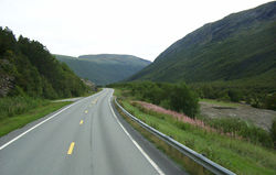
paved
|
A feature that is predominantly paved; i.e., it is covered with paving stones, concrete or bitumen. This value gives general description; use a more precise value if possible, like asphalt, concrete, paving_stones and other options below.
|

|
|
asphalt
|
Short for asphalt concrete - mineral aggregate bound by asphalt. | 
|
|
chipseal
|
Less expensive alternative to asphalt concrete, using a thin base of hot bitumen or asphalt with aggregate pushed into it. Common in many American countries and Oceania. Often hard to distinguish from asphalt concrete by laypersons, some consider it as subtype of asphalt rather separate surface. In the end vast majority of chipsealed roads are tagged as surface=asphalt instead.
|

|
|
concrete
|
Portland cement concrete, forming a large surface, typically cast in place and may have predetermined breaking joints. For pre-fabricated plates, please use concrete:plates or concrete:lanes if you know how the concrete is laid out and one of these tags fits.
|

|
|
concrete:lanes
|
Long, narrow concrete elements for a two-tracked vehicle (motorcars) so that the tires always hit the concrete. There might be sand, ground, grass, pavers, asphalt, etc. in between them. Note that if you tag a single-tracked way you just use concrete, since there are no lanes. | 
|
|
concrete:plates
|
Large, heavy duty prefabricated concrete plates placed closely together. | 
|
|
paving_stones
|
A relatively smooth surface paved with artificial blocks (block pavers, bricks) or natural stones (specifically, flagstones), with a flat top. The gaps between individual paving stones are very narrow, either because the stones have a perfectly regular shape (rectangular, or any surface-filling shape) or because they have been carefully selected, fitted and placed in order to form an even, closed surface. | 
|
|
paving_stones:lanes
|
lanes of paving stones for two-tracked vehicles (motorcars). There might be sand, ground, grass, pavers, asphalt, etc. in between them. Note that if you tag a single-tracked way you just use paving_stones, since there are no lanes. | 
|
|
grass_paver
|
A sort of permeable paving using regular cell structure, where the voids in this structure enable rainwater to drain into the ground and the structure itself increases the load bearing capability. Often used for parking lots or infrequently used service ways. | 
|
|
sett
|
Sett paving, formed from natural stones cut to have roughly a flat top, with a regular or irregular shape. The stones do not cover the surface completely, unlike paving_stones. They also may be not entirely flat.
|
 
|
|
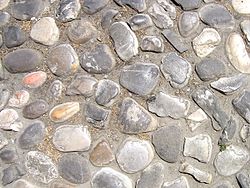
unhewn_cobblestone
|
Raw cobblestone of natural, uncut, rounded stones. Unlike pebblestone, the stones are firmly connected to the ground. | 
|
|
cobblestone
|
cobblestone is an unclear value, and was widely used for sett and actual cobblestone. Please adopt a more precise value, like sett or unhewn_cobblestone (described above).
|
||
cobblestone:flattened |
Should not be used, as there is neither a commonplace or defined meaning. Likely use sett or unhewn_cobblestone instead.
|
||
bricks
|
A surface paved with dried clay bricks. Note that some people use surface=paving_stones for them and treat them as subtype of paving stones.
|

|
|
metal
|
Used for metal-surfaced bridges, or for temporary tracks over fields for normal road vehicles or site traffic (note that objects lasting for just a few days should not be mapped in OSM).
Not used for road metal in the sense of crushed, quarried rock. |
 
|
|
metal_grid
|
Metal grids are often used as a surface on industrial-style bridges or stairs. When wet, the surface can become very slippery, especially for bikes. The surface can also be unsuitable for dogs, due to the sharp edges and the look-through effect. This surface is sometimes known as metal grate, metal grating, steel grate/grating, or open grate. | 
|
|
wood
|
Used for wood surfaced bridges, plank walkways, and garden decking. | 
|
|
stepping_stones
|
Stones or plates individually arranged in a row, allowing to walk on, surrounded by an unpaved medium such as grass or water |  
|
|
rubber
|
Playground safety surfacing made of recycled rubber tire products such as poured rubber, rubber tiles or loose rubber mulch. These surfaces are usually made of rubber designed specifically for aesthetics, child safety, and/or ADA wheelchair accessibility. | 
|
|
tiles
|
Ceramic tiles. Those are commonly used for paving indoor corridors in public spaces such as airports or shopping malls. Outdoors, they are sometimes encountered on smaller footways in parks and terraces. | 
|
|
fibre_reinforced _polymer_grate
|
Oftern used on outdoor walkways, they provide good grip due to the rough surface and open grate allows water to go through the surface. Also known as FRP Grate/Grating. | 
|
|
| user_defined | All commonly used values according to Taginfo. | ||
Unpaved | |||
unpaved
|
A feature that is predominantly unsealed (unpaved); i.e., it has a loose covering ranging from compacted stone chippings to soil. Unpaved roads may, in aerial imagery, show evidence of water along their course; in such circumstances, the waterway should not be tagged as a stream, though it might appear as such. This value gives only a rough description; use a more precise value if possible. | ||
compacted
|
A mixture of larger (e.g., gravel) and smaller (e.g., sand) parts, compacted (e.g., with a roller), so the surface is more stable than loose gravel. Used, for example, for park paths, better tracks, some service ways, … Best sort of ways below paving with asphalt, concrete, paving stones. Sometimes known as water-bound macadam. Mixture and compacting leads to more grip and stability. | 
|
|
fine_gravel
|
This tag is used somewhat inconsistently; see its detail page. It may be used to specify fine loose gravel (as shown in the picture) which makes it unsuitable for road bicycles, but it is also sometimes used as an alias for compacted, which is easy to cycle on. If the gravel is fixed instead of loose, please consider using well-defined compacted instead.
|

|
|
gravel
|
This tag has very large meaning range. Used for cases ranging from huge gravel pieces like track ballast used as surface, through small pieces of gravel to compacted surface. | 
|
|
shells
|
Crushed or whole seashells; commonly seen on footways and cycleways in the Netherlands. | 
|
|
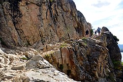
rock
|
Big pieces of rock used to improve path quality or exposed bare rock, including trails across natural=bare_rock. Typically in mountainous areas.
|
 
|
|
pebblestone
|
Pebbles are stones rounded by waves or river flow. Typical size range from 2 to 8 cm. Describing a surface in OSM they are loosely arranged. Like gravel pebbles can be used as a building part of compacted.
|

|
|
ground
|
No special surface, the ground itself has marks of human or animal usage. This value gives only a rough description; if possible, use a more precise value such as grass, clay, sand, dirt, gravel or pebblestone.
|

|
|
dirt
|
Used for where surface is exposed soil, also commonly referred to as earth or dirt, but it is not sand, gravel, or rock. Gravel is sometimes mistakenly called dirt. Some compacted surfaces are sometimes called "dirt" too, please consider the definition of compacted.
|

|
|
earth
|
The same meaning as dirt. Use the more common dirt instead.
|

|
|
grass
|
Grass covered ground. Mostly nice to walk. May turn into surface=dirt or become overgrown and disappear.
|

|
|
mud
|
Similar to ground but most of the year wet which gives a soft ground with low carrying capacity. Mostly found on wetland like swamps or in tidal areas. Sometimes also found on slopes draining onto a way.
|

|
|
sand
|
Small to very small fractions (less than 2 mm) of rock. | 
|
|
woodchips
|
Woodchips as a surface, perhaps for a playground or walking trail. Can consist of either chips of actual wood, or of bark only. Sometimes written as wood chips. | 
|
|
snow
|
Winter roads surfaced with compacted snow. | 
|
|
ice
|
Ice roads, winter roads | 
|
|
salt
|
Dry salt lakes | 
|
|
| user_defined | All commonly used values according to Taginfo. | ||
Special (sports, etc.) | |||
clay
|
Most common on tennis courts. Sometimes used for other sports: soccer, athletic tracks, boules, etc. | 
|
|
tartan
|
A synthetic, all-weather surface typically used in running and other sport tracks. Although Tartan is a trademark, it is used as a generic term due to its widespread usage. Other well-known brand names include Rekortan or Mondotrack. | 
|
|
artificial_turf
|
An all-weather surface made from synthetic fibres to look and feel like natural grass. Often used for tracks and pitches of sports such as football, baseball, etc. | 
|
|
acrylic
|
An artificial surface covered with acrylic resin-bound coating. Often used for tennis courts, basketball courts, etc. Prominent brands include: DecoTurf, GreenSet and so on. | 
|
|
carpet
|
Carpet may be used for some sport courts such as indoor tennis courts and appear on some highway=corridor.
|

|
|
plastic
|
An artificial surface made from plastic, can be used on pitches and playgrounds. | 
|
|
| user_defined | All commonly used values according to Taginfo. | ||
This table is a wiki template with a default description in English. Editable here.
Surface for motor roads

surface=unhewn_cobblestone - more specific than surface=paved for this surfaceFor roads for motor vehicles, there is typically an assumption that the surface is surface=paved unless otherwise stated. Paved in OpenStreetMap is non-specific and may cover sealed, tarmac, asphalt, bitumen, even sett or true cobblestone. surface=unpaved is treated as the opposite of paved. More specific tags can be used for surfaces which are normally classified into paved or unpaved for routing purposes. Navigation software should assume that roads-that-are-not-paved will have slower driving speed (and therefore longer driving time) and may be impassable in some weather conditions.
On paved roads, tags more specific than surface=paved are also welcomed; for example surface=asphalt.
smoothness=* is also an important surface property and refers to surface regularity/flatness, regardless of material. May be especially useful for roller blades and similar purposes.
tracktype=* is also an important surface property and refers to surface firmness, regardless of shape.
highway=* ways should ideally always be tagged with surface (and/or with tracktype=*) given that there is no default for such paths.
Rendering software convention varies, but generally roads-that-are-not-paved are shown in a different colour but same width as their paved cousins or use the same colour but are dashed. Rendering of road surface in standard OSM style is a complicated subject.
In some cases when other tags are not sufficient to describe the road conditions good enough the use of smoothness=* and maxspeed:practical=* can be considered. maxspeed:practical=* can be useful in situations where other tags are not sufficient to describe what kind of travelling speed could be reasonably expected. If there is one good surface=unpaved road, where practical speed is 60 km/h, and a second bad road with concrete:lanes surface allowing a practical speed 10 km/h, users or routing software could be misguided to choose the second road for routing, because by default paved roads are assumed to allow much higher speeds than unpaved roads.
Surface for footways and cycleways

cycleway:surface=asphalt and footway:surface=paving_stones for specifying surfaceIf a footway or cycleway was tagged as a tag (not as a separate way) on a highway (i.e., highway=secondary + cycleway=track/lane), you can add surface by the following syntax:
or more specific
sidewalk:both:surface=*sidewalk:left:surface=*(left side depends on way direction)sidewalk:right:surface=*(right side depends on way direction)
Or if there is a foot- or cycleway only at one side from street, or there are different surfaces at both sides, you can use right and left (or both, to tag explicit both sides):
See cycleway:right=* / cycleway:left=* / cycleway:both=* for more examples.
With this syntax you also can add other relevant tags like: smoothness=*, oneway=*, bicycle=*, foot=*, width=*, segregated=*, and more.
In case of segregated cycleway+footway tagged as a single line where each has a separate value, footway:surface=* + cycleway:surface=* can be used.
Uses
The primary use is navigation. A router for bicycles could avoid an otherwise normal road that is tagged as having surface=sand. For vehicles, the router might tie-break by preferring a slightly longer asphalt route over a earth/compacted/gravel/cobblestone route. Pedestrians probably also prefer any paved value over a potentially muddy footpath. The tag can furthermore be used to use the right texture when rendering, for example to indicate which ways are unpaved.
OsmAnd shows smoothness and surface, if enabled in the menu (Configure map - Details). Here is the map key with the rendering for each smoothness and surface value.
Potentially helpful tools
See also
material=*- Describes the main material of a physical feature. Some mappers usesurface:material=*instead.smoothness=*- Specifies the physical usability of a way for wheeled vehicles due to surface regularity/flatnesstracktype=*- Provides a classification of trackssurface:colour=*- Describes the colour of the surface (if it cannot be inferred), followingcolour=*guidelinessurface:grade=*- Poorly defined tag for tagging surface quality with numeric code, consider usingsmoothness=*insteadsurface:middle=*- Describes the surface of the middle of the way if is not the same, where the wheel tracks aresurface:lanes=*- For describing multiple parallel surfaces on the same way (e.g., bike/walking path composed of two distinct surfaces)- Landcover
- Proposed features/Surface:all weather, a proposal for value hierarchy and all_weather value
- Seamarks/General Attributes#Nature of surface (NATSUR)
- Rendering style (very rough, incomplete) using OverpassTurbo
- Query finding surface values used in OSM not documented in this page using OverpassTurbo
Maps showing surface data
- https://graphhopper.com/maps/ – once the route is determined, the surface can be seen on the graph at the bottom by changing to 'surface'
- OsmAnd - its default vector map has an option to show road surface, and if a navigation route is calculated then surfaces are summed and graphed in the route details.
- StreetComplete - once surface overlay is activated
Possible tagging mistakes
References
- ↑ https://lists.openstreetmap.org/pipermail/tagging/2019-September/048330.html
- ↑ https://lists.openstreetmap.org/pipermail/tagging/2019-September/048338.html
- ↑ https://lists.openstreetmap.org/pipermail/tagging/2019-September/048355.html "Ultimately, where information is missing, you as a data consumer will need to make a decision about whether or not a road is likely to be paved or not. [...] Adding a default (even per-country) won't magically make all non-surface-tagged roads paved or unpaved"