FR:Éléments cartographiques
Template:Language-Map Features
Volontairement, OpenStreetMap ne restreint pas les "clés" et leurs "valeurs" assignées aux nœuds, aux chemins et aux zones. Cependant, il est bénéfique que les participants en partagent un maximum pour que les données soient le mieux exploitables. Cette page recense donc les clés et leurs valeurs communément utilisées.
Cette liste n'est pas exhaustive et si vous ne trouvez pas ce que vous cherchez vous êtes encouragés à faire de nouvelles propositions qui seront discutées. Pour regrouper chemins et nœuds dans des ensembles de plus haut niveau, utilisez les Relations.
- Pour comprendre les termes de nœud/chemin/zone, voir Data Primitives
- Pour proposer des attributs, utilisez la page proposed features
- Pour proposer une nouvelle icône, utilisez la page Proposed_Icons
- Pour voir la liste des clés/valeurs qui ont existé mais ne sont plus utilisées, consultez la page Deprecated features.
- Voir également Editing_Standards_and_Conventions
Notes sur le rendu :
- En utilisant les clés/valeurs ci-dessous, il y a de fortes chances que votre travail apparaisse avec les différents moteurs de rendu. Cependant il n'y a aucune garantie qu'un attribut listé ici sera rendu par un moteur en particulier ou par les moteurs utilisés sur la carte OSM.
- Il peut aussi y avoir des attributs qui seront rendus sur les cartes bien qu'ils ne soient pas listés ici. Cette n'est pas mise à jour avec tous les attributs utilisés par les différents moteurs de rendu.
Les tableaux sont groupés par thèmes, avec les plus souvent utilisés en premier.
Représentations physiques
=== Routes (highway) ===
Le tag highway est le tag principal pour les routes. C'est le minimum pour voir un "way" rendu sur une carte. Les conventions peuvent différer d'un pays à l'autre. Voir aussi les pages Highway tag usage et Road .
| Key | Value | Element | Comment | Rendering carto | Examples | |
|---|---|---|---|---|---|---|
Roads | ||||||
|
These are the principal tags for the road network. They range from the most to least important. | ||||||
| highway | motorway | Autoroute Par défaut : lanes="2", maxspeed="130" + ref="Axx" + oneway="true" + int_ref="Exx" + name="autoroute du soleil" + lanes="x" (si voies > 2) |
||||
| highway | trunk | Voie rapide ou voie express. Voie ayant les caractéristiques d'une autoroute. En général, une 2x2 voies avec séparation centrale. Par défaut : lanes="2", maxspeed="110" (sauf périph. Paris: 80) + ref="Nxx" ou "Dxx" + oneway="true" + lane="x" (si voies <> 2) |
||||
| highway | primary | Route nationale, grosse départementale ou artère principale en ville + ref="Nxx" ou "Dxx" + name="nom_de_rue" (en ville) |
||||
| highway | secondary | Route départementale ou rue importante en ville mais pas assez pour mériter "primary" Par défaut : lanes="2", maxspeed="90" ou "50" + ref="Dxx" + name="nom_de_rue" (en ville) |
||||
| highway | tertiary | Petite départementale ou communale avec typiquement une ligne de séparation au sol (sinon -> unclassified) ou en ville, présentant un trafic inférieur à "secondary" mais pas encore en zone uniquement "residential" Par défaut : lanes="2", maxspeed="90" ou "50" + ref="Dxx" (ou "Cxx") + name="nom_de_rue" (en ville) |
||||
| highway | unclassified | Pas de classification administrative. Route secondaire typiquement sans ligne de séparation (mais deux voitures peuvent se croiser de front) Note: ce tag n'est pas un marqueur pour signaler qu'il faudra choisir un highway plus-tard. |
||||
| highway | residential | Route de desserte ou à l'intérieur d'une zone résidentielle qui n'a pas de nomenclature spécifique. | ||||
Link roads | ||||||
| highway | motorway_link | Bretelle d'accès ou de sortie d'une autoroute Par défaut : lanes="1", maxspeed=? + oneway="true" voir "motorway_junction" pour le numéro de sortie |
||||
| highway | trunk_link | Voie d'accès à une voie rapide ou voie express Par défaut : lanes="1", maxspeed=? + oneway="true" |
||||
| highway | primary_link | Voie d'accès à une route nationale + oneway="true" |
||||
| highway | secondary_link | The link roads (sliproads/ramps) leading to/from a secondary road from/to a secondary road or lower class highway. | ||||
| highway | tertiary_link | The link roads (sliproads/ramps) leading to/from a tertiary road from/to a tertiary road or lower class highway. | ||||
Special road types | ||||||
| highway | living_street | For living streets, which are residential streets where pedestrians have legal priority over cars, speeds are kept very low and this is can use for narrow roads that usually using for motorcycle roads. | ||||
| highway | service | Route d'accès à un bâtiment, site industriel, plage, camping, etc. ou l'intérieur d'un grand parking, etc. | ||||
| highway | pedestrian | Rue piétonne. + area="yes" pour une place |
||||
| highway | track | Route à usage privé sans revêtement (chemin agricole, chemin forestier...) | ||||
| highway | bus_guideway | A busway where the vehicle guided by the way (though not a railway) and is not suitable for other traffic. Please note: this is not a normal bus lane, use access=no, psv=yes instead! | ||||
| highway | escape | For runaway truck ramps, runaway truck lanes, emergency escape ramps, or truck arrester beds. It enables vehicles with braking failure to safely stop. | ||||
| highway | raceway | A course or track for (motor) racing | ||||
| highway | road | A road/way/street/motorway/etc. of unknown type. It can stand for anything ranging from a footpath to a motorway. This tag should only be used temporarily until the road/way/etc. has been properly surveyed. If you do know the road type, do not use this value, instead use one of the more specific highway=* values. | ||||
| highway | busway | A dedicated roadway for bus rapid transit systems | ||||
Paths | ||||||
| highway | footway | Chemin pour piétons, chemin de randonnée. + bicycle="yes" pour éventuellement indiquer que les vélos sont autorisés |
||||
| highway | bridleway | Chemin pour cavaliers | ||||
| highway | steps | Escaliers | ||||
| highway | corridor | For a hallway inside of a building. | ||||
| highway | path | A non-specific path. Use highway=footway for paths mainly for walkers, highway=cycleway for one also usable by cyclists, highway=bridleway for ones available to horse riders as well as walkers and highway=track for ones which is passable by agriculture or similar vehicles. | ||||
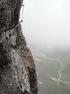
| highway | via_ferrata | A via ferrata is a route equipped with fixed cables, stemples, ladders, and bridges in order to increase ease and security for climbers. These via ferrata require equipment : climbing harness, shock absorber and two short lengths of rope, but do not require a long rope as for climbing. | ||||
When sidewalk/crosswalk is tagged as a separate way | ||||||
| footway | sidewalk | Sidewalk that runs typically along residential road. Use in combination with highway=footway or highway=path | ||||
| footway | crossing | Passage piéton | ||||
When sidewalk (or pavement) is tagged on the main roadway (see Sidewalks) | ||||||
| sidewalk | both | left | right | no | Specifies that the highways has sidewalks on both sides, on one side or no sidewalk at all | ||||
When cycleway is drawn as its own way (see Bicycle) | ||||||
| highway | cycleway | Piste cyclable. + foot="yes" si les marcheurs sont autorisés |
||||
Cycleway tagged on the main roadway or lane (see Bicycle) | ||||||
| cycleway | lane | A lane is a route that lies within the roadway | ||||
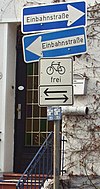
| cycleway | opposite | Used on ways with oneway=yes where it is legally permitted to cycle in both directions. Used together with oneway:bicycle=no. | ||||
| cycleway | opposite_lane | Used on ways with oneway=yes that have a cycling lane going the opposite direction of normal traffic flow (a "contraflow" lane). Used together with oneway:bicycle=no. | ||||
| cycleway | track | A track provides a route that is separated from traffic. In the United States, this term is often used to refer to bike lanes that are separated from lanes for cars by pavement buffers, bollards, parking lanes, and curbs. Note that a cycle track may alternatively be drawn as a separate way next to the road which is tagged as highway=cycleway. | ||||
| cycleway | opposite_track | Used on ways with oneway=yes that have a cycling track going the opposite direction of normal traffic flow. Used together with oneway:bicycle=no. | ||||
| cycleway | share_busway | There is a bus lane that cyclists are permitted to use. | ||||
| cycleway | opposite_share_busway | Used on ways with oneway=yes that have a bus lane that cyclists are also permitted to use, and which go in the opposite direction to normal traffic flow (a "contraflow" bus lane). Used together with oneway:bicycle=no. | ||||
| cycleway | shared_lane | Cyclists share a lane with motor vehicles, there are markings reminding about this. In some places these markings are known as "sharrows" ('sharing arrows') and this is the tag to use for those. | ||||
| busway | lane | Bus lane on both sides of the road. (See also: Parallel scheme for bus/psv lane tagging lanes:bus=* / lanes:psv=*) | ||||
Street parking tagged on the main roadway (see Street parking) | ||||||
| parking:left / :right / :both (hereafter: parking:side) |
lane | street_side | on_kerb | half_on_kerb | shoulder | no | separate | yes | Primary key to record parking along the street. Desribes the parking position of parked vehicles in the street. | ||||
| parking:sideorientation=* | parallel | diagonal | perpendicular | To specify the orientation of parked vehicles if there is street parking. | ||||
Lifecycle (see also lifecycle prefixes) | ||||||
| highway | proposed | For planned roads, use with proposed=* and a value of the proposed highway value. | ||||
| highway | construction | For roads under construction. Use construction=* to hold the value for the completed road. | different colours | |||
Attributes | ||||||
| abutters | commercial | industrial | mixed | residential | retail etc. | See Key:abutters for more details. | ||||
| bicycle_road | yes | A bicycle road is a road designated for bicycles. If residential streets get the status of bicycle roads, normally, by special signs, motor traffic is admitted with limited speed, often only for residents. | ||||
| bus_bay | both | left | right | A bus bay outside the main carriageway for boarding/alighting | ||||
| change | yes | no | not_right | not_left | only_right | only_left | Specify the allowed/forbidden lane changes | ||||
| destination | <place name of destination> | Destination when following a linear feature | ||||
| embankment | yes | dyke | A dyke or a raised bank to carry a road, railway, or canal across a low-lying or wet area. | ||||
| embedded_rails | yes | <type of railway> | A highway on which non-railway traffic is also allowed has railway tracks embedded in it but the rails are mapped as separate ways. | ||||
| ford | yes | Un gué : la route croise un ruisseau qui peut amener les véhicules à rouler dans l'eau | ||||
| ice_road | yes | A highway is laid upon frozen water basin, definitely doesn't exist in summer. | ||||
| incline | Number % | ° | up | down | Route inclinée, où l'on peut rencontrer des véhicules lents (camions, caravanes, etc) à cause de la pente | ||||
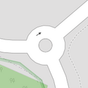
| junction | roundabout | Rond point. Le sens de circulation est défini par le sens des segments. + highway="quelque chose" obligatoire. - oneway="true" : pas nécessaire |
||||
| lanes | <number> | The number of traffic lanes for general purpose traffic, also for buses and other specific classes of vehicle. | ||||
| lane_markings | yes | no | Specifies if a highway has painted markings to indicate the position of the lanes. | ||||
| lit | yes | no | Street lighting | ||||
| maxspeed | <number> | Specifies the maximum legal speed limit on a road, railway or waterway. | ||||
| motorroad | yes | no | The motorroad tag is used to describe highways that have motorway-like access restrictions but that are not a motorway. | ||||
| mountain_pass | yes | The highest point of a mountain pass. | ||||
| mtb:scale | 0-6 | Applies to highway=path and highway=track. A classification scheme for mtb trails (few inclination and downhill). | ||||
| mtb:scale:uphill | 0-5 | A classification scheme for mtb trails for going uphill if there is significant inclination. | ||||
| mtb:scale:imba | 0-4 | The IMBA Trail Difficulty Rating System shall be used for bikeparks. It is adapted to mtb trails with artificial obstacles. | ||||
| mtb:description | Text | Applies to highway=path and highway=track. A key to input variable infos related to mtbiking on a way with human words | ||||
| oneway | yes | no | reversible | Oneway streets are streets where you are only allowed to drive in one direction. | ||||
| oneway:bicycle | yes | no | | Used on ways with oneway=yes where it is legally permitted to cycle in both directions. | ||||
| overtaking | yes | no | caution | both | forward | backward | Specifying sections of roads where overtaking is legally forbidden. Use overtaking:forward=yes/no/caution and overtaking:backward=yes/no/caution when it depends on driving direction. | ||||
| parallel | diagonal | perpendicular | marked | no_parking | no_stopping | fire_lane. | Deprecated variant to map parking along streets. See section on street parking above or the street parking page for more details. | |||||
| free | ticket | disc | residents | customers | private | Deprecated variant to map parking conditions along streets. See section on street parking above or the street parking page for more details. | |||||
| passing_places | yes | A way which has frequent passing places (See also: highway=passing_place) | ||||
| priority | forward | backward | Traffic priority for narrow parts of roads, e.g. narrow bridges. | ||||
| priority_road | designated | yes_unposted | end | Specifying roads signposted as priority roads. | ||||
| sac_scale | hiking | mountain_hiking | demanding_mountain_hiking | alpine_hiking | demanding_alpine_hiking | difficult_alpine_hiking | Applies to highway=path and highway=footway. A classification scheme for hiking trails. | ||||
| service | alley | driveway | parking_aisle etc. | See Key:service for more details. | ||||
| shoulder | no | yes | right | both | left | Presence of shoulder in highway | ||||
| smoothness | excellent | good | intermediate | bad | very_bad | horrible | very_horrible | impassable | Specifies the physical usability of a way for wheeled vehicles due to surface regularity/flatness. See Key:smoothness for more details. | ||||
| surface | paved | unpaved | asphalt | concrete | paving_stones | sett | cobblestone | metal | wood | compacted | fine_gravel | gravel | pebblestone | plastic | grass_paver | grass | dirt | earth | mud | sand | ground | See Key:surface for more details. | ||||
| tactile_paving | yes | no | A paving in the ground to be followed with a blindman's stick. | ||||
| tracktype | grade1 | grade2 | grade3 | grade4 | grade5 | To describe the quality of the surface. See Key:tracktype for more information. | ||||
| traffic_calming | bump | hump | table | island | cushion | yes | etc. | Features used to slow down traffic. See Key:traffic calming for more details. | ||||
| trail_visibility | excellent | good | intermediate | bad | horrible | no | Applies to highway=path, highway=footway, highway=cycleway and highway=bridleway. A classification for hiking trails visibility | ||||
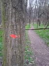
| trailblazed | yes | no | poles | cairns | symbols | Applies to highway=*. Describing trail blazing and marking. See Key:trailblazed for more information. | ||||
| trailblazed:visibility | excellent | good | intermediate | bad | horrible | no | Applies to trailblazed=*. A classification for visibility of trailblazing. See Key:trailblazed:visibility for more information. | ||||
| turn | left | slight_left | through | right | slight_right | merge_to_left | merge_to_right | reverse | The key turn can be used to specify the direction in which a way or a lane will lead. | ||||
| width | <number> | The width of a feature. | ||||
| winter_road | yes | A highway functions during winter, probably can't be driven in summer. | ||||
Other highway features | ||||||
| highway | bus_stop | Arrêt de bus. ou amenity=bus_station pour les grandes stations de bus (gares routières) |
||||
| highway | crossing | A.k.a. crosswalk. Pedestrians can cross a street here; e.g., zebra crossing | ||||
| highway | cyclist_waiting_aid | Street furniture for cyclists that are intended to make waiting at esp. traffic lights more comfortable. | ||||
| highway | elevator | An elevator or lift, used to travel vertically, providing passenger and freight access between pathways at different floor levels. | ||||
| highway | emergency_bay | An area beside a highway where you can safely stop your car in case of breakdown or emergency. | ||||
| highway | emergency_access_point | Sign number which can be used to define your current position in case of an emergency. Use with ref=NUMBER_ON_THE_SIGN. See also emergency=access_point | ||||
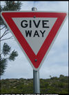
| highway | give_way | A "give way," or "Yield" sign | ||||
| emergency | phone | A calling device can be used to tell on your current position in case of an emergency. Use with ref=NUMBER_ON_THE_SIGN | ||||
| highway | ladder | A vertical or inclined set of steps or rungs intended for climbing or descending of a person with the help of hands. | ||||
| highway | milestone | Highway location marker | ||||
| highway | mini_roundabout | Mini rond point (UK : panneau avec un cercle sur fond bleu; FR: très petit ronds-point sans terre-plein central). | ||||
| highway | motorway_junction | Indique une sortie d'autoroute ou de route pour automobiles. + ref="numéro de sortie" |
||||
| highway | passing_place | The location of a passing space | ||||
| highway | platform | A platform at a bus stop or station. | ||||
| highway | rest_area | Place where drivers can leave the road to rest, but not refuel. | ||||
| highway | services | Aire de repos ou de service (souvent sur autoroutes) | ||||
| highway | speed_camera | A fixed road-side or overhead speed camera. | ||||
| highway | stop | Panneau stop | ||||
| highway | street_lamp | A street light, lamppost, street lamp, light standard, or lamp standard is a raised source of light on the edge of a road, which is turned on or lit at a certain time every night | ||||
| highway | toll_gantry | A toll gantry is a gantry suspended over a way, usually a motorway, as part of a system of electronic toll collection. For a toll booth with any kind of barrier or booth see: barrier=toll_booth | ||||
| highway | traffic_mirror | Mirror that reflects the traffic on one road when direct view is blocked. | ||||
| highway | traffic_signals | Feu tricolore | ||||
| highway | trailhead | Designated place to start on a trail or route | ||||
| highway | turning_circle | A turning circle is a rounded, widened area usually, but not necessarily, at the end of a road to facilitate easier turning of a vehicle. Also known as a cul de sac. | ||||
| highway | turning_loop | A widened area of a highway with a non-traversable island for turning around, often circular and at the end of a road. | ||||
| highway | User Defined | All commonly used values according to Taginfo | ||||
Voie cyclable (cycleway)
| Clé | Valeur | Élément | Commentaire | Rendu par défaut | Photo |
|---|---|---|---|---|---|
| cycleway | lane | Une bande cyclable sur la voie de circulation | |||
| cycleway | track | Une piste cyclable dédiée (séparée de la route) | |||
| cycleway | opposite_lane | Une bande cyclable dans le sens opposé | |||
| cycleway | opposite_track | Une piste cyclable dans le sens opposé (séparée de la route) | |||
| cycleway | opposite | Dans une rue à sens unique, les vélos ont le droit de circuler à contre-sens. Note : ce type de rue est fréquent en Hollande et au Danemark par exemple. On en trouve aussi en France (Strasbourg) | |||
| cycleway | User Defined |
Revêtement (tracktype)
Voir aussi la discussion surface key.
| Clé | Valeur | Élément | Commentaire | Rendu par défaut | Photo |
|---|---|---|---|---|---|
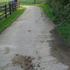
| tracktype | grade1 | Surface possédant un revêtement dur de type asphalte ou composée de matériaux très compactés. | 
| ||
| tracktype | grade2 | Surface en gravier ou en terre/sable compact. | 
| ||
| tracktype | grade3 | Surface mixte matériaux durs et terre/sable. Assez compact. | 
| ||
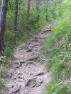
| tracktype | grade4 | Surface comportant des marques de passages de véhicules au milieu desquelles pousse de la végétation (souvent juste de l'herbe). Essentiellement en terre, bien que parfois également composée de matériaux plus durs ou compactés. | 
| ||
| tracktype | grade5 | Surface comportant des marques de passages de véhicules mais moins visibles. Surface naturelle devenue voie de passage à l'usage. Sol mou, peu d'adhérence, empreinte visuelle presque nulle sur le paysage. | 
|
Hydrographie (waterway)
| Clé | Valeur | Élément | Commentaire | Rendu par défaut | Photo |
|---|---|---|---|---|---|
| waterway | river | Rivière étroite tracée comme une ligne sur la carte. Pour les rivières plus larges, tracez un area (voir Large rivers) (Autres langages). | |||
| waterway | canal | Un canal artificiel utilisé pour le transport, la génération d'énergie ou l'irrigation.(Autres langues). | |||
| waterway | stream | Un cours d'eau naturel étroit, qui ne mérite pas d'être appelé "rivière". Il est peut être même possible de simplement sauter par dessus. | |||
| waterway | drain | Un canal artificiel prévu pour évacuer les eaux de pluie après un orage ou de décharges industrielles. | |||
| waterway | dock | Un bassin clos utilisé pour le chargement, déchargement, construction ou réparation des navires | |||
| waterway | lock_gate | Une écluse. | |||
| waterway | turning_point | Un aménagement permettant de changer de direction lorsque le bateau a une longueur supérieure à la largeur du canal. | |||
| waterway | aqueduct | Un pont supportant une conduite d'eau (acqueduc) (Autres langues). | |||
| waterway | boatyard | Chantier naval, un lieu pour la construction, la réparation de navires et le stockage hors de l'eau. | |||
| waterway | water_point | Un point d'eau fraîche, par exemple pour les camping-cars | |||
| waterway | waste_disposal | Un point de vidange des eaux usées, par exemple pour les camping-cars. | |||
| waterway | mooring | Un endroit où les bateaux peuvent jeter l'ancre | |||
| waterway | weir | Un petit barrage utilisé généralement pour détourner l'eau à des fins industrielles (seuil). L'eau peut encore passer par-dessus ce genre de barrage. | |||
| waterway | User Defined |
Voies ferrées (railway)
| Clé | Valeur | Élément | Commentaire | Rendu par défaut | Photo |
|---|---|---|---|---|---|
| railway | station | Gare ferroviaire (Other languages) |  |
||
| railway | halt | Petite gare. Peut ne pas avoir de plate-forme. Eventuellement avec arrêt sur demande. Également utilisé pour les arrêts de tramway |  |
||
| railway | viaduct | Un haut ou long pont avec les piliers intermédiaires de soutien (Other languages). | |||
| railway | crossing | Passage pour les piétons. | |||
| railway | level_crossing | Intersection entre route et rail (passage à niveau) . | |||
| railway | rail | Voie ferrovière pour trains passagers ou fret |  |
||
| railway | tram | Ligne de tramway. Généralement, la chaussée est partagée avec les voitures. (Autres langues) |  |
||
| railway | light_rail | Petits/légers trains passagers (régionaux ?, RER ?) | |||
| railway | subway | Métro | |||
| railway | subway_entrance | Bouche de métro. | |||
| railway | preserved | Une voie de chemin de fer utilisée pour faire circuler de vieux trains, à des fins touristique en général (Changé de "preserved_rail" à "preserved" puisque "rail" est redondant). | |||
| railway | disused | Une portion de voie ferrée désaffectée mais dont l'infrastructure est encore en place | |||
| railway | abandoned | Le tracé d'une ancienne voie de chemin de fer dont l'infrastructure a été retirée. Ne pas utiliser cette désignation si la voie est maintenant dédiée à un autre usage, par exemple une voie cyclable . | |||
| railway | narrow_gauge | Trains passagers ou fret à voie étroite. | |||
| railway | monorail | Monorail. | |||
| railway | User Defined |
Aviation (aeroway)
| Clé | Valeur | Élément | Commentaire | Rendu par défaut | Photo |
|---|---|---|---|---|---|
| aeroway | aerodrome | Aéroport voir aussi military="airfield" |
|||
| aeroway | terminal | Terminaux et bâtiments de l'aéroport | |||
| aeroway | helipad | Héliport | File:Aeroway-helipad.png | ||
| aeroway | runway | Piste d'atterrissage / d'envol |  |
||
| aeroway | taxiway | Voie de circulation |  |
||
| aeroway | apron | Aire de parking pour les avions | |||
| aeroway | User Defined |
Transport aériens par câble (aerialway)
| Clé | Valeur | Élément | Commentaire | Rendu par défaut | Photo |
|---|---|---|---|---|---|
| aerialway | cable_car | Ligne de télécabines. |  |
||
| aerialway | chair_lift | Ligne de télésièges. | File:800px-Chair lift in Bad Hofgastein Austria.jpg | ||
| aerialway | drag_lift | Téléski (ou remonte-pente ou tire-fesses). |
Énergie (power)
| Clé | Valeur | Élément | Commentaire | Rendu par défaut | Photo |
|---|---|---|---|---|---|
| power | tower | Pylône électrique pour ligne à haute tension. Normallement en treillis métallique. Ne devrait pas être utilisé pour les lignes basse tension ou téléphoniques. | |||
| power | line | Lignes électriques (aériennes) | 
|
Édifices (man_made)
| Clé | Valeur | Élément | Commentaire | Rendu par défaut | Photo |
|---|---|---|---|---|---|
| man_made | works | Bâtiment industriel destiné à la production de biens. | |||
| man_made | beacon | Signal lumineux voir aussi man_made="lighthouse" pour les phares |
|||
| man_made | survey_point | Poteau de triangulation, sommet géodésique, et autres équipements fixes utilisés par les topographes (par ex. les stations radio DGPS ) | |||
| man_made | power_wind | Énergie éolienne voir aussi man_made="windmill" |
|||
| man_made | power_hydro | Énergie hydroélectrique (rivière, lac, marée ...) | |||
| man_made | power_fossil | Énergie issue de la combustion fossile (pétrole, gaz ...) | |||
| man_made | power_nuclear | Centrale nucléaire. | |||
| man_made | tower | Structure de grande hauteur, par exemple une antenne de telecom voir building="yes" pour les immeubles |
|||
| man_made | water_tower | Château d'eau. Se trouve souvent sur une colline, près ou dans une tour | |||
| man_made | gasometer | Gasomètre (réservoir à gaz) | 
| ||
| man_made | reservoir_covered | Réservoir couvert | |||
| man_made | lighthouse | Phare, émet de la lumière pour guider les bateaux | |||
| man_made | windmill | Moulin à vent voir aussi man_made="power_wind" |
|||
| man_made | pier | Ponton, la plupart du temps destiné au loisir. |  |
||
| man_made | User Defined |
Loisirs (leisure)
| Clé | Valeur | Élément | Commentaire | Rendu par défaut | Photo |
|---|---|---|---|---|---|
| leisure | sports_centre | Centre sportif |  |
||
| leisure | golf_course | Golf |  |
||
| leisure | stadium | Stade |  |
||
| leisure | track | Terrain de course ex: course à pied, vélo, chevaux. |  |
||
| leisure | pitch | Terrain de sport ex: football, rugby, baseball, cricket... |  |
||
| leisure | water_park | Parc aquatique | |||
| leisure | marina | Marina | |||
| leisure | slipway | Plan incliné pour la mise à l'eau des bateaux. | |||
| leisure | fishing | Zone de pêche | |||
| leisure | nature_reserve | Réserve naturelle. Zone protégée contenant des espèces animales ou végétales protégées. | |||
| leisure | park | Parc |  |
||
| leisure | playground | Zone de jeu pour enfants |  |

| |
| leisure | garden | Jardin |  |
||
| leisure | common | Espace où chacun peut se promener où bon lui semble (UK) |  |
||
| leisure | User Defined |
Equipements (amenity)
| Clé | Valeur | Élément | Commentaire | Rendu par défaut | Photo |
|---|---|---|---|---|---|
| amenity | pub | Pub, bar, bistrot voir aussi amenity="cafe" |
|||
| amenity | biergarten | http://fr.wikipedia.org/wiki/Biergarten | |||
| amenity | nightclub | Un nightclub | |||
| amenity | fast_food | Restauration rapide | |||
| amenity | cafe | Café | |||
| amenity | restaurant | Restaurant (pas un fast-food) | |||
| amenity | parking | Parking. Seuls les nodes portent le symbole "parking". Les areas sont colorées. + highway="service" pour les voies à l'intérieur du parking (voir aussi Concept example) |
|||
| amenity | bicycle_parking | Parking à vélos | |||
| amenity | bicycle_rental | Location de vélos (seulement les grands réseaux) | |||
| amenity | car_rental | Location de voiture | |||
| amenity | car_sharing | Voiture partagée (car-sharing) | |||
| amenity | taxi | Station de taxis. Endroit où les taxis attendent des passagers. | |||
| amenity | fuel | Station essence | |||
| amenity | telephone | Téléphone | |||
| amenity | toilets | Toilettes | |||
| amenity | recycling | Point de collecte pour le recyclage (bouteilles etc.) | |||
| amenity | public_building | Bâtiment public | |||
| amenity | place_of_worship | Édifice religieux (église, mosquée, temple, synagogue, etc.) + religion="religion" (exp.: "christian") + denomination="denomination" (exp.: "anglican") + name="nom de l'édifice" (exp.: "Église Notre-Dame") Voir cette page pour les détails. |
|||
| amenity | grave_yard | Un (petit) endroit contenant des tombeaux, souvent à côté d'une église. voir aussi landuse="cemetery" pour les cimetières |
|||
| amenity | post_office | Bureau de poste | |||
| amenity | post_box | Boîte aux lettres + operator="compagnie" quand plusieurs opérateurs postaux |
|||
| amenity | school | École | |||
| amenity | university | Université, campus | |||
| amenity | college | Établissement d'enseignement supérieur | |||
| amenity | pharmacy | Pharmacie + dispensing="yes" : avec pharmacien pour médicaments sur ordonnance + dispensing="no" ou rien : vente de médicaments sans ordonnances (pas en France) |
|||
| amenity | hospital | Hôpital |  |
||
| amenity | library | Bibliothèque (municipale, universitaire) |  |
||
| amenity | police | Poste de police, gendarmerie | |||
| amenity | fire_station | Caserne de pompiers | |||
| amenity | bus_station | Gare routière voir aussi highway="bus_stop" pour les arrêts de bus |
|||
| amenity | theatre | Théâtre | |||
| amenity | cinema | Cinéma | |||
| amenity | arts_centre | Centre des arts; centre culturel | |||
| amenity | courthouse | Palais de justice | |||
| amenity | prison | Prison | |||
| amenity | bank | Banque ou amenity="bank,atm" si la banque dispose de distributeur automatique de billets |
|||
| amenity | bureau_de_change | Bureau de change | |||
| amenity | atm | Distributeur automatique de billets | |||
| amenity | townhall | Mairie | |||
| amenity | User Defined | ||||
Commerces (shop)
| Clé | Valeur | Élément | Commentaire | Rendu par défaut | Photo |
|---|---|---|---|---|---|
| shop | supermarket | Supermarché |  |
||
| shop | convenience | Épicerie, supérette | |||
| shop | butcher | Boucherie | |||
| shop | bicycle | Magasin de vélos et accessoires, éventuellement aussi avec location, réparation. | |||
| shop | doityourself | Magasin de bricolage (outils, matériaux, jardinage, etc...) | |||
| shop | dry_cleaning | Pressing ou point de dépôt pour pressing. | |||
| shop | bakery | Boulangerie | |||
| shop | outdoor | Magasin vendant du matériel de sport de plein air (camping, marche à pied, escalade, pêche...)... (et des GPS!) |
Tourisme (tourism)
| Clé | Valeur | Élément | Comment | Rendu par défaut | Photo |
|---|---|---|---|---|---|
| tourism | information | Office de tourisme, Point information | |||
| tourism | camp_site | Camping | |||
| tourism | caravan_site | Aire pour caravanes | |||
| tourism | picnic_site | Aire de pique-nique | File:Pique-nique F.gif | ||
| tourism | viewpoint | Point de vue | |||
| tourism | theme_park | Parc d'attraction | 
| ||
| tourism | hotel | Hôtel | 
| ||
| tourism | motel | Motel | |||
| tourism | guest_house | Gîte ? (Guest House) | |||
| tourism | hostel | Auberge de jeunesse | |||
| tourism | attraction | Attraction touristique | |||
| tourism | zoo | Zoo | |||
| tourism | User Defined |
Patrimoine (historic)
| Clé | Valeur | Élement | Comment | Rendu par défaut | Photo |
|---|---|---|---|---|---|
| historic | castle | Château | |||
| historic | monument | Monument commémoratif | |||
| historic | memorial | Mémorial (NDT : d'après la version anglaise, memorial est comme monument mais en plus petit) | 
| ||
| historic | museum | Musée | |||
| historic | archaeological_site | Site archéologique | |||
| historic | icon | ?? | |||
| historic | ruins | Ruines | |||
| historic | User Defined |
voir aussi railway="preserved" pour les vieux trains
Type de terrain, usage (landuse)
| Clé | Valeur | Élement | Comment | Rendu par défaut | Photo |
|---|---|---|---|---|---|
| landuse | farm | Ferme (Élevage d'animaux, culture de fruits, légumes, fleurs, céréales...) | |||
| landuse | quarry | Carrière | |||
| landuse | landfill | Décharge | |||
| landuse | basin | Bassin Autres langues |  |
||
| landuse | reservoir | Bassin de retenue. Peut être couvert ou non. (Autres langues) |  |
||
| landuse | forest | Forêt ou natural="wood" utilisé pour la plupart des forêts en Allemagne et Suisse |
 |
||
| landuse | allotments | Jardins familiaux |  |
||
| landuse | residential | Zone résidentielle (maisons et immeubles d'habitation) |  |
||
| landuse | retail | Zone commerciale (magasins) |  |
||
| landuse | commercial | Zone tertiaire (bureaux) |  |
||
| landuse | industrial | Zone industrielle (ateliers, usines, entrepôts...) |  |
||
| landuse | brownfield | Ancienne zone industrielle ou commerciale où les bâtiments ont été rasés | File:Landuse-brownfield.png | ||
| landuse | greenfield | Zone non construite, réservée pour de futurs développements | |||
| landuse | construction | Site "en construction", deviendra quelque chose de différent une fois la construnction terminée | |||
| landuse | military | Zone détenue/utilisée par les militaires | |||
| landuse | cemetery | Cimetière. + religion="religion" s'il y a lieu (voir liste dans place of worship) ou amenity="grave_yard" pour les petites surfaces (à proximité d'une église par exemple) |
 |

| |
| landuse | village_green | Une zone publique, généralement herborée, au centre d'un village (spécifique à la Grande-Bretagne) |  |
||
| landuse | recreation_ground | Aire de jeux |  |
||
| landuse | User Defined |
Défense (military)
| Clé | Valeur | Élément | Comment | Rendu par défaut | Photo |
|---|---|---|---|---|---|
| military | airfield | Terrain d'aviation militaire | |||
| military | bunker | Casemate (bunker, blockhaus) | |||
| military | barracks | Baraquements où vivent les militaires | |||
| military | danger_area | Zone dangereuse (tirs...) | |||
| military | range | Terrain d'exercice (armes à feu, bombes...). | |||
| military | User Defined |
Nature (natural)
| Clé | Valeur | Élément | Comment | Rendu par défaut | Photo |
|---|---|---|---|---|---|
| natural | spring | Source ((hydrology, land) (3596) autres langues) | |||
| natural | peak | Sommet d'une colline ou d'une montagne + tourism="attraction" si le sommet a un intérêt touristique |
 |
||
| natural | cliff | Falaise | |||
| natural | scree | Zone d'éboulements | |||
| natural | scrub | Friche (zone non cultivée couverte de broussailles ou d'arbustes), Garrigue, Maquis |  |
||
| natural | fell | Talus Limite de terrain constituée d'une langue de terre amassée, souvent plantée d'arbres ou de broussailles. Caractéristique du bocage. | |||
| natural | heath | Lande |  |
||
| natural | wood | Bois ou landuse="forest" |
 |
||
| natural | marsh | Marais | |||
| natural | water | Lacs, étangs... Pour un rendu correct, l'eau doit se trouver du côté droit du way et la terre du côté gauche |  |
||
| natural | coastline | Côte/Littoral. La ligne côtière doit tourner dans le sens des aiguilles d'une montre autour de l'eau et dans le sens inverse autour de la terre (par ex. la terre sur le côté gauche et l'eau sur le côté droit dans le sens définit par les chemins (ways) (suivant la séquence des noeuds), pour être affichée correctement sur la carte. |  |
||
| natural | mud | Terrain boueux, vase | |||
| natural | beach | Plage : sable, graviers ou galets |  |
||
| natural | bay | Baie | |||
| natural | land | Terre qui se trouve à l'intérieur d'une autre zone (area) (exp: une île). Gardez l'eau à droite et la terre à gauche dans le sens du chemin (way). L'utilisation des layers peut être nécessaire. Depuis l'API 0.5, il doit être préférable d'utiliser une relation multipolygon |  |
||
| natural | glacier | Zone ou sommet recouvert par la glace toute l'année | |||
| natural | volcano | Volcan, soit dormant, éteint ou actif | |||
| natural | User Defined |
Représentations immatérielles
Itinéraires (route)
| Clé | Valeur | Élément | Comment | Rendu par défaut | Photo |
|---|---|---|---|---|---|
| route | bus | Ligne de bus | |||
| route | ferry | Ligne de ferry | |||
| route | flight | Couloir aérien | |||
| route | ncn | Déprécié. ncn = "National Cycle Network" au Royaume-Uni | |||
| route | subsea | Itinéraire sous-marin (plongée) | |||
| route | ski | Piste de ski | |||
| route | tour | Circuit touristique | |||
| route | pub_crawl | Barathon; une route (inofficielle) pour la tournée des bars | |||
| route | User Defined |
Frontières (boundary)
| Clé | Valeur | Élément | Comment | Rendu par défaut | Photo |
|---|---|---|---|---|---|
| boundary | administrative | État, région, département + border_type="nation","city","province","state" éventuellement |
 |
||
| boundary | civil | ||||
| boundary | political | Zone électorale (circonscription ?) | |||
| boundary | national_park | Parc naturel |
Sport (sport)
| Clé | Valeur | Élément | Comment | Rendu par défaut | Photo |
|---|---|---|---|---|---|
| sport | 10pin | Bowling | |||
| sport | athletics | Athlétisme | |||
| sport | baseball | Baseball | |||
| sport | basketball | Basketball | |||
| sport | bowls | Bowls | |||
| sport | climbing | Escalade (Élément naturel ou mur d'escalade) | |||
| sport | cricket | Cricket | |||
| sport | cricket_nets | Filets d'entrainement pour le cricket | |||
| sport | croquet | ||||
| sport | cycling | Cyclisme | |||
| sport | dog_racing | Course de chiens | |||
| sport | equestrian | Sports équestres | |||
| sport | football | Football (à clarifier) | |||
| sport | golf | Golf | |||
| sport | gymnastics | Gymnastique | |||
| sport | hockey | Hockey | |||
| sport | horse_racing | Course à cheval | |||
| sport | motor | Sports mécaniques | |||
| sport | multi | ||||
| sport | pelota | Pelote Basque | |||
| sport | racquet | Sports de raquette (autres que tennis : badminton, squash) | |||
| sport | rugby | Rugby | |||
| sport | skating | ||||
| sport | skateboard | ||||
| sport | soccer | Football | File:Sport-soccer.png | ||
| sport | swimming | Natation | |||
| sport | skiing | Ski | |||
| sport | table_tennis | Tennis de table | |||
| sport | tennis | Tennis | File:Sport-tennis.png |
Urbanisme (abutters)
La clé abutters s'applique aux ways uniquement (pour ceux qui ne disposent pas de vues aériennes par exemple). Pour une zone, utilisez landuse.
| Clé | Valeur | Élément | Comment | Rendu par défaut | Photo |
|---|---|---|---|---|---|
| abutters | residential | Voie à dominance résidentielle | |||
| abutters | retail | Voie à dominance commerciale | |||
| abutters | industrial | Voie à dominance industrielle | 
| ||
| abutters | commercial | Voie à dominance de bureaux | |||
| abutters | mixed | Voie sans prédominance claire, par exemple des commerces et des résidences en centre ville |
Accessoires
| Clé | Valeur | Élément | Comment | Rendu par défaut | Photo |
|---|---|---|---|---|---|
| fenced | yes/no | Clôturé | |||
| lit | yes/no | Éclairé (ex: rue, route) --- ce tag est listé dans les Deprecated_features (aucune alternative pour l'instant) |
Propriétés
| Clé | Valeur | Élément | Comment | Rendu par défaut | Photo |
|---|---|---|---|---|---|
| area | yes | indique que le segment est une zone ex: avec highway="pedestrian" pour une place de marché |
|||
| bridge | yes | Pont + layer = 1 (de -5 à 5) pour indiquer ce qui est dessus/dessous) (voir Concept example) |
 |
||
| tunnel | yes | Tunnel + layer = -1 (de -5 à 5) + maxheight="3,5m" si hauteur limitée + maxwidth="2,5m" si largeur limitée (voir Concept example) |
 |
||
| cutting | yes | Une tranchée faites pour le passage d'une route ou d'une voie ferrée. Généralement dans les zones vallonées. Source | Image | ||
| embankment | yes | Un remblai de terre fait pour supporter une route, une voie ferrée ou un canal traversant une zone en creux ou humide. Source | |||
| lanes | Num | Nombre de voies de circulation dans chaque direction | |||
| layer | -5 à 5 | Niveau de superposition des éléments. Par défaut "0"; layer 1 (pas +1) : au dessus du niveau 0; layer=-1 : en dessous | |||
| surface | paved/unpaved | Surface de la route goudronnée ou pavée | |||
| ele | Num | Élevation, altitude (en mètres au-dessus du niveau de la mer) | |||
| width | Num | Largeur de la voie, en mètres | |||
| est_width | Num | Estimation de la largeur de la voie, en mètres | |||
| depth | Num | Profondeur, en mètres | |||
| est_depth | Num | Estimation de la profondeur, en mètres | |||
| start_date | Date | Date de création de la fonctionnalité | |||
| end_date | Date | Date de fin de la fonctionnalité | |||
| operator | User Defined | Désigne la compagnie responsable de l'élément ex: ref="une compagnie" |
Restrictions (access)
| Clé | Valeur | Élément | Comment | Rendu par défaut | Photo |
|---|---|---|---|---|---|
| access | yes/private/ permissive/ unknown/no | Permissions d'accès access="permissive" : le propriétaire autorise le passage access="private" : accès privé |
|||
| bicycle | yes/private/ permissive/ unknown/no | Permissions pour les vélos | |||
| foot | yes/private/ permissive/ unknown/no | Permissions pour les piétons | |||
| goods | yes/private/ permissive/ unknown/no | Permissions pour le transport de marchandises (moins de 3,5 tonnes) | |||
| hgv | yes/private/ permissive/ unknown/no | Permissions pour les poids lours (plus de 3,5 tonnes) | |||
| horse | yes/private/ permissive/ unknown/no | Permissions pour les chevaux | |||
| motorcycle | yes/private/ permissive/ unknown/no | Permissions pour les deux roues motorisés | |||
| motorcar | yes/private/ permissive/ unknown/no | Permissions pour les voitures | |||
| psv | yes/private/ permissive/ unknown/no | Permissions pour les transports en commun | |||
| motorboat | yes/private/ permissive/ unknown/no | Permissions pour les bateaux à moteur | |||
| boat | yes/private/ permissive/ unknown/no | Permissions pour les bateaux | |||
| oneway | yes (true/1) -1 no (false) |
Sens unique. La direction est déterminée par l'ordre des nœuds dans le chemin (activez le fléchage dans JOSM). -1 pour la direction inverse à l'ordre des noeuds. 'no/false' pour les cas particuliers (quand 'yes' est la valeur par défaut). (voir Concept example) |
|||
| noexit | yes | Cul-de-sac | |||
| date_on | Date | Date où la restriction commence | |||
| date_off | Date | Date où la restriction s'arrête | |||
| day_on | Day of Week | Jour de la semaine où la restriction commence | |||
| day_off | Day of Week | Jour de la semaine où la restriction s'arrête | |||
| hour_on | Time | Heure où la restriction commence | |||
| hour_off | Time | Heure où la restriction s'arrête | |||
| maxweight | Num | Poids maximal (en tonnes) | |||
| maxheight | Num | Hauteur maximale (en mètres) | |||
| maxwidth | Num | Largeur maximale (en mètres) | |||
| maxlength | Num | Longueur maximale (en mètres) | |||
| maxspeed | Num | Vitesse maximale (en km/h) | |||
| minspeed | Num | Vitesse minimale (en km/h) | |||
| toll | yes | Payage ou taxe nécessaire au passage voir aussi highway="toll_booth" pour le péage autouroutier |
Dénomination
Nom
| Clé | Valeur | Élément | Comment | Rendu par défaut | Photo |
|---|---|---|---|---|---|
| name | User Defined | Nom usuel | |||
| int_name | User Defined | Nom international | |||
| nat_name | User Defined | Nom national | |||
| reg_name | User Defined | Nom régional | |||
| loc_name | User Defined | Nom local | |||
| old_name | User Defined | Nom historique | |||
| name:lg | User Defined | Nom dans différentes langues. Ex: name:fr="Londres". Voir Bilingual_street_names |
Références
| Clé | Valeur | Élément | Comment | Rendu par défaut | Photo |
|---|---|---|---|---|---|
| ref | User Defined | Référence usuelle ex: ref="A7" et name="Autoroute du Soleil" |
|||
| int_ref | User Defined | Référence internationale ex: ref="A1" et int_ref="E19" |
|||
| nat_ref | User Defined | Référence nationale | |||
| reg_ref | User Defined | Référence régionale | |||
| loc_ref | User Defined | Référence locale | |||
| old_ref | User Defined | Référence historique ex: old_ref="ancien Nxx" pour les nationales rétrogradées en régionales en 2006 |
|||
| ncn_ref | User Defined | Références de pistes cyclable, uniquement au Royaume-Uni | |||
| rcn_ref | User Defined | Références de pistes cyclable, uniquement au Royaume-Uni | |||
| lcn_ref | User Defined | Références de pistes cyclable, uniquement au Royaume-Uni | |||
| source_ref | User Defined | Source de l'information (URI, image satellite (Landsat), autres). | |||
| icao | User Defined | ICAO Code international des aéroports sinternationaux | |||
| iata | User Defined | IATA Code international des aéroports |
Toponymie (place)
| Clé | Valeur | Élément | Comment | Rendu par défaut | Photo |
|---|---|---|---|---|---|
| place | continent | Continent: Asie, Afrique, Amérique du nord, Amérique du sud, Antarctique, Europe, Australie (du plus grand au plus petit en superficie) |
|||
| place | country | Pays ou border_type=nation pour les chemins (ways) ou les zones (areas) |
|||
| place | state | État | |||
| place | region | Région | |||
| place | county | Comté, canton (département ?) | |||
| place | city | Ville (plus de 100.000 habitants) Tagging standard pour city,town,village,hamlet défini par Alban : + code_INSEE="xxxxx" à 5 chiffres + code_departement="xx" à 2 ou 3 chiffres (2A, 2B pour la Corse) + is_in="Europe,France,nom du département" + name="nom de la ville" + population="chiffre" (source Insee ou Wikipédia) + postal_code="xxxxx" le code postal à 5 chiffres |
|||
| place | town | Commune (entre 10.000 et 100.000 habitants) voir place="city" pour le tagging standard des villes françaises |
|||
| place | village | Village (moins de 10.000 habitants) voir place="city" pour le tagging standard des villes françaises |
|||
| place | hamlet | Hameau (quelques maisons; population < 100 ?) voir place="city" pour le tagging standard des villes françaises |
|||
| place | suburb | Banlieue (Quartier ?) | |||
| place | locality | Lieu-dit (non habité) voir place=hamlet si habité |
|||
| place | island | Île |
Voir OSM_tags_for_routing sur l'interprétation automatique de ces tags pour le routage (système de navigation).
| Clé | Valeur | Élément | Comment | Rendu par défaut | Photo |
|---|---|---|---|---|---|
| place_name | User Defined | Pour "areas" uniquement. Pour les noeuds, utiliser 'name' (voir Notes). Mais utiliser les deux ne gênera pas. | |||
| place_numbers | User Defined | Pour les numéros de propriétés | |||
| postal_code | User Defined | Code postal | |||
| is_in | User Defined | Pour une catégorisation - par exemple place=suburb; name=Eccleshall; is_in=Sheffield,South Yorkshire,England,UK |
Annotation
Quelques clés sont permises avec une des valeurs suivantes.
| Clé | Valeur | Élément | Comment | Rendu par défaut | Photo |
|---|---|---|---|---|---|
| note | User defined | Une note pour vous-mêmes ou pour les autres cartographes. Il y a une carte où les notes sont visibles | |||
| description | User defined | Un texte qui pourrait être visible pour l'utilisateur final (peut-être en utilisant un système de recherche ou une carte avec des pop-ups). | |||
| image | URI | Référence à une image (utiliser la clé "source_ref" quand l'image est la source de l'élément) | |||
| source | extrapolation | Extension de l'information d'une source connue | |||
| source | knowledge | Connaissance locale ou commune | |||
| source | historical | Carte libre de droits ou document historique | |||
| source | image | Source photographique ou vidéo | |||
| source | survey | Tracé GPS ou autre appareil de mesure | |||
| source | voice | Enregistrement vocal, ex: dictaphone | |||
| source | User Defined | ||||
| source_ref | User Defined | Pour enregistrer l'URI, la référence de la source (ex: Landsat) ou autre lien vers les sources physiques. |
Clés des éditeurs
Ces clés sont uniquement utilisées par les éditeurs (normalement JOSM ou Potlatch) et ne sont pas destinées à être modifiées manuellement.


