JA:Proposed Japan tagging/Road types
| Japan_tagging/Road_types | |
|---|---|
| Proposal status: | Approved (active) |
| Proposed by: | hayashi |
| Tagging: | highway=motorway |
| Applies to: | |
| Definition: | Implies of Japan_tagging Road_types |
| Statistics: |
|
| Draft started: | 2019-01-26 |
| RFC start: | 2019-02-24 |
| Vote start: | 2019-04-27 |
| Vote end: | 2019-05-27 |
Proposal(提案内容)- Road types
In Japan, there are pre-defined tags for each element -- these are listed in the "Implies" column. If a road does not match that column, tweak the relevant tags.
日本では、これらのhighway タグを付けることは、"Implies"の列にリストされている各要素的タグをつけたのと同じ意味を持ちます。もし、それらの"Implies"に道路の実態があってないのなら、要素的タグを加えて、訂正してください。
| Key | Value | Element | Comment | Example | Typical image | Useful combination よく併用されるタグ | Implies 含まれる意味 |
|---|---|---|---|---|---|---|---|
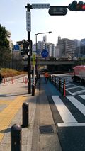
| highway | motorway | Expressways or motor roads. If you see a sign drawn a white car in blue background: 自動車専用道路。青地に白い車の標識のある道。 高速道路、有料道路、国道のバイパスなどにこの標識があったらこれに分類します。 |

Tomei Expressway (東名高速道路), Shuto Expressway (首都高速道路), Hachioji Bypass (八王子バイパス), Hakone Turnpike (箱根ターンパイク). |
| |||
| highway | motorway_link | The link roads (sliproads / ramps) leading to and from a motorway. Normally with the same motorway restrictions.
自動車専用道路への出入りに使用する連絡路や加速車線。通常は自動車専用道路と同じ利用制限が適用されている。 |

|
| |||
| highway | motorway_junction | Indicates a junction or exit ref should be set to the exit number or junction identifier.
自動車専用道路のインターチェンジ(出入口)の番号を表示する際に使用する。 |

|
| |||
| highway | trunk | National highways excluding expressways and motorways. Usually, National highways have blue triangle shield signs: Note that a little part of Japanese National highways have regions which cannot be accessed by motor vehicles, for example, steps, a pedestrian, a hiking way, or a ferry route. Those region should be tagged by other highway tags and add it to Relation:route with route=road and ref=number. 国道。国道の道路標識がある道。但し、自動車専用道路の区間は除く。 基本的には逆三角形のいわゆるおにぎり標識がある道路はこれに分類します。 例外的にtrunk(幹線)とはとても呼べない国道(いわゆる「酷道」)の存在が知られていますが、 これらは別途タグやリレーションを補って実態に合った表現をすることが推奨されています。 |

|
||||
| highway | trunk_link | The link roads (sliproads / ramps) leading to and from a trunk road.
国道間又は国道への連絡路や加速車線。 |
| ||||
| highway | primary | Major Prefectural road, numbered with one or two digits and maintained by the prefecture. If you see a hexagonal shield sign, A region of expressway, motorway or road that cannot be accessed by motor vehicles should be tagged using other highway tags and added to Relation:route with route=road and ref=number. 主要地方道。 六角形のいわゆるヘキサ標識があり、標識の数字が2桁以下の(東京都などの一部都道県を除く)主要な都道府県道または市道。東京都では標識の数字が3桁でも300番台か400番代の場合は主要都道です。 自動車が通行できないような主要地方道(いわゆる「険道」)の存在が知られていますが、 これらは別途タグやリレーションを補って実態に合った表現をすることが推奨されています。 |

Hokkaido Route 1 (北海道道1号小樽定山渓線), Tokyo Route 318 (東京都道318号環状七号線). |
||||
| highway | primary_link | The link roads (sliproads / ramps) leading to and from a primary road.
主要地方道への連絡路や加速車線。 |
| ||||
| highway | secondary | Minor Prefectural road, numbered with three digits and maintained by the prefecture. If you see a hexagonal shield sign A region of the road that cannot be accessed by motor vehicles should be tagged by other highway tags and added to Relation:route with route=road and ref=number. 一般地方道。 六角形のいわゆるヘキサ標識があり、標識の数字が3桁以上(例外あり)の一般(主要地方道では無い)都道府県道。ただし、東京の都道で数字が300番台か400番代の場合は一般都道ではありません。 自動車が通行できないような一般地方道(いわゆる「険道」)の存在が知られていますが、 これらは別途タグやリレーションを補って実態に合った表現をすることが推奨されています。 |

|
||||
| highway | secondary_link | The link roads (sliproads / ramps) leading to and from a secondary road.
一般地方道への連絡路。 |
| ||||
| highway | tertiary | For 2 lane roads (1 lane each way and drawn a center line, or 2 lanes one way) within a shi (city), a machi (town) or a mura (village). This should not be a major (motorway, motorway_link, trunk, trunk_link, primary, primary_link, secondary, or secondary_link) road or a residential road. | 
|
||||
| highway | tertiary_link | The link roads (sliproads / ramps) leading to and from a tertiary road.
一般道路への連絡路。 |
| ||||
| highway | unclassified | Narrow and paved roads, less than 2 lanes. This includes low grade roads, provided they are important to interconnect the grid network. This should not be a residential road.
一般道(2車線未満)。 1.5車線以下でセンターラインも無いが、交通ネットワークを形成する舗装路。 舗装林道や圧石路も含む。 |

|
| |||
| highway | residential | For roads within a residential area, public facility, compound, or private area. Typically, this is not a road designed for driving through an area, but rather for driving to it.
居住区域内道路。 住宅街にある道路で、通り抜けを目的としていない道路。 |

|
| |||
| highway | service | Service roads. parking aisles, roads in a park, roads in industrial factory, etc.
敷地内道路。 駐車場、広い工場、公共施設、テーマパーク、ショッピングセンターなどの敷地内で通り抜けを目的としていない道路。 |
| ||||
| highway | pedestrian | For roads used mainly or exclusively for pedestrians. For example, shopping streets, or pedestrian roads in universities or big parks. You can see 歩行者専用道路。 歩行者用広場、商店街、広い歩行者用道路など終日歩行者天国のような場所。 |

|
| |||
| highway | cycleway | Separate ways for the exclusive use of cyclists. You can see a sign |

|
自転車以外の'軽車両'や'小型特殊自動車'に関しては、標識等で通行を許可/禁止する表示がある場合に限り
|
| ||
| highway | footway | Footways, mainly in cities and paved. You can see 遊歩道。 主に街中にあるもの。 |

|
|
| ||
| highway | path | A path, mainly out of cities and unpaved, which cannot be accessed by motor vehicles.
小道。 主に山や野原にあるもの。歩行者専用とは謳っていないが、事実上車は通行不能な道。 |

|
| |||
| highway | track | Agricultural or forest roads. The definitions for grades are the same as the other countries.
農道または林道。ただし「農道」または「林道」と名前がついている場合でも、一般車両の通行が多い舗装道路は別のタグをつける。 |

|
|
|
- 2019-04-15 Proposed_Japan_tagging/Road_types_2/cycleway [Apploved/承認済]
変更点
- Useful combinationの欄を追加
- Impliesの項目から対象地物の意味として含まれていない項目をUseful combinationに移動
- Impliesの項目から対象地物の意味として含まれていない項目を除去
- 'highway=motorway'の 'smoothness=excellent' を除去
- 'highway=pedestrian'の 'motorcar=no'と'motorcycle=no'を"motor_vehicle=no"に変更
- '
 リレーション'への'タグroute=road' をImpliesの項目から除外
 - '
 ウェイ'の'highway=motorway', 'highway=motorway_link'と、'
 ノード'の'highway=motorway_junction'のUseful combinationとImplesとを区別した
 - 各_link 接続道路のUseful combinationに 'oneway=yes/no' を明記
- 各_link 接続道路のImpliesから 'oneway=yes' を除去
- 'highway=secondary_link'の項目を追加
- 'highway=tertiary_link'の項目を追加
Rationale(理由)
冗長なタグを削減するために
Impliesの本来の役割はメインタグに意味的に含まれるタグを明示することで冗長なデータを排除したり編集をしやすくするためのものだと思います。 例えば 'highway=motorway' は、「国で最高品質の道路を表す」ものなので 当然「舗装'surface=paved'」となります
つまり「'highway=motorway'+'surface=paved'」とするのは冗長です
OSM標準にはない「'motorcar=designated', 'motorcycle=designated'」が JapanTagging に制定されているのは 冗長なデータを削減するのが目的だと思われます
しかし、現実には日本の多くの高速道路には「'highway=motorway'+'motorcar=designated'+'motorcycle=designated'+'surface=paved'」とタグ付けされています(むしろ海外より多い)
これは、JapanTaggingの表に「Useful combination よく併用されるタグ」の欄がないために、「Implies」の欄を「推奨タグ」と誤解しているのだと思います(Impliesの日本語訳がなかったのも要因と考えられます)
そのため、「Useful combination よく併用されるタグ」の欄を新設して、「Implies 含まれる意味」と明確に区別できるようにしました
World Wide との相反の是正
「OSM標準」と「JapanTagging」のImpliesに設定された項目が異なっているために World Wide と Japan で地物の意味が相反するケースが見られます
例えば、JapanTaggingのhighway=motorwayではImpliesに 'toll=yes'が定義されているため、
「'toll=yes'がない場合は'highway=motorway'は 有料である」 ← 日本での解釈
「'toll=yes'がない場合は'highway=motorway'は 無料である」 ← OSM標準での解釈
というような相反が発生しています。これは、JapanTaggingを考慮していないルートナビアプリ(ほぼすべての現行アプリ)は日本では正しく動作しないことを意味します
この問題を是正するために、JapanTaggingの「Implies」から タグの意味的に含まれていない項目を除外し、 OSM標準のImpliesに定義されているものをJapanTaggingに追加しました
主な除外項目
主な追加項目
「車両種別によるアクセス制限」に伴う変更
「車両種別によるアクセス制限」が承認されたことにより、それ以前から運用さてていた「Japan_tagging Road_types」と意味に変化が生じました
RoadType関連で意味が明確になったもの
- hgv=*
- motorcar=*
- motorcycle=*
- moped=*
- mofa=*
- agricultural=*
JapanTaggingの「Implies」にこれらの変更を反映させました
'highway=***_link'における'oneway=yes/no'の記載
'highway=*_link'では 'oneway=yes/no'は省略できません(参照「JA:接続道路 / motorway についての特記事項」)
このことは、'oneway=yes'は 'highway=motorway_link'のImpliesにはなりえないことを意味します
現行のJapanTaggingでは'highway=***_link'の「Implies」欄が'highway=*'と共用されているため、このことが正しく表記されていません
そのため、'highway=*'と'highway=***_link'の「Implies」欄を分離しました
また、'highway=secondary_link'と'highway=tertiary_link'の項目を追加しました
実情と、OSM標準側の変更に追従するために
日本独自の'Implies'を設定せずにOSM標準をそのまま流用して、標準との違いは適切なタグ付けする方式で十分と考えます
実際にはほとんどのマッパーがすでにこの方針で編集しているようです 実情に合わせて'JapanTagging'を改定すべきと考えます
'highway=cycleway' のImplies
日本の'highway=cycleway'に「自転車専用道路」が割当られることとなりましたので、それに合わせて、「自転車専用」を示す access=no をImpliesに追加しました。
Examples(実例)
ここでの提案によって、日本国内のすべての highway=*が影響を受けます
ここでは最も影響を受ける 'highway=motorway'とhighway=motorway_link を例としました
自動車専用道路 (本線部分) |
|
自動車専用道路 の連絡路 |
|
- Impliesで定義済みなので下記のタグは不要
- access=no
- motor_vehicle=yes
- motorcar=designated
- motorcycle=designated
- surface=paved
Tagging(タグ付け)
'Implies'の設定をOSM標準に合わせたことにより、日本国内においてもOSM標準と同じ基準に従ってタグ付けができるようになります
- 'oneway=*'
- 'lanes=*':
- 'maxspeed=*':
- 'access=*'
- 下記の'access=*'は、通常は'連絡路(highway=motorway_link)'にタグ付けします
- '連絡路(highway=motorway_link)'がなく、いきなり本線と一般道とが接続される場合には、一般道と接続する最初のウェイに'access=*'を付けます
- 'moped=no'と'mofa=no':
- 125cc以下のバイクについてはImpliesに定義されていないので明示する必要があります
- 'agricultural=*':
- 別途標識などで小特の通行が許可されている場合は'yes'とする
- 禁止標識がある場合は'no'
- 小特に関する標識がないときはタグ付けしない
- 'toll=*':
- 'toll=*'も、通常は'連絡路(highway=motorway_link)'にタグ付けします
- '連絡路(highway=motorway_link)'がなく、いきなり本線と一般道とが接続される場合には、一般道と接続する最初のウェイに'toll=*'を付けます
※ その他、JapanTaggingに記載のない項目はOSM標準Wikiに準じます
Applies to(適用対象)
- 「Japan_tagging Road_types」の すべての highway=* の Implies部分
Rendering(レンダリング)
- 'highway=motorway'部分の 'agricultural=*'などの Japan_tagging/Access_transportation_mode に関する'Implies'は、交通手段別のルーティング算出に影響を与えます。
- 'highway=*'の 'maxspeed=*'は、ルーティング算出に影響を与えます。また、「速度オーバー警告」機能のあるアプリの動作に影響します。
- 'highway=*'の 'lanes=*'は、ルーティング算出に影響を与えます
- 'highway=motorway'の 'oneway=*'を省略すると、対面通行区間としてレンダリングされます。また、正しくルーティングを算出することができません
Features/Pages affected(影響がある機能/ページ)
'Implies'の定義を変更したことにより、タグが省略されたときの地物の解釈が変化します
| base tag / ベースタグ | When the following tags are omitted / 省略されたタグ | Current JapanTagging interpretation / 現行の JapanTagging での解釈 | Interpretation after change to proposal implies / 提案での解釈 | OSM world wide interpretation / 標準での解釈 |
|---|---|---|---|---|
| highway=motorway | oneway | oneway=yes | UnMapped | UnMapped |
| lanes | lanes=2 | UnMapped | UnMapped | |
| toll | toll=yes | toll=no | toll=no | |
| maxspeed | maxspeed=100 | UnMapped | UnMapped | |
| highway=motorway_link | oneway | oneway=yes | 不適切な編集 | 不適切な編集 |
| lanes | lanes=2 | UnMapped | UnMapped | |
| maxspeed | maxspeed=100 | UnMapped | UnMapped | |
| toll | toll=yes | toll=no | toll=no | |
| highway=trunk | lanes | lanes=2 | UnMapped | UnMapped |
| maxspeed | maxspeed=60 | UnMapped | UnMapped | |
| highway=trunk_link | lanes | lanes=2 | UnMapped | UnMapped |
| maxspeed | maxspeed=60 | UnMapped | UnMapped | |
| highway=primary | lanes | lanes=2 | UnMapped | UnMapped |
| maxspeed | maxspeed=60 | UnMapped | UnMapped | |
| highway=primary_link | lanes | lanes=2 | UnMapped | UnMapped |
| maxspeed | maxspeed=60 | UnMapped | UnMapped | |
| highway=secondary | lanes | lanes=2 | UnMapped | UnMapped |
| maxspeed | maxspeed=60 | UnMapped | UnMapped | |
| surface | surface=paved | UnMapped | UnMapped | |
| highway=tertiary | lanes | lanes=2 | UnMapped | UnMapped |
| maxspeed | maxspeed=60 | UnMapped | UnMapped | |
| highway=unclassified | lanes | lanes=1.5 | UnMapped | UnMapped |
| maxspeed | maxspeed=40 | UnMapped | UnMapped | |
| surface | surface=paved | UnMapped | UnMapped | |
| highway=residential | maxspeed | maxspeed=30 | UnMapped | UnMapped |
| surface | surface=paved | UnMapped | UnMapped | |
| highway=service | maxspeed | maxspeed=20 | UnMapped | UnMapped |
| surface | surface=paved | UnMapped | UnMapped | |
| highway=pedestrian | motorcar | motorcar=no | motorcar=yes | motorcar=yes |
| motorcycle | motorcycle=no | motorcycle=yes | motorcycle=yes | |
| bicycle | bicycle=no | bicycle=yes | bicycle=yes | |
| foot | foot=designated | foot=yes | foot=yes | |
| surface | surface=paved | UnMapped | UnMapped | |
| highway=footway | motorcar | motorcar=no | motorcar=yes | motorcar=yes |
| motorcycle | motorcycle=no | motorcycle=yes | motorcycle=yes | |
| bicycle | bicycle=no | bicycle=yes | bicycle=yes | |
| foot | foot=designated | foot=yes | foot=yes | |
| surface | surface=paved | UnMapped | UnMapped | |
| highway=path | motor_vehicle | motor_vehicle=yes | motor_vehicle=no | motor_vehicle=no |
| surface | surface=unpaved | UnMapped | UnMapped |
上記の変更に対処するため、現行の編集済みのデータを変換する必要があります
- 省略されたタグに「現行のImplies」(maxspeed=100など)を付加する必要があります
しかし、入力済みのPOIにおいて'maxspeed=*'が省略された場合、Impliesの値と等値だから省略されたのか、未調査項目だから未編集なのかの判別がつかないので下記の2通りの解釈が生じます
- 調査の結果 Impliesの値と等値だからタグを省略した
- 未調査項目だから入力していない
このように、一概に解釈することができないため、機械的なデータ変換を行わずにマッパーの自発的な編集活動にゆだねることとします
External Discussions(外部の議論)
| date | name | title | link |
|---|---|---|---|
| 2019年 1月 22日 (火) 13:05:49 UTC | kkondo | [OSM-ja] 日本の「Acces / 交通手段による制限 - 陸上交通 車両種別アクセス」について | Talk-ja |
| 2019年 1月 23日 (水) 15:59:03 UTC | yuu hayashi | [OSM-ja] 日本の「Acces / 交通手段による制限 - 陸上交通 車両種別アクセス」について | Talk-ja |
| 2019年 1月 27日 (日) 05:04:26 UTC | yuu hayashi | [OSM-ja] [改定提案] Japan_tagging/Road_types Implies | Talk-ja |
| 2019年 2月 24日 (日) 03:27:56 UTC | yuu hayashi | [OSM-ja] 改定提案 - RFC - Proposed Japan tagging/Road types | Talk-ja |
| 2019年 3月 9日 (土) 16:22:24 UTC | kkondo | 「"Implies"の列にリストされている」と書かれていている理由? | Talk-ja |
| 2019年 3月 9日 (土) 16:22:24 UTC | kkondo | highway=motorway に moped=no を付加する必要 or 冗長について | Talk-ja |
Comments(コメント)
Please comment on the discussion page.
コメントを 議論 のページに書き加えてください。
Voting
- Log in to the wiki if you are not already logged in.
- Scroll down to voting and click 'Edit source'. Copy and paste the appropriate code from this table on its own line at the bottom of the text area:
| To get this output | you type | Description |
|---|---|---|
{{vote|yes}} --~~~~
|
Feel free to also explain why you support proposal. | |
{{vote|no}} reason --~~~~
|
Replace reason with your reason(s) for voting no. | |
{{vote|abstain}} comments --~~~~
|
If you don't want to vote but have comments. Replace comments with your comments. |
~~~~ automatically inserts your name and the current date.For full template documentation see Template:Vote. See also how vote outcome is processed.
 I approve this proposal. --hayashi (talk) 22:45, 26 April 2019 (UTC)
 I approve this proposal. ついに投票開始となりましたか。感慨深いです。--Yumean1119 (talk) 00:04, 27 April 2019 (UTC)
 I approve this proposal. --nyampire (talk) 16:34, 14 May 2019 (JPT)
 I approve this proposal. --Hiroshi Miura 09:50, 14 May 2019 (UTC)
 I approve this proposal. --Ryo-a (talk) 12:59, 15 May 2019 (UTC)
 I approve this proposal. --Zoar (talk) 01:53, 17 May 2019 (UTC)
 I approve this proposal. --Minoura 10:56, 18 May 2019 (JST)
投票方法
- ログインしていなければ OSM Wikiにログインする
- Votingの項目まで下にスクロールして[ソースの編集]をクリックする
- 上表から適切なコード(you type)をコピーして、行を挿入する
ehicle=no
 I have comments but abstain from voting on this proposal. In the last table for the tag 'path' there is a column entry for motor_vehicle=yes, usually path would imply motor_vehicle=no, where there is provision for motor vehicle I would use highway=track --Warin61 (talk) 00:47, 24 May 2019 (UTC)
Alterations are not supposed to occur to the proposal once voting commences untill voting stops. Recommend that voting is stopped and any changes made. Then start a new voting sequence. Warin61 (talk) 02:28, 26 May 2019 (UTC)
Sorry, I think you did not know because the column title was in only Japanese. Added English notation to column titles. The purpose of this proposal is to correct the problems that you have pointed out. --hayashi (talk) 14:02, 26 May 2019 (UTC)


